Showing 1628 items matching "the royal australian regiment"
-
 Bendigo Military Museum
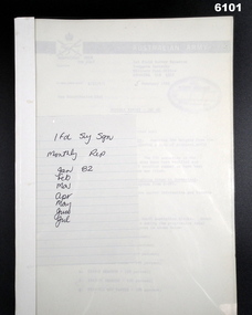
Administrative record - 1 Fd Svy Sqn Monthly Report: Jan - Jul 1982
Report covering the activities of 1 Fd Svy Sqn Jan 82 - Jul 82Plastic bound, cardboard covered, paper, reports, diagramsroyal australian survey corps, rasvy, fortuna, army survey regiment, army svy regt, asr -
 Bendigo Military Museum
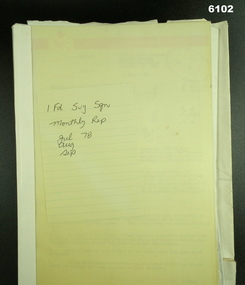
Administrative record - 1 Fd Svy Sqn Monthly Report: Jul -Dec 1982
Report covering the activities of 1 Fd Svy Sqn between Jul 82 - Dec 82Plastic bound, cardboard covered, paper report, diagramsroyal australian survey corps, rasvy, army survey regiment, army svy regt, asr, fortuna -
 Bendigo Military Museum
Administrative record - 2 Fd Svy Sqn Monthly Report: May - Aug 1981
Report covering the activities of 2 Fd Svy Sqn between May 81 and Sep 81Plastic bound; cardboard covered, paper report, diagramsroyal australian survey corps, rasvy, army survey regiment, army svy regt, asr, fortuna -
 Bendigo Military Museum
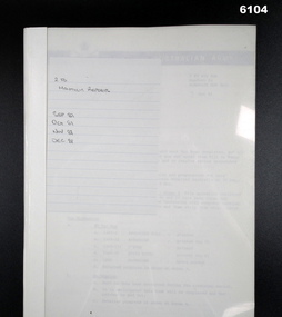
Administrative record - 2 Fd Svy Sqn Monthly Report: Sep - Dec 1981
Report covering the activities of 2Fd Svy Sqn between Sep 81 and Dec 81Plastic bound, cardboard covered, paper report, diagramsroyal australian survey corps, rasvy, fortuna, army survey regiment, army svy regt, asr -
 Bendigo Military Museum
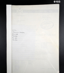
Administrative record - 2 Fd Svy Sqn Monthly Report : Jan - Apr 1982
Report covering the activities of 2 Fd Svy Sqn between Jan 82 and Apr 82Plastic bound, cardboard covered, paper report, diagramsroyal australian survey corps, rasvy, fortuna, army survey regiment, army svy regt, asr -
 Bendigo Military Museum
Administrative record - 8 Fd Svy Sqn Monthly Report: Jun - Aug 1978
Report covering the activities of 8 Fd Svy Sqn between Jul 78 and Sep 78Plastic bound, cardboard covered, paper report, diagramsroyal australian survey corps, rasvy, army survey regiment, army svy regt, asr, fortuna -
 Bendigo Military Museum
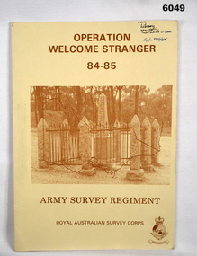
Administrative record - Army Survey Regiment - Operation Welcome Stranger - Operation Report
Operation Report of Mapping areas in central Victoria in 29 Mar 84 - 6 Mar 85. Covering 1:250,000 map areas SJ54-4 St Arnaud, SJ 55-1 Bendigo, SJ54-8 Ballarat, SJ %%-2 WangarattaAn A4 booklet sepia cardboard cover, brown text Survey Corps Badge, Photo of " Welcome Stranger Monument", outline shape of Victoria, glide on Arnos fastener binder.royal australian survey corps, rasvy, fortuna, army survey regiment, army svy regt, asr -
 Bendigo Military Museum
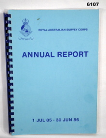
Administrative record - Royal Australian Survey Corps Annual Report 1 Jul 85 - 30 Jun 86, DSvy - A, RASvy Corps, Report on activities 1 Jul 85 - 30 Jun 86, Circa 1986
The status of RASVY activities (for the dates shown) in field surveying, mapping and charting is given in this report and is shown pictorially in the Annexes to the reportBlue book, plastic ring binder, Map and Chart production 85-86, Annexes graphically depicting map productionroyal australian survey corps, rasvy, fortuna, army survey regiment, army svy regt, asr -
 Bendigo Military Museum
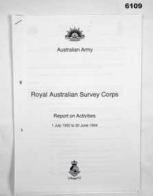
Administrative record - Royal Australian Survey Corps Report on Activities - 1 Jul 1992 - 30 Jun 1994, DSvy - A, Circa 1994
Report is a summary of activities of the R0yal Australian Survey Corps Financial Years 92/9411 Pages stapled, reports and diagramsroyal australian survey corps, rasvy, fortuna, army survey regiment, army svy regt, asr -
 Bendigo Military Museum
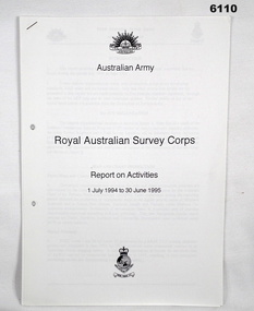
Administrative record - Royal Australian Survey Corps Report on Activities - 1 July 1994 - 30 Jun 1995, DSvy - A, Circa 1995
Report is a summary of activities of the Royal Australian Survey Corps Financial year 94/958 pages, stapled, reports and diagrams royal australian survey corps, rasvy, fortuna, army survey regiment, army svy regt, asr -
 Bendigo Military Museum
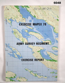
Administrative record - Army Survey Regiment - Exercise Mapex 78, Mar 1979
Exercise Report on exercise Mapex 78. The exercise was designed to test the Army Survey Regiment in an intensive production phase of 30 days duration.A4 soft covered booklet, printed map of part of the Kimberley region of Western Australia on front and back covers, staple boundTop right hand corner of front cover "File on 788-2-14"royal australian survey corps, rasvy, fortuna, army survey regiment, army svy regt, asr -
 Bendigo Military Museum
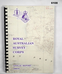
Administrative record - Royal Australian Survey Corps - Annual Report 1990/91, Royal Australian Survey Corps, Late 1991
Annual Report detailing the status of Australian mapping, charting and geodesy for the period 1 Jul 90 - 30 Jun 91A4 soft covered book, glossy paper pages and plastic pockets containing maps. Plastic ring bindingTop right hand corner "2IC Tech WO"royal australian survey corps, rasvy, fortuna, army survey regiment, army svy regt, asr -
 Bendigo Military Museum
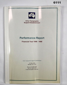
Administrative record - Army Topographic Support Establishment: Performance Report Financial Year 1998 - 1999, 13 Jul 1999
A Report showing numerous charts of production objectives for all types of mapping production conducted by the Army Topographic Support Establishment in the Financial year 1998 - 1999A4 size, clear plastic front cover, white plastic back cover, bound with tape. 16 loose pages, 8 x coloured pages showing production rates, 7 x pages roduction summary and RAAF C-130E Hercules replacement programme, 1 x page summarising production.royal australian survey corps, rasvy, fortuna, army survey regiment, army svy regt, asr -
 Bendigo Military Museum
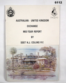
administrative record - Australian - United Kingdom Exchange Mid Tour Report by SSGT NJ Collins RE 1987, SSGT N.J. Collins RE, 29. 03.1987
... to the Army Survey Regiment. Royal Australian Survey Corps RASvy ...The document is the Mid Tour Report by SSGT N.J. Collins RE, a British Army Senior NCO on a two-year exchange to the Army Survey Regiment. A4 size, Stapled, Front cover has a reproduction of a painting of Fortuna Villa in bottom half. Back cover has a difficult to see street scene of Pall Mall, Bendigo with a paragraph describing Bendigo's history superimposed. 19 Pages. The actual Report is contained on Pages 1-16. Annex A is 2 x pages plus a contents page.Green Hi-Light on parts of pages 10 and 11.royal australian survey corps, rasvy, fortuna, army survey regiment, army svy regt, asr -
 Bendigo Military Museum
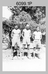
photograph - Fortuna - 1st Year of Army Occupation in Bendigo, 1942
This is a set of 17 photographs taken during the first year of Army occupation at Fortuna, Bendigo in 1942. The photos provide an insight into the preparatory work performed on the Fortuna Villa and surrounding buildings, by the Working Party 5th Army Troop and Ordnance Training Depot, before its occupation by personnel from LHQ Cartographic Company, Royal Australian Survey Corps. The annotation on the back of Photos .9P and .10P is misspelt. The correct spelling is ‘Nell Gwynne’. The poppet head of the Central Nell Gwynne mine is still an iconic landmark in Bendigo, lying just down the road from the poppet head lookout at Victoria Hill. The Central Nell Gwynne was the premier mine of Bendigo's 1930s mining revival and is of high historical value, due to the extensive and relatively intact features which remain at the site. The annotation on the back of Photo .17P is incorrect. The location of HQ 5th Army Troop was ‘Reynard St, Coburg.’ By late 1941 as Japan extended its control throughout Indo-China, resolving the accommodation problem of AHQ Cartographic Company located in Melbourne became more urgent. The steady Japanese advance made the bombing of Melbourne no longer a remote possibility, and in accordance with a general policy of dispersion, the Deputy Chief of the General Staff, Major General Sidney Rowell instructed Major William Sarll, in the interests of security of plant and to provide against possible damage of air attack, to investigate suitable safer inland accommodation for AHQ Cartographic Company. Major Sarll inspected many properties before finding one that would meet the requirements of the Cartographic Company. In late 1941, he came to inspect Fortuna, a rambling old mansion with about fifteen acres of ground in central Bendigo. Initially there was no intention to occupy the site beyond the end of the war, although Major Sarll's report to the Director of Survey noted many advantages in moving the Company to Bendigo. Major General Rowell quickly approved the selection of Fortuna before other authorities, which were investigating the evacuation of school children, could get in ahead of the Cartographic Company. On 23 March 1942, the Commonwealth of Australia, under the provisions of the National Security Act of 1939, took possession of the house, the old battery buildings and the fifteen acres of grounds. Under Warrant Officer J. Trist’s direction, over fifty Parks and Works tradesmen completed building works necessary to accommodate the Survey Corps’ military, map making and printing requirements. The building program was still under way when the first officer, Lieutenant Ralph Westgarth, arrived in May 1942 with the advance party which received and positioned all equipment as it came up from Melbourne in semi-trailers. Once the equipment was installed the rest of the Cartographic Company completed its shift to Bendigo by 11th June 1942. The first year of the Survey Corps’ occupation of Fortuna is covered in more detail with additional historic photographs, in pages 17-22 of Valerie Lovejoy’s book 'Mapmakers of Fortuna – A history of the Army Survey Regiment’ ISBN: 0-646-42120-4.This is a set of 17 photographs taken during the first year of Army Occupation at Fortuna, Bendigo in 1942. The black and white photographs were printed on photographic paper and are part of the Army Survey Regiment’s Collection. The photographs were scanned at 300 dpi. .1) - Photo, black & white, 1942. Bendigo Parks and Works tradesmen at Fortuna. L to R: Cliff Day, Ernie Arnold, Norm? .2) - Photo, black & white, 1942. “Don” - possibly SGT Don Sutcliffe. Fortuna, Bendigo. .3) - Photo, black & white, 1942. Parks and Works tradesmen in garden at Fortuna, Bendigo. L to R: Fred & Ernie. .4) - Photo, black & white, 1942. Benny Jack Williams at Fortuna, Bendigo. Accommodation tents were erected above the lake, which later became the parade ground. .5) - Photo, black & white, 1942. Working dress - Giggle suits. Parks and Works tradesmen at Fortuna, Bendigo. L to R: Cliff and Harry on big roof. .6) - Photo, black & white, 1942. Parks and Works tradesmen at Fortuna, Bendigo. Ted on big roof. .7) - Photo, black & white, 1942. Gold crusher battery just behind Fortuna. .8) - Photo, black & white, 1942. Scene of Bendigo from Fortuna. .9) - Photo, black & white, 1942. Nell Gwynne Mine from mullock heap at Victoria Hill near Fortuna, Bendigo. .10) - Photo, black & white, 1942. Nell Gwynne Mine and crusher near Fortuna, Bendigo. .11) - Photo, black & white, 1942. Sluicing for gold at Eaglehawk. .12) - Photo, black & white, 1942. Fortuna, Bendigo taken from the far side of tennis courts. .13) - Photo, black & white, 1942. Fortuna, Bendigo & its reflection from across the lake. .14) - Photo, black & white, 1942. Fortuna, Bendigo from the fishpond. .15) - Photo, black & white, 1942. Fortuna, Bendigo. .16) - Photo, black & white, 1942. First Fortuna Football Team at unknown location. L to R: 5th Bob Wright, 11th SGT Don Sutcliffe. .17) - Photo, black & white, 1942. Working Party from 5th Army Troop and Ordnance Training Depot at Fortuna, Bendigo.Some personnel are identified. Annotated with date within photos. .1) – Annotated on back ‘Cliff, Ernie, Norm, Dec ‘42. Cliff Day - dairy farmer, plasterers’ labourer. Ernie Arnold – hard plasterer. Norm? - QM Store for tools etc. QM Store was the Stables.’ .2) - Annotated on back ‘Don. Fortuna 1942’ .3) - Annotated on back ‘Fred & Ernie. Dec 1942. Carpenters. Note the state of the gardens.’ .4) - Annotated on back ‘Benny Jack Williams Fortuna Bendigo. Tents were erected where present day parade ground is above the lake.’ .5) - Annotated on back ‘Working dress - Giggle suits. June 42. Cliff and Harry on big roof. This photo was taken as the ventilating ridge was being installed on the building housing the printing machines. The machines were installed later by civilian labour when building was complete.’ .6) - Annotated on back ‘Ted on big roof Fortuna Bendigo.’ .7) - Annotated on back ‘Gold crusher battery – Bendigo for slay heap – 1942. 12 stamp battery. Just behind Fortuna. Was working at night when the “Army” came to Bendigo. Later removed to “Coolgardie - WA. Present site of Southern Cross TV.’ .8) - Annotated on back ‘Scene of Bendigo from Fortuna. June 1942.’ .9) - Annotated on back ‘Nell Gwyne Mine from mullock heap (Victoria Hill) Sept 1942.’ .10) - Annotated on back ‘Nell Gwyne Mine and crusher September 1942.’ .11) - Annotated on back ‘Sluicing for gold at Eaglehawk. August 1942.’ .12) - Annotated on back ‘Fortuna Bendigo 1942. Taken from far side of tennis courts.’ .13) - Annotated on back ‘ “Fortuna” across the lake & reflection.’ .14) - Annotated on back ‘Fortuna from fishpond June 1942.’ .15) - Annotated on back ‘Fortuna Dec 1942.’ .16) - Annotated on front ‘X’ x2. Annotated on back First Fortuna Football Team 1942‘Bob Wright’, ‘SGT Don Sutcliffe’. .17) - Annotated ‘Working Party at Fortuna before one of the drafts’, Working Party 5th Army Troop and Ordnance Training Depot Showgrounds, now the Sportsground Bendigo’, ‘HQ of 5th Army Troop was Reynards Rd, Coburg.’royal australian survey corps, rasvy, army survey regiment, army svy regt, fortuna, asr -
 Bendigo Military Museum
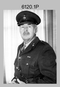
photograph - Regimental Sergeant-Majors (RSMs) of the Army Survey Regiment, Bendigo, 1963 to 1982
This is a set of four photographs of three Regimental Sergeant-Majors (RSMs) of the Army Survey Regiment at Fortuna. Their appointments as RSM spanned from 1963 to 1976. WO1 Robin Wilson’s appointment was from 1963 to 1966. He served in the Australian Army from 1946 to 1979. WO1 Wilson ended his service in another corps as a commissioned officer and reached the rank of Major. WO1 Peter Gale’s appointment was from 1966 to 1968. He served in the Australian Army from 1946 to 1968. WO1 John Hogan’s appointment was from 1968 to 1976. After transfer from the British Army, he served in the Australian Army from 1952 to 1976. WO1 Hogan continued his service in Defence as the RAN Liaison Officer located in Fortuna’s coach house building for several more years. WO1 Aub Harvey’s appointment was from 1976 to 1982.This is a set of five photographs of four Regimental Sergeant-Majors (RSMs) of the Army Survey Regiment at Fortuna, Bendigo, from 1963 to 1982. The black and white photographs were printed on photographic paper and are part of the Army Survey Regiment’s Collection. The photographs were scanned at 300 dpi. .1) - Photo, black & white, 1963-1966, WO1 Robin Wilson. .2) - Photo, black & white, 1963-1966, WO1 Robin Wilson. .3) - Photo, black & white, 1966-1968 WO1 Peter Gale. .4) - Photo, black & white, 1968-1976, WO1 John Hogan. .5) - Photo, black & white, 1976-1982, WO1 Aub Harvey..1P to .5P – No annotation.royal australian survey corps, rasvy, army survey regiment, army svy regt, fortuna, asr -
 Bendigo Military Museum
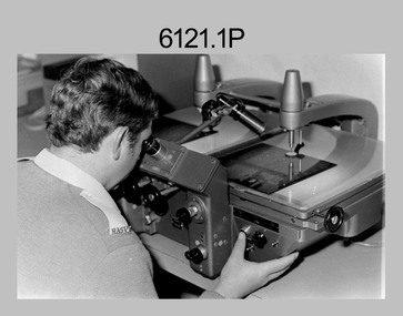
photograph - Aerotriangulation Production – Army Survey Regiment, Fortuna, Bendigo, c1980
This collection of five photos was most likely taken in 1980. Wild PUG4 point transfer devices were used by technicians in Air Survey Squadron to stereoscopically view the photography containing the survey control points and the mapping aerial photography. The Control points were transferred from the control photography to the mapping diapositives of aerial photography by drilling their locations into the photographic emulsion. The Zeiss (Jena) Stecometer analytic stereocomparator for air photography was introduced at Air Survey Squadron in 1963. Aerotriangulation production was expedited using computers for analytical photogrammetric processes. The technician accurately measured between pass, tie, and survey control points on aerial photographs.Air Survey Squadron Aerotriangulation Section - Army Survey Regiment, Bendigo. c1980. This is a set of five photographs of Air Survey Squadron personnel operating aerotriangulation equipment at the Army Survey Regiment at Fortuna, Bendigo, c1980. Photographs .1P to .4P are on 35mm negative film and were scanned at 96 dpi. Black and white photo .5P is on photographic paper and was scanned at 300 dpi. They are part of the Army Survey Regiment’s Collection. .1) - Photo, black & white, c1980, Wild PUG4 point transfer device, unidentified technician. .2) - Photo, black & white, c1980, Wild PUG4 point transfer device, unidentified technician. .3) - Photo, black & white, c1980, Wild PUG4 point transfer device, unidentified technician. .4) - Photo, black & white, c1980, Zeiss (Jena) Stecometer, unidentified technician. .5) - Photo, black & white, c1980, Zeiss (Jena) Stecometer..1P to .5P No personnel are identified.royal australian survey corps, rasvy, army survey regiment, army svy regt, fortuna, asr, air survey, aerotrig -
 Bendigo Military Museum
photograph - Cartographic Squadron Production – Army Survey Regiment, Fortuna, c1980
This collection of 12 photos was most likely taken in 1980. The photos were most likely taken in Cartographic Squadron’s Ante Room, the Attic and small offices on the top floor of Fortuna Villa. The computer based Editwriter typesetting system was introduced in 1975 as a replacement to the aging Fotosetter machine. It was operated by a specialised technician, who generated a large variety of map type styles and sizes quickly and reliably, as well as text panels. CPL Richards performed this task for several years and in photo .1P and .2P is reading off a type order next to the computer monitor. Output on Copy proof adhesive backed stripping type film replaced messy wax and spray adhesives in 1978. The Editwriter capability supported all RASvy units and contractor type setting requirements. Scribing was the cartographic process of drafting features such as drainage, relief, vegetation, roads and culture on specially coated map reproduction material. The cartographic technician scribed out the map feature such as a contour to a specified line width on the map sheet, using a tool affixed with a sapphire tipped cutter. The quality control edit (Proving) stage of map production was the first opportunity to inspect a proof of the map independently and systematically. Proving tasks were carried out by technicians conversant of the map product specification and task requirement, however, was not involved in its production. Corrections were identified, marked up and sent to back to the correcting section or contractors. Terrain Embossing was a manual map production technique to produce hill shading on medium to small scale graphics and air charts. SPR John Martin is seen in photos .8P to.10P using a fine embossing metal stylus to push down on the drainage impression on a thin malleable opaque plastic material (AK Poligraphy). Ridge lines were then pushed down using the contour impression as a guide, on the opposing side of the AK Poligraphy to create a 3D plastic model terrain effect. The map impression was sprayed with white paint and photographed to create a contone tone hill shade. SPR Gina (Coore) Neilson is seen in photo .11P washing a contone positive of a land mass in a solution. The contone components were registered to the map sheet, as shown in photo .12P and masked using an air brush and a halftone negative was then created. The terrain embossing method of producing hill shading was more efficient to produce than previous specialised artistic methods such pencil/eraser and air brush. Furthermore, a more consistent enhancement of terrain on charts was achieved between technicians.This is a set of 12 photographs of Cartographic Squadron performing four map production tasks at the Army Survey Regiment, Fortuna, Bendigo c1980. The first ten photographs were on 35mm negative film and were scanned at 96 dpi. Photos .11P and .12P were on photographic paper and scanned at 300 dpi. They are part of the Army Survey Regiment’s Collection. .1) - Photo, black & white, c1980, Editwriter typesetter, CPL Paul Richards. .2) - Photo, black & white, c1980, Editwriter typesetter, CPL Paul Richards. .3) - Photo, black & white, c1980, Scribing contours on a RAAF Chart, SPR Megan (McBurney) Reynolds. .4) - Photo, black & white, c1980, Scribing contours on a RAAF Chart, SPR Megan (McBurney) Reynolds. .5) - Photo, black & white, c1980, Scribing contours on a RAAF Chart, SPR Rod Skidmore. .6) - Photo, black & white, c1980, Scribing contours on a RAAF Chart, SPR Rod Skidmore. .7) - Photo, black & white, c1980, Formal quality control edit (Proving), CPL Ian Belmont. .8) - Photo, black & white, c1980, Hill Shade Terrain Embossing, SPR John Martin. .9) - Photo, black & white, c1980, Hill Shade Terrain Embossing, SPR John Martin. .10) - Photo, black & white, c1980, Hill Shade Terrain Embossing, SPR John Martin. .11) - Photo, black & white, c1980, Hill Shade Terrain Embossing, SPR Gina (Coore) Neilson. .12) - Photo, black & white, c1980, Hill Shade Terrain Embossing, unidentified..1P to .10P No personnel are identified. .11P and .12P annotated ‘Terrain Embossing’royal australian survey corps, rasvy, army survey regiment, army svy regt, fortuna, asr, carto -
 Bendigo Military Museum
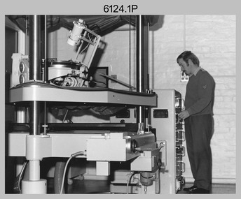
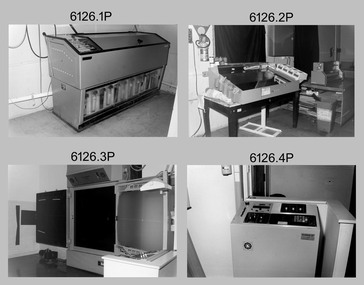
photograph - Orthorectification Equipment - Army Survey Regiment, Fortuna, Bendigo, c1975
Orthophoto mapping provided the Survey Corps with the capability to produce map products quickly in the event of a crisis. These are four photographs of equipment used by the Army Survey Regiment to produce orthophotomaps. The Wild GZ1 orthophoto projector was introduced in 1973 and was the first equipment used to orthorectify colour and monochrome film aerial photography. Height profiles were originally produced on a PEB8 Stereo profiler and later were software generated. Photos of the PEB8 are available in Victorian Collections item 6222.17P, photos .5P and .6P. In the same era the IBM 1130 computer; OMI/Nistri AP/C-3 analytical plotter with coordinatograph, OP/C orthophoto projector and Zeiss Planimat D2 stereoplotters were introduced. Orthorectification is the process of removing geometric distortions and scale errors/variations from images. Images have tilt and relief distortions that make it difficult to compare accurately a map and an image of the same geographic area. Once an image is orthorectified, features on the image are shown in their planimetric locations. These four photographs of orthorectification equipment were taken at the Army Survey Regiment at Fortuna, Bendigo, c1975. Photo .1P and .3P were printed on photographic paper and scanned at 300 dpi. Photos .2P, .4P and .5P were on 35mm negative film and scanned at 96 dpi. They are part of the Army Survey Regiment’s Collection. .1) - Photo, black & white, c1975, Wild GZ1 orthophoto projector operated by CPL Phil Boyle. .2) - Photo, black & white, c1975, Wild GZ1 orthophoto projector. .3) - Photo, black & white, c1975, Wild GZ1 orthophoto projector. .4) - Photo, black & white, c1978, Zeiss D2 Planimat Stereoplotter. .5) - Photo, black & white, c1978, Zeiss D2 Planimat Stereoplotter..1P to .5P No annotations.royal australian survey corps, rasvy, army survey regiment, army svy regt, fortuna, asr -
 Bendigo Military Museum
Photograph - Army Survey Regiment’s Officers, Warrant Officers and Sergeants and Squadrons, at Fortuna, Bendigo, 1982
This is a set of six staff photographs of the Army Survey Regiment’s Officers, Warrant Officers and Sergeants, and each of its four Squadrons at Fortuna, Bendigo in December 1982. Note - Air Survey Squadron’s photo was probably taken in July 1982 as they appear in winter dress. Air Survey Squadron was responsible for aerotriangulation, photogrammetric feature extraction and the AUTOMAP 1 system. Typical tasks were flight planning the acquisition of aerial photography, pugging, mensuration and block adjustments, photogrammetric extraction of topographic features from aerial photography, digital feature editing, map compilation, operating the scanner/plotter, operating the AUTOMAP 1 system and computer programming by civilians. Cartographic Squadron was responsible for the production of the following military products: Joint Operation Graphics, small-scale RAAF Air Charts, large-scale topographic line maps and orthophotomaps. Cartographic technician tasks were scribing, compiling, retouching, masking, type setting, type stickup, terrain embossing, correcting and proving quality control. Headquarters Squadron was responsible for the planning and coordination of map production and contracts. It also performed administrative and support functions such as personnel administration, pay, finance, transportation, records, map Library, kitchens, messes and facility maintenance. It was staffed by Army personnel from RASvy, RACT, AACC, RAAOC and RAEME corps. Other supporting staff at this time included the RAAF Liaison Officer, RAN Liaison Officer and several civilians employed in administration, the Q-Store and grounds maintenance. A component of the Army Svy Regt’s cartographic map production was carried out by the Detachment, a sub-unit located at Bonegilla next to the School of Military Survey. Lithographic Squadron was responsible for the reproduction of map materials and printing of military map products. The main tasks undertaken by photographic technicians were photographic enlargements, reductions and duplication of map reproduction material and processing of aerial photography. Printing technician tasks included platemaking, offset printing, map stock despatching and proofing.This is a set of six staff photographs of the Army Survey Regiment’s Officers, Warrant Officers and Sergeants, and its four Squadrons, at Fortuna, Bendigo, 1982. The black and white photographs were printed on photographic paper and are part of the Army Survey Regiment’s Collection. The photograph was scanned at 300 dpi. No personnel are identified. No personnel are identified. .1P – Annotated on front “OFFICERS MESS DEC ’82” .2P – Annotated on back “SGTS MESS DEC ’82” .4P– Annotated on front “CARTO SQN DEC ’82” .5P– Annotated on front “HQ SQN DEC ’82”royal australian survey corps, rasvy, army survey regiment, army svy regt, fortuna, asr, air survey, carto, litho -
 Bendigo Military Museum
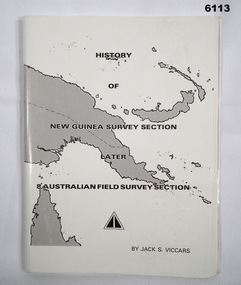
Booklet - History of the New Guinea Survey Section 1967 by LT Jack Viccars, Lt Jack Stewart Viccars, Circa 1967
Military surveying in New Guinea began in in WWII with the formation of the New Guinea Force Field Survey Section which later became 8th Australian Field Survey Section and later 2 Field Survey Section of 6th Army Topographical Survey Section. This history was written by LT Jack Viccars and member of the Unit.A4 Booklet, Black and white, 43 Pages, 4 Annexes, Map Indexes, Gloss Paper Cover, Bound by staplesForward by Brigadier D. Macdonald (Retd) AM, Royal Australian Survey Corps 1936-1967, Preface by LT Jack J.S. Viccarsroyal australian survey corps, rasvy, fortuna, army survey regiment, asr -
 Bendigo Military Museum
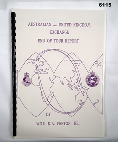
Administrative record - Australian - United Kingdom Exchange End of Tour Report by WO2 KA Fenton RE 1990, WO2 KA Fenton RE, 25.10.1990
A 2 x year personnel exchange program existed between RASvy and the Survey elements of the Royal Engineers UK. This is an end of Tour Report produced by WO2 KA Fenton RE of his experiences during his exchange tour. An A4 Booklet stylised map of the world with Corps Badges foe RASvy and Royal Engineers (UK), back cover overhead aerial Photo of Army Svy Regt, 14 Pages, 4 Annexes and an enclosureroyal australian survey corps, rasvy, fortuna, army survey regiment, army svy regt, asr -
 Bendigo Military Museum
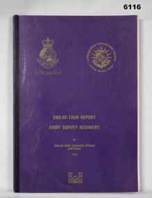
Administrative record - RASvy - Defense Mapping Agency Exchange Officer End of Tour Report MAJ D Bowen 1982, MAJ DH Bowen US Army Corps of Engineers, 3. 5. 1982
A 2 x year personnel exchange program existed between RASvy and the US Army Corps of Engineers. This is the End of Tour Report produced by David H Bowen, Major, Corps of Engineers, US Army Exchange Officer, Australia in 1982A4 Document, Plastic cover, Purple and gold, RASvy Badge emblem and Defense Mapping Agency Badge emblems in gold, 17 pages, 13 enclosures, black and white print, colour photos and mapsReport compiled by David H Bowen, Major, Corps of Engineers, US Army Exchange Officer, Australiaroyal australian survey corps, rasvy, fortuna, army survey regiment, army svy regt, asr -
 Bendigo Military Museum
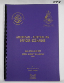
Administrative record - RASvy - Defense Mapping Agency Exchange Officer Mid Tour Report MAJ J Charland 1983, MAJ JJ Charland US Army Corps of Engineers, 15.08.83
A 2 x year personnel exchange program existed between RASvy and the US Army Corps of Engineers. This is the Mid Term Tour Report produced by John J Charland, Major, Corps of Engineers, US Army Exchange Officer, Australia in 1983A4 document, Purple Cover, Gold Badge Image US Defense Mapping Agency and RASvy, 13 PagesCompiled by John J Charland, Major, Corps of Engineers, United States Armyroyal australian survey corps, rasvy, fortuna, army survey regiment, army svy regt, asr -
 Bendigo Military Museum
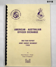
Administrative record - American - Australian Officer Exchange - Mid Tour Report ASR 1988, Major J Wright US Corps of Engineers, Major Edward J Wright US Army Corps of Engineers, 30 June 1988
Mid Tour Report USA - Aust Officer Exchange 1988 by Major Edward J Wright, US Army Corps of EngineersA4 Booklet, cream card, DMA and RASvy Corps Badges on cover, 16 pagesroyal australian survey corps, rasvy, fortuna, army survey regiment, army svy regt, asr -
 Bendigo Military Museum
Photograph - Photo Troop, Lithographic Squadron – Army Survey Regiment, Fortuna, Bendigo, 1986
This collection of 18 photos was most likely taken at Lithographic Squadron, Army Survey Regiment, Fortuna, Bendigo in 1986. The main tasks undertaken by technicians in Photo Troop were most likely enlargements, reductions and duplication of map reproduction material, and processing of aerial photography.This is a set of 18 photographs of Photo Troop personnel and equipment from Lithographic Squadron at the Army Survey Regiment, Fortuna, Bendigo, 1986. The photographs were on 35mm negative film and were scanned at 96 dpi. They are part of the Army Survey Regiment’s Collection. .1) - Photo, black & white, 1986, Film developer. .2) - Photo, black & white, 1986, Chromalin Proof equipment. .3) - Photo, black & white, 1986, KLIMSCH Commodore camera. .4) - Photo, black & white, 1986, KLIMSCH Commodore camera operator’s console. .5) - Photo, black & white, 1986, Film contact frame. .6) - Photo, black & white, 1986, Film processing chemicals. .7) - Photo, black & white, 1986, Unidentified technician. .8) - Photo, black & white, 1986, L to R: Unidentified technician, SPR Russell Pajank, SPR Carmel (Butler) Fauth. .9) - Photo, black & white, 1986, SPR Carmel (Butler) Fauth. .10) - Photo, black & white, 1986, SPR Carmel (Butler) Fauth. .11) - Photo, black & white, 1986, L to R: CPL Paul Baker, SGT Rob Bougumil. .12) - Photo, black & white, 1986, CPL Paul Baker. .13) - Photo, black & white, 1986, CPL Paul Baker. .14) - Photo, black & white, 1986, L to R: CPL Paul Baker, CPL Brian Paul. .15) - Photo, black & white, 1986, L to R: CPL Frank Lenane, SGT Rob Bougumil. .16) - Photo, black & white, 1986, CPL Brian Fauth. .17) - Photo, black & white, 1986, WO1 Trevor Osborne. .18) - Photo, black & white, 1986, L to R: SPR Kerron South, SGT Rob Bogumil.No personnel are identifiedroyal australian survey corps, rasvy, army survey regiment, army svy regt, fortuna, asr, litho -
 Bendigo Military Museum
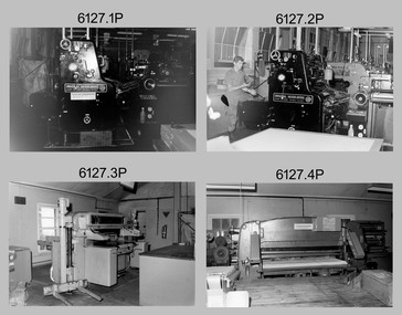
Photograph - Print Troop – Lithographic Squadron – Army Survey Regiment, Fortuna, Bendigo, 1986
This collection of twenty photos was most likely taken in Lithographic Squadron, Army Survey Regiment, Fortuna, Bendigo in 1986. Print Troop’s technicians were most likely operating the Komoni, Planeta or Ultra-MAN-III offset printing presses and working in the map despatch dock. Although these photos are not annotated most personnel are positively identified.This is a set of twenty photographs of Print Troop personnel and equipment from Lithographic Squadron at the Army Survey Regiment, Fortuna, Bendigo, 1986. The photographs were on 35mm negative film and were scanned at 96 dpi. They are part of the Army Survey Regiment’s Collection. .1) - Photo, black & white, 1986, Original Heidelberg Printing Press. .2) - Photo, black & white, 1986, Original Heidelberg Printing Press, unidentified technician. .3) - Photo, black & white, 1986, Heavy-duty paper guillotine. .4) - Photo, black & white, 1986, Polygraph Heavy-duty paper guillotine. .5) - Photo, black & white, 1986, Newkoni Komori Printing Press .6) - Photo, black & white, 1986, Ultra-MAN-III Printing Press, Russ Mollenhauer. .7) - Photo, black & white, 1986, Print roller cleaning tank .8) - Photo, black & white, 1986, Planeta Polygraph Printing Press .9) - Photo, black & white, 1986, Planeta Polygraph Printing Press .10) - Photo, black & white, 1986, Roy Hicks, unidentified technician, Steve Egan, Dale Hudson. .11) and .12) - Photo, black & white, 1986, L to R: Paper drilling machine, wire stitcher. .13) - Photo, black & white, 1986, Map Despatch dock, Greg Rowe. .14) - Photo, black & white, 1986, Print area, Pear Andersen. .15) - Photo, black & white, 1986, Map Despatch dock, Pear Andersen. .16) - Photo, black & white, 1986, Map Despatch dock, .17) - Photo, black & white, 1986, Map Despatch dock, Russ Mollenhauer. .18) - Photo, black & white, 1986, Map Despatch dock, unidentified technician. .19) - Photo, black & white, 1986, Map Despatch dock. Peter Dillon, Mick Minchin. .20) - Photo, black & white, 1986, Map Despatch dock.No personnel are identifiedroyal australian survey corps, rasvy, army survey regiment, army svy regt, fortuna, asr, litho, printing -
 Bendigo Military Museum
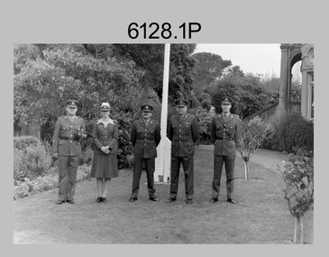
Photograph - Senior Leadership – Army Survey Regiment, Fortuna, Bendigo, c1986
These two photos were taken in front of the flagpole at the Army Survey Regiment, Fortuna probably in 1986. LTCOL Don Swiney MBE was appointed as CO of the Army Survey Regiment from 1985 to 1987. He was subsequently promoted to Colonel and was Director of the Royal Australian Survey Corp from November 1988 to January 1991, and the honorary position as Colonel Commandant from January 1993 to January 1996. WO1 Jeff Lynch’s appointment period as RSM was 1986 to 1988.This is a set of two photographs of the Survey Regiment’s senior leadership at Fortuna, Bendigo, 1986. The photographs were on 35mm negative film and were scanned at 96 dpi. They are part of the Army Survey Regiment’s Collection. .1) - Photo, black & white, 1986, L to R: RSM - WO1 Jeff Lynch, LT Alison Black, MAJ Terry Edwards, CO – LTCOL Don Swiney MBE, CAPT Andrew McLeod. .2) - Photo, black & white, 1986, L to R: RSM - WO1 Jeff Lynch, LT Alison Black, MAJ Terry Edwards, CO – LTCOL Don Swiney MBE, CAPT Andrew McLeod.No personnel are identifiedroyal australian survey corps, rasvy, army survey regiment, army svy regt, fortuna, asr -
 Bendigo Military Museum
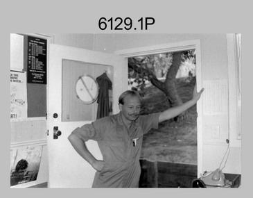
Photograph - Records Hut Personnel – Army Survey Regiment, Fortuna, Bendigo, c1986
These four photos of RaSVY personnel were taken inside the Records Hut, one of Headquarters Squadron’s work areas at the Army Survey Regiment, Fortuna probably in 1986. This building was located near the basketball court and probably at that time, held aerial photography archives, flight planning records, production data folders and final colour separated negatives of published maps.This is a set of two photographs of Records Hut personnel from Headquarters Squadron, Army Survey Regiment, Fortuna, Bendigo, 1986. The photographs were on 35mm negative film and were scanned at 96 dpi. They are part of the Army Survey Regiment’s Collection. .1) - Photo, black & white, 1986, Records Hut – SPR Brett Treneman. .2) - Photo, black & white, 1986, Records Hut – LCPL Bob Sheppard. .3) - Photo, black & white, 1986, Records Hut – L to R: LCPL Bob Sheppard, SPR Brett Treneman. .4) - Photo, black & white, 1986, Records Hut – L to R: LCPL Bob Sheppard, SPR Brett Treneman.No personnel are identifiedroyal australian survey corps, rasvy, army survey regiment, army svy regt, fortuna, asr -
 Bendigo Military Museum
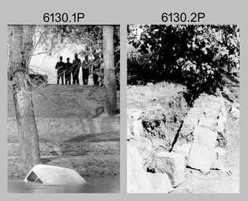
Photograph - Vehicle in Lake Incident - Army Survey Regiment, Fortuna, Bendigo, 1986
This is a set of 12 photographs of contractors removing a vehicle from the lake at the Army Survey Regiment, Fortuna, Bendigo in September 1986. The Ford XB panel van belonging to WO2 Ted Burgess rolled down the embankment during the night from the SGTs Mess carpark. Despite written off by the insurance company, the panel van was remarkably restored by Ted to roadworthy condition and driven in to Fortuna with a shark’s fin mounted on its roof. This incident is covered in more detail in page 152 of Valerie Lovejoy’s book 'Mapmakers of Fortuna – A history of the Army Survey Regiment’ ISBN: 0-646-42120-4.This is a set of 12 photograph of a civilian vehicle being removed from the lake at Army Survey Regiment at Fortuna, Bendigo, September 1986. The photographs were on 35mm negative film and were scanned at 96 dpi. They are part of the Army Survey Regiment’s Collection. .1) to .3) - Photo, black & white, 1986. Vehicle removal from lake. .4) - Photo, black & white, 1986. Vehicle removal from lake, Neil Morgan in foreground. .5) to .8) - Photo, black & white, 1986. Vehicle removal from lake. .9) to .10) - Photo, black & white, 1986. Vehicle removal from lake, Neil Morgan on right. .11) to .12) - Photo, black & white, 1986. Vehicle removal from lake.No personnel are identified. Annotated with date on negative sleeve.royal australian survey corps, rasvy, army survey regiment, army svy regt, fortuna, asr