Showing 244 items matching "atlases"
-
 Ballarat Heritage Services
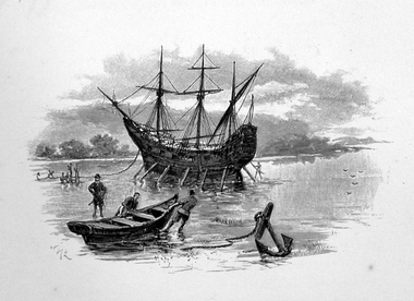
Image, Anchored Ship
First Published in Picturesque Atlas of Australia.Line drawing of a ship anchored on the coast.ship, exploration, immigration -
 Clunes Museum
Document - SHIRE DOCUMENT
COLLECTION MINUTES, ADVICE, RE CONSERVATION FOR TOWNSHIP OF CLUNES AND TALBOT RE LOCATION OR UNDER GROUNDING OF POWER AND REGISTER AND ATLAS OF LOCAL GOVERNMENT LAND USE ISSUESlocal history, document, conservation, talbot & clunes shire, heritage project -
Port Melbourne Historical & Preservation Society
Photograph - Double-sided aerial photograph, Hobson's Bay and the Yarra River/Port Phillip and Western Port Bay, Surveyor General and Director of Mapping, Apr 1990
Landsat imagery - an extract from the atlas of VictoriaAerial photos of Port Phillip and Western Port (double sided aerial photographs). 1995 side A: Hobson's Bay and Yarra River - aerial photo mosaic; side B. Port Phillip and Western Port Bays - satellite photo.port of melbourne authority -
Port Melbourne Historical & Preservation Society
Photograph - Double-sided aerial photograph, Hobson's Bay and the Yarra River/Port Phillip and Western Port Bay, Surveyor General and Director of Mapping, Apr 1990
Landsat imagery - an extract from the atlas of VictoriaAerial photos of Port Phillip and Western Port (double sided aerial photographs), framed and with timber display stand. 1995 side A: Hobson's Bay and Yarra River - aerial photo mosaic; side B. Port Phillip and Western Port Bays - satellite photomelbourne harbor trust - port of melbourne authority -
 Flagstaff Hill Maritime Museum and Village
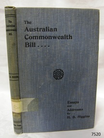
Book, Essays and Addresses on The Australian Commonwealth Bill
Essays and Addresses on The Australian Commonwealth Bill by Henry Bournes Higgins, one of the Victorian Members of the Australiasian Federal Convention, 1897-1898 Publisher: The Atlas Press Date: 1900Label on spine cover with typed text R.A. 994.03 HIG Pastedown front endpaper has sticker from Warrnambool Mechanics Institute and Free Library warrnambool, shipwrecked-coast, flagstaff-hill, flagstaff-hill-maritime-museum, maritime-museum, shipwreck-coast, flagstaff-hill-maritime-village, shipwrecked-artefact, book, warrnambool mechanics’ institute, essays and addresses on the australian commonwealth bill, the australian commonwealth bill, henry bournes higgins, victorian members of the australiasian federal convention, australiasian federal convention, -
Stawell Historical Society Inc
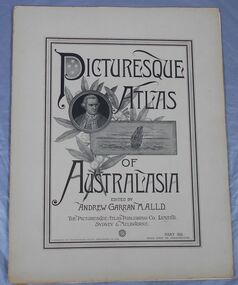
Book, Paul Hamlyn Pty, Ltd, Australia The First Hundred Years, 17.05.2021
Facsimile of Picturesque Atlas of Australia 1888. Bicentenary of Australia PublicationEditor: The Hon. Andrew Gartan M.A., L.L.D., M.L.C. A4 Mustard Cover Book Victoria P 151-254, 255-312. Stawell Lithograph P 275. Information p 277 - 278First Centuary of European Settlement - Inside Front cover. Berthing at Semi Circular Quay Sydney - end of Lithograph engravings.illustrated history -
 Bendigo Historical Society Inc.
Journal - Picturesque Atlas of Australasia
The Picturesque Atlas of Australasia was released in 42 supplements between 1886 and 1889 and attracted over 50,000 subscribers. Produced by the Picturesque Atlas Publishing Company in Wynyard Square, Sydney. The company was established in 1885. Edited by Andrew Garran. For detailed information search the website of the National Library of Australia. Thirty-three parts. Volume 9 to Volume 42. Volumes 1 - 8 and 28 are missing. Light tan coloured covers have a printed central rectangular double border. The title and publication information and illustrations are printed inside the border. The illustrations included are Captain Cook, a sailing ship and a sprig of wattle. The pages include many black and white illustrations. Volume 16 Separate map of Fiji. This Volume covers Bendigo as one of Victoria's country towns Volume 27 Includes separate Railway, Postal and telegraph map of Queensland. Volume 42 This last Volume contains a Miscellaneous section at the back with an Editorial Postscript and two maps - Australia and The Solar System.australasia, flora and fauna, subscription, history, exploration -
 Kiewa Valley Historical Society
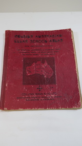
Book - Educational - School Atlas, Collins' Australian Clear School Atlas
Australian schools used Atlases to teach students geography and the nationalities of countries worldwide.Clare Roper was a resident of the Kiewa Valley. This atlas is of interest because it is circa 1950s and shows the world at this time.Thick red cardboard cover with black print and map of Australia on cover. It includes coloured maps of countries, black & white photos and an index at the back. On the inside of the cover both front and back it has black and white maps. There are 30 pages and it is bound. Circa 1950sCover page: handwritten "Margaret Tulloh / C. Roper / Margaret Tulloh / M.L.C. Some pages have been marked with pencilaustralian school atlas, clare roper -
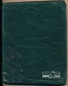
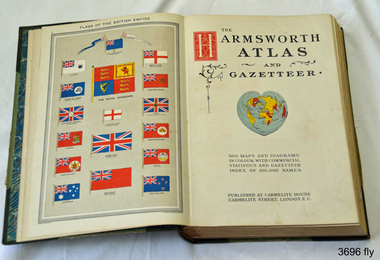 Flagstaff Hill Maritime Museum and Village
Book, Harmsworth Atlas and Gazetteer, 1908
This Harmsworth Atlas and Gazetteer was inherited by one of the donors, a gift from her father who was Tasmanian.Large hard covered book with maps, charts and tables. The cover is green linen with green leather, gilt trimmed corners and decorative spine, It includes 500 maps and diagrams in colour, with commercial statistics and gazetteer index of 105,000 names. Jan 1908. Also inserted between the pages of the book were 2 folded sheets of waxed paper, each with carefully placed flowers pressed between them; native orchids and wattle. Published at Carmelite House, Carmelite Road, London flagstaff hill, warrnambool, shipwrecked coast, flagstaff hill maritime museum, maritime museum, shipwreck coast, flagstaff hill maritime village, great ocean road, harmsworth atlas and gazetteer, atlas 1908, maps 1908, gazetteer 1908, book 1908, pressed australian native flowers, pressed wattle, pressed orchid -
 Yarrawonga and Mulwala Pioneer Museum
Book, The Specialty Press, The New Elizabethan World Atlas Illustrated, 1952
Provides names of countries and their borders as they were during the 1950'sMaroon hard cover illustrated atlas. Front embossed with title and royal seal. 152 pages. Contains detailed maps of world countries in colour. Early world history and it's development and comprehensive gazetteer.Owners name written in front pagesmaps -
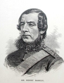 Ballarat Heritage Services
Image, Sir Henry Barkly, Governor of Victoria, c1886
First Published in Picturesque Atlas of Australia. Artist William Macleod, (1850-1929) had an extensive involvement in the 'Picturesque Atlas of Australasia' publication executing many of the portraits and was chairman of its publishing company. Macleod went onto join the Bulletin full time in 1886. (http://adb.anu.edu.au/biography/macleod-william-7419, accessed 28 March 2019)Line drawing of Henry Barkly.henry barkly, portrait, governor barkly, william macleod -
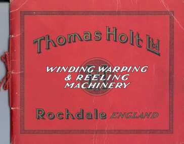 National Wool Museum
Booklet, Thomas Holt Ltd - Winding, Warping and Reeling Machinery
Catalogue of winding, warping and reeling machinery produced by the textile machinery manufacturers Thomas Holt Ltd at the Atlas Ironworks, Rochdale.Booklet, 36pp. Red card cover bound with red cord tie. Cover is printed with text in black, white and gold. Contains black and white illustrations of machinery.Thomas Holt Ltd / WINDING WARPING / & REELING / MACHINERY / Rochdale ENGLAND / TH Ltdthomas holt limited, warping machinery, winding machinery, reeling machinery -
 Bendigo Historical Society Inc.
Document - THE SYDENHAM GARDENS HOTEL
''The Sydenham Gardens Hotel'' - by John O'C. Hattam. Reference to Sydenham Gardens Road; the Atlas Hotel on Heathcote road; The Beehive; Roberts and Sons iron foundry; Craigs; fire; de-licencing; horse race - the ''A-Free-Goer'';buildings, hotel, sydenham garden hotel, white hills. -
 Bendigo Historical Society Inc.
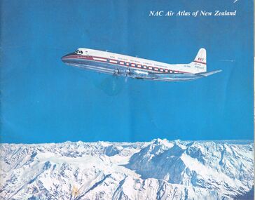
Document - MCCOLL, RANKIN AND STANISTREET COLLECTION: NAC AIR ATLAS OF NEW ZEALAND, 1955
McColl Rankin & Stanistreet, NAC Air Atlas of New Zealand. Photographs, arial photographs & maps. Shows air routes. Information on commercial air flights in New Zealand. Published by New Zealand National Airways Corp.organization, business, bendigo businesses, mccoll rankin & stanistreet, nac air atlas of new zealand -
Port Melbourne Historical & Preservation Society
Archive - Alan Mathews and family
The Mathews family have been in continuous ownership of 395 Howe Parade (was 8 Howe Parade until 1964 when addresses re-assigned), Port Melbourne from 1938 to the present (Sept 2019)Six folders of assorted documents relating to the life of Alan Mathews and his family. Collected items, paper notes, drawings from Alan's childhood. Nestle's Picture Album, Pictorial Atlas. Picture no 88 Rhineland castle Germanydomestic life, alan mathews -
 Linton and District Historical Society Inc
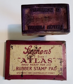
Stamp set, Rubber Stamp and Pad
Stamp set used in Carrie Murrell's lending library, run in conjunction with Murrell's Newsagency and shop, Sussex Street, Linton.Oblong, wooden stamp, with black handle and rubber face. When printed, stamp reads 'C. Murrell / Linton Library'. Stamp pad in shallow, metal container, "Stephen's No. 2 size 'Atlas' Rubber Stamp Pad" on lid."C. Murrell's/Linton Library".stamps, stamp pads, office equipment, murrell's newsagency and library -
 Greensborough Historical Society
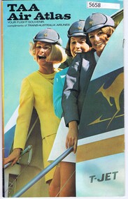
Booklet, TAA Air Atlas, 1972_
Souvenir publication, detailing airline routes, services and aircraft. TAA air atlas: your flight souvenir, compliments of Trans-Australia Airlines.16 p., printed in colour, maps, photographs and text.airlines, trans-australia airlines -
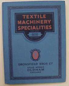 National Wool Museum
Catalogue, Textile Machinery Specialities
"Textile Machinery Specialities" - Dronsfield Bros Ltd, Atlas Works, Oldham, England, 13th ed. 1924. Catalogue for grinding machines and card making machines.textile machinery, dronsfield bros ltd -
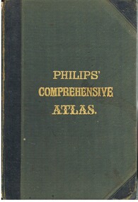 Bendigo Historical Society Inc.
Book - LYDIA CHANCELLOR COLLECTION: PHILLIPS' COMPREHENSIVE ATLAS
A gray hard covered atlas titled ' Phillips' Comprehensive Atlas of Ancient and Modern Geography.' Edited by William Hughes, FRGS. London. George Phillip and Son, 32 Fleet St., Liverpool, Caxton Buildings, South John St., 1874. 42 pgs., maps, index. NB: In the inside cover of the book is a newspaper cutting of a letter from G. Wilson Brown Secretary, Education Department, Melbourne, 12th November, 1878 advertising 'an examination of Teachers and Candidates will be held at School 1,976, Sandhurst, on Thursday and Friday, 19th and 20th December, 1878, commencing at 9.30 a.m.'Edited by William Hughes, F.R.G.S.map, lydia chancellor collection, collection, atlas, maps, world, book, books -
 Eltham District Historical Society Inc
Book, George Robertson and Company, Atlas
School atlas (title and year of publication unknown) owned by Ada Shillinglaw. Ada was the youngest child of the Shillinglaw family. One of five items relating to the Shillinglaw Family collectionThe book was owned by Ada Shillinglaw. This family were pioneer settlers in the Eltham area.Hardcover covered in green vinyl wrapInscription on flyleaf: Ada Shillinglaw shillinglaw family collection, atlas -
Clunes Museum
book, PEARS, PEARS CYCOPAEDIA, CIRCA 1912
RED HARD COVERED BOOK. PEARS SHILLING CYCLOPAEDIA. INDEX ON FRONT COVER. 1072 PAGES. HAS UNIVERSAL TIME INDICATER IN BACK COVER. PRINTED AND PUBLISHED BY A AND F PEARS LIMITED, 71 - 75 NEW OXFORD STREET.local history, book, reference, books - reference -
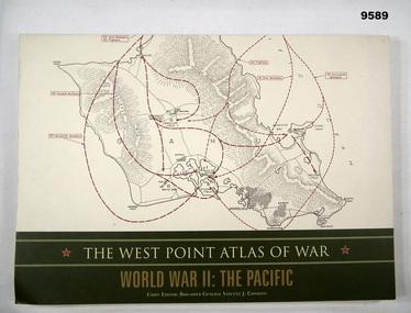 Bendigo Military Museum
Book - ATLAS, PACIFIC, WW2, Brigadier General Vincent J. Esposito, THE WEST POINT ATLAS OF WAR/ WORLD WAR II: THE PACIFIC, Original 1959
"Originally published in 1959 as part of a two volume set. The West Point Atlas of War: World War II/ The Pacific provides a unique way of studying military history."Soft cover book. Cover - cardboard, beige and gold colour print on front, spine and back. Illustrated - front and back - red and black colour print of maps. 128 pages - cut, plain, off white colour, heavy gauge paper. Illustrated black, red and dark green maps and black and white photographs.publication, book, atlas, pacific, ww2 -
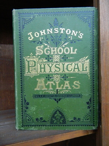 Ballarat Clarendon College
Book, School atlas of physical geography
Robert Mitchell attended Ballarat College 1879The book was printed in 1878 year, The place of publication of the book is W & A K Johnston, Edinburgh and London, 1878. A School Atlas of Physical Geography. Book in English language. Book has cover wear and fading, modest foxing to plates. Some plates are missingHandwritten on flyleaf: R. A Mitchell July 1878 / Ballarat / RAM -
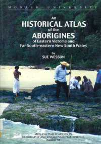 Victorian Aboriginal Corporation for Languages
Book, Sue Wesson, An historical atlas of the Aborigines of Eastern Victoria and Far South-eastern New South Wales, 2000
An extremely detailed atlas of tribes, clans, and languages in eastern Victoria and south-eastern New South Wales. Includes maps, census information about the numbers and makeup of these clans in historical records, meanings and comparative spellings of all known named tribes and clans.maps, b&w photographs, colour photographs, tables -
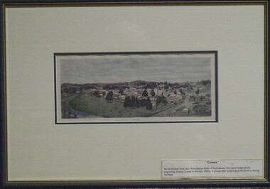 Clunes Museum
Print - ANTIQUARIAN PRINT, 1890
An illustration from the Picturesque Atlas of Australasia, hand-tinted photo-engraving by W.C. Fitler shows Clunes in late 1880's. It shows little evidence of the town's mining heritageTINTED RELIEF WOOD ENGRAVING PRINT OF THE TOWNSHIP OF CLUNES. HAND COLOURED, MOUNTED AND FRAMED WITH CREAM COLOURED MATT, DARK GREEN FRAME AND GOLD INSIDE TRIM.GENUINE ANTIQUARIAN PRINT LABEL ON BACK FROM LECKIE GALLERYwood engraving, relief, 1890, w.c.fitler -
Blacksmith's Cottage and Forge
Piano
The piano has a serial number of 15931 which makes its birth date about 1868 - given the approximate figures from the 'Pierce Piano Atlas' of 13000 for 1865 and 19000 for 1870.Wood framed upright piano. Ornate turned legs, keyhold in lid (no key). Two moving brass candleholdes on upright attached by bracket - dragon like design. Gold inlay inside lid. Top has wooden - press knob to open. Wooden msic rach folds out.A Bord, Paris. Serial number is 15931furniture, domestic, piano, musical instruments, keyboard, candleholders, upright -
 Greensborough Historical Society
Book - Atlas, Victoria. Department of Sustainability and Environment, Melbourne atlas, 2006_
The purpose of the Melbourne Atlas is to give a spatial view of physical , environmental, social, economic and cultural aspects of Melbourne which can be used in planning. It contains maps and graphs depicting many aspects of life in Melbourne. A snapshot of life in Melbourne in 2006.Various paging, text, illus., colour maps. Wire binding.melbourne, maps, town planning, social conditions -
Glenelg Shire Council Cultural Collection
Book, Illustrated Bible Geography and Atlas, n.d
religion; atlas; geography; Bible; Judah; Israel;Book, 'Illustrated Bible Geography and Atlas'. red card covers, white banner with red print. Map of Judah and Israel in white on front cover. 32 pages on geography of the Bible; 16 pages of coloured maps, most in biblical times; 8 black and white photos of Jerusalem.religion; atlas; geography; Bible; Judah; Israel; -
 Flagstaff Hill Maritime Museum and Village
Book, Coltons General Atlas
Colton's General Atlas Date: 1866 Register of Authorised Copies of the Standard Weights and Measures Issued The Centre page of the Book has the heading of "Register of Authorised Copies of The Standard Weights and Measures Issued 1866." All front half pages are stapled together. All back half pages are stapled together. No Markingsflagstaff hill, warrnambool, maritime village, maritime museum, shipwreck coast, great ocean road, coltons general atlas, weights and measures -
 Tennis Australia
Racquet, Circa 1927
A wooden racquet, with purple plastic shoulder reinforcements, green and white whipping, and fine-grooved handle. Inscription along throat on obverse: CHAMPION. Inscription across throat on reverse: DAVEGA/SPORTS/DIVISION OF ATLAS STORES CORP. OF AMERICA. Materials: Wood, Gut, String, Plastic, Ink, Cloth, Glue, Lacquer, Metaltennis