Showing 211 items
matching grass tree
-
 Vision Australia
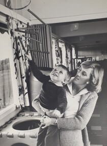
Photograph (item) - Image, Sandie Mackevicius holding a child
... there is a grassed area bordered by trees. The curtains are distinctly..., that children can play in, and outside the window there is a grassed ...Early childhood educator Sandie Mackevicius holds a small boy as he reaches overhead for some wooden rods that are suspended from the ceiling. Beside them is a large square cube with holes, that children can play in, and outside the window there is a grassed area bordered by trees. The curtains are distinctly patterned and the room stretches out behind them. This image was probably taken at RVIB School.rvib school, royal victorian institute for the blind, sandie mackevicius -
 Federation University Historical Collection
Document, Mount Helen Campus Arboretum, c1992
... (Geocrinia victoriana), and admire the grass trees (Xanthorrhea...), and admire the grass trees (Xanthorrhea australis) that grow ...A trail travels through the Arboretum where you may see resting kangaroos and wallabies, crosses a creek that holds a vulnerable colony of frogs commonly known as Victorian Smooth Froglet (Geocrinia victoriana), and admire the grass trees (Xanthorrhea australis) that grow on the campus behind accommodation. In 2018 2000 native trees planted by State Library Victoria and Federation University in the Arboretum .Planted with the help of locals, students, and kindergarten children as part of the joint project the plantings included indigenous trees, shrubs and grasses native to Ballarat. Federation University student Clancy Meaney is managing the tree planting project as part of her studies. “The arboretum is a fantastic resource that is used extensively by Federation University students as an outdoor classroom,” Ms Meaney said. “Being situated in between two main forests, our campus is also an important connection for native animals. These new trees will help migrating wildlife to move from one forest to the other.” State Library Victoria Project Management Office Director, Sarah Slade said the project was a wonderful opportunity to work with Mount Helen residents and the University to help protect the native landscape. “We’re thrilled to be able to give back to students, local residents and native flora and fauna through this valuable environmental initiative,” Ms Slade said. The tree planting project is a result of State Library Victoria’s ongoing partnership with Federation University. Construction of the Library’s second state-of-the-art storage facility, BOSS2 (Ballarat off-site store 2), is currently underway on the Federation University site. The existing storage facility at the Mount Helen Campus already holds more than half of the State Library’s collection, including newspapers, books, journals, textiles, paintings, architectural drawings, furniture and photographic glass plate negatives. In addition to State Library collection, BOSS2 will also provide two dedicated storage areas for the University’s collection. When completed, BOSS2 will provide additional storage of 25-30 linear kilometres, the equivalent of driving from Ballarat to Clunes or running 175 lengths of the MCG. The Mount Helen Campus Arboretum was established c1992.arboretum, mt helen campus arboretum, graeme ambrose, mt helen campus -
 Bendigo Historical Society Inc.
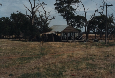
Photograph - ROY J MITCHELL COLLECTION: FARM SHED
... iron roof. Trees behind, grass paddock in foreground. Written... with corrugated iron roof. Trees behind, grass paddock in foreground ...Colour photograph of dilapidated farm shed near Goornong. Shed appears to be a shelter, open underneath with corrugated iron roof. Trees behind, grass paddock in foreground. Written on back ' 29.3.96 near Goornong vict 14.30 hours, Shepparton-Bendigo Road, near Goornong. By Roy J Mitchell Bendigo.'agriculture, farm, shed -
 Glenelg Shire Council Cultural Collection
Postcard - Postcard - Portland Beach, 1905-1915
... , in background. Two ladies sitting on bench, right 3 men lying in grass..., in background. Two ladies sitting on bench, right 3 men lying in grass ...Black and white postcard. Showing band reserve and beach at Portland. Looking towards sea. railway pier and ocean pier visible, in background. Two ladies sitting on bench, right 3 men lying in grass, right. Cypress in tree guard, beach shelter, numerous people sitting/walking on beach. Reverse, address and message in pen, penny stamp.Front: 'Band Reserve and Beach, Portland'- printed bottom left. Back- Message and address in pen.photography, postcard, portland seafront, beach, recreation -
 Federation University Historical Collection
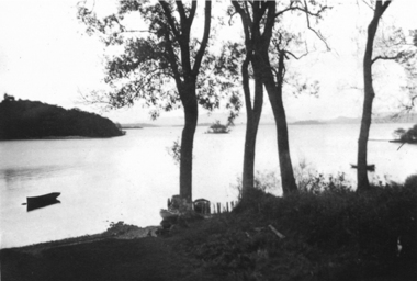
Photograph - black and white, Frank Wright at Loch Lomond, 1933, 1933
... of a lake. In the foreground is a grassed area with four trees... is a grassed area with four trees. a small boat is at anchor just ...Frank Wright was a renoun resident of Smeaton, where he was born on 2 August 1901. He lived at Laura Villa, and attended Smeaton State School. His father William was a gold miner and his mother's name was Sarah. Their family won many singing and instrumental awards. Frank was tutored by Percy Code and was awarded a gold medal for the highest marks in the ALCM examinations in the British Colonies at the age of seventeen years. He became the Australian Open Cornet Champion by the age of eighteen. A year later, Frank conducted the City of Ballarat Band, and later the Ballarat Soldiers’ Memorial Band. He formed the Frank Wright Frisco Band and Frank Wright and his Coliseum Orchestra. These bands won many South Street awards, and Frank as conductor won many awards in the Australian Band Championship contest. In 1933 Frank Wright sailed to England to conduct the famous St Hilda’s Band and was later appointed Musical Director of the London County Council, where he organized many amazing concerts in parks, in and around the London district. He was made Professor of Brass and Military Band Scoring and conducted at the Guildhall of Music and Drama. Frank was often invited to adjudicate Brass Band Championships around Europe, in Australia, including South Street and in New Zealand. The Frank Wright Medal at the Royal South Street competition is awarded to an individual recognized as making an outstanding contribution to brass music in Australia. He died on 16 November 1970.1). A black and white photograph of a man dressed in a suit, overcoat and hat, standing on a wooden pier over a stretch of water which is Loch Lomond. There are mountains to be seen in the distance. The man is Frank Wright. 2). Black and white photograph of a lake. In the foreground is a grassed area with four trees. a small boat is at anchor just offshore. The place is Loch Lomond.Written in pencil on the reverse side of the photograph is 1). "Frank Wright at Loch Lomond 1933" 2). Loch Lomond 1933frank wright, loch lomond, musician, composer -
Tatura Irrigation & Wartime Camps Museum
Painting - Painting - watercolour - copy, South Africa from Ferry
... of trees, rocks, grass and plants.... of trees, rocks, grass and plants. South Africa from Ferry Painting ...Painted by George RosenkranzThe watercolour has a thin black border around it, a 1 cm brown paper frame, a 4cm plus white mat and framed in a brown wooden frame. Picture is a view looking down into a valley with a pointed top mountain in the centre of the picture. Blue skies with a bird flying in right side. front of mountain are a couple of trees, rocks, grass and plants.george rosenkranz, south africa -
 Glenelg Shire Council Cultural Collection
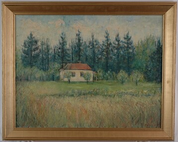
Painting, Jack Freeman, Landscape Dandenong, c. 1961
... trees and grasses. The building is situated in the centre... a small building set amongst tall trees and grasses. The building ...CEMA Art Collection Winner of Portland Artist's Society Prize 1961The painting depicts a small building set amongst tall trees and grasses. The building is situated in the centre of the work and is cream with a red roof and red awnings. In the foreground is a large area of long grass which leads into the shorter maintained grass that surrounds the building. Behind the building are numerous tall dark green trees. The work has a wide gilded frame and exposed canvas.Front: (No inscriptions) Back: Jack Freeman 1961 Landscape Dandenong (top right, black handwriting) 18 (white sticker) -
 Bendigo Historical Society Inc.
Photograph - BOTANICAL GARDENS
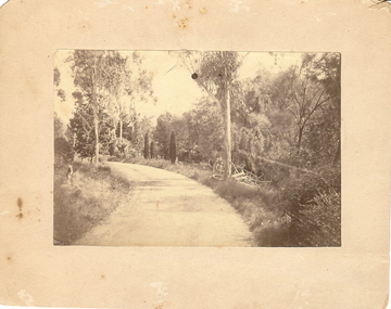
... , gravelled, eucalypt and conifer trees, uncut grass, wire fence... trees, uncut grass, wire fence middle distance. Pathway curving ...sepia photograph on cream board. Driveway/pathway, gravelled, eucalypt and conifer trees, uncut grass, wire fence middle distance. Pathway curving to left from front of photo. Written in blue pen on rear of photo : Botanical Gardens or early path in Fortuna. English trees planted, e.g. cypress. Holdsworth Road, adj. White Hills Cemetery Reserve. Crowned road grade. Heavy intermediate fence posts.unknownplace, land, botanical gardens, fortuna ? -
 Bendigo Historical Society Inc.
Document - MALONE COLLECTION: GREETING CARDS
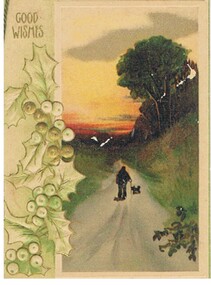
... walking along a road in hill country. There are trees and grass.... There are trees and grass along the road. In the distance the sky is red ...Document. Greeting Cards. Pale green card with darker shade around the edges. On the left is embossed holly coloured in green, white & gold. On the right is a coloured scene with a white raised frame. The scene consists of a man and a dog walking along a road in hill country. There are trees and grass along the road. In the distance the sky is red, yellow & orange. Good Wishes printed in gold in the top left corner. Verse by H. M. Burnside inside. Card & insert held together with green cord.Raphael Tuck & Sons Ltdperson, greeting cards, malone collection, malone collection, greeting cards, h. m. burnside -
 Bayside Gallery - Bayside City Council Art & Heritage Collection
Painting - oil and acrylic on canvas, Robert Kelly, Chinaman's Creek, 2016
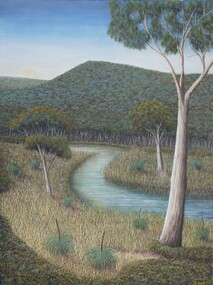
... the surrounding vegetation of spinifex grasses and gum trees... of spinifex grasses and gum trees, the background hills are abundant ...Bob Kelly paints landscapes of culturally significant sites along the Mornington Peninsula and depicts these locations as he imagines they originally were before colonisation. Using traditional Western painting techniques, Kelly records the underlying spirit of the Peninsula from a Wathaurong perspective. Chinaman’s Creek in Capel Sound (Rosebud West) was an important watercourse that originally ran from Wonga (Arthur’s Seat) down through Tootgarook Swamp into Port Phillip Bay. It was a great fresh water and food source and home for many Boonwurrung people. Since settlement over 170 years ago, the creek has been drained, blocked, reconstructed and damaged. Kelly depicts a lush green landscape in which the clean creek water winds through the surrounding vegetation of spinifex grasses and gum trees, the background hills are abundant with trees, untouched from man's intervention. Using painstaking detail, Kelly records each blade of grass and ripple on the surface of Chinaman’s Creek. His attention to detail serves to powerfully reimagine this important cultural site, returning it to its former pristine state, and reinvigorating its role as a key place of sustenance for the Indigenous populations of the Peninsula. Chinaman's Creek was a finalist in the 2017 Bayside Acquisitive Art Prize.oil and acrylic on canvaslandscape, creek, trees, chinaman's creek, painting, indigenous, robert kelly, bayside acquisitive art prize, bob kelly, wathaurong, rosebud, arthur's seat, tootgarook swamp, port phillip bay, boonwurrung -
 Eltham District Historical Society Inc
Photograph - Digital Photograph, Alan King, Kinglake National Park, 27 March 2008
... grass-trees, ferns and Hazel Pomaderris. In spring, orchids... grass-trees, ferns and Hazel Pomaderris. In spring, orchids ...Fern gullies around Jehosaphat Gully Covered under National Estate. Published: Nillumbik Now and Then / Marguerite Marshall 2008; photographs Alan King with Marguerite Marshall.; p125 The magnificent Kinglake National Park, fringing Nillumbik’s north, is the largest national park close to Melbourne. Thanks to the vision and hard work of a band of local people, the park was created from what was rapidly becoming degraded land. Seeing a threat to Kinglake’s indigenous flora and fauna, several prominent local people campaigned for a national park, which was established in 1928.1 Since then, the park has grown through donations and acquisitions of land, from around 13,800 acres of land (5585ha) to 22,360 hectares. The Sugarloaf and Everard Blocks – of almost 8000 hectares – stand in Nillumbik and the park extends into Mitchell and Murrundindi Shires and the City of Whittlesea. Mt Everard commemorates William Hugh Everard, State member for Evelyn when the park was established. Before 1928, European settlers had degraded the Kinglake area, which was named after the celebrated English author and lawyer, Alexander William Kinglake. Remains of gold shafts and diggings in the park are reminders of Kinglake’s first settlers, who hoped to strike it rich at the gold diggings. But like other gold fields in this shire, they proved not very lucrative and soon timber cutting replaced mining in importance. However, before long, the accessible timber supply ran out, so in the 1920s agriculture took over – particularly potatoes and berry fruits – which involved large-scale clearing.2 The park’s instigator was retired Melbourne University Professor of Music, William Laver.3 As chair of the Kinglake Progress Association he began negotiations to have crown lands on the southern scarp of the Great Dividing Range reserved as a national park. Even before the park was proclaimed, from 1927, KPA members cut tracks to the major scenic points. Professor Laver was one of several people who gave land for the park, donating around 50 acres (20ha), including the Jehosaphat Gully.4 Laver chaired the park’s first Committee of Management, which raised money to employ a ranger and provide facilities, including tracks and roads for fire protection vehicles, toilets and shelters. The committee charged fees for firewood collection, some grazing of livestock, and visitor entrance, and obtained small State Government and Eltham Shire grants. In 1957 the State Government provided revenue for national parks. Then, in 1975, the State Government took over the management and the Committee of Management became an advisory committee, which disbanded in 1978. Originally, the park covered crown land in the Shires of Eltham and Whittlesea; then Wombelano Falls in Yea and other areas were added. In 1970 the park extended into the Shires of Eltham, Healesville, Whittlesea and Yea.5 Bush fires have been an ongoing problem. In 1939 hundreds of eucalypts and acacias had to be sown around the Jehosaphat Gully to rejuvenate the forest. To manage bushfires, the Committee of Management, then the State Government, worked closely with the Forestry Commission, shire councils and local fire brigades. Early national parks focussed on recreation. But by the 1980s, conservation, education and scientific research became more important, playing a vital role in preserving representative samples of the natural environment. Each year many thousands of people use the park’s extensive network of walking tracks amongst the protected plant and animal life as well as camping, cycling and horse riding. The park, along the slopes of the Great Dividing Range, has lookouts revealing magnificent views of the Melbourne skyline, Port Phillip Bay, the Yarra Valley and the You Yangs. Vegetation in the Masons Falls area includes messmate forest, Austral grass-trees, ferns and Hazel Pomaderris. In spring, orchids, lilies, everlasting daisies, correas, grevillea and heath appear. Around Jehosaphat Gully are wet and dry forest, fern gullies and banksia. Animal life includes wallabies, kangaroos, koalas, echidnas, possums, gliders and bandicoots. Male lyrebirds can be heard mimicking in the Jehosaphat Gully, particularly in the Everard Block in winter.This collection of almost 130 photos about places and people within the Shire of Nillumbik, an urban and rural municipality in Melbourne's north, contributes to an understanding of the history of the Shire. Published in 2008 immediately prior to the Black Saturday bushfires of February 7, 2009, it documents sites that were impacted, and in some cases destroyed by the fires. It includes photographs taken especially for the publication, creating a unique time capsule representing the Shire in the early 21st century. It remains the most recent comprehenesive publication devoted to the Shire's history connecting local residents to the past. nillumbik now and then (marshall-king) collection, kinglake national park, jehosaphat gully -
 Ballarat Heritage Services
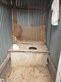
Photograph - Photograph - Colour, Clare Gervasoni, Toilet at St Laurence O'Toole Catholic Church, Sandon, 2017, 08/04/2023
... of graves and cemetery architecture, and the grassed and treed rural... of graves and cemetery architecture, and the grassed and treed rural ...St Laurence O'Toole church and cemetery is located in a rural setting at 801/821 Creswick-Newstead Rd, Sandon. Originally a small wooden school (22’x14’) was erected in Sandon by Father Patrick Smyth (who was involved in the Eureka Stockade movement) in 1859. It was also used for Mass and became known as a chapel. In June 1882 tenders were called for the construction of a brick Church by the Castlemaine architect, T.F. Kibble, and it was built at a cost of 1000 pounds. The church was blessed by Archbishop Goold on 06 May 1883 and dedicated to St Laurence O'Toole. The brick building demonstrates original design qualities of a Victorian Rudimentary Gothic style, including the steeply pitched, parapet gable roof form, together with a central steeply pitched, gabled porch that projects slightly from the main gable end. Other intact qualities include the exposed brick wall construction, lapped galvanised corrugated iron roof cladding, minor gabled porch at the rear, small ventilation dormers nearby the roof ridgeline, series of stone steps that lead to the central porch with its double pointed door opening and vertical boarded doors, simple rose window in the main gable end, pointed windows, brick buttresses with double lower copings, and the light masonry detailing (the banding marking the floor level within, buttress copings, window and door surrounds and quoins, and the drip moulds).(Shire of Mount Alexander: Heritage Study of the former Shire of Newstead, 2000) The visually connected cemetery demonstrates important visual qualities formed by the regular rows of graves and cemetery architecture, and the grassed and treed rural landscape. It is a rare and substantially intact example of a Victorian Catholic Church with a cemetery in its churchyard. Many headstones and cemetery architecture, date from the 19th century and represent some fine examples of masonry craftsmanship. Some refurbisments occurred during the 1940s and in 2002 a major restoration project was undertaken from roof to footings, by a dedicated band of volunteers and trades people. Work was completed mid 2003 and in November 2003 St Laurence’s was re-dedicated with the celebration of Mass and a picnic tea. Colour photograph of a long drop toliet at the Catholic Church, Sandon, Victoria.sandon, sandon cemetery, st laurence o'toole catholic church, sandon -
 Ballarat Heritage Services
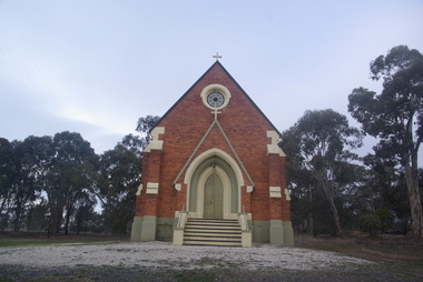
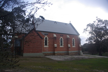
Photograph - Photograph - Colour, Lisa Gervasoni, St Laurence O'Toole Catholic Church, Sandon, 2017, 16/07/2017
... of graves and cemetery architecture, and the grassed and treed rural... of graves and cemetery architecture, and the grassed and treed rural ...St Laurence O'Toole church and cemetery is located in a rural setting at 801/821 Creswick-Newstead Rd, Sandon. Originally a small wooden school (22’x14’) was erected in Sandon by Father Patrick Smyth (who was involved in the Eureka Stockade movement) in 1859. It was also used for Mass and became known as a chapel. In June 1882 tenders were called for the construction of a brick Church by the Castlemaine architect, T.F. Kibble, and it was built at a cost of 1000 pounds. The church was blessed by Archbishop Goold on 06 May 1883 and dedicated to St Laurence O'Toole. The brick building demonstrates original design qualities of a Victorian Rudimentary Gothic style, including the steeply pitched, parapet gable roof form, together with a central steeply pitched, gabled porch that projects slightly from the main gable end. Other intact qualities include the exposed brick wall construction, lapped galvanised corrugated iron roof cladding, minor gabled porch at the rear, small ventilation dormers nearby the roof ridgeline, series of stone steps that lead to the central porch with its double pointed door opening and vertical boarded doors, simple rose window in the main gable end, pointed windows, brick buttresses with double lower copings, and the light masonry detailing (the banding marking the floor level within, buttress copings, window and door surrounds and quoins, and the drip moulds).(Shire of Mount Alexander: Heritage Study of the former Shire of Newstead, 2000) The visually connected cemetery demonstrates important visual qualities formed by the regular rows of graves and cemetery architecture, and the grassed and treed rural landscape. It is a rare and substantially intact example of a Victorian Catholic Church with a cemetery in its churchyard. Many headstones and cemetery architecture, date from the 19th century and represent some fine examples of masonry craftsmanship. Some refurbisments occurred during the 1940s and in 2002 a major restoration project was undertaken from roof to footings, by a dedicated band of volunteers and trades people. Work was completed mid 2003 and in November 2003 St Laurence’s was re-dedicated with the celebration of Mass and a picnic tea. Colour photograph of a brick church at Sandon, Victoria.sandon, sandon cemetery, st laurence o'toole catholic church, sandon -
 Ballarat Heritage Services
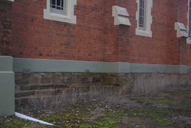
Photograph - Photograph - Colour, Clare Gervasoni, Sandstone foundations at St Laurence O'Toole Catholic Church, Sandon, 2017, 16/07/2017
... of graves and cemetery architecture, and the grassed and treed rural... of graves and cemetery architecture, and the grassed and treed rural ...St Laurence O'Toole church and cemetery is located in a rural setting at 801/821 Creswick-Newstead Rd, Sandon. Originally a small wooden school (22’x14’) was erected in Sandon by Father Patrick Smyth (who was involved in the Eureka Stockade movement) in 1859. It was also used for Mass and became known as a chapel. In June 1882 tenders were called for the construction of a brick Church by the Castlemaine architect, T.F. Kibble, and it was built at a cost of 1000 pounds. The church was blessed by Archbishop Goold on 06 May 1883 and dedicated to St Laurence O'Toole. The brick building demonstrates original design qualities of a Victorian Rudimentary Gothic style, including the steeply pitched, parapet gable roof form, together with a central steeply pitched, gabled porch that projects slightly from the main gable end. Other intact qualities include the exposed brick wall construction, lapped galvanised corrugated iron roof cladding, minor gabled porch at the rear, small ventilation dormers nearby the roof ridgeline, series of stone steps that lead to the central porch with its double pointed door opening and vertical boarded doors, simple rose window in the main gable end, pointed windows, brick buttresses with double lower copings, and the light masonry detailing (the banding marking the floor level within, buttress copings, window and door surrounds and quoins, and the drip moulds).(Shire of Mount Alexander: Heritage Study of the former Shire of Newstead, 2000) The visually connected cemetery demonstrates important visual qualities formed by the regular rows of graves and cemetery architecture, and the grassed and treed rural landscape. It is a rare and substantially intact example of a Victorian Catholic Church with a cemetery in its churchyard. Many headstones and cemetery architecture, date from the 19th century and represent some fine examples of masonry craftsmanship. Some refurbisments occurred during the 1940s and in 2002 a major restoration project was undertaken from roof to footings, by a dedicated band of volunteers and trades people. Work was completed mid 2003 and in November 2003 St Laurence’s was re-dedicated with the celebration of Mass and a picnic tea. Details of the exterior of St Laurence O'Toole Catholic Church, Sandon in Central Victoria.sandon, sandon cemetery, st laurence o'toole catholic church, sandon, sandstone, foundations -
 Ballarat Heritage Services
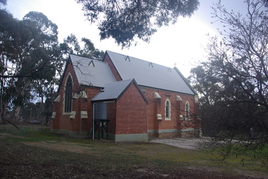
Photograph - Photograph - Colour, Clare Gervasoni, St Laurence O'Toole Catholic Church, Sandon, 2017, 16/07/2017
... of graves and cemetery architecture, and the grassed and treed rural... of graves and cemetery architecture, and the grassed and treed rural ...St Laurence O'Toole church and cemetery is located in a rural setting at 801/821 Creswick-Newstead Rd, Sandon. Originally a small wooden school (22’x14’) was erected in Sandon by Father Patrick Smyth (who was involved in the Eureka Stockade movement) in 1859. It was also used for Mass and became known as a chapel. In June 1882 tenders were called for the construction of a brick Church by the Castlemaine architect, T.F. Kibble, and it was built at a cost of 1000 pounds. The church was blessed by Archbishop Goold on 06 May 1883 and dedicated to St Laurence O'Toole. The brick building demonstrates original design qualities of a Victorian Rudimentary Gothic style, including the steeply pitched, parapet gable roof form, together with a central steeply pitched, gabled porch that projects slightly from the main gable end. Other intact qualities include the exposed brick wall construction, lapped galvanised corrugated iron roof cladding, minor gabled porch at the rear, small ventilation dormers nearby the roof ridgeline, series of stone steps that lead to the central porch with its double pointed door opening and vertical boarded doors, simple rose window in the main gable end, pointed windows, brick buttresses with double lower copings, and the light masonry detailing (the banding marking the floor level within, buttress copings, window and door surrounds and quoins, and the drip moulds).(Shire of Mount Alexander: Heritage Study of the former Shire of Newstead, 2000) The visually connected cemetery demonstrates important visual qualities formed by the regular rows of graves and cemetery architecture, and the grassed and treed rural landscape. It is a rare and substantially intact example of a Victorian Catholic Church with a cemetery in its churchyard. Many headstones and cemetery architecture, date from the 19th century and represent some fine examples of masonry craftsmanship. Some refurbisments occurred during the 1940s and in 2002 a major restoration project was undertaken from roof to footings, by a dedicated band of volunteers and trades people. Work was completed mid 2003 and in November 2003 St Laurence’s was re-dedicated with the celebration of Mass and a picnic tea. Brick church at Sandon, Victoriasandon, sandon cemetery, st laurence o'toole catholic church, sandon -
 Ballarat Heritage Services
Photograph, Clare Gervasoni, St Laurence O'Toole Catholic Church, Sandon, 2017, 16/07/2017
... of graves and cemetery architecture, and the grassed and treed rural... of graves and cemetery architecture, and the grassed and treed rural ...St Laurence O'Toole church and cemetery is located in a rural setting at 801/821 Creswick-Newstead Rd, Sandon. Originally a small wooden school (22’x14’) was erected in Sandon by Father Patrick Smyth (who was involved in the Eureka Stockade movement) in 1859. It was also used for Mass and became known as a chapel. In June 1882 tenders were called for the construction of a brick Church by the Castlemaine architect, T.F. Kibble, and it was built at a cost of 1000 pounds. The church was blessed by Archbishop Goold on 06 May 1883 and dedicated to St Laurence O'Toole. The brick building demonstrates original design qualities of a Victorian Rudimentary Gothic style, including the steeply pitched, parapet gable roof form, together with a central steeply pitched, gabled porch that projects slightly from the main gable end. Other intact qualities include the exposed brick wall construction, lapped galvanised corrugated iron roof cladding, minor gabled porch at the rear, small ventilation dormers nearby the roof ridgeline, series of stone steps that lead to the central porch with its double pointed door opening and vertical boarded doors, simple rose window in the main gable end, pointed windows, brick buttresses with double lower copings, and the light masonry detailing (the banding marking the floor level within, buttress copings, window and door surrounds and quoins, and the drip moulds).(Shire of Mount Alexander: Heritage Study of the former Shire of Newstead, 2000) The visually connected cemetery demonstrates important visual qualities formed by the regular rows of graves and cemetery architecture, and the grassed and treed rural landscape. It is a rare and substantially intact example of a Victorian Catholic Church with a cemetery in its churchyard. Many headstones and cemetery architecture, date from the 19th century and represent some fine examples of masonry craftsmanship. Some refurbisments occurred during the 1940s and in 2002 a major restoration project was undertaken from roof to footings, by a dedicated band of volunteers and trades people. Work was completed mid 2003 and in November 2003 St Laurence’s was re-dedicated with the celebration of Mass and a picnic tea. Colour photograph of a red brick church in Sandon. sandon, sandon cemetery, st laurence o'toole catholic church, sandon -
 Ballarat Heritage Services
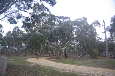
Photograph - Photograph - Colour, Clare Gervasoni, Treed road behind St Laurence O'Toole Catholic Church, Sandon, 2017, 16/07/2017
... of graves and cemetery architecture, and the grassed and treed rural... of graves and cemetery architecture, and the grassed and treed rural ...St Laurence O'Toole church and cemetery is located in a rural setting at 801/821 Creswick-Newstead Rd, Sandon. Originally a small wooden school (22’x14’) was erected in Sandon by Father Patrick Smyth (who was involved in the Eureka Stockade movement) in 1859. It was also used for Mass and became known as a chapel. In June 1882 tenders were called for the construction of a brick Church by the Castlemaine architect, T.F. Kibble, and it was built at a cost of 1000 pounds. The church was blessed by Archbishop Goold on 06 May 1883 and dedicated to St Laurence O'Toole. The brick building demonstrates original design qualities of a Victorian Rudimentary Gothic style, including the steeply pitched, parapet gable roof form, together with a central steeply pitched, gabled porch that projects slightly from the main gable end. Other intact qualities include the exposed brick wall construction, lapped galvanised corrugated iron roof cladding, minor gabled porch at the rear, small ventilation dormers nearby the roof ridgeline, series of stone steps that lead to the central porch with its double pointed door opening and vertical boarded doors, simple rose window in the main gable end, pointed windows, brick buttresses with double lower copings, and the light masonry detailing (the banding marking the floor level within, buttress copings, window and door surrounds and quoins, and the drip moulds).(Shire of Mount Alexander: Heritage Study of the former Shire of Newstead, 2000) The visually connected cemetery demonstrates important visual qualities formed by the regular rows of graves and cemetery architecture, and the grassed and treed rural landscape. It is a rare and substantially intact example of a Victorian Catholic Church with a cemetery in its churchyard. Many headstones and cemetery architecture, date from the 19th century and represent some fine examples of masonry craftsmanship. Some refurbisments occurred during the 1940s and in 2002 a major restoration project was undertaken from roof to footings, by a dedicated band of volunteers and trades people. Work was completed mid 2003 and in November 2003 St Laurence’s was re-dedicated with the celebration of Mass and a picnic tea. Colour photograph of bushland behind a church at Sandon, Victoria.sandon, sandon cemetery, st laurence o'toole catholic church, sandon, landscape, road -
 Mission to Seafarers Victoria
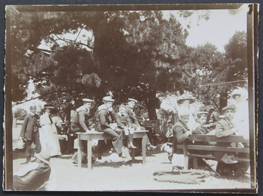
Photograph - Photograph, Sepia, Mr and Mrs Gurney Goldsmith, Picnic at Orchard House, Cup Day 1909, 2 Novembre 1909
... the unusual pleasure of sitting on the green grass under the trees... the unusual pleasure of sitting on the green grass under the trees ...This photograph depicts a picnic for Cup Day (Tuesday 2 November 1909) organised by the Mission and the LHLG members at Orchard House. The property belongs to Mr George Higgins, engineer and his wife, Beatrice who was the LHLG Malvern branch secretary. Beatrice nee Shuter was the daughter of Charles Shuter. In the Punch published on 11 November 1909, we could read: "The pretty garden of "Orchard House," and the paddock adjoining (kindly lent by Mr. and Mrs. Singleton), was the scene on Cup Day of a most successful sailors' picnic, when Mr. and Mrs. George Higgins and the Malvern members of the Ladies' Harbour Lights Guild entertained some 110 sailors from the Royal Navy and Merchant Service. A football match, sports, and "costume" races were indulged in by the more active members of the party, while others enjoyed the unusual pleasure of sitting on the green grass under the trees. Mrs. MacLeod, Mrs. Knight, Mrs. Simon Fraser, Mrs. H. B. Higgins, Mrs. Albert Keep, Miss Ethel Godfrey, the Misses Wollaston, and a number of other ladies assisted to wait on the "tars." One "Jack," from H.M.S. Cambrian, voted it the "nicest day he had had since leaving the Old Country." Hearty cheers for the kind hostesses closed the proceedings. The evening was spent at the Institutes of the Missions to Seamen on the Australian Wharf and at Port Melbourne respectively, where prizes were distributed to the successful competitors. "Small monochrome photograph1909, malvern, cup day, mr george higgins, mce, beatrice elizabeth higgins (nee shuter), h.m.s. cambrian, ethel augusta godfrey, orchard house, ina higgins, rica godfrey, rita godfrey, reverend alfred gurney goldsmith, picnics, social events, frederica godfrey, entertainments, sailors, seafarers, seamen, goldsmith album -
 University of Melbourne, Burnley Campus Archives
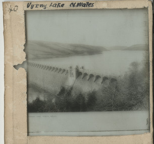
Album - Glass slides, W. H. Cooper, Glass Lantern Slides Full Collection, 1900s-1950s
... '; plants, trees and grasses; parasites, organisms and fungal... f l reeves a w jessep history of the rose plants trees ...Sandra Pullman visited the Melbourne City Council Exhibition, 'Melbourne Parks and Gardens Through the Magic Lantern' in November 2012. Lex Nieboer, former Burnley student graduating in 1975, found a large number of glass lantern slides in a store room and took them home as he was concerned they would be thrown out. His family has a long tradition of being involved in photography, so he understood the value of the slides. He donated the ones that were of Melbourne City Parks and Gardens to the Council and they used them in their exhibition. Sandra contacted Lex and arranged with Jane Wilson (Archivist) to visit Lex on 12 April, 2013 at Wilson Botanic Park, Berwick where he works. After Lex showed them the slides, he, very generously, donated approximately 300 slides back to the Burnley Archives. There was already a collection of almost 100 glass slides in the Archives. They were in a wooden box containing glass lantern slides with label on outside, "Slides of Horticultural Objects and Views." Inside lid is handwritten, "Mr Bailey Botanic Gardens Adelaide." (John Frederick Bailey, Director Adelaide Botanic Gardens 1917-1932.) and, "Mr Isaac 9 pla? 2 ficifolia." (Probably Mr Isaacs Mayor of Adelaide 1917.) Also, "Purchased from Estate of Reeves Late Malvern Gardens, AWJ." (F.L. Reeves, Malvern Council's Park Curator in the 1920's died in 1933. AWJ, A.W. Jessep, Principal Burnley Horticultural College 1926-1941.) These were numbers 61-85 "History of the Rose." Geoff Olive, former Staff member, remembered taking a number of glass slides to a photographic processor to have 35mm slides made from them. 60 of these are also in this collection. Also see B10.0057 for Melbourne City Council collection and, 11.0039, 12.0033 for photograph prints of lantern slides lost to the collection.Collection of approximately 400 glass lantern slides used for teaching at Burnley Horticultural College during the first half of the twentieth century. Some were made specifically for Burnley. Some images would not upload. The images include: overseas views of gardens, historical sites and geographical features (some hand coloured from Japan); a series of hand coloured images of roses with notes for teaching the history of the rose; school gardens of the early 1900's; fruit and vegetables; miscellaneous horticulltural; Australian native plants; cells; 'Living Races'; plants, trees and grasses; parasites, organisms and fungal diseases; miscellaneous horticultural scenes; parks; cattle; agricultural data.sandra pullman, lex nieboer, melbourne city council exhibition through the magic lantern, john frederick bailey, mr isaacs, f l reeves, a w jessep, history of the rose, plants, trees, diseases -
 Kew Historical Society Inc
Photograph - Civic event in Stradbroke Park, 1976
... Condition: The park is largely of mown grass that has mature trees... is largely of mown grass that has mature trees set ...Stradbroke Park. Extent: Kilby Road to Harp Road at Burke Road. Historical Documentation: 1851 - Portion 91 purchased by Edward Glynn; 1888 - The Harp of Erin Estate (which included Section 91) offered for sale; 1896 - The area now known as Stradbroke Park was bisected by a creek that flowed from the Yarra via Hay's Paddock (q.v.) and extended through to Burke Road; 1943 - W.D. Birrell, Town Clerk of Kew, proposed that the creek be filled and a reserve created; 1954 - Entire area designated as 'open space' and named 'Stradbroke Park'. The line of the creek that ran through the Park created a further reserve on the north side of High Street, now known as 'Harrison Reserve'. Existing Condition: The park is largely of mown grass that has mature trees set into it It is possible that a number of these are remnant of the original vegetation, while there are also a number of exotic trees introduced, particularly at the northern end of the park. The southern end is dominated by playing fields. (Source: Sanderson, P 1988. Kew Conservation Study)Colour photographic positive (with colour degradation) of sporting teams at a civic event in Stradbroke Park in Kew East in May 1976. The event was officiated by the Mayor of Kew, Cr Alan Hutchinson. Sporting teams in uniform included: footballers, athletes, cricketers, hockey players. Stradbroke Park is situated on the western boundary of Kew at Burke and Harp Roads.stradbroke park, cr alan hutchinson, team sports -- kew (vic.) -
 Kew Historical Society Inc
Photograph - Civic event in Stradbroke Park, 1976
... Condition: The park is largely of mown grass that has mature trees... is largely of mown grass that has mature trees set ...Stradbroke Park. Extent: Kilby Road to Harp Road at Burke Road. Historical Documentation: 1851 - Portion 91 purchased by Edward Glynn; 1888 - The Harp of Erin Estate (which included Section 91) offered for sale; 1896 - The area now known as Stradbroke Park was bisected by a creek that flowed from the Yarra via Hay's Paddock (q.v.) and extended through to Burke Road; 1943 - W.D. Birrell, Town Clerk of Kew, proposed that the creek be filled and a reserve created; 1954 - Entire area designated as 'open space' and named 'Stradbroke Park'. The line of the creek that ran through the Park created a further reserve on the north side of High Street, now known as 'Harrison Reserve'. Existing Condition: The park is largely of mown grass that has mature trees set into it It is possible that a number of these are remnant of the original vegetation, while there are also a number of exotic trees introduced, particularly at the northern end of the park. The southern end is dominated by playing fields. (Source: Sanderson, P 1988. Kew Conservation Study)Colour photographic positive (with colour degradation) of sporting teams at a civic event in Stradbroke Park in Kew East in May 1976. The event was officiated by the Mayor of Kew, Cr Alan Hutchinson. Stradbroke Park is situated on the western boundary of Kew and bordered by Burke and Harp Roads.stradbroke park, cr alan hutchinson, team sports -- kew (vic.) -
University of Melbourne, Burnley Campus Archives
Album - Black and white and sepia prints, Gardens Other Than Burnley, 1890-1920
... view. (28) Narrow path through long grass and trees. (29) Trees... view. (28) Narrow path through long grass and trees. (29) Trees ...Identification and information on reverse of some photographs given by Georgina Whitehead (Tel-9572 1225) who visited the Archives on 26 September, 1995 when she was writing a book on the various gardens owned and run by the Melbourne City Council-'Civilizing the city: a history of Melbourne's public gardens,' State Library of Victoria, Melbourne 1997.34 bkack and white and sepia photographs. Possibly used for Magic Lantern slides. Fitzroy Gardens: (1) Possibly, towards St Patrick's Cathedral. (2, 3) Path through avenue of trees. (4) Winter. Heavily pruned Elms. (5) Looking towards Clarendon St-eastwards. (6) Probably, lawn. (7) 2 copies, possibly Kiosk. (8) 1920's or earlier. Man sitting on bench. (9) Path through avenue of trees. (10) 2 copies. Probably-fenced originally-fences coming down 1890's on. (11) Statue at crossroad. (12) The Vase Fountain. (13) Tree trunks. (14) Tree trunks. (15) Probably, tree trunks. (16) Winding path. (17) Probably, misty winter scene. (18) Probably, summer. (19) Probably, this is the sort of garden seat used. (20) Avenue of trees, information about exposure on reverse. (21) 2 copies. Probably. Treasury Gardens: (22) Japanese Garden. (23)Japanese Garden. This area around the Lake done by Guilfoyle c.1901-1902. This photograph about this period. (24) Gardener at lake edge. Snowdon Gardens: (25) View towards city. Unidentified: (26) ?Botanic fern Gully/ Fitzroy Fern Gully. (27) Lake view. (28) Narrow path through long grass and trees. (29) Trees in winter. (30, 30a) Tree ferns. (31,32) Cordylines. (33) People on lawn. (34) Winter view of path through elms. These photographs have been scanned but have not been uploaded.georgina whitehead, fitzroy gardens, trees, elms, the vase fountain, trunks, treasury gardens, japanese garden, guilfoyle, snowdon gardens, fern gully, lake view, parks -
 Mission to Seafarers Victoria
Article - Digital copy, Sailors on Holiday, 9 November 1909
... of these sons of the sea, to whom a sight of the tree , and grass... of these sons of the sea, to whom a sight of the tree , and grass ...SAILORS ON HOLIDAY. . "A jolly party of Jack Tars mustered at the Missions to Seamen Institute yesterday at noon, and proceeded by train to Glen Iris, where they were the guests of Dr. and Mrs. Cherry. Liberal arrangements had been made for the delectation of these sons of the sea, to whom a sight of the tree , and grass and flowers were alone a real treat. A football match and a cricket match resulted in well contested struggles. Then followed tea of a substantial kind on the lawn, under the trees. As soon as this had been despatched, sports of various kinds— including a side-splitting "costume race"— were carried out with great vigor. The host and hostesses provided useful and ornamental articles as prizes, and these were distributed to the successful competi tors by Mr. Cherry. Then followed cheers for Dr. and Mrs. Cherry at the call of tire chaplains, Rev. A. E. Goldspink and Rev. W. F. Haire. Dr. Cherry replied by say ing that it gave him and M Cherry great pleasure to see the men enjoying them selves, and he hoped arrangements would be made for another such party ou an other occasion. Till a late hour at night the institutes on the Australian Wharf and at Port Melbourne were merry with crowds of tars."The article shows the importance of these outdoor outings for sailors after spending several months at sea.sailors, seamen, lhlg, picnics, sports, dr cherry, glen iris, thomas cherry -
 Ringwood and District Historical Society
Map - Public Land Sale by Thomas Ham, 2000 Acres for Sale - Crown Sections 20, 23, 24 - Ringwood, Victoria - 1855
Two 1850s surveyor's maps on cardboard backing showing area from Melbourne extending East beyond Bulleen and Nunawading. Detailed description of lots for sale and navigational directions to the property from Richmond by Thomas Ham, Victorian public servant, map maker, publisher, lithographer and original Ringwood land owner. Inset map enlarging area between Yarra River and Dandenong Creek, with southern boundary of allotments later forming part of Oban Road, North Ringwood.TRANSCRIPT: "This really valuable Property is now offered to the public for sale, in lots to suit purchasers at the Iow rate of £1 per Acre for 80 acres and upwards, and £1.10s per Acre for any smaller portion. Terms of payment Half Cash, Balance in 6 and 12 months, bearing 8 per cent interest. The Estate is well wooded with Gum, Cherry Tree and Stringy Bark, with Wattle in the valleys of the several creeks. Every lot is Staked and Trenched at the corners marked on the Plan thus - The Surveyor has carefully sub-divided the Property, in order to give every Farm a Creek for Water, Valley for Cultivation, and Hills for House and Grass Paddock. The ROADS have been very carefully laid out so as to give a firm, well drained, and nearly level road to each Homestead. Intending purchasers can readily find the property by the following directions, viz: Start from Richmond Bridge, at Hawthorne, then take the left-hand road to KEW. When at the "Woodman Inn", take the Cotham Road to the right, bearing due east, keep this Road, passing Trainor's "White Horse" Inn, and before you leave the fences, you will see calico bills (see margin) nailed to the Trees on the bush track leading to the Upper Yarra country, follow the Bills till you come to the SOUTH boundary line of the Property, which bears East and West (see Plan) where you will see Bills nailed up "THIS PROPERTY FOR SALE, etc." The Bills from Town lead direct to where Mr. Jull is erecting his Store, and arrangements have been made with him to show the lots to intending purchasers free of charge. At the respective corners of the lots the Bills are nailed up double, with numbers to denote the lot, and that the corner stake is adjacent. Any parties wishing to proceed to the property by way of BULLEEN will find Bills nailed on the Trees, commencing at the NEW INN, at "Wilson's Slip Rail." Keep this Track till you come to the Log Bridge, over the Deep Creek at Bloxhome's Paddock; go through the land now being cleared; keep the track over the hill till you come to an Iron House, you will then be on the property, which Iies to the North and East as per Plan. Follow the Bills till you come to Mr. Jull's Store, etc. etc. Further particulars can be had from the Agent for the Property. THOMAS HAM. " -
 Eltham District Historical Society Inc
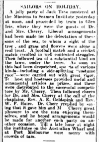
Photograph, George Burton Coop, The Royal Train enroute to Lilydale, near Croydon, 6 Mar. 1954
Believed to have been taken bewteen Croydon Railway Station and the Dorset Road bridge. Taken late afternnon by George Coop's father. There is a Landrover parked on the grass with a person standing on it - believed to be Security. George recalls originally being located closer to the fence and being ushered up the hill where it was 'safer' to stand. In 1954 at age 27, Queen Elizabeth II was the first reigning British monarch to visit Australia.. She visited Victoria between March 1-10. Where to see the Queen (1954, January 21). Fern Tree Gully and District Times (Boronia, Vic. : 1953-1954), p. 5. Retrieved October 25, 2021, from http://nla.gov.au/nla.news-article264220429 “The Lilydale Shire President, Cr. Burgi, stated that the Royal train en route for Warburton on Saturday, March 6th, would slow down at Croydon and Lilydale. There was little possibility that it would stop at either of these towns. The train would pass through Lilydale at 5.52 p.m. Council had appointed a sub-committee to arrange matters, and had allocated £400 towards expenses. It was suggested that the train slow down between the railway station and Dorset Rd. bridge at Croydon, and between the Cave Hill Quarry and railway station at Lilydale.” An album of images of the Queen's visit to Victoria is available on the PROV Flickr account at https://www.flickr.com/photos/public-record-office-victoria/7252885616Digital TIFF file Scan of Kopdak 620 black and white negative transparencygeorge coop collection, croydon, royal train -
 Eltham District Historical Society Inc
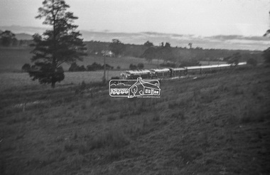
Photograph, George Burton Coop, The Royal Train enroute to Lilydale, near Croydon, 6 Mar. 1954
Believed to have been taken bewteen Croydon Railway Station and the Dorset Road bridge. Taken late afternnon by George Coop's father. There is a Landrover parked on the grass with a person standing on it - believed to be Security. George recalls originally being located closer to the fence and being ushered up the hill where it was 'safer' to stand. In 1954 at age 27, Queen Elizabeth II was the first reigning British monarch to visit Australia.. She visited Victoria between March 1-10. Where to see the Queen (1954, January 21). Fern Tree Gully and District Times (Boronia, Vic. : 1953-1954), p. 5. Retrieved October 25, 2021, from http://nla.gov.au/nla.news-article264220429 “The Lilydale Shire President, Cr. Burgi, stated that the Royal train en route for Warburton on Saturday, March 6th, would slow down at Croydon and Lilydale. There was little possibility that it would stop at either of these towns. The train would pass through Lilydale at 5.52 p.m. Council had appointed a sub-committee to arrange matters, and had allocated £400 towards expenses. It was suggested that the train slow down between the railway station and Dorset Rd. bridge at Croydon, and between the Cave Hill Quarry and railway station at Lilydale.” An album of images of the Queen's visit to Victoria is available on the PROV Flickr account at https://www.flickr.com/photos/public-record-office-victoria/7252885616Digital TIFF file Scan of Kopdak 620 black and white negative transparencygeorge coop collection, croydon, royal train -
 Eltham District Historical Society Inc
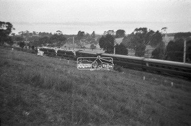
Photograph, George Burton Coop, The Royal Train enroute to Lilydale, near Croydon, 6 Mar. 1954
Believed to have been taken bewteen Croydon Railway Station and the Dorset Road bridge. Taken late afternnon by George Coop's father. There is a Landrover parked on the grass with a person standing on it - believed to be Security. George recalls originally being located closer to the fence and being ushered up the hill where it was 'safer' to stand. In 1954 at age 27, Queen Elizabeth II was the first reigning British monarch to visit Australia.. She visited Victoria between March 1-10. Where to see the Queen (1954, January 21). Fern Tree Gully and District Times (Boronia, Vic. : 1953-1954), p. 5. Retrieved October 25, 2021, from http://nla.gov.au/nla.news-article264220429 “The Lilydale Shire President, Cr. Burgi, stated that the Royal train en route for Warburton on Saturday, March 6th, would slow down at Croydon and Lilydale. There was little possibility that it would stop at either of these towns. The train would pass through Lilydale at 5.52 p.m. Council had appointed a sub-committee to arrange matters, and had allocated £400 towards expenses. It was suggested that the train slow down between the railway station and Dorset Rd. bridge at Croydon, and between the Cave Hill Quarry and railway station at Lilydale.” An album of images of the Queen's visit to Victoria is available on the PROV Flickr account at https://www.flickr.com/photos/public-record-office-victoria/7252885616Digital TIFF file Scan of Kopdak 620 black and white negative transparencygeorge coop collection, croydon, royal train -
 Eltham District Historical Society Inc
Book, Percy Leason: an artist's life by Margot Tasca, 2016
"Who would have thought that a boy born in 1889 from the Victorian Mallee would become a successful artist on New York’s Staten Island? This finely illustrated, exhaustively researched and beautifully written biography on Leason features the artist’s entire career as a painter and cartoonist renowned for his depictions of Australian society in the 1920s and 1930s. Leason’s story is a poignant one tracing his beginnings as a cartoonist, to the bohemian Melbourne art scene in the early 20th century, to his involvement in the artists’ camps of Eltham, to his important series of portraits of Lake Tyers Indigenous Australians, and his eventual move to the US where he has been acknowledged as making an enormous contribution to the New York arts scene. This story, as yet untold, fills a gap in the history of art in Australia and offers a new perspective on Australian art in the first half of the 20th century." - Thames and Hudson website A NEW HOME IN ELTHAM Once they had settled back into Melbourne, Perry and Belle began to look for a place to make a permanent home. Having enjoyed the bush setting of Mosman, they decided to explore the rural fringes of Melbourne. Each weekend they packed a picnic and travelled to the towns in the nearby hills - such as Ferntree Gully, Sassafras, Lilydale and, of course, Cockatoo Creek. Eventually deciding these places might be a little too far from The Herald office, they searched closer to the city. The Heidelberg and Box Hill regions that had inspired his old teacher McCubbin, had become busy, urban areas but further east, towards Warrandyte and Templestowe, there were still large tracts of bush. Finally they settled on Eltham, an area Percy knew very well, having often painted there with Jock Frater. Perry's old friend Dick McCann and his wife Margery had also settled in Eltham. The township was fifteen miles from Melbourne and serviced by an electric train that went to the central Melbourne station of Flinders Street, near where The Herald offices were located. Eltham was a small village in 1925, separated from Melbourne by the Yarra River, and surrounded by orchards and large tracts of bush. Small farms dotted the landscape and the main businesses revolved around ironmongers, blacksmiths, and farming supplies. Of particular appeal to artists was Eltham Park, a large expanse of bushland bounded by the Yarra River on the south side and the Diamond Creek on the east. The park included a playing field that was busy on weekends with cricket or football matches, but for the rest of the week it was mostly empty and an ideal place to paint. The scenery there provided the inspiration for many paintings by Leason, Meldrum and other artists such as Colin Colahan and Peter (A.E.) Newburv. The Leasons found a rundown old farmhouse on four-and-a-half acres of land in New Street, now known as Lavender Park Road. The site was splendid, at the top of a gentle slope which gave panoramic views east to the Dandenong hills, south over the Templestowe orchards and north to Kinglake. The front lawn was taken over by onion grass (or wiregrass as Leason called it) and scattered about the property were many wattles and gum trees. Aloe cacti covered much to the front of the house, while old quince and lucerne hedges separated the house and out-buildings from a rundown apple orchard. Here they would build a new home. ·with financial assistance from The Herald, Leason bought the property and immediately commissioned an architectural firm to design a new house in the popular bungalow style of the time. The old farm house was demolished but Percy saved the siding boards, bricks and corrugated iron for the outbuildings of his new home. The new house was a two storey, triple brick with a large, gabled, terracotta tiled roof. It was situated at the very top of the slope. The paint and varnish were barely dry when the family moved in during the summer of 1925-26 and the fumes were overpowering in the heat. Despite the house being wired for electricity, power poles had not yet reached the area and initially the family had to rely on kerosene lamps and candles. When electricity did arrive, Leason reflected on the community's reception of electricity at the expense of the old growth gum tree corridors in his cartoon, Electricity comes to Wiregrass. The family had now grown to seven. Jack was nearly nine, Jean was seven, Marjory was four, Nancy was two and the baby Patricia was seven months old. Jack and Jean were enrolled in the local primary school down the hill. A retired farmer, Jock McMillan, came to live on the property and help out with the general maintenance. Jock built himself a shack and Belle provided him with meals. He was kept occupied building structures around the property·, such as the garage, the outside toilet, garden beds, trellis arbours and a number of ponds. The elderly, bearded Scotsman with his old hat and baggy pants also provided the inspiration for one of the characters Leason regularly included in his cartoons. Like Leason, Jock smoked a straight stemmed pipe. A neighbour was employed to help Belle with domestic chores, and so the family settled down to live comfortably in their new Eltham house. Two dogs, Maginary and Wodger, completed the large and vibrant household. “Percy Leason; an artist’s life” by Margot Tasca, Thames & Hudson Australia Pty Ltd, Port Melbourne 2016, pp 63-64 Hardback Bookpercy leason, margot tasca, biography, artist, landscape -
Federation University Historical Collection
Booklet - Booklet - Media Clippings, University of Ballarat: Community Service Activities, 1994
Booklet of article that appeared in the newspaper outlining events, programmes, etc. that are of community involvement. Computer and IT programmes; Uni helps kids learn about safe, active, healthy life; Uni eager to foster partnership with local community; Professor David James (Vice Chancellor) to be chair of regional consultation group reforming State's planning system; Ballarat's Martin Hughes of BU Geology Department and Queensland's Neil Phillips to present paper at Geological Society of America in Seattle; Uni to build aquatic centre to attract top swimmers; Open Days planned by Ballarat Universities; Sue Hadden, Ballarat Uni, received $75,000 grant to carry out research on Victoria's disappearing native grasses; Ballarat Uni to host major student sculpture show; Moves to develop high-tech park plan; New Research Plans assisted by Professor Tom O'Donnell; Indian experts look for answers to get more from their depleted desert forests; Uni conducts nursing survey re courses to be offered; Rabbit numbers rise - survey from farmers; Ted Lovett, VFL footballer (Fitzroy) talk on racism in sport at Ballarat Uni.; Australian beer awards at Ballarat Uni.; Study on Unhealthy Fitness - Heart Foundation suggests regular exercise at level suited to individual needs; Survey tracks path of yellow spotting; Tertiary push for hospital - Ararat; University considered for athletics facility; Top-level study on fitness for the elderly to be monitored by Human Movement and Sports Science students, University of Ballarat; Institute of Chartered Accountants will hold its annual accounting information day at the University of Ballarat's Foundation Hall. Students from other universities to attend; Prince Edward's visit - challenge of "Great Rubber Tube Raft Regatta" at Lake Wendouree; Uni, company in joint training initiative - installation on Novell's networking software in the degree course; Uni begins study into tree threat; Eureka leadership conference in Ballarat; Leadership conference an outstanding success.Buff coloured cover, black print. Pages glued and bound - black tape. Newspaper articles - photographs and print - on separate sheets in reverse order of appearance in paper; December to February.Symbol of University of Ballarat - cover.computer and it, newspaper items, health, local community involvement, david james, vice chancellor, state's planning system, martin hughes, geology department, neil phillips, queensland university, geological society of america, seattle, aquatic centre, sue hadden, research grant, $75000, native grasses, sculpture exhibitiontom o'donnell, indian experts, nursing survey, rabbit survey, ted lovett, footballer, racism in sport, australian beer awards, unhealthy fitness, heart foundation, athletics facility, fitness for the elderly, human movement and sports science, intitute of chartered accountants, networking system in degree course, eureka leadership conference