Showing 799 items
matching heritage planning
-
 Glen Eira Historical Society
Ephemera - ROSENEATH, NEPEAN HIGHWAY, 31, ELSTERNWICK
... . The file contains: 1/descriptions from Andrew Ward’s Heritage... Heritage Planning Report. Notes on residents of ‘Roseneath’ from ...This file contains 8 pages and one property notice. The file contains: 1/descriptions from Andrew Ward’s Heritage Planning Report. Notes on residents of ‘Roseneath’ from 1866 to 1963. Articles include household goods sale, public notices, wills and estate notices from Trove and census record. Details from Ancestry.com 2016. 2/Property sale notice of ‘Roseneath’ dated 04/03/2016 from Leader newspaper.‘roseneath’, house names, point nepean road, elsternwick, bogle andrew esq., auctions, wragge william, wragge mary, wragge william charles, miller william, councillors, rusden street, mcmillan street, subdivision, boyle andrew, merchants, shire of caulfield, east st kilda riding, breckinhill lodge, bogle andrew mrs., wragge w mrs, st kilda cemetery, cemeteries, kirkham councillor, long councillor, riddell councillor, lempriere councillor, ilberry concillor, worthington george, judges, tulloch annie, st kilda ladies benevolent society, worthington mrs, wheeldon isaac, tulloch w.g., breweries, elsternwick, madame berry west company, tulloch and son, mccracken’s brewery, elsternwick station, ‘elderslie’, glenhuntly road, wheeldon sarah, cross anastacia, brick houses, meek alexander charles, meek una eveline, meek david, meek jane, meek james, meek alexander, meek kathleen, meek william, lloyd i. captain, lloyd mary, lloyd nova, lloyd eileen, meek anastasia mary, meek william john, meek monica venus, engineers, marine surveyors, social events and activities, wills and estates, real estate, advertisements -
Kew Historical Society Inc
Archive (Series) - Subject File, Kew Historical Society, Heritage Studies [Kew & Boroondara], 1958
... city of boroondara heritage action plan... articles/clippings, a City of Boroondara Heritage Action Plan (2012... initiatives. city of boroondara heritage action plan clemson house ...Various partiesReference, Research, InformationSecondary Values (KHS Imposed Order)Subject file containing correspondence, reports, newspaper articles/clippings, a City of Boroondara Heritage Action Plan (2012) relating to heritage in Kew, Victoria. The earliest item dates from 1964, and is a letter from W. D. Birrell, Town Clerk to the Secretary of the Historical Society. The file also includes a National Trust of Victoria listing of classified buildings as of 1981. The most interesting documents in the file are the City of Kew Heritage Advice Note 1-4, compiled in 1991 and which provides advice on Protecting Heritage through Planning, Victorian Buildings, Edwardian Buildings, and 1930s-1940s houses. The latter would benefit from digitisation and publication.city of boroondara heritage action plan, clemson house - kew (vic), charleville - cotham road - kew (vic), ross house - cotham road - kew (vic), 120 princess street - kew (vic), 14-16 princess street - kew (vic), fairyland - 57 malmsbury street (kew), raheen - studley park road (kew)city of boroondara heritage action plan, clemson house - kew (vic), charleville - cotham road - kew (vic), ross house - cotham road - kew (vic), 120 princess street - kew (vic), 14-16 princess street - kew (vic), fairyland - 57 malmsbury street (kew), raheen - studley park road (kew) -
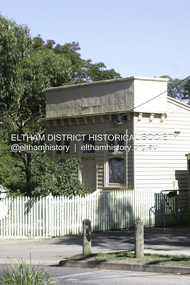
 Eltham District Historical Society Inc
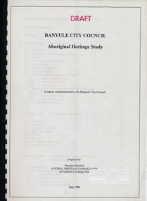
Book, Banyule City Council Aboriginal Heritage Study prepared by Austral Heritage Consultants, 1998 July
... of the Woi Wurrung. The report discusses heritage overlay, planning... lands of the Woi Wurrung. The report discusses heritage overlay ...A draft report on the pre-European Aboriginal achaeological sites in the city of Banyule, including results of previous field surveys; Banyule covers a small part of the former lands of the Woi Wurrung. The report discusses heritage overlay, planning issues and the proposed Victorian planning provisions.100p, 30 cm.Marked "Draft"aboriginal heritage banyule, woi wurrung -
Glen Eira Historical Society
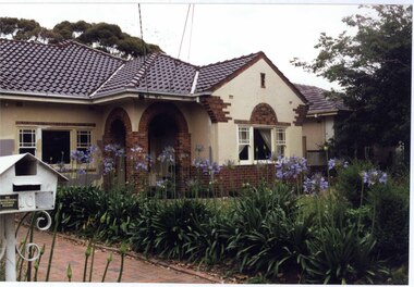
Document - Linlithgow Ave, 4 Caulfield North
... City of Glen Eira Heritage Management Plan...A heritage study from the City of Glen Eira Heritage... Heritage Management Plan by Andrew Ward, 1996 on Linlithgow, 4 ...A heritage study from the City of Glen Eira Heritage Management Plan by Andrew Ward, 1996 on Linlithgow, 4 Linlithgow Avenue, Caulfield North. Report details the building’s significance, history and exterior and interior features. Includes references and a photocopied black and white photograph of the exterior.linlithgow, linlithgow avenue, linlithgow co-ed college, caulfield north, ward andrew, streamline moderne, art deco, duncan william, melbourne jockeys premiership, melbourne cup, slaney h, glen eira road, wood samuel, wood muriel, bambra road, jackson archibald, golding elizabeth, inkerman hotel, stables, horse racing, horse training, city of glen eira heritage management plan, haase eva nm, favelle bessie bain, favelle jack joseph, architectural styles, architectural features -
 Eltham District Historical Society Inc
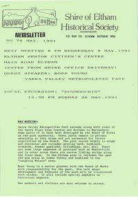
Newsletter, Newsletter, No. 78 May 1991
... general Meeting • Subscriptions • Neil Blair • Shire Heritage... general Meeting • Subscriptions • Neil Blair • Shire Heritage ...Contents: • Next meeting, guest speaker; Ross Young: Yarra Valley Metropolitan Park • May Meeting • Dunmoochin Trip • Annual general Meeting • Subscriptions • Neil Blair • Shire Heritage Study • Planning Controls – Historic Buildings and Significant Trees • Other Society News The Shire of Eltham Historical Society was formed in October 1967. The first newsletter of the Society was issued May 1978 and has been published continuously ever since on a bi-monthly basis. With the cessation of the Shire of Eltham in late 1994, the Society's name was revised to Eltham District Historical Society and this name first appeared with issue No. 103, July 1995. The collection of the Society's newsletters provides a valuable resource on the history of the Society's activities, office bearers and committee members, guest speakers and subjects of historical interest pertinent to the former Shire of Eltham and the Eltham District.A4 photocopied newsletter distributed to membersnewsletter, eltham district historical society, shire of eltham historical society -
 Greensborough Historical Society
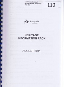
Book, Heritage Information Pack August 2011, 2011_08
... "Heritage Policy and Plan". Its purpose is "To give strategic... City Council's "Heritage Policy and Plan". Its purpose ...This is an updated draft of Banyule City Council's "Heritage Policy and Plan". Its purpose is "To give strategic direction for improved understanding, protection and promotion of Banyule's heritage"This document lists sites in the City of Banyule assessed for their heritage value.261 pages plus appendices. Photocopied A4 book on white paper with red pages interleaved. Blue spiral binding, clear front cover and brown card back cover.bnayule city council, banyule heritage review -
 Bendigo Historical Society Inc.
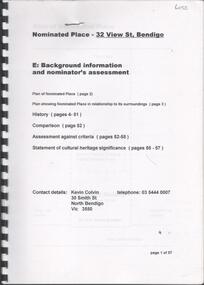
Book - 32 VIEW ST, BENDIGO, not known
... - 32 View St, Bendigo'. History and cultural heritage... Place - 32 View St, Bendigo'. History and cultural heritage ...29 page spiral bound soft cover booklet 'Nominated Place - 32 View St, Bendigo'. History and cultural heritage significance. Plans, drawings, extracts from Annals of Bendigo, Bendigo Advertiser and Sandhurst Directory 1872-73. Includes 4 pages from 'Bendigo Mac and His Courts'. 32 View St is currently between the Trades Hall and Temperance Hall.Kevin Colvin -
 Bendigo Historical Society Inc.
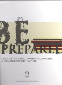
Book - BE PREPARED, c2000
... A Disaster Prearedness Plan. Publisher: Heritage Collections Council... For Small Mueums For Writing A Disaster Prearedness Plan. Publisher ...Be Prepared, Guidelines For Small Mueums For Writing A Disaster Prearedness Plan. Publisher: Heritage Collections Council. ISBN: 0 642 75097 1. Place of publication: Canberra. 112 pages.australia, disaster preperation for museums -
Clunes Museum
Document - CONSERVATION STUDY, RICHARD AITKEN, 1986
... HERITAGE COMMISSION'& MINISTRY FOR PLANNING & ENVIRONMENT... FOR THE SHIRE OF TALBOT & CLUNES 'AUSTRALIAN HERITAGE COMMISSION ...REPORT FOR THE SHIRE OF TALBOT & CLUNES 'AUSTRALIAN HERITAGE COMMISSION'& MINISTRY FOR PLANNING & ENVIRONMENT, BY RICHARD AITKEN - 10TH APRIL, 1986TALBOT AND CLUNES CONSERVATION STUDY - HISTORY OF SIGNIFICANT BUILDINGS.local history, document, report, hepburn shire -
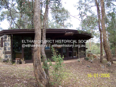
 Eltham District Historical Society Inc
Photograph - Digital Photograph, Alan King, Busst House, cnr Silver Street and Kerrie Crescent, Eltham, 2 February 2008
... by Alistair Knox. Covered under Heritage Overlay, Nillumbik Planning... by Alistair Knox. Covered under Heritage Overlay, Nillumbik Planning ...Considered the best of the early mud-brick houses built by Alistair Knox. Covered under Heritage Overlay, Nillumbik Planning Scheme. Published: Nillumbik Now and Then / Marguerite Marshall 2008; photographs Alan King with Marguerite Marshall.; p143This collection of almost 130 photos about places and people within the Shire of Nillumbik, an urban and rural municipality in Melbourne's north, contributes to an understanding of the history of the Shire. Published in 2008 immediately prior to the Black Saturday bushfires of February 7, 2009, it documents sites that were impacted, and in some cases destroyed by the fires. It includes photographs taken especially for the publication, creating a unique time capsule representing the Shire in the early 21st century. It remains the most recent comprehenesive publication devoted to the Shire's history connecting local residents to the past. nillumbik now and then (marshall-king) collection, alistair knox, alistair knox design, busst house, kerrie crescent, mudbrick construction, mudbrick houses, silver street -
 Eltham District Historical Society Inc
Photograph - Digital Photograph, Alan King, Southernwood, cnr Bolton and Brougham Street, Eltham, 30 January 2008
... and Brougham Streets, Eltham. Covered under Heritage Overlay... and Brougham Streets, Eltham. Covered under Heritage Overlay ...Walter Withers once lived at the corner of Bolton and Brougham Streets, Eltham. Covered under Heritage Overlay, Nillumbik Planning Scheme. Published: Nillumbik Now and Then / Marguerite Marshall 2008; photographs Alan King with Marguerite Marshall.; p105This collection of almost 130 photos about places and people within the Shire of Nillumbik, an urban and rural municipality in Melbourne's north, contributes to an understanding of the history of the Shire. Published in 2008 immediately prior to the Black Saturday bushfires of February 7, 2009, it documents sites that were impacted, and in some cases destroyed by the fires. It includes photographs taken especially for the publication, creating a unique time capsule representing the Shire in the early 21st century. It remains the most recent comprehenesive publication devoted to the Shire's history connecting local residents to the past. nillumbik now and then (marshall-king) collection, bolton steet, brougham steet, eltham, southernwood, walter withers house -
 Eltham District Historical Society Inc
Photograph - Digital Photograph, Marguerite Marshall, View of the Yarra River from 'Worlingworth', 10-26 Banoon Road, Eltham, 30 January 2006
... . Covered under Heritage Overlay, Nillumbik Planning Scheme.... Covered under Heritage Overlay, Nillumbik Planning Scheme ...'Worlingworth', Eltham, home of noted anthropologist the late Professor Donald Thomson and his wife Dorita Thomson. Covered under Heritage Overlay, Nillumbik Planning Scheme. Published: Nillumbik Now and Then / Marguerite Marshall 2008; photographs Alan King with Marguerite Marshall.; p127This collection of almost 130 photos about places and people within the Shire of Nillumbik, an urban and rural municipality in Melbourne's north, contributes to an understanding of the history of the Shire. Published in 2008 immediately prior to the Black Saturday bushfires of February 7, 2009, it documents sites that were impacted, and in some cases destroyed by the fires. It includes photographs taken especially for the publication, creating a unique time capsule representing the Shire in the early 21st century. It remains the most recent comprehenesive publication devoted to the Shire's history connecting local residents to the past. nillumbik now and then (marshall-king) collection, banoon road, donald thomson, dorita thomson, eltham, worlingworth -
 Eltham District Historical Society Inc
Photograph - Digital Photograph, Alan King, Stonygrad, 34 Hamilton Road, North Warrandyte, 30 January 2008
... , of a sculpture. Covered under Heritage Overlay, Nillumbik Planning..., of a sculpture. Covered under Heritage Overlay, Nillumbik Planning ...Vassilieff dynamited rock from his own property to build his house. Stonygrad is reminiscent of a grotto and in parts, of a sculpture. Covered under Heritage Overlay, Nillumbik Planning Scheme. Published: Nillumbik Now and Then / Marguerite Marshall 2008; photographs Alan King with Marguerite Marshall.; p135This collection of almost 130 photos about places and people within the Shire of Nillumbik, an urban and rural municipality in Melbourne's north, contributes to an understanding of the history of the Shire. Published in 2008 immediately prior to the Black Saturday bushfires of February 7, 2009, it documents sites that were impacted, and in some cases destroyed by the fires. It includes photographs taken especially for the publication, creating a unique time capsule representing the Shire in the early 21st century. It remains the most recent comprehenesive publication devoted to the Shire's history connecting local residents to the past. nillumbik now and then (marshall-king) collection, danila vassilieff, hamilton road, north warrandyte, stonygrad -
Glen Eira Historical Society
Album - Photograph Album, Beauville Estate Album, 2001
... unknown. Glen Eira’s Heritage Management Plan by Andrew Ward... unknown. Glen Eira’s Heritage Management Plan by Andrew Ward ...Originally labelled "Beauville Estate, Established 1936, Still Thriving 65 years on, 10th March 2001", the Beauville Estate Album contains colour photographs of houses in the Estate. They were taken around the time of the Beauville Estate’s 65th Heritage Celebration held on 10/03/2001 and donated to the Caulfield Historical Society shortly afterwards. Photographer unknown. Glen Eira’s Heritage Management Plan by Andrew Ward (1996) Vol 2 p78 states that by the end of 1934, the first 3 houses had been built in this housing estate.City of Glen Eira’s Heritage Management Plan Vol 2 p79 (p84 of the pdf version) – HO12 Beauville Estate and environs, Murrumbeena: The Beauville Historic Area is important at the State level as the first large housing estate undertaken by the AV Jennings Construction Co, later Jennings Group Limited, Victoria’s largest home builder. It is important also as a very early estate development incorporating a range of features other than houses and including made roads, shops and recreation facilities. In this respect it was the forerunner of the comprehensively planned housing estate of the post war era. The estate is distinguished by its aesthetic values, as is the earlier and comparable Hillcrest Estate, which are formed by a combination of restrained diversity in house styles, with the exception of no. 30 in the emerging International style, and by a landscaped garden environment.Colour photographs of house exteriors, as well as parks and tennis courts on the Beauville Estate. murrumbeena, houses, beauville avenue, architectural styles, 1930's, inter war style, a.v. jennings, av jennings, jennings, brick houses, beauville estate, murrumbeena road, lindsay avenue, gloucester court, dalny road, a v jennings construction co, beauville estate heritage area, glen eira city council, architectural features, plans, shops, residential development, tennis courts, housing estates, builders, building regulations, local government, commercial development, history, maps, photographs, commercial establishments, jennings group limited, land subdivision, gardens, beauville historic area, sir albert victor jennings -
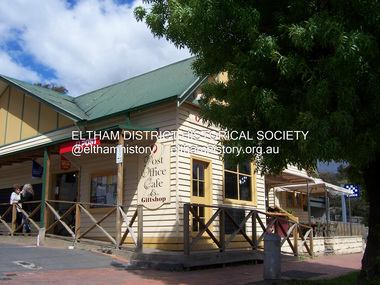 Eltham District Historical Society Inc
Photograph - Digital Photograph, Marguerite Marshall, Post Office, Hurstbridge, 27 September 2007
... . Covered under Heritage Overlay, Nillumbik Planning Scheme.... Covered under Heritage Overlay, Nillumbik Planning Scheme ...The Post Office building was built in 1918 by printer, Robert Charles Harris, owner of The Evelyn Observer newspaper. In 2007 a Post Office, cafe and giftshop operated from here. Covered under Heritage Overlay, Nillumbik Planning Scheme. Published: Nillumbik Now and Then / Marguerite Marshall 2008; photographs Alan King with Marguerite Marshall.; p13This collection of almost 130 photos about places and people within the Shire of Nillumbik, an urban and rural municipality in Melbourne's north, contributes to an understanding of the history of the Shire. Published in 2008 immediately prior to the Black Saturday bushfires of February 7, 2009, it documents sites that were impacted, and in some cases destroyed by the fires. It includes photographs taken especially for the publication, creating a unique time capsule representing the Shire in the early 21st century. It remains the most recent comprehenesive publication devoted to the Shire's history connecting local residents to the past. nillumbik now and then (marshall-king) collection, hurstbridge, post office, post office cafe -
 Glen Eira Historical Society
Photograph, Beauville Avenue, 10, Murrumbeena, 2001
... unknown. From Glen Eira’s Heritage Management Plan by Andrew Ward... unknown. From Glen Eira’s Heritage Management Plan by Andrew Ward ...Originally labelled "Beauville Estate, Established 1936, Still Thriving 65 years on, 10th March 2001", the Beauville Estate Album contains colour photographs of houses in the Estate. They were taken around the time of the Beauville Estate’s 65th Heritage Celebration held on 10/03/2001 and donated to the Caulfield Historical Society shortly afterwards. Photographer unknown. From Glen Eira’s Heritage Management Plan by Andrew Ward (1996) Vol 2 p63: The inclusion of shops in Murrumbeena Road and a common parkland developed at the rear of the properties were complemented by the construction of a gas display home at No. 10 Beauville Avenue.City of Glen Eira’s Heritage Management Plan Vol 2 p79 (this is p84 of the pdf version) – HO12 Beauville Estate and environs, Murrumbeena: The Beauville Historic Area is important at the State level as the first large housing estate undertaken by the AV Jennings Construction Co, later Jennings Group Limited, Victoria’s largest home builder. It is important also as a very early estate development incorporating a range of features other than houses and including made roads, shops and recreation facilities. In this respect it was the forerunner of the comprehensively planned housing estate of the post war era. The estate is distinguished by its aesthetic values, as is the earlier and comparable Hillcrest Estate, which are formed by a combination of restrained diversity in house styles, with the exception of no. 30 in the emerging International style, and by a landscaped garden environment. Colour photograph of cream rendered house with decorative unpainted brown brick features. Other features include a porch with two decorative open arches, tiled roof, 2 sets of matching double sashed windows with large square pane within each set, agapanthus lining the brick paved driveway and a cast iron work metal letterbox with number "10" on it. murrumbeena, houses, beauville avenue, architectural styles, 1930's, inter war style, a.v. jennings, av jennings, jennings, brick houses, beauville estate, porches, arches, sir albert victor jennings, a v jennings construction co, beauville estate heritage area, glen eira city council, architectural features, jennings group limited, land subdivision, gardens, beauville historic area, brick features, sash windows, paved drives, cast iron work, letter boxes, gas display houses -
 Glen Eira Historical Society
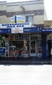
Photograph, Murrumbeena Road, 229, Murrumbeena, 2001
... unknown. From Glen Eira’s Heritage Management Plan by Andrew Ward... unknown. From Glen Eira’s Heritage Management Plan by Andrew Ward ...Originally labelled "Beauville Estate, Established 1936, Still Thriving 65 years on, 10th March 2001", the Beauville Estate Album contains colour photographs of houses in the Estate. They were taken around the time of the Beauville Estate’s 65th Heritage Celebration held on 10/03/2001 and donated to the Caulfield Historical Society shortly afterwards. Photographer unknown. From Glen Eira’s Heritage Management Plan by Andrew Ward (1996) Vol 2 p78: In Murrumbeena Road, the shops which form part of the estate are a simple cream brick row relieved by manganese bricks in bands across the upper storeys. City of Glen Eira’s Heritage Management Plan Vol 2 p79 (this is p84 of the pdf version) – HO12 Beauville Estate and environs, Murrumbeena: The Beauville Historic Area is important at the State level as the first large housing estate undertaken by the AV Jennings Construction Co, later Jennings Group Limited, Victoria’s largest home builder. It is important also as a very early estate development incorporating a range of features other than houses and including made roads, shops and recreation facilities. In this respect it was the forerunner of the comprehensively planned housing estate of the post war era. The estate is distinguished by its aesthetic values, as is the earlier and comparable Hillcrest Estate, which are formed by a combination of restrained diversity in house styles, with the exception of no. 30 in the emerging International style, and by a landscaped garden environment. Colour photograph of a section of a double storey, unpainted brick, commercial property containing shops at ground level all with awnings over the footpath. This specific property is a milk bar on street level with plate glass windows and door, colourful advertising and "229' in the top right section of the window. Shop signage says "MURREMBEENA MILK BAR". The upper storey brick residence features a large window, a flat roof and decorative two tone banded brickwork. MURREMBEENA (sic) MILK BAR / PK's / SANDWICH / BAR / MILK BAR & Sandwich Bar / 229 / SUB NEWSmurrumbeena, architectural styles, 1930's, inter war style, a.v. jennings, av jennings, jennings, beauville estate, murrumbeena road, milk bars, commercial establishments, flats, sir albert victor jennings, a v jennings construction co, beauville estate heritage area, glen eira city council, architectural features, jennings group limited, land subdivision, beauville historic area, shops, brick features, window displays, advertising signs, murrembeena (sic) milk bar -
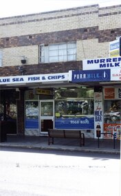 Glen Eira Historical Society
Photograph, Murrumbeena Road, 229A, Murrumbeena, 2001
... unknown. From Glen Eira’s Heritage Management Plan by Andrew Ward... unknown. From Glen Eira’s Heritage Management Plan by Andrew Ward ...Originally labelled "Beauville Estate, Established 1936, Still Thriving 65 years on, 10th March 2001", the Beauville Estate Album contains colour photographs of houses in the Estate. They were taken around the time of the Beauville Estate’s 65th Heritage Celebration held on 10/03/2001 and donated to the Caulfield Historical Society shortly afterwards. Photographer unknown. From Glen Eira’s Heritage Management Plan by Andrew Ward (1996) Vol 2 p78: In Murrumbeena Road, the shops which form part of the estate are a simple cream brick row relieved by manganese bricks in bands across the upper storeys.City of Glen Eira’s Heritage Management Plan Vol 2 p79 (this is p84 of the pdf version) – HO12 Beauville Estate and environs, Murrumbeena: The Beauville Historic Area is important at the State level as the first large housing estate undertaken by the AV Jennings Construction Co, later Jennings Group Limited, Victoria’s largest home builder. It is important also as a very early estate development incorporating a range of features other than houses and including made roads, shops and recreation facilities. In this respect it was the forerunner of the comprehensively planned housing estate of the post war era. The estate is distinguished by its aesthetic values, as is the earlier and comparable Hillcrest Estate, which are formed by a combination of restrained diversity in house styles, with the exception of no. 30 in the emerging International style, and by a landscaped garden environment. Colour photograph of a section of a double storey, unpainted brick, commercial property containing shops at ground level all with awnings over the footpath. This specific property is a fish and chip shop. The upper storey brick residence features a curtained window, a flat roof and decorative two tone bands of brickwork. It has a large street seat on the footpath out front.BLUE SEA FISH & CHIPS / TAKE AWAY FOODmurrumbeena, architectural styles, 1930's, inter war style, a.v. jennings, av jennings, jennings, beauville estate, murrumbeena road, milk bars, commercial establishments, flats, fish & chip shops, sir albert victor jennings, a v jennings construction co, beauville estate heritage area, glen eira city council, architectural features, jennings group limited, land subdivision, beauville historic area, brick features, restaurants -
 Eltham District Historical Society Inc
Photograph - Digital Photograph, Marguerite Marshall, Neil Douglas house, Bend Of Islands, 3 October 2006
... . Covered under Heritage Overlay, Nillumbik Planning Scheme.... Covered under Heritage Overlay, Nillumbik Planning Scheme ...Mud brick house first owned by naturalist and artist Neil Douglas and Helen (Abbie) Heathcote at the Bend of Islands. They were original residents in the 1970s. This house is on the Victorian Heritage Database and is considered locally significant. Covered under Heritage Overlay, Nillumbik Planning Scheme Published: Nillumbik Now and Then / Marguerite Marshall 2008; photographs Alan King with Marguerite Marshall.; CoverThis collection of almost 130 photos about places and people within the Shire of Nillumbik, an urban and rural municipality in Melbourne's north, contributes to an understanding of the history of the Shire. Published in 2008 immediately prior to the Black Saturday bushfires of February 7, 2009, it documents sites that were impacted, and in some cases destroyed by the fires. It includes photographs taken especially for the publication, creating a unique time capsule representing the Shire in the early 21st century. It remains the most recent comprehenesive publication devoted to the Shire's history connecting local residents to the past. nillumbik now and then (marshall-king) collection, bend of islands, neil douglas house, neil douglas -
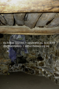
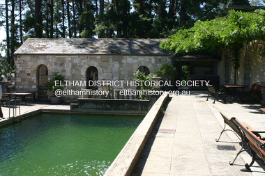 Eltham District Historical Society Inc
Photograph - Digital Photograph, Alan King, Swimming Pool, Montsalvat, 8 January 2008
... , Victorian Heritage and Heritage Overlay, Nillumbik Planning Scheme..., Victorian Heritage and Heritage Overlay, Nillumbik Planning Scheme ...Re-claimed material were used during the construction of Montsalvat, the artists colony in Eltham. The swimming pool was donated and cubicles were built for the students with their initials marked in tiles on each doorstep. Covered under National Estate, National Trust of Australia (Victoria) State Significance, Victorian Heritage and Heritage Overlay, Nillumbik Planning Scheme. Published: Nillumbik Now and Then / Marguerite Marshall 2008; photographs Alan King with Marguerite Marshall.; p131This collection of almost 130 photos about places and people within the Shire of Nillumbik, an urban and rural municipality in Melbourne's north, contributes to an understanding of the history of the Shire. Published in 2008 immediately prior to the Black Saturday bushfires of February 7, 2009, it documents sites that were impacted, and in some cases destroyed by the fires. It includes photographs taken especially for the publication, creating a unique time capsule representing the Shire in the early 21st century. It remains the most recent comprehenesive publication devoted to the Shire's history connecting local residents to the past. nillumbik now and then (marshall-king) collection, eltham, montsalvat, swimming pool -
 Melbourne Tram Museum
Document, Maidstone Tram Maintenance and Stabling Facility - Proposed Plans - Planning Approval, 2022
... steps, planning approval, heritage issues, environmental..., planning approval, heritage issues, environmental, construction ...Provides the proposed plans for the Maidstone Tram Maintenance and Stabling Facility - Proposed Plans - Planning Approval stage - site plans, perspective, land use and sight lines from various locations. The information booklet looks at the project steps, planning approval, heritage issues, environmental, construction, timing and operations.Yields information about the proposed Maidstone tram depot.Digital copy of a 13 A3 page document titled - Maidstone Tram Maintenance and Stabling Facility - Proposed Plans - Planning Approval and a 12 A4 page Information booklettrams, maidstone, tramways, new depot -
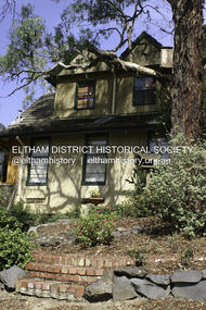 Eltham District Historical Society Inc
Photograph - Digital Photograph, Alan King, Langi Dorn, Fay Street, Eltham, 29 January 2008
... style. Covered under Heritage Overlay, Nillumbik Planning... style. Covered under Heritage Overlay, Nillumbik Planning ...Langi Dorn, Fay Street. This house is reminiscent of ‘ye olde’ England, with its steep-pitched gabled roof. The rectangular single storey building with two attics has a warm atmosphere, created in part by the extensive use of timber in walls and floors. Some walls are framed in timbers as in the English Tudor style. Covered under Heritage Overlay, Nillumbik Planning Scheme. Published: Nillumbik Now and Then / Marguerite Marshall 2008; photographs Alan King with Marguerite Marshall.; p151This collection of almost 130 photos about places and people within the Shire of Nillumbik, an urban and rural municipality in Melbourne's north, contributes to an understanding of the history of the Shire. Published in 2008 immediately prior to the Black Saturday bushfires of February 7, 2009, it documents sites that were impacted, and in some cases destroyed by the fires. It includes photographs taken especially for the publication, creating a unique time capsule representing the Shire in the early 21st century. It remains the most recent comprehenesive publication devoted to the Shire's history connecting local residents to the past. nillumbik now and then (marshall-king) collection, eltham, fay street, john harcourt, langi dorn -
 Eltham District Historical Society Inc
Photograph - Digital Photograph, Alan King, Little Bank Building, the former Commercial Bank of Australia Branch, Hurstbridge, 1 February 2008
... of the Hurstbridge Neighbourhood House. Covered under Heritage Overlay... of the Hurstbridge Neighbourhood House. Covered under Heritage Overlay ...The Little Bank Building at the corner of Anzac Avenue, formerly a Commercial Bank of Australia branch, was moved to Hurstbridge around 1917. It was one of a few portable branch buildings, towed by horse or bullock team to a site as required. The branch operated until the early 1980s. In 1985 it was moved about 42 metres south to the Allwood House grounds to become part of the Hurstbridge Neighbourhood House. Covered under Heritage Overlay, Nillumbik Planning Scheme. Published: Nillumbik Now and Then / Marguerite Marshall 2008; photographs Alan King with Marguerite Marshall.; p13This collection of almost 130 photos about places and people within the Shire of Nillumbik, an urban and rural municipality in Melbourne's north, contributes to an understanding of the history of the Shire. Published in 2008 immediately prior to the Black Saturday bushfires of February 7, 2009, it documents sites that were impacted, and in some cases destroyed by the fires. It includes photographs taken especially for the publication, creating a unique time capsule representing the Shire in the early 21st century. It remains the most recent comprehenesive publication devoted to the Shire's history connecting local residents to the past. nillumbik now and then (marshall-king) collection, cba bank, commercial bank of australia, hurstbridge, little bank building, portable buildings -
 Glen Eira Historical Society
Photograph, Dalny Road, 5-17 Rear, Murrumbeena, 2001
... unknown. From Glen Eira’s Heritage Management Plan by Andrew Ward... unknown. From Glen Eira’s Heritage Management Plan by Andrew Ward ...Originally labelled "Beauville Estate, Established 1936, Still Thriving 65 years on, 10th March 2001", the Beauville Estate Album contains colour photographs of houses in the Estate. They were taken around the time of the Beauville Estate’s 65th Heritage Celebration held on 10/03/2001 and donated to the Caulfield Historical Society shortly afterwards. Photographer unknown. From Glen Eira’s Heritage Management Plan by Andrew Ward (1996) Vol 2 p78: "Beauville Avenue is unusual in that it is terminated in a cul-de-sac (see Section 3.9.2) whilst the design of the estate may well be unique for its time in that the houses back onto 6 tennis courts for public use. St. Patrick's Church, which adjoins the estate is a comparatively recent structure whilst the school has one building erected in 1930 and prior to the release of the Beauville lots." It also notes that St.Patrick's Church and School now run the tennis courts. The Beauville Historic Area is important at the State level as the first large housing estate undertaken by the AV Jennings Construction Co, later Jennings Group Limited, Victoria’s largest home builder. It is important also as a very early estate development incorporating a range of features other than houses and including made roads, shops and recreation facilities. In this respect it was the forerunner of the comprehensively planned housing estate of the post war era. The estate is distinguished by its aesthetic values, as is the earlier and comparable Hillcrest Estate, which are formed by a combination of restrained diversity in house styles, with the exception of no. 30 in the emerging International style, and by a landscaped garden environment. See Significance Statement in Glen Eira’s Heritage Management Plan by Andrew Ward (1996) Vol 2 p.79. Available from https://www.gleneira.vic.gov.au/media/4779/heritage_management_plan_volume_2.pdf (Note see p.84 of pdf)Colour photograph of a playground on the Beauville Estate. murrumbeena, houses, 1930's, a.v. jennings, av jennings, jennings, beauville estate, playgrounds, parks and reserves, sir albert victor jennings, a v jennings construction co, beauville estate heritage area, glen eira city council, jennings group limited, land subdivision, gardens, beauville historic area, st patrick's church, st patrick's school, dalny road -
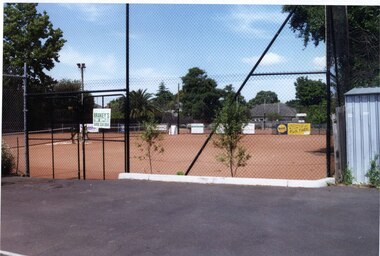
 Glen Eira Historical Society
Photograph, Dalny Road, 5-17 Rear, Murrumbeena, 2001
... unknown. From Glen Eira’s Heritage Management Plan by Andrew Ward... unknown. From Glen Eira’s Heritage Management Plan by Andrew Ward ...Originally labelled "Beauville Estate, Established 1936, Still Thriving 65 years on, 10th March 2001", the Beauville Estate Album contains colour photographs of houses in the Estate. They were taken around the time of the Beauville Estate’s 65th Heritage Celebration held on 10/03/2001 and donated to the Caulfield Historical Society shortly afterwards. Photographer unknown. From Glen Eira’s Heritage Management Plan by Andrew Ward (1996) Vol 2 p78: "Beauville Avenue is unusual in that it is terminated in a cul-de-sac (see Section 3.9.2) whilst the design of the estate may well be unique for its time in that the houses back onto 6 tennis courts for public use. St. Patrick's Church, which adjoins the estate is a comparatively recent structure whilst the school has one building erected in 1930 and prior to the release of the Beauville lots." It also notes that St.Patrick's Church and School now run the tennis courts.City of Glen Eira’s Heritage Management Plan Vol 2 p79 (this is p84 of the pdf version) – HO12 Beauville Estate and environs, Murrumbeena: The Beauville Historic Area is important at the State level as the first large housing estate undertaken by the AV Jennings Construction Co, later Jennings Group Limited, Victoria’s largest home builder. It is important also as a very early estate development incorporating a range of features other than houses and including made roads, shops and recreation facilities. In this respect it was the forerunner of the comprehensively planned housing estate of the post war era. The estate is distinguished by its aesthetic values, as is the earlier and comparable Hillcrest Estate, which are formed by a combination of restrained diversity in house styles, with the exception of no. 30 in the emerging International style, and by a landscaped garden environment. Colour photograph of a tennis club house and a park on the Beauville Estate. murrumbeena, houses, 1930's, a.v. jennings, av jennings, jennings, beauville estate, jennings albert victor, parks and reserves, sports and recreations establishments, clubhouses, tennis clubs, beauville tennis courts, st patrick's tennis club, sir albert victor jennings, a v jennings construction co, beauville estate heritage area, glen eira city council, architectural features, jennings group limited, land subdivision, gardens, beauville historic area, dalny road -
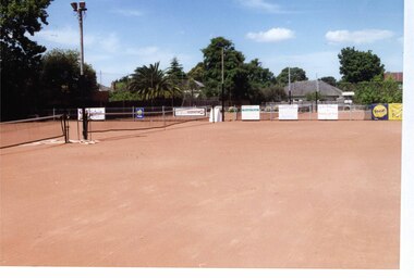
 Glen Eira Historical Society
Photograph, Dalny Road, 5-17 Rear, Murrumbeena, 2001
... unknown. From Glen Eira’s Heritage Management Plan by Andrew Ward... unknown. From Glen Eira’s Heritage Management Plan by Andrew Ward ...Originally labelled "Beauville Estate, Established 1936, Still Thriving 65 years on, 10th March 2001", the Beauville Estate Album contains colour photographs of houses in the Estate. They were taken around the time of the Beauville Estate’s 65th Heritage Celebration held on 10/03/2001 and donated to the Caulfield Historical Society shortly afterwards. Photographer unknown. From Glen Eira’s Heritage Management Plan by Andrew Ward (1996) Vol 2 p78: "Beauville Avenue is unusual in that it is terminated in a cul-de-sac (see Section 3.9.2) whilst the design of the estate may well be unique for its time in that the houses back onto 6 tennis courts for public use. St. Patrick's Church, which adjoins the estate is a comparatively recent structure whilst the school has one building erected in 1930 and prior to the release of the Beauville lots." It also notes that St.Patrick's Church and School now run the tennis courts.City of Glen Eira’s Heritage Management Plan Vol 2 p79 (this is p84 of the pdf version) – HO12 Beauville Estate and environs, Murrumbeena: The Beauville Historic Area is important at the State level as the first large housing estate undertaken by the AV Jennings Construction Co, later Jennings Group Limited, Victoria’s largest home builder. It is important also as a very early estate development incorporating a range of features other than houses and including made roads, shops and recreation facilities. In this respect it was the forerunner of the comprehensively planned housing estate of the post war era. The estate is distinguished by its aesthetic values, as is the earlier and comparable Hillcrest Estate, which are formed by a combination of restrained diversity in house styles, with the exception of no. 30 in the emerging International style, and by a landscaped garden environment. Colour photograph of tennis courts and surrounding mesh fencing on the Beauville Estate. murrumbeena, houses, 1930's, a.v. jennings, av jennings, jennings, beauville estate, parks and reserves, sports and recreations establishments, tennis courts, sportsgrounds, sir albert victor jennings, a v jennings construction co, beauville estate heritage area, glen eira city council, architectural features, jennings group limited, land subdivision, gardens, beauville historic area, tennis clubs, beauville tennis courts, st patrick's tennis club, dalny road -
 Glen Eira Historical Society
Photograph, Dalny Road, 5-17 Rear, Murrumbeena, 2001
... unknown. From Glen Eira’s Heritage Management Plan by Andrew Ward... unknown. From Glen Eira’s Heritage Management Plan by Andrew Ward ...Originally labelled "Beauville Estate, Established 1936, Still Thriving 65 years on, 10th March 2001", the Beauville Estate Album contains colour photographs of houses in the Estate. They were taken around the time of the Beauville Estate’s 65th Heritage Celebration held on 10/03/2001 and donated to the Caulfield Historical Society shortly afterwards. Photographer unknown. From Glen Eira’s Heritage Management Plan by Andrew Ward (1996) Vol 2 p78: "Beauville Avenue is unusual in that it is terminated in a cul-de-sac (see Section 3.9.2) whilst the design of the estate may well be unique for its time in that the houses back onto 6 tennis courts for public use. St. Patrick's Church, which adjoins the estate is a comparatively recent structure whilst the school has one building erected in 1930 and prior to the release of the Beauville lots." It also notes that St.Patrick's Church and School now run the tennis courts. City of Glen Eira’s Heritage Management Plan Vol 2 p79 (this is p84 of the pdf version) – HO12 Beauville Estate and environs, Murrumbeena: The Beauville Historic Area is important at the State level as the first large housing estate undertaken by the AV Jennings Construction Co, later Jennings Group Limited, Victoria’s largest home builder. It is important also as a very early estate development incorporating a range of features other than houses and including made roads, shops and recreation facilities. In this respect it was the forerunner of the comprehensively planned housing estate of the post war era. The estate is distinguished by its aesthetic values, as is the earlier and comparable Hillcrest Estate, which are formed by a combination of restrained diversity in house styles, with the exception of no. 30 in the emerging International style, and by a landscaped garden environment. Colour photograph of tennis courts with lights on the Beauville Estate. murrumbeena, houses, 1930's, a.v. jennings, av jennings, jennings, beauville estate, parks and reserves, sports and recreations establishments, tennis courts, sportsgrounds, sir albert victor jennings, a v jennings construction co, beauville estate heritage area, glen eira city council, architectural features, jennings group limited, land subdivision, gardens, beauville historic area, tennis clubs, beauville tennis courts, st patrick's tennis club, dalny road -
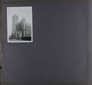 Glen Eira Historical Society
Album - Album page, Glen Huntly Road, Circa 1972
... 198 pages. From: Glen Eira Heritage Management Plan (1996... 198 pages. From: Glen Eira Heritage Management Plan (1996 ...This photograph is part of the Caulfield Historical Album 1972. This album was created in approximately 1972 as part of a project by the Caulfield Historical Society to assist in identifying buildings worthy of preservation. The album is related to a Survey the Caulfield Historical Society developed in collaboration with the National Trust of Australia (Victoria) and Caulfield City Council to identify historic buildings within the City of Caulfield that warranted the protection of a National Trust Classification. Principal photographer thought to be Trevor Hart, member of Caulfield Historical Society. Most photographs were taken between 1966-1972 with a small number of photographs being older and from unknown sources. All photographs are black and white except where stated, with 386 photographs over 198 pages. From: Glen Eira Heritage Management Plan (1996) by Andrew Ward and Associates This Area is marked by the imposing brick and freestone gothic Revival church of the Holy Cross, built in 1937 to the design of O.H. Jorgensen. Church of the Holy Cross and Presbytery are contributory buildings to HO66.Page 65 of Photograph Album with one exterior photograph (landscape) of a brick church with a three storey tower.Hand written: Glenhuntly Rd [top left] / HOLY CROSS RC CHURCH / Dec 1972 [written underneath the photo] / 65 [bottom left] trevor hart, 1930's, gothic revival, brick, bell tower, spire, facade, catholic church, o h jorgensen, holy cross catholic church, caulfield, glenhuntly road, caulfield south, presbytery -
 Eltham District Historical Society Inc
Photograph - Digital Photograph, Marguerite Marshall, Former office of Alistair Knox, King Street, Eltham, 16 January 2006
... Community Festival in 1975. Covered under Heritage Overlay... Community Festival in 1975. Covered under Heritage Overlay ...Situated in King Street, Eltham, Alistair Knox built his home and office in 1962-1963 with mud-bricks made from the local soil and recycled materials blending the house with bush around it. Knox popularised the Eltham earth building movement, begun by Montsalvat founder, Justus Jorgensen. Alistair Knox (1912-1986) was also an Eltham Shire Councillor 1971-1975 and Shire President in 1975. He established the inaugural Eltham Community Festival in 1975. Covered under Heritage Overlay, Nillumbik Planning Scheme. Published: Nillumbik Now and Then / Marguerite Marshall 2008; photographs Alan King with Marguerite Marshall.; p145This collection of almost 130 photos about places and people within the Shire of Nillumbik, an urban and rural municipality in Melbourne's north, contributes to an understanding of the history of the Shire. Published in 2008 immediately prior to the Black Saturday bushfires of February 7, 2009, it documents sites that were impacted, and in some cases destroyed by the fires. It includes photographs taken especially for the publication, creating a unique time capsule representing the Shire in the early 21st century. It remains the most recent comprehenesive publication devoted to the Shire's history connecting local residents to the past. nillumbik now and then (marshall-king) collection, alistair and margot knox house, alistair knox design, mudbrick construction, eltham, king street -
 Eltham District Historical Society Inc
Photograph - Digital Photograph, Alan King, Pigeon Bank, one of the Nillumbik shire's oldest farm dwellings, 6 February 2008
... Heritage Overlay, Nillumbik Planning Scheme. Published: Nillumbik... Heritage Overlay, Nillumbik Planning Scheme. Published: Nillumbik ...In 1848, Francis Rogerson form Dumfriesshire, Scotland purchased 80 acres of land at Kangaroo Ground on which he built a two-roomed bark hut. He named the property afterr the many Bronzewings and Wonga Pigeons in the area. Ewen Hugh Cameron moved to Pigeon Bank the same year he was elected to Parliament as the Member for Evelyn. At the time he moved in, Pigeon Bank had six rooms and the present water well. He made further extensive additions and lived there until his death in 1915. Covered under Heritage Overlay, Nillumbik Planning Scheme. Published: Nillumbik Now and Then / Marguerite Marshall 2008; photographs Alan King with Marguerite Marshall.; p27This collection of almost 130 photos about places and people within the Shire of Nillumbik, an urban and rural municipality in Melbourne's north, contributes to an understanding of the history of the Shire. Published in 2008 immediately prior to the Black Saturday bushfires of February 7, 2009, it documents sites that were impacted, and in some cases destroyed by the fires. It includes photographs taken especially for the publication, creating a unique time capsule representing the Shire in the early 21st century. It remains the most recent comprehenesive publication devoted to the Shire's history connecting local residents to the past. nillumbik now and then (marshall-king) collection, ewen hugh cameron, francis rogerson, kangaroo ground, kangaroo ground-warrandyte road, pigeon bank