Showing 11194 items matching "planning."
-
 Whitehorse Historical Society Inc.
Document, Whitehorse Planning Scheme, 2002
... Whitehorse Planning Scheme ...Amendment C44 to Whitehorse Planning Scheme, to include Walker Estate in the significant landscape overlayAmendment C44 to Whitehorse Planning Scheme, to include Walker Estate in the significant landscape overlayAmendment C44 to Whitehorse Planning Scheme, to include Walker Estate in the significant landscape overlayplanning development, walker estate, mitcham road, mitcham -
Whitehorse Historical Society Inc.
Book, Whitehorse Planning Scheme Amendment C157, 11/05/2015 12:00:00 AM
... Whitehorse Planning Scheme Amendment C157 ...City of Whitehorse Planning Scheme Amendment - C157.City of Whitehorse Planning Scheme Amendment - C157 affecting 29 individual places and 3 precincts.City of Whitehorse Planning Scheme Amendment - C157. city of whitehorse, planning development -
Whitehorse Historical Society Inc.
Document, Whitehorse Planning Scheme Amendment C52, 28/07/2004 12:00:00 AM
... Whitehorse Planning Scheme Amendment C52 ...Explanatory Report of Amendment C52 under Planning and Environment Act 1987, application of a Heritage overlay.Explanatory Report of Amendment C52 under Planning and Environment Act 1987, application of a Heritage overlay.Explanatory Report of Amendment C52 under Planning and Environment Act 1987, application of a Heritage overlay.planning development, city of whitehorse, thomas street, mitcham, whitehorse planning scheme -
 Ringwood and District Historical Society
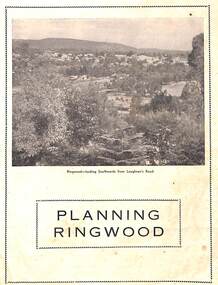
Booklet - Brochure, Planning Ringwood, circa 1946
... Planning Ringwood ...Brochure on town planning by Cr. H.E. Parker, JP., Mayor of the Borough of Ringwood (Victoria), circa 1946Includes reprinted article from the Melbourne Herald, Tuesday, July 23rd, 1946. - "Ringwood has the Right Idea." -
Federation University Historical Collection
Book, Dr Ian D. Clark et al, Pyrenees Shire, University of Ballarat, Tourism Planning and Development
... Pyrenees Shire, University of Ballarat, Tourism Planning ...The Themes that have been most prevalent in the Shire are: Major Mitchell's Impact Pastoral Runs in the Pyrenees Shire Aboriginal History Gold Rush Era Chinese History Wine ProductionPink soft covered book of 35 pages with fifteen appendices. It includes pull out maps and plans. nature based tourism, accommodation, restaurants, transport, attractions, funding, community interest, production development plan, trevor peek, geoffrey gray, djadja wurrung aboriginal clan, the australian tourism commission, tourism victoria, avoca, beaufort, snake valley, amphitheatre, landsborough, lexton, elmhurst, moonambel, mt cole, redbank, mount lonarch, lake goldsmith, st arnaud, lamplough, buangor, natte yallock, navarre/barkly, percydale -
 Ringwood and District Historical Society
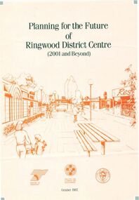
Pamphlet, Planning for the Future of Ringwood District Centre 2001 and Beyond - October 1987
... Planning for the Future of Ringwood District Centre 2001 ...A4 size 6-page multi-fold consultants' report outlining Ringwood's central structure plan for the new millennium. Topics: Traffic Circulation and Parking, Regional Retailing Focus, Entertainment Precinct, Office Precinct, Railway Precinct, Residential Conservation Zones, Retail Specialty Core, Commercial Boulevard, Possible Station Street Upgrading. Planning consultants - Wolinski Planners Pty. Ltd., were commissioned by Ministry for Planning and Environment, City of Ringwood and the Ministry of Transport in 1986 to prepare and exhibit the plan for public comment. After consideration of responses, the Working Group will make recommendations to the Council and Ministers subject to hearings of any formal submissions. -
 Melbourne Tram Museum
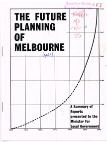
Document - Report, Commerce News, "The Future Planning of Melbourne - A summary of Reports - Minister for Local Government", 1967
... "The Future Planning of Melbourne - A summary of Reports ...Printed report or paper, 16 pages on gloss paper, centre stapled titled "The Future Planning of Melbourne - A summary of Reports presented to the Minister for Local Government" looking at the growth of Melbourne, water supply, metropolitan boundaries, 1966-67. Includes submissions from Town and Country Planning Association, MMBW, Regional planning, decentralisation, finance, commuter services. Process created by Rupert Hamer, the Local Government Minister at the time. Published as a supplement to "January Commerce News.""4E1" in ink on front cover, AETA stamp, the date "(1967)" and peoples initials on the front cover.trams, tramways, melbourne, victoria, development -
Federation University Historical Collection
Booklet - Report, Regional College Development Planning Paper, 1976
... Regional College Development Planning Paper, 1976 ...Ballarat School of Mine's 'Regional College Development Plan' for the Lydiard Street Campus. It includes minutes of meeting in 1976.ballarat school of mines, ballarat regional college, graham beanland, ballarat technical school, ballarat girls'high school, mount clear technical high school, tertiary orientation program, campus plan, smb campus plan -
Federation University Historical Collection
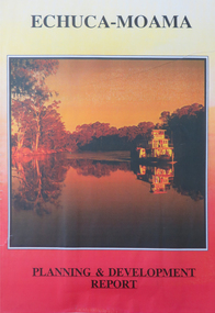
Report, Echuca Moama Tourism Planning and Development Strategy, c1996
... Echuca Moama Tourism Planning and Development Strategy ...Report compiled by three students of 'Tourism Planning and Development' at Ballarat University College (later Federation University Australia).victorian tourism industry, tourism, alumni, echuca, moama, hopwood's ferry, murray river, goulburn river, campaspe river, gaming -
 Federation University Historical Collection
Report, Echuca Moama Tourism Planning and Development Strategy, 1993, 06/1993
... Echuca Moama Tourism Planning and Development Strategy ...Report compiled by four students of 'Tourism Planning and Development' at Ballarat University College (later Federation University Australia).victorian tourism industry, tourism, alumni, echuca, moama, hopwood's ferry, murray river, goulburn river, campaspe river, gaming, port of echuca -
Whitehorse Historical Society Inc.
Document, City of Nunawading Forward Planning Special Committee, 1/07/1994 12:00:00 AM
... City of Nunawading Forward Planning Special Committee ...Notice and agenda of Forward planning Committee includes items re Amalgamation submission and proposed names for merged city.Notice and agenda of Forward planning Committee includes items re Amalgamation submission and proposed names for merged city.Notice and agenda of Forward planning Committee includes items re Amalgamation submission and proposed names for merged city.city of nunawading, local government, amalgamations -
 Greensborough Historical Society
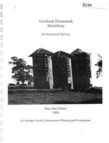
Booklet, Sera Jane Peters, Viewbank Homestead, Heidelberg: an historical survey, by Sera Jane Peters for Heritage Victoria, Department of Planning and Development, 1996
... Sera Jane Peters for Heritage Victoria, Department of Planning ...History of the Viewbank Homestead, originally a 90 acre site with homestead and outbuildings, now demolished.Black and white photocopy of typescript, with photographs, plans, reproductions of documents. 25 p plus 17 p of Appendices, unboundviewbank homestead, heritage victoria -
Ringwood and District Historical Society
Envelope, Packet: Town Planning Act 1944 and Greater Melbourne Printed Matter and Correspondence
... Packet: Town Planning Act 1944 and Greater Melbourne ...Packet 2 (of 2); Town Planning Act 1944 Municipal Administration Institute Pamphlets and minutes of general meetings; Correspondence -
 Stawell Historical Society Inc
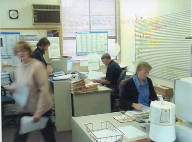
Photograph - Aunde Album 29, Production Planning, 2002
... Production Planning ...Aunde / Norwellan Textiles North Western Woolen Mills became Norwellan Textiles then AUNDEColour landscape photo: Office, 2 Women, 2 Men, planning calanders, file, computers, clock 1.50 PM.AUnde Australia Ltd. logoindustry, aunde -
 Camberwell Historical Society
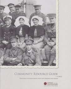
Booklet (Item), Victorian Government, Community Resource Guide: Planning a commemorative event and sharing local stories, 2014
... Community Resource Guide: Planning a commemorative event ...victoria, war -
Lakes Entrance Historical Society
Book, Regional Coordination Group and Strategy Steering Committee, The East Gippsland Planning and Development Strategy, 1997
... The East Gippsland Planning and Development Strategy. ...An outline of planning and proposed development by the East Gippsland, Victoria, Shire Council from 1997 to the year 2010. Maps included.township, land settlement, tourism -
 Glen Eira City Council History and Heritage Collection
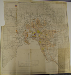
Map - Map, zoning, Metropolitan Town Planning Commission, "DISTRIBUTION AND USE OF EXISTING PROPERTY. MAP NO. 6.", 1929
... Metropolitan Town Planning Commission ...The map titled: “Distribution and use of Existing property map No. 6” (Metropolitan Town Planning Commission Melbourne and Suburbs) is of historical significance. It is listed on page 168 of Chapter 4 the Zoning section of the "Plan of General Development Melbourne Report of the Metropolitan Town Planning Commission 1929" - Melbourne's first strategic plan. Map No. 6 is mentioned throughout Chapter 4 of the 1929 Report. It states on page 156 that this Map was created to graphically illustrate the data collected by the Planning Commission. The Map illustrates the general distribution of uses of existing property throughout the metropolitan area. The coloured sections show the areas which were developed or were in the process of development in 1929. The colours indicate the distribution of uses in the developed areas. The pink coloured areas, which include Caulfield, were almost completely residential.1929, metropolitan town planning commission, melbourne, suburbs -
Lakes Entrance Historical Society
Book, Gippsland Lakes Use Strategy Plan Background Report, 1978
... Town and Country Planning Board Melbourne ...Background report from Planning Board 1978Paperback with 125 pagestownships, planning committee -
Ringwood and District Historical Society
Envelope, Packet: Ringwood Regional Shopping Centre later Eastland. Town Planning from 1945, Clippings, Eastland Development Dispute
... . Town Planning from 1945, Clippings, Eastland Development ...Town Planning and Development 1945; Newspaper cuttings Eastland Shopping Centre; Eastland development dispute; Regional Shopping Centre for Ringwood -
Whitehorse Historical Society Inc.
Article, Tougher planning power for councils, 2004
... Tougher planning power for councils ...VCAT (the planning appeals tribunal) approved dual apartment towers in Colombo Street Mitcham.VCAT (the planning appeals tribunal) approved dual apartment towers in Colombo Street Mitcham. Many lobby groups disagree with the decisionVCAT (the planning appeals tribunal) approved dual apartment towers in Colombo Street Mitcham. colombo street, mitcham, building permits, mitcham residents' group, hogg, tony, high-rise buildings -
Southern Sherbrooke Historical Society Inc.
Council Planning Scheme - Shire of Sherbrooke, "Sherbrooke Planning Scheme 1993", 14-Jul-94
... "Sherbrooke Planning Scheme 1993" ...Donated to Southern Sherbrooke Historical Society by Judy Woolfe, Local History Librarian, Eastern Regional Libraries, Belgrave BranchShire of Sherbrooke Planning Scheme, in ring binder, detailing land use zones through the former Shire of Sherbrooke. Two copies.Copy 1: barcode sticker, red "Cancelled" stamp, "031" stamp, "$10.00/Gift/XX/S1" in pencil, stamp "Eastern Regional Library Victoria Australia Received 17 Feb 1995" on first page, sticker on spine "LH/352./96/SHE"/Copy 2: stamp "011" on first page.shire of sherbrooke -
 Greensborough Historical Society
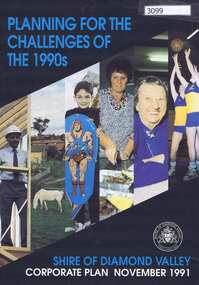
Pamphlet, Planning for the challenges of the 1990s: Shire of Diamond Valley Corporate Plan, 1991_11
... Planning for the challenges of the 1990s: Shire of Diamond ...Shire of Diamond Valley Corporate Plan 1991. Includes Shire map and statistics with plans for services to the community.16p. text and coloured photographsshire of diamond valley -
 Eltham District Historical Society Inc
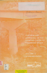
Book, A Review and Appraisal of the Diamond Creek to Ringwood Study, volume 2, working paper, by Loder and Bayly, 1979
... Loder and Bayly Planning and Engineering Consultants ...Volume 2: Working papers. This report is a review and appraisal of the Outer Ring Road Study Diamond Creek to Ringwood prepared for The Road Planning Liaison Committee by the Joint Road Planning Group for the The City of Doncaster & Templestowe and The Shire of Eltham by Loder & Bayly Planning & Engineering Consultants. "This paper attempts to set a framework for an evaluation of the recommended road link between Diamond Creek and Ringwood." Various perspectives are examined. Includes fold out maps.91 p, maps, 27 cm.melbourne ring road, roads, freeways -
University of Melbourne, Burnley Campus Archives
Map, Melbourne Metropolitan Planning Scheme, c. 1978
... Melbourne Metropolitan Planning Scheme ...Maps showing Zones and Reservations in the Merri Creek area of Melbourne, prepared by the Drafting Department, Planning Branch, MMBW. (1) Map No 36, coloured. (2) Map No 37, coloured. (3) Map No 38, not coloured. (4) Map No 46. Scale 1:9600. May have been used in planning the Native Garden Woodland Area. merri creek, melbourne and metropolitan board of works, melbourne metropolitan area -
Ringwood and District Historical Society
Envelope, Jeanette Maynard, Packet: Jeanette Maynard, Masters Prelim in Environmental Studies - Ringwood History and Planning, 1991, 1991
... Studies - Ringwood History and Planning, 1991. ...Jeanette Maynard, Masters Prelim in Environmental Studies, Faculty of Architecture and Planning Melbourne 1991; Letter from Jeanette Maynard to Mrs Pullin -
Lakes Entrance Historical Society
Book, Tambo Shire, Shire of Tambo Planning Report, 1990
... Shire of Tambo Planning Report ...The Guide to planning and co-ordinating the development of Rural Residential and general rural subdivision through the municipality of Tambo Shire for the next five yearslocal government, township -
Port Melbourne Historical & Preservation Society
Document - Binder, Bayside Open Planning Forum, Aug 1992
... Bayside Open Planning Forum ...Donor Pat HAWKINS participated in forum which she described as 'the most democratic thing I have ever done'Large, white, plastic binder of material relating to the Bayside Open Planning Forum, a consultation process to set a direction for planning for the 'Bayside' site, 6 - 10 August 1992. Open to the public day and night for four days, incorporating large public meetings pklus opportunity for individuals to convey their ideas to a team of town planners. Refer photos 1505.01-.08.pencil sketch inside front coverbuilt environment, town planning, public action campaigns, local government - city of port melbourne, bayside open planning forum, f patricia (pat) hawkins, beris campbell, paul merain, major projects victoria -
 Bendigo Military Museum
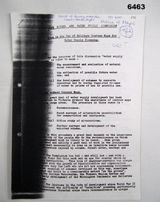
Administrative record - Use of Military maps for water supply planning, 1962
... Use of Military maps for water supply planning ...These are typed notes on the use of Military maps for water supply planning. This demonstrates the value of Military Mapping containing accurate relief information that can then be used for water supply planning.5 x A4 pages of typed notes, poorly photocopiedroyal australian survey corps, rasvy, fortuna, army survey regiment, army svy regt, asr, state rivers and water supply commission -
 Greensborough Historical Society
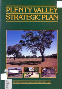
Booklet - Leaflet, Plenty Valley strategic plan, August 1989
... Ministry for Planning and Environment, Victoria ...A 1989 planning document for the Plenty Valley growth area, as much of it moved from rural to residential zoning.8 p., text and col. illustrationsplenty valley, urban development, plenty river, shire of diamond valley, whittlesea -
Whitehorse Historical Society Inc.
Map, Nunawading Planning Scheme, 7/06/1994 12:00:00 AM
... Nunawading Planning Scheme ...Local Section maps 1 - 4 with index. Geographical information system land Information Branch. Scale 1:10,000 Shows zoning under planning scheme.Local Section maps 1 - 4 with index. Geographical information system land Information Branch. Scale 1:10,000 Shows zoning under planning scheme.Local Section maps 1 - 4 with index. Geographical information system land Information Branch. Scale 1:10,000 Shows zoning under planning scheme.blackburn, blackburn north, blackburn south, forest hill, heatherdale, maps, nunawading, vermont, vermont south, town planning, burwood east, laburnum