Historical information
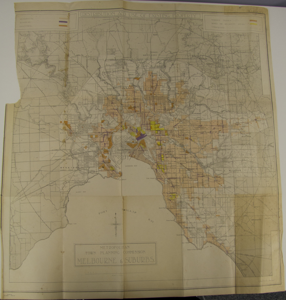
The map titled: “Distribution and use of Existing property map No. 6” (Metropolitan Town Planning Commission Melbourne and Suburbs) is of historical significance. It is listed on page 168 of Chapter 4 the Zoning section of the "Plan of General Development Melbourne Report of the Metropolitan Town Planning Commission 1929" - Melbourne's first strategic plan. Map No. 6 is mentioned throughout Chapter 4 of the 1929 Report. It states on page 156 that this Map was created to graphically illustrate the data collected by the Planning Commission. The Map illustrates the general distribution of uses of existing property throughout the metropolitan area. The coloured sections show the areas which were developed or were in the process of development in 1929. The colours indicate the distribution of uses in the developed areas. The pink coloured areas, which include Caulfield, were almost completely residential.