Showing 10945 items matching "plenty"
-
 Eltham District Historical Society Inc
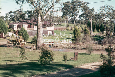
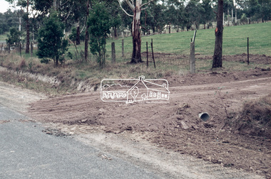
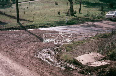
Photograph, Driveway detail, Riverhill Drive, Lower Plenty, c.March 1981, 1981
Infrastructure features used by Eltham Shire Council in the construction of Riverhill Drive, Lower Plenty, c.March 198135mm colour positive transparency Kodak Kodachrome cardboard mountinfrastructure, lower plenty, riverhill drive, road construction, streets -
 Eltham District Historical Society Inc
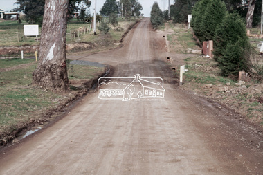
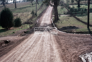
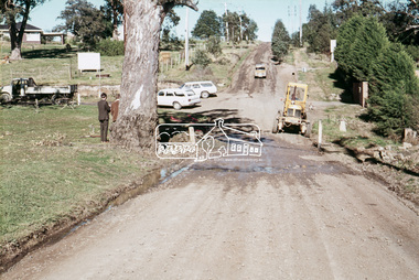
Photograph, Riverhill Drive leadup to Rosehill Road, Lower Plenty, c.March 1981, 1981
Infrastructure features used by Eltham Shire Council in the construction of Riverhill Drive, Lower Plenty, c.March 198135mm colour positive transparency Kodak Kodachrome cardboard mountinfrastructure, lower plenty, riverhill drive, road construction, rosehill road, streets -
 Eltham District Historical Society Inc
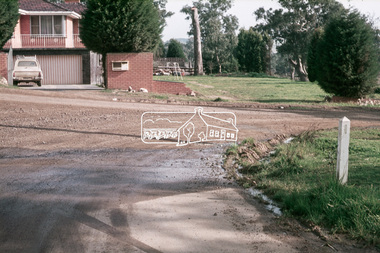
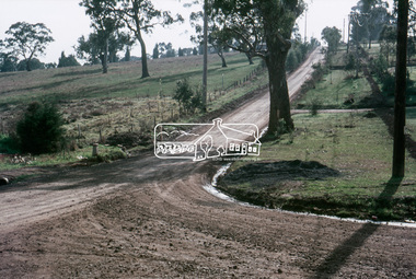
Photograph, Riverhill Drive intersection with Rosehill Road, Lower Plenty, c.March 1981, 1981
Infrastructure features used by Eltham Shire Council in the construction of Riverhill Drive, Lower Plenty, c.March 198135mm colour positive transparency Kodak Kodachrome cardboard mountinfrastructure, lower plenty, riverhill drive, road construction, rosehill road, streets -
 Greensborough Historical Society
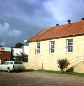
Photographs, Lower Plenty Hall, 1981, 1981_
5 photographs of the exterior of Lower Plenty Hall 1981, taken by Peter Graham, a Shire of Eltham Councillor.5 colour photographs.lower plenty, lower plenty hall, peter graham -
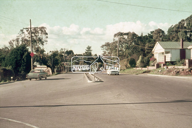 Eltham District Historical Society Inc
Photograph, Looking northeast along Main Road at intersection with Para Road, Lower Plenty, July 1969, 1969
House on right is 122 Main Road, Lower Plenty viewed from intersection of Main Road with Para Road35mm colour positive transparency blue Agfacolour Service plastic mountlower plenty, main road, para road -
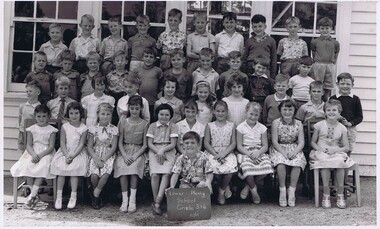
 Greensborough Historical Society
School Photograph - Digital Image, Lower Plenty Primary School LP1295 1963 Grade 6, 1963_
Class photograph from Grade 6 1963 at Lower Plenty Primary School No.1295. Student names are not identified.Digital copy of black and white class photograph.lower plenty primary school, lower plenty state school -
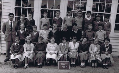
 Greensborough Historical Society
School Photograph - Digital Image, Lower Plenty Primary School LP1295 1961 Grades 3&4, 1961_
Class photograph from Grades 3 and 4 1961 at Lower Plenty Primary School No.1295. Student names are not identified.Digital copy of black and white class photograph.lower plenty primary school, lower plenty state school -
 Greensborough Historical Society
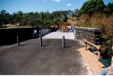
Photograph - Digital Image, Anne Paul, Opening of restored Old Lower Plenty Bridge 2001 - area adjacent, 14/03/2001
The opening of the restored Old Lower Plenty Bridge, opened on 14/03/2001 by the Minister for Environment and Conservation Sherryl Garbutt MLA and Mayor of Banyule Cr Dale Peters. The project was jointly funded by Banyule Council and Parks Victoria. The restored bridge is the oldest remaining bridge in Nillumbik and forms part of the Plenty River Trail. this photograph shows the area adjacent to the bridge on the day of the opening.Digital copy of colour photographlower plenty, lower plenty bridge, sherryl garbutt, dale peters, banyule council, parks victoria -
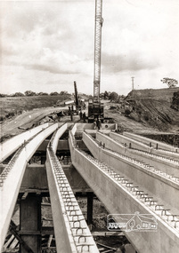 Eltham District Historical Society Inc
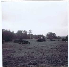
Photograph, Construction of Lower Plenty Bridge, Main Road, c.August 1966, 1966
This black and white photograph records construction activity of the then new Main Road bridge over the Plenty River at Lower Plenty in 1969.Local significanceBlack and white photograph taken during construction of the Main Road bridge over the Plenty River. Includes structural members, construction personnel, vehicles and a Clarke mobile crane.mobile cranes, bridge construction, main road, plenty river, lower plenty, bridges -
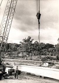 Eltham District Historical Society Inc
Map (item) - Sales Brochure, Plenty Township Estate and Bryn Teg Hill's Estate, Coghill & Haughton, Melbourne, c.1924
Plenty Township Estate "The rapid growth of Greensborough and the great traffic development on the main road between Heidelberg and Eltham augurs well for Plenty Township Estate. Already a Store, Post Office and State School have been started, and the activities of the Local Progress Association will help the district forward considerably. Within walking distance of the Montmorency and Greensborough stations." Bryn Teg Hill's Estate "Better known as "The Old Sand Hill, "within walking distance of the Montmorency and Greensborough railways stations." "Some few years back Mrs Thomas subdivided portion of the Sand Hill Paddocks, and the areas sold have been settled and many converted into charming outer suburban garden homes with cultivation and orchard plots. The south-eastern slope gives the land a grand outlook over the Yarra Valley on to the Dandenoings, and the are is very picturesque and homely." "A number of the blocks contain large deposits of valuable building sand, which should prove good speculation in view of the forecast for further rapid home development along the Eltham Suburban Electric Service." Sand Hills Road (Old Eltham Road) Date estimated as c.1924 - Electricification of railway line to Eltham referenced on map occured April 1923 and Mrs Mary Thomas died August 1925. Her home Bryn Teg became part of the Heidelberg Golf Club in 1927.The establishment of Lower Plenty as a suburban growth area supported by easy commuting facilitated by the elctrification of the Eltham railway linebonds road, bridge, bryn teg hill's estate, coghill & haughton, eltham road, heidelberg golf club hotel, houses, lower plenty, lower plenty bridge, lower plenty road, main road, plenty hotel, plenty river, plenty township estate, real estate agent, sales brochure, sand hills road, the old sand hill, sand hill paddocks, woodfull road, old eltham road, bryn teg, mrs m thomas -
 Greensborough Historical Society
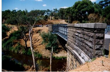
Photograph - Digital Image, Anne Paul, Opening of restored Old Lower Plenty Bridge 2001 - side view of bridge, 14/03/2001
The opening of the restored Old Lower Plenty Bridge, opened on 14/03/2001 by the Minister for Environment and Conservation Sherryl Garbutt MLA and Mayor of Banyule Cr Dale Peters. The project was jointly funded by Banyule Council and Parks Victoria. The restored bridge is the oldest remaining bridge in the former Shire of Eltham and forms part of the Plenty River Trail. This photograph shows the bridge from the side elevation, showing the bluestone and iron construction.Digital copy of colour photographlower plenty, lower plenty bridge, sherryl garbutt, dale peters, banyule council, parks victoria -
 Greensborough Historical Society
Photograph - Digital Image, Anne Paul, Opening of restored Old Lower Plenty Bridge 2001 - bridge and community, 14/03/2001
The opening of the restored Old Lower Plenty Bridge, opened on 14/03/2001 by the Minister for Environment and Conservation Sherryl Garbutt MLA and Mayor of Banyule Cr Dale Peters. The project was jointly funded by Banyule Council and Parks Victoria. The restored bridge is the oldest remaining bridge in the former Shire of Eltham and forms part of the Plenty River Trail. This photograph shows the bridge area ready for the opening ceremony and the assembled community members attending the function.Digital copy of colour photographlower plenty, lower plenty bridge, sherryl garbutt, dale peters, banyule council, parks victoria -
 Eltham District Historical Society Inc
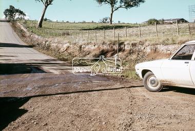
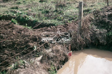
Slide, In front of Martin property drive on Bonds Road looking east up Montpelier Drive, Lower Plenty, 18 July 1972, 1972
Water drainage work undertaken by Eltham Shire Council in Bonds Road, Lower Plenty outside the Martin property opposite Montpelier Drive, July 197235 mm colour positive transparency Mount - Agfacolor Service (Blue)Bonds Road (Martin property) 12.10 pm 18.7.72bonds road, drainage works, eltham shire council, infrastructure, lower plenty, martin property, montpelier drive -
 Eltham District Historical Society Inc
Slide, On the east side of Bonds Road looking west onto Martin's property, Lower Plenty, 18 July 1972, 1972
Water drainage work undertaken by Eltham Shire Council in Bonds Road, Lower Plenty outside the Martin property opposite Montpelier Drive, July 1972 35 mm colour positive transparency Mount - Agfacolor Service (Blue)Bonds Road (Martin property) 12.10 pm 18.7.72bonds road, drainage works, eltham shire council, infrastructure, lower plenty, martin property, montpelier drive -
 Eltham District Historical Society Inc
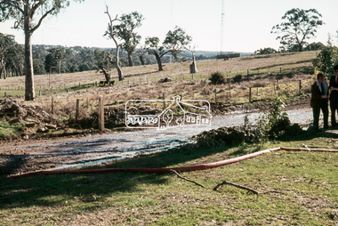
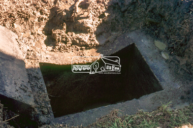
Slide, Pit located on the east side of Bonds Road, Lower Plenty, 18 July 1972, 1972
Water drainage work undertaken by Eltham Shire Council in Bonds Road, Lower Plenty outside the Martin property opposite Montpelier Drive, July 1972 35 mm colour positive transparency Mount - Agfacolor Service (Blue)Bonds Road (Martin property) 12.10 pm 18.7.72bonds road, drainage works, eltham shire council, infrastructure, lower plenty, martin property, montpelier drive -
 Eltham District Historical Society Inc
Slide, Looking westerly into Martin's property across Bonds Road, Lower Plenty, 18 July 1972, 1972
Water drainage work undertaken by Eltham Shire Council in Bonds Road, Lower Plenty outside the Martin property opposite Montpelier Drive, July 1972 35 mm colour positive transparency Mount - Agfacolor Service (Blue)Bonds Road (Martin property) 12.10 pm 18.7.72bonds road, drainage works, eltham shire council, infrastructure, lower plenty, martin property, montpelier drive -
 Eltham District Historical Society Inc
Slide, View of Martin's house indicating its relationship to the gully, Bonds Road, Lower Plenty, 18 July 1972, 1972
Water drainage work undertaken by Eltham Shire Council in Bonds Road, Lower Plenty outside the Martin property opposite Montpelier Drive, July 1972 35 mm colour positive transparency Mount - Agfacolor Service (Blue)Bonds Road (Martin property) 12.10 pm 18.7.72bonds road, drainage works, eltham shire council, infrastructure, lower plenty, martin property, montpelier drive -
 Eltham District Historical Society Inc
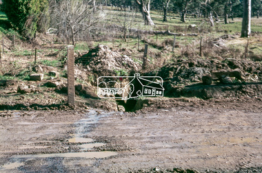
Slide, Looking south, post drainage repairs on Bonds Road near Martin property and Montpelier Drive, Lower Plenty, c.July 1972, 1972
Water drainage work undertaken by Eltham Shire Council in Bonds Road, Lower Plenty outside the Martin property opposite Montpelier Drive, July 1972 35 mm colour positive transparency Mount - Agfacolor Service (Blue)Bonds Road (Martin property) 12.10 pm 18.7.72bonds road, drainage works, eltham shire council, infrastructure, lower plenty, martin property, montpelier drive -
 Eltham District Historical Society Inc
Slide, Post drainage repairs on Bonds Road near Martin property and Montpelier Drive, Lower Plenty, c.July 1972, 1972
Water drainage work undertaken by Eltham Shire Council in Bonds Road, Lower Plenty outside the Martin property opposite Montpelier Drive, July 1972 35 mm colour positive transparency Mount - Agfacolor Service (Blue)Bonds Road (Martin property) 12.10 pm 18.7.72bonds road, drainage works, eltham shire council, infrastructure, lower plenty, martin property, montpelier drive -
 Eltham District Historical Society Inc
Slide, Looking north post drainage repairs on Bonds Road near Martin property and Montpelier Drive, Lower Plenty, c.July 1972, 1972
Water drainage work undertaken by Eltham Shire Council in Bonds Road, Lower Plenty outside the Martin property opposite Montpelier Drive, July 1972 35 mm colour positive transparency Mount - Agfacolor Service (Blue)Bonds Road (Martin property) 12.10 pm 18.7.72bonds road, drainage works, eltham shire council, infrastructure, lower plenty, martin property, montpelier drive -
 Eltham District Historical Society Inc
Slide, Post drainage repairs on Bonds Road near Martin property and Montpelier Drive, Lower Plenty, c.July 1972, 1972
Water drainage work undertaken by Eltham Shire Council in Bonds Road, Lower Plenty outside the Martin property opposite Montpelier Drive, July 1972 35 mm colour positive transparency Mount - Agfacolor Service (Blue)Bonds Road (Martin property) 12.10 pm 18.7.72bonds road, drainage works, eltham shire council, infrastructure, lower plenty, martin property, montpelier drive -
 Eltham District Historical Society Inc
Slide, Post drainage repairs on Bonds Road near Martin property and Montpelier Drive, Lower Plenty, c.July 1972, 1972
Water drainage work undertaken by Eltham Shire Council in Bonds Road, Lower Plenty outside the Martin property opposite Montpelier Drive, July 1972 35 mm colour positive transparency Mount - Agfacolor Service (Blue)Bonds Road (Martin property) 12.10 pm 18.7.72bonds road, drainage works, eltham shire council, infrastructure, lower plenty, martin property, montpelier drive -
 Greensborough Historical Society
Photographs, Plenty River Flood 1974, 1974_05
Five photographs of the Plenty River in flood 1974, taken around Greensborough by June and Brian Roberts.Five photographs b & w; one note with #3#1: Plenty River may '74 flood. Flintoff St. bridge wrecked #2: [Unmarked]? #3: Plenty at Greensborough1974 flood (Note: "The house on left hand side of the picture - would it be the Medical/dental #4: Rand St. foot bridge remnants (Plenty R.) May '74 #5: Debris dumped on park by Plenty R. flood May 1974 floods, plenty river -
 Greensborough Historical Society
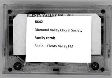
Audio - Audio Cassette, Diamond Valley Choral Society, Family Carols on Plenty Valley FM, performed by Diamond Valley Choral Society, 1990s
A recording of Family Carols, as broadcast on Plenty Valley FM. This performance is by the Diamond Valley Choral Society.1 audio cassette in clear plastic caseHandwritten on cassette: "Plenty Valley FM 88.6: Family Carols".diamond valley choral society, christmas music, diamond valley, carols, plenty valley fm -
 Greensborough Historical Society
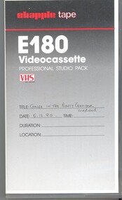
Film - Video Cassette, John Ramsdale, Change in the Plenty corridor, 05/12/1990
Video of a fieldwork for teachers, taken by John Ramsdale in 1990, investigating changes along the Plenty River.Part of the John Ramsdale collection of slides and audio visual material.VHS video tape, 2 copies."Chapple E180 videocassette" and "Change in the Plenty corridor unedited 5.12.90"plenty river, plenty gorge -
 Eltham District Historical Society Inc
Photograph, Looking east along Main Road, Lower Plenty approaching the top of the hill and Grand Boulevard, July 1969, 1969
The Eltham Apex Club conducted a Community Service Project (1965-1968) to raise funds for a new Ambulance Station to service the community. A site bounded by the intersection of Main Road, Grand Boulevard and Looker Road at Montmorency was purchased in 1969. In 1970, Eltham Shire Council undertook roadworks to construct Apex Way in preparation for the new station as well as duplicate Main Road, Lower Plenty, east of Grand Boulevard including the new Lower Plenty Bridge, which had been opened in November 1966, bordering with the City of Heidelberg.35mm colour positive transparency blue Agfacolour Service plastic mountambulance station, apex-diamond valley ambulance station, eltham ambulance station, eltham apex club, lower plenty, main road, montmorency -
 Eltham District Historical Society Inc
Slide, Looking south along Bonds Road towards intersection of Montpelier Drive, Lower Plenty, 18 July 1972, 1972
Water drainage work undertaken by Eltham Shire Council in Bonds Road, Lower Plenty outside the Martin property opposite Montpelier Drive, July 1972 Note blocked table drains.35 mm colour positive transparency Mount - Agfacolor Service (Blue)Bonds Road (Martin property) 12.10 pm 18.7.72bonds road, drainage works, eltham shire council, infrastructure, lower plenty, martin property, montpelier drive