Showing 646 items
matching australia - explorers
-
 Lakes Entrance Historical Society
Book, Beaglehole, J. C, The Endeavour Journals of Joseph Banks 1768-1771 Volume II, 1962
Part II of an edited edition of the journal of Joseph Banks, written during the voyage with Captain James Cook in the Endeavour, which in April 1770 brought Banks to the eastern shores of Australia. Illustrated and annotated. The original Banks Papers avegetation, arts, explorers -
 Flagstaff Hill Maritime Museum and Village
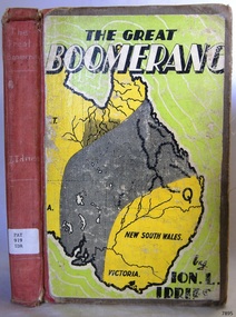
Book - Historical, Australia, The Great Boomerang
... in the Northern Territory of Australia and then exploring in Central ...This item is from the ‘Pattison Collection’, a collection of books and records that was originally owned by the Warrnambool Mechanics’ Institute, which was founded in Warrnambool in 1853. By 1886 the Warrnambool Mechanics’ Institute (WMI) had grown to have a Library, Museum and Fine Arts Gallery, with a collection of “… choice productions of art, and valuable specimens in almost every branch and many wonderful national curiosities are now to be seen there, including historic relics of the town and district.” It later included a School of Design. Although it was very well patronised, the lack of financial support led the WMI in 1911 to ask the City Council to take it over. In 1935 Ralph Pattison was appointed as City Librarian to establish and organise the Warrnambool Library as it was then called. When the WMI building was pulled down in 1963 a new civic building was erected on the site and the new Warrnambool Library, on behalf of the City Council, took over all the holdings of the WMI. At this time some of the items were separated and identified as the ‘Pattison Collection’, named after Ralph Pattison. Eventually the components of the WMI were distributed from the Warrnambool Library to various places, including the Art Gallery, Historical Society and Flagstaff Hill. Later some were even distributed to other regional branches of Corangamite Regional Library and passed to and fro. It is difficult now to trace just where all of the items have ended up. The books at Flagstaff Hill Maritime Village generally display stamps and markings from Pattison as well as a variety of other institutions including the Mechanics’ Institute itself. RALPH ERIC PATTISON Ralph Eric Pattison was born in Rockhampton, Queensland, in 1891. He married Maude Swan from Warrnambool in 1920 and they set up home in Warrnambool. In 1935 Pattison accepted a position as City Librarian for the Warrnambool City Council. His huge challenge was to make a functional library within two rooms of the Mechanics’ Institute. He tirelessly cleaned, cleared and sorted a disarrayed collection of old books, jars of preserved specimens and other items reserved for exhibition in the city’s museum. He developed and updated the library with a wide variety of books for all tastes, including reference books for students; a difficult task to fulfil during the years following the Depression. He converted all of the lower area of the building into a library, reference room and reading room for members and the public. The books were sorted and stored using a cataloguing and card index system that he had developed himself. He also prepared the upper floor of the building and established the Art Gallery and later the Museum, a place to exhibit the many old relics that had been stored for years for this purpose. One of the treasures he found was a beautiful ancient clock, which he repaired, restored and enjoyed using in his office during the years of his service there. Ralph Pattison was described as “a meticulous gentleman whose punctuality, floorless courtesy and distinctive neat dress were hallmarks of his character, and ‘his’ clock controlled his daily routine, and his opening and closing of the library’s large heavy doors to the minute.” Pattison took leave during 1942 to 1945 to serve in the Royal Australian Navy, Volunteer Reserve as Lieutenant. A few years later he converted one of the Museum’s rooms into a Children’s Library, stocking it with suitable books for the younger generation. This was an instant success. In the 1950’s he had the honour of being appointed to the Victorian Library Board and received more inspiration from the monthly conferences in Melbourne. He was sadly retired in 1959 after over 23 years of service, due to the fact that he had gone over the working age of council officers. However he continued to take a very keen interest in the continual development of the Library until his death in 1969. The Pattison Collection, along with other items at Flagstaff Hill Maritime Village, was originally part of the Warrnambool Mechanics' Institute’s collection. The Warrnambool Mechanics’ Institute Collection is primarily significant in its totality, rather than for the individual objects it contains. Its contents are highly representative of the development of Mechanics' Institute libraries across Australia, particularly Victoria. A diversity of publications and themes has been amassed, and these provide clues to our understanding of the nature of and changes in the reading habits of Victorians from the 1850s to the middle of the 20th century. The collection also highlights the Warrnambool community’s commitment to the Mechanics’ Institute, reading, literacy and learning in the regions, and proves that access to knowledge was not impeded by distance. These items help to provide a more complete picture of our community’s ideals and aspirations. The Warrnambool Mechanics Institute book collection has historical and social significance for its strong association with the Mechanics Institute movement and the important role it played in the intellectual, cultural and social development of people throughout the latter part of the nineteenth century and the early twentieth century. The collection of books is a rare example of an early lending library and its significance is enhanced by the survival of an original collection of many volumes. The Warrnambool Mechanics' Institute’s publication collection is of both local and state significance. About Ion L Idriess Ion Llewellyn Idriess was born in Waverley, Sydney, New South Wales on 20th September 1889 and passed away on 6th June 1979 in Mona Vale, Sydney, New South Wales at the age 89. After Idriess finished school he worked in the assay office of Broken Hill Proprietary mine. Both Idriess and his mother had typhoid fever when Ion was about 15 years old and it caused his mother’s death. After spending time with his Grandmother in Sydney he found work on a paddle-steamer and had a relapse of the fever. He then went into the western district of New South Wales where he worked in many different itinerant jobs, including rabbit poisoner, boundary rider, drover, sandalwood harvester, shearer, dingo shooter and opal miner. While opal mining at Lightning Ridge he wrote short stories, about life on the opal fields, for the Bulletin using the name “Gouger”. Idriess then moved to North Queensland in search of gold, tin and sandalwood. He travelled over a great deal of the Cape York Peninsula spending a lot of this travel time with local indigenous people; thus began his lifelong interest in their customs. He then spent time on cattle stations in the Gulf of Carpentaria. In 1914 Idriess travelled to Townsville and enlisted in the 5th Light Horse as a trooper. He became a specialist in sniping and was a spotter for the noted sniper Billy Sing. He saw service in Palestine, Sinai and Turkey. Idriess was wounded at Beersheba and after fighting the Battle of Gaza he was invalided home in March 1918. After recovering from his wounds Idriess again travelled to Cape York Peninsula where he worked with pearlers and missionaries in the Torres Strait Islands. He then went gold mining in Papua New Guinea, buffalo shooting in the Northern Territory of Australia and then exploring in Central and Western Australia. LITERARY WORKS OF IDRIESS In 1928 Idriess settled in Sydney and published the first of his 47 books. In 1931 - “Lasseter’s Last Ride”, became his first best seller. In the years 1932 and 1940 he published three books in each year. “The Cattle King” (1936) and “Flynn of the Inland” (1932) have gone through reprinting forty to fifty times. His last book was published in 1969. Idriess’ books where in general non-fiction and were written in a colourful and immediate story style, taken from life experiences gained during his travels. Idriess was appointed an Officer of the Most Excellent Order of the British Empire (OBE) for his service to literature in 1968. The Great Boomerang Author: Ion L Idriess Publisher: Angus & Robertson Date: 1948Label on spine cover with typed text PAT 919 IDR Pastedown front endpaper has sticker from Corangamite Regional Library Service warrnambool, shipwrecked-coast, flagstaff-hill, flagstaff-hill-maritime-museum, maritime-museum, shipwreck-coast, flagstaff-hill-maritime-village, shipwrecked-artefact, book, pattison collection, warrnambool library, warrnambool mechanics’ institute, ralph eric pattison, corangamite regional library service, warrnambool city librarian, mechanics’ institute library, victorian library board, warrnambool books and records, warrnambool children’s library, great ocean road, the great boomerang, ion l idriess -
 Warrnambool and District Historical Society Inc.
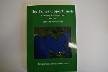
Book, The Tamar Opportunists - Mahogany Ship Mysteries and the Port Fairy Adventurers, 2022
This book explores aspects of the Mahogany Ship wreck and aspects of early Port Fairy history.This is a book of 122 pages. The cover is green with a green and blue map on the front and white printing on the front and back. It contains a Foreword and Acknowledgements, an Epilogue, Appendices, Bibliography, Index and printed material, maps, sketches, tables and black and white photographs.non-fictionThis book explores aspects of the Mahogany Ship wreck and aspects of early Port Fairy history.port fairy history, the tamar opportunists, mahogany ship -
 Vision Australia
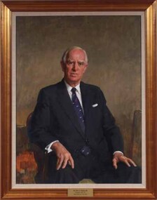
Painting - Artwork, Portrait of John Wicking, 1980
Framed portrait of John Wicking who was President of the Association for the Blind 1973-1984 as well as a generous benefactor. It is part of a series of paintings commissioned by the AFB Board to commemorate the work of past presidents of the organisation. Mr. Wicking wears a navy suit, white shirt and navy blue Kiwi tie. He was Managing Director and Chairman of Kiwi International when he was introduced to the Committee in 1971. With a natural air of authority, he was known to be both strong and wise. One of the first hurdles Mr Wicking faced following his election as President in 1973 was understanding the health service system and sorting out the differing views of committee members over recommendations for projects costing hundreds of thousands of dollars with no funds to implement them. The ten years of his Presidency were a time of exceptional growth and expansion. He was instrumental in acquiring an adjacent property to those already owned in Glenferrie Road in 1974 at a cost of $120,000, on which the Low Vision Clinic was erected – the first of its type in Australia. Land was also bought in both the metropolitan and country areas for future expansion. Day care centres were opened in Ballarat and Bendigo and new metropolitan services commenced. Mr Wicking formed a committee to explore the possibility of a radio station people unable to read standard print. As a result 3RPH commenced broadcasting in 1981. After his retirement as President, Mr. Wicking continued as a committee member until 1994. In 1995 he was instrumental in the establishment of the Tilly Aston Heritage Collection, on which he served as Chairman until sadly passing away in 2002. 1 art original in old gold frameThe plaque at the base of the painting reads 'Mr John O. Wicking AM / President 1973-1984 / Association for the Blind'. association for the blind, john wicking -
 Merri-bek City Council
Painting - Oil on linen, Renee Cosgrave, Learning Whakapapa (Māori Land Court Archives), 2023
-
 Merri-bek City Council
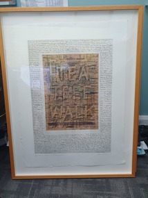
Work on paper - Charcoal and pages from Aboriginal Words and Place Names, Jenna Lee, Without us, 2022
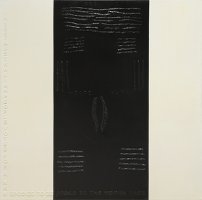
Jenna Lee dissects and reconstructs colonial 'Indigenous dictionaries' and embeds the works with new cultural meaning. Long obsessed with the duality of the destructive and healing properties that fire can yield, this element has been applied to the paper in the forms of burning and mark-making. In Without Us, Lee uses charcoal to conceal the text on the page, viewing this process as a ritualistic act of reclaiming and honouring Indigenous heritage while challenging the oppressive legacies of colonialism. Lee explains in Art Guide (2022), ‘These books in particular [used to create the proposed works] are Aboriginal language dictionaries—but there’s no such thing as “Aboriginal language”. There are hundreds of languages. The dictionary just presents words, with no reference to where they came from. It was specifically published by collating compendiums from the 1920s, 30s and 40s, with the purpose to give [non-Indigenous] people pleasant sounding Aboriginal words to name children, houses and boats. And yet the first things that were taken from us was our language, children, land and water. And the reason our words were so widely written down was because [white Australians] were trying to eradicate us. They thought we were going extinct. The deeper you get into it, the darker it gets. But the purpose of my work is to take those horrible things and cast them as something beautiful.’Framed artwork -
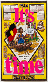 Merri-bek City Council
Textile - Wool, cotton, on printed cotton, Kait James, It’s Time, 2023
-
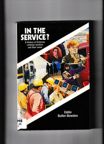 Victorian Railway History Library
Book, Hyland House, In the service? A history of Victorian railways workers and their union, 1991
This book explores the human dimensions of the Australian Railways Union's history and looks at the way in which one of the oldest industrial unions in Australia has responded to the challenges of social and economic change.Index, ill, p.180.non-fictionThis book explores the human dimensions of the Australian Railways Union's history and looks at the way in which one of the oldest industrial unions in Australia has responded to the challenges of social and economic change.australian railways union - victorian branch - history, trade unions - railways - history -
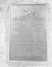 Ringwood and District Historical Society
Photograph, Plaque, Ringwood Library, commemorating Golden Jubilee of Ringwood's severance from Lilydale Shire. 1974
Black and white photograph of plaque set in rock outside Library.Plaque reads: IN THIS YEAR, 1974, WHEN AUSTRALIA IS CELEBRATING THE BI-CENTENARY OF THE BIRTH OF THAT GREAT NAVIGATOR AND CARTOGRAPHER, MATTHEW FLINDERS, IT IS FITTING THAT WE ALSO COMMEMORATE THE LABOUR OF RINGWOOD'S FIRST SETTLERS WHO FOLLOWED THE DISCOVERERS, EXPLORERS & SURVEYORS, CLEARED THE FORESTED HILLS AND PLOUGHED THE HARD GROUND BEFORE PLANTING THEIR ORCHARDS. ERECTED BY THE RINGWOOD HISTORICAL RESEARCH GROUP, 26TH OCTOBER, 1974 ON THE OCCASION OF THE GOLDEN JUBILEE OF RINGWOOD'S SEVERANCE FROM LILYDALE SHIRE Typed below photograph: "1974 - Plaque Ringwood Library." Written on rear of backing sheet: "Before the plaque was finally fitted in I had a new 1974 ten cent piece slipped in behind it. R. Pullin, Archivist, RHR Group." -
 Glenelg Shire Council Cultural Collection
Mixed media - Framed Art Work, Wallace, Carmel et al, Lagoon Page 2, 2004
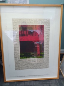
© Anna Lanyon , Carmel Wallace 2004. Apart from any fair dealing for the purposes of private study, research, criticism or review permitted under the Copyright Act, no text, image or part thereof may be reproduced, stored in a retrieval system, or transmitted in any form, without prior written permission from the authors.This suite of etchings explores the natural and social history of Fawthrop Lagoon, an ancient intertidal lagoon that lies at the heart of Portland on the far south-west coast of Victoria, Australia. The work records and interprets essential moments in the life of the lagoon, the plants, birds, insects, water-creatures and humans who have lived and continue to live around its shores. White card backing with white torn looking inner frame. Centre is a black printed overlay of a the words 'TEA TREE WALK' on top of a newspaper page taken from the Herald Sun on Saturday September 4, 2004 with the weather forecast and the tides, moon, air quality, fish, world, beach report etc. Around the outside of the centre image is hand written wording in fine black ink.4/30 'Lagoon' Page 2 : Cliff Beauglehole Carmel Wallacefawthrop lagoon, portland, victoria, australia, plants, birds, insects, water, creatures, humans -
 Glenelg Shire Council Cultural Collection
Mixed media - Framed Art Work, Wallace, Carmel et al, Lagoon, P1, Second - State, 2004
© Anna Lanyon , Carmel Wallace 2004. Apart from any fair dealing for the purposes of private study, research, criticism or review permitted under the Copyright Act, no text, image or part thereof may be reproduced, stored in a retrieval system, or transmitted in any form, without prior written permission from the authors.This suite of etchings explores the natural and social history of Fawthrop Lagoon, an ancient intertidal lagoon that lies at the heart of Portland on the far south-west coast of Victoria, Australia. The work records and interprets essential moments in the life of the lagoon, the plants, birds, insects, water-creatures and humans who have lived and continue to live around its shores. White card backing with white torn looking inner frame. Centre is a black printed overlay of a survey marker on top of a newspaper page taken from the Herald Sun on Tuesday February 3, 2004 with the weather forecast and the tides, moon, air quality, fish, world, beach report etc. Around the outside of the centre image is hand written wording in fine black ink.A/P 'Lagoon, P1, Second - State' Carmel Wallacefawthrop lagoon, portland, victoria, australia, plants, birds, insects, water, creatures, humans -
 Glenelg Shire Council Cultural Collection
Mixed media - Framed Art Work, Wallace, Carmel et al, Lagoon Page 3, 2004
© Anna Lanyon , Carmel Wallace 2004. Apart from any fair dealing for the purposes of private study, research, criticism or review permitted under the Copyright Act, no text, image or part thereof may be reproduced, stored in a retrieval system, or transmitted in any form, without prior written permission from the authors.This suite of etchings explores the natural and social history of Fawthrop Lagoon, an ancient intertidal lagoon that lies at the heart of Portland on the far south-west coast of Victoria, Australia. The work records and interprets essential moments in the life of the lagoon, the plants, birds, insects, water-creatures and humans who have lived and continue to live around its shores. White card backing with white torn looking inner frame. Centre is print of an extract taken from a survey record of the Fawthrop Lagoon Portland listing the name of the reserve, Allotment number, section number, Township, and Municipality. Markings and dates have been written in. Around the outside of the centre image is hand written wording in fine black ink and a map of the town of Portland also in black ink.4/30 Lagoon, Page 3 Carmel Wallacefawthrop lagoon, portland, victoria, australia, plants, birds, insects, water, creatures, humans -
 Glenelg Shire Council Cultural Collection
Mixed media - Framed Art Work, Wallace, Carmel et al, Lagoon Page 4, 2004
© Anna Lanyon , Carmel Wallace 2004. Apart from any fair dealing for the purposes of private study, research, criticism or review permitted under the Copyright Act, no text, image or part thereof may be reproduced, stored in a retrieval system, or transmitted in any form, without prior written permission from the authors.This suite of etchings explores the natural and social history of Fawthrop Lagoon, an ancient intertidal lagoon that lies at the heart of Portland on the far south-west coast of Victoria, Australia. The work records and interprets essential moments in the life of the lagoon, the plants, birds, insects, water-creatures and humans who have lived and continue to live around its shores. White card backing with white torn looking inner frame. Centre is print of green dragons and flowers in the background and five red stamps in the foreground with the words ' Blood of China' and Chinese characters down the left and right hand sides of the stamps. The image is surrounded by red hand writing in fine liner.A/P Lagoon Page 4 : Gold / leaf Carmel Wallacefawthrop lagoon, portland, victoria, australia, plants, birds, insects, water, creatures, humans -
 Glenelg Shire Council Cultural Collection
Mixed media - Framed Art Work, Wallace, Carmel et al, Lagoon Page 5, 2004
© Anna Lanyon , Carmel Wallace 2004. Apart from any fair dealing for the purposes of private study, research, criticism or review permitted under the Copyright Act, no text, image or part thereof may be reproduced, stored in a retrieval system, or transmitted in any form, without prior written permission from the authors.This suite of etchings explores the natural and social history of Fawthrop Lagoon, an ancient intertidal lagoon that lies at the heart of Portland on the far south-west coast of Victoria, Australia. The work records and interprets essential moments in the life of the lagoon, the plants, birds, insects, water-creatures and humans who have lived and continue to live around its shores. White card backing with white torn looking inner frame. Centre is print in the colours red and green with the word '21-ST' stamped into the print. Looks like reeds and grass in the green section and a photograph of a pillar concrete type structure with the words 'EVASSER FITTED' stamped into the leg lengthways.A/P 'Lagoon' P5 Carmel Wallacefawthrop lagoon, portland, victoria, australia, plants, birds, insects, water, creatures, humans -
 Glenelg Shire Council Cultural Collection
Mixed media - Framed Art Work, Wallace, Carmel et al, Lagoon, 2004
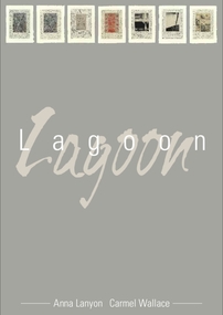
© Anna Lanyon , Carmel Wallace 2004. Apart from any fair dealing for the purposes of private study, research, criticism or review permitted under the Copyright Act, no text, image or part thereof may be reproduced, stored in a retrieval system, or transmitted in any form, without prior written permission from the authors.This suite of etchings explores the natural and social history of Fawthrop Lagoon, an ancient intertidal lagoon that lies at the heart of Portland on the far south-west coast of Victoria, Australia. The work records and interprets essential moments in the life of the lagoon, the plants, birds, insects, water-creatures and humans who have lived and continue to live around its shores. A suite of seven mixed media artworks each piece framed. Each piece is unique and is labelled as A/P (Artists Proof) Text: Anna Lanyon Images: Original etchings printed by Carmel Wallace at Portland Bay Press Victoria Australia 2004 Medium: Etching with chine collé Paper: Blue Lake (Australia) 100% cotton rag 600gsmfawthrop lagoon, portland, victoria, australia, plants, birds, insects, water, creatures, humans -
 Glenelg Shire Council Cultural Collection
Mixed media - Framed Art Work, Wallace, Carmel et al, Lagoon Page 7, 2004
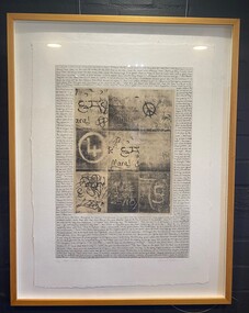
© Anna Lanyon , Carmel Wallace 2004. Apart from any fair dealing for the purposes of private study, research, criticism or review permitted under the Copyright Act, no text, image or part thereof may be reproduced, stored in a retrieval system, or transmitted in any form, without prior written permission from the authors.This suite of etchings explores the natural and social history of Fawthrop Lagoon, an ancient intertidal lagoon that lies at the heart of Portland on the far south-west coast of Victoria, Australia. The work records and interprets essential moments in the life of the lagoon, the plants, birds, insects, water-creatures and humans who have lived and continue to live around its shores. White card backing with white torn looking inner frame. Black and white, portrait orientation, inner image is of an off white colour and is a gride of 9 images, snap shots of graffiti. Cental images are bordered by handwriting.3/30 'Lagoon' P7 Carmel Wallacefawthrop lagoon, portland, victoria, australia, plants, birds, insects, water, creatures, humans -
 Glenelg Shire Council Cultural Collection
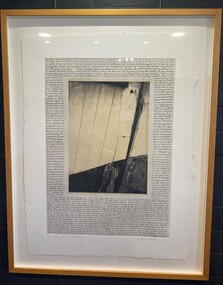
Mixed media - Framed Art Work, Wallace, Carmel et al, Lagoon Page 6 Captain Fawthrop, 2004
© Anna Lanyon , Carmel Wallace 2004. Apart from any fair dealing for the purposes of private study, research, criticism or review permitted under the Copyright Act, no text, image or part thereof may be reproduced, stored in a retrieval system, or transmitted in any form, without prior written permission from the authors.This suite of etchings explores the natural and social history of Fawthrop Lagoon, an ancient intertidal lagoon that lies at the heart of Portland on the far south-west coast of Victoria, Australia. The work records and interprets essential moments in the life of the lagoon, the plants, birds, insects, water-creatures and humans who have lived and continue to live around its shores. White card backing with white torn looking inner frame. Black and white, portrait orientation, inner image of a close up of the side of a timber boat, white panelling meets a black hull, on a back drop of the ocean and sky. Dark strip with a black dot, marks the boats edge. Image is bordered by handwriting.5/30 'Lagoon' P6 Captain Fawthrop Carmel Wallacefawthrop lagoon, portland, victoria, australia, plants, birds, insects, water, creatures, humans -
 Merri-bek City Council
Painting - Liquid nails and spray enamel on canvas, Brian McKinnon, Scars, 2008
Uncle Brian McKinnon (b. 1957 – d. 2023) was a Geelong-based artist and descendent of the Amangu and Wongai people of Western Australia. He created powerful mixed media works that explore his campaign for Aboriginal rights and his childhood experiences growing up in Western Australia. Scars is a deeply personal and political work that reflects on some of the ways in which Aboriginal people have historically been discriminated against and marginalised because of the colour of their skin and cultural practices. Originally exhibited with two other paintings, it was also made in honour of the artist’s children and their struggle to maintain positive self-esteem. Uncle Brian McKinnon said his children inherited keloids from their ancestors: ‘These keloids look like body scars. In this work, I have placed them in the past and the presence of their ancestors through the act of beautifying the marks, which reflect the landscape and the identity of the person wearing the beautification marks. Although the marks on my children are not so beautiful and they are ostracised because of them, this made me think of racist policies and of course the referendum and when my people were seen for the first time as being human.’ -
Bendigo Historical Society Inc.
Document - Newspaper article re Sir John Quick, Michele Matthews Collection, 1992
The Sir John Quick Committee was formed in 1991 to commemorate the achievements of Sir John Quick who played a prominent role in the federation of Australia. The Committee aimed to raise awareness of the contribution of Sir John Quick and to ensure that he was recognized for the part he played.Copy of a newspaper article published in the Bendigo Advertiser Supplement "Bendigo: Birthplace of a Nation". Two page article written by Michele Matthews - "FEDERATION. One community's response". The article explores the role of Sir John Quick in persuading Bendigo to support federation of the Australian States. Published on September 23rd 1992. sir john quick, federation -
Clunes Museum
Book, MICHAEL TAFFE et al, EXPLORING BALLARAT'S GARDEN HERITAGE, 1999
PICTUERS AND TEXT ABOUT THE FOLLOWING: GLENHOLME, HOMELEIGH ,HYMETTUS, LOTEO, MARYS MOUNT, OAKLANDS,ST. MICHAEL'S, ST. PATRICK COLLEGE, BALLARAT BOTANICAL GARDENS AND MOREDARK GREEN COVER WITH A PICTURE OF THE GARDENS IN A GOLDEN FRAME. ON THE BACK A PHOTOGRAPH OF MICHAEL TAFFE - THE AUTHOR - AND HIS STORY 63 PAGES non-fictionPICTUERS AND TEXT ABOUT THE FOLLOWING: GLENHOLME, HOMELEIGH ,HYMETTUS, LOTEO, MARYS MOUNT, OAKLANDS,ST. MICHAEL'S, ST. PATRICK COLLEGE, BALLARAT BOTANICAL GARDENS AND MOREmichael taffe, heritage gardens -
 Hymettus Cottage & Garden Ballarat
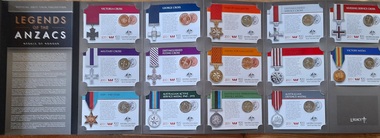
Souvenir - Medals, Legends of the Anzacs
The 2017 Official Coin Collection The Legends of the Anzacs: Medals of Honour – commemorate 14 significant military honours (both Imperial and Australian honours) awarded to Australians throughout the 100 years of Anzac. The folder contains all 14 coins including the 4 unique issue 25 cent coins produced as part of the News Corp program . Each coin design explores a different medal and the stories behind them, inspired by images supplied by the Australian War Memorial, Gary Ramage and the Australian Government Department of Defence. Coins presented in a card, housed in the display folder. Released by the Australian Mint as the official collection of ANZAC medals of honour commemorating the centenary of the Great War, World War 1.anzac, medals, world war i, military, australian mint -
 Narre Warren and District Family History Group
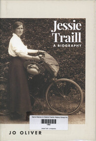
Book, Jo Oliver, Jessie Traill : a biography, 2020
This biography explores the remarkable life of Jessie Traill - artist, traveller, humanitarian and independent spirit. From the ten-year-old who first met Tom Roberts painting on the shores of Port Phillip Bay, to a student of Frederick McCubbin and etchers John Mather and Frank Brangwyn, Jessie developed her professional skills. She interrupted her career to work as a voluntary nurse in France during World War I, later raising funds for and revisiting war-torn Europe. She also became one of Australia's most outstanding etchers, working in a field uncommon for women of her time. Through diary extracts, descriptions of her world travels and personal letters we hear her voice and see through her eyes, beauty, humour and the joys of simple living.xvii, 388 p.; 24 cmnon-fictionThis biography explores the remarkable life of Jessie Traill - artist, traveller, humanitarian and independent spirit. From the ten-year-old who first met Tom Roberts painting on the shores of Port Phillip Bay, to a student of Frederick McCubbin and etchers John Mather and Frank Brangwyn, Jessie developed her professional skills. She interrupted her career to work as a voluntary nurse in France during World War I, later raising funds for and revisiting war-torn Europe. She also became one of Australia's most outstanding etchers, working in a field uncommon for women of her time. Through diary extracts, descriptions of her world travels and personal letters we hear her voice and see through her eyes, beauty, humour and the joys of simple living. jessie traill, frederick mccubbin, tom roberts, artist -
 Alfred Hospital Nurses League - Nursing Archive
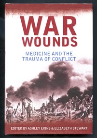
Book - Illustrated book, Elizabeth Stewart 1964- et al, War wounds: medicine and the trauma of conflict, 2011
War has been an accelerator of the advances in medical treatment and surgery. As modern weaponry became more destructive, medicine developed techniques and procedures to deal with the volume and nature of battlefield casualties. This book is a collection of chapters by historians, medical practitioners and researchers, former and serving military medical officers, surgeons, nurses and veterans, who explore the impact of war, wounds and trauma through the historical record, reported narratives and personal experiences.Illustrated book with dust jacket. Book has a light brown cover with abbreviated title authors' and publisher's names embossed in silver on the spine. Dust jacket has background of shades of brown, off-white and grey. On the front is a photograph 'Australian infantrymen evacuate a wounded soldier on a stretcher to the beach during the landing at Balikpapan, Borneo, July 1945, along with the title printed in brown and navy, and the authors names printed in white. On the spine, the abbreviated title is printed in brown, authors names in black, and publishers name in white. On the back cover is a photograph of a soldier with arm in a sling (in an advanced dressing station on the Menin Road near Ypres, Belgium, 20 September 1917) Also on the back cover is a quote from Graham Edwards (Vietnam veteran, veteran's advocate and former MP) and a list of other contributors to the book. non-fictionWar has been an accelerator of the advances in medical treatment and surgery. As modern weaponry became more destructive, medicine developed techniques and procedures to deal with the volume and nature of battlefield casualties. This book is a collection of chapters by historians, medical practitioners and researchers, former and serving military medical officers, surgeons, nurses and veterans, who explore the impact of war, wounds and trauma through the historical record, reported narratives and personal experiences.war-medical aspects, medicine-military-history-australia, soldiers-wounds and injuries-treatment-australia, alfred nurses -
 Narre Warren and District Family History Group
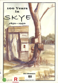
Book, Dot Morrison, 100 years in Skye 1850-1950, 2004
The book 100 Years in Skye, 1850-1950 by Dot Morrison explores the history of Skye in a detailed account of the area's development over a century, including its social, economic, and cultural changes. The book's illustrations, maps, and photographs offer a vivid portrayal of life in Skye during this period. Includes an index and bibliography.99 p.; 29 cmnon-fictionThe book 100 Years in Skye, 1850-1950 by Dot Morrison explores the history of Skye in a detailed account of the area's development over a century, including its social, economic, and cultural changes. The book's illustrations, maps, and photographs offer a vivid portrayal of life in Skye during this period. Includes an index and bibliography.skye (vic.), skye (vic.) -- history, skye (vic.) -- road names, wedge family, skye (vic.) -- murders, south lyndhurst state school -
 Bacchus Marsh & District Historical Society
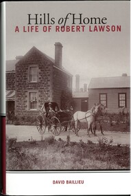
Book, Hills of Home: A Biography of Robert Lawson
Robert Lawson was the first Principal of Scotch College in Melbourne. He was Principal of Scotch College from 1851 until 1856. He later acquired land in the Pentland Hills near Bacchus Marsh and operated a school at Blackwood which he called the Landsberg Mains School. It was also known as the Landsberg Academy. The school opened in 1857 and operated under Lawson's direction until 1868. The school building was an imposing bluestone structure which came to be known as Landsberg House.The school was very successful for a time in the 1860s attracting students from across Victoria. Lawson died in 1869 and the school continued to operate until 1880 under a different Principal. Lawson is considered a pioneer educationalist in Australia. This is a substantial and scholarly biography about Lawson and his wife Isabella Wilson. Several chapters explore the time Lawson spent operating his school at Blackwood.Book, hard cover. First edition. Melbourne, Vic., Melbourne University Publishing, 2009. By David Baillieu. 389 pages. BMDHS Location: AR/SU63/S2 non-fictionRobert Lawson was the first Principal of Scotch College in Melbourne. He was Principal of Scotch College from 1851 until 1856. He later acquired land in the Pentland Hills near Bacchus Marsh and operated a school at Blackwood which he called the Landsberg Mains School. It was also known as the Landsberg Academy. The school opened in 1857 and operated under Lawson's direction until 1868. The school building was an imposing bluestone structure which came to be known as Landsberg House.The school was very successful for a time in the 1860s attracting students from across Victoria. Lawson died in 1869 and the school continued to operate until 1880 under a different Principal. Lawson is considered a pioneer educationalist in Australia. This is a substantial and scholarly biography about Lawson and his wife Isabella Wilson. Several chapters explore the time Lawson spent operating his school at Blackwood. schools bacchus marsh region, schools blackwood victoria, landsberg academy, robert lawson 1826-1869, isabella lawson -
 Narre Warren and District Family History Group
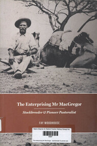
Book, Fay Woodhouse, The enterprising Mr MacGregor : stockbreeder & pioneer pastoralist, 2016
The Enterprising Mr MacGregor: Stockbreeder and Pioneer Pastoralist by Fay Woodhouse is a biography of Duncan MacGregor, a Scottish Highlander who became a prominent figure in Australia's pastoral industry. The book explores his journey from a shepherd to establishing successful breeding programs for cattle, sheep, and horses in the harsh Australian climate. MacGregor's ventures included draining the Kooweerup Swamp in Victoria and pioneering pastoral activities in Queensland's Channel Country. Despite facing challenges like the Federation Drought and financial setbacks, his story is one of resilience and ambition. (AI generated)ix, 189 p.; 24 cmnon-fictionThe Enterprising Mr MacGregor: Stockbreeder and Pioneer Pastoralist by Fay Woodhouse is a biography of Duncan MacGregor, a Scottish Highlander who became a prominent figure in Australia's pastoral industry. The book explores his journey from a shepherd to establishing successful breeding programs for cattle, sheep, and horses in the harsh Australian climate. MacGregor's ventures included draining the Kooweerup Swamp in Victoria and pioneering pastoral activities in Queensland's Channel Country. Despite facing challenges like the Federation Drought and financial setbacks, his story is one of resilience and ambition. (AI generated)duncan macgregor, koo wee rup (vic.), stockbreeding -
 Flagstaff Hill Maritime Museum and Village
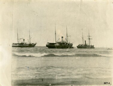
Photograph - Steamers - Julia Percy, Dawn and Coorong, Chuck Photo Ballarat, Circa 1885
This photograph was one of ten photographs donated to Flagstaff Hill Maritime Museum and Village by Fred Trewartha. Frederick John Fox Trewartha (Fred) was a well-known Warrnambool businessman. He was born in Beeac near Geelong in 1920 and came to Warrnambool with his family as a very young child. He was apprenticed to his father John, as a saddler and later opened his own shop on Raglan Parade. He then moved into working with tarpaulins and canvases for the trucking industry. Fred was keenly interested in photography (and was a member of the Warrnambool Cine Club), yachting and boat building. He kept his yacht moored at Port Fairy for many years and participated in sailing events locally and interstate. He also built boats with his sons. He had the opportunity to meet many older sailors and it's thought this photo (and others in the set) may have been given to him by one of these men. Fred Trewartha died in 2016 in Warrnambool. Shipping was the cheapest and most practical means of carrying produce and goods during the period 1840-1890. Regular domestic steamer services commenced in the Warrnambool district in the late 1850’s and by 1870 the passenger trade was booming. Four coastal traders made regular stops at Warrnambool in the 1880's - S. S. Julia Percy, S. S. Dawn, S. S. Nelson and S. S. Casino. The S.S. Julia Percy (later named Leeuwin) was an iron passenger-cargo steam ship built in 1876. At one point in time the Julia Percy would sail from Warrnambool to Melbourne every Friday and return from Melbourne to Warrnambool every Tuesday. The cost of a return ticket for a Saloon Fare was £1.0.0. The Julia Percy was built in Glasgow by Thomas Wingate & Company, Whiteinch, in 1876 for the Warrnambool Steam Packet Company, which commissioned it for trade in Victoria’s western district. It was first registered in Warrnambool, Victoria in 1876. Two steamships, the Julia Percy and the Nelson, collided on 25th December 1881. The Julia Percy was at that time owned by its first owners, the Warrnambool Steam Packet Company, and she sailed under the command of Captain Chapman. It had left Melbourne the evening of 24th December, with about 150 passengers, sailing in fine weather through Port Phillip Heads around 9pm. It was headed for Warrnambool, Belfast (now named Port Fairy) and Portland. The Julia Percy was off Apollo Bay when Captain Chapman was woken by the ship’s whistle after midnight, the steamer Nelson being on a collision course with the Julia Percy. The Nelson struck Julia Percy midship. Boats were lowered from the ship (apart from a damaged lifeboat) and about 30-40 of the passengers boarded the Nelson. The engine room and the forehold were checked and found clear of water. The company manager, Mr. Evans, had been on the Nelson, so he boarded and inspected the Julia Percy and the decision was made to continue on to Warrnambool with the passengers as there appeared to be no immediate danger. However, Captain Thomas Smith said the Nelson was taking on water, so Julia Percy followed it for about an hour towards Melbourne on standby in case of need. Then Julia Percy turned around towards Warrnambool again. Shortly afterwards the Nelson turned to follow her, the ships stopped and passengers were returned to Julia Percy, and three from Julia Percy boarded the Nelson. Both ships proceeded on their way. Julia Percy passed Cape Otway light afterwards, signaling that there had been a collision. It was discovered later that one of the passengers was missing, then thought to have boarded the Nelson but later thought to have fallen into the sea and drowned while trying to jump from Julia Percy to Nelson. There had been 3 tickets purchased under the same name of that passenger “Cutler”; a father, son and friend named Wordsworth, which had caused quite some confusion. No further mishap occurred to either ship and both the Julia Percy and the Nelson reached their destinations safely. An enquiry was instigated by the Victoria Steam Navigation Board regarding the cause of the accident between the two steamships, in connection with the death of Cutler who was supposed to have lost his life by the collision. The enquiry resulted in Captain Thomas Smith having his master's certificate suspended for six months. The Julia Percy changed hands several times. Its next owner was the Western Steam Navigation Co (1887), managed by Mr. T.H. Osborne (the company’s office was on the corner of Timor and Liebig Streets - its north-western wall is now part of the current Warrnambool Regional Art Gallery.) The Melbourne Steamship Co became the next owners (1890), followed by William Howard Smith and Sons (1901) for use in Queensland coastal trades and then it was bought by George Turnbull in 1903 and used for local mail contract in Western Australia. The Julia Percy was sold to the Melbourne Steamship Company Ltd. (1906) and re-named the “Leeuwin” but continued in her Western Australian coastal run. It was converted into a coal hulk in Melbourne in 1910 as a result of damaged caused when it was driven against the jetty at Dongara during a gale. The ship was eventually dismantled and scuttled off Port Phillip Heads on 28 December 1934. The steamship "Dawn" was a 522-ton coastal trader built in 1876 and the vessel operated around the Victorian west coast from 1877 until 1898 for the Portland & Belfast Steam Navigation Co. sailing between Melbourne and Portland, via Warrnambool. The vessel was then owned in October 1885 by the renamed company, Belfast & Koroit Steam Navigation Co., until March 1896 when its ownership moved to W Howard Smith & Sons Ltd. This Melbourne company used the ship to service most ports around Australia. Captain F. Chapman took over from Captain Jones and served on the SS Dawn from 1898 until 1900 when he took command of the SS Casino. On September 4th 1880, the three masted clipper ship, "Eric the Red" struck Otway Reef, near Cape Otway. The S. S. Dawn, under the command of Captain Jones, was returning to Warrnambool from Melbourne, its sailing time different to its usual schedule. The provedore of the Dawn, Benjamin Lear, heard cries of distress coming through the portholes of the saloon. He gave the alarm and the engines were stopped. Cries could be heard clearly, coming from the land. Captain Jones sent out crew in two boats, and fired off rockets and blue lights to illuminate the area. They picked up the three survivors who were in the long boat from "Eric the Red". Two men were picked up out of the water, one being the owner’s son who was clinging to floating kerosene boxes. At daylight the Dawn then rescued the 18 men from the floating portion of the deckhouse, which had drifted about 4 miles from where they’d struck the reef. Shortly after the rescue the deckhouse drifted onto breakers and was thrown onto rocks at Point Franklin, about 2 miles east of Cape Otway. Captain Jones had signalled to Cape Otway lighthouse the number of the Eric the Red and later signalled that there was a wreck at Otway Reef but there was no response from the lighthouse. The captain and crew of the Dawn spent several more hours searching unsuccessfully for more survivors, even going back as far as Apollo Bay. On board the Dawn the exhausted men received care and attention to their needs and wants, including much needed clothing. Four men (three crew and one passenger) died. A week after the shipwreck, the Australian Government had also conveyed its thanks to the Captain and crew of the S.S. Dawn - “Captain Griffith Jones, S.S. Dawn, The Hon. Mr Clark desires that the thanks of the Government should be conveyed to you for the prompt, persevering and seamanlike qualities displayed by you, your officers and crew in saving the number of lives you did on the occasion referred to. The Hon. The Commissioner has also been pleased to award you a souvenir in commemoration of the occasion, and a sum of 65 pounds to be awarded to your officers and crew according to annexed scale. I am, &c, W Collins Rees, for and in the absence of the Chief Harbour Master.” The Awards are as follows: - Crew of DAWN'S lifeboat-Chief Officer, Mr G. Peat, 15 pounds; boat's crew-G. Sterge, A.B., 5 pounds; T. Hammond, A.B., 5 pounds; J. Black, A.B., 5 pounds; H. Edwards, A.B., 5 pounds. Dinghy's Crew-Second Officer, Mr Christie, 10 pounds; boat's crew -F. Lafer, A.B., 5 pounds; W. Johnstone, A.B., 5 pounds; Mr Lear, provedore, 5 pounds; Mr Dove, purser, 5 pounds. Captain Jones receives a piece of plate. (from “Wreck of the ship Eric the Red” by Jack Loney). Medals of Bravery were awarded to the Captain and crew of the S.S. Dawn by the President of the United States, through the Consul-general (Mr Oliver M. Spencer), in July 1881 “ … in recognition of their humane efforts in rescuing the 23 survivors of the American built wooden sailing ship, the Eric the Red, on 4th September 1880.” The men were also presented with substantial monetary rewards and gifts. The city of Warrnambool’s care of the survivors was also mentioned by the President at the presentation, saying that “the city hosted and supported the crew ‘most graciously’. The Medal of Bravery awarded to Nelson Johnson is in the collection at Flagstaff Hill Maritime Museum and Village in Warrnambool. Prior to 1882, and the arrival of the S. S. Casino, the "Dawn" was the only steamer to be able to navigate up the Moyne River at Port Fairy and unload at the wharf. The other regular steamers had to anchor in the bay instead. In February 1891 (as reported in The Age newspaper) the "Dawn" became the first vessel to berth alongside the newly completed Warrnambool Breakwater. The occasion was celebrated with a number of prominent townspeople assembling on board to "participate of a glass of wine". In 1895 the owners of the S.S. Dawn, the Portland and Belfast Steam Navigation Co., wound up and sold out to the Belfast Company who took over the Dawn for one year before selling it to Howard Smith. It took over the Melbourne to Warrnambool run in 1906 when the S. S. Flinders was sold. The S. S. Dawn was condemned and sunk in Suva in 1928. The State Library of Victoria has a lithograph in its collection depicting the steamer Dawn and the shipwrecked men, titled. "Wreck of the ship Eric the Red, Cape Otway: rescue of the crew by the Dawn". The third ship depicted in the photograph was thought to be the S. S. Coorong but there was a question mark next to its name. The photograph was thought to have been taken in 1885 and it's possible the S.S. Coorong was working in Clarence River, N. S. W. by this time. The steamer "Coorong" was built in 1862 by J. G. Lawrie of Glasgow. It was an "iron screw" steamer of 304 tons. It had many owners including Joseph Darwent of Adelaide (1863 - 1871), McMeckan Blackwood and Company, Melbourne (1871 - 1877), Mount Gambier Steamship Company Ltd. (1877 - 1881). William Whineham, Port Adelaide (1882), John See and Company, Sydney (1884 - 1892) and the North Coast Steam Navigation Company Ltd, Sydney (1892 - 1910). In 1911 it was hulked in Sydney Harbour and in 1921 it was being used as a coal hulk at Sydney. It had been originally imported into South Australia for the Port Augusta trade (primarily transporting goods needed by the early settlers) however the owners recognized that it had too much space for that purpose, so it was moved to work on the Adelaide to Melbourne line. Its passenger accommodation was enlarged and it enjoyed a "first class reputation" and by 1874 had made 313 voyages between Melbourne and Adelaide. Its captains included Captain McLean, Captain Ashton and Captain Dowell. In 1867, when 25 miles west of Cape Otway, while travelling from Adelaide to Melbourne, it came across the crew of the schooner "Black Watch" who had abandoned ship after it began quickly taking on water. The crew (six men) were able to get away in a small boat with a compass, chart and few candles. They were "excessively cold from exposure to the weather" when the S. S. Coorong picked them up. In 1877 the Coorong ran aground when entering the Outer Harbour at Adelaide (but was not damaged) and in 1882 it was stranded (for a short time) near Curdies Inlet (Victoria) with some slight damage to its bottom plates. Note - A ship with the same name "Coorong" (a coal carrying barque) was often on the Newcastle / Wollongong to Adelaide route also stopped several times in Warrnambool in the mid 1880's. The photograph has the label "Chuck Photos" printed on the front. Thomas Foster Chuck (born 1826 in London) was a photographer and entrepreneur who arrived in Victoria in 1861. The following year he produced and toured a "Grand Moving Diarama" of dramatic painted scenes from the Burke and Wills expedition. By 1866 he had established a photography studio in Daylesford and later he returned to Melbourne where he opened a studio in the Royal Arcade. In 1874 a collection of Chuck's photographs won a gold medal at the Annual International Exhibition in London. Throughout the 1870's he took over 700 individual photographs of prominent citizens for his historical photographic montage titled "Historical Pictures of the Explorers and Early Colonists of Victoria" which is now in the collection of the National Library of Australia. By 1888 he had sold his Melbourne studio and had established a studio in Ballarat (with his son Thomas Henry Chuck). In 1886 they produced an album titled "Warrnambool and District 1886, Western Hotel - J. Fox proprietor" containing over sixty large photographs of local coastal scenes and seascapes, for the use of patrons of the Western Hotel. This photo (of the three steamers in Lady Bay) was taken at this time and is in the album. Thomas Chuck died on December 7th, 1898, in Albert Park, Melbourne and his son Thomas Henry continued to operate the photography studio in Ballarat into the 1920's.This photograph is a significant record of several of the well-known coastal traders (S. S. Julia Percy, S. S. Dawn and possibly S. S. Coorong) that sailed along the southwest coast of Victoria for many years - transporting goods and passengers between Melbourne and Warrnambool in the 1880's. They are also significant in the role they played in the history of Warrnambool and the other coastal ports they visited as well as being examples of the dangers and hazards associated with navigating the waters along the southern coast of Australia. It is also a good example of a photograph taken by a well-known and significant photographer of that era.Black and white photograph of three steam ships anchored in Lady Bay, Warrnambool. They each have a funnel and two masts and are side on to the beach. A small rowboat with a crew can be seen on the far right. The words "CHUCK-PHOTO" are on the bottom left of the photograph. On the back of the photograph is the name and telephone number of the donor (handwritten in black ball point pen) and the names of the three steamships and date written in uppercase letters in dark blue ink. There is a four-figure number stamped in the centre of the back.Front - "CHUCK-PHOTO" Back - Name of donor and telephone number "6944" "JULIA PERCY, DAWN & KOORONG(?) IN LADY BAY 1885"flagstaff hill maritime museum and village, warrnambool, great ocean road, fred trewartha, s. s. julia percy, s. s. dawn, s. s. nelson, s. s. casino, leeuwin, steamer, steamship, coastal trader, warrnambool steam packet company, captain chapman, victorian steam navigation board, western steam navigation company, melbourne steamship company, william howard smith and sons, portland and belfast steam navigation company, w howard smith and sons ltd, eric the red, captain jones, medal of bravery, rescue, moyne river, warrnambool breakwater, lady bay, s. s. coorong, mount gambier steamship company, black watch, thomas foster chuck, chuck photos, chuck photography -
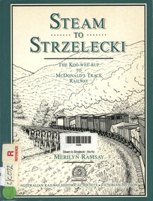 Narre Warren and District Family History Group
Book, Merilyn Ramsay, Steam to Strzelecki - The Kooweerup to McDonalds Track Railway, 1991
This book explores the construction, operation, and eventual closure of the railway line in South Gippsland, Victoria. (AI generated)x, 150 p.; 21 cmnon-fictionThis book explores the construction, operation, and eventual closure of the railway line in South Gippsland, Victoria. (AI generated)koo wee rup (vic.), mcdonalds track railway -
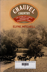 Narre Warren and District Family History Group
Book, Elyne Mitchell, Chauvel country : the story of a great Australian pioneering family, 1983
Chauvel Country is the history of a family whose roots can be traced into France, then England, and who came to Australia as pioneers of the Clarence River in New South Wales. It is the story of the individual members of that family, soldiers and sailors who fought their battles in the far places of the Empire. There are memories of the First World War of the author's hero father, and of the idyllic English countryside. In more recent times we share the author's experiences of riding through the Australian bush, of the lure of distant snow-capped mountains to be explored on skis, in the days before easy access roads, of skiing in North and South America, Europe and New Zealand. We also share the lonely years of the Second World War, when she carried on the family property while her husband was a prisoner of war in Changi prison. Elyne Mitchell is a remarkable woman, and in this book the reader is led on a unique journey through her life from childhood to an aware maturity and wisdom.non-fictionChauvel Country is the history of a family whose roots can be traced into France, then England, and who came to Australia as pioneers of the Clarence River in New South Wales. It is the story of the individual members of that family, soldiers and sailors who fought their battles in the far places of the Empire. There are memories of the First World War of the author's hero father, and of the idyllic English countryside. In more recent times we share the author's experiences of riding through the Australian bush, of the lure of distant snow-capped mountains to be explored on skis, in the days before easy access roads, of skiing in North and South America, Europe and New Zealand. We also share the lonely years of the Second World War, when she carried on the family property while her husband was a prisoner of war in Changi prison. Elyne Mitchell is a remarkable woman, and in this book the reader is led on a unique journey through her life from childhood to an aware maturity and wisdom.elyne mitchell, clarence river (nsw) -
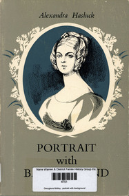 Narre Warren and District Family History Group
Book, Alexandra Hasluck, Georgiana Molloy : portrait with background, 2002
This is a biography written by Alexandra Hasluck. It explores the life of Georgiana Molloy, an Englishwoman who emigrated to Western Australia in 1829 and became a pioneering botanist. Despite the hardships of colonial life, she made significant contributions to the study of Australian flora, collecting and classifying native plants with remarkable precision. The book includes excerpts from Molloy's letters and provides insight into her resilience and passion for botany. (AI generated)non-fictionThis is a biography written by Alexandra Hasluck. It explores the life of Georgiana Molloy, an Englishwoman who emigrated to Western Australia in 1829 and became a pioneering botanist. Despite the hardships of colonial life, she made significant contributions to the study of Australian flora, collecting and classifying native plants with remarkable precision. The book includes excerpts from Molloy's letters and provides insight into her resilience and passion for botany. (AI generated)georgiana molloy 1805-1843, biography, botany, western australia