Showing 632 items
matching rural community
-
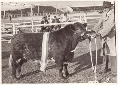 Melbourne Royal
Photograph, Frank Johnson, 1953
A Champion bull (small) 1953This item is a part of a larger collection of 4,500 Frank Johnson photographs and negatives donated to Melbourne Royal by Frank Johnson’s daughter, Francis Beatty Wallace in 2016. This collection spanning from the 1930s to the 1980s holds important social and historical significance in preserving and sharing Victoria’s agricultural history and community. The photographs capture the local, regional, and state’s shared relationships developed through agriculture and the importance of farming and husbandry to the population and development of Australia. A large proportion of these photographs depict events from the Royal Melbourne Show, including livestock competitions, exhibitions and awards ceremonies. Dating back to 1848 when the society first began, the Royal Melbourne Show has held a special place in the hearts and minds of Victorians, allowing for extensive showcasing and celebration of agricultural excellence, bridging the divide between metropolitan and rural Victoria.A black and white photograph, landscape, printed on gloss paper with a white border[on bull's neck number] 138royal melbourne show, bull, cattle, blue ribbon competitions, agricultural shows -
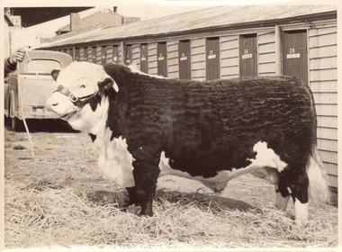 Melbourne Royal
Photograph, Frank Johnson, 1954
Black and white photograph of a hereford bullThis item is a part of a larger collection of 4,500 Frank Johnson photographs and negatives donated to Melbourne Royal by Frank Johnson’s daughter, Francis Beatty Wallace in 2016. This collection spanning from the 1930s to the 1980s holds important social and historical significance in preserving and sharing Victoria’s agricultural history and community. The photographs capture the local, regional, and state’s shared relationships developed through agriculture and the importance of farming and husbandry to the population and development of Australia. A large proportion of these photographs depict events from the Royal Melbourne Show, including livestock competitions, exhibitions and awards ceremonies. Dating back to 1848 when the society first began, the Royal Melbourne Show has held a special place in the hearts and minds of Victorians, allowing for extensive showcasing and celebration of agricultural excellence, bridging the divide between metropolitan and rural Victoria.A black and white photograph, landscape, printed on gloss paper with a white borderroyal melbourne show, hereford, bull, agricultural shows, blue ribbon competitions -
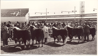 Melbourne Royal
Photograph, Frank Johnson, 1954
Black and white photograph of a poll Hereford bulls lined up for judgingThis item is a part of a larger collection of 4,500 Frank Johnson photographs and negatives donated to Melbourne Royal by Frank Johnson’s daughter, Francis Beatty Wallace in 2016. This collection spanning from the 1930s to the 1980s holds important social and historical significance in preserving and sharing Victoria’s agricultural history and community. The photographs capture the local, regional, and state’s shared relationships developed through agriculture and the importance of farming and husbandry to the population and development of Australia. A large proportion of these photographs depict events from the Royal Melbourne Show, including livestock competitions, exhibitions and awards ceremonies. Dating back to 1848 when the society first began, the Royal Melbourne Show has held a special place in the hearts and minds of Victorians, allowing for extensive showcasing and celebration of agricultural excellence, bridging the divide between metropolitan and rural Victoria.A black and white photograph, landscape, printed on gloss paper with a white border[printed and taped on the reverse] Poll Hereford line up for Ch. Bullroyal melbourne show, hereford, bull, cattle, livestock, blue ribbon competitions, agricultural shows, judging -
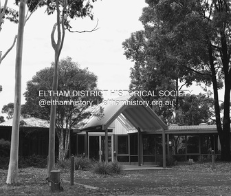 Eltham District Historical Society Inc
Photograph - Digital Photograph, Alan King, Wycliffe Centre, Graham Road, Kangaroo Ground, 2008
Wycliffe translates the Bible for people around the world. Published: Nillumbik Now and Then / Marguerite Marshall 2008; photographs Alan King with Marguerite Marshall.; p171 The peace and beauty of Australia’s Wycliffe Centre reflects what it aims to bring to thousands of people around the world. Kangaroos calmly feed, accompanied by bird song, near the mud-brick buildings set amongst Kangaroo Ground’s rolling hills. On 11 hectares off Graham Road, the centre aims to transform people’s lives by giving groups around the world, with no written language, help with literacy and Bible translation into their own tongue. Associate Director, Harley Beck, says reading the Bible (probably history’s most influential collection of books), in one’s own language, provides a strong moral basis, helping people withstand exploitation and escape poverty. One of Wycliffe’s field partners, SIL (formerly Summer Institute of Linguistics) Papua New Guinea, has won two UNESCO awards, and SIL branches in many other countries have won international and national awards. The translators are modern heroes. They undertake hardships, forsaking for years, sometimes decades, a salary and the soft western lifestyle, to face loneliness and primitive conditions that most of us would not even contemplate. No staff is paid a salary. An example is the first Australian Director and former International President, David Cummings, who for 50 years has depended on donations from supporters and churches. Students of all ages at the EQUIP Training School on the site come from all walks of life. They train in linguistics and learn how to communicate in a way that is sensitive to other cultures. Spiritual resilience is encouraged, enabling people to persist until the job in the field is done, which takes on average ten to 15 years. Courses range from a few weeks to a year. The Wycliffe concept was born in the 1920s when American missionary, Cameron Townsend, found a Spanish Bible was inadequate to evangelise the Cakchiquel people of Guatemala. When a Cakchiquel man challenged: ‘If your God is so great, why doesn’t he speak my language?’ Townsend decided to translate the Bible into all languages! He founded a linguistics training school in 1934, naming it after 14th century theologian John Wycliffe, the first to translate the Bible into English. The first Wycliffe Bible was completed in 1951 in the Mexican San Miguel Mixtec language. In May 2007 after 30 years of work, Wycliffe Australia, with other organisations, completed the first Bible for indigenous people in the Kriol* language, for about 30,000 people in northern Australia. Wycliffe Australia began in 1954 in the Keswick Bookshop basement, Collins Street, Melbourne. As the organisation grew, its quarters became so cramped that Director Cummings at times interviewed potential recruits in his car! The development of the Kangaroo Ground property is a story of faith and generosity. In 1967 Cummings proposed moving to a larger property despite having no funds. Within a month Wycliffe received a $20,000 donation and a gift of land towards a national centre. An earlier owner of the Kangaroo Ground property, Mrs Elsie Graham, would have been delighted, as she had wanted her land to be used for ‘God’s service’. Mud-brick architect and Christian, Alistair Knox, offered to design the centre at no charge. Despite a drought, straw was donated to make bricks. Many volunteers helped with the building, including church youth groups who made mud-bricks. Volunteers planted thousands of native plants, watered by recycled water from the site’s dam. Building began in 1968 and in 1983 the South Pacific SIL School (now EQUIP Training) followed. Wycliffe, the world’s largest linguistic organisation, and other organisations, have translated the Scriptures into more than 2000 languages. But another 2000 languages still lack any portion of the Bible. However translations are now completed more quickly, because of new computer programs and as education spreads, more speakers of the local language can assist. Despite the growth of secularisation, Beck says support for Wycliffe Australia, which has offices in all states and the ACT, is stronger than ever. * Kriol is a Pidgin language, which has become a speech community’s prime language.This collection of almost 130 photos about places and people within the Shire of Nillumbik, an urban and rural municipality in Melbourne's north, contributes to an understanding of the history of the Shire. Published in 2008 immediately prior to the Black Saturday bushfires of February 7, 2009, it documents sites that were impacted, and in some cases destroyed by the fires. It includes photographs taken especially for the publication, creating a unique time capsule representing the Shire in the early 21st century. It remains the most recent comprehenesive publication devoted to the Shire's history connecting local residents to the past. nillumbik now and then (marshall-king) collection, graham road, kangaroo ground, wycliffe centre -
 Eltham District Historical Society Inc
Photograph - Digital Photograph, Alan King, Diamond Creek, Barak Bushlands, Eltham, 2008
A habitat corridor and it strengthens the community. Published: Nillumbik Now and Then / Marguerite Marshall 2008; photographs Alan King with Marguerite Marshall.; p185 Barak Bushlands lie west of the Diamond Creek on the corner of Falkiner Street and busy, noisy Main Road. They form part of an important habitat corridor linking the Yarra River to the Kinglake National Park.1 Manna Gums, tawny frogmouths and platypuses are some of the indigenous plants and animals that have made their home there. The bushlands are the result of more than nine years of hard work by the local community with the Nillumbik Council, to transform a degraded flood plain into this refuge of natural beauty. In 1997, shortly after moving into the new Riverside Estate on Falkiner Street, Eltham, several residents noticed the sorry state of the Diamond Creek and surrounding area. Part of it was used as a cow paddock and although small patches of vegetation survived, the area was infested with weeds, rabbits, rubbish and drainage from the housing estate. At various times the 4.4 hectares had been used as a market garden and for shire stock piles. The residents began to restore the area by revegetating land along the Diamond Creek. In 1998 they established the Friends of the Diamond Creek Falkiner Street Reserve2 and 35 families joined from the 90-house Estate. Carolyn Mellor, as the Friends’ Land Manager, undertook a four-year horticulture course to guide this massive project for a volunteer organisation. Since 1999, she has been the Friends’ President. In 1999 the Friends urged the Nillumbik Council to undertake a feasibility study into establishing a wetland system and urban forest. Work began in 2002 with Nillumbik Council funding the project, supplemented by government grants. The Friends also received grants from Melbourne Water and Parks Victoria. Aided by the Friends and other community members, the Council created the Barak Bushlands consisting of a forest, a wetland, a bridge, a path and open space. The beautiful wetland treats most of the estate’s stormwater runoff. Storm water is filtered through plants in the wetland ponds then is released slowly into the billabong, before flowing into the Diamond Creek. The wetland also helps to minimise flooding and the improved water quality provides a flora and fauna habitat. The Friends and other volunteers planted more than 27,000 plants, more than one third of which they grew from seeds they collected at Lower Eltham and Wingrove Parks. Eltham High School students planted thousands of these through a Year Eight program introduced for this purpose. Other groups who assisted were: Green Corps, local Scouts and Guides – 2nd Montmorency, 1st Diamond Creek and 1st Eltham Cub Packs, Eltham College students, Eltham East Primary School, Landcare members, Eltham Lions Club and the Eltham Baptist Church. To maintain enthusiasm for the mammoth task, the Friends and other volunteers ‘adopted’ trees to water and wrote their names on the stakes. In 2004, to recognise the area’s original occupiers, the reserve was named Barak Bushlands. William Barak, who lived from 1824 to 1903, was the last chief of the Yarra Yarra tribe of the Wurundjeri-willam people. Traces of these original inhabitants remain in scar trees (bark sections removed to make a shield or canoe). That same year the Friends’ group was a finalist in the prestigious Federal Government, Banksia Environmental Awards. The Friends have also participated in Clean Up Australia, removing tonnes of rubbish and regularly testing the billabong, wetland and creek, for pollutants. For years the Friends, together with the Australian Platypus Conservancy, have tagged, measured and checked the health of platypuses from the Diamond and Mullum Mullum Creeks. With Latrobe University the Friends have conducted night walks to view owls, possums, bats and sugar gliders. Challenges for the council and the Friends continue with a large rabbit population, some vandalism, weed eradication and maintenance. However, thanks to this community effort, locals can now escape confined urban living on small blocks of land and enjoy the beauty of indigenous plants and animals. Working together has also strengthened the local community,This collection of almost 130 photos about places and people within the Shire of Nillumbik, an urban and rural municipality in Melbourne's north, contributes to an understanding of the history of the Shire. Published in 2008 immediately prior to the Black Saturday bushfires of February 7, 2009, it documents sites that were impacted, and in some cases destroyed by the fires. It includes photographs taken especially for the publication, creating a unique time capsule representing the Shire in the early 21st century. It remains the most recent comprehenesive publication devoted to the Shire's history connecting local residents to the past. nillumbik now and then (marshall-king) collection, barak bushlands, diamond creek (creek), eltham -
 Greensborough Historical Society
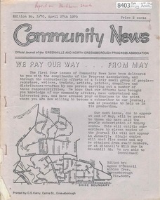
Newsletter, Greenhills and North Greensborough Progress Association, Community News: official journal of the Greenhills and North Greensborough Progress Association. April 27th 1970. Edition No. 3/70, 27/04/1970
This edition includes a report on the Progress Association's April 1970 meeting, Councillors' report, Memories of an old resident, William Trevithick, Report on Blackburn Group of Semi-Rural Streets, School and kinder news, Scout and Guide news, Personal news. A digital copy of this Newsletter is available from Greensborough Historical Society.Newsletter, 16 p., illus. greenhills and north greensborough progress association, greenhills -
 8th/13th Victorian Mounted Rifles Regimental Collection
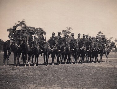
Photograph - Tocumwal Troop 20LH mounted with swords drawn
No 1 Troop C Squadron 20th Light Horse Regiment drawn from the farming community of Tocumwal, personified the strength of citizen soldiering in rural Victorian and Southern NSW in the period following World War One and especially in the years immediately prior to the second World War. Building on the strength and enthusiasm of the Tocumwal Troop other Troops were raised at Finley, Berigan and Jerilderie. The Tocumwal Troop won the coveted Hutton Trophy in 1937 and 1938, defeating crack Troops from other States. The 20th Light Horse (Victorian Mounted Rifles) was raised in 1920 as part of the 3rd Cavalry Brigade, 2nd Cavalry Division, Citizen Military Forces, with Headquarters at Seymour and depots along the Goulburn Valley from Mansfield to Tocumwal in southern NSW. In December 1941, 20th Light Horse (Victorian Mounted Rifles) converted from horse to mechanised, initially as 20th Motor Regiment. In 1943 the Regiment was deployed to Merauke, Dutch New Guinea. Upon its return in April 1945, the Regiment was redesignated 20th Pioneer Battalion. It was disbanded following the end of the war. 20th Light Horse was the only light horse regiment to serve overseas in WWII.This is one of a collection of photographs featuring a Light Horse regiment drawn from rural and regional Victoria in the period immediately prior to mobilisation for World War 2 (1939-1945).Black and white photograph of single rank of 15 light horsemen with drawn sabres." Tocumwal Troop. No. 1 Troop ' C ' Squadron,20th Light Horse Regiment. Lieutenant H.G. Fyffe and Warrant Officer V.G. Groutsch on the right flank. 1937 or 1938 "tocumwal, 20lh, fyffe, warrant officer v.g. groutsch mm, uniform, horse, nulla -
 8th/13th Victorian Mounted Rifles Regimental Collection
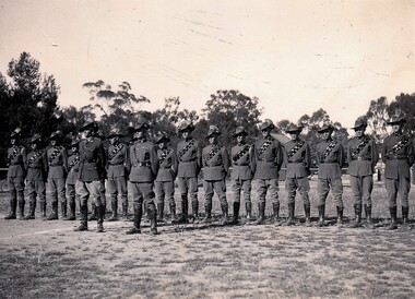
Photograph - Tocumwal Troop 20 Light Horse c.1938
No 1 Troop C Squadron 20th Light Horse Regiment drawn from the farming community of Tocumwal, personified the strength of citizen soldiering in rural Victorian and Southern NSW in the period following World War One and especially in the years immediately prior to the second World War. Building on the strength and enthusiasm of the Tocumwal Troop other Troops were raised at Finley, Berigan and Jerilderie. The Tocumwal Troop won the coveted Hutton Trophy in 1937 and 1938, defeating crack Troops from other States. The 20th Light Horse (Victorian Mounted Rifles) was raised in 1920 as part of the 3rd Cavalry Brigade, 2nd Cavalry Division, Citizen Military Forces, with Headquarters at Seymour and depots along the Goulburn Valley from Mansfield to Tocumwal in southern NSW. In December 1941, 20th Light Horse (Victorian Mounted Rifles) converted from horse to mechanised, initially as 20th Motor Regiment. In 1943 the Regiment was deployed to Merauke, Dutch New Guinea. Upon its return in April 1945, the Regiment was redesignated 20th Pioneer Battalion. It was disbanded following the end of the war. 20th Light Horse was the only light horse regiment to serve overseas in WWII.This is one of a collection of photographs featuring a Light Horse regiment drawn from rural and regional Victoria in the period immediately prior to mobilisation for World War 2 (1939-1945).Black and white photograph of 16 soldiers in line with two Officers standing in front. All are wearing Light Horse uniform. Part of a collection of 20th Light Horse photographs circa 1938."Tocumwal Troop ; Left : Lt. B. Fyffe. Right: WOII V. Groutsh Military Medallight horse, tocumwal, uniform, fyffe, v.g. groutsch, hutton trophy -
 8th/13th Victorian Mounted Rifles Regimental Collection
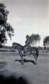
Photograph - Sergeant JP Smith 20LH Tocumwal Troop
Sergeant JP Smith was a member of No 1 Troop C Squadron 20th Light Horse Regiment drawn from the farming community of Tocumwal, personifying the strength of citizen soldiering in rural Victorian and Southern NSW in the period following World War One and especially in the years immediately prior to the second World War. Building on the strength and enthusiasm of the Tocumwal Troop other Troops were raised at Finley, Berigan and Jerilderie. The Tocumwal Troop won the coveted Hutton Trophy in 1937 and 1938, defeating crack Troops from other States. The 20th Light Horse (Victorian Mounted Rifles) was raised in 1920 as part of the 3rd Cavalry Brigade, 2nd Cavalry Division, Citizen Military Forces, with Headquarters at Seymour and depots along the Goulburn Valley from Mansfield to Tocumwal in southern NSW. In December 1941, 20th Light Horse (Victorian Mounted Rifles) converted from horse to mechanised, initially as 20th Motor Regiment. In 1943 the Regiment was deployed to Merauke, Dutch New Guinea. Upon its return in April 1945, the Regiment was redesignated 20th Pioneer Battalion. It was disbanded following the end of the war. 20th Light Horse was the only light horse regiment to serve overseas in WWII.This is one of a collection of photographs featuring a Light Horse regiment drawn from rural and regional Victoria in the period immediately prior to mobilisation for World War 2 (1939-1945).Black and white photograph of Light Horse soldier on horseback. Part of a collection of 20th Light Horse photographs circa 1939.Sgt. J.P. Smith Tocumwal Troop 20th LHRtocumwal, 20th, light horse, smith -
 Bacchus Marsh & District Historical Society
Photograph, Border Inn, Main Street Bacchus Marsh 1883
The Border Inn located on the corner of Main Street and Graham Street Bacchus Marsh opened in 1851 making it a very early hotel in Victoria. It was built and owned by John Pilmer. The first licensee was James Watt. The building has been added to and changed many times. It was originally a single storey building. A second storey was added in 1863 by John Pilmer. In 1866 the hotel was purchased by Edward Jones. The Jones family owned and operated the hotel until 1939. Additional second storey sections were added in 1883, 1904 and 1936. For a number of years the Border Inn was a stopping post for coaching services between Melbourne and Ballarat. The first licensee of the hotel James Watt was among the first in Victoria to offer a regular coaching service and his hotel was used for overnight accommodation by coach travellers. At the time this picture was taken coach services were still operating between Bacchus Marsh and other locations. The coach in this picture is possibly one of those coaches.This building has been documented as of state significance by Richard Peterson and Daniel Catrice in their 1995 heritage study for the then Shire of Bacchus Marsh. Their assessment of the heritage significance of the building was: "The Border Inn is of state historical significance as a pioneering pre-gold rush building, on the route to the Ballarat goldfields. It is the representative-embodiment of several historical periods and their way of life. It demonstrates a complex changing sequence of patterns of occupancy and architectural styles. Its development at this location, demonstrates the effect of a social movement, the gold rush, as a transport stopover.It is also historically significant for its association with the first rural public transport in Victoria. Locally, the hotel is significance for its association with the first meeting of municipal government, and also for its social significance as a traditional community, visitor focus and meeting place".Small sepia unframed photograph on card with gold border framing photograph. Housed in the album, 'Photographs of Bacchus Marsh and District in 1883 by Stevenson and McNicoll'. The image shows the Border Inn Hotel at an angle depicting the front of the building facing directly to the camera. It is a two storey brick building, with one-story additions at either end. Five chimneys can be seen extending from the building. The bottom storey has a verandah extending onto the footpath. A covered wagon, probably a coach, with four horses in harness is in front of the building. There are several people in the image. Two people are sitting on the driver’s seat of the wagon. Another man is standing holding the reins of the horses. At his feet is a dog. Behind them are two male adults. One is holding a small child. A young boy stands beside him.On the front: Stevenson & McNicoll. Photo. 108 Elizabeth St. Melbourne. COPIES CAN BE OBTAINED AT ANY TIME. On the back: LIGHT & TRUTH inscribed on a banner surmounted by a representation of the rising sun. Copies of this Portrait can be had at any time by sending the Name and Post Office Money Order or Stamps for the amount of order to STEVENSON & McNICOLL LATE BENSON & STEVENSON, Photographers. 108 Elizabeth Street, MELBOURNE. stevenson and mcnicoll 1883 photographs of bacchus marsh and district, hotels bacchus marsh, border inn hotel bacchus marsh, carriages and coaches, stagecoaches, james watt bacchus marsh, john pilmer bacchus marsh, edward jones family bacchus marsh -
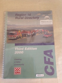 Stawell Historical Society Inc
Book, Country Fire Authority, Region 16 Rural Directory, Third Edition 2000 - Country Fire Authority - Previously Cat No 3635A, 2000
A Book of Maps in region 16 for use by the fire brigade in case of bushfires.Clear Plastic cover, with wire binding over green cover with colour photo of four fire tucks and another fire vehicle with people standing in front of the trucks. Region 16 Rural Directory Third Edition 2000 Creating a safer community CFAstawell map -
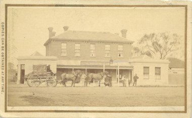
 Wodonga & District Historical Society Inc
Photograph - Wodonga Civic Buildings Over Time
Wodonga Shire was created in 1876 when the colonial government agreed to ratepayers' petitions to have their part of the local government district severed from the Yackandandah Shire to form a new municipality. After meeting for 14 years in rented remises, in the Prince of Wales Hall, Wodonga Council built its first Shire Hall on the corner of High and Elgin Streets in 1890. The date on the façade of the building, 1876, represents the date of the formation of the Shire. In 1957 the second Shire Office was built in Woodland Grove by A.B. and M. A. Chick. These offices were considered more than adequate for future needs. The façade featured floor to ceiling windows and several different meeting rooms in addition to the council chamber, which featured an impressive “horse shoe” table. It also included a kitchen equipped with modern fittings and a President’s room. In the late 1960s the area between Hovell and Havelock Streets as far as Jack Hore Place was zoned for civic purposes. In 1969 plans for a civic centre providing a library, theatre and senior citizens’ rooms. It was opened on 22 April 1971. In 1973, the Council engaged Bruce Marshall to design new offices beside the Civic Centre. Jennings Industries were contracted to complete the offices. The Governor, Sir Henry Winneke, laid the foundation stone of the new offices on 10 March 1976. The Civic Centre was demolished in 2011 to make may for a new $10 million community and entertainment centre which opened in August 2012.These photos are significant because they depict the different buildings which have housed the centre of local government in Wodonga since its inception as an independent shire in 1876.A series of photographs depicting the different buildings used to house the Wodonga Council and Civic buildings over time.wodonga civic buildings, wodonga council, shire of wodonga, rural city of wodonga -
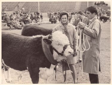 Melbourne Royal
Photograph, Frank Johnson, 1969
This photograph shows the Champion Poll Hereford Bull at the 1969 Royal Melbourne Show. The animal is exhibit 536, Springfield Hiawatha, exhibited by S, K & C Hawkins. The people in the photograph are Thea Manson and Terry Ryan, who was stud-groom at Springfield Poll Herefords in Finley NSW.This item is a part of a larger collection of 4,500 Frank Johnson photographs and negatives donated to Melbourne Royal by Frank Johnson’s daughter, Francis Beatty Wallace in 2016. This collection spanning from the 1930s to the 1980s holds important social and historical significance in preserving and sharing Victoria’s agricultural history and community. The photographs capture the local, regional, and state’s shared relationships developed through agriculture and the importance of farming and husbandry to the population and development of Australia. A large proportion of these photographs depict events from the Royal Melbourne Show, including livestock competitions, exhibitions and awards ceremonies. Dating back to 1848 when the society first began, the Royal Melbourne Show has held a special place in the hearts and minds of Victorians, allowing for extensive showcasing and celebration of agricultural excellence, bridging the divide between metropolitan and rural Victoria.A black and white, landscape photograph printed on card.royal melbourne show, manson, thea manson, ryan, terry ryan, springfield poll hereford, poll hereford, hereford, cattle, beef cattle, bull, livestock, blue ribbon competition, beef cattle competition, agricultural show, champion, grand champion, grand champion bull, winners, 1969 royal melbourne show -
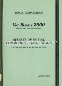 Eltham District Historical Society Inc
Book, Roads Corporation, Vic Roads 2000: results of intial community consultation, outer Melbourne rural fringe, August 1989
... Vic Roads 2000: results of intial community consultation... community consultation, outer Melbourne rural fringe Book Roads ...This report presents a summary of the issues and needs communicated by community and road user groups, local government, industry and government department representatives, at two of a series of VICROADS Regional Workshops convened by the Roads Corporation, as the Vic Roads 2000 Victoria's Rural Arterial Strategy is developed. Includes three parts: Outer Metropolitan Regional Workshop Report, Outer Dandenong Regional Workshop Report and background paper - Outer Melbourne rural fringe regional economy and road travel demand.100p.non-fictionThis report presents a summary of the issues and needs communicated by community and road user groups, local government, industry and government department representatives, at two of a series of VICROADS Regional Workshops convened by the Roads Corporation, as the Vic Roads 2000 Victoria's Rural Arterial Strategy is developed. Includes three parts: Outer Metropolitan Regional Workshop Report, Outer Dandenong Regional Workshop Report and background paper - Outer Melbourne rural fringe regional economy and road travel demand.roads, vicroads -
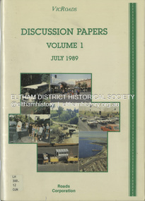 Eltham District Historical Society Inc
Book, VicRoads, Discussion Papers Volume 1, July 1989
VICROADS Discussion papers address key issues that have been identified by the community, through regional workshops, as having particular significance in determining the direction that should be taken in managing the rural arterial road system in Victoria to the year 2000. Volume One consists of the following discussion papers: road safety, rural development, conservation and the environment, future rural transport task and traffic in towns.non-fictionVICROADS Discussion papers address key issues that have been identified by the community, through regional workshops, as having particular significance in determining the direction that should be taken in managing the rural arterial road system in Victoria to the year 2000. Volume One consists of the following discussion papers: road safety, rural development, conservation and the environment, future rural transport task and traffic in towns.roads, vicroads, rural areas, road safety, rural development, conservation, traffic -
 Flagstaff Hill Maritime Museum and Village
Book - Textbook, Introduction to Modern Geography
This mid-19th century scientific reference book, Introduction to Modern Geography, explains geography and astronomy using the globe of the world as a teaching aid. The inscription connects this book to the Bobinawarrah Public Library but research to date has found no further details about the library. The rural area was settled in 1859, but in 2016 its population was only 87. It is situated about 21 kilometres south of the City of Wangaratta, in Northeast Victoria. In 2024 the local community received a grant for preservation of its almost 100-year-old Bobinawarrah Memorial Hall which displays an honour board of the Pioneers of Bobinawarrah 1859-1959. The donor of the book lived in Warrnambool. ABOUT THE AUTHOR, James Thomson (1786-1849): - James Thomson was a British Irish mathematician. He became Professor of Mathematics at the University of Glasgow. He wrote many school textbooks and reference books, one of which was Introduction to Modern Geography, first published in Belfast in 1827, and revised and published in over 20 more editions. Thomson tutored two of his several children at home. His older son James Thomson (1822-1892) became an engineer and physicist. His younger son William Thomson (1824-1907) became Professor of Natural Philosophy from 1846-1899 at the University of Glasgow, and later the 1st Baron of Kelvin, famous for his designs of nautical instruments such as the navigational compass and sounding equipment used in the transatlantic installation of sea cable. William was part of the firm that became famous as Kelvin & Hughes Ltd., suppliers of radar and echo sounders to the Ministry of Transport and the Ministry of Defence. The name continued on as Kelvin & Hughes. James Thomson (1786-1849) was a renowned British Irish mathematician and Professor of Mathematics at the University of Glasgow. He was a respected author of many important school books and textbooks that were widely used to provide understanding of arithmetic and geography. Thomson encouraged practical education and held extra classes for young ladies to learn mathematics and geography, which were a novelty at that time. Many of his works were known and used worldwide. This work was published in many editions. It is now considered as culturally significant as a basis for knowledge about our civilisation and has been made publicly available in overseas countries, and republished and reproduced in a readable format, including its diagrams and maps. Book; scientific textbook. The book has a black leather cover. The front cover is blank, but the spine has an embossed gold vertical title within a rectangular border boasting fancy corners. The fly page has a detailed title. The author is James Thomson. It is the Eighteenth edition, published in Simms & McIntyre of London and Belfast in 1845. An inscription connects it to the Bobinawarrah Public Library in Victoria.Spine within a gold border: "THOMSON'S GEOGRAPHY" Fly Page: "AN INTRODUCTION TO MODERN GEOGRAPHY, WITH AN APPENDIX, CONTAINING AN OUTLINE OF ASTRONOMY, AND THE USE OF THE GLOBES. BY JAMES THOMSON, LL.D., PROFESSOR OF MATHEMATICS IN THE UNIVERSITY OF GLASGOW." "Eighteenth Edition" "LONDON: SIMMS AND McINTYRE, ALDINE CHAMBERS, PATERSOSTER ROW; AND DONEGALL -STREET, BELFAST.""1845"flagstaff hill, flagstaff hill maritime museum and village, warrnambool, maritime museum, maritime village, great ocean road, shipwreck coast, introduction to geography, james thomson, reference book, professor thomson's introduction to modern geography, bobinawarrah public library, james thomson mathematician, james thomson engineer, 19th century irish mathematician, irish presbyterian, william thomson 1st baron of kelvin, professor of mathematics, glasgow university, william thomson professor of natural philosophy, introduction to modern geography, outline of astronomy, use of the globes, james thomson ll.d., simms and mcintyre, 1843, scientific book, school book, lord kelvin, baron kelvin of langs, nautical instruments, marine instruments, transatlantic cable, kelvin & hughes, thomson’s geography, astronomy, geography, world globe, cartography, pioneers of bobinawarrah, textbook -
 Musculoskeletal Health Australia (now held by the Glen Eira Historical Society)
Photograph - Group photo, 19/10/1999
... dandenong accessible communities diversity action plan rural access ...On the 19th of October, 1999, the Accessible Cities and Shires Forum was held in Bendigo. In this photo, Chris Stewart, City of Greater Dandenong Diversity Officer, and Shirley Caulfield, CEO of the Arthritis Foundation of Victoria, promote the Diversity Action Plan.COL photo of two people standing close to one another. They are each holding some publications, one of which is titled 'Diversity Action Plan'. [on label, in blue ink] Chris Stewart, City of Greater Dandenong Diversity Officer, and Shirley Caulfield, CEO of Arthritis Victoria at the Bendigo Accessible Communnities Forumshirley caulfield, ceo, arthritis foundation of victoria, afv, chris stewart, diversity officer, city of greater dandenong, accessible communities, diversity action plan, rural access project, accessible cities & shires project, forum, bendigo, 1999 -
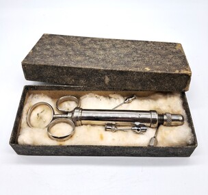 Glenelg Shire Council Cultural Collection
Functional object - Veterinary Syringe, 1900s
This syringe would have been used by a vet to administer drugs and medicines to animals.The Glenelg Shire has a strong farming industry and community. Vets were and still are invaluable to the community. This was donated by a worker at Portland Veterinary ClinicGrey mottled cardboard box containing a silver coloured syringe. There are also four needles. The syringe and needles are on cotton wool. The syringe has three circular rings at the top. Two are attached to the main body of the syringe and the third is attached to the plunger. The plunger has numerical measurements on it. The end of the syringe can be screwed off in order to place in the needle required.Plunger: 0 2 4 6 8 10 rural, agriculture, farming, portland, glenelg shire -
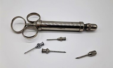 Glenelg Shire Council Cultural Collection
Functional object - Veterinary Syringe, 1900s
This syringe would have been used by a vet to administer drugs and medicines to animals.The Glenelg Shire has a strong farming industry and community. Vets were and still are invaluable to the community. This was donated by a worker at Portland Veterinary ClinicStainless steel syringe. The syringe has three circular rings at the top. Two are attached to the main body of the syringe and the third is attached to the plunger. The plunger has numerical measurements on it. The end of the syringe can be screwed off in order to place in the needle required.Plunger: 0 2 4 6 8 10 rural, agriculture, farming, portland, glenelg shire -
 Bendigo Historical Society Inc.
Document - Michele Matthews collection - paperwork and reports for re-zoning of Maiden Gully (1993 - 1996). Residents opposed the re-zoning as they had purchased land as "bush blocks", 25/02/2025
documents for Maiden Gully Sewerage SchemeMichele Matthews collection - paperwork and reports for re-zoning of Maiden Gully (1993 - 1996). Residents opposed the re-zoning as they had purchased land as "bush blocks" Coliban water Annual report 1993/94 21/12/1994 Maiden Gully Development Committee - newsletter No 1 - cttee met with representatives of Coliban Water Caliban Water information Bulletin January 1995 - Maiden Gully Sewerage Scheme 22/02/1995 Maiden Gully Development Committee - newsletter No 2 - cttee activities re the planned sewerage scheme 27/03/1995 - Coliban Water letter to WR & MS Matthews, owners 3 Clay Gully Court (Lot 56 LP 212245) undated - Maiden Gully Neighborhood Sewerage Schemes - Robin Hill Estate Scheme (cost allocation to property owners 21/04/1995 five-page letter of objection/complaint from WR & MS Matthews, owners 3 Clay Gully Court, re costs allocated against their property (Lot 56 LP 212245) 16/06/1995 five-page response from Coliban Water to WR & MS Matthews, owners 3 Clay Gully Court; regarding the outcome of their objection to the sewerage scheme 22/08/1995 letter from WR & MS Matthews, to resident re the results of their objections (and consequent concessions) from Coliban Water re the Robin Hill Estate Sept 1995 Maiden Gully Structure Plan, prepared by TEA planners & Planning Australia Consultants; provides a structure plan, for the Rural City of Marong, the propose future development of the Maiden Gully area Greater Bendigo Planning Scheme - Amendment L43 - Maiden Gully Township: * undated and author unstated - Maiden Gully questions sheet for residents re the proposed Maiden Gully Structure Plan - seven questions and answers * Fauna species - observed /recorded site 6; Maiden Gully (off Pioneer drive) * Explanatory report, three pages * 1/11/1995 Notice of Amendment to a Planning Scheme * Greater Bendigo Planning Scheme, Chapter 6, Amendment L43 (five pages) December 1995 Coliban Water "In the Pipe line", Maiden Gully Region Community Newsletter No 2 - Halfway mark for Sewerage Scheme March 1996 Coliban Water "In the Pipe line", Maiden Gully Region Community Newsletter No 3 - Home stretch for new sewer scheme May 1996 Coliban Water "In the Pipe line", Maiden Gully Region Community Newsletter No 4 - New sewerage scheme comes in well under budget Undated - Maiden Gully Township - Amendment L43 - Panel Hearing report (31 pages) maiden gully, sewerage scheme -
 Glenelg Shire Council Cultural Collection
Functional object - Veterinary Syringe - needle, 1900s
This syringe would have been used by a vet to administer drugs and medicines to animals.The Glenelg Shire has a strong farming industry and community. Vets were and still are invaluable to the community. This was donated by a worker at Portland Veterinary ClinicMetal needle for use with a syringeSTAINLESS rural, agriculture, farming, portland, glenelg shire -
 Warrnambool and District Historical Society Inc.
Booklet, Country Women’s Association, Warrnambool Branch, History of Warrnambool Branch CWA, 2016
The Country Women’s Association of Australia advances the rights and equity of women, families and communities in Australia through advocacy and empowerment, especially for those living in regional, rural and remote Australia. The Country Women’s Association of Victoria was founded in 1928 and the Warrnambool Branch was founded in 1931. The branch has given assistance through the years to the Red Cross, Baby Health Centres, the Warrnambool Hospital, bush fire relief, mental health and aged care and it has regular displays of country arts and crafts. In 1961 the C.W.A. Centre and Rest Rooms were opened in Kepler Street, Warrnambool. In 2016 the group celebrated the 85th anniversary of its founding.This booklet is of interest to researchers and others wanting a brief outline of the history of the Warrnambool Branch of the Country Women’s Association. This is a small booklet of 12 pages. The front cover is white with black printing and it has a yellow back cover. The booklet has black plastic spiral binding. The pages contain printed information, photocopies of newspaper articles, a knitting pattern and other photocopied material. The booklet has been produced in-house by the Warrnambool Country Women’s Association.‘Looking Back at 85 Years, the History of the Warrnambool Branch of the Country Women’s Association of Victoria Inc. 1931 until 2016 and Still Going Strong.’country women’s association, history of warrnambool -
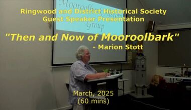 Ringwood and District Historical Society
Mixed media - Video, RDHS Meeting Presentation - "Then and Now of Mooroolbark" - Marion Stott OAM
Digitised video (3.68GB). Duration: 62 minutes. Recorded March, 2025 (Video is available for viewing at Ringwood & District Historical Society Archives by appointment)The Parish of Mooroolbark was surveyed in 1855, with a township originally called Brushy Creek standing where North Croydon is today. The name "Mooroolbark" was to be popularised with eventual European settlement in the late 19thy century. A rural hub developed around the train station, which opened in 1887 and offered rail access to Melbourne, with the Post Office opened shortly after in 1888. In this video presentation, Marion Stott, OAM, President and Founding Member of the Mooroolbark History Group, provides "Then and Now" details of all this and more. As well as activities in promoting local history, Marion is actively involved in local RSL, Traders group, and community events including Mooroolbark Red Earth Festival. For services to the community of Mooroolbark, Marion was awarded an OAM in 2020. -
 Narre Warren and District Family History Group
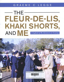
Book, Graeme C Legge, The Fleur-De-Lis, Khaki Shorts and Me: A Logbook of My Adventures in Scouting, 2022
'This Log Book is much more than its title suggests. This is the story of Scouting and of community service in and around Emerald, Victoria and ref lects the impact of Scouting in a semi-rural part of Victoria and Graeme’s role in moulding a part of it. It commences through the eyes of a youth, Graeme Legge, who joined the re-established Emerald Scout Group as a 12 year old in 1948 and recounts his leadership and support to youth and community of his town, its Scout District and Cardinia Shire over more than seven decades. Graeme shares his early Scouting travel experiences in the 1950s to Fraser Island in Queensland, to the Pieman River in western Tasmania, to Jamborees at Wonga Park, Victoria in 1948, Greystanes, Sydney in 1952 and Clifford Park, Victoria, 1956 as something we the readers can contrast with how Scouting does such adventures today.He outlines four months of overseas travel to the UK in 1951 as part of the “Sun” newspaper Youth Travel scheme where he met some fellow Scouts who, like him, were chosen to represent their local Shire and he visited places and experiences which clearly had an impact on his future Scouting journey. He captures the mood and the energy of his years of Scouting Leadership, as when he met Lady Baden-Powell in Emerald, illustrated through his photos, clippings and graphics which are drawn from his personal collection and research of local newspapers in the Victorian Scout Magazine, all befitting the method of a teaching and educational professional."--Foreword.159 p.non-fiction'This Log Book is much more than its title suggests. This is the story of Scouting and of community service in and around Emerald, Victoria and ref lects the impact of Scouting in a semi-rural part of Victoria and Graeme’s role in moulding a part of it. It commences through the eyes of a youth, Graeme Legge, who joined the re-established Emerald Scout Group as a 12 year old in 1948 and recounts his leadership and support to youth and community of his town, its Scout District and Cardinia Shire over more than seven decades. Graeme shares his early Scouting travel experiences in the 1950s to Fraser Island in Queensland, to the Pieman River in western Tasmania, to Jamborees at Wonga Park, Victoria in 1948, Greystanes, Sydney in 1952 and Clifford Park, Victoria, 1956 as something we the readers can contrast with how Scouting does such adventures today.He outlines four months of overseas travel to the UK in 1951 as part of the “Sun” newspaper Youth Travel scheme where he met some fellow Scouts who, like him, were chosen to represent their local Shire and he visited places and experiences which clearly had an impact on his future Scouting journey. He captures the mood and the energy of his years of Scouting Leadership, as when he met Lady Baden-Powell in Emerald, illustrated through his photos, clippings and graphics which are drawn from his personal collection and research of local newspapers in the Victorian Scout Magazine, all befitting the method of a teaching and educational professional."--Foreword. scouting, emerald (vic.), graeme legge -
 Narre Warren and District Family History Group
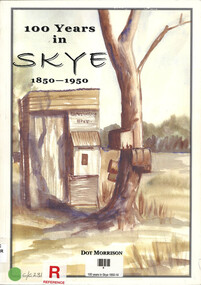
Book, Dot Morrison, 100 years in Skye 1850-1950, 2004
The book 100 Years in Skye, 1850-1950 by Dot Morrison explores the history of Skye in a detailed account of the area's development over a century, including its social, economic, and cultural changes. The book's illustrations, maps, and photographs offer a vivid portrayal of life in Skye during this period. Includes an index and bibliography.99 p.; 29 cmnon-fictionThe book 100 Years in Skye, 1850-1950 by Dot Morrison explores the history of Skye in a detailed account of the area's development over a century, including its social, economic, and cultural changes. The book's illustrations, maps, and photographs offer a vivid portrayal of life in Skye during this period. Includes an index and bibliography.skye (vic.), skye (vic.) -- history, skye (vic.) -- road names, wedge family, skye (vic.) -- murders, south lyndhurst state school -
 Wodonga & District Historical Society Inc
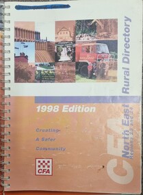
Book - North East Rural Directory 1998
The CFA North East Rural Directory for Regions 23 and 24 was designed to assist fire brigades and other emergency services in responding to calls in the North East region of Victoria. Its purpose was to minimize response times to emergency situations by providing accurate and detailed information about all of the localities in the regions. District 23 is based at Wangaratta and Extends as far south as Woods Point. District 24 is centred in Wodonga and extends past Corryong to the New South Wales border following the Murray River. It also includes Falls Creek and Mount Hotham.A spiral bound volume including colour topographic maps and illustrations of North East Victoria. The cover features a collage of colour photo of North East Victoria including a CFA firefighter in a truck with members of his family beside it. The book also features a key map, explanation of map references and symbols, localities index. Alphabetical road indexes for Wodonga, Albury, Wangaratta and Benalla as well as township maps and alphabetical road indexes for smaller communities are included.The CFA North East Rural Directory for Regions 23 and 24 was designed to assist fire brigades and other emergency services in responding to calls in the North East region of Victoria. Its purpose was to minimize response times to emergency situations by providing accurate and detailed information about all of the localities in the regions. District 23 is based at Wangaratta and Extends as far south as Woods Point. District 24 is centred in Wodonga and extends past Corryong to the New South Wales border following the Murray River. It also includes Falls Creek and Mount Hotham.emergency management north east victoria, cfa region 24, cfa wodonga, cfa region 23 -
 Wangaratta RSL Sub Branch
Document - Framed Document, Freedom of the City of Wangaratta, 27/10/1990
The 2/24th Australian Infantry Battalion Association was uniquely granted the Freedom of the City by the Rural City of Wangaratta in 1990 - to our knowledge the only/first Battalion Association in Australia to be granted this honour. Council acknowledges its appreciation of the contribution made by this Unit to community peace and national democracy and congratulates “Wangaratta’s Own” 2/24 Australian Infantry Battalion Association on its Fiftieth Anniversary since formation.The 2/24th Australian Infantry Battalion Association was uniquely granted the Freedom of the City by the Rural City of Wangaratta in 1990 - to our knowledge the only/first Battalion Association in Australia to be granted this honour. Council acknowledges its appreciation of the contribution made by this Unit to community peace and national democracy and congratulates “Wangaratta’s Own” 2/24 Australian Infantry Battalion Association on its Fiftieth Anniversary since formation.Brown timber and gold gilt edged frame containing document with three signatures and red seal. A plaque is attached to glass on lower edge below document.Plaque reads - On 18 November 1994 the City of Wangaratta the Shires of Wangaratta, Oxley and part of the Shires of Benalla, Yarrawonga and Beechworth were amalgamated to create what is now the Rural City of Wangaratta. On 9 November 1996 the Commissioners and Citizens Proudly conferred "Freedom of Entry to the Rural City of Wangaratta" on the 2/24th Infantry Battalion Association.freedom of the city of wangaratta, 2/24th australian infantry battalion association -
 Narre Warren and District Family History Group
Book - Narre Warren North Red Cross Minute Books 1939 to 1964, Narre Warren North Red Cross, 1939-1964
... of life in a small rural community. The early minutes reflect ...Narre Warren North had a population of 200 in 1933. Just a month after World War 2 began in September 1939, a meeting was held in the Narre Warren Scout Hall to discuss the formation of a branch of the Red Cross Society. Mrs Harry Randle was elected president, Mrs Montague, vice president; Mrs Brundrett, secretary and Mrs Ewart, treasurer. All financial members were deemed to constitute the committee. By 1953, just 14 years after their formation they had raised over two thousand pounds, of which one thousand, eight hundred and eighty-two pounds had been sent to headquarters.The minutes bring together the ladies of all walks of life in a small rural community. The early minutes reflect the difficulties of the war years when many of the women may have had husbands, sons and daughters in the services. Despite rationing and shortages of materials these ladies always seemed to have most of what they needed to make goods to sell at stalls, provide suppers at concerts and social afternoons and hold an annual fair. In their spare time they knitted socks and helmets and sewed pyjamas that were sent to those serving overseas. The minutes highlight the work of our local women and give us an insight into the often unrecorded contributions women made within their communities in a time when local histories were dominated by male achievements.Six exercise books bound with hard cover binding. Navy blue debossed cover.narre warren north (vic.), narre warren north (vic.) -- red cross, red cross society