Showing 1123 items
matching building materials
-
 Greensborough Historical Society
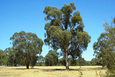
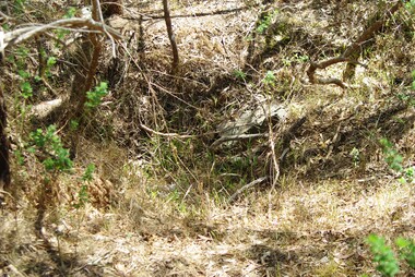
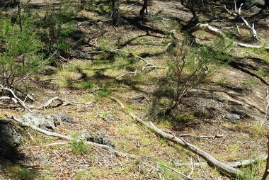
Photograph - Digital image, Marilyn Smith et al, Janefield Precinct: Looking down toward Kookaburra Bend 2, 27/11/2014
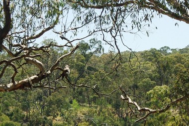
... was constructed from salvaged materials. Instruction included building... 1944 to 1946. The Camp was constructed from salvaged materials ...Looking down toward Kookaburra Bend 2. The remains of this site are between Greensborough and Janefield. A RAAF Hygiene Training Camp was located on the Plenty River, just south of the Janefield community. It was in use from 1944 to 1946. The Camp was constructed from salvaged materials. Instruction included building and maintenance of grease traps, latrines, elementary plumbing and carpentry.Early remains of a WW2 training camp Digital colour photograph. -
 Greensborough Historical Society
Photograph - Digital image, Marilyn Smith et al, Janefield Precinct: Looking towards the future - new residential development, 27/11/2014
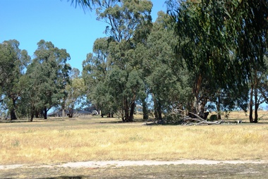
... materials. Instruction included building and maintenance of grease... materials. Instruction included building and maintenance of grease ...Janefield Precinct: Looking towards the future - new residential development. The remains of this site are between Greensborough and Janefield. A RAAF Hygiene Training Camp was located on the Plenty River, just south of the Janefield community. It was in use from 1944 to 1946. The Camp was constructed from salvaged materials. Instruction included building and maintenance of grease traps, latrines, elementary plumbing and carpentry.Early remains of a WW2 training camp Digital colour photograph.janefield -
 Greensborough Historical Society
Photograph - Digital image, Marilyn Smith et al, Janefield Precinct: Looking towards the past, 27/11/2014
... was constructed from salvaged materials. Instruction included building... 1944 to 1946. The Camp was constructed from salvaged materials ...Janefield Precinct: Looking towards the past. The remains of this site are between Greensborough and Janefield. A RAAF Hygiene Training Camp was located on the Plenty River, just south of the Janefield community. It was in use from 1944 to 1946. The Camp was constructed from salvaged materials. Instruction included building and maintenance of grease traps, latrines, elementary plumbing and carpentry.Early remains of a WW2 training camp Digital colour photograph.raaf hygiene training camp janefield, janefield -
 Greensborough Historical Society
Photograph - Digital image, Marilyn Smith et al, Janefield Precinct: more pondering - Janefield view, 27/11/2014
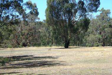
... materials. Instruction included building and maintenance of grease... to 1946. The Camp was constructed from salvaged materials ...More pondering - Janefield view. The remains of this site are between Greensborough and Janefield. A RAAF Hygiene Training Camp was located on the Plenty River, just south of the Janefield community. It was in use from 1944 to 1946. The Camp was constructed from salvaged materials. Instruction included building and maintenance of grease traps, latrines, elementary plumbing and carpentry.Early remains of a WW2 training camp Digital colour photograph. -
 Greensborough Historical Society
Photograph - Digital image, Marilyn Smith et al, Janefield Precinct: Looking toward grave area from camp, 27/11/2014
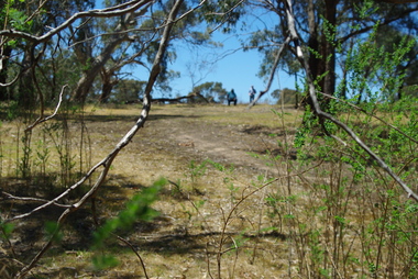
... to 1946. The Camp was constructed from salvaged materials... materials. Instruction included building and maintenance of grease ...Janefield Precinct: Looking toward grave area from camp. The remains of this site are between Greensborough and Janefield. A RAAF Hygiene Training Camp was located on the Plenty River, just south of the Janefield community. It was in use from 1944 to 1946. The Camp was constructed from salvaged materials. Instruction included building and maintenance of grease traps, latrines, elementary plumbing and carpentry.Early remains of a WW2 training camp Digital colour photograph. -
 Greensborough Historical Society
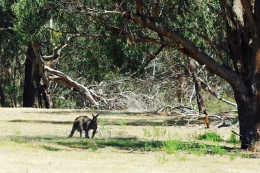
Photograph - Digital image, Marilyn Smith et al, Janefield Precinct: Lone kangaroo, 27/11/2014
... materials. Instruction included building and maintenance of grease... to 1946. The Camp was constructed from salvaged materials ...Janefield Precinct: Lone kangaroo. The remains of this site are between Greensborough and Janefield. A RAAF Hygiene Training Camp was located on the Plenty River, just south of the Janefield community. It was in use from 1944 to 1946. The Camp was constructed from salvaged materials. Instruction included building and maintenance of grease traps, latrines, elementary plumbing and carpentry.Early remains of a WW2 training camp Digital colour photograph.raaf hygiene training camp janefield -
 Greensborough Historical Society
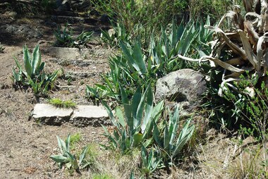
Photograph - Digital image, Marilyn Smith et al, Janefield Precinct: Aloe plant on lower terrace, 27/11/2014
... to 1946. The Camp was constructed from salvaged materials... materials. Instruction included building and maintenance of grease ...Janefield Precinct: Aloe plant on lower terrace. The remains of this site are between Greensborough and Janefield. A RAAF Hygiene Training Camp was located on the Plenty River, just south of the Janefield community. It was in use from 1944 to 1946. The Camp was constructed from salvaged materials. Instruction included building and maintenance of grease traps, latrines, elementary plumbing and carpentry.Early remains of a WW2 training camp Digital colour photograph. -
 Greensborough Historical Society
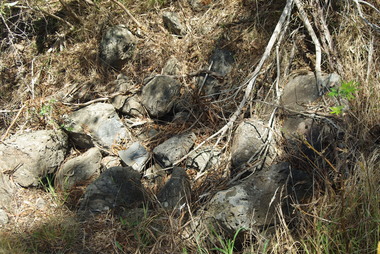
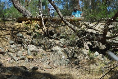
Photograph - Digital image, Marilyn Smith et al, Janefield Precinct: Basalt Quarry Remnants, 27/11/2014
... was constructed from salvaged materials. Instruction included building... 1944 to 1946. The Camp was constructed from salvaged materials ...Janefield Precinct: Basalt quarry remnants. The remains of this site are between Greensborough and Janefield. A RAAF Hygiene Training Camp was located on the Plenty River, just south of the Janefield community. It was in use from 1944 to 1946. The Camp was constructed from salvaged materials. Instruction included building and maintenance of grease traps, latrines, elementary plumbing and carpentry.Early remains of a WW2 training camp Digital colour photograph. -
 Greensborough Historical Society
Photograph - Digital image, Marilyn Smith et al, Janefield Precinct: Basalt remains, 27/11/2014
... was constructed from salvaged materials. Instruction included building... to 1946. The Camp was constructed from salvaged materials ...Janefield Precinct: Basalt remains. The remains of this site are between Greensborough and Janefield. A RAAF Hygiene Training Camp was located on the Plenty River, just south of the Janefield community. It was in use from 1944 to 1946. The Camp was constructed from salvaged materials. Instruction included building and maintenance of grease traps, latrines, elementary plumbing and carpentry.Early remains of a WW2 training camp Digital colour photograph. -
 Greensborough Historical Society
Photograph - Digital image, Marilyn Smith et al, Janefield Precinct: Basalt Rubble, 27/11/2014
... materials. Instruction included building and maintenance of grease... to 1946. The Camp was constructed from salvaged materials ...Janefield Precinct: Basalt rubble. The remains of this site are between Greensborough and Janefield. A RAAF Hygiene Training Camp was located on the Plenty River, just south of the Janefield community. It was in use from 1944 to 1946. The Camp was constructed from salvaged materials. Instruction included building and maintenance of grease traps, latrines, elementary plumbing and carpentry.Early remains of a WW2 training camp Digital colour photograph. -
 Greensborough Historical Society
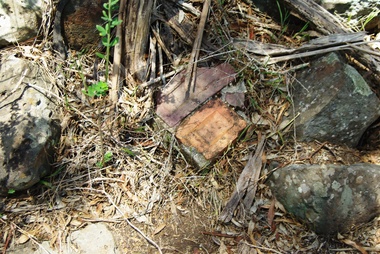
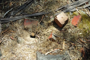
Photograph - Digital image, Marilyn Smith et al, Janefield Precinct: Bricks circa 1940, 27/11/2014
... was constructed from salvaged materials. Instruction included building... 1944 to 1946. The Camp was constructed from salvaged materials ...Janefield Precinct: Bricks circa 1940s. The remains of this site are between Greensborough and Janefield. A RAAF Hygiene Training Camp was located on the Plenty River, just south of the Janefield community. It was in use from 1944 to 1946. The Camp was constructed from salvaged materials. Instruction included building and maintenance of grease traps, latrines, elementary plumbing and carpentry.Early remains of a WW2 training camp Digital colour photograph. -
 Greensborough Historical Society
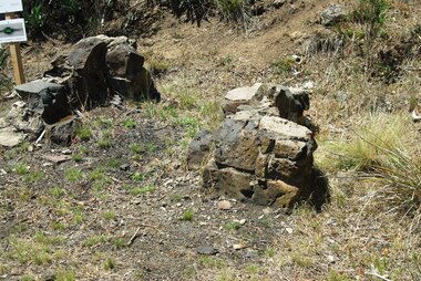
Photograph - Digital image, Marilyn Smith et al, Janefield Precinct: Cut Bluestone blocks from old building, 27/11/2014
... Janefield Precinct: Cut Bluestone blocks from old building... materials. Instruction included building and maintenance of grease ...Janefield Precinct: Cut Bluestone blocks from old building. The remains of this site are between Greensborough and Janefield. A RAAF Hygiene Training Camp was located on the Plenty River, just south of the Janefield community. It was in use from 1944 to 1946. The Camp was constructed from salvaged materials. Instruction included building and maintenance of grease traps, latrines, elementary plumbing and carpentry.Early remains of a WW2 training camp Digital colour photograph. -
 Greensborough Historical Society
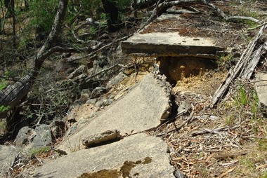
Photograph - Digital image, Marilyn Smith et al, Janefield Precinct: Decaying slabs near edge of cliff, 27/11/2014
... to 1946. The Camp was constructed from salvaged materials... materials. Instruction included building and maintenance of grease ...Janefield Precinct: Decaying slabs near edge of cliff. The remains of this site are between Greensborough and Janefield. A RAAF Hygiene Training Camp was located on the Plenty River, just south of the Janefield community. It was in use from 1944 to 1946. The Camp was constructed from salvaged materials. Instruction included building and maintenance of grease traps, latrines, elementary plumbing and carpentry.Early remains of a WW2 training camp Digital colour photograph. -
 Greensborough Historical Society
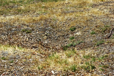
Photograph - Digital image, Marilyn Smith et al, Janefield Precinct: Dug in building site, 27/11/2014
... was constructed from salvaged materials. Instruction included building... Plenty Lower Plenty melbourne Janefield Precinct: Dug in building ...Janefield Precinct: Dug in building site. The remains of this site are between Greensborough and Janefield. A RAAF Hygiene Training Camp was located on the Plenty River, just south of the Janefield community. It was in use from 1944 to 1946. The Camp was constructed from salvaged materials. Instruction included building and maintenance of grease traps, latrines, elementary plumbing and carpentry.Early remains of a WW2 training camp Digital colour photograph. -
 Greensborough Historical Society
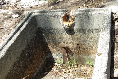
Photograph - Digital image, Marilyn Smith et al, Janefield Precinct: Grease traps, 27/11/2014
... materials. Instruction included building and maintenance of grease... to 1946. The Camp was constructed from salvaged materials ...Janefield Precinct: Grease traps. The remains of this site are between Greensborough and Janefield. A RAAF Hygiene Training Camp was located on the Plenty River, just south of the Janefield community. It was in use from 1944 to 1946. The Camp was constructed from salvaged materials. Instruction included building and maintenance of grease traps, latrines, elementary plumbing and carpentry.Early remains of a WW2 training camp Five digital colour photographs. -
 Greensborough Historical Society
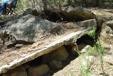
Photograph - Digital image, Marilyn Smith et al, Janefield Precinct: Ruined slabs, 27/11/2014
... materials. Instruction included building and maintenance of grease... to 1946. The Camp was constructed from salvaged materials ...Janefield Precinct: Ruined slabs. The remains of this site are between Greensborough and Janefield. A RAAF Hygiene Training Camp was located on the Plenty River, just south of the Janefield community. It was in use from 1944 to 1946. The Camp was constructed from salvaged materials. Instruction included building and maintenance of grease traps, latrines, elementary plumbing and carpentry.Early remains of a WW2 training camp Digital colour photograph. -
 Greensborough Historical Society
Photograph - Digital image, Marilyn Smith et al, Janefield Precinct: Near mess block, 27/11/2014
... was constructed from salvaged materials. Instruction included building... to 1946. The Camp was constructed from salvaged materials ...Janefield Precinct: Near mess block. The remains of this site are between Greensborough and Janefield. A RAAF Hygiene Training Camp was located on the Plenty River, just south of the Janefield community. It was in use from 1944 to 1946. The Camp was constructed from salvaged materials. Instruction included building and maintenance of grease traps, latrines, elementary plumbing and carpentry.Early remains of a WW2 training camp Digital colour photograph. -
 Greensborough Historical Society
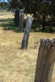
Photograph - Digital image, Marilyn Smith et al, Janefield Precinct: Old fence line, and, retained earth on fence line, 27/11/2014
... 1944 to 1946. The Camp was constructed from salvaged materials... materials. Instruction included building and maintenance of grease ...Janefield Precinct: Old fence line, and retained earth on fence line. The remains of this site are between Greensborough and Janefield. A RAAF Hygiene Training Camp was located on the Plenty River, just south of the Janefield community. It was in use from 1944 to 1946. The Camp was constructed from salvaged materials. Instruction included building and maintenance of grease traps, latrines, elementary plumbing and carpentry.Early remains of a WW2 training camp 2 Digital colour photographs. -
 Greensborough Historical Society
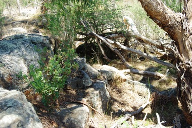
Photograph - Digital image, Marilyn Smith et al, Janefield Precinct: Old fire place on lower terrace, 27/11/2014
... to 1946. The Camp was constructed from salvaged materials... materials. Instruction included building and maintenance of grease ...Janefield Precinct: Old fire place on lower terrace. The remains of this site are between Greensborough and Janefield. A RAAF Hygiene Training Camp was located on the Plenty River, just south of the Janefield community. It was in use from 1944 to 1946. The Camp was constructed from salvaged materials. Instruction included building and maintenance of grease traps, latrines, elementary plumbing and carpentry.Early remains of a WW2 training camp 2 Digital colour photographs. -
 Greensborough Historical Society
Photograph - Digital image, Marilyn Smith et al, Janefield Precinct: Old shed base, outline, spoon drain and post holes, 27/11/2014
... 1944 to 1946. The Camp was constructed from salvaged materials... materials. Instruction included building and maintenance of grease ...Janefield Precinct: Old shed base, outline, spoon drain and post holes. The remains of this site are between Greensborough and Janefield. A RAAF Hygiene Training Camp was located on the Plenty River, just south of the Janefield community. It was in use from 1944 to 1946. The Camp was constructed from salvaged materials. Instruction included building and maintenance of grease traps, latrines, elementary plumbing and carpentry.Early remains of a WW2 training camp 4 Digital colour photographs. -
 Greensborough Historical Society
Photograph - Digital image, Marilyn Smith et al, Janefield Precinct: Outside building next to admin block, 27/11/2014
... Janefield Precinct: Outside building next to admin block... materials. Instruction included building and maintenance of grease ...Janefield Precinct: Outside building next to admin block. The remains of this site are between Greensborough and Janefield. A RAAF Hygiene Training Camp was located on the Plenty River, just south of the Janefield community. It was in use from 1944 to 1946. The Camp was constructed from salvaged materials. Instruction included building and maintenance of grease traps, latrines, elementary plumbing and carpentry.Early remains of a WW2 training camp Digital colour photograph. -
 Greensborough Historical Society
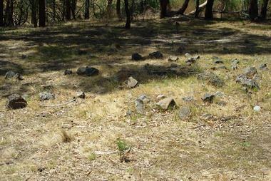
Photograph - Digital image, Marilyn Smith et al, Janefield Precinct: possible grave sites, 27/11/2014
... was constructed from salvaged materials. Instruction included building... 1944 to 1946. The Camp was constructed from salvaged materials ...Janefield Precinct: possible grave sites. The remains of this site are between Greensborough and Janefield. A RAAF Hygiene Training Camp was located on the Plenty River, just south of the Janefield community. It was in use from 1944 to 1946. The Camp was constructed from salvaged materials. Instruction included building and maintenance of grease traps, latrines, elementary plumbing and carpentry.Early remains of a WW2 training camp 3 Digital colour photographs. -
 Greensborough Historical Society
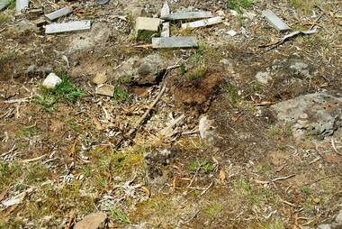
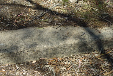
Photograph - Digital image, Marilyn Smith et al, Janefield Precinct: Preserved concrete edging, 27/11/2014
... was constructed from salvaged materials. Instruction included building... 1944 to 1946. The Camp was constructed from salvaged materials ...Janefield Precinct: Preserved concrete edging. The remains of this site are between Greensborough and Janefield. A RAAF Hygiene Training Camp was located on the Plenty River, just south of the Janefield community. It was in use from 1944 to 1946. The Camp was constructed from salvaged materials. Instruction included building and maintenance of grease traps, latrines, elementary plumbing and carpentry.Early remains of a WW2 training camp Digital colour photograph.raaf hygiene training camp janefield -
 Greensborough Historical Society
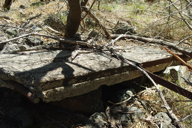
Photograph - Digital image, Marilyn Smith et al, Janefield Precinct: Side view showing reinforcements, 27/11/2014
... to 1946. The Camp was constructed from salvaged materials... materials. Instruction included building and maintenance of grease ...Janefield Precinct: Side view showing reinforcements. The remains of this site are between Greensborough and Janefield. A RAAF Hygiene Training Camp was located on the Plenty River, just south of the Janefield community. It was in use from 1944 to 1946. The Camp was constructed from salvaged materials. Instruction included building and maintenance of grease traps, latrines, elementary plumbing and carpentry.Early remains of a WW2 training camp Digital colour photograph. -
 Greensborough Historical Society
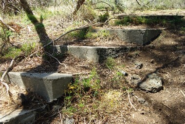
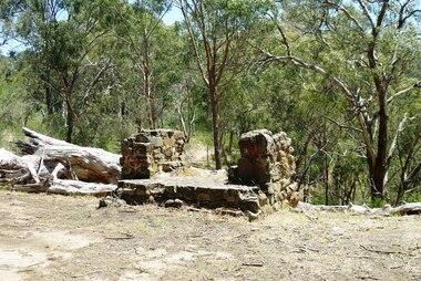
Photograph - Digital image, Marilyn Smith et al, Janefield Precinct: Steps to officers' quarters, 27/11/2014
... to 1946. The Camp was constructed from salvaged materials... materials. Instruction included building and maintenance of grease ...Janefield Precinct: Steps to officers' quarters. The remains of this site are between Greensborough and Janefield. A RAAF Hygiene Training Camp was located on the Plenty River, just south of the Janefield community. It was in use from 1944 to 1946. The Camp was constructed from salvaged materials. Instruction included building and maintenance of grease traps, latrines, elementary plumbing and carpentry.Early remains of a WW2 training camp Digital colour photograph.janefield -
 Greensborough Historical Society
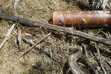
Photograph - Digital image, Marilyn Smith et al, Janefield Precinct: Terra cotta pipes, 27/11/2014
... was constructed from salvaged materials. Instruction included building... 1944 to 1946. The Camp was constructed from salvaged materials ...Janefield Precinct: Terra cotta pipes. The remains of this site are between Greensborough and Janefield. A RAAF Hygiene Training Camp was located on the Plenty River, just south of the Janefield community. It was in use from 1944 to 1946. The Camp was constructed from salvaged materials. Instruction included building and maintenance of grease traps, latrines, elementary plumbing and carpentry.Early remains of a WW2 training camp Digital colour photograph.janefield -
 Greensborough Historical Society
Photograph - Digital image, Marilyn Smith et al, Janefield Precinct: Chimney remains, 27/11/2014
... was constructed from salvaged materials. Instruction included building... to 1946. The Camp was constructed from salvaged materials ...Janefield Precinct: Chimney remains. The remains of this site are between Greensborough and Janefield. A RAAF Hygiene Training Camp was located on the Plenty River, just south of the Janefield community. It was in use from 1944 to 1946. The Camp was constructed from salvaged materials. Instruction included building and maintenance of grease traps, latrines, elementary plumbing and carpentry.Early remains of a WW2 training camp Digital colour photograph.janefield -
 Greensborough Historical Society
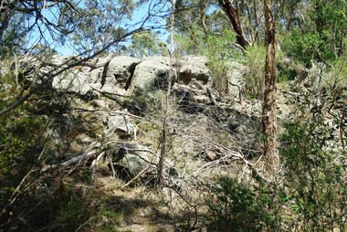
Photograph - Digital image, Marilyn Smith et al, Janefield Precinct: View of edge of basalt flow, 27/11/2014
... to 1946. The Camp was constructed from salvaged materials... 1944 to 1946. The Camp was constructed from salvaged materials ...Janefield Precinct: View of edge of basalt flow. The remains of this site are between Greensborough and Janefield. A RAAF Hygiene Training Camp was located on the Plenty River, just south of the Janefield community. It was in use from 1944 to 1946. The Camp was constructed from salvaged materials. Instruction included building and maintenance of grease traps, latrines, elementary plumbing and carpentry.Early remains of a WW2 training camp Digital colour photograph.janefield -
 Greensborough Historical Society
Photograph - Digital image, Marilyn Smith et al, Janefield Precinct: View of river bend, 27/11/2014
... was constructed from salvaged materials. Instruction included building... 1944 to 1946. The Camp was constructed from salvaged materials ...Janefield Precinct: View of river bend. The remains of this site are between Greensborough and Janefield. A RAAF Hygiene Training Camp was located on the Plenty River, just south of the Janefield community. It was in use from 1944 to 1946. The Camp was constructed from salvaged materials. Instruction included building and maintenance of grease traps, latrines, elementary plumbing and carpentry.Early remains of a WW2 training camp Digital colour photograph.janefield -
 Greensborough Historical Society
Photograph - Digital image, Marilyn Smith et al, Janefield Precinct: View of slab from below showing formwork marks, 27/11/2014
... 1944 to 1946. The Camp was constructed from salvaged materials... materials. Instruction included building and maintenance of grease ...Janefield Precinct: View of slab from below showing formwork marks. The remains of this site are between Greensborough and Janefield. A RAAF Hygiene Training Camp was located on the Plenty River, just south of the Janefield community. It was in use from 1944 to 1946. The Camp was constructed from salvaged materials. Instruction included building and maintenance of grease traps, latrines, elementary plumbing and carpentry.Early remains of a WW2 training camp Digital colour photograph.janefield