Showing 1105 items
matching historic house
-
 Tatura Irrigation & Wartime Camps Museum
Photographic Glass Plates, : AUSTRAL DRY PLATE, T. Baker & Co., Austral Laboratory, Williams Family, 1900
Williams store was a department store near the corner of Hogan and Thomson Streets with a house attached. These glass plates were found in 1973 by Mr Jack Smith who owned the building then.33 glass negatives discovered in the ceiling of a Tatura historic home. Some family photos (F. Williams of Williams Store); some hymns with music and some coastal scenes.early photography, glass negatives, williams family -
 City of Ballarat
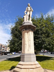
Sculpture - Public Artwork, George Grant, Thomas Moore Memorial Statue George Grant, 1889
Irish poet and balladeer Thomas Moore, best-known for penning The Minstrel Boy and The Last Rose of Summer, is honored in this statue prominently located in Sturt Street created by sculptor George Grant from white Carrara marble. George Grant was trained at the School of Art associated with the National Gallery of Victoria, apparently in the 1880s, and then worked as an artist, specialist house painter, and banner artist. Several of his paintings are held by the Ballarat Art Gallery. Moore`s writings range from lyric to satire, from prose romance to history and biography. His popular "Irish Melodies" appeared in ten parts between 1807 and 1835. Moore was a good musician and skillful writer of songs, which he set to Irish tunes, mainly of the 18th century. This statue is of historic and aesthetic significance to the people of Ballarat.Marble statue of Thomas Moore above a large sandstone pillar West: Presented to the City Council of Ballaarat by the following citizens: H.F. Elliot, The Honorable E. Morey M.L.C., Cr C.R. Retallick, Cr J. Heinz. South: R.S. Mitchell, P. Papenhagen, T. Elliot, J. Snow, G.K. Coutts, C. Bailey, J.J. Goller & Co, W.E. Ballhausen, G. Thompson, W.H. Figgis. North: S. Seward, F.G. Haymes, Craig Williamson, R. Giddings, G. Berry, R. Inge, J.A. Pittard, L. Lederman, H. Bremer, D. Jones. thomas moore -
 City of Ballarat
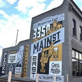
Artwork, other - Public Artwork, Travis Price, Main Road Mural by Travis Price, May 2018
Whilst my main focus for the artwork design was on the Hotels on Main Road, I felt there was an opportunity to tell a broader story of Main Rd and combine/include some interesting pieces of information from many stages of the history of Main Road. Considering that at one point in time there would have been at more than six hotels in this very short section of street….there’s no doubt Main Rd was an epicentre of communication and festivities for the Goldfields of Ballarat. “No matter what luck he had, every miner needed supplies, food and something to entertain him when he was not searching for gold.” Described as being an overcrowded jumble of muddy streets loosely arranged around mining camps...and loud, muddy, colourful and sometimes illicit. I wanted the artwork composition to consist of overlapping images and text to reflect this sense of hustle and bustle. Main Road Mural tells the broader story of the history of Main Road in Ballarat. In 2018, the City of Ballarat commissioned local Ballarat artist Travis Price to create an artwork to align with the Main Road Revitalisation Project and deliver a key component of the storytelling (heritage interpretation) project that spans the length of the shopping precinct. The artwork is featured on a prominent site in the shopping precinct of main road and tells the story of Main Road through depicting key timeline events. Main Road, as its name suggests, was one of the main entries to the mining areas of East Ballarat. It had several names: Main Street before 1858, Plank Road between 1858 and 1868 and Main Road from 1868 onwards. The centre of mining life, it was crowded, prosperous, raucous and dirty. Painted mural on shop wall in Main Road, BallaratBallaarat, Gold Fever, The Royal Standard Hotel, Flood, Boxing Saloon, Plank Road, Kulin Nation, 3350, Election, East, Grog House, The Scandinavian Hotel. Images; Chinese lantern, Pick & Shovel, Miners Licence burning.main road history, ballarat hotels, gold fever, wadawurrung, kulin nation -
 Wangaratta RSL Sub Branch
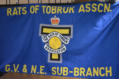
Banner, Rats of Tobruk
During World War 2, more than 14,000 Australians fought at Tobruk (Libya), during the historic 242 day siege. These men became famously known as the Rats of Tobruk. After returning to Australia, the Tobruk siege servicemen looking for comradeship, established the Rats of Tobruk Association. Around 1944, active branches and sub-branches were started in every state. In more recent times, these branches and subbranches have been wound up owing to the declining numbers of surviving veteran members. The only exception has been the Victorian Branch, which has now operated for over 70 years.Large blue cloth banner housed between two timber poles. In the centre of the banner there is a crown above a grey,black and yellow T shape overlaid by a crest with a kangaroo in a yellow circleRats of Tobruk Assoc GV & NE Sub Branchrats of tobruk, ww2 -
 Robin Boyd Foundation
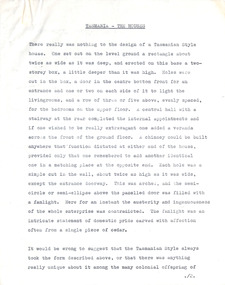
Document - Manuscript, Robin Boyd, Tasmania – The Houses, 1964
Description of a Tasmanian Style of domestic architecture as developed by colonial builders and the occasional architect. Boyd admires the ingenuous nature of these buildings, describing Tasmania as a living museum.Published as ‘Tasmania – The Houses’, pp.15 - 16 in 'Priceless Heritage: Historic Buildings of Tasmania', Platypus Publications, Hobart. 1964 Typewritten (c copy), quarto, 4 pagestasmania, colonial georgian, robin boyd, manuscript -
 Robin Boyd Foundation
Document - Manuscript, Robin Boyd, The Rape of Nareeb, 1965
Discusses the Estate of Nareeb, Kooyong Rd; 1888. The National Trust is disinterested, land denuded and house demolished, and there is needless destruction of natural and historic relics for redevelopment, particular destruction of trees exclusive to Australia. Boyd says it shows no consideration for future residents; innocence and undemanding passivity of consumers.Original manuscript of an article published as 'The Rape of Nareeb' in The Australian in 06.03.1965.Typewritten, quarto, 6 pagesnareeb, kooyong rd; national trust; destruction of natural historical environment; redevelopment, robin boyd, manuscript -
 Robin Boyd Foundation
Document - Manuscript, Robin Boyd, Our History Under Fire, 1965
Boyd discusses exemplar cases of historical preservation, and many lost opportunities. The task of preserving Australia's historic relics is left to volunteers and amateurs, with notable exception of Nunawading, unlike almost every other countries In other countries, the Government recognises its responsibility and Boyd presents examples. He suggests a model that Australia could follow.Original manuscript of an article published in "The Australian", 23.10.1965Typewritten (c copy), quarto, 9 pagesst matthew's church, francis greenway, robe, ormerod cottages, robe customs house, avoca lodge, andrew hayward newell, preservation, conservation, robin boyd, manuscript -
 Robin Boyd Foundation
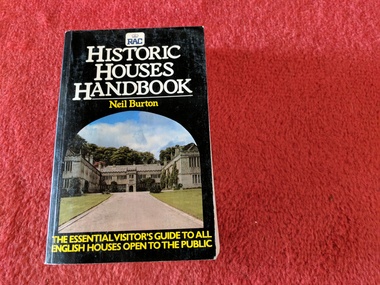
Book, Neil Burton, Historic Houses Handbook, 1981
... melbourne Walsh St library Softcover Historic Houses Handbook Book ...Softcoverwalsh st library -
 Robin Boyd Foundation
Booket, Index Publishers Limited, Historic Houses and Castles in Great Britain and Northern Ireland, 1957
... melbourne Historic Houses in England Historic Houses in Northern ...historic houses in england, historic houses in northern ireland, walsh st library -
 Ruyton Girls' School
Literary work - Ruyton Prize Book, Geoffrey Cumberlege Oxford University Press, The Complete Works of William Shakespeare, No date
... of the 2022 Victorian Senior Achiever Award at Parliament House ...This book contains a collection of literary works written by William Shakespeare. Shakespeare was an English playwright, poet, and actor, widely esteemed as the foremost writer in the English language and the world's premier dramatist. Often hailed as England's national poet, his surviving works comprise around 39 plays, 154 sonnets, three lengthy narrative poems, and a handful of other verses, some of which are of uncertain authorship. His plays have been translated into every major living language and are staged more frequently than those of any other playwright. Shakespeare remains arguably the most influential figure in English literature, with his works persistently reinterpreted and reimagined. Ruyton Girls' School has a long tradition of awarding prizes to students at annual "Speech Night" events. Speech Night at Ruyton is an extraordinary occasion. It is a time when we gather to celebrate both the year just lived and the contribution of our Year 12 girls to the life of our School. It is a night of stirring student speeches, acknowledgement of student endeavour and excellence and awe-inspiring performances by School choirs and ensembles. The record has strong historic significance as it was awarded to a former notable student, Helen Gordon (maiden name Cole). Helen started at Little Ruyton in Prep 1940 and finished Year 12 in 1952 as School Captain, Bromby Captain, Form Captain for Matric, Tennis Captain, Hockey Captain, Swimming Vice Captain, and an award for Best All-Round Girl. She also played baseball for Victoria. After finishing school, Helen went on to graduate from the University of Melbourne as a physiotherapist in 1956. Her first position at age 19 involved setting up clinics with the Victorian Health Department Poliomyelitis Rural division. Helen’s strong ties to Ruyton continued when she held the position of President of the Old Ruytonians’ Association from the start of 1966 to the end of 1967. In 2019, Helen received an Order of Australia Medal for service to community health as a physiotherapist. She was also the recipient of the 2022 Victorian Senior Achiever Award at Parliament House. This historic significance is further enhanced by Ruyton's bygone "Shakespeare Night" tradition. A celebration of ‘culture’, and a chance to enjoy some ‘fun and games, cakes and ale’, were the motivation behind Ruyton’s annual Shakespeare Night party, led by longstanding Principal Miss Hilda Daniell. In her book, "The History of Ruyton 1878-1956", she describes how the yearly tradition began in 1915, just two years after she took over the role of Principal. That first Shakespeare Night, the senior girls and other guests gathered in the School’s chrysanthemum-filled dining room for music, games and supper. Such fun was had that the festivities became an annual event and was one of the coveted privileges of being one of Ruyton’s older girls. The Night was always held as close and possible to April 23rd, which is the date of William Shakespeare’s death, and the approximate date of his birth. Senior girls and some staff and parents would be invited to a party in the School. There, Shakespearean songs were sung, his poetry recited, and scenes from his plays were acted. Sometimes a competition was held to see who could recognise the largest number of quotations. In other years all the attendees would dress as Shakespearean characters. In a nod to a minor character from ‘A Midsummer Night’s Dream’, Senior teacher Miss Dorothy Derham famously came disguised as a lion one time, and no one knew who it was until she dramatically removed her mask at the end of the evening. Whatever the programme, the Night always drew to a close with a delicious supper that included a spectacular birthday cake especially in honour of the Bard. (Accompanying it may have been the ‘ale’ of Miss Daniell’s description, though of course it was presumably of the ginger rather than the alcoholic variety.) The evening was complete when ‘God Save the King’ and ‘Auld Lang Syne’ were sung. Shakespeare Night was held almost without interruption from 1915 to at least the mid 1950s. Only in 1919, with the threat of Spanish Flu, did the Night get cancelled. Later, fear of Japanese invasion in the Second World War years, and the consequent black-out restrictions, turned the ‘Night’ into an afternoon event. Thankfully, Miss Daniell notes, "from 1944 the programmes could be given as usual", though as we now know, it was a School tradition that eventually faded away. The record's significance is also supported by its strong provenance, having been produced by Ruyton Girls' School and donated to the Archives by a familial connection.Navy leather hardcover bound book with gold detailing on front cover and spine. 1,164 pages.Front Cover: R / RECTE ET FIDE LITER / RUYTON / Spine: SHAKESPEARE'S / COMPLETE / WORKS / OXFORD / Inside Cover: R / RECTE ET FIDE LITER / RUYTON / PRIZE / AWARDED TO / Helen Cole / FOR / Latin / VB / H. Daniell. / 9th Dec. 1949 / Katie Alsop Memorial Prize /ruyton girls' school, school, students, prize, speech night, poetry, lord tennyson, queen victoria, senior school, high school, ruyton, old ruytonians' association -
 Villa Alba Museum
Photograph - Waste water pipes, c.1987
Built for William and Anna-Maria Greenlaw in the early 1880s, and with interiors decorated by the Paterson Bros, Villa Alba remained in private ownership until 1949. From 1950, the house was owned by a number of institutions. By 1984, the Villa Alba Preservation Society had been formed, and three years later, the Mount Royal Hospital granted a 25-year lease to Kew Council. In 2004, the title to Villa Alba was passed by the Victorian Government to The Villa Alba Museum Incorporated. The Museum, at 44 Walmer Street, Kew, is now a cultural institution committed to the collection, study and display of 19th century interior decorative finishes, and the components of 19th and 20th century interior decoration.This is one of a number of historically and aesthetically significant photos of the interiors and exterior of Villa Alba when it was still owned by the Mount Royal Hospital, showing twentieth century accretions and deterioration of the historic fabric of the building. This was a benchmark survey against which future conservation and restoration activities can be measured.In December 1987, Mockridge Stahle & Mitchell Pty Ltd Architects prepared ‘Villa Alba Survey: A Report on the fabric for Mount Royal Hospital’ of which this photograph is a part. Photo of numerous pipes, all installed during the period when the house was owned by the Royal Women's Hospital as a home for nurses (1950-1974). The pipes extended from a bathroom installed at the end of the first floor hall, running along the box gutter to the rear of the building. [The pipes were removed in subsequent restorations].villa alba museum, conservation photographs, victorian architecture, drain pipes, waste water -
 Villa Alba Museum
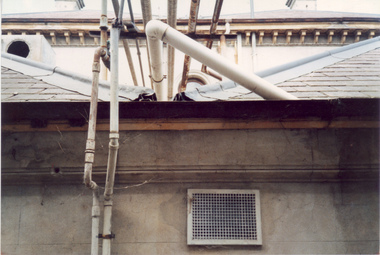
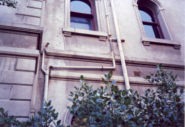
Photograph - Exterior pipe work, c.1987
Built for William and Anna-Maria Greenlaw in the early 1880s, and with interiors decorated by the Paterson Bros, Villa Alba remained in private ownership until 1949. From 1950, the house was owned by a number of institutions. By 1984, the Villa Alba Preservation Society had been formed, and three years later, the Mount Royal Hospital granted a 25-year lease to Kew Council. In 2004, the title to Villa Alba was passed by the Victorian Government to The Villa Alba Museum Incorporated. The Museum, at 44 Walmer Street, Kew, is now a cultural institution committed to the collection, study and display of 19th century interior decorative finishes, and the components of 19th and 20th century interior decoration.This is one of a number of historically and aesthetically significant photos of the interiors and exterior of Villa Alba when it was still owned by the Mount Royal Hospital, showing twentieth century accretions and deterioration of the historic fabric of the building. This was a benchmark survey against which future conservation and restoration activities can be measured.In December 1987, Mockridge Stahle & Mitchell Pty Ltd Architects prepared ‘Villa Alba Survey: A Report on the fabric for Mount Royal Hospital’ of which this photograph is a part. Photo of numerous pipes, all installed during the period when the house was owned by the Royal Women's Hospital as a home for nurses (1950-1974). The pipes extended from the roof and from rooms used as washrooms on the first floor.villa alba museum, conservation photographs, victorian architecture, drain pipes, waste water -
 Villa Alba Museum
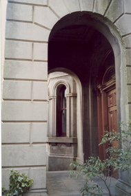
Photograph - Arched entrance to portico, c.1987
Built for William and Anna-Maria Greenlaw in the early 1880s, and with interiors decorated by the Paterson Bros, Villa Alba remained in private ownership until 1949. From 1950, the house was owned by a number of institutions. By 1984, the Villa Alba Preservation Society had been formed, and three years later, the Mount Royal Hospital granted a 25-year lease to Kew Council. In 2004, the title to Villa Alba was passed by the Victorian Government to The Villa Alba Museum Incorporated. The Museum, at 44 Walmer Street, Kew, is now a cultural institution committed to the collection, study and display of 19th century interior decorative finishes, and the components of 19th and 20th century interior decoration.This is one of a number of historically and aesthetically significant photos of the interiors and exterior of Villa Alba when it was still owned by the Mount Royal Hospital, showing twentieth century accretions and deterioration of the historic fabric of the building. This was a benchmark survey against which future conservation and restoration activities can be measured.In December 1987, Mockridge Stahle & Mitchell Pty Ltd Architects prepared ‘Villa Alba Survey: A Report on the fabric for Mount Royal Hospital’ of which this photograph is a part. Photo of one of two arched entrances to the portico on the ground floor with the main entrance door. Above this raised portico is the central tower at the front of the house. villa alba museum, conservation photographs, victorian architecture, porticos, towers, romanesque revival arches -
 Villa Alba Museum
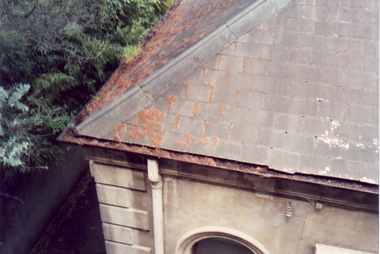
Photograph - Slate roof and guttering, c.1987
Built for William and Anna-Maria Greenlaw in the early 1880s, and with interiors decorated by the Paterson Bros, Villa Alba remained in private ownership until 1949. From 1950, the house was owned by a number of institutions. By 1984, the Villa Alba Preservation Society had been formed, and three years later, the Mount Royal Hospital granted a 25-year lease to Kew Council. In 2004, the title to Villa Alba was passed by the Victorian Government to The Villa Alba Museum Incorporated. The Museum, at 44 Walmer Street, Kew, is now a cultural institution committed to the collection, study and display of 19th century interior decorative finishes, and the components of 19th and 20th century interior decoration.This is one of a number of historically and aesthetically significant photos of the interiors and exterior of Villa Alba when it was still owned by the Mount Royal Hospital, showing twentieth century accretions and deterioration of the historic fabric of the building. This was a benchmark survey against which future conservation and restoration activities can be measured.In December 1987, Mockridge Stahle & Mitchell Pty Ltd Architects prepared ‘Villa Alba Survey: A Report on the fabric for Mount Royal Hospital’ of which this photograph is a part. Photo of one corner of the slate roof with evidence of slipped slates, rusted and blocked galvanised guttering and encroaching trees. This section of the roof is in the north west corner of the house.villa alba museum, conservation photographs, victorian architecture, slate roofs, gutters -
 Villa Alba Museum
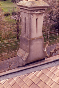
Photograph - Rendered chimney, c.1987
Built for William and Anna-Maria Greenlaw in the early 1880s, and with interiors decorated by the Paterson Bros, Villa Alba remained in private ownership until 1949. From 1950, the house was owned by a number of institutions. By 1984, the Villa Alba Preservation Society had been formed, and three years later, the Mount Royal Hospital granted a 25-year lease to Kew Council. In 2004, the title to Villa Alba was passed by the Victorian Government to The Villa Alba Museum Incorporated. The Museum, at 44 Walmer Street, Kew, is now a cultural institution committed to the collection, study and display of 19th century interior decorative finishes, and the components of 19th and 20th century interior decoration.This is one of a number of historically and aesthetically significant photos of the interiors and exterior of Villa Alba when it was still owned by the Mount Royal Hospital, showing twentieth century accretions and deterioration of the historic fabric of the building. This was a benchmark survey against which future conservation and restoration activities can be measured.In December 1987, Mockridge Stahle & Mitchell Pty Ltd Architects prepared ‘Villa Alba Survey: A Report on the fabric for Mount Royal Hospital’ of which this photograph is a part. Photo of one chimney on the south west corner of the house. The distinctive rendering of the chimney cornets with the welsh slates used on the roof. This chimney services the fireplaces in the dining room and the second and third bedrooms. villa alba museum, conservation photographs, victorian architecture, slate roofs, chimneys -
 Villa Alba Museum
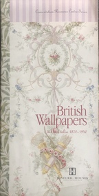
Book, British wallpapers on Australia 1870–1940, 1995
... Series. Exhibition catalogue published 1995 by Historic Houses ...Conservation Resources Centre Series. Exhibition catalogue published 1995 by Historic Houses Trust of New South Wales. 36 pages : colour illustrations ; 30 x 15 cm.non-fictionConservation Resources Centre Series. Exhibition catalogue published 1995 by Historic Houses Trust of New South Wales. 36 pages : colour illustrations ; 30 x 15 cm.wallpapers - history, interior decoration - history, wall coverings - history, elizabeth bay house -- exhibitions -
 Villa Alba Museum
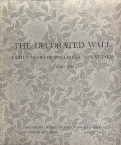
Book, The decorated wall: eighty years of wallpaper in Australia 1850–1930, 1981
... ; for the Historic Houses Trust of New South Wales [for an exhibition held ...The decorated wall : eighty years of wallpaper in Australia, c. 1850-1930 / compiled by Phyllis Murphy ; for the Historic Houses Trust of New South Wales [for an exhibition held in March 1981 at the Elizabeth Bay House]non-fictionThe decorated wall : eighty years of wallpaper in Australia, c. 1850-1930 / compiled by Phyllis Murphy ; for the Historic Houses Trust of New South Wales [for an exhibition held in March 1981 at the Elizabeth Bay House]wallpapers - history, interior decoration - history, wall coverings - history, elizabeth bay house -- exhibitions -
 Ruyton Girls' School
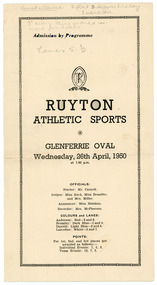
Programme, Ruyton Girls' School, Ruyton Athletic Sports, 26 April 1950
The pamphlet documents the agenda for the Ruyton Girls' School athletics sports carnival hosted at Glenferrie Oval on Wednesday, 26 April 1950. The program outlines a series of activities to be undertaken by junior and senior school students (including day girls and boarders), including crossball, potato sack race, hockey dribbling, egg and spoon race, relays, baseball throwing, and obstacle courses. Each sport is divided into age brackets including under 14, under 16, and 16 and over. The pamphlet also acts as a scorecard, featuring columns for recording results, points scored, progress points and times. Ruyton Girls' School has an exceptional reputation in school sport. The School is a member school of Girls' Sport Victoria (GSV), a large sporting association involving 24 independent girls’ schools in Melbourne. Girls in the Senior School have the opportunity to compete in a range of sports over the four terms and at three major carnivals; Swimming and Diving, Cross Country and Track and Field. Ruyton also has a very successful Rowing program and participates in the Victorian Interschools Snowsports Championships.The record has strong historic significance as it gives insight into the House system at Ruyton Girls' School; in particular, how the House system is used in a sports context. In the early 1920s, Ruyton was settling into its new home at Selbourne Road, Kew. At the time, students were arranged by their form (or year level) for lessons and other school activities. A collection of eight emblems and mottoes for each form group was published in the Ruytonian December 1922, although the genesis of each were left unexplained. With enrolments continually growing, Principal Miss Hilda Daniell felt a new basis of organisation would benefit students, giving them a broader outlook and something bigger to work for. She took inspiration from tradition and implemented a House system. The House system was adopted at Ruyton in September 1924 to "provide a new kind of co-operation and competition among the girls, especially in Sport." There were four houses, three of which were named after early Principals: Anderson, Bromby and Lascelles. There was also the School House, initially for boarders only. Some time after the publication of the Ruytonian in April 1928, the School House was renamed Daniell House, and had opened up to day girls. The account published by the newly formed Daniell House in the Ruytonian December 1928 reads, "we are rather bashful in presenting this account of our doings, for we are conscious of our newness. Our house has now the honour of being known as Daniell House." Four of the original eight form emblems were adopted by the new Houses, while the others were discarded. According to former teacher and author of the centenary history of Ruyton, Ms Majorie Theobald, the House system "gave a new focus for all competitive sport, which had previously been organised on a rather inequitable basis." The colours chosen for the Houses were cherry red for Anderson, royal blue for Bromby, gold for Lascelles, and pale blue for School (later Daniell). New students starting at Ruyton from Prep onwards are allocated to one of the following Houses with consideration to family connections and balance of numbers. The record's significance is further enhanced by its strong provenance, having been produced by Ruyton Girls' School and donated to the Archives by a familial connection of a former notable student.Pamphlet printed on cream coloured paper with navy blue ink. Two pages, folded in half.Obverse: tenns allowed 2 flat 3 teas 1 relay / 1 noveltie / 3 every thing entered in. / move for heats / Lanes 5 - 2 / First Page: under 15 50 yds. / 2. / 3 under 15 75 yds. / 4 / 5 / 6. Junior Crossball. / 7 / 8 / Second Page: 9 / 10 under 15. / 11 / 12 / 13 / 14 under 15 / 15 / 16. / Reverse: 21 Diamond Throwing open / 22 / 23 under 15 / 24 / 25 / 26 / 27 / Diamond / 28 / 29 / 30 / 31 / 32 / Junior under 15 1st July 1 Junior relay (?) / under 15 / Two sprints and potato go for championships /ruyton girls' school, students, school, ruyton, victoria, high school, senior school, day school, letter, old ruytonians association, kew, sport, school sport, girls' sport victoria, house, anderson, lascelles, bromby, daniell, athletics, glenferrie -
 Ruyton Girls' School
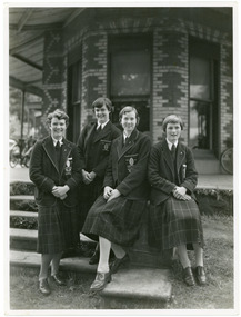
Photograph, Ruyton Girls' School, 1951
Depicted are four students who were the 1951 House Captains at Ruyton Girls' School. The photo is an official school portrait, taken outdoors in front of Henty House (formerly Tarring). In the background, we can see two bicycles. The girls are dressed in their school uniforms, comprising a knee-length check-print skirt, dark jumper, light-coloured collared buttoned blouse with a dark tie, wool blazer, stockings, and dark-coloured lace-up shoes. Two of the girls are standing, while the other two are seated on a small concrete plinth. The students have been identified, from left to right, as A. Dickinson (Lascelles), C. Kent (Anderson, H. Cole (Bromby), and E. Duff (Daniell). Student leadership commenced at Ruyton Girls' School in 1906 with the introduction of the prefect system. Prefects had numerous responsibilities—gate duty, grounds duty, classroom marking, assembly door watch, uniform monitoring, and even supervising student detention. In 1947, a dedicated Prefects Room was erected on the east side of the Ruyton Girls' School Assembly Room in Henty House. The prefects system was revised in 1968 with a new leadership structure: there would be a permanent School Captain, Vice Captain and School Sports Captain; six permanent prefects would be elected, and the rest of the Matriculation class would form committees. These included Library, Social Services, S.C.M., Editorial, and Music. In this way, it was thought "that each Matric girl would have a certain amount of responsibility." With this revised structure came a brand new Prefects' Study, located in a former classroom next to the Domestic Science building. Each prefect was allocated one book locker, one clothing locker, "a small share in the heater", plus a new shared lounge. The prefect system was updated again in 1974. All sixth formers would become prefects, or "school officials." This saw the sixth form divided into two halves: one group would be prefects for the first half of the year, then the second group would take the reigns in the latter half of the year. In October 2023, Ruyton announced a new collaborative leadership structure for captains, prefects and house leaders, which would see two students in each leadership role.The record has strong historic significance as it gives insight into the House system at Ruyton Girls' School. In the early 1920s, Ruyton was settling into its new home at Selbourne Road, Kew. At the time, students were arranged by their form (or year level) for lessons and other school activities. A collection of eight emblems and mottoes for each form group was published in the Ruytonian December 1922, although the genesis of each were left unexplained. With enrolments continually growing, Principal Miss Hilda Daniell felt a new basis of organisation would benefit students, giving them a broader outlook and something bigger to work for. She took inspiration from tradition and implemented a House system. The House system was adopted at Ruyton in September 1924 to "provide a new kind of co-operation and competition among the girls, especially in Sport." There were four houses, three of which were named after early Principals: Anderson, Bromby and Lascelles. There was also the School House, initially for boarders only. Some time after the publication of the Ruytonian in April 1928, the School House was renamed Daniell House, and had opened up to day girls. The account published by the newly formed Daniell House in the Ruytonian December 1928 reads, "we are rather bashful in presenting this account of our doings, for we are conscious of our newness. Our house has now the honour of being known as Daniell House." Four of the original eight form emblems were adopted by the new Houses, while the others were discarded. According to former teacher and author of the centenary history of Ruyton, Ms Majorie Theobald, the House system "gave a new focus for all competitive sport, which had previously been organised on a rather inequitable basis." The colours chosen for the Houses were cherry red for Anderson, royal blue for Bromby, gold for Lascelles, and pale blue for School (later Daniell). New students starting at Ruyton from Prep onwards are allocated to one of the Houses with consideration to family connections and balance of numbers. The record's significance is further enhanced by its strong provenance, having been produced by Ruyton Girls' School and donated to the Archives by a familial connection of a former notable student.Black and white rectangular photograph printed on matte photographic paper.Reverse: Caroline Kent / Mary Murray. / 11.12.51. / Ann Dickinson / RGS011/1951/0003ruyton girls' school, ruyton, students, school, senior school, girls school, kew, melbourne, school uniform, prefects, photograph, henry henty, henty house, marion henty, tarring -
 Ruyton Girls' School
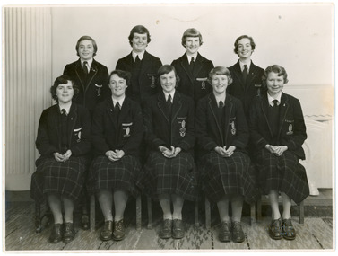
Photograph, Clive Stuart Tompkins, 1952
The photograph depicts nine Ruyton Girls' School prefects and probationers in 1952. The four students standing in the back row are probationers, who have been identified from left to right as M. Hartshorn, C. Kent, J. Hodgson, and M. Morrison. The five students seated in the front row are prefects identified from left to right as E. Macdonald, V. Mummery, H. Cole (School Captain), S. Backhouse, and T. Abson. All of the prefects and probationers are dressed in full Ruyton uniform including knee-length check-print skirts, brown lace-up shoes, dark jumper, white collared button blouse with a tie, and wool blazer. The students are all looking straight at the camera and smiling. The image is an official school photograph taken by Clive Stuart Tompkins. The same photograph appears in the 1952 Ruytonian.The record holds strong historic significance as it provides insight into the history of student leadership at Ruyton Girls' School. Student leadership commenced in 1906 with the introduction of the prefect system. Prefects had numerous responsibilities—gate duty, grounds duty, classroom marking, assembly door watch, uniform monitoring, and even supervising student detention. In 1947, a dedicated Prefects Room was erected on the east side of the Ruyton Girls' School Assembly Room in Henty House. The prefects system was revised in 1968 with a new leadership structure: there would be a permanent School Captain, Vice Captain and School Sports Captain; six permanent prefects would be elected, and the rest of the Matriculation class would form committees. These included Library, Social Services, S.C.M., Editorial, and Music. In this way, it was thought "that each Matric girl would have a certain amount of responsibility." With this revised structure came a brand new Prefects' Study, located in a former classroom next to the Domestic Science building. Each prefect was allocated one book locker, one clothing locker, "a small share in the heater", plus a new shared lounge. The prefect system was updated again in 1974. All sixth formers would become prefects, or "school officials." This saw the sixth form divided into two halves: one group would be prefects for the first half of the year, then the second group would take the reigns in the latter half of the year. In October 2023, Ruyton announced a new collaborative leadership structure for captains, prefects and house leaders, which would see two students in each leadership role. The record's significance is further enhanced by its strong provenance, having been produced by Ruyton Girls' School and donated to the Archives by a familial connection.Black and white rectangular photograph printed on matte photographic paper.Obverse: C STUART TOMPKINS / CAMBERWELL / Reverse: Ruyton / Rawcey Ware (?) / Add to order / no 5488 / & make a / others / Ruyton / [illegible] /ruyton girls' school, ruyton, students, school, senior school, girls school, kew, melbourne, school uniform, prefects, photograph -
 Ruyton Girls' School
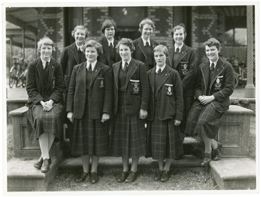
Photograph, Ruyton Girls' School, 1951
Depicted are nine Ruyton Girls' School prefects for the 1951 school year. The image is a formal school portrait taken outdoors on school grounds outside of Henty House (formerly Tarring). In the background, we can see three bicycles with cane baskets. The students are all dressed in knee-length check skirts, a dark jumper, light-coloured collared button-up blouse with a dark tie, wool blazers, and dark coloured shoes. Four girls are standing in the back row, and five are positioned in the front row. Students in the back row have been identified from left to right as M. Murray, B. Addison, T. Abson and H. Cole; in the front row, from left to right we can see S. Backhouse, J. Wigg (Vice Captain), F. Jacobs (Captain), E. Duff, and A. Dickinson. The same photograph appears in the Ruytonian 1951. Student leadership commenced at Ruyton Girls' School in 1906 with the introduction of the prefect system. Prefects had numerous responsibilities—gate duty, grounds duty, classroom marking, assembly door watch, uniform monitoring, and even supervising student detention. In 1947, a dedicated Prefects Room was erected on the east side of the Ruyton Girls' School Assembly Room in Henty House. The prefects system was revised in 1968 with a new leadership structure: there would be a permanent School Captain, Vice Captain and School Sports Captain; six permanent prefects would be elected, and the rest of the Matriculation class would form committees. These included Library, Social Services, S.C.M., Editorial, and Music. In this way, it was thought "that each Matric girl would have a certain amount of responsibility." With this revised structure came a brand new Prefects' Study, located in a former classroom next to the Domestic Science building. Each prefect was allocated one book locker, one clothing locker, "a small share in the heater", plus a new shared lounge. The prefect system was updated again in 1974. All sixth formers would become prefects, or "school officials." This saw the sixth form divided into two halves: one group would be prefects for the first half of the year, then the second group would take the reigns in the latter half of the year. In October 2023, Ruyton announced a new collaborative leadership structure for captains, prefects and house leaders, which would see two students in each leadership role.The record has strong historic significance as it depicts a former notable student, Helen Gordon (maiden name Cole), pictured third from the right in the front row. Helen started at Little Ruyton in Prep 1940 and finished Year 12 in 1952 as School Captain, Bromby Captain, Form Captain for Matric, Tennis Captain, Hockey Captain, Swimming Vice Captain, and an award for Best All-Round Girl. She also played baseball for Victoria. After finishing school, Helen went on to graduate from the University of Melbourne as a physiotherapist in 1956. Her first position at age 19 involved setting up clinics with the Victorian Health Department Poliomyelitis Rural division. Helen’s strong ties to Ruyton continued when she held the position of President of the Old Ruytonians’ Association from the start of 1966 to the end of 1967. In 2019, Helen received an Order of Australia Medal for service to community health as a physiotherapist. She was also the recipient of the 2022 Victorian Senior Achiever Award at Parliament House. Helen passed away in July 2023 at age 88. The record's significance is further enhanced by its strong provenance, having been produced by Ruyton Girls' School and donated to the Archives by a familial connection.Black and white rectangular photograph printed on matte photographic paper.Reverse: Felicity Jacobs / Judi Olsen / Ann Dickinson / Bev. Addison / RGS011/1951/0004 /ruyton girls' school, ruyton, students, school, senior school, girls school, kew, melbourne, school uniform, prefects, photograph, henry henty, henty house, marion henty, tarring -
Lakes Entrance Regional Historical Society (operating as Lakes Entrance History Centre & Museum)
Book, Marie Fish, Reg Remembers, 2008c
... Entrance gippsland Houses Historic Sites Genealogy Public Works ...Folder containing material collected prior to the writing of the book Carpentertown A history of the new works cottages also the book launch at the new works Lakes Entrance Victoriahouses, historic sites, genealogy, public works -
 Sunshine and District Historical Society Incorporated
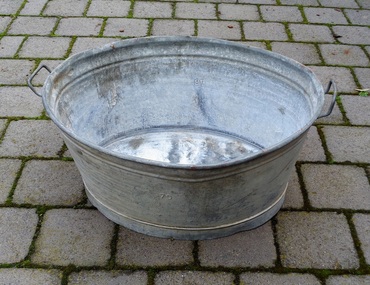
Galvanised Wash Tub, Probably Circa 1940's
Many displaced people who migrated to Australia after World War 2 brought similar tubs with them as part of their luggage. The tubs were valued by the migrants because they were used for washing clothes and other laundry items, and for bathing children and even adults. The tub in our possession was brought out to Australia in 1950 by the Pierzak family who eventually settled in North Sunshine, Victoria. The following story about the Pierzak family has been provided by the daughter Halina Wlodarczyk (nee Pierzak). The father Stanislaw Pierzak was born on the 26th of July 1916 in Zbrza, and the mother Teodozja (Teodozia) Szalas on the 5th of March 1919 in Goleciny, both villages in the Kielce district of Poland. In 1940 they were both taken by the German Army to work as slave labour on farms in Germany. Stanislaw worked in the Saxonia area and Teodozja near Dillingen. The work was hard, and when Teodozja contracted pneumonia she was told that she would not be given any food if she did not work. After the war the displaced persons, as they were called, were settled in various barracks and camps organised by the United States Army. Stanislaw and Teodozja married in Gablingen, Bavaria, Germany, and Halina was born in the camp at Gablingen in 1949. The displaced people were given the choice of several countries if they wanted to migrate from war torn Germany, and so the Pierzak family chose Australia. The Pierzak family set sail from Naples, Italy aboard the ship General M. B. Stewart and arrived in Sydney on the 17th of April 1950. The men and women had to stay in separate quarters, and many passengers were so sick that they did not think they would survive the journey. In Australia they lived in migrant camps in NSW at Bathurst, Orange, Parkes and Cowra. To pay off their fares to Australia migrants were required to work under contract for 2 years. Stanislaw Pierzak worked in Broken Hill NSW returning to visit his family every 3 to 4 months. The son John was born in the Red Cross building at the Parkes camp in 1952. In 1953 the whole family moved to Melbourne and lived in a converted garage in Victor Street, North Sunshine. In 1954 the family bought a bungalow on a block of land in Compton Parade, North Sunshine, where eventually they built a house. Stanislaw Pierzak worked at Steelweld in Ashley Street, Braybrook travelling there on his bicycle, while Teodozja Pierzak found work at Smorgon in West Footscray. Stanislaw and Teodozja Pierzak lived in North Sunshine for the rest of their lives, and Mrs Pierzak always said that Sunshine was the best place in the world.Tubs like this which belonged to displaced people were highly valued possessions and are of historic significance. They were brought out to Australia after World War 2 by many migrating displaced families. The tubs were used for washing activities in the camps in Germany, and the migrant camps in Australia, and also when people lived in bungalows in Australia before they built houses with laundries and bathrooms.Oval shaped galvanised iron tub with two rigid handles, one at each end. The top of the tub is larger than the base. The galvanising is deteriorating in some parts which show a whitish appearance. There are some small dents, and a few chips in the galvanising where surface rust has appeared.The number 70 is stamped on both sides.washing tub, galvanised tub, laundry, bath, displaced persons, immigration, general m. b. stewart, galvanized tub, pierzak, galvanised wash tub -
Clunes Museum
Photograph
FIVE PHOTOGRAPHS OF HISTORIC CLUNES. FIVE VIEWS FROM THE PAST. 1.CLUNES IN THE EARLY SIXTIES, 2. TOWNSHIP OF CLUNES FROM THE ROCKS, 3. CLUNES HOSPITAL,4.CLUNES TOWN HALL AND COURT HOUSE, 5. BUTTER FACTORY, CLUNES.local history, photographs, clunes buildings -
Clunes Museum
Book, PETER DONOVAN, SO, YOU WANT TO WRITE HISTORY?, 1992
HISTORY IN THE COMMUNIYT IS THRIVING. UNFORTUNATELY, SOME OF WHAT PASSES FOR POPULAR HISTORY IS ILL-INFORMED, UNCRITICAL AND UNRELECTIVE AT BES, AND SPURIOUS AT IT'S WORSESMALL BOOK BY PETER DONOVAN, TO ASSIST IN WRITING LOCAL HISTORY.HISTORY IN THE COMMUNIYT IS THRIVING. UNFORTUNATELY, SOME OF WHAT PASSES FOR POPULAR HISTORY IS ILL-INFORMED, UNCRITICAL AND UNRELECTIVE AT BES, AND SPURIOUS AT IT'S WORSElocal history, book, reference, history -
 Wangaratta Art Gallery
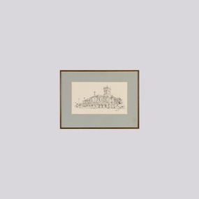
Work on paper, Maurice Cantlon, Bontharambo, 1965
Cantlon is widely known for his illustrative paintings of Victorian historic homes, and he wrote and illustrated Homesteads of Victoria 1836-1900 published by Georgian House in 1967. Bontharambo is a homestead located in Wangaratta and was built in 1857-9. This homestead plays a prominent role in the history of Wangaratta and the pastoral history of Victoria. Rural City of Wangaratta Collection. Purchased with funds from the Wangaratta Art Council.An black ink sketch of the Bontharambo homestead on white paper.Obverse: Cantlon 65/ (bottom right)wangaratta art gallery, maurice cantlon, ink drawing, bontharambo, homestead -
 Wangaratta Art Gallery
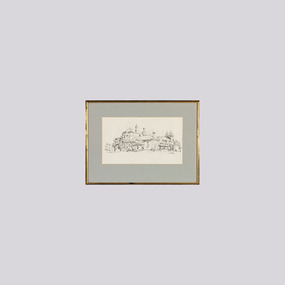
Work on paper, Maurice Cantlon, Fairfield, Rutherglen, 1966
Cantlon is widely known for his illustrative paintings of Victorian historic homes, and he wrote and illustrated Homesteads of Victoria 1836-1900 published by Georgian House in 1967. Fairfield, Rutherglen is located in the North East region of Victoria and is a historic homestead that was built in 1889 and plays a prominent role in the history of the region. Rural City of Wangaratta Collection. Purchased with funds from the Wangaratta Art Council.An black ink sketch of the Fairfield homestead on white paperObverse: Cantlon 66/ (bottom right)wangaratta art gallery, maurice cantlon, ink drawing, homestead, fairfields, rutherglen -
 Nillumbik Shire Council
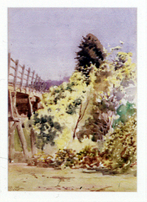
Painting: Walter WITHERS (b.1854 Warwickshire, UK — d.1914 Eltham, Aus), Trestle Bridge, Eltham, c.1903-10
Walter Withers was a significant Australian landscape artist and a member of the Heidelberg School of Australian Impressionists. In 1903 Withers bought 'Southernwood', a house on 2½ acres (1 ha) at Eltham, to which he added a studio. Because of ill health, he lived during the week at his studio in Oxford Chambers, Melbourne, and on weekends and holidays with his family at Eltham until his death in 1914. The Eltham rail bridge is a unique and valuable historic relic of an earlier steam locomotive transport era in the Diamond Creek Valley and has long formed an important part of a magnificent Eltham landscape. When built in 1902 it was close to the terminus point of the Heidelberg-Eltham rail extension, on the route of the proposed Diamond Valley Railway that was then planned to continue much further up the valley towards Kinglake. This bridge is situated in attractive river-valley parkland amidst the tall and spreading manna gums and candlebarks of the Diamond Creek Valley. The Alistair Knox Park river-valley landscape, of which the timber trestle bridge is an important visual component, has been classified by the National Trust. Large manna gum and candlebark trees adorn the adjacent creek banks, and historic Shillinglaw Cottage is also part of this much-prized Eltham landscape. Eltham is home to a historic wooden railway trestle bridge. Mainly of timber-pier and timber-beam construction, but varied by a few longer steel-joists spans on timber piers at the main stream channel, this substantial bridge has almost two hundred metres of timber deck. Built in 1902, it is the only railway bridge of predominantly timber construction that is still in regular use as an integral part of Melbourne's metropolitan electric railway network and one of extremely few timber rail bridges in the State that still carry trains. Apart from its important continuing social function as a carrier of rail transport for the Hurstbridge line, this impressive bridge and its beautiful parkland environs contribute much to the character of Eltham township and that town's special reputation as an historic centre of environmental and conservation concerns. This section of the Diamond Creek Valley was the subject of a Walter Withers painting in the earliest years of the twentieth century and has strong historic links with our Heidelberg School of painters. Watercolour painting on paper of Eltham's Trestle Bridge in the middle of the day. A small section of the wooden bridge is located to the left of the painting. The focus is predominately on the wattle, manna gum and candlebark trees that is to the right of the bridge. The golden hues typically represent the australian sunlight and landscape. "W.W" in gothic script on the lower right side of the painting. Not dated. withers, eltham, trestle bridge, railway, watercolour -
 Peterborough History Group
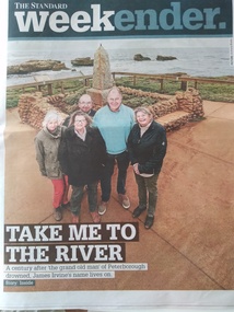
Article, Warrnambool Standard, Centenary of the drowning of Jame Irvine while crossing the river, 2019
The article is about the drowning 100 years previously of James Irvine, proprietor of Peterborough House and later the Peterborough Hotel.James Irvine was so well regarded that a community collection raised funds to build the Memorial, which still stands today. Five surviving great grand children retain connection to the town.Three page article with current and historic photosjames irvine, james irvine memorial reserve, peterborough, peterborough house, peterborough hotel, drowning -
 Westbourne Grammar Heritage Collection
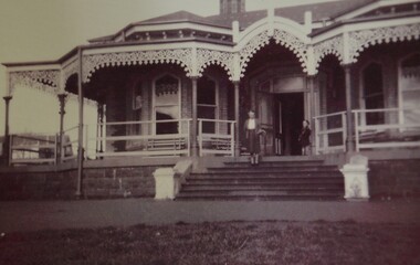
Photograph - Mabel Molland at Monomeith 1962
This reproduction photograph was donated at a major reunion in 2008, organised by students of the school from the 1950s. It pictures Mabel Molland and a young student at Monomeith, home to the school since 1956. Monomeith is a Victorian Heritage Register listed (VHR number H0452), italianate styled brick villa, built in 1887 for one of Williamstown’s most important identities, James Styles. Styles’ distinguished career in public life included membership of the Williamstown Council, a stint in state parliament as the Member for Williamstown (1894-1900) and, in 1901, election to the first commonwealth parliament as a senator. During the 1890s he was also a commissioner of both the Melbourne Harbour Trust and the Melbourne and Metropolitan Board of Works and one of the trustees of the Williamstown Grammar School. The property comprises the residence designed by W Bennett Hall and built by James Styles in 1887 and the former migrant hostel buildings (now administration and classrooms), erected around 1951 by the then owner the Melbourne Harbour Trust, and intended to house migrant workers during the dredging of Port Phillip Bay. By the 1950s, the School had outgrown its home at Holy Trinity Hall and Mabel Molland reached out to Mr. Keith White, president of the Parent's Association and well-respected member of Williamstown Council for assistance. In 1956, following lengthy negotiations led by Mr. White, Monomeith was leased from the Melbourne Harbour Trust under a seven-year lease, which eventuated as a twenty-one year lease, followed by purchase of the property in 1972. Since then this historic building has come to be a much-loved symbol of the history of Westbourne Grammar School. This is a rare image of Mabel Molland at Monomeith, taken in the year prior to her retirement having taken over the school in 1914 and then set it on a path for the future as an incorporated company in the hands of a school council, with Mr Keith White as president, in 1956. Black and white reproduction photograph of a a residence (Monomeith) with steps in the middle ground, leading up to a verandah with ornate ironwork. Mabel Molland stands on the steps and a young student can be seen on the verandah.