Showing 26086 items
matching councils
-
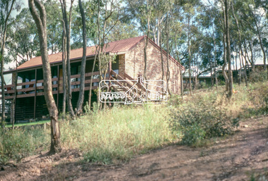
 The Beechworth Burke Museum
Photograph
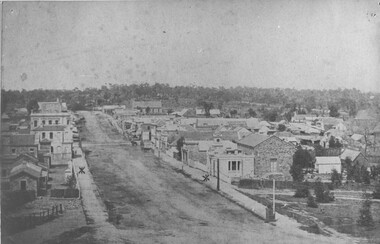
Taken in Beechworth 1859, this photograph depicts Ford Street looking South West. On the left hand side is now what we know as Beechworth Historic precinct and includes The Gold Wardens office being the first building in view followed by The Chinese Protectors office, The Gold Vault and The Courthouse. The Telegraph station is out of shot in this image.his image of Ford Street is the first council chambers copy known to exist.Black and white rectangular photograph. Image is printed on matte photographic paper. Obverse: NO INSCRIPTION Reverse: 2827 AO2827 See Tibbets 'Beechworth Historical Reconstruction page 53" FORD ST BEECHWORTH LOOKING S/WEST 1859burke museum, ford street, council chambers, beechworth historic precinct -
 Warrnambool and District Historical Society Inc.
Brass Plate, Chamber of Commerce 1933, 1933
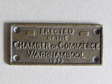
This plaque has been attached to a Warrnambool installation in 1933. It is not known to which site this refers but it may have been the Warrnambool Information Pavilion which was erected outside the old Warrnambool City Council Chambers. There have been many Warrnambool Chambers of Commerce over the years. These were established by Warrnambool businessmen and women to promote the interests of the town/city and to encourage the development of local industry and the tourism trade. This plaque is of great local interest but unfortunately does not have a clear provenance.This is a small brass plaque. The plaque has four holes at each corner for attachment to a building or other object. ‘Erected by the Chamber of Commerce, Warrnambool, 1933’warrnambool chamber of commerce, warrnambool city council chambers, plaque -
 Kiewa Valley Historical Society
Book - Kiewa Voters' Roll, Shire of Bright - Voters' Roll 1979 - Kiewa Riding, 1979
Electoral rolls list people who are registered and eligible to vote at federal, state, territory & local government elections and referenda. Prior to 1990 the rolls list voters in alphabetical order by surnames & first names within each Sub division of an electoral division of each State or Territory. The roll is useful & interesting for family historians and the study of demographics. Alex McCullough lived in the Shire of Bright and was on its Council. Electoral roles help to locate the residential address of a person in a particular year or over a period of years. They can be used as a substitute for census records for family historians and the history of a particular place in this case the Kiewa Valley - Tawonga and Tawonga South.Approx. 60 pages of firm yellow paper with black typed print on one side only in 'landscape' format. Held by three staples. Each page has column - numbered 1 to 943; Surnames in alphabetical order; Given names; Occupation; includes L (=land). Address followed by Lot number and parish. Includes Tawonga and Tawonga SouthOn the cover on the right hand side handwritten and difficult to read - "Jack? / Indi / Benambra / Nth Eastern / Division? of Dawson / 123 Victoria Rd. / Melbourne 3000"shire of bright; kiewa riding; voters roll; alex mccullough; tawonga; tawonga south -
 Warrnambool and District Historical Society Inc.
Register, Survey & subdivision street index, 1930s
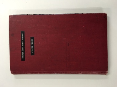
This is a book with the City of Warrnambool surveys and subdivisions listed under the street names. It covers the period from 1938 to 1975. The information is listed under the headings of plan number, street name, section, allotment, date and remarks. The information contained therein would now be held as electronic data in the Council Records Department. Warrnambool, founded in 1847, became a municipality in 1856, a Borough in 1863, a Town in 1883 and a City in 1918. This book is of considerable interest because it lists Warrnambool streets from 1938 to 1975 and gives details of the subdivisions and surveys during that time. It will be very useful for researchers. This is a foolscap-size hard-cover book with a red cover with a mottled-blue pattern paper inside the covers. It has 95 pages with ruled red and blue lines. It has a handwritten alphabet index throughout the pages. The contents are handwritten in blue, green and black ink. The inside binding has been mended with adhesive tape and one page is loose. The book lists subdivisions in the City of Warrnambool under the heading of the street names and covers 1938 to 1975. The cover is somewhat grubby.Front Cover (in plastic tape): ‘Survey and Subdivision. Street Index’warrnambool city council, warrnambool streets and subdivisions -
 Warrnambool and District Historical Society Inc.
Publication, Collett and Bain, Heytesbury Forest School, c.1971
This booklet, by Rosamund Duruz, gives the history of the schools in the Heytesbury Forest area. The Heytesbury Shire Council was established in 1863 and the first schools in the area opened in the 1870s. Most of them were closed when Timboon Consolidated School (later Timboon High School) opened in 1948. The Heytesbury Forest was largely deforested by the Bailey Closer Settlement Scheme of the 1930s and later the establishment of more farming properties in the 1950s. This booklet is of interest as a comprehensive history of the schools in the Heytesbury Forest area pre 1970. It will be useful for researchers. This is a soft-cover booklet of 63 pages. The cover is a cream colour with brown images of trees and a school on the front cover. The booklet includes a map, a sketch and several black and white photographs. The booklet is bound with metal staples.schools in heytesbury forest, victoria, rosamund duruz, historian, history of warrnambool -
 Warrnambool and District Historical Society Inc.
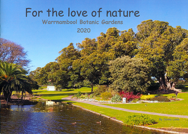
Book - Children's book, For the love of nature: Warrnambool Botanic Gardens 2020
This children's book was produced to document the construction of the Nature Play Space in Warrnambool Botanic Gardens in 2020. It tells the story of what great community spirit, persistence and excellent teamwork can achieve; a nature play space for all to enjoy. The project was funded by the Victorian Government's 'Pick my Project' initiative and overseen by the Friends of Warrnambool Botanic Gardens in conjunction with the Botanic Gardens team and Warrnambool City Council.This book is significant as it documents the construction of the nature play space in Warrnambool Botanic Gardens. It is one of few locally produced children's books.Soft cover book with image of Warrnambool Botanic Gardens which wraps around to the back cover. The image shows the lake with children feeding ducks and trees in autumn colours.The title text is black and sub-title and author's name in grey.children's literature, garden construction, children's playgrounds -
 Eltham District Historical Society Inc
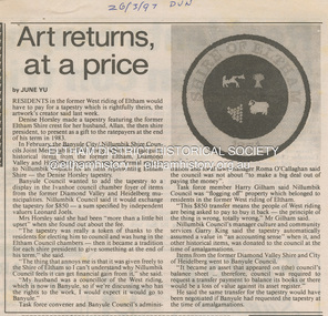
Document - News Clipping, June Yu, Art returns at a price, 26 March 1997
About former Shire / City council memorabilia. Concerning a tapestry made by Denise Horsley of a crest of the former Shire of Eltham which had been made for her husband, a former Shire President of Eltham to present as a gift to the ratepayers at the end of his term in 1983. Cr Horsley represeneted the West Riding which was transferred to the City of Banyule December 15, 1994. Article is about the issue of ownership. banyule city council, joint memorabilia taskforce, nillumbik shire council, allan horsley, artwork, city of heidelberg, denise horsley, diamond valley shire, garry king, harry gilham, shire of eltham, tapestry, west riding -
 Eltham District Historical Society Inc
Photograph, Peter Pidgeon, Site of the former Village Pond, Main Road, Eltham, 2 Aug. 2022
View looking up Dalton Street from near Main Road where the former pond was situated. The pond was drained by Council in 1932 due to concerns of mosquitoes, etc against the wishes of long standing residents such as Thekla Jarrold (39 years) and John Clark (22 years). On the right is the Eltham Primary Schoool No. 209 with the former Headmaster's residence and to the left is Eltham Clinic once the site of the Grant home.Born Digitaleltham, dalton street, main road, eltham clinic, eltham primary school, headmaster's residence, state school no. 209 -
 Eltham District Historical Society Inc
Document - Folder, Warrandyte Bushfire Relief, 1962
Following the January 1962 bushfires in Warrandyte, affected land holders and residents made application for financial assistance. These records are a small part of more than 1,300 applications made at the time. Contents include: Approximately 200 applications for assistance which include details of property, residence (holiday, farm holding, main residence), residents and property loss Approximately 500 Council responses for each application Miscellaneous correspondencePovides a clear description of property ownership, type, size, holdings and people at the timeapplication form, assessments, bushfire relief, eltham shire council, north warrandyte, scan - tbd, victorian bushfires - 1962, warrandyte -
 Eltham District Historical Society Inc
Document, Nillumbik Shire Council, Information Bulletin, 1996 Nillumbik Festival, 8 Aug 1996
In 1996 the Eltham Festival was renamed the Nillumbik Festival, centred around Alistait Knox Park and the Rugby Oval. The theme for the 1996 Nillumbik Festival held 9-10 November 1996 was "Celebrating Our Lifestyle" Information bulletin issued by Nillumbik Shire Council addressing how community groups can be involved and interpretation of the festival's theme covering the Grand Parade, Stage performance and sporting displays and Stalls3 x A4 photocopy, various coloured papereltham community festival, eltham festival, 1996, nillumbik festival -
 Eltham District Historical Society Inc
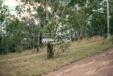
Photograph, Vacant Lot, 57 Park Road, Eltham, Dec. 1980
Roll of film taken by Eltham Shire Council officers of roads and houses in the Eltham East area in December 1980. They provide perspective of the changes in housing styles and road development that began sweeping in from the mid 1970s with increasing urbanisation of what was once more outlying suburbs and regions. Typically part of the Beard street group, a private street scheme that developed the road infrastructure commencing in February 1982.35mm colour positive transparency Mount - Kodak Kodachrome Cardeltham, housing estate, infrastructure, park road, roads -
 Eltham District Historical Society Inc
Photograph, 53 Park Road, Eltham, Dec. 1980
Roll of film taken by Eltham Shire Council officers of roads and houses in the Eltham East area in December 1980. They provide perspective of the changes in housing styles and road development that began sweeping in from the mid 1970s with increasing urbanisation of what was once more outlying suburbs and regions. Typically part of the Beard street group, a private street scheme that developed the road infrastructure commencing in February 1982.35mm colour positive transparency Mount - Kodak Kodachrome Cardeltham, housing estate, infrastructure, park road, roads -
 Eltham District Historical Society Inc
Photograph, 85 Park Road, Eltham, Dec. 1980
Roll of film taken by Eltham Shire Council officers of roads and houses in the Eltham East area in December 1980. They provide perspective of the changes in housing styles and road development that began sweeping in from the mid 1970s with increasing urbanisation of what was once more outlying suburbs and regions. Typically part of the Beard street group, a private street scheme that developed the road infrastructure commencing in February 1982.35mm colour positive transparency Mount - Kodak Kodachrome Cardeltham, housing estate, infrastructure, park road, roads -
 Eltham District Historical Society Inc
Photograph, Undeveloped land, Beard Street, Eltham, Dec. 1980
Roll of film taken by Eltham Shire Council officers of roads and houses in the Eltham East area in December 1980. They provide perspective of the changes in housing styles and road development that began sweeping in from the mid 1970s with increasing urbanisation of what was once more outlying suburbs and regions. Typically part of the Beard street group, a private street scheme that developed the road infrastructure commencing in February 1982.35mm colour positive transparency Mount - Kodak Kodachrome Cardeltham, housing estate, infrastructure, roads, andrews street, beard street -
 Eltham District Historical Society Inc
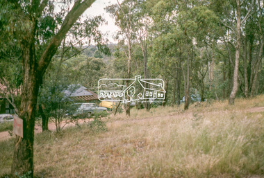
Photograph, Andrews Street, Eltham, Dec. 1980
Roll of film taken by Eltham Shire Council officers of roads and houses in the Eltham East area in December 1980. They provide perspective of the changes in housing styles and road development that began sweeping in from the mid 1970s with increasing urbanisation of what was once more outlying suburbs and regions. Typically part of the Beard street group, a private street scheme that developed the road infrastructure commencing in February 1982.35mm colour positive transparency Mount - Kodak Kodachrome Cardeltham, housing estate, infrastructure, roads, andrews street -
 Eltham District Historical Society Inc
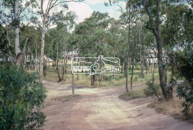
Photograph, Frank Street, Eltham, Dec. 1980
Roll of film taken by Eltham Shire Council officers of roads and houses in the Eltham East area in December 1980. They provide perspective of the changes in housing styles and road development that began sweeping in from the mid 1970s with increasing urbanisation of what was once more outlying suburbs and regions. Typically part of the Beard street group, a private street scheme that developed the road infrastructure commencing in February 1982.35mm colour positive transparency Mount - Kodak Kodachrome Cardeltham, housing estate, infrastructure, roads, frank street -
 Eltham District Historical Society Inc
Photograph, Frank Street, Eltham, Dec. 1980
Roll of film taken by Eltham Shire Council officers of roads and houses in the Eltham East area in December 1980. They provide perspective of the changes in housing styles and road development that began sweeping in from the mid 1970s with increasing urbanisation of what was once more outlying suburbs and regions. Typically part of the Beard street group, a private street scheme that developed the road infrastructure commencing in February 1982.35mm colour positive transparency Mount - Kodak Kodachrome Cardeltham, housing estate, infrastructure, roads, frank street, beard street -
 Eltham District Historical Society Inc
Photograph, Frank Street, Eltham, Dec. 1980
Roll of film taken by Eltham Shire Council officers of roads and houses in the Eltham East area in December 1980. They provide perspective of the changes in housing styles and road development that began sweeping in from the mid 1970s with increasing urbanisation of what was once more outlying suburbs and regions. Typically part of the Beard street group, a private street scheme that developed the road infrastructure commencing in February 1982.35mm colour positive transparency Mount - Kodak Kodachrome Cardeltham, housing estate, infrastructure, roads, frank street -
 Eltham District Historical Society Inc
Photograph, Shalbury Avenue, Eltham, Dec. 1980
Roll of film taken by Eltham Shire Council officers of roads and houses in the Eltham East area in December 1980. They provide perspective of the changes in housing styles and road development that began sweeping in from the mid 1970s with increasing urbanisation of what was once more outlying suburbs and regions. Typically part of the Beard street group, a private street scheme that developed the road infrastructure commencing in February 1982.35mm colour positive transparency Mount - Kodak Kodachrome Cardeltham, housing estate, infrastructure, roads, shalbury avenue -
 Eltham District Historical Society Inc
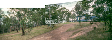
Photograph, Shalbury Avenue, Eltham, Dec. 1980
Roll of film taken by Eltham Shire Council officers of roads and houses in the Eltham East area in December 1980. They provide perspective of the changes in housing styles and road development that began sweeping in from the mid 1970s with increasing urbanisation of what was once more outlying suburbs and regions. Typically part of the Beard street group, a private street scheme that developed the road infrastructure commencing in February 1982.Born digital based on two 35mm colour positive transparencies converged into a panormaeltham, housing estate, infrastructure, roads, shalbury avenue -
 Eltham District Historical Society Inc
Photograph, Shalbury Avenue, Eltham, Dec. 1980
Roll of film taken by Eltham Shire Council officers of roads and houses in the Eltham East area in December 1980. They provide perspective of the changes in housing styles and road development that began sweeping in from the mid 1970s with increasing urbanisation of what was once more outlying suburbs and regions. Typically part of the Beard street group, a private street scheme that developed the road infrastructure commencing in February 1982.35mm colour positive transparency Mount - Kodak Kodachrome Cardeltham, housing estate, infrastructure, roads, shalbury avenue -
 Eltham District Historical Society Inc
Photograph, Rattray Road access from Sherbourne Road, Montmorency opposite the 7-Eleven and Eltham Fort Knox, c.July 1991, 1991
Opposite the Shire Council Depot (formerly Fayrefield Hat Factory and now Eltham Fort Knox). Comment from David Taylor (via Facebook 2/4/2018): My family home was at 216 Rattray and I remember Powell's old garage on the right where the servo is now decades before the road was excavated. They had an aviary (very exciting for a very young child) and hand pumped kerosene.Colour photographmontmorency, streets, rattray road, sherbourne road