Showing 6891 items matching "hotels"
-
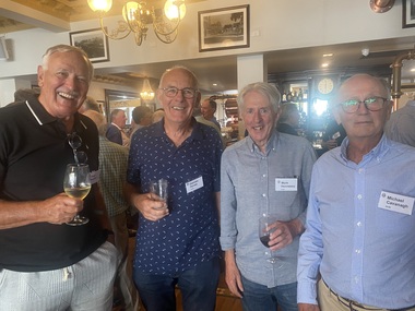
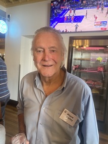
 St Patrick's Old Collegians Association (SPOCA)
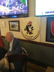
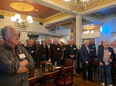
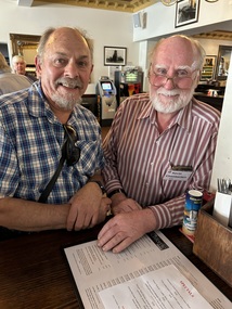
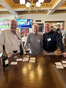
Photograph - SPOCA, Class Reunions, 55 Years since Closure, Glenferrie Hotel, Feb2023
-
 St Patrick's Old Collegians Association (SPOCA)
Photograph - SPOCA, Class Reunions, 55 Years since Closure, Glenferrie Hotel, Feb2023
-
 St Patrick's Old Collegians Association (SPOCA)
Photograph - SPOCA, Class Reunions, 55 Years since Closure, Glenferrie Hotel, Feb2023
-
 St Patrick's Old Collegians Association (SPOCA)
Photograph - SPOCA, Class Reunions, 55 Years since Closure, Glenferrie Hotel, Feb2023
-
 St Patrick's Old Collegians Association (SPOCA)
Photograph - SPOCA, Class Reunions, 55 Years since Closure, Glenferrie Hotel, Feb2023
-
 St Patrick's Old Collegians Association (SPOCA)
Photograph - SPOCA, Class Reunions, 55 Years since Closure, Glenferrie Hotel, Feb2023
-
 St Patrick's Old Collegians Association (SPOCA)
Photograph - SPOCA, Class Reunions, 55 Years since Closure, Glenferrie Hotel, Feb2023
-
 St Patrick's Old Collegians Association (SPOCA)
Photograph - SPOCA, Class Reunions, 55 Years since Closure, Glenferrie Hotel, Feb2023
-
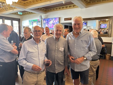
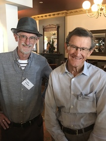
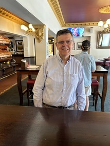
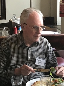
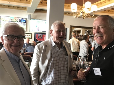
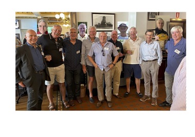
 St Patrick's Old Collegians Association (SPOCA)
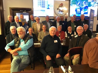
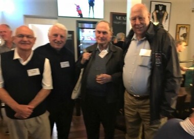
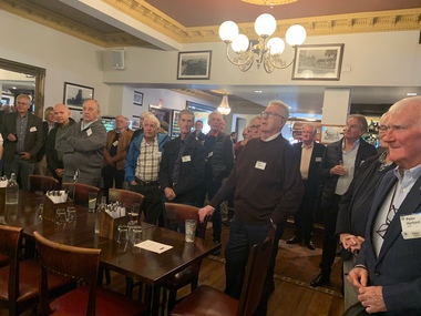
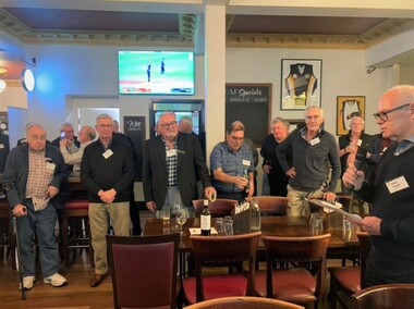
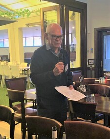
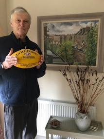
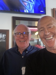
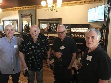
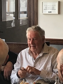
Photograph - SPOCA, Class Reunions, Feb 2024, Glenferrie Hotel
-
 St Patrick's Old Collegians Association (SPOCA)
Photograph - SPOCA, Class Reunions, Feb 2024, Glenferrie Hotel
-
 St Patrick's Old Collegians Association (SPOCA)
Photograph - SPOCA, Class Reunions, Feb 2024, Glenferrie Hotel
-
 St Patrick's Old Collegians Association (SPOCA)
Photograph - SPOCA, Class Reunions, Feb 2024, Glenferrie Hotel
-
 St Patrick's Old Collegians Association (SPOCA)
Photograph - SPOCA, Class Reunions, Feb 2024, Glenferrie Hotel
-
 St Patrick's Old Collegians Association (SPOCA)
Photograph - SPOCA, Class Reunions, Feb 2024, Glenferrie Hotel
-
 St Patrick's Old Collegians Association (SPOCA)
Photograph - SPOCA, Class Reunions, Feb 2024, Glenferrie Hotel
-
 St Patrick's Old Collegians Association (SPOCA)
Photograph - SPOCA, Class Reunions, Feb 2024, Glenferrie Hotel
-
 St Patrick's Old Collegians Association (SPOCA)
Photograph - SPOCA, Class Reunions, Feb 2024, Glenferrie Hotel
-
 St Patrick's Old Collegians Association (SPOCA)
Photograph - SPOCA, Class Reunions, Feb 2024, Glenferrie Hotel
-
 St Patrick's Old Collegians Association (SPOCA)
Photograph - SPOCA, Class Reunions, Feb 2024, Glenferrie Hotel
-
 St Patrick's Old Collegians Association (SPOCA)
Photograph - SPOCA, Class Reunions, Feb 2024, Glenferrie Hotel
-
 St Patrick's Old Collegians Association (SPOCA)
Photograph - SPOCA, Class Reunions, Feb 2024, Glenferrie Hotel
-
 City of Kingston
Photograph - Colour, Paul Tresize, 1998
The name Mordialloc was derived from the name Moody Yallock, which comes from the Bunurong language. The Bunurong Peoples are the Traditional Owners of this area. The name means “high water” or “high creek”. In 1839, colonial authorities declared the mouth of the creek, and an additional 830 odd acres as an Aboriginal Reserve, although this proclamation was never gazetted. The reserved land included part of the Carrum Carrum Swamp which was abundant with wild life and natural resources. Regular encroachments, including land sales which began in 1863, were made on the land until 1878 when the Reserve was declared closed, and the land was opened up to land sales. Market gardening and suburban house lots quickly began to develop, and Mordialloc became a renowned picnic and holiday site. Mordialloc Creek is a popular bay side destination for local and visitors, and is a site for boating, kayaking, fishing and swimming, along with many other activities.Colour photograph of Mordialloc Creek with boats moored on both sides of the street and Pompei's boat yard visible on the right hand side of the creek., Main Street and St Brigid's Catholic Church are visible in backgroundmordialloc, bunurong, traditional owners, suburbs, boats, fishing, waterways, hotel, church -
 City of Kingston
Photograph - Colour, 31 January 1993
Patterson Lakes is a suburb in the City of Kingston that is built one kilometre upstream of the mouth of the Patterson River. The area is bordered by the Patterson River and Eel Race Drain which enters the Kananook Creek. The suburb consists predominantly of newer housing developments and the tidal canal system of the development joins Port Phillip Bay. Patterson Lakes and the Kananook Creek were previously part of the extensive Carrum Carrum Swamp. The area was once a source of fish and eels for the Mayone-Bulluk clan of the Bunurong people. Over time the area was drained and in 1973 investigations commenced into the development of a unique residential area that would be built adjacent to canals and waterways. It was originally proposed to be known as "Gladesville". The development would give the suburb's homeowners access to Port Phillip Bay "from their back door". Circa 1974, the area was rezoned from rural to residential and named Patterson Lakes. Development has been continuous since the 1970s with construction of residential housing, schools, shopping centres, marinas, a hotel and library.Laminated colour aerial photograph of the Carrum and Patterson Lakes region within City of Kingston. This 1993 image includes Patterson River Secondary College, Roy Dore Reserve, Kananook Creek and Nepean Highway. The railway line can be seen as it veers inland from Eel Race Road, Seaford. The section of Ocean Reef Drive and Palm Beach Drive in Patterson Lakes appears to be a recent development with many spare blocks and new houses under construction.Black typed lettering on white adhesive label: 31.1.93 Black typed lettering on white adhesive label: 27E/7140 31/1/93 12.55 pm Black typed lettering on white label: 7140 Yellow round adhesive label located on left sidepatterson lakes, seaford, kananook creek, carrum carrum swamp, canals and waterways -
City of Kingston
Photograph - Colour, c. 1993
Patterson Lakes is a suburb in the City of Kingston that is built one kilometre upstream of the mouth of the Patterson River. The area is bordered by the Patterson River and Eel Race Drain which enters the Kananook Creek. The suburb consists predominantly of newer housing developments and the tidal canal system of the development joins Port Phillip Bay.Patterson Lakes and the Kananook Creek were previously part of the extensive Carrum Carrum Swamp. The area was once a source of fish and eels for the Mayone-Bulluk clan of the Bunurong people. Over time the area was drained and in 1973 investigations commenced into the development of a unique residential area that would be built adjacent to canals and waterways. It was originally proposed to be known as "Gladesville". The development would give the suburb's homeowners access to Port Phillip Bay "from their back door". Circa 1974, the area was rezoned from rural to residential and named Patterson Lakes. Development has been continuous since the 1970s with construction of residential housing, schools, shopping centres, marinas, a hotel and library.Laminated colour aerial photograph of the Carrum and Patterson Lakes region within City of Kingston. This 1993 image includes Patterson River Secondary College, Roy Dore Reserve, Kananook Creek and Nepean Highway. The railway line can be seen as it veers inland from Eel Race Road, Seaford. The section of Palm Beach Drive, Curlew Point Drive, Snapper Point Drive, Clipper Island and Myola Street in Patterson Lakes appears to be a recent development with many spare blocks and new houses under construction.patterson lakes, seaford, kananook creek, carrum carrum swamp, canals and waterways -
City of Kingston
Photograph - Colour, 1993
Carrum is a suburb in the City of Kingston bordered by the Patterson River in the north and Kananook Creek in the south. To the east the suburb is adjacent to Patterson Lakes. The Carrum Station was opened in 1882, when the railway line from Mordialloc was extended to Frankston. In the early 20th century, it was a destination for holidaymakers occupying tents and cabins. The area now consists of older housing and over time there have been many new housing developments.Carrum is located in the area that was originally part of the Carrum Carrum Swamp. The district had originally been the home of the Bunerong people who fished, gathered food and found refuge in the sand dunes. The Swamp was drained in 1879 when the Patterson Cut was formed and became known as Patterson River. Apart from local farmers, fishermen and hotel-keepers, there were few permanent residents until the early 20th century when it had become popular as a beach resort. In the 1920s and 1930s the area became occupied by more permanent residents.Laminated aerial colour photograph of Carrum and Patterson Lakes in the City of Kingston. The photograph also includes Kananook Creek and the northern section of Seaford. Prominent features include Roy Dore Reserve, Carrum Primary School, Patterson River Secondary College, Keast Park Seaford, the Seaford Swamp Drain and a section of Downs Estate situated on the traditional lands of the Bunurong people.Black type on white adhesive sticker: No. 7140 Black type of white adhesive sticker: 31-1-93 Black handwritten ink (marker): * [an asterisk] Yellow circular adhesive stickerpatterson lakes, seaford, carrum carrum swamp -
 Linton and District Historical Society Inc
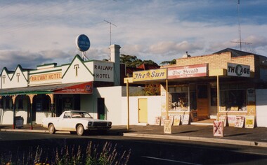
Photograph, Railway Hotel and Murrell's Newsagency, Sussex Street, Linton, 1988, 1988
Murrell's newsagency, originally the home & shop of the Cornish family. (Dan Cornish's shoe shop.)Colour photograph showing a brick two storey building with chimney, green trim and verandah, next to a smaller building with brick front and verandah.railway hotel, murrell's newsagency, buildings -
 Stawell Historical Society Inc
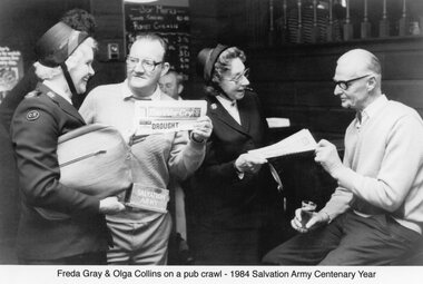
Photograph, Salvation officers Distributing the War Cry in a Hotel Bar
Two Salvation Army officers & Two Men in a barFreda Gray & Olga Collins on a Pub Crawl -
Port Melbourne Historical & Preservation Society
Document - Scrapbook relating to Port Melbourne, Newspaper Cuttings, 1900
98 pages of clippings kept by Port Melbourne Town Clerk E.C. CROCKFORD; sequential to item 162. (This also has his bowling scores in back). NB Crockford supposed to have moved to South Melbourne in November, 1909, but this book kept up to 28-07-1910, apparently still in Crockford's handwriting.Notationslocal government - town of port melbourne, engineering - board of works, melbourne harbor trust - port of melbourne authority, sandridge lagoon, livestock, piers and wharves - miscellaneous, amalgamation, royal visits and occasions, law, sport - lawn bowls, transport - tramways, health - general health, business & traders - dairies, flood, transport - horse, transport - railways, environmental issues, fishermans bend, engineering - canals and drainage, built environment - domestic, celebrations fetes and exhibitions, town planning - proposals shelved, natural environment, edward c crockford, town clerks, pumping station, waste disposal, sand carters, business and traders - hotels -
Port Melbourne Historical & Preservation Society
Photograph, Aerial Survey of Port Melbourne; December 1945, 2105
Seventeen (17) individual photos were joined together by John KIRBY to make a compsite image.Aerial Survey of Port Melbourne; December 1945 Large photograph mounted on foam board. Shows aerial view of Port Melbourne showing its extent from the Bay. Panel on right hand side has key to numbered areas on map . PMHPS logo on top left cornereclipse picture theatre, brookes lemos ltd, built environment, local government, natural environment, built environment - industrial, religion - roman catholic church (st josephs), gmh, general motors-holden, rotten row, sport - trotting, j kitchen & sons pty ltd, australian wool board, government aircraft factory, gaf, commonwealth aircraft corporation, cac, north port oval, fire and fire services, market reserve, religion - presbyterian church, leading lights, foresters arms hotel, commonwealth government engine works, st josephs catholic primary school, mission to seamen, centenary bridge, naval drill hall, mail exchange, gasworks, piers and wharves - town pier, robert harper & co ltd, ran - royal australian navy, hmas lonsdale, port melbourne yacht club, pmyc -
Port Melbourne Historical & Preservation Society
Document - 1997 PMHPS Calendar, Pat Grainger, Historic Port Melbourne, Sep 1996
Produced by PMH&PS as a promotional/fundraising item. 500 printed, then errors discovered. Recalled, de-stapled, reprinted (8 pp), collated and redistributed. Sold in Bay Street from Town Hall, Library, newsagent, Sandridge Gallery, Emerald Hill Bookstore, Sweet Port and Yorkville Kangaroo1997 calendar produced by PMH&PS, printed sepia on ivory, 16pp; cover photo 'Gem' at Railway Pier from foreshore. Revised printing with April and May correctedsocieties clubs unions and other organisations, built environment, piers and wharves - railway pier, sandridge lagoon, beacons, arts and entertainment - film/cinema, pat grainger, faram brothers hardware, ps gem, business and traders - hotels