Showing 1921 items matching " bridge rd"
-
 Eltham District Historical Society Inc
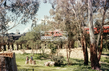
Slide - Photograph, Russell Yeoman, Steam engine K-184 hauling a special excursion train across the Eltham Railway Trestle Bridge, c.1974
Special excursion vintage train. Same engine (K-184) that hauled the vintage train for the Shire of Eltham Centenary celebrations in 1971. K 184 was used on railtour duty by Steamrail Victoria until 1980. It has since been stored at Newport Workshops.35mm colour positive transparency Mount - Grey and White (Fuji)eltham trestle bridge, k-184, k-class steam locomotive (vr newport workshops), red rattler, steam engine, steam train, trestle bridge -
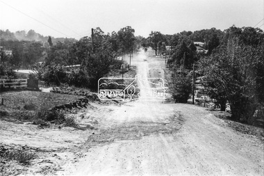
 Eltham District Historical Society Inc
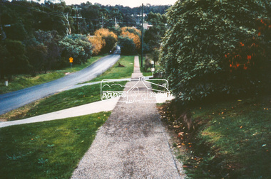
Slide - Photograph, Brougham Street, Eltham, c.Aug. 1978
35mm colour positive transparency Mount - Grey and Whitebrougham steet, brougham steet bridge, eltham, infrastructure, roads -
 Eltham District Historical Society Inc
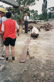
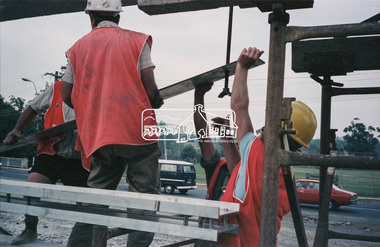
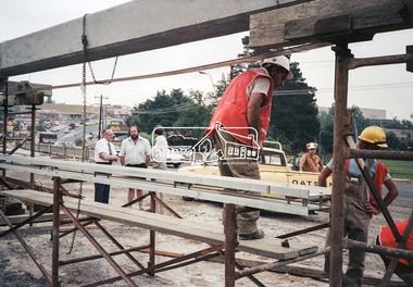
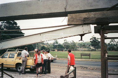
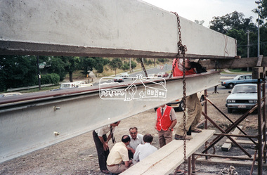
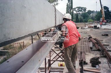
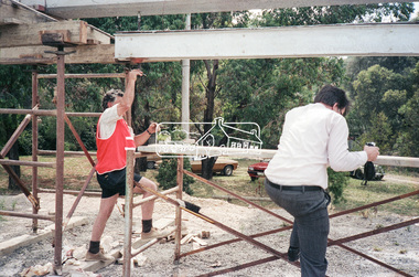
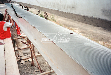
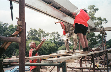
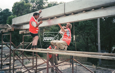
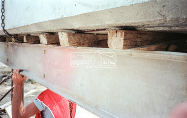
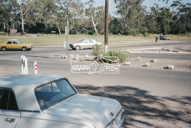
Negative - Photograph, Construction work, Main Street Bridge, Greensborough, c.Dec. 1983
The original bridge over the Plenty River was replaced by a single lane bridge each way fed by two lanes each way on either side. As traffic grew a second bridge was added to complete the divided road across the riverFilm - Kodak CM 400 5079 7 strips, 26 framesinfrastructure, roads, bridge construction, greensborough, main street bridge, road construction -
 Eltham District Historical Society Inc
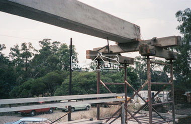
Negative - Photograph, Construction work, Main Street Bridge, Greensborough, c.Aug. 1978
The original bridge over the Plenty River was replaced by a single lane bridge each way fed by two lanes each way on either side. As traffic grew a second bridge was added to complete the divided road across the riverFilm - Kodak CM 400 5079 7 strips, 26 framesinfrastructure, roads, bridge construction, greensborough, main street bridge, road construction -
 Eltham District Historical Society Inc
Negative - Photograph, Construction work, Main Street Bridge, Greensborough, c.Dec. 1983
The original bridge over the Plenty River was replaced by a single lane bridge each way fed by two lanes each way on either side. As traffic grew a second bridge was added to complete the divided road across the riverFilm - Kodak CM 400 5079 7 strips, 26 framesinfrastructure, roads, bridge construction, greensborough, main street bridge, road construction -
 Eltham District Historical Society Inc
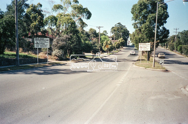
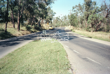
Negative - Photograph, Main Road, Eltham, c.Dec. 1983
Road sign advising of proposed reconstruction works of Main Road to install a roundabout at Mount Pleasant Road. Traffic to Lower Plenty and Templestowe to be diverted down Bridge Street (and Bolton Street) effective January 1984. The proposed roundabout did not proceed. Instead traffic islands on Mount Pleasant Road were installed in place of temporary blocked out islands.Film - Kodak CM 400 5079 7 strips, 26 framesinfrastructure, roads, road construction, roundabout, road sign, main road, mount pleasant road -
 Eltham District Historical Society Inc
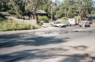
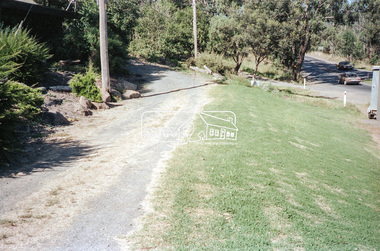
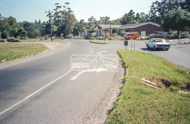
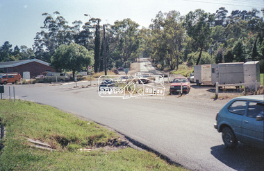
Negative - Photograph, Intersection of Mt Pleasant Road at Main Road, Eltham, c.Dec. 1983
Reconstruction work was planned for Main Road to install a roundabout at Mount Pleasant Road. Traffic to Lower Plenty and Templestowe to be diverted down Bridge Street (and Bolton Street) effective January 1984. The proposed roundabout did not proceed. Instead traffic islands on Mount Pleasant Road were installed in place of temporary blocked out islands and revised extended driveway to properties 622-642 Main Road with access off Mount Pleasant Road instead.Film - Kodak CM 400 5079 7 strips, 26 framesinfrastructure, roads, road construction, roundabout, road sign, main road, mount pleasant road, eltham -
 Eltham District Historical Society Inc
Negative - Photograph, Intersection of Mt Pleasant Road at Main Road, Eltham, c.Dec. 1983
Reconstruction work was planned for Main Road to install a roundabout at Mount Pleasant Road. Traffic to Lower Plenty and Templestowe to be diverted down Bridge Street (and Bolton Street) effective January 1984. The proposed roundabout did not proceed. Instead traffic islands on Mount Pleasant Road were installed in place of temporary blocked out islands and revised extended driveway to properties 622-642 Main Road with access off Mount Pleasant Road instead.Film - Kodak CM 400 5079 7 strips, 26 framesinfrastructure, roads, road construction, roundabout, road sign, main road, mount pleasant road, eltham, service station -
 Eltham District Historical Society Inc
Negative - Photograph, Intersection of Mt Pleasant Road at Main Road, Eltham, c.Dec. 1983
Reconstruction work was planned for Main Road to install a roundabout at Mount Pleasant Road. Traffic to Lower Plenty and Templestowe to be diverted down Bridge Street (and Bolton Street) effective January 1984. The proposed roundabout did not proceed. Instead traffic islands on Mount Pleasant Road were installed in place of temporary blocked out islands and revised extended driveway to properties 622-642 Main Road with access off Mount Pleasant Road instead.Film - Kodak CM 400 5079 7 strips, 26 framesinfrastructure, roads, road construction, roundabout, road sign, main road, mount pleasant road, eltham -
 Eltham District Historical Society Inc
Negative - Photograph, Intersection of Mt Pleasant Road at Main Road, Eltham, c.Dec. 1983
Reconstruction work was planned for Main Road to install a roundabout at Mount Pleasant Road. Traffic to Lower Plenty and Templestowe to be diverted down Bridge Street (and Bolton Street) effective January 1984. The proposed roundabout did not proceed. Instead traffic islands on Mount Pleasant Road were installed in place of temporary blocked out islands and revised extended driveway to properties 622-642 Main Road with access off Mount Pleasant Road instead.Film - Kodak CM 400 5079 7 strips, 26 framesinfrastructure, roads, road construction, roundabout, road sign, main road, mount pleasant road, eltham -
 Eltham District Historical Society Inc
Film - Video (VHS), IMP Productions, The Shire of Etham - The Evergreen Shire (Series 69, Item 4), c.1985
Shire of Eltham Archives: Series 69, Item 4 This video was produced for the Shire of Eltham by IMP Productions and provides a description of the shire, 277 square km on a north/northeast axis, some 25 km northeast of the centre of Melbourne with a population of around 40,000. Scenes include Yarra River, rural settings and urban settings, housing estates, Shillinglaw Cottage, Pigeon Bank at Kangaroo Ground, the Eltham Railway Trestle Bridge with reference to the fight by locals in the 1970s to save it from replacement, Montsalvat, mudbrick making and its use as a building material, the use of mudbrick in the Eltham Community Centre blending harmoniously with the environment. Emphasises people living in the area due to the qualities of life provided. Also the Living and Learning Centre, St Andrews Markets and other local markets, the Eltham Leisure Centre, cricket and horse riding at Eltham Lower Park, the Infant Welfare Centre (part of the Eltham War Memorial), how residents are mindful of protecting their historical heritage, the CBA bank and Allwood House at Hurstbridge, Tracey Naughton about the Eltham "As we are" Community Banner project and the “River of Life banner”, the Parks and Gardens office in the former Police Residence building (now the Local History Centre), Alistair Knox Park, road planning and types of roads, tree canopy, Peck's Dam, green carparks, road drainage, Gordon Ford's garden and natural landscapes, and Were Street shops in Montmorency. Planning for shopping facilities and carparks with a population of 40,000 growing to 55,000, Arthur Street Mall and carpark, local village feel in the shopping centre. Councillors and Council staff featured include Mary Grant, Bob Manuell, Rodney Roschellor, John Cohen, Alan Baker. Also scenes of Commercial Place, Diamond Valley Railway, Eltham Galley, Riverclay and canoeing on the Yarra intermingled with images of the shire from the Shire of Eltham Pioneers Photograph collection.VHS Video cassette Converted to MP4 file format 00:11:56; 79MBshire of eltham, video recording, shire of eltham archives, alistair knox park, allwood house, arthur street, arthur street mall, bob manuell, canoeing, carparks, cba bank, commercial place, council staff, councillors, cr. mary grant, cricket, diamond valley railway, eltham community banner project, eltham community centre, eltham galley, eltham leisure centre, eltham living and learning centre, eltham lower park, eltham railway trestle bridge, eltham war memorial, gordon ford garden, horse riding, housing estates, hurstbridge, infant welfare centre, john cohen, kangaroo ground, local history centre, montmorency, montsalvat, mudbrick, parks and gardens, peck's dam, pigeon bank, police residence, river of life banner, riverclay, road drainage, road planning, rodney roschellor, shillinglaw cottage, shire of eltham pioneers photograph collection, st andrews market, tracey naughton, tree canopy, were street, yarra river, alan baker -
 Eltham District Historical Society Inc
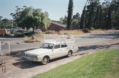
Photograph, Brougham Street, Eltham, c. Sep. 1966
Taken from alongside the Justice Precinct looking east. In the distance on the right hand verge there is a large Eucalyptus tree with a branch growing out over the road. That tree still stands today and is outside No. 102. The two houses on the right are possibly numbers 94 and 96.Black and white photographic printOriginally located in a Filmpro King Size Prints processing envelope $3.01 Shire of Eltham 9/9/66 and noted as Calrossie Ave area and crossed out Eltham-Yarra Glen Road, Bridge Street to Elsa Court existing conditions mid 1967brougham street, eltham, infrastructure, road construction, roads