Showing 1513 items matching "country road"
-
 Eltham District Historical Society Inc
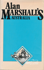
Book, Hyland House, Alan Marshall's Australia, 1981
One of a collection of books by local writer Alan Marshall held at EDHS. This one is of "anecdotes and yarns" as described by Marshall before its publication in July 1981 in the Canberra Times. Alan Marshall's Australia, the Australia of "I Can Jump Puddles" has vanished. No longer do we have time to sit on the sliprail and exchange yarns, to drive buggies down long, quiet dusty roads, or to watch the king-hit merchant operating in some small hotel. Even the Cu-nims hold no terrors for a Boeing 427! And yet - Alan Marshall's Australia lives for all those who read this book. Meet Lance Skuthorpe who tethered an old bull in Bourke Street and offered £5 to anyone who could ride it for half a minute and Binjarrpooma, the Arnhem Land terror. Accompany Alan in his horse-drawn caravan or buggy to country sales, pubs and stations and listen with him to great bush eccentrics, lairs and yarn spinners. Go further back and remember Conversation Lollies, the cigarette cards you collected and the school yard games. Can you recall how to test an axe blade, choose a pocket knife, or the penetrating power of Goanna Oil? But this book is more than a nostalgic journey into the past ; it is history for the young and a timely reminder for us all - it is our roots. - Front end papers viii, 165 p. : ill. ; Two copiesISBN 0908090390alan marshall, prose, short stories, ancedotes, australia, tales, yarms -
 Eltham District Historical Society Inc
Ledger, Contract Register; Country Roads Board, Shire of Eltham, 1933
... columns Contract Register; Country Roads Board, Shire of Eltham ...Ledger describing name and address of contractor, description and locality, particulars, schedule of tender (description incl quantities and price) and payments - hand written. Ledger maintained for period 1933-1964 and contains 97 entries.Hard cover bound ledger with leather corners and spine and pre-printed columns -
 Eltham District Historical Society Inc
Magazine, Sun News-Pictorial, Bush Fires: A pictorial survey of Victoria's most tragic week, January 8-15, 1939, 1939
THE WEEK REVIEWED (Article; Bush Fires: A pictorial survey of Victoria's most tragic week, January 8-15, 1939. Published in aid of the Bush Fire Relief Fund by the Sun News-Pictorial in co-operation with its newsagents, pp2-3) THE fiercest bush fires Australia has known since its discovery are quiescent at the moment, and Victoria, in the comparative coolness of the change which came with rain on Sunday night, has begun·to count its losses. In the fiery eight days, from Sunday to Sunday, at least sixty-six men, women and children have lost their lives in forest fires, or have succumbed to burns and shock; many others have died from heat; and several serious cases of burns are being treated in hospitals. Two babies in Narrandera district have died, and ten others are in hospital, because of milk soured by the record temperatures of those eight days. Forest damage totals at least a million pounds, and incalculable damage has been done to the seedlings which were to have been the forests of the future. Water conservation will be seriously affected by the silting-up of reservoirs and streams from which protective timber has been taken by the all-engulfing flames. More than a thousand houses have been destroyed, and these, with 40 mills, and schools, post-offices, churches, and other buildings, represent a loss of at least half a million. At least 1500 are homeless. For their aid, money raised in appeals has now passed the £50,000 mark, and the biggest relief organisation ever set up in peace time has swung into operation. The First Hint Victoria's first hint of what was to come appeared on Sunday, January 8, when most parts of the State awoke to find a blistering day awaiting. At 12.20 p.m., when the thermometer reached its highest for the day, 109.6 degrees, the first fire victims were at that moment going to their death on a bush track five feet wide off the main road to Narbethong. They were the forestry officers Charles Isaac Demby and John Hartley Barling, who went to warn Demby of his danger when he parted from his companions, and was himself surrounded by the treacherous fire. It was not until 8 o'clock next morning that the tragic news was flashed throughout the State. Searchers found the two charred bodies close together, one seeking protection in the nook of two logs. Barling's watch had stopped at 1.20. In the meantime, tragedy was spreading its cloak. By Monday, big fires were raging at Toolangi, Erica, Yallourn, Monbulk, Frankston, Dromana, Drouin South, Glenburn, and Blackwood, with smaller outbreaks at many other centres. In the ensuing week, while women and children were evacuated as fast as the flames would permit, Erica-scene of the 1926 fire disaster-thrice escaped doom by a change of wind. Indeed, those who have been in the fire country these past days say that the numbers of times a change of wind has saved towns from destruction is amazing. In the towns they speak of miracles. Monday's Miracles The escapes from Monett's Mill at Erica and from the Hardwood Company's Mill at Murrindindi, near where Demby and Barling went to their death, were Monday's miracles. Twenty came out alive from each mill. At the first a 60ft. dugout provided an oven-like refuge; at the second, 12 women and children survived in the smoke-filled gloom of a three-roomed cottage while their eight men, their clothes sometimes afire, poured water on the wooden walls. Three houses out of ten remained when the fire had passed. Record Temperatures Sunday had been the hottest Melbourne day for 33 years; Monday dropped to a 76.1 degree maximum; but Tuesday dawned hotter than ever, the mercury reaching 112.5. By now rumor was racing ahead of fact; whole towns were being reported lost; the alarm was raised for scores of missing persons. But fact soon overtook rumor, and within a few days the staggering toll began to mount to a figure beyond the wildest imaginings of the panic-stricken. Six died from heat on this torrid Tuesday, and the fires spread in a wide swathe from south-west to north-east across the State. Fish died in shallow streams. A curtain of smoke hid the sky from all Victoria, and hung far out to sea. It alarmed passengers on ships. On the Ormonde, on the voyage to Sydney from Burnie, women ran on deck, believing fire had broken out in the hold. Days later the smoke reached New Zealand. In Melbourne thousands of fire-volunteers were leaving in cars: vans, motor-buses-anything reliable on wheels-to aid the country in its grim fight. In the fires at Rubicon and. Narbethong, seventeen were facing death this day. But not till Wednesday, when Melbourne breathed again in a cool change, while the country still sweltered in temperatures up to 117 degrees, did the news come through the tree blocked roads. A woman and her little daughter, trapped on the road, were among those who died. Their bodies, and those of menfolk with them, were found strewn out at intervals along the road, where the furnace of the surrounding fire had dropped them in their tracks as they ran. Twelve died at a Rubicon mill, five on the road at Narbethong. At Alexandra, not far distant, a baby was born while the fires raged, and stretcher-bearers brought in the injured. On Thursday the State Government voted £5000 for the relief of fire victims. The Governor (Lord Huntingfield) and the Lord Mayor (Cr. Coles) visited some of the stricken areas, and dipped into their pockets personally. Later, the City Council, too, voted £5000. Friday, The 13th Friday, the Thirteenth, justified its evil name. A blistering northerly came early in the morning, presaging destruction, and forcing the mercury to a new record of 114 degrees. Racing fires killed at least ten in those terrible 12 hours. Four children were engulfed in the furnace at Colac. Panic drove them, uncontrollable, into the smoke-filled road when the fire raced down behind their home. They choked to death. In other parts fires were joining to make fronts of scores of miles. Kinglake was being menaced on two fronts, £60,000 worth of timber was going up in smoke in Ballarat district. Warburton was surrounded. Residents at Lorne, favoured resort, were being driven to the sea-front by a fire which destroyed at least 20 homes. Healewille. with flames visible from the town at one stage, was in a trough between two fires which burned four guest-houses, seven homes and left its surrounding beauty-spots wastes of bowed-over, blackened tree-fern fronds; with its famous Sanctuary, however, intact. Most of Omeo was destroyed this black day: Noojee. while 200 residents crouched in the river, was being reduced to a waste of buckled iron and smoking timber; Erica was once again saved by a change of wind. Beneath a pall of smoke, the Rubicon victims were buried at Alexandra. Friday night and the early hours of Saturday saw the streets of beleagured towns strewn with exhausted fire-fighters. Their flails beside them, ready for the next call, they lay where exhaustion overtook them-on footpaths, beside lamp-posts, in gutters, in cars, under trucks. Saturday's dawn brought clear skies and lower temperatures in many parts, and from the burnt-out areas came a great rush of tragic reports. The death-roll rushed past the fifty mark with incredible speed. Some had been trapped on roads, others at mills; some, after burying their treasures, had clung too long to the places they had made their homes for many years. Four men lost their lives because one went back for his dog. By Sunday, when the first of the saving rain came, nearly another score of names had been added to the list.Newspaper magazine, 48 pages (incl. covers). Fully digitised and searchable PDFPublished in aid of the Bush Fire Relief Fund by the Sun News-Pictorial in co-operation with its newsagents.bushfires, 1939 bushfires, black friday, warrandyte -
 Warrnambool and District Historical Society Inc.
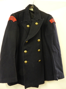
Clothing, Warrnambool Urban Fire Brigade, Mid 20th century
This jacket was part of the working uniform of the Warrnambool Urban Fire Brigade in the mid 20th century. It belonged to John (Jack) Sizeland, a member of the Fire Brigade for over 37 years. He retired in 1977. Prompted by a fire at the Flying Buck Hotel in Liebig Street the Warrnambool Fire Brigade was established in the mid 1860s. It has been successful in Victorian Fire Brigade Championships over the years, especially in the 19th century. It is currently situated in Mortlake Road. This jacket is of interest as an example of the clothing worn by firefighters in Victoria in the mid 20th century. It is also of interest because it was worn by Jack Sizeland, a local firefighter for over 37 years. This is a black double-breasted cloth jacket with six brass buttons down the front and two brass buttons on the lapels. The buttons are impressed with a shield and the words ‘Country Fire Authority Victoria’. There are two brass clips on the side to hold a belt. There are two black and red cloth attachments at the top of each sleeve (‘Warrnambool Urban Fire Brigade’). There is some black cloth lining inside the garment across the shoulders. The maker’s label, ‘David Lack Pty Ltd, Melbourne’ is on the inside collar. ‘David Lack Pty Ltd Melbourne’ ‘Warrnambool Urban Fire Brigade’ warrnambool fire brigade, jack sizeland, history of warrnambool -
 Warrnambool and District Historical Society Inc.
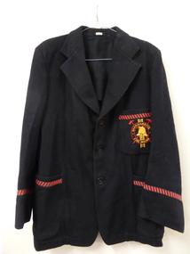
Clothing, Jacket Warrnambool Fire Brigade, Mid 20th century Place Made
This blazer was worn by a Warrnambool Fire Brigade member (Jack Sizeland). It was part of the dress uniform for fire brigade members in the 1960s and 70s. The Warrnambool Fire Brigade was established in the early 1860s after a fire at the Flying Buck Hotel in Liebig Street prompted a public meeting to establish a permanent fire authority in the town. There had been a couple of attempts previously to set up a local fire brigade. The Warrnambool Fire Brigade actively participates in Country Fire Authority Championships and competitions and has been very successful, particularly in the 19th century. John (Jack) Sizeland retired when he was 65 in 1977 (37 years of service).This blazer is of interest as it shows us what fire fighters in Warrnambool were wearing in the mid 20th century (dress uniform). It is also a memento of one long-serving firefighter, Jack SizelandThis is a man’s black blazer with three large black buttons. The sleeve ends and the three pockets have a diagonal red and black patterned braid stitched on. The upper portion of the blazer and the sleeves are lined with black material. The top pocket has the badge of the Warrnambool Fire Brigade in red and yellow stitched on. The badge features a Fire Brigade helmet, a ladder and two axes set in two concentric circles. A printed label with the owner’s name (Sizeland) is stitched inside the collar areaName ‘Sizeland’ stitched inside collar areawarrnambool fire brigade, country fire authority, john sizeland, history of warrnambool -
 Warrnambool and District Historical Society Inc.
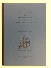
Booklet, Anglo-Irish Colonists in Australia, 1970s
This is a certificate issued by the Victorian Country Fire Authority to John Sizeland, a member of the Warrnambool Urban Fire Brigade. The date is 13th April 1977 and the certificate marked John (Jack) Sizeland’s retirement from the Warrnambool Fire Brigade after more than 37 years’ service (the certificate is exact – 37 and five-twelfths years). In our collection we have Jack Sizeland’s Fire Brigade uniform and accessories. This certificate is of interest because it documents the years of service of a Warrnambool identity, John Sizeland. This is a 1977 certificate issued by the Country Fire Authority to John Sizeland. It is a white sheet with a blue tinge around the edges. It has the emblem of the Country Fire Authority, the name of the Authority in a cream, yellow and black ornate setting and printing in black and yellow. There are three signatures (blue ink) on the certificate. Three signatures – P. Ea….., C. Howe, J. Allen warrnambool urban fire brigade, john sizeland, history of warrnambool -
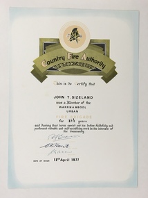 Warrnambool and District Historical Society Inc.
Certificate, Country Fire Authority J T Sizeland, 1977
This is a certificate awarded to John Sizeland of Banyan Street Warrnambool s membership of the Warrnambool Urban Fire Brigade. Mr. Sizeland joined the C.F.A. in 1945 and retired at the compulsory age of 65 in 1977 after over 37 years membership.. The Warrnambool Fire Brigade was established in 1863.This certificate is of interest as it records the work of a prominent fireman in Warrnambool in the 20th century.A sheet of white card featuring a black printing, photocopied hand signatures and a title in an ornamental scroll, a title and a logo of the Country Fire Authority.Country Fire Authority John T. Sizeland john t sizeland -
 Warrnambool and District Historical Society Inc.
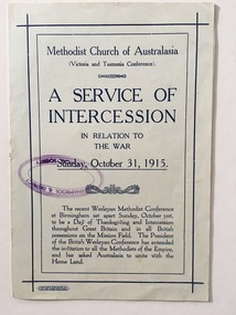
Document, A Service of Intercession, 1915
This is a programme for a Service of Intercession in Relation to the War. It was held by the Methodist Church (Victoria and Tasmania Conference) in October 1915. The Wesleyan Methodist Conference at Birmingham, England requested that Sunday October 31st 1915 be set aside as a Day of Thanksgiving and Intercession throughout Britain and all other countries in the British Empire. The service was held to seek Divine intercession and aid for those on active military service in World War One and for the families of these men and women. This programme is of interest as the 1915 service would have been held in Methodist Churches throughout Victoria and Tasmania and this would have included the Warrnambool Methodist Church. World War One was a highly significant event in the history of Australia and Warrnambool, along with all other places in Australia, was affected deeply by the war with many young local people enlisting and many dying on active service.These are two sheets of paper folded in two to make eight pages. The pages contain a programme for the Methodist Church service in October 1915. The printing is in blue on a whitish/bluish background. The front cover is edged with blue lines. There is a blue stamp of the Warrnambool & District Historical Society on the front cover. The programme has been stapled but the staples have been removed. methodist church, world war one -
 Warrnambool RSL Sub Branch
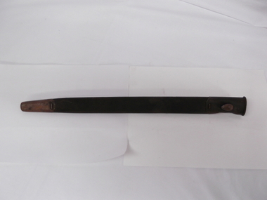
WW1 Bayonet Scabbard, around 1910
This scabbard was used to carry a 1907 pattern British bayonet which was used by all Commonwealth Countries during WW1 and WW2The scabbard is made of leather and has a metal top section and a metal end sectionbritish ww1 bayonet scabbard -
 Warrnambool RSL Sub Branch
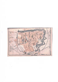
BOB: Map - 1:13,000, YPRES, Yperen, p.40, 'Baedeker's Belgium and Holland',1905,14th Edition (English), Leipzig: Karl Baedeker, Publisher, 1905
Bob Snape always included in his kit a few second hand Baedeker's guide books, as well as the 'Belgium and Holland' volume. Bob was a keen observer and commentator and used these guide books as any interested tourist. Bob's letters home often made reference to the history, culture and architecture of the countries he visited in the course of the war. Bob's English born father had lived and worked in France from 1878 to 1880 before his emigration to Australia.Two tone map in orange, grey and black. snape collection -
 Warrnambool RSL Sub Branch
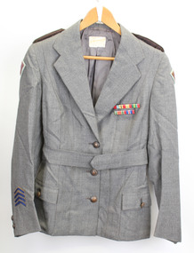
Service Jacket; Army Nurses Uniform, Early 1940's
This uniform was worn by Sister Winifred Ride during World War 2.. Nurses played a key role in the conflict through their care and compassion to the servicemen who were wounded and sick.The nurses uniform is symbolic of the sacrifice and service of the many women who served their country in WW2. Grey fitted, lined jacket with long sleeves, collar and lapels. Three front metal buttons buttons and two smaller buttons on each sleeve. Dark green epaulette with four metal buttons on each shoulder (Right side is faded). Two hip pockets with one button fastener. One internal pocket with small grey button. Unit patches on each sleeve and four inverted service chevrons on right sleeve at wrist. Two ribbon bars containing 5 Campaign Ribbons on left side of front, attached with standard 'brooch' fitting . Belt (same material as jacket) passes through two loops on back of jacket and is fastened by two buttons, hidden when belt is fastened. Metal buttons stamped with map of Australia with crown above and the words Australian Military Forces around. Makers label inside back below collar: " /tailors and habit makers, J .RAVENSDALE & SON Nicholas Bldg Swanston Street Melbourne". Name of owner handwritten "Sister Ride:" -
 Warrnambool RSL Sub Branch
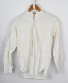
Shirt; Army Nurses Uniform, 1940-1942
This shirt is part of the uniform worn by Sister Winifred Ride during World War 2. Nurses played a key role in the conflict through their care and compassion to the servicemen who were wounded and sick.The nurses uniform is symbolic of the sacrifice and service of the many women who served their country in WW2. Cream Cotton Shirt, long sleeves and separate collar. Front fastening with five bakelite buttons. Cuff of each sleeve fastened with one bakelite button. Button hole on back of neck to attach collar.Makers mark on back neck "1180 1943 Made in Australia. -
 Warrnambool RSL Sub Branch
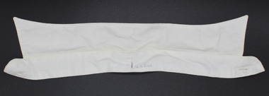
Shirt collar; Army Nurses Uniform, 1940-1942
This Collar is part of the uniform worn by Sister Winifred Ride during World War 2. Nurses played a key role in the conflict through their care and compassion to the servicemen who were wounded and sick.The nurses uniform is symbolic of the sacrifice and service of the many women who served their country in WW2. Cream Cotton Shirt Collar with buttonhole to attach the collar to shirt with stud. One button hole on each end of collar band for shirt stud fastenerSize "131/2" printed on neck band underside. Name of owner "W.M. RIDE" printed on top side of neck band. -
 Warrnambool RSL Sub Branch
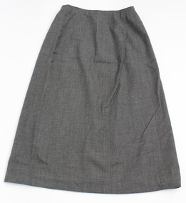
Skirt; Army Nurses Uniform, 1940-1942
This Skirt is part of the uniform worn by Sister Winifred Ride during World War 2. Nurses played a key role in the conflict through their care and compassion to the servicemen who were wounded and sick.The nurses uniform is symbolic of the sacrifice and service of the many women who served their country in WW2. Grey A line skirt, bak fastening. Five press stud fasteners and two hook and eye fasteners. One fabric hook on each side for hanging. -
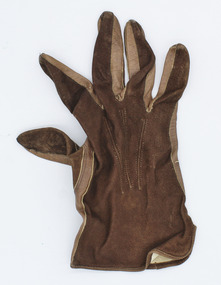 Warrnambool RSL Sub Branch
Glove; Army Nurses Uniform, 1940-1942
This glove is one of a pair and is part of the uniform worn by Sister Winifred Ride during World War 2. Nurses played a key role in the conflict through their care and compassion to the servicemen who were wounded and sick.The nurses uniform is symbolic of the sacrifice and service of the many women who served their country in WW2. Brown leather and suede glove. One of a pair, leather palm with suede top.inside mark "Size 7" -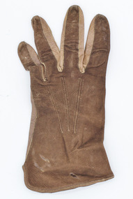
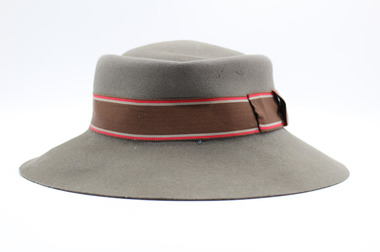 Warrnambool RSL Sub Branch
Hat; Army Nurses Uniform, 1940-1942
This hat is part of the uniform worn by Sister Winifred Ride during World War 2. Nurses played a key role in the conflict through their care and compassion to the servicemen who were wounded and sick.The nurses uniform is symbolic of the sacrifice and service of the many women who served their country in WW2. Grey felt hat with 60mm brim. Brown hat band 30mm wide with narrow stripes top and bottom. Narrow stripes red and grey at top of band, grey and red at bottom of band.Inner hat band marked with "N231, 6 7/8, 1942" -
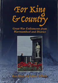 Warrnambool RSL Sub Branch
Book. WW1. Local Enlistments, For King & Country. Great War Enlistments from Warrnambool and District, 2016
Paperback. Coloured/Illustrated Front CoverAuthors, Ron Blair and James Affleck Published by James Affleck First Published 2004 Second Edition February 2016 Complimentary copy from WDHS 22nd April 2016 -
 Warrnambool and District Historical Society Inc.
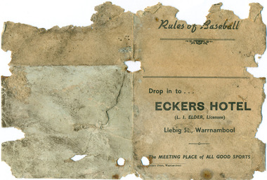
Work on paper - Leaflet, Rules of Baseball, Circa 1940
The Warrnambool Baseball Club was formed around 1932 initially and reformed in the late 1940’s. They played in a regional competition with other country teams in the district.Eckers Hotel was a Liebig Street landmark from the 1870s until 1960s. It had numerous licensees in that time and the licensee at the time of this advertisement, L. I. Elder, was licensee in1944 and again in 1946. Four page leaflet in cream card with black text. Title Rules of Baseball on top of front cover with advertisement for Eckers Hotel underneath. The inside pages contain a diagram of baseball field with the remainder of the two pages listing the rules. Back page is blankAdvertisement: Drop in to ... Eckers Hotel, L I Elder, Licensee, Liebig St, Warrnambool; The meeting place of all good sportsbaseball, warrnambool, hotels, eckers hotel, elder l i, liebig street, hotel licensees, baseball, warrnambool, hotels, eckers hotel, elder l i, liebig street, hotel licensees -
 Warrnambool and District Historical Society Inc.
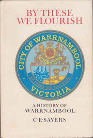
Book, C. E. Sayers, By These We Flourish A History of Warrnambool, 1969
History of Warrnambool to 1969This is a hard cover book with a sepia photograph on the cover and a cream-coloured dust cover with a colour image of the City of Warrnambool logo. Endpapers have a black and white 1840s sketch of a Plan of Township and Warrnambool Bay. There are 21 chapters and 16 pages of black and white photographs. There is a Foreword by Harold Stephenson, an introduction by the author, a Table of Contents, an Index, Appendices and lists of Warrnambool Councillors. non-fictionHistory of Warrnambool to 1969history of warrnambool book, ‘by these we flourish’, c e sayers, warrnambool -
 Warrnambool and District Historical Society Inc.
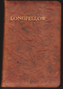
Book, Longfellow, Late 19th century
Henry Longfellow (1807-1882) was an American poet, the most popular one of his day. With poems such as ‘Paul Revere’s Ride’ he helped shape the American character. He was also popular in the British Empire countries and many people in places such as Warrnambool would have had a copy of his published works. The recipient of this volume, Albert Henry Lawson, was the son of Thomas and Susan Lawson, shopkeepers in Warrnambool in the 1870s and 80s. Albert Lawson became a pupil teacher in Cobden in 1903 and from 1904 to 1907 it appears that he was an assistant teacher at his brother’s school, Warrnambool College. This was a private school established by Richard Lawson and William Oakley in 1900. Albert Lawson was given the copy of Longfellow’s poems when he left Warrnambool College in 1907. He then embarked on a teaching career with the Victorian Education Department, married Susan Oakley, the daughter of William Oakley, and died in Melbourne in 1972.This beautiful book of Longfellow poems is worth keeping as an example of an antiquarian book. But it is most significant because of its inscription, telling us of its association with both the Lawson and Oakley Warrnambool College and Albert Lawson, a member of the Lawson family which had many members important in Warrnambool’s history. The inscription tells us that Albert Lawson worked as a teacher for some years at his brother’s school, a fact that was not fully documented until the acquisition of this book. This is a leather bound book of 698 pages. The cover is mottled brown in a raised pattern and the pages are edged with a red-gold tinge. The insides of the cover are edged with a red and gold border and have a blue, brown and cream mottled pattern. There is a sketch of Longfellow in the front with a tissue page covering the sketch. The pages of the book are of fine paper typical of a late Victorian publication. The book has a thin blue ribbon page marker which has become detached from the book. The book is edited by William Michael Rossetti.Front Cover: ‘Longfellow’ Spine: ‘Longfellow’ Inside on a blank page: ‘To Mr A.H. Lawson from his pupils at the W’bool College, with best wishes for his future welfare, April 15th 1907’. warrnambool college (lawson & oakley), albert lawson -
 Warrnambool and District Historical Society Inc.
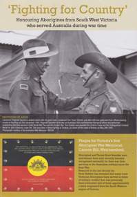
Booklet, 'Fighting for Country' Honouring Aborigines from South West Victoria who served Australia during war time, February 2014
This booklet was collated and printed for the 2014 Lake Bolac Eel Festival, ‘Return to Country’. The author, Peter Bakker, has spent several years researching the part played by south western Victorian aborigines and this booklet details the results of this research. Several of the soldiers came from the Warrnambool area.This is a booklet of ten pages with printed material and black and white and colour photographs and a map.Front Cover: ‘Fighting For Country – Honouring Aborigines from South West Victoria who served Australia during War Time’ (plus other printed material) Back Cover: Map and List of Service Men and Women of Aboriginal Descent with connections to South West Victoria aborigines from south west victoria, return to country, lake bolac eel festival, peter bakker, world war one, world war two, korean war, vietnam war -
 Eltham District Historical Society Inc
Negative - Photograph, The Bridge, Hurstbridge, Vic, c.1925
Copied from brochure "Wattle Valley Estate" 7 minutes from the bridge. The new bridge designed by Sir John Monash over the Diamond Creek near Hurst's home of 'Mia Mia' at Hurstbridge. The Wattle Valley Estate was first advertised in August 1925 as weekend building allotments by the Greater Melbourne Land and Development Company. Advertised from £28.10.0 or £60 per block. In August 1926, 30 picked allotments of 60x150 feet were put up for auction Saturday August 14, 1926 with frontages to Valley View Road and Fawkner Crescent advertised in the “Heart of the Glorious Wattle Country” and “Within 15 Minutes of the Newly Electrified Railway Station”. The Advertiser on August 13, 1926 in an article promoting the auction stated “the estate is regarded as one of the best in the district, and will be sold practically without reserve.” It is noted that an advertisement running in The Argus February 22, 1951 offered the remaining 16 blocks for sale at £12.10.0 or £200 the lot. By March 7, the remaining blocks were advertised at £17.10.0 The Wattle Valley Estate took over 20 years to sell and then people could not build on them This image was also used in a brochure advertising the "Wattle Valley Estate", which forms part of the Shire of Eltham Pioneers Photograph Collection (Cross Reference Photo No.(s): 1056, 1057)This photo forms part of a collection of photographs gathered by the Shire of Eltham for their centenary project book,"Pioneers and Painters: 100 years of the Shire of Eltham" by Alan Marshall (1971). The collection of over 500 images is held in partnership between Eltham District Historical Society and Yarra Plenty Regional Library (Eltham Library) and is now formally known as the 'The Shire of Eltham Pioneers Photograph Collection.' It is significant in being the first community sourced collection representing the places and people of the Shire's first one hundred years.Digital image 4 x 5 inch B&W Negshire of eltham pioneers photograph collection, hurstbridge, bridge, diamond creek (creek), monash bridge, wattle valley estate -
 Eltham District Historical Society Inc
Negative - Photograph, Rose Stereograph Company, The Bridge, Hurstbridge, Vic, c.1925
Copied from brochure "Wattle Valley Estate". The new bridge designed by Sir John Monash over the Diamond Creek near Hurst's original home "Mia Mia" seen in the distance. Reprinted from brochure advertising "Wattle Valley Estate" 7 minutes from bridge. The Wattle Valley Estate was first advertised in August 1925 as weekend building allotments by the Greater Melbourne Land and Development Company. Advertised from £28.10.0 or £60 per block. In August 1926, 30 picked allotments of 60x150 feet were put up for auction Saturday August 14, 1926 with frontages to Valley View Road and Fawkner Crescent advertised in the “Heart of the Glorious Wattle Country” and “Within 15 Minutes of the Newly Electrified Railway Station”. The Advertiser on August 13, 1926 in an article promoting the auction stated “the estate is regarded as one of the best in the district, and will be sold practically without reserve.” It is noted that an advertisement running in The Argus February 22, 1951 offered the remaining 16 blocks for sale at £12.10.0 or £200 the lot. By March 7, the remaining blocks were advertised at £17.10.0 The Wattle Valley Estate took over 20 years to sell and then people could not build on them This image was also used in a brochure advertising the "Wattle Valley Estate", which forms part of the Shire of Eltham Pioneers Photograph Collection (Cross Reference Photo No.(s): 1056, 1057). Also cross reference SEPP_1028 / 29 for other views of Mia Mia. Part of a slide show presentation "Bridges & Waterways of the Shire" by Russell Yeoman to the 13 September 1989 Society meeting. The presentation included slides of historic photos from the Shire of Eltham Pioneers collections as well as several recent views. This photo forms part of a collection of photographs gathered by the Shire of Eltham for their centenary project book,"Pioneers and Painters: 100 years of the Shire of Eltham" by Alan Marshall (1971). The collection of over 500 images is held in partnership between Eltham District Historical Society and Yarra Plenty Regional Library (Eltham Library) and is now formally known as the 'The Shire of Eltham Pioneers Photograph Collection.' It is significant in being the first community sourced collection representing the places and people of the Shire's first one hundred years.Digital image 4 x 5 inch B&W Negshire of eltham pioneers photograph collection, hurstbridge, mia mia, bridge, diamond creek (creek), monash bridge, wattle valley estate -
 Eltham District Historical Society Inc
Negative - Photograph, Popular Picnicing at Hurstbridge, c.1925
Picnickers enjoying a Sunday outing near the Wattle Valley Estate at Hurstbridge. Copied from brochure "Wattle Valley Estate". It is believed the picture is taken at the northwest corner of the intersection of Wattletree Road and Hurstbridge-Arthurs Creek Road looking southeast towards the township (most likely where the house is located on the property of what is today No. 2 Wattletree Road)- https://goo.gl/maps/VDorwCe1rJJUapjE6 According to a comment by Jean Verso (via @nillumbikcouncil FB page 3 Jan 2020) - "This view is from Wattle Tree Road with Haleys Gully Road to the right and across the creek to William Gray's nursery at Allwood. The building to the far left looks like Dorset House. The building on the left in the middle distance is still there today and has been used for storage and as a stable/tack room for a number of years." The Wattle Valley Estate was first advertised in August 1925 as weekend building allotments by the Greater Melbourne Land and Development Company. Advertised from £28.10.0 or £60 per block. In August 1926, 30 picked allotments of 60x150 feet were put up for auction Saturday August 14, 1926 with frontages to Valley View Road and Fawkner Crescent advertised in the “Heart of the Glorious Wattle Country” and “Within 15 Minutes of the Newly Electrified Railway Station”. The Advertiser on August 13, 1926 in an article promoting the auction stated “the estate is regarded as one of the best in the district, and will be sold practically without reserve.” It is noted that an advertisement running in The Argus February 22, 1951 offered the remaining 16 blocks for sale at £12.10.0 or £200 the lot. By March 7, the remaining blocks were advertised at £17.10.0 The Wattle Valley Estate took over 20 years to sell and then people could not build on them Cross Ref EDHS_02665 Rose Series Postcard P. 4341, "View at Hurstbridge, Vic." Also, other images from sales brochure SEPP_1055 / 1056This photo forms part of a collection of photographs gathered by the Shire of Eltham for their centenary project book,"Pioneers and Painters: 100 years of the Shire of Eltham" by Alan Marshall (1971). The collection of over 500 images is held in partnership between Eltham District Historical Society and Yarra Plenty Regional Library (Eltham Library) and is now formally known as the 'The Shire of Eltham Pioneers Photograph Collection.' It is significant in being the first community sourced collection representing the places and people of the Shire's first one hundred years.Digital image 4 x 5 inch B&W Neg1925, dorset house, fawkner crescent, haleys gully road, hurstbridge, hurstbridge-arthurs creek road, picnic, postcards, shire of eltham pioneers photograph collection, valley view road, wattle valley estate, wattletree road, exhibition yprl 2019-12 -
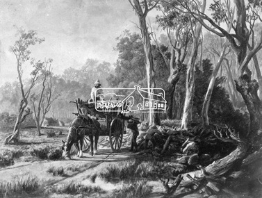 Eltham District Historical Society Inc
Photograph, Collection of wood
... collection other areas pioneer life country scene country roads ...Etching of country scene, a horse pulling a rudimentary cart with three men collecting wood and possibly stones from underneath trees on a rough track. Two huts are in the background. Early settlers often had to make use of what was available in their local environment to build their shelters. Today roadside collection of firewood is regulated by the State government. Unknown location, unknown artist and unknown date.This photo forms part of a collection of photographs gathered by the Shire of Eltham for their centenary project book," Pioneers and Painters: 100 years of the Shire of Eltham" by Alan Marshall (1971). The collection of over 500 images is held in partnership between Eltham District Historical Society and Yarra Plenty Regional Library (Eltham Library) and is now formally known as 'The Shire of Eltham Pioneers Photograph Collection.' It is significant in being the first community sourced collection representing the places and people of the Shire's first one hundred years.Digital imagesepp, shire of eltham pioneers photograph collection, other areas, pioneer life, country scene, country roads -
 Eltham District Historical Society Inc
Photograph, Hume and Hovell passed here at Seymour 28 Oct 1824, Spring Excursion, Hume and Hovell's 1824 expedition (Part 2), 26 October 1997, 26/10/1997
[article by Diana Bassett-Smith in EDHS Newsletter No. 117, November 1997:] MONUMENT HUNTING THE HUME AND HOVELL WAY - Sunday October 26 1997 dawned bright and very warm. Some twenty-five members, complete with picnic baskets, met outside the Eltham Library awaiting the Cobb and Co. large coach which would be taking us on the second leg of our travels along the route of the early explorers Hume and Hovell. Stephen West was our very good driver for the day. He would be guided around the circuitous route by Russell Yeoman who had made a detailed study, not only of the intended route, but of the story of these two explorers. During the trip Russell regaled us with poetry, quotations from the Journals and the History of the Shire of Seymour, "The New Crossing Place" by Martindale, 1982, (now Mitchell Shire due to the recent amalgamations). We headed towards the Hume Highway via Greensborough and Cooper Street and proceeded north to our first stop, noting on the way Monument Hill in the distance which is near Kilmore and, according to Russell, well worth the effort to visit as the view across the valley is magnificent. Past Sunday Creek Valley, Mt Piper and Mt Disappointment, all traversed and noted and named by them. We passed through Tallarook, then onto Seymour where we took photos of the monument telling us that Hume and Hovell had passed through on the 28th of October 1824. We also deviated down Hume and Hovell Road viewing deer and emu farming and the Bellbourie property now a sanctuary. Leaving Seymour behind we travelled up the Avenel Road to the Avenel monument, pyramidal in design of four reducing square blocks with a sharply pointed peak, erected in 1924 in memory of the 1824 exploration. The day was warming up and the countryside showing the dryness of the current drought. A parallel note had been made in their journal too of 1824 of the drought appearance of the country they were traversing. At Seven Creeks, Euroa we stopped for some minutes to check the monument placed 20th November 1924 to commemorate their passage on the 29th December 1824. More photos. Russell had pointed out the abrupt termination of the distant ranges which is noted in their journal. The next monument is beside the road at the entrance to Honey Suckle Creek Caravan Park, Violet Town. The squarish shaped monument some eight feet high is topped with a simple steel cross, and was to mark the date of 28th December 1824 and built for the 20th November 1924. By now it was 12.20 and nearly lunchtime as we drove along the Warranbayne Road to Roach's Road, monument hunting without success. Though there is a large, what appears to be an old timber sign which was hard to read, maybe this was the lost monument. In many of the paddocks hay had been cut and baled or was being cut, what a contrast to the rugged country they had passed through which was smoky from the fires of the natives burning off. By 1.00 pm we were at Benalla and pulled up beside the park where abundant beds of roses filled the air with their scent and the smell of barbecued food twitched the nostrils whilst the cheerful sounds of other picnickers could be heard throughout the park. We left the bus and collected up our picnics, dispersed to the various tables and enjoyed the shade from the various European trees. 2.00 pm and we were on the road again driving along the Benalla, Mansfield, Yea road. The Swanpool monument states that they passed four miles south and returned three miles north. Then we stopped at the Barjarg monument which notes that they camped near this spot. It is again a pyramidal monument and this time topped with a steel arrow indicating their route of the 29th November 1824. Half an hour later we came to another monument, again with a steel arrow marker on top and the plaque dated the 2nd of 12th 1824. Erected on the 12th of 12th 1924. "They blazed the way that we might inherit the land." Another square based and needle topped monument appeared at Yarck near Yea and this plaque records the date of 3 December 1824. Near McGuigans Road Russell related that the expedition had lost a dog but it had found them next day, the dog was apparently torn by a kangaroo. A short while later Russell reminded us here of the problems they encountered in crossing the Goulburn River near Molesworth where banks were high, water deep and wide. "Good coat of grass but quite dry due to drought". At Yea we stopped for afternoon tea and raided the last of our picnics and looked at the monument to their journey of 1824, situated at a corner of the gardens near the bowling green. No photo – we were out of film. We returned home via Kinglake West and Whittlesea past the Yan Yean Reservoir, not full. 5.00 pm back at Eltham we emptied out of the bus and everyone, including Joan Cole, collected their things, Joan also had the major souvenir of the day, a large carp she had picked up from the river bank, her cat was in for a great feast. The day was made so interesting by the informed commentary which Russell provided. His background knowledge of the route and nature of the journey could only have come from many hours of reading and driving the area. Thank you to Russell and to everyone who made the day so informative and pleasurable. Colour photographactivities, hume and hovell, monument, seymour -
 Eltham District Historical Society Inc
Photograph, Gaol at Seymour, Spring Excursion, Hume and Hovell's 1824 expedition (Part 2), 26 October 1997, 26/10/1997
[article by Diana Bassett-Smith in EDHS Newsletter No. 117, November 1997:] MONUMENT HUNTING THE HUME AND HOVELL WAY - Sunday October 26 1997 dawned bright and very warm. Some twenty-five members, complete with picnic baskets, met outside the Eltham Library awaiting the Cobb and Co. large coach which would be taking us on the second leg of our travels along the route of the early explorers Hume and Hovell. Stephen West was our very good driver for the day. He would be guided around the circuitous route by Russell Yeoman who had made a detailed study, not only of the intended route, but of the story of these two explorers. During the trip Russell regaled us with poetry, quotations from the Journals and the History of the Shire of Seymour, "The New Crossing Place" by Martindale, 1982, (now Mitchell Shire due to the recent amalgamations). We headed towards the Hume Highway via Greensborough and Cooper Street and proceeded north to our first stop, noting on the way Monument Hill in the distance which is near Kilmore and, according to Russell, well worth the effort to visit as the view across the valley is magnificent. Past Sunday Creek Valley, Mt Piper and Mt Disappointment, all traversed and noted and named by them. We passed through Tallarook, then onto Seymour where we took photos of the monument telling us that Hume and Hovell had passed through on the 28th of October 1824. We also deviated down Hume and Hovell Road viewing deer and emu farming and the Bellbourie property now a sanctuary. Leaving Seymour behind we travelled up the Avenel Road to the Avenel monument, pyramidal in design of four reducing square blocks with a sharply pointed peak, erected in 1924 in memory of the 1824 exploration. The day was warming up and the countryside showing the dryness of the current drought. A parallel note had been made in their journal too of 1824 of the drought appearance of the country they were traversing. At Seven Creeks, Euroa we stopped for some minutes to check the monument placed 20th November 1924 to commemorate their passage on the 29th December 1824. More photos. Russell had pointed out the abrupt termination of the distant ranges which is noted in their journal. The next monument is beside the road at the entrance to Honey Suckle Creek Caravan Park, Violet Town. The squarish shaped monument some eight feet high is topped with a simple steel cross, and was to mark the date of 28th December 1824 and built for the 20th November 1924. By now it was 12.20 and nearly lunchtime as we drove along the Warranbayne Road to Roach's Road, monument hunting without success. Though there is a large, what appears to be an old timber sign which was hard to read, maybe this was the lost monument. In many of the paddocks hay had been cut and baled or was being cut, what a contrast to the rugged country they had passed through which was smoky from the fires of the natives burning off. By 1.00 pm we were at Benalla and pulled up beside the park where abundant beds of roses filled the air with their scent and the smell of barbecued food twitched the nostrils whilst the cheerful sounds of other picnickers could be heard throughout the park. We left the bus and collected up our picnics, dispersed to the various tables and enjoyed the shade from the various European trees. 2.00 pm and we were on the road again driving along the Benalla, Mansfield, Yea road. The Swanpool monument states that they passed four miles south and returned three miles north. Then we stopped at the Barjarg monument which notes that they camped near this spot. It is again a pyramidal monument and this time topped with a steel arrow indicating their route of the 29th November 1824. Half an hour later we came to another monument, again with a steel arrow marker on top and the plaque dated the 2nd of 12th 1824. Erected on the 12th of 12th 1924. "They blazed the way that we might inherit the land." Another square based and needle topped monument appeared at Yarck near Yea and this plaque records the date of 3 December 1824. Near McGuigans Road Russell related that the expedition had lost a dog but it had found them next day, the dog was apparently torn by a kangaroo. A short while later Russell reminded us here of the problems they encountered in crossing the Goulburn River near Molesworth where banks were high, water deep and wide. "Good coat of grass but quite dry due to drought". At Yea we stopped for afternoon tea and raided the last of our picnics and looked at the monument to their journey of 1824, situated at a corner of the gardens near the bowling green. No photo – we were out of film. We returned home via Kinglake West and Whittlesea past the Yan Yean Reservoir, not full. 5.00 pm back at Eltham we emptied out of the bus and everyone, including Joan Cole, collected their things, Joan also had the major souvenir of the day, a large carp she had picked up from the river bank, her cat was in for a great feast. The day was made so interesting by the informed commentary which Russell provided. His background knowledge of the route and nature of the journey could only have come from many hours of reading and driving the area. Thank you to Russell and to everyone who made the day so informative and pleasurable. Colour photographactivities, hume and hovell, seymour, gaol -
 Eltham District Historical Society Inc
Photograph, Hume and Hovell Monument, Avenel, Spring Excursion, Hume and Hovell's 1824 expedition (Part 2), 26 October 1997, 26/10/1997
[article by Diana Bassett-Smith in EDHS Newsletter No. 117, November 1997:] MONUMENT HUNTING THE HUME AND HOVELL WAY - Sunday October 26 1997 dawned bright and very warm. Some twenty-five members, complete with picnic baskets, met outside the Eltham Library awaiting the Cobb and Co. large coach which would be taking us on the second leg of our travels along the route of the early explorers Hume and Hovell. Stephen West was our very good driver for the day. He would be guided around the circuitous route by Russell Yeoman who had made a detailed study, not only of the intended route, but of the story of these two explorers. During the trip Russell regaled us with poetry, quotations from the Journals and the History of the Shire of Seymour, "The New Crossing Place" by Martindale, 1982, (now Mitchell Shire due to the recent amalgamations). We headed towards the Hume Highway via Greensborough and Cooper Street and proceeded north to our first stop, noting on the way Monument Hill in the distance which is near Kilmore and, according to Russell, well worth the effort to visit as the view across the valley is magnificent. Past Sunday Creek Valley, Mt Piper and Mt Disappointment, all traversed and noted and named by them. We passed through Tallarook, then onto Seymour where we took photos of the monument telling us that Hume and Hovell had passed through on the 28th of October 1824. We also deviated down Hume and Hovell Road viewing deer and emu farming and the Bellbourie property now a sanctuary. Leaving Seymour behind we travelled up the Avenel Road to the Avenel monument, pyramidal in design of four reducing square blocks with a sharply pointed peak, erected in 1924 in memory of the 1824 exploration. The day was warming up and the countryside showing the dryness of the current drought. A parallel note had been made in their journal too of 1824 of the drought appearance of the country they were traversing. At Seven Creeks, Euroa we stopped for some minutes to check the monument placed 20th November 1924 to commemorate their passage on the 29th December 1824. More photos. Russell had pointed out the abrupt termination of the distant ranges which is noted in their journal. The next monument is beside the road at the entrance to Honey Suckle Creek Caravan Park, Violet Town. The squarish shaped monument some eight feet high is topped with a simple steel cross, and was to mark the date of 28th December 1824 and built for the 20th November 1924. By now it was 12.20 and nearly lunchtime as we drove along the Warranbayne Road to Roach's Road, monument hunting without success. Though there is a large, what appears to be an old timber sign which was hard to read, maybe this was the lost monument. In many of the paddocks hay had been cut and baled or was being cut, what a contrast to the rugged country they had passed through which was smoky from the fires of the natives burning off. By 1.00 pm we were at Benalla and pulled up beside the park where abundant beds of roses filled the air with their scent and the smell of barbecued food twitched the nostrils whilst the cheerful sounds of other picnickers could be heard throughout the park. We left the bus and collected up our picnics, dispersed to the various tables and enjoyed the shade from the various European trees. 2.00 pm and we were on the road again driving along the Benalla, Mansfield, Yea road. The Swanpool monument states that they passed four miles south and returned three miles north. Then we stopped at the Barjarg monument which notes that they camped near this spot. It is again a pyramidal monument and this time topped with a steel arrow indicating their route of the 29th November 1824. Half an hour later we came to another monument, again with a steel arrow marker on top and the plaque dated the 2nd of 12th 1824. Erected on the 12th of 12th 1924. "They blazed the way that we might inherit the land." Another square based and needle topped monument appeared at Yarck near Yea and this plaque records the date of 3 December 1824. Near McGuigans Road Russell related that the expedition had lost a dog but it had found them next day, the dog was apparently torn by a kangaroo. A short while later Russell reminded us here of the problems they encountered in crossing the Goulburn River near Molesworth where banks were high, water deep and wide. "Good coat of grass but quite dry due to drought". At Yea we stopped for afternoon tea and raided the last of our picnics and looked at the monument to their journey of 1824, situated at a corner of the gardens near the bowling green. No photo – we were out of film. We returned home via Kinglake West and Whittlesea past the Yan Yean Reservoir, not full. 5.00 pm back at Eltham we emptied out of the bus and everyone, including Joan Cole, collected their things, Joan also had the major souvenir of the day, a large carp she had picked up from the river bank, her cat was in for a great feast. The day was made so interesting by the informed commentary which Russell provided. His background knowledge of the route and nature of the journey could only have come from many hours of reading and driving the area. Thank you to Russell and to everyone who made the day so informative and pleasurable. Colour photographactivities, hume and hovell, avenel, monument -
 Eltham District Historical Society Inc
Photograph, Hume and Hovell Monument, Seven Creeks, Euroa (29.12.1824), Spring Excursion, Hume and Hovell's 1824 expedition (Part 2), 26 October 1997, 26/10/1997
[article by Diana Bassett-Smith in EDHS Newsletter No. 117, November 1997:] MONUMENT HUNTING THE HUME AND HOVELL WAY - Sunday October 26 1997 dawned bright and very warm. Some twenty-five members, complete with picnic baskets, met outside the Eltham Library awaiting the Cobb and Co. large coach which would be taking us on the second leg of our travels along the route of the early explorers Hume and Hovell. Stephen West was our very good driver for the day. He would be guided around the circuitous route by Russell Yeoman who had made a detailed study, not only of the intended route, but of the story of these two explorers. During the trip Russell regaled us with poetry, quotations from the Journals and the History of the Shire of Seymour, "The New Crossing Place" by Martindale, 1982, (now Mitchell Shire due to the recent amalgamations). We headed towards the Hume Highway via Greensborough and Cooper Street and proceeded north to our first stop, noting on the way Monument Hill in the distance which is near Kilmore and, according to Russell, well worth the effort to visit as the view across the valley is magnificent. Past Sunday Creek Valley, Mt Piper and Mt Disappointment, all traversed and noted and named by them. We passed through Tallarook, then onto Seymour where we took photos of the monument telling us that Hume and Hovell had passed through on the 28th of October 1824. We also deviated down Hume and Hovell Road viewing deer and emu farming and the Bellbourie property now a sanctuary. Leaving Seymour behind we travelled up the Avenel Road to the Avenel monument, pyramidal in design of four reducing square blocks with a sharply pointed peak, erected in 1924 in memory of the 1824 exploration. The day was warming up and the countryside showing the dryness of the current drought. A parallel note had been made in their journal too of 1824 of the drought appearance of the country they were traversing. At Seven Creeks, Euroa we stopped for some minutes to check the monument placed 20th November 1924 to commemorate their passage on the 29th December 1824. More photos. Russell had pointed out the abrupt termination of the distant ranges which is noted in their journal. The next monument is beside the road at the entrance to Honey Suckle Creek Caravan Park, Violet Town. The squarish shaped monument some eight feet high is topped with a simple steel cross, and was to mark the date of 28th December 1824 and built for the 20th November 1924. By now it was 12.20 and nearly lunchtime as we drove along the Warranbayne Road to Roach's Road, monument hunting without success. Though there is a large, what appears to be an old timber sign which was hard to read, maybe this was the lost monument. In many of the paddocks hay had been cut and baled or was being cut, what a contrast to the rugged country they had passed through which was smoky from the fires of the natives burning off. By 1.00 pm we were at Benalla and pulled up beside the park where abundant beds of roses filled the air with their scent and the smell of barbecued food twitched the nostrils whilst the cheerful sounds of other picnickers could be heard throughout the park. We left the bus and collected up our picnics, dispersed to the various tables and enjoyed the shade from the various European trees. 2.00 pm and we were on the road again driving along the Benalla, Mansfield, Yea road. The Swanpool monument states that they passed four miles south and returned three miles north. Then we stopped at the Barjarg monument which notes that they camped near this spot. It is again a pyramidal monument and this time topped with a steel arrow indicating their route of the 29th November 1824. Half an hour later we came to another monument, again with a steel arrow marker on top and the plaque dated the 2nd of 12th 1824. Erected on the 12th of 12th 1924. "They blazed the way that we might inherit the land." Another square based and needle topped monument appeared at Yarck near Yea and this plaque records the date of 3 December 1824. Near McGuigans Road Russell related that the expedition had lost a dog but it had found them next day, the dog was apparently torn by a kangaroo. A short while later Russell reminded us here of the problems they encountered in crossing the Goulburn River near Molesworth where banks were high, water deep and wide. "Good coat of grass but quite dry due to drought". At Yea we stopped for afternoon tea and raided the last of our picnics and looked at the monument to their journey of 1824, situated at a corner of the gardens near the bowling green. No photo – we were out of film. We returned home via Kinglake West and Whittlesea past the Yan Yean Reservoir, not full. 5.00 pm back at Eltham we emptied out of the bus and everyone, including Joan Cole, collected their things, Joan also had the major souvenir of the day, a large carp she had picked up from the river bank, her cat was in for a great feast. The day was made so interesting by the informed commentary which Russell provided. His background knowledge of the route and nature of the journey could only have come from many hours of reading and driving the area. Thank you to Russell and to everyone who made the day so informative and pleasurable. Colour photographactivities, hume and hovell, monument, euroa, seven creeks