Showing 11483 items matching "maps"
-
 Bendigo Historical Society Inc.
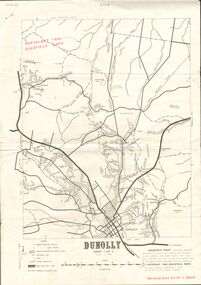
Document - JOAN O'SHEA COLLECTION: DUNNOLLY MAPS, 1980
Joan O'Shea Collection. Goldfield Maps Dunolly 3 Sheets 1980. Page 1: Mines in Dunolly, Whistling Flat, Painswick and Surrounds. Page 2: Mines in Goldsborough, McKinnons Gap, Bealiba Range, Stewarts Flat and Surrounds. Page 3: Mines in Dunolly, Emu Creek, Bet Bet, Bromley & Surrounds. Scale in Chains and Kilometres.GoldField Maps 1980 based on Dunolly 7624 by Division of National Mappinggold, goldfields, goldfield maps dunolly & surrounds -
 Clunes Museum
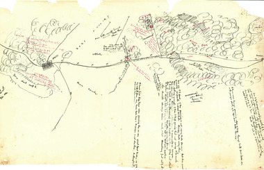
Document - SURVEYORS MAP, A.C. BROOKS GOVERNMENT PRINTER MELBOURNE, 1937
... maps ...NO.2 COPY OF NOTES TAKEN FROM DIARY 1865 THOUGHT TO BE WRITTEN BY JESSE HOARE SMITH WHO WAS A SURVEYOR AT CLUNES AT THE TIME. DIARY TURNED UP IN NORTH QUEENSLAND AND NOW IN POSSESSION OF A CRESWICK MAN.NO.1 SURVEYORS MAP TALBOT AND SURROUNDING TOWNS 1937. NO.2 DIARY NOTES 1865 THOUGHT TO BE WRITTEN BY JESSE HOARE SMITHlocal history, documents, maps, weickhardt, wattleworth -
Whitehorse Historical Society Inc.
Map, City of Nunawading map, 1970s (post 1974)
Catchment area of Blackburn East Primary School.Catchment area of Blackburn East Primary School marked in texta on map of the City of Nunawading. Scale: 1 km:6 kmCatchment area of Blackburn East Primary School. city of nunawading, blackburn east primary school no. 4800 -
 Beechworth Honey Archive
Hand-Drawn Map Centred on Ararat by Frank Lebbell Frost December 1916
This is one of the maps drawn by Frank L. Frost while he was beekeeping in North-East Victoria. This particular map may be reference in the "Wooden" Diary on page 11. Front Side: Hand-drawn map centred on Ararat, central Victoria. Details road and railway and vegetation with comments on flowering. Back Side: Comments in grey lead [ca 1923]hand drawn, hand-drawn, map, ararat, frost, beekeeper, beechworth honey -
 Bendigo Military Museum
Map - EASTER NEW GUINEA NAVIGATION CHART, RAAF, Aug 1943
From the collection of "Maxwell Lennox Matheson" No.418447 RAAF. Enlisted 22/5/1942 Aged 19. Discharged 19/2/1948 - Rank FLTLT.This map is in colour. It is made of a stiff paper and has a map printed on both sides. Side1 - scale 1:2,315,000. 31.72 Nautical miles = 1 inch. It shows Eastern half of New Guinea. It also shows New Britain and New Ireland. Manus Island is at the top. Side 2 - Scale 1:1,000,000 - this shows Manus Island on right side, top of New Guinea at bottom edge (Wewak) and some other little islands. The map on side 1 has numerous navigation tracks and calculations in pencil. i.e. LAE, KOKODA, PORT MORESBY.ww2, raaf, new guinea -
Federation University Historical Collection
Map, Creswick Gold Field Map, 1981
A fragment of the original 1880 map is also held in the collection. See 116Rectangular geological map with brown paper strip on top edge with 4 holes on top edge. Scale is 40 chains to one inch.Geologically and topographically surveyed by Ferdinand M Krause. Lithographed by R. Shepherd. Printed by J. Finnie. Mining Department, Melbourne. Preprinted with additional shaft and lead detail. F. D. Atkinson, Government Printer 1981creswick, krause, surveyor, smeaton, spring hill, tourello, ascot, dean, bullarook, gold fields, gold -
 Ballarat Tramway Museum
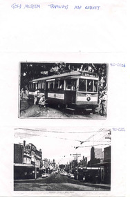
Document, Gold Museum, Royal visit tram 38, 1990's
Yields information about the photographic holdings of the Gold Museum, an din particular the preparation of No. 38 decorated for the Royal visit of 1954 and Bridge St Ballarat.Photocopy of two photographs from the Gold Museum Tramways Map Cabinet: 80-020b - No. 38 in Wendouree Parade, at depot junction receiving finishing touches in March 1954, prior to the Royal visit - See Reg Item 412 for a photo in Lydiard St Nth and other items. 80-020c - Bridge St looking West from Stones Comer, shows tram track, parked cars.Along top edge "Gold Museum Tramways Map Cabinet"trams, tramways, ballarat, royal visit, decorated trams, bridge st -
 Marysville & District Historical Society
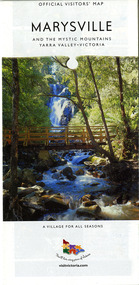
Map (Item) - Map and touring guide, Murrindindi Regional Tourism Association Inc, MARYSVILLE AND THE MYSTIC MOUNTAINS YARRA VALLEY-VICTORIA, Unknown
A fold out map and touring guide of Marysville and the surrounding district published by Murrindindi Regional Tourism Association Inc.A fold out map and touring guide of Marysville and the surrounding district published by Murrindindi Regional Tourism Association Inc.marysville, victoria, australia, map and touring guide, the cumberland, murrindindi regional tourism association inc, abbey green b&b, amberview lodge, anastasia fairytale cottage, ashlar cottage b&b, blackwood cottages, camellia log cabin, crossways country inn, dalrymples guest cottages, eagle mountain retreat, esa camping and conference centre, fruit salad farm, gilberts restaurant, keppels hotel motel, kerami house, kooringa resort and conference centre, lomatia lodge, lyelll guest cottages, marylands country house, marylyn holiday resort, marysville caravan park, marysville visitor information centre, alpacas at carmyle farm, australian adventure experience, bruno's art and sculpture garden, buxton trout farm, country touch tours, lake mountain, lake mountain ski hire, manical mechanicals, marysville district country club, marysville ski centre, rubicon valley horse riding, things of sand & stone, clearstream olives, the old woolshed cafe, fraga's cafe restaurant, lake mountain resort bistro, mantirri blueberry farm, gallipoli park, keppels lookout, cambarville, lady talbot drive, cathedral range state park, steavenson falls, steavenson river, taggerty river, acheron river, marysville auto and hardware, marysville newsagency & general store, narbethong visitor information centre, visit victoria -
 Marysville & District Historical Society
Map (Item) - Map and touring guide, Murrindindi Regional Tourism Association Inc, MARYSVILLE AND THE MYSTIC MOUNTAINS YARRA VALLEY-VICTORIA, Unknown
A fold out map and touring guide of Marysville and the surrounding district published by Murrindindi Regional Tourism Association Inc.A fold out map and touring guide of Marysville and the surrounding district published by Murrindindi Regional Tourism Association Inc.marysville, victoria, australia, map and touring guide, the cumberland, murrindindi regional tourism association inc, abbey green b&b, amberview lodge, anastasia fairytale cottage, ashlar cottage b&b, blackwood cottages, camellia log cabin, crossways country inn, dalrymples guest cottages, eagle mountain retreat, esa camping and conference centre, fruit salad farm, gilberts restaurant, keppels hotel motel, kerami house, kooringa resort and conference centre, lomatia lodge, lyelll guest cottages, marylands country house, marylyn holiday resort, marysville caravan park, marysville visitor information centre, alpacas at carmyle farm, australian adventure experience, bruno's art and sculpture garden, buxton trout farm, country touch tours, lake mountain, lake mountain ski hire, manical mechanicals, marysville district country club, marysville ski centre, rubicon valley horse riding, things of sand & stone, clearstream olives, the old woolshed cafe, fraga's cafe restaurant, lake mountain resort bistro, mantirri blueberry farm, gallipoli park, keppels lookout, cambarville, lady talbot drive, cathedral range state park, steavenson falls, steavenson river, taggerty river, acheron river, marysville auto and hardware, marysville newsagency & general store, narbethong visitor information centre, visit victoria -
Hume City Civic Collection
Book - Street Directory, Gregory"s Melbourne Street Directory
... Maps ...This 1972 Gregory's Melbourne Street Directory published by Gregory's Guides & Maps Pty Ltd was used by the donor, her husband and family.A black leather removable cover with gold embossed vintage car on the front enclosing a Gregory's Melbourne Street Directory.Gold embossed vintage car on front cover.joan houston, maps, street directory, roads, suburbs -
![Map, Millbank Estate Bacchus Marsh Thursday 4th October 1888 [Land sales], 1924](/media/collectors/5e461d8021ea67224c82f2a1/items/67765662eb6d2cbd24e0797f/item-media/67765682eb6d2cbd24e07a41/item-fit-380x285.jpg) Bacchus Marsh & District Historical Society
Bacchus Marsh & District Historical SocietyMap, Millbank Estate Bacchus Marsh Thursday 4th October 1888 [Land sales], 1924
The Millbank Estate was a parcel of land close to the centre of the shopping area of Bacchus Marsh which was sub-divided and offered for sale in 62? lots on the 4th October 1888. The lots had frontages to Ballarat Road (Main Street), Maddingley Road (now Grant Street), Turner Street, Millbank Street, Clarinda Road (now Clarinda Street), and an unnamed street south of Turner Street (possibly known as Grant Street at this time) which connected to Maddingley Road through the vicinity of the present day Bacchus Marsh Hospital. This was a significant sub-division of land and represented a major expansion of residential housing in Bacchus Marsh in the late 19th century. The map includes a wealth of detail about the time of the sale, where it will take place, who the selling agents were, the deposit terms for purchases and details of a special train from Melbourne to Bacchus Marsh on sale day. The location of the allotments in relation to the shopping and commercial area of Bacchus Marsh, Maddingley and the railway station are indicated on an inset map within the overall map and poster. The Millbank Estate area was an area which had once belonged to the Grant family who were prominent early citizens of Bacchus Marsh and lived in a house in this area known as 'Millbank'.This land sale map is a typical example of housing estate land sales advertising maps produced by real estate agents in this era. The map is significant for the detailed information it provides about when and where land was sold for new housing estates in Bacchus Marsh in the late nineteenth century.Single page map showing land allotments for sale at auction in Bacchus Marsh in October 1888. A significant portion of the map is missing from the bottom right side. land sales bacchus marsh, land subdivsion bacchus marsh, housing estates land sales bacchus marsh, grant family bacchus marsh, millbank estate land sales -
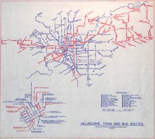 Melbourne Tram Museum
Map, Melbourne & Metropolitan Tramways Board (MMTB), "Melbourne tram and bus routes", c1961
Map showing MMTB tram and bus routes following the closure of the Point Ormond line on 22/10/1960 and before the closure of the Footscray lines on 10/3/1962. Shows route numbers at termini and along the route and points of interest in a reference table. Yields information the MMTB services c1961.Map - printed in two colours on paper. Two copies held.tramways, map, mmtb, tram, bus, routes -
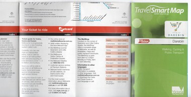 Melbourne Tram Museum
Map, Department of Transport, "TravelSmart Map - Darebin", Jun. 2010
... Maps ...Map - pocket - 28 fold - showing walking, cycling and public transport in the City of Darebin, using a Melway Map base along with public transport information, Metcard, cycling and walking groups. Produced by the Dept of Transport June 2010.trams, tramways, city of darebin, maps, public transport, metcard, metlink -
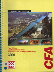 Victorian Aboriginal Corporation for Languages
Map, Country Fire Authority, Goulburn Murray Area regions 12 and 22 regional directory, 2001
mapsgoulburn river, fire protection districts, northern victoria -
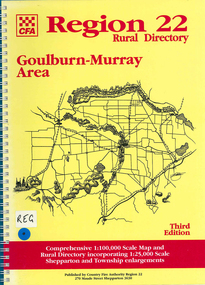 Victorian Aboriginal Corporation for Languages
Map, Country Fire Authority, Region 22 rural directory Goulburn-Murray area, 1997
mapsgoulburn region, fire protection, emergency services, victorian maps, directories -
 Victorian Aboriginal Corporation for Languages
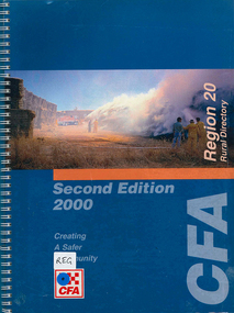
Map, Country Fire Authority, Region 20 rural directory, 2000
mapskerang, regional maps, atlas, fire protection -
 Victorian Aboriginal Corporation for Languages
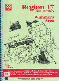
Map, Country Fire Authority, Region 17 rural directory : Wimmera area, 1997
mapshorsham, wimmera, west wimmera, hindmarsh, yarramback, grampians, fire protection, emergency services, victorian regional maps -
 Victorian Aboriginal Corporation for Languages
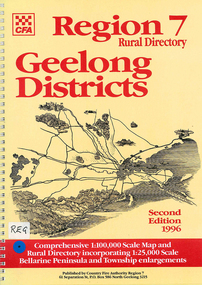
Map, Country Fire Authority, Region 7 rural directory Geelong districts, 1996
Shows roads, railway, power lines, buildings and emergency locations. Lists property owners.mapsgeelong, regional victoria, fire protection -
Victorian Aboriginal Corporation for Languages
Book, Wilfrid Prest, The Wakefield companion to South Australian history, 2001
A one volume guide to events, people, places themes and topics in South Australian history.mapssouth australia, history, encyclopedias -
 Victorian Aboriginal Corporation for Languages
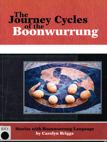
Book, Carolyn Briggs, The journey cycles of the Boonwurrung: stories with Boonwurrung language, 2008
mapsboonwurrung, stories, word lists -
 Victorian Aboriginal Corporation for Languages
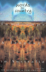
Book, Tim Bonyhady, Words for country : landscape &? language in Australia, 2002
Landscape and Language -- Lubra Creek -- The River Runs Backwards -- These Blarsted Hills -- Scarcely Any Water on Its Surface -- Everyone Who Has Ever Done A Tree Sit Always Says That The Tree Talks To You -- The Spirit of the Plains Kangaroo -- The Graveyard of a Century -- So Much for a Name -- Blackfellow Oven Roads -- The Ends of the Earth -- Natural Beauty, Man-Made -- Uluru -- The Outside Country -- It's Only Words.Mapslanguage and landscape, language essays, writing, storytelling -
 Victorian Aboriginal Corporation for Languages
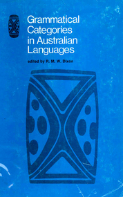
Book, RMW Dixon, Grammatical categories in Australian languages, 1976
Various authors, technical linguistic studies of the encoding of particular syntactic functions across many Australian languages. Discussion of ?having? suffix, suffix -ku, syntactic ergativity, and verbal auxiliaries.Mapslinguistics, case relations in languages, pama-nyungan languages -
 Victorian Aboriginal Corporation for Languages
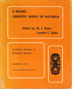
Book, W J Oates, A revised linguistic survey of Australia, 1970
Lists languages under areas and language classification; records location, previous research, degree of urgency of research and assessment of total linguistic knowledge; index of variant language names.Mapslinguistics -
 Victorian Aboriginal Corporation for Languages
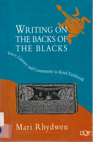
Book, Mari Rhydwen, Writing on the backs of the blacks, 1996
The author has set out to study the effects of newly developing literacy on a predominantly oral society. She persuasively argues for an awareness of the dangers of denying a voice to the very people who are the objects of such linguistics research.Mapsbilingual education, kriol, ethics and research -
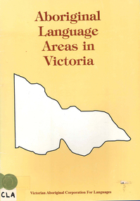 Victorian Aboriginal Corporation for Languages
Book, Ian D Clark, Aboriginal language areas in Victoria : a report to the Victorian Aboriginal Corporation for Languages, 1996
This book consists of a series of feasibility plans for language retrieval for Daungwurrung, Woiwurring, Yorta Yorta, Way Wurru, Dhudhuroa, Wadiwadi, Wembawemba and Wathawurrung.mapslanguage resources, language revival, daungwurrung, taungurung, woiwurrung, yorta yorta, way wurru, waywurru, dhudhuroa, wadiwadi, wadi wadi, wembawemba, wemba wemba, wathawurrung, wadawurrung -
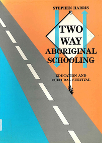 Victorian Aboriginal Corporation for Languages
Book, Stephen Harris, Two-way Aboriginal schooling : education and cultural survival, 1990
In a time where more communities are moving towards control of their children?s education, the author explores the theoretical concept of bicultural schooling and its practical implications in the classroom.mapsbilingual education, multicultural education, biculturalism -
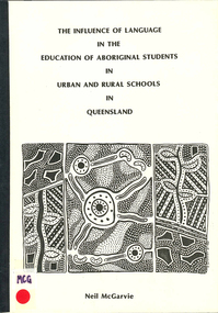 Victorian Aboriginal Corporation for Languages
Book, Neil McGarvie, The influence of language in the education of Aboriginal students in urban and rural schools in Queensland, 1986
mapssecondary school education, aboriginal english, queensland education system, language and education -
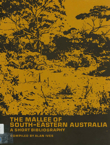 Victorian Aboriginal Corporation for Languages
Book, The Mallee of south-eastern Australia : a short bibliography, 1973
mapsmallee region, south-eastern australia, geography, geology, climatology, water, agriculture, soils, botany, zoology, national parks, historical geography, australian literature, anthropology, sociology -
 Victorian Aboriginal Corporation for Languages
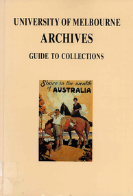
Book, University of Melbourne Archives, University of Melbourne Archives : guide to collections, 1983
mapsuniversity of melbourne archives, archive guides, victorian history -
 Victorian Aboriginal Corporation for Languages
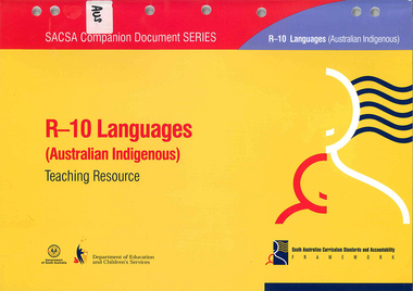
Book, South Australia Department of Education and Children's Services, R-10 languages (Australian Indigenous) teaching resource, 2005
Looks at an outline of learning and teaching of Indigenous Languages across the primary and secondary school years.mapslanguage learning, primary school education, secondary school education