Showing 945 items matching "reservoir"
-
 Eltham District Historical Society Inc
Photograph, Liz Pidgeon, Heritage Excursion; Maroondah Aqueduct, 3 September 2016, 3 September 2016
Newsletter No., 229, August 2016 Heritage Excursion - Maroondah Aqueduct Walk - Saturday 3rd September The Maroondah Aqueduct was once a major link in Melbourne’s water supply system. It was built between 1886 and 1891 to transfer water from the Watts River near Healesville to the Preston Reservoir. It was 66 km in length, made up of 41 km of open channel, 10 km of tunnel through hills and 15 km of pipeline across stream valleys known as inverted siphons. The section of the aqueduct through the Eltham area has been abandoned since the 1980s but the open channel has largely been retained. A recreational path follows the aqueduct reserve. For our excursion on 3rd September we intend to walk along the section of the aqueduct adjacent to Allendale Road. This is a section not visited on previous excursions and includes the transition from open channel to the inverted siphon across the Diamond Creek valley. Apart from the aqueduct itself the main feature of the walk is the extensive views across Eltham North and Diamond Creek. Along the way we will talk about the history of the aqueduct and the area. This easy walk is about 3 km return and will take 2 to 2.5 hours. It will start at 2pm at the junction of Allendale Road with Godber Road and Zig Zag Road North, officially Diamond Creek, but on the northern boundary of Eltham. (Melway ref.12 B10). Born Digitalmaroondah aqueduct, eltham north, activities, eltham district historical society, heritage excursion, aqueduct trail -
 Flagstaff Hill Maritime Museum and Village
Container - Ink Bottle, 19th to early-20th century
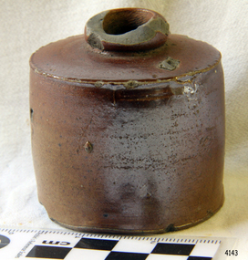
This design of ink bottle or ink well was commonly referred to as a ‘penny ink well’ because it was very inexpensive to produce. It is also known as a dwarf bottle. Pen and ink has been in use for hand writing from about the seventh century up until the mid-20th century. Up until around the mid-19th century a quill pen made from a bird’s feather was used. In the 1850s the steel point pen was invented and could be manufactured on machines in large quantities. In the 1880s a successful portable fountain pen was designed, giving a smooth flowing ink and ease of use. Ink wells, used with steel nib dip pens, were commonly used up until the mid-20th century. The pens only held a small amount of ink so users had to frequently dip the nib of the pen into an ink well for more ink. Hand writing with pen and ink left wet writing on the paper, so blotting paper was carefully used to absorb the excess ink and prevent smudging. Ink could be purchased, ready to use, or in the powdered form, which needed to be mixed with water. After the invention of fountain pens, which had a reservoir of ink, and then ballpoint pens, which also had ink that flowed freely, the dip pen was slowly replaced. However, artisans continue to use nib pens to create beautiful calligraphy.This ink well is historically significant as it represents methods of hand written communication that were still common up until the mid-20th century, when fountain pens and ballpoint pens took over in popularity and convenience.Ink bottle or ink well, sometimes called a Penny Ink Well. Cylindrical body, salt-glazed, brown ceramic stoneware bottle, handmade. Stoneware bottle. flagstaff hill, warrnambool, shipwreck coast, flagstaff hill maritime museum, flagstaff hill maritime village, maritime museum, great ocean road, shipwreck artefact, writing equipment, writing accessory, office equipment, stationery, domestic, stoneware, clay, ceramic, pottery, ink well, inkwell, ink bottle, penny ink well, nib pen, dip pen, ink, hand writing, record keeping, household, business, vintage, blotting paper, dwarf bottle -
 Kiewa Valley Historical Society
Meter Ammeter Recorder, Circa 1950
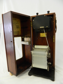
This testing voltmeter recorder was last certified by SEC Vic laboratories on the 17/4/77. It was used extensively as mobile recorder placed for periods of one month at locations experiencing unacceptable fluctuations of power. These locations would cover the North East regions of Victoria. They cover voltage drops at domestic and business properties especially those that were experiencing regular fluctuations(daily) at approximately the same time of the day. As the electrical network is required to operate within a set level of voltage, fluctuations outside of this has to be investigated and necessary remedial action taken. This is especially so for rural properties where power "drainage" can occur through animal/bird and tree interference. It can also be the result of defective wiring and overloading at peek operational times (milking machines).This mobile voltage recorder is very significant to the Kiewa Valley because it highlights the difficulties that can occur in maintaining a power supply that experiences fluctuating power demands by the rural industries that it supplies. The requirement of a mobile testing apparatus to cover the various sections in the Kiewa Valley and other rural areas in the northeast region is one of necessity as electricity once connected to a rural property is a labour saving supply as generators on rural properties require a higher degree of maintenance an ultimately at a higher cost. The testing of the SEC Vic supplied electricity to rural properties,those who had previously run on generators, had to be quick and unassuming with certainty of correct supply levels.The mechanism of this voltage recorder has been installed(by the manufacturer) into its own protective wooden box. This box has a front (swing open) lockable section which permits direct access to the installed measuring equipment (for servicing and data collection). The top section of the box has two screw on terminals for access to the machine being tested. This tester has its own inbuilt ink supply facilities and a mechanical clockwork device that unwinds a roll of paper onto a second roll at a rate of 10 mm per hour. The recording chart is marked with time slots against voltage. There is a recording arm which has an ink pen at the end. Both arm and pen carry the ink supply from the ink reservoir, located on the left side of the cabinet door in specially constructed bottle holder( three small bottle capacity). To record a suspect power problem to a home or business establishment the voltmeter is connected to a power supply outlet being tested and wind the recording clockwork mechanism (gives a four week running time). Before leaving the recorder in situ the electrician checks to see if the chart is recording the correct voltage and that the clock mechanism is advancing correctly.On the front of the access "door" at the top a metal label "RECORDING AMMETER" below this "MURDAY SYSTEM" below this "ALTERNATING CURRENT" and below this the manufacturer's registered number "No. 139156" Below this is a metal tag with State Electricity Commission of Victoria Electrical Engineer's Section equipment number "338" Below these tags and above the viewing window is the manufacturer's dtails "EVERSHED & VIGNOLES Led LONDON"sec vic kiewa hydro scheme, alternate energy supplies, alpine feasibility studies temperature, rainfall, power outages -
 Ballarat Tramway Museum
Newspaper, The Courier Ballarat, Courier, 8/3/1938 p21, 22, 29 & 30 - photo of Sturt St, Mar. 1938
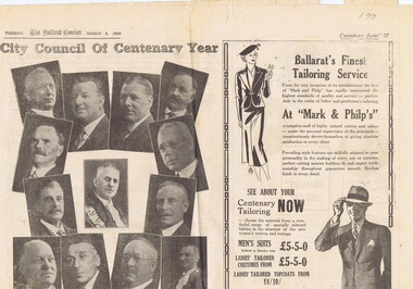
Yields information about Ballarat and its locations or environs late 1938.Pages 21,22,29 and 30 of the Centenary issue of the Ballarat Courier, 8/3/1938. Page 21 "When the World was Wide", photos, Ballaarat City Council of Centenary of settlement in the Ballarat district, year, and Sturt St. from Bridge St., possibly original photo of time. Ads. - Marks & Phillips, - Tailors and C.J.Coles. Page 22 - Towns that have a history - Learmonth, Clunes, Creswick and Buninyong. Photos - Learmonth, Clunes and Forestry school Creswick. Ads - State Savings Bank of Vic, Swanston Used Cars. Page 29 - Ballarat's historic Sports Grounds - origin and development, Eastern Oval incident, listing of nuggets found and quartz specimens. Ads for Prestige stockings, T&G Mutual Life and Fosters Lager. Photo of mine at No. 6 shaft on Band of Hope and Albion Consolidated. Page 30 - articles - Ballarat's sporting origins and swamp to reservoir (water supply). Photos of First England Cricket team to visit Ballarat and aqueduct at Kirks storage basin. Ads for Craig Bros, Pratts cash stores, Haymes paints and Ballarat Block Arcade - shops. Record reviewed and images of some of the pages added 10-9-2013trams, tramways, ballarat centenary celebrations, centenary, sports ground, water supply -
 Eltham District Historical Society Inc
Photograph, Liz Pidgeon, Heritage Excursion; Maroondah Aqueduct, 3 September 2016, 3 September 2016
Heritage Excursion - Maroondah Aqueduct Walk - Saturday 3rd September The Maroondah Aqueduct was once a major link in Melbourne’s water supply system. It was built between 1886 and 1891 to transfer water from the Watts River near Healesville to the Preston Reservoir. It was 66 km in length, made up of 41 km of open channel, 10 km of tunnel through hills and 15 km of pipeline across stream valleys known as inverted siphons. The section of the aqueduct through the Eltham area has been abandoned since the 1980s but the open channel has largely been retained. A recreational path follows the aqueduct reserve. For our excursion on 3rd September we intend to walk along the section of the aqueduct adjacent to Allendale Road. This is a section not visited on previous excursions and includes the transition from open channel to the inverted siphon across the Diamond Creek valley. Apart from the aqueduct itself the main feature of the walk is the extensive views across Eltham North and Diamond Creek. Along the way we will talk about the history of the aqueduct and the area. This easy walk is about 3 km return and will take 2 to 2.5 hours. It will start at 2pm at the junction of Allendale Road with Godber Road and Zig Zag Road North, officially Diamond Creek, but on the northern boundary of Eltham. (Melway ref.12 B10). Newsletter No., 229, August 2016 Abandoned and rusted house base probably purposed to water or feed cattle. Born Digitalmaroondah aqueduct, eltham north, activities, eltham district historical society, heritage excursion, bath, acqueduct trail -
 Eltham District Historical Society Inc
Photograph, Liz Pidgeon, Heritage Excursion; Maroondah Aqueduct, 3 September 2016, 3 September 2016
Heritage Excursion - Maroondah Aqueduct Walk - Saturday 3rd September The Maroondah Aqueduct was once a major link in Melbourne’s water supply system. It was built between 1886 and 1891 to transfer water from the Watts River near Healesville to the Preston Reservoir. It was 66 km in length, made up of 41 km of open channel, 10 km of tunnel through hills and 15 km of pipeline across stream valleys known as inverted siphons. The section of the aqueduct through the Eltham area has been abandoned since the 1980s but the open channel has largely been retained. A recreational path follows the aqueduct reserve. For our excursion on 3rd September we intend to walk along the section of the aqueduct adjacent to Allendale Road. This is a section not visited on previous excursions and includes the transition from open channel to the inverted siphon across the Diamond Creek valley. Apart from the aqueduct itself the main feature of the walk is the extensive views across Eltham North and Diamond Creek. Along the way we will talk about the history of the aqueduct and the area. This easy walk is about 3 km return and will take 2 to 2.5 hours. It will start at 2pm at the junction of Allendale Road with Godber Road and Zig Zag Road North, officially Diamond Creek, but on the northern boundary of Eltham. (Melway ref.12 B10). Newsletter No., 229, August 2016 Abandoned rusty farm machinery possibly used for tilling the soil - off the Aqueduct trail Born Digitalmaroondah aqueduct, eltham north, activities, eltham district historical society, heritage excursion, aqueduct trail, farm machinery -
 Eltham District Historical Society Inc
Photograph, Liz Pidgeon, Heritage Excursion; Maroondah Aqueduct, 3 September 2016, 3 September 2016
Heritage Excursion - Maroondah Aqueduct Walk - Saturday 3rd September The Maroondah Aqueduct was once a major link in Melbourne’s water supply system. It was built between 1886 and 1891 to transfer water from the Watts River near Healesville to the Preston Reservoir. It was 66 km in length, made up of 41 km of open channel, 10 km of tunnel through hills and 15 km of pipeline across stream valleys known as inverted siphons. The section of the aqueduct through the Eltham area has been abandoned since the 1980s but the open channel has largely been retained. A recreational path follows the aqueduct reserve. For our excursion on 3rd September we intend to walk along the section of the aqueduct adjacent to Allendale Road. This is a section not visited on previous excursions and includes the transition from open channel to the inverted siphon across the Diamond Creek valley. Apart from the aqueduct itself the main feature of the walk is the extensive views across Eltham North and Diamond Creek. Along the way we will talk about the history of the aqueduct and the area. This easy walk is about 3 km return and will take 2 to 2.5 hours. It will start at 2pm at the junction of Allendale Road with Godber Road and Zig Zag Road North, officially Diamond Creek, but on the northern boundary of Eltham. (Melway ref.12 B10). Newsletter No., 229, August 2016 Brick bridge on Parsons road, Eltham North over the aqueduct on the aqueduct trail. Born Digitalmaroondah aqueduct, eltham north, activities, eltham district historical society, heritage excursion, parsons road, bridges, aqueduct trail -
 Bendigo Historical Society Inc.
Document - DRAFT ARTICLES FOR USE IN RHSV (BENDIGO) NEWSLETTER, MARCH 1972
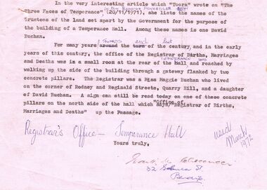
Draft articles for use in RHSV (Bendigo) Newsletter, March 1972: 1. article by Edith Ceccucci (sp?) re Registrar of Births, Marriages and Deaths at Temperance Hall, View Street - mention of location of office and Miss Maggie Buchan and David Buchan (father of Maggie and Trustee of land (Temperance Hall); 2. extract from Annals of Bendigo 1873 re proposal to sell the Town Hall and erect a new one upon another site submitted by (??) Bennett, Rose St.; 3. Short article about the ''Cannons at Eaglehawk''; 4. ''Extracts from my memories of the Eaglehawk'' by D. M. Carroll - mention of Hibernian Hotel, St. Augustine’s Catholic Church; Balmers School; South new Moon Mine. 5 Handwritten draft entitled ''Henley-on-Weeroona'' by ''Joc'' (John O'C Hattam) refers to article in Bendigo Advertiser 20 Jan 1972 - details of formation of Sandhurst Rowing Club; originally on Upper Grassy Flat Reservoir; ''exponents of rowing at the time (1870's) - W. R. Lane, David Watson, J. R. Goodison, R. Whiteside, F. Sciallero, G. C. Bockelman, John Godfrey; Hallas's Band; Strathfieldsaye Shire Band; the move to Lake Weeroona 22/10/1879; description of Henley-on-Weeroona activities.document, names of bendigo pioneers -
 Ballarat Tramway Museum
Postcard - Folder set, Nu-color-vue or Nucolorvue Productions, "A Souvenir of Beautiful Ballarat", late 1940's
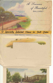
Set of 12 coloured views of Ballarat printed with six photos on either side of a folded strip of paper glued within an embossed paper folder. Published by Nucolorvue Productions Vic., titled "A Souvenir of Beautiful Ballarat". Front cover has a colour rural scene, title, address area and on base of cover "12 Specially Selected Views in Full Colour". Rear of Cover has a part of a colour scene as well and a slit for the envelope to be closed over and sealed. On the inside of the front cover are notes on the City of Ballarat and that it has just embarked upon its second century. 1. Another section of Ballarat's Fine Botanical Gardens 2. Overlooking Ballarat City 3. Botanical Gardens showing statues of Australian Prime Ministers 4. Sturt Street showing City Hall and Fine Statues 5. Lake Wendouree Ballarat 6. Lovely Trees and Statuary Botanical Gardens 7. Botanical Gardens showing Wallace's Statue 8. Lovely Sturt St looking West 9. Overlooking Sturt St towards Mt Warrenheip (has single truck tram in photo) - see image i9 for a hi res version. 10. Ballarat's Famous Art Gallery 11. One of Ballarat's many fine Reservoirs 12. Eureka Stockade Monument, Ballarat. On front cover in pencil in stamp area "1/-"trams, tramways, ballarat, postcards, sturt st, bridge st, gardens -
 Ballarat Tramway Museum
Newspaper, The Courier Ballarat, City Honored by six Royal Visits, Mar. 1938
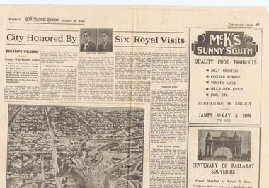
Yields information about Ballarat and its locations or environs late 1938.Pages 11,12, 19 and 20 of the centenary of settlement in the Ballarat district by the Ballarat Courier - March 1938. See also items 186, 198 and 199. Page 11 Royal visits, banking in Ballarat, photos - NW section of Ballarat, railway station in foreground. Ads for J.McKay and Son, Roy Reeds (Men's store) and Ballarat Gas Co. Also photo of "The Corner" in Sturt St. - old Mining Exchange. Page 12 - full page ad for Morseheads, women's store. Page 19 - articles - Ballarat Lighting and Power, ESCo, SEC, electric trams. photos of the Arch of Victory, first electric tram, Lake Wendouree. Advertisements for Austin Spears (cycles), McDougall and Chisholm (drapers), W.E. Longhurst (bread) and the ES&A bank. Also article on South St. Society - music and elocution. Page 20 - articles - Ballarat Gas Co., horse and electric trams, agriculture in district and Ballarat's war record (WWI). Photos of work at Gong Gong Reservoir and Committeemen of the Ballarat Horticultural Society - 1859 to 1885. Ads for Ballarat College, Clarendon, Queens (girls) and Ballarat Grammar schools, Ern Craig Motors (Vauxhall) and Snows men's wear. Record reviewed and images of pages added 7-9-2013 and 10-9-2013trams, tramways, ballarat electricity, centenary, banking, transport, trams, esco -
 Bendigo Historical Society Inc.
Document - LUDERMAN COLLECTION: SPRING GULLY, MANDURANG DOCUMENTS
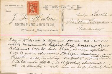
Document. Pastel Drawing Book, 'Bulldog' Series No. 589, containing series of invoices and documents relating to the Hargreaves family. Items stuck in book in order includes: invoices from J.R. Hoskin, Bendigo Timber and Iron Yards relating to construction of residence in Spring Gully (1896); Certificate of Registration of Residence Area for Thomas Snowdon, adjoining Hargreaves residence 200 yards from Reservoir; Elector's Right for John Billman Hargreaves of Mandurang, Tanner; handwritten note (Bairnsdale 24.1.34) on John Billman Hargreaves born 1861 on 14 June on Sheepwash Creek in Mandurang riding Shire of Strathfieldsaye near Bendigo possibly registered at Strathfieldsaye, Kangaroo Flat or Bendigo. Father's name John Hargreaves (English) mother's name Hosannah Hargreaves nee Billman'; 2 scrip certificates issued by 'Tanners Gold Mining Compagnie Pipers Hill, Sheepwash' overwritten on top of document ( underneath North Lord Warden Tribute Co., ) scrip certificate issued to John B. Hargreaves on 25 September 1882; invoice Jas. Knowlton, late J. Moody, watchmaker and jeweller, No. 1 Bath Corner, Bendigo 3.8.1895 for Diamond brooch; invoice H. Credginton watchmaker and jeweller and optician for 1 gem ring. Loose document inside contains written advice re taking wool off sheep skins and curing hides.person, individual, hargreaves, hoskins, hargreaves, snowdon, elector's right, tanner's gold mining compagnie, north lord warden tribute co., knowlton, credgington -
 Southern Sherbrooke Historical Society Inc.
Information folder - Menzies Creek
Information folder containing items pertaining to the history of Menzies Creek. Contents: -document, "Menzies Creek, Now...And Then", by Pam Dennis, written for Eastern Regional Libraries History Writing Competition, 11 pages -single page from 'Australian Places' (Monash University), extracted 21st May 2004 -article, 'Following Tradition...', about Bill Hermon's retirement, The Trader, 19th July 1984, 2 copies -article, 'Museum draws first shots', re. the possible removal of the Puffing Billy Museum, Free Press, 9th August 1989 -article, 'There's gold in the Dandenongs!', re. Hancock's Nursery, Retirement, Issue 64, September 1998 -article, 'To remember...', re. Bill and Jean Hermon, Hills Trader, 1st August 1990 -article, 'Family honoured for community service', Free Press, 8th August 1990 -article, '30 years and still going strong', re. Puffing Billy, Knox-Sherbrooke Post, 29th July 1992 -article, "Daffodil delights", Free Press, 2nd Sep 1998, inc. photo of Rex Breen -article, 'People of the century', re. Hermon family, Ranges Trader Mail, 14th December 1999 -article, 'Pages from the past', re. the opening of John's Hill Reservoir in 1981, Ranges Trader Mail, 18th April 2000 -article, 'Historic reunion for family', re. Johns family, Ranges leader, 30th January 2002 menzies creek, gold-mining, timber, road transport, early settlers, menzies creek state school, puffing billy railway, st cuthbert's church, menzies creek rural fire brigade, menzies creek hall -
 Melbourne Tram Museum
Newspaper, The Age, "City that went off the rails", "Is it time to get rid of Trams", May. 1969
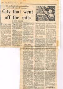
Newspaper Clipping - set of four clippings adhered to two sides of two sheets of ruled quarto paper with punched holes on the left hand side - from newspapers about the removal of trams from Melbourne 1 - Part one of a Large article written by John Messer of The Age, titled "City that went off the rails" about the impact of the closure of the Brisbane tramway system, quotes Brisbane City Mayor - Clem Jones. Dated 7/5/1969 2 - Second part "Is it time to get rid of Trams", dated 8/5/1969 following the closure of the Brisbane system. Mainly quotes from Brisbane transport officials with some Sydney officials. Has photos of a tram in Swanston St and a crowded tram. 3 - "Willy-nilly scrapping of trams 'nonsense'" - written by F. R. Kirby - Acting Chairman of the MMTB - The Age" responding to John Messer's articles. The Age 20/5/1969. 4 - letter from Bernard Boles of Reservoir about the removal of trams in Collins St and replacement by buses. 5 - "Hour fight to free trapped driver" - The Age 19/5/1969 - about the collision of a panel van at corner of High and Chapel St Prahran 6 - Set of two Letters from Edward Sykes and V. Lovel about the removal of trams - for and against.trams, tramways, brisbane trams, sydney trams, closure, tram replacement, buses, collins st, accidents, letter to the editor -
Federation University Historical Collection
Tool - Object, E. Thomas & Williams Limited, Cambrian Lampworks, Kop Staszic Carbide Lamp
Carbide lamps, or acetylene gas lamps, are simple lamps that produce and burn acetylene (C2H2) which is created by the reaction of calcium carbide (CaC2) with water. Acetylene gas lamps were used to illuminate buildings, as lighthouse beacons, and as headlights on motor-cars and bicycles. Portable acetylene gas lamps, worn on the hat or carried by hand, were widely used in mining in the early twentieth century. A mining or caving lamp has calcium carbide placed in a lower chamber, the generator. The upper reservoir is then filled with water. A threaded valve or other mechanism is used to control the rate at which the water is allowed to drip into the chamber containing the calcium carbide. By controlling the rate of water flow, the production of acetylene gas is controlled. This, in turn, controls the flow rate of the gas and the size of the flame at the burner, and thus the amount of light it produces. Staszic is a coal mine located in Katowice , in the district Giszowiec, Poland This type of lamp generally has a reflector behind the flame to help project the light forward. An acetylene gas powered lamp produces a bright, broad light. Many cavers prefer this type of unfocused light as it improves peripheral vision in the complete dark. The reaction of carbide with water produces a fair amount of heat independent of the flame. In cold caves, carbide lamp users can use this heat to help stave off hypothermia. When all of the carbide in a lamp has been reacted, the carbide chamber contains a wet paste of slaked lime (calcium hydroxide). This is emptied into a waste bag and the chamber can be refilled. (http://en.wikipedia.org/wiki/Carbide_lamp, accessed 06/05/2015)Metal Carbide Mining lamp with light reflector and hook.miners lamp, mining lamp, statszic, poland, carbide, mining -
 Bendigo Historical Society Inc.
Document - MCCOLL, RANKIN AND STANISTREET COLLECTION: ANGOVE AND CARRS LEASE, DIAMOND HILL, 1935
McColl Rankin & Stanistreet, Angove & Carrs Lease, Diamond Hill. a/ Manila folio Markings: Angove & Carrs Lease Diamond Hill. Freed?aus Extended. b/ Plan Area Applied For On Lease No. 10103 Ben. By A A Macintosh. Mining District of Bendigo Parish of Mandurang County of Bendigo. Inscriptions: G Birch advises 16/5/35. Survey made by Assistant he has yet to receive. 10710 W J Angove - Spring Gully PO. Dated August 12th 1933 signed: Garnet G Birch J Victor Buley. c/ Agreement of lease for 1 month with the option of 9 months, followed by the option of purchase between Summerhill Anticlines NL of Adelaide and Angove & Carr at German Gully (Mandurang). Markings: 25/3/13 note by Summerhill Anticline NL. Requests information as to whether or not the Syndicate (E Mann, W Angove & H Irvine, H. Mc……….) desire to take up the options of lease or not. d/ Notice to Shareholders of a meeting in Collins Street Melbourne. 6 March, 1935 to consider proposals of the future of the company. J G Stanfield & Stewart, Manager. e/ Neangar Gold Mining Company NL 6 Month Report 27/2/1935 Business, Director's Report & Financial Report. f/ Report by A J J Moore BCE Mining Engineer, Ramrod Lease, Golden Fleece Mine near Spring Gully Reservoir the most Southern mine being Worked in Bendigo. Lease in on the Carshalton line. Report details the progress of the workings at the mine.organization, business, gold mine, mccoll rankin & stanistreet, angove & carrs lease, diamond hill a a macintosh parish of mandurang county of bendigo w j angove august 12th 1933 summerhill anticlines 6 month report 27/2/1935 golden fleece mine near spring gully reservoir -
 Ballarat Tramway Museum
Book, Ballarat Litho & Printing Co, "The Picturesque Folio of Ballarat - 'The Modern Athens", 1904
Forty two page book with red covers, titled "The Picturesque Folio of Ballarat - 'The Modern Athens". Sheets have been individually printed both sides, stapled and then glued to the covers. Cover - gives title and printer details First sheet - with a greetings sheet for Good wishes and seasons greetings. Has a printed date of 1905. See Inscriptions. Dated 22/11/1904. Pages 3 - 10 - a historical sketch of Ballarat, compiled by Lieut-Colonel R. W. Williams V.D. Pages 12 - 41 - photos of Ballarat and district - such as: Sturt St The Lakes Post Office - note the trams clock board - taken at corner of Lydiard and Sturt Streets, looking east. The Gardens Queen Victoria Square Lydiard and Sturt St with a horse tram in the photo Victoria Park Eureka Monument The Statues Botanical Gardens Benevolent Asylum Hospital The City Oval - Richards & Co Photograph Fairy Land - the Lake Railway Station with a D class loco waiting for a signal, 3 post home before the level crossing. Has Irwin's Provincial hotel in view. Gong Gong Lake School of Mines and Methodist Church Lake Fountain A Ballarat view - 1853 - 54. View Point Gong Gong reservoir embankment South Star Mine Lal Lal Falls Band & Loch Mine On last page has the logo for the printers - Ballarat Litho & Printing Co, successors to F. W. Niven & Co. 56 and 58 Lydiard St. Ballarat. PDF scan of book added 21/9/2019 as btm3326i.pdfOn first page in black ink " to Chorus? Dodds, from Robert Dodds, and dated 22 Nov 1904.trams, tramways, ballarat, horse trams, sturt st, gardens, railway station, hospital -
 Bendigo Historical Society Inc.
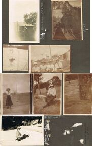
Photograph - HILDA HILL COLLECTION: BLACK AND WHITE PHOTOS, 1919-1924
Series of Black and White Photos Post War Life for Hill Family & Friends. Total 8 Photos. Kath 'The Ranche' Eppalock September 1919. Kath dressed in 20's ? Dark dress, fur stole around neck, cloche hat, corrugated iron fence with wooden rail on top, garden setting. Arch, wearing white shirt waistcoat and dark trousers, gable roofed house in background, brick chimney left, tree at corner of house roof, Monte Video Queensland July 1924. Four ladies all wearing dark skirts and white blouses, all wearing broad rimmed hats, windmill tank on stand in background, tall post and wire netting, structure to the right, Kilmore October 1919. A Swan on the reservoir unknown place January 1920. lady wearing dark skirt and white blouse and hat, holding ball in left hand, right hand maybe swinging a tennis racquet ( not visible), post and rail fence in the far background. Lady sitting on stool wearing a dark skirt and white blouse, high post and wire netting fence, dark coloured horse to left, post and rail fence far right background, holding a camera bag and camera on stool beside her. Flirt the Dog, standing in doorway, door is broken and leaning to the right, shed has wide timber planks for cladding, 'The Ranche' Eppalock November 1919. Helen Mount Buffalo Tobogganing, wearing dark skirt, jacket with striped sleeves, and hat, August 1924.Hilda Hill Personal Collectionaustralia, history, post war life -
 Bendigo Historical Society Inc.
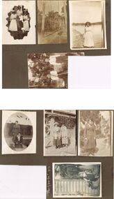
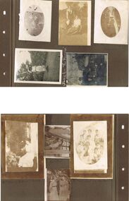
Photograph - HILDA HILL COLLECTION: BLACK AND WHITE PHOTOS, 1918-1919
7 Complete Black & White Photographs: Maisie and Bess One standing wearing a light coloured dress and one kneeling wearing Dark suit with white blouse on pathway, background is large hedge, right background is a corner of a lawn area, oval photo, S.H.L.C. 24 September 1918. House in Bendigo With Pillared Gate & Picket Fence, Tess & Dorothy Out The Front 21/10/1918. Claire wearing a dark coloured coat dress standing in a garden setting, light post to her left, hose laying on the path to her left, small flat roofed shed near light post 'The Ranche' 23/10/1918. Nancy wearing a tunic style dress and white blouse standing next to a wall with a pot plant at front, 'The Ranche' 1919. Group Photo Three Ladies wearing all white outfits and two with white hats, two standing one sitting, at front is small case and Thermos flask, grubby but happy the end of a perfect day Axedale Hibernian Picnic 13/11/1918. Two Ladies wearing heavy coats on rope swing Botanical gardens Bendigo June Year Unknown Cation On photo Illegible, Mo. Smith Lady standing on shore at Reservoir No. 7 Kangaroo Flat 09/011919. two boys standing in bush scene wearing white shirts and dark trouser held up with braces, boy on left holding long stick with both hands. Part of this photo has been cut off in the process of taking a photo from the other side.Hilda Hill Personal Collectionaustralia, history, post war life -
 Bendigo Historical Society Inc.
Document - Collection of photographs from newspaper on a single page
John Perry Collection. Laminated copy of page from 'Weekly Times' newspaper, February, 1962. Nine images relating to establishing and building Eppalock Reservoir, 15 miles from Bendigo. The dam was built by the State Rivers and Water Supply Commission of Victoria. The dam wall height is 45 metres (148 ft) and the main embankment is 1,041 metres (3,415 ft) long. At 100% capacity the dam wall was designed to hold back 304,651 megalitres (6.7014×10¹⁰ imp gal; 8.0480×10¹⁰ US gal) of water. The surface area of Lake Eppalock is 3,011 hectares (7,440 acres) and the catchment area is 2,124 square kilometres (820 sq mi). The controlled spillway is capable of discharging 8,040 cubic metres per second (284,000 cu ft/s). Lake Eppalock supplies both stock and domestic water to the Campaspe irrigation district. It also serves as a water supply to Bendigo and Heathcote and, in more recent times, Ballarat. The lake is a major attraction for those engaging in watersports, with a number of tourist parks and accommodation facilities available. Permissible activities on the lake include high-speed boating, water skiing, sailing, canoeing, fishing and swimming. The lake's water levels were low for approximately eight years between 2002 and 2010 during a prolonged drought, which restricted the amount of recreational activity until rainfall in the latter half of 2010 returned the lake to 100 percent capacity. Built between 1961 and 1964, Lake Eppalock remains the only water storage on the Campaspe River system. dam, engineering, water, eppalock -
 Halls Gap & Grampians Historical Society
Map - Coloured
Background on Bridle Path up Stony Creek Gorge Pre 1840 C. B. Hall, squatter on Mokepilly Run 1841-1842, first European to discover the Fyans Creek valley, the entrance of which became known as Hall's Gap. He later recorded that he followed a number of tracks which he assumed had been made by the Aboriginies and described one as "leading up a wild romantic glen and over on to the source of the Glenelg River". This could well have been the route taken up Stony Creek gorge by the first timber-cutters in this part of the Grampians to the saddle between the Wonderland and Mt. Difficult ranges known as Valley Gap 1850s/60s Timber cutters and shingle splitters were reported to be moving into the eastern side of the Grampians and by the mid 1860s there were a number of families connected to the supplying of timber to Pleasant Creek living in the "Hall's Gap ranges". John Wakeham, the first store owner in Pleasant Creek in 1854, established a timer-mill in upper Stony Creek Gorge in the late 1850s. Wakeham is credited for the clearing and levelling of the first bridle-path up the gorge. 1870s By the mid 1870s the track had been extended over Valley Gap to the Victoria Forest (the upper region of the Victoria Valley). McKeon's bullock team was known to have hauled red gum from the Valley to Stawell in the late 1870s and the 1880s. 1880s In 1887 an article in the Pleasant Creek news describes the Stony Creek Gorge track as "being a ledge alongside the mountain range, formed in the early days with the aid of earth and timber, along which the bullock teams used to travel to Horsham and plains of the Wimmera beyond." 1890s Gold was discovered in the catchment area of Stony Creek and by the end of the 1890s a new track was built from "near the junction of Fyan's and Stony Creeks, up the gorge to the diggings settlement. The mining Department had paid L300 for its construction and, when completed, the track was "three miles and 30 chains in length, the side cuttings at the narrowest part being 10 feet between" and "the watercourses which cross the track at various points" having been "filled up with rocks rolled down the sides of the hills, and consequently there can be no damage caused by bushfires which destroyed the former wooden bridges erected on the old track to Wakeham's saw-mill, the remains of which are still to be seen at the side of the diggings" The article goes on to further describe the track as one which "can with ease travel with a two horse conveyance either up or down" and that the workmen engaged in the construction of the track would be attending "a ball that night at McKeon's farm near the mouth of the gap to celebrate the successful completion of the undertaking". 1900s At what time the bridle path was extended beyond Valley Gap to the Wartook basin on the Mt. Difficult Range has not yet been determined. However, it is known that, by the turn of the century, people were travelling between Halls Gap and the caretakers' residence at Wartook Reservoir along what was now known as the "Bluff Road. Wartook's embankment had been constructed in 1887 and at that time there was already a track from Rosebrook Station homestead (near the present day Wartook Pottery) to the reservoir. Philip Rose owned both Rosebrook and Wartook Stations from the mid 1840s to the late 1850s and had regularly leased the Wartook basin to Cobb & Co. to rest horses there. 1920s Following the war of 1914-1918, tourism really took off in the Grampians, and Halls Gap rapidly grew. People would travel as far as they could on the many tracks then hike to the many lookouts being discovered by local tour guides. This led to the need for access across the range so that horse riders and the increasing number of vehicles could travel between Horsham and Halls Gap. To this end, the Bluff Road was improved and extended on 1929 and at its opening in March, 1930, by Lady Somers it was renamed the Mt. Victory Road.Map of Mt Victory Road and othersaccess routes, mt victory rd, bridle path, roads -
 Flagstaff Hill Maritime Museum and Village
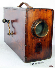
Instrument - Foghorn, Late 19th century
A foghorn is a device that uses sound to warn of navigational hazards like rocky coastlines, or boats of the presence of other vessels, in foggy conditions. The term is most often used with marine transport. When visual navigation aids such as lighthouses are obscured, foghorns provide an audible warning of rocky outcrops, shoals, headlands, or other dangers to shipping. An early form of fog signal was to use a bell, gong, explosive signal or firing a cannon to alert shipping. From the early 20th century an improved device called the diaphone was used in place of these other devices, The diaphone horn was based directly on the organ stop of the same name invented by Robert Hope-Jones, creator of the Wurlitzer organ. Hope-Jones' design was based on a piston that was closed only at its bottom end and had slots, perpendicular to its axis, cut through its sides, the slotted piston moved within a similarly slotted cylinder. Outside of the cylinder was a reservoir of high-pressure air. Initially, this air would be admitted behind the piston, pushing it forward. When the slots of the piston aligned with those of the cylinder, air passed into the piston, making a sound and pushing the piston back to its starting position, whence the cycle would be repeated. This method of producing a low audible sound was further developed as a fog signal by John Northey of Toronto and these diaphones were powered by compressed air produced by an electric motor or other mechanical means that admitted extremely powerful low-frequency notes. The example in the Flagstaff collection is an early cased and portable diaphone used on pleasure or sailing craft. By manually turning the crank handle air is produced and fed into valves that direct air across vibrating metal reeds to produce the required sound. in foggy weather, fog horns are used to pinpoint a vessels position and to indicate how the vessel is sailing in foggy conditions. One blast, when sailing on starboard tack and two blasts, when sailing on a port tack and three dots, when with wind is behind the vessel. Since the automation of lighthouses became common in the 1960s and 1970s, most older foghorn marine installations have been removed to avoid the need to run the complex machinery associated with them, and have been replaced with an electrically powered diaphragm or compressed air horns. The example in the collection is significant as it was used in the early 19th century for sailing vessels was important but these portable crank fog horns have also been superseded by modern electric varieties. Therefore the item has a historical connection with sailing and maritime pursuits from our past.English Rotary Norwegian Pattern nautical foghorn within a boxed pine varnished case with exposed corner dovetailing, original leather carrying strap, brass side crank, and original copper trumped horn. Card accessory with Directions for Use in both English and French.Noneflagstaff hill, warrnambool, shipwrecked coast, flagstaff hill maritime museum, maritime museum, shipwreck coast, flagstaff hill maritime village, great ocean road, foghorn, maritime technology, maritime communication, marine warning signal, portable foghorn, bellows foghorn, crank handle, robert hope-jones, john northey -
 Surrey Hills Historical Society Collection
Photograph, Mabel Pye, daughter of William and Alice Pye of 12 Loch Street, Surrey Hills
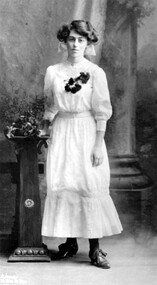
Mabel Pye was a printmaker and painter. She was born in Box Hill in 1894, probably at the family’s Loch Street property. She was the daughter of Alice Eleanor Noar and her husband William Edward Pye, who married in 1893. William was known as Ted and is recorded in electoral rolls as a legal clerk and later as a public servant. Mabel had a sister Hazel who was also an artist, but less well known. 12 Loch Street, Surrey Hills was known as ‘Mulberry Hill’ and the Pyes appear to be the first occupants – Alan Holt’s register of Surrey Hills properties has them there from c1900. The property was originally about an acre in size and was later divided into 4 house blocks. In 1923 they built a house for themselves on one of the blocks facing Benwerrin Street and called it ‘Tanglewood’. The Loch Street house abutted the Surrey Hills Reservoir and was diagonally linked to the land in Benwerrin Street. In 2019 both the houses still stand. The family were involved in amateur theatre and at times the studio doubled as a rehearsal space for the Benwerrin Players, a group which operated through the late 1920s and early 1930s being comprised of friends and neighbours from Benwerrin Street and Windsor Crescent. Some of their performances were at the Surrey Hall in Union Road. Most of Mabel’s known work dates from the 1930s. She had studied under Bernard Hall at the National Gallery School. Mabel was a member of both the Victorian Artists Society from 1918-1941 and also the Melbourne Society of Women Painters and Sculptors from 1920-1950. Her work is represented in the Australian National Collection and in state galleries. The NGV has one of her works, the Gallery of NSW has 9 works, a large body of works and personal material is held by the Ian Potter Collection and there is one piece in the City of Whitehorse Collection. This ink sketch of the White Horse Hotel is signed MP and dated 1933, the year the building was demolished. A black and white studio photograph of a young lady standing beside a pedestal and wearing a light coloured dress with 3/4 length sleeves, dark stockings and lace up shoes. A corsage of dark flowers adorns the bodice. loch street, surrey hills, artists, whitehorse hotel, box hill, miss mabel pye, city of whitehorse collection, william edward pye, miss alice elanor noar, mrs alice eleanor pye, frank stamford -
 City of Moorabbin Historical Society (Operating the Box Cottage Museum)
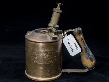
Tools, Blowtorch 'Sievert', 20thC
A blowtorch or blowlamp is a fuel-burning tool used for applying flame and heat to various applications, usually metalworking. Early blowlamps used liquid fuel, carried in a refillable reservoir attached to the lamp. Modern blowtorches are mostly gas-fuelled. The blowlamp is of ancient origin and was used as a tool by gold and silversmiths. They began literally as a "blown lamp", a wick oil lamp with a mouth-blown tube alongside the flame. This type of lamp, with spirit fuel, continued to be in use for such small tasks into the late 20th century. In 1882, a new vaporizing technique was developed by Carl Richard Nyberg in Sweden, and the year after, the production of the Nyberg blow lamp started. It was quickly copied or licensed by many other manufacturers. Carl Richard Nyberg (May 28, 1858, – 1939) was the founder of Max Sievert’s Lödlampfabrik, then one of the largest industries in Sundbyberg, Sweden. After school he started working for a jeweller and later he moved to Stockholm and worked with various metalworks. 1882 and set up a workshop at Luntmakargatan in Stockholm making blowtorches. However the business didn't work well because it took too long to both manufacture and sell them. In 1886 he met Max Sievert (1849 - 1913) at a country fair and Sievert became interested in Nyberg's blowtorch and started selling it. In 1922 the company was sold to Max Sievert who continued to own it until 1964 when it was bought by Esso. The blowtorch is commonly used where a diffuse high temperature naked flame heat is required but not so hot as to cause combustion or welding: soldering, brazing, softening paint for removal, melting roof tar, or pre-heating large castings before welding such as for repairing. It is also common for use in weed control by controlled burn methods, melting snow and ice from pavements and driveways in cold climate areas, road repair crews may use a blowtorch to heat asphalt or bitumen for repairing cracks in preventive maintenance. It is also used in cooking; one common use is for the creation of the layer of hard caramelised sugar in a crème brûlée. A brass blowtorch, 'Sievert' with a wooden handleSIEVERTtools, blow torches, blow lamps, welding, brazing, jewellery, cookery, soldering, nyberg carl, sievert max, stockholm, sweden, spirit fuel, kerosene, gas fuel, moorabbin, bentleigh, cheltenham, market gardeners, pioneers, early settlers, plumbing, carpenters, -
 Ballarat Tramway Museum
Book, Berry Anderson Co, "Panoramic Views , The Garden City, of Ballarat & District", c1920s
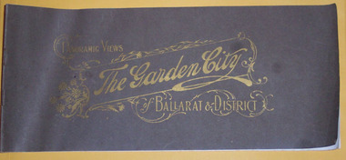
Thirty two pages on gloss white paper plus brown covers, centre stapled, titled ""Panoramic Views , The Garden City, of Ballarat & District" in Gold printing. On rear has name of printers "Berry and Anderson Co Subtitle on page 1, "The Garden City being a series of 40 magnificent Panoramic Views of Ballarat and District, with special descriptive article, "Ballarat Revisited". On page 1, comprises a list of photos and a photo of Sturt St. looking east with an electric tram hauling a trailer. Pages 2 and 3 comprise the article. Most small photos are recycled postcard photos, dating from around the time of horse trams, through to the 1920, featuring the Arch of Victory, A number of photos of buildings such as Orphan Asylum, or Orphanage, Eureka Stockade, Lake Wendouree, Gardens, Ballarat and District Hospital, The Gardens and Reservoirs or Lakes. Many of the street scenes in Sturt St, feature tram in the City area - see the 11 image files including some close detail scans or horse trams turning from Sturt St to Lydiard St while one horse tram is coming up the hill on the same side of Sturt St. Features both electric and some horse trams. Many photos have marks or ID marks in bottom corners - "PS x Co" and "H.J.S" See email from Alan Bradley - in worksheet file re notes on photos. Purchased on eBay from Pametna McGuire of Mt Eliza on 17/1/200 for $30.55 + postage. See worksheet file for details. For image i5, see also Reg Item 5907 for a postcard view. PDF scan version added 21/5/2019 - see image btm3278i.pdf See email from Alan Bradley of 9/4/06 re notes on the photographs. trams, tramways, ballarat, horse trams, esco, sturt st -
 Ballarat Tramway Museum
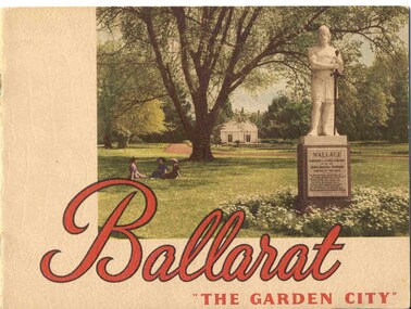
Book, Nu-color-vue or Nucolorvue Productions, "Ballarat - 'The Garden City' ", late 1940's or early 1950s
Yields information about Ballarat through pictures of the 1940-50's various locations, institutions and street scenes, including tramways. Good comparison with earlier books, eg Item 3900.24 page book, plus embossed covers saddle stapled with two staples titled "Ballarat - 'The Garden City' ". Features photographs of Ballarat and district - full colour with accompanying text about Ballarat and its history. Cover features Gardens view with statute of Wallace in foreground - see image c1 p3 - photo of No. 22 (bogie) at Grenville St in Sturt St with a single trucker behind in the City loop - see image c2 - see also Reg Item 5354 for a postcard version. p5 - Eureka Stockade memorial p6 - Lake Wendouree p7 - Sturt St with Town hall in background, and No. 33 in Sturt St. south side. p9 - Begonia hothouse p10 - St Andrews Kirk p11 - St Peter's Church of England p12 - Lake Wendouree p13 - Botanical Gardens p14 - Monuments and statues around Ballarat p15 - Post Office, State Offices, Ballarat Orphanage and Queen Elizabeth Benevolent Home p16 - A Ballarat Reservoir p17 - Botanical Gardens p18 - Gordon's Cottage, Congregational Church, Lydiard St and The Cenotaph p19 - Ballarat Grammar School, St. Patrick's Cathedral (no spire), St. Patrick's College, street scene p20 - Arch of Victory, Lake Wendouree, Sturt St with tram in distance and Eureka Swimming pool p22 - Avenue of Prime Ministers p23 - Harvest near Mt Warrenheip, Country side photo, I&R Morley Pty Ltd factory and houses in the lake area. Purchased through eBay 25/10/2004. See worksheet for eBay emails. See also Reg. Item 3041 for the same image of No. 22. 2nd Copy added 26/12/2007 - donation of Ron Scholten. pdf image of the full book added 8/5/19 as btm2925i.pdf trams, tramways, ballarat, sturt st, history, gardens -
 Bendigo Historical Society Inc.
Photograph - HILDA HILL COLLECTION: BLACK AND WHITE PHOTOS, 1918-1920
Hilda Hill Collection. Black & White Photos of Hill Family Total 9. Three girls at SHLC 1918 with white sashes and medallions, dark clothing with white collars, background is garden scene , photo has over exposure problem which gives a lighter print, 24 September 1918, could it be a ladies college of education? Al standing wearing white blouse and dark dress holding a white hat standing and Gert sitting and holding a white hat in front of a bush wearing a white blouse and a light coloured skirt, background is forested area, 'The Pines' January 9th 1919. Claire dressed in dark dress and wearing a white hat with her hands together, oval photo, 'The Ranche', October 23 1918. Jonah wearing a hat and white dress with colourful hemline standing before a large hedge holding a parasol, large tree background left, 'The Ranche'. Three boys and two dogs All boys dressed in dark coats and shorts long socks two of the boys are on their haunches, Background is a gabled roof and 2 chimneys, white fence, between two of the boys is a water tap on a medium height pipe, Durvol December 1919. Moll Noonan seated on a round backed chair wearing a white dress, right background shows the side of a building, at knee level sis a broad leafed plant, other shrubbery in the background, 'The Ranche' November 1918. Ettie seated on a staircase and holding a dog, lady is wearing a broad brimmed hat, One Tree Hill April 18 1920. Two ladies in lightly coloured dresses standing in a garden setting, lady on left has a black sash waistband, Durvol December 1919 . Group of seven girls and 4 boys, all of the girls are dressed in white, front girl has black neck accessory, 'The Pines' January 9 1919 No. 7 Reservoir.Hilda Hill Personal Collectionaustralia, history, post war life -
 Flagstaff Hill Maritime Museum and Village
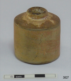
Container - Ink Bottle, 1890s to 1902
This design of ink bottle or ink well was commonly referred to as a ‘penny ink well’ because it was very inexpensive to produce. It is also known as a dwarf ink bottle. It was recovered from the wreck of the 1895-1902 ship Inverlochy and is part of the John Chance Collection. Pen and ink has been in use for hand writing from about the seventh century up until the mid-20th century. Up until around the mid-19th century a quill pen made from a bird’s feather was used. In the 1850s the steel point pen was invented and could be manufactured on machines in large quantities. In the 1880s a successful portable fountain pen was designed, giving a smooth flowing ink and ease of use. Ink wells, used with steel nib dip pens, were commonly used up until the mid-20th century. The pens only held a small amount of ink so users had to frequently dip the nib of the pen into an ink well for more ink. Hand writing with pen and ink left wet writing on the paper, so blotting paper was carefully used to absorb the excess ink and prevent smudging. Ink could be purchased, ready to use, or in the powdered form, which needed to be mixed with water. After the invention of fountain pens, which had a reservoir of ink, and then ballpoint pens, which also had ink that flowed freely, the dip pen was slowly replaced. However, artisans continue to use nib pens to create beautiful calligraphy. INVERLOCHY 1895-1902 - The Inverlochy was a steel sailing barque built in Scotland in 1895 for international trade. In 1902 the Inverlochy left Liverpool under the command of Captain E.R. Kendrick. There were 21 officers and crew and the captain’s wife Mrs Kendrick, on board, bound for Australia with cargo that included tools, chemicals, liquor (beer, whisky, stout, rum, and brandy), steel, iron, wire netting, hoop iron, tinplate and pig iron), and steel wire for the Melbourne Tramway Company, tiles, soap, soft goods and earthenware. On December 18 almost at their destination, the Inverlochy ran aground on Ingoldsby Reef at Point Addis, near Anglesea. The crew and passengers left the ship via lifeboat and landed at Thompson’s Creek, then walked about 20 kilometres to Barwon Heads. Salvagers were interested in the 10 miles of cable in the hold. Mrs Kendrick’s ‘high grade’ bicycle was amongst the items salvaged but she lost her jewellery and two pianos. By February 1903 the ship had broken up and objects such as bottles and casks of liquor were washed ashore. Bad weather shook the wreck in June 1903, causing the ship’s spars and figurehead to be washed ashore. This ink bottle is historically significant as it represents methods of hand written communication that were still common up until the mid-20th century, when fountain pens and ballpoint pens took over in popularity and convenience. The Ink bottle also has significant as it was recovered by John Chance, a diver from the wreck of the Inverlochy in the late 1960s to early 1970s. Items that come from several wrecks along Victoria's coast have since been donated to the Flagstaff Hill Maritime Village’s museum collection by his family, illustrating this item’s level of historical value. This Ink bottle is significant because of its historical connection to the barque Inverlochy, which is an example of a commercial international steel sailing barque and is listed on the Victorian Heritage Database VHR S338. The Inverlochy is significant for its cargo, which is a snapshot of the kind of goods imported into Australia at the turn of the 19th century, including cable for the Melbourne Tramway Company. The wreck of the Inverlochy is important as an accessible dive site that shows the remains of a large international trading vessel and its contents. It is valuable for an insight into Victorian era of shipping and maritime history.Ink bottle or ink well; cylindrical shaped, salt-glazed, mid-brown ceramic bottle. It has a small round mouth, rounded lip that extend past the short neck, wide shoulders, straight sides, flat bottom. Handmade. Also called a Penny Ink Well.flagstaff hill, warrnambool, flagstaff hill maritime museum, maritime museum, shipwreck coast, flagstaff hill maritime village, great ocean road, john chance, inverlochy, scotland, captain e.r. kendrick, melbourne tramway company, tramway cable, ingoldsby reef, point addis, anglesea, thompson’s creek, barwon heads, ink bottle, writing equipment, writing accessory, office equipment, stationery, domestic, stoneware, clay, ceramic, pottery, ink well, inkwell, penny ink well, nib pen, dip pen, ink, hand writing, record keeping, household, business, vintage, blotting paper, dwarf ink -
 Flagstaff Hill Maritime Museum and Village
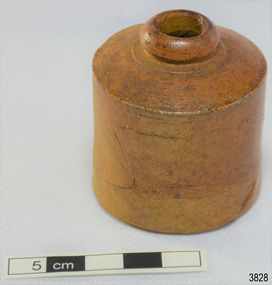
Container - Ink Bottle, 1890s to 1902
This design of ink bottle or ink well was commonly referred to as a ‘penny ink well’ because it was very inexpensive to produce. It is also known as a dwarf bottle. It was recovered from the wreck of the 1895-1902 ship Inverlochy and is part of the John Chance Collection. Pen and ink has been in use for hand writing from about the seventh century up until the mid-20th century. Up until around the mid-19th century a quill pen made from a bird’s feather was used. In the 1850s the steel point pen was invented and could be manufactured on machines in large quantities. In the 1880s a successful portable fountain pen was designed, giving a smooth flowing ink and ease of use. Ink wells, used with steel nib dip pens, were commonly used up until the mid-20th century. The pens only held a small amount of ink so users had to frequently dip the nib of the pen into an ink well for more ink. Hand writing with pen and ink left wet writing on the paper, so blotting paper was carefully used to absorb the excess ink and prevent smudging. Ink could be purchased, ready to use, or in the powdered form, which needed to be mixed with water. After the invention of fountain pens, which had a reservoir of ink, and then ballpoint pens, which also had ink that flowed freely, the dip pen was slowly replaced. However, artisans continue to use nib pens to create beautiful calligraphy. INVERLOCHY 1895-1902 - The Inverlochy was a steel sailing barque built in Scotland in 1895 for international trade. In 1902 the Inverlochy left Liverpool under the command of Captain E.R. Kendrick. There were 21 officers and crew and the captain’s wife Mrs Kendrick, on board, bound for Australia with cargo that included tools, chemicals, liquor (beer, whisky, stout, rum, and brandy), steel, iron, wire netting, hoop iron, tinplate and pig iron), and steel wire for the Melbourne Tramway Company, tiles, soap, soft goods and earthenware. On December 18 almost at their destination, the Inverlochy ran aground on Ingoldsby Reef at Point Addis, near Anglesea. The crew and passengers left the ship via lifeboat and landed at Thompson’s Creek, then walked about 20 kilometres to Barwon Heads. Salvagers were interested in the 10 miles of cable in the hold. Mrs Kendrick’s ‘high grade’ bicycle was amongst the items salvaged but she lost her jewellery and two pianos. By February 1903 the ship had broken up and objects such as bottles and casks of liquor were washed ashore. Bad weather shook the wreck in June 1903, causing the ship’s spars and figurehead to be washed ashore. This ink bottle is historically significant as it represents methods of hand written communication that were still common up until the mid-20th century, when fountain pens and ballpoint pens took over in popularity and convenience. The Ink bottle also has significant as it was recovered by John Chance, a diver from the wreck of the Inverlochy in the late 1960s to early 1970s. Items that come from several wrecks along Victoria's coast have since been donated to the Flagstaff Hill Maritime Village’s museum collection by his family, illustrating this item’s level of historical value. This Ink bottle is significant because of its historical connection to the barque Inverlochy, which is an example of a commercial international steel sailing barque and is listed on the Victorian Heritage Database VHR S338. The Inverlochy is significant for its cargo, which is a snapshot of the kind of goods imported into Australia at the turn of the 19th century, including cable for the Melbourne Tramway Company. The wreck of the Inverlochy is important as an accessible dive site that shows the remains of a large international trading vessel and its contents. It is valuable for an insight into Victorian era of shipping and maritime history. Ink bottle, glazed, prange-brown ceramic cylinder, ring of clay on top for lip, narrow mouth, very short neck on wide shoulder that reaches out to edge of of straight-sided body, flat base. On the shoulder, close to the neck, are concentric lines in the clay. There are dark areas around the lip and mouth opening. The clay appears to have a fold line on its body. The material has flecks of darker material in it. Sediment around shoulder. Handmade. Also called a Penny Ink Well.flagstaff hill, warrnambool, flagstaff hill maritime museum, maritime museum, shipwreck coast, flagstaff hill maritime village, great ocean road, john chance, inverlochy, scotland, captain e.r. kendrick, melbourne tramway company, tramway cable, ingoldsby reef, point addis, anglesea, thompson’s creek, barwon heads, ink bottle, writing equipment, writing accessory, office equipment, stationery, domestic, stoneware, clay, ceramic, pottery, ink well, inkwell, penny ink well, nib pen, dip pen, ink, hand writing, record keeping, household, business, vintage, blotting paper, dwarf ink -
 Eltham District Historical Society Inc
Film - Video (DVD), Melbourne and Metropolitan Board of Works, Yarra River Conference Proceedings; a Board of Works centenary event, 13-16 April 1991
Yarra River Conference History Segment [Noted on VHS tape jackets "Due to unavoidable circumstances, the quality of these tapes in some setions is less than desired."] The Yarra River Conference, organised by the Board of Works as part of the Centenary Celebrations, was held in the Board's Head Office Theatrette from 13-16 April, 1991. A segment of the Conference focussed on the role that the Yarra River has played in relation to the historical development of Melbourne. Conceived and presented by a group of prominent historians as a chronological 'trip down the river in time', and profusely illustrated with slides, this segment traced the various impacts that urban and rural growth, development of marine commerce, recreational uses, and environmental problems have had on the Yarra during a century and a half of European occupation. As no formal written paper of this combined presentation is available, these two video-tapes provide a record for anyone who has an interest in tis fascinating aspect of the Yarra's history. The speakers who combined to present this segment are identified on the cover of Tape 2. Tape 1 (2 hours) 1838-1863 Deputy ?? to Utility Early navigators of the Yarra River; developing the port of Melbourne; the gold rush and its effect on the new colony; punts and bridges; water supply; pollution of the Yarra; the discovery of gold and early settlement of the Yarra valley; floods of 1839 and 1863. 1863-1891 Formation of the Harbour Trust; Coode Canal; pollution of the Yarra by industry; aborigines, gold miners, timber getters in the Upper Yarra areas; bridges; the flood of 1891. Tape 2 ( 1 1/2 hours) 1892-1934: People Begin to See Beauty and Romance to the River Henley-on-Yarra; realignment of the Yarra; MMBW is responsible for a sewerage system; new docks to cope with increased overseas trade; development of recreational parks; new reservoirs; timber production and timber tramways; bushfire; flood of 1934. 1935-1970: The River is Neglected Still, Except When it Proves Useful Bushfirs of 1939; the end of many sawmills; birth of tourism; increased interest in conservation and preservation of land for open space; further augmentation of water supply system; birth of containerisation changes the port; environmental concerns gain momentum. Speakers Dr Tony Dingle *, Department of Economic History, Monash University Dr Carolyn Rasmussen *, History Consultant Prof. Graeme Davison, History Department, Monash University Mr. Tom Griffiths, Lecturer in Public History, Monash Uiversity Mr. Patrick Miller, History Consultant Mr. Colin Jones, Author and Historian * Co-authors of the Board's history, 'Vital Connections'.video recording, yarra river, conference proceedings