Showing 4655 items
matching white hills.
-
 Eltham District Historical Society Inc
Photograph - Digital Photograph, Alan King, Jarrold Cottage, 701 Main Road, Eltham, 29 January 2008
Jarrold Cottage or White Cloud is known by many to be associated with the Skipper family, and has been since 1944 when Lena Skipper, wife of Mervyn Skipper purchased the cottage. She purchased it from the Estate of Thekla Jarrold who had died in March of the previous year. By the time Thekla died, she had lived in the Jarrold Cottage for 50 years. Thekla Alvenia Sissilia Ellian married John William Jarrold in 1888 at Clifton Hill. They started their family there but when John’s father William (who was married to Hannah Coleman) died in 1893 the family moved to Eltham. William had married Hannah Coleman in 1856 at his home in Eltham. William had arrived in the colony in 1848 so it is believed the Jarrold Cottage goes back at least to 1856 and possibly early 1850s. For a short period of time the cottage was rented to the Police as a temporary Police Station whilst a new and more permanent station was built further up the hill in 1859. The cottage was originally located closer to the Diamond Creek but was subject to flooding so was relocated to its present position on top a mound of rubble placed there from the nearby quarry next to the Dalton Street school (on Main Road). By 1916, John Henry Clark, a photographer who took many early photos of Eltham relocated from Fitzroy to Eltham and boarded with recently widowed Thekla Jarrold and her family. He changed professions from photographer to boot and harness maker around 1931 and Thekla had a small bootmakers shop built ifor him in the corner of her property next to the family home. J.H. Clark remained living at the property until his death in December 1956. At some stage after Clark's death, Lena Skipper is recorded living at the property having relocated from Montsalvat following the death of her husband Mervyn. The property continues to remain within the Skipper family as of 2023. Covered under Heritage Overlay, Nillumbik Planning Scheme. Published: Nillumbik Now and Then / Marguerite Marshall 2008; photographs Alan King with Marguerite Marshall.; p47This collection of almost 130 photos about places and people within the Shire of Nillumbik, an urban and rural municipality in Melbourne's north, contributes to an understanding of the history of the Shire. Published in 2008 immediately prior to the Black Saturday bushfires of February 7, 2009, it documents sites that were impacted, and in some cases destroyed by the fires. It includes photographs taken especially for the publication, creating a unique time capsule representing the Shire in the early 21st century. It remains the most recent comprehenesive publication devoted to the Shire's history connecting local residents to the past. nillumbik now and then (marshall-king) collection, bootmaker's shop, hannah coleman, jarrold cottage, john henry clark, john william jarrold, lena skipper, police station, thekla alvenia sissilia jarrold (nee ellian), white cloud cottage, william jarrold -
 Eltham District Historical Society Inc
Photograph - Digital Photograph, Alan King, Former bootmaker's shop, Main Road Eltham, 29 January 2008
The former bootmaker's shop is one of only three remaining original shops from the early 20th century in what was once Little Eltham, the others being the present day Cafe Zen-Den at 736 Main Road and the former Burgoyne General Store and Post Office, present-day San Antonio Barbershop at 820 Main Road. Jarrold Cottage or White Cloud is known by many to be associated with the Skipper family, and has been since 1944 when Lena Skipper, wife of Mervyn Skipper purchased the cottage. She purchased it from the Estate of Thekla Jarrold who had died in March of the previous year. By the time Thekla died, she had lived in the Jarrold Cottage for 50 years. Thekla Alvenia Sissilia Ellian married John William Jarrold in 1888 at Clifton Hill. They started their family there but when John’s father William (who was married to Hannah Coleman) died in 1893 the family moved to Eltham. William had married Hannah Coleman in 1856 at his home in Eltham. William had arrived in the colony in 1848 so it is believed the Jarrold Cottage goes back at least to 1856 and possibly early 1850s. For a short period of time the cottage was rented to the Police as a temporary Police Station whilst a new and more permanent station was built further up the hill in 1859. The cottage was originally located closer to the Diamond Creek but was subject to flooding so was relocated to its present position on top a mound of rubble placed there from the nearby quarry next to the Dalton Street school (on Main Road). By 1916, John Henry Clark, a photographer who took many early photos of Eltham relocated from Fitzroy to Eltham and boarded with recently widowed Thekla Jarrold and her family. He changed professions from photographer to boot and harness maker around 1931 and Thekla had a small bootmakers shop built ifor him in the corner of her property next to the family home. J.H. Clark remained living at the property until his death in December 1956. At some stage after Clark's death, Lena Skipper is recorded living at the property having relocated from Montsalvat following the death of her husband Mervyn. The property continues to remain within the Skipper family as of 2023. Covered under Heritage Overlay, Nillumbik Planning Scheme. Published: Nillumbik Now and Then / Marguerite Marshall 2008; photographs Alan King with Marguerite Marshall.; p47This collection of almost 130 photos about places and people within the Shire of Nillumbik, an urban and rural municipality in Melbourne's north, contributes to an understanding of the history of the Shire. Published in 2008 immediately prior to the Black Saturday bushfires of February 7, 2009, it documents sites that were impacted, and in some cases destroyed by the fires. It includes photographs taken especially for the publication, creating a unique time capsule representing the Shire in the early 21st century. It remains the most recent comprehenesive publication devoted to the Shire's history connecting local residents to the past. nillumbik now and then (marshall-king) collection, bootmaker's shop, jarrold cottage, john henry clark, lena skipper, thekla alvenia sissilia jarrold (nee ellian), white cloud cottage, shops -
 Eltham District Historical Society Inc
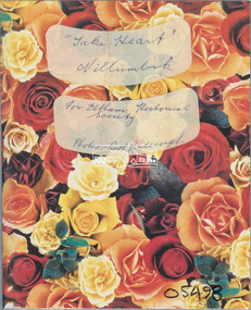
Album - Photo Album, Ruth Pendavingh, Take Heart, Nillumbik, 1998-2002
Album of photographs associated with activities of the Cardiac Rehab "Take Heart" Group including the Arthritis Group (Land and Water exercise) managed by Eltham Community Health Centre allied health assistant, arthritis group (land and water exercise), arthritis group, arthurs creek, betty willis, bundoora park, cardiac rehab 'take heart' group, christmas break-up, diamond valley railway, dirk pendavingh, elizabeth dick, eltham community health centre, eltham health group, eltham leisure centre, eltham lower park, eltham, ernie robinson, fairfield park, fairfield, flagstaff hill, griffiths park, ken willis, lavender farm, migrant teachers, mt cooper, new eltham diabetes contact group, parkinson support group, picnic, ruth pendavingh, scienceworks, sugarloaf reservoir, veronica white-hall, warringal, water exercise group, warrrnambool, warrnambool rsl -
 Eltham District Historical Society Inc
Document - Folder, McDonald/Draper
The McDonald and Draper families were pioneers of the Arthur's Creek and Kangaroo Ground areas. Contents Letter from Ross McDonald, 26 May 2010, to Eltham District Historical Society, enclosing copy of booklet prepared for McDonald/Draper family meeting 8 April 2010 at Arthur's Creek Mechanics Institute. Booklet mentions, among others, Harry Gilham, Rob White, Ruby McDonald. Disc and print of Powerpoint presentation to Eltham District Historical Society on McDonald/Draper families. Newspaper clippings, A4 photocopies, etcross mcdonald, mcdonad/draper families, arthur's creek victoria, kangargoo ground victoria, harry gilham, rob white, ruby mcdonald, memorial tower kangaroo ground, charles draper, garden hill kangaroo ground -
 Eltham District Historical Society Inc
Photograph - Digital Photograph, Alan King, Shire of Eltham War Memorial, Kangaroo Ground, 28 January 2008
The Eltham Shire War Memorial, a tower of remembrance, was built with public donations to commemorate the memory of the fallen soldiers from the shire who enlisted in the 1914-1918 war. The tower is reminiscent of the peel-towers or watchtowers that lined the English-Scottish border from the mid 14th century to around 1600 and is constructed from locally quarried stone. This uncommon and picturesque war memorial, which affords an excellent view of the surrounding district was unveiled by His Excellency the Governor-General (Lord Stonehaven) on November 11, 1926. In July 1922 a deputation of returned soldiers from Panton Hill, presumably the Panton Hill branch of the Returned Sailors and Soldiers Imperial League of Australia (RSSILA), proposed to Eltham Shire Council that the monument should be a cairn of local stone “sufficiently high to form a prominent and conspicuous landmark, and crowned with some suitable device”. Eltham Shire Councillor and President of the Panton Hill branch of the RSSILA, Basil Hall, was credited with being the first to suggest a tower, and with organising a Memorial Park committee to raise funds for the monument in the Memorial Park. A meeting for those interested in the establishing a War Memorial monument in the park was held in January 1924 and the Eltham Shire War Memorial League was formed for this purpose. It appears that the broad and rounded cairn that had been recently built was considered by the League a temporary affair, and not the substantial cairn-as-monument, sufficiently high to form the conspicuous landmark, which had been envisaged by the Panton Hill RSSILA. A design competition was held for the monument. The chairman of the League, Councillor Basil Hall, suggested that the site of the memorial in Kangaroo Ground would lend itself to something rugged, instead of polished stone. By April 1924 thirty designs for a memorial had been received from which three designs were selected and of those, the design by the shire engineer Mr McCormack, for a 70ft tower suitable for construction in rough stone, was chosen. Artist Harold Herbert suggested that a peel tower-like design reminiscent of those along the English-Scottish border would be fitting for the site. Herbert drew up a rough sketch that was approved of, and later, Melbourne architect Percy Meldrum volunteered to draw up the design from sketch to architectural drawings. By January 1925 the Soldiers’ Memorial League had adopted Meldrum’s design for a 50ft high tower. Meldrum had also offered his design and supervision of construction free of charge. The Shire provided the stone to the builders, which was a gift quarried from land owned at Kangaroo Ground by Dr Ethel and Professor William Osborne The Shire of Eltham War Memorial, a tower of remembrance, and honour board were unveiled on November 11, 1926, by the Governor General Lord Stonehaven. At this stage a temporary honour roll was painted on the panels on either side of the tower entrance. In September 1930 bronze plates were added above the portal with the names of men who fell in the 1914-18 war. On November 16, 1951, the Governor of Victoria, Sir Dallas Brooks re-dedicated the war memorial tower and unveiled the names of men who gave their lives in the 1939-45 war. Two additional bronze plaques which recognise service in the armed conflicts of Korea, Borneo, Malaya, and Vietnam were unveiled November 11, 2001, by the Governor of Victoria, John Landy, A.C., M.B.E. The tower was first used for fire spotting activities following the Black Friday bushfire in January 1939 in response to a request from Mr R.D. Ness, secretary of the Kangaroo Ground bush fire brigade, who asked Council that the tower be used as an observation tower for detecting bush fires, and asked Council to arrange a telephone to be installed. It was suggested that if the Shire were to appoint a caretaker for the Memorial Park, his duties could also include raising the alarm in the event of a fire. Later in 1939 Council applied for a radio transmitter, which the Forestry Commission planned to install at vantage places throughout the state. The first dedicated fire spotter appointed from December1948, was Mr Smith of Warrandyte. A prefabricated glazed cabin was installed in 1974, which involved the removal of the original stone structure around the rooftop exit door. A new fire spotting cabin, which included the latest technology, was installed soon after the 2009 Black Saturday fires and is manned by CFA personnel on high fire danger days. Covered under Heritage Overlay, Nillumbik Planning Scheme. Published: Nillumbik Now and Then / Marguerite Marshall 2008; photographs Alan King with Marguerite Marshall.; p123This collection of almost 130 photos about places and people within the Shire of Nillumbik, an urban and rural municipality in Melbourne's north, contributes to an understanding of the history of the Shire. Published in 2008 immediately prior to the Black Saturday bushfires of February 7, 2009, it documents sites that were impacted, and in some cases destroyed by the fires. It includes photographs taken especially for the publication, creating a unique time capsule representing the Shire in the early 21st century. It remains the most recent comprehenesive publication devoted to the Shire's history connecting local residents to the past. While published in the book in black and white, this collection features the original colour digital photographs. nillumbik now and then (marshall-king) collection, garden hill, kangaroo ground, memorial park, shire of eltham war memorial -
 Eltham District Historical Society Inc
Photograph, Peter Pidgeon, Dalton Street, Eltham, 2 Aug. 2022
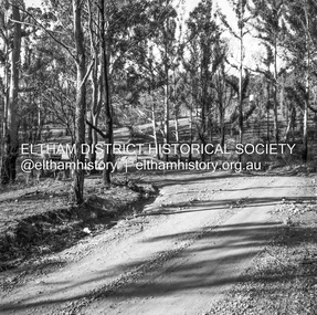
View looking up Dalton Street from near Main Road where the former pond was situated. The pond was drained by Council in 1932 due to concerns of mosquitoes, etc against the wishes of long standing residents such as Thekla Jarrold (39 years) and John Clark (22 years). On the right is the Eltham Primary Schoool No. 209 with the former Headmaster's residence and to the left is Eltham Clinic once the site of the Grant home. Comparison photo: SEPP_0643 In April 1935 the local paper reported on a story where a schoolgirl was talking whilst on her bicycle and it started moving off, flying down Dalton Street and across the main road missing cars and the guy wires for the telephone pole and hurtled 21 feet through the air into the drained pond suffering a broken arm and shock. She was rescued unconscious by John and taken into Mrs Jarrold’s for first aid. This was not the only instance of young girls losing control of bicycles down the hill. Part of a presentation by Peter Pidgeon to the Society, 13 August 2022 showcasing a series of photographs taken by John Henry Clark over the period 1895 to 1930. John Henry Clark was the youngest of three boys born to William Henry Clark (1823-1877) and Maria White (1843-1914). He and his brothers, William Charles Clark (1872-1945), Clement Kent Clark (1874-1912) operated a photography business (Clark Bros.) from 25 Thomas Street, Windsor near Prahran during the period c.1894 to 1914. Following death of Clement in September 1912 and their mother in 1914, the Clark Bros business appears to have dissolved, the premises demolished, and a new house was under construction in 1915. John set up business independently in 1914 operating out of 29 Moor Street, Fitzroy where he is registered in the 1914 and 1915 Electoral Rolls. By 1916 John had relocated to Eltham where he continued his practice as a photographer and took many of the early images around the district of Little Eltham. Around 1930 John changed professions and opened a small cobbler's shop in 1931 near the pond opposite Dalton Street adjacent to the Jarrold family cottage. He never married and continued his profession as a bootmaker from this little shop, maintaining a close relationship with Mrs Jarrold for the rest of their lives. His bootmaker shop remains today beside the Whitecloud cottage and is one of only three remaining shops in the area from the early 20th century.Comparative photo taken 2022 with one taken from same location over 100 years earlier by noted local photographer J.H. ClarkBorn Digitaleltham, j.h. clark photo (2022), dalton street, main road, eltham clinic, eltham primary school, headmaster's residence, state school no. 209 -
 Eltham District Historical Society Inc
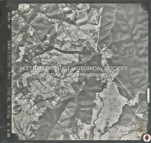
Photograph - Aerial Photograph, Smiths Gully, Christmas Hills, St Andrews, Kinglake National Park, 6 Mar. 1986
Small scale Red arrow indicates Northshire of eltham archives, aerial photo, christmas hills, kinglake national park, smiths gully, st andrews -
 Eltham District Historical Society Inc
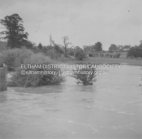
Album - Photograph, J.A. McDonald, Eltham-Greensborough Road, 18 Oct. 1956
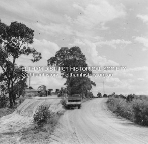
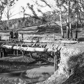
Bridge Street Bridge Flooding on Hill’s property 18th October 1956 This view is looking west north west from the Bridge Street Bridge across the present day Eltham Skatepark. The shed visibile in the distance is directly opposite Brisbane Street where it used to run into Susan Street but now turns the corner. To the right of the shes is the site for present-dayHarris Plumbing which was formerly occupied by Sibbel Builders; to the left the site now occupied by Bunnings. At the skyline to the right of centreeline is a gap in the trees where the railway line runs. The Silver Street bridge over the railway is visible. Beware!.. our rivers are rising (1956, October 19). The Argus (Melbourne, Vic. : 1848 - 1957), p. 1. Retrieved August 24, 2022, from http://nla.gov.au/nla.news-article84392304Record of various Shire of Eltham infrastructure works undertaken during the period of 1952-1962 involving bridge and road reconstruction projects, sometimes with Eltham Shire Council Project Reference numbers quoted. It was during this period that a number of significant improvements were made to roads and new bridges constructed within the shire that remain in place as of present day (2022). In many situations, the photos provide a tangible visible record of infrastructure that existed throughout the early days of the Shire. The album was put together by or under the direction of the Shire Engineer, J.A. McDonald.infrastructure, road construction, shire of eltham, bridge construction, bridge street bridge, eltham, eltham-greensborough road, 1956-10-18, diamond creek (creek), floods, floodwater, hill property, silver street bridge -
 Eltham District Historical Society Inc
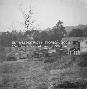
Album - Photograph, J.A. McDonald, Eltham-Yarra Glen Road, 3 Aug. 1956
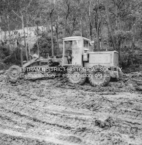
... Eltham-Yarra Glen Road 1956-08-03 Caterpillar Christmas Hills ...Reconstruction Christmas Hills Showing Caterpillar bogged – 3/8/1956Record of various Shire of Eltham infrastructure works undertaken during the period of 1952-1962 involving bridge and road reconstruction projects, sometimes with Eltham Shire Council Project Reference numbers quoted. It was during this period that a number of significant improvements were made to roads and new bridges constructed within the shire that remain in place as of present day (2022). In many situations, the photos provide a tangible visible record of infrastructure that existed throughout the early days of the Shire. The album was put together by or under the direction of the Shire Engineer, J.A. McDonald.infrastructure, road construction, shire of eltham, bridge construction, eltham-yarra glen road, 1956-08-03, caterpillar, christmas hills, graders -
 Eltham District Historical Society Inc
Album - Photograph, J.A. McDonald, Eltham-Yarra Glen Road, 3 Aug. 1956
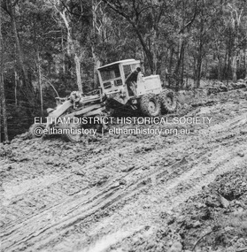
... Eltham-Yarra Glen Road 1956-08-03 Caterpillar Christmas Hills ...Reconstruction Christmas Hills Showing Caterpillar bogged – 3/8/1956Record of various Shire of Eltham infrastructure works undertaken during the period of 1952-1962 involving bridge and road reconstruction projects, sometimes with Eltham Shire Council Project Reference numbers quoted. It was during this period that a number of significant improvements were made to roads and new bridges constructed within the shire that remain in place as of present day (2022). In many situations, the photos provide a tangible visible record of infrastructure that existed throughout the early days of the Shire. The album was put together by or under the direction of the Shire Engineer, J.A. McDonald.infrastructure, road construction, shire of eltham, bridge construction, eltham-yarra glen road, 1956-08-03, caterpillar, christmas hills, graders -
 Eltham District Historical Society Inc
Album - Photograph, J.A. McDonald, General; Box Hill Tip, c. 1956
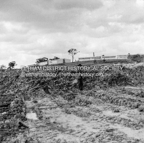
... Box Hill Teachers College Box Hill Tip Black and white photo ...Box Hill tip looking east, showing Teachers College and State School 4 ft face.Record of various Shire of Eltham infrastructure works undertaken during the period of 1952-1962 involving bridge and road reconstruction projects, sometimes with Eltham Shire Council Project Reference numbers quoted. It was during this period that a number of significant improvements were made to roads and new bridges constructed within the shire that remain in place as of present day (2022). In many situations, the photos provide a tangible visible record of infrastructure that existed throughout the early days of the Shire. The album was put together by or under the direction of the Shire Engineer, J.A. McDonald.infrastructure, shire of eltham, benchmark studies, box hill state school, box hill teachers college, box hill tip -
 Eltham District Historical Society Inc
Album - Photograph, J.A. McDonald, Kangaroo Ground-Queenstown Road, Mar. 1959
... -Queenstown Road Kangaroo Ground-St Andrews Road Panton Hill Black ...(Kangaroo Ground-St Andrews Road) Realignment South of Alma Road, Panton Hill Opposite CA Sec., Parish of Greensborough March 1959Record of various Shire of Eltham infrastructure works undertaken during the period of 1952-1962 involving bridge and road reconstruction projects, sometimes with Eltham Shire Council Project Reference numbers quoted. It was during this period that a number of significant improvements were made to roads and new bridges constructed within the shire that remain in place as of present day (2022). In many situations, the photos provide a tangible visible record of infrastructure that existed throughout the early days of the Shire. The album was put together by or under the direction of the Shire Engineer, J.A. McDonald.infrastructure, shire of eltham, bridge construction, heidelberg-kinglake road, road construction, 1959-03, alma road, kangaroo ground-queenstown road, kangaroo ground-st andrews road, panton hill -
 Eltham District Historical Society Inc
Album - Photograph, J.A. McDonald, Were Street, Montmorency, Nov. 1956
Victoria Roads construction May 1956Record of various Shire of Eltham infrastructure works undertaken during the period of 1952-1962 involving bridge and road reconstruction projects, sometimes with Eltham Shire Council Project Reference numbers quoted. It was during this period that a number of significant improvements were made to roads and new bridges constructed within the shire that remain in place as of present day (2022). In many situations, the photos provide a tangible visible record of infrastructure that existed throughout the early days of the Shire. The album was put together by or under the direction of the Shire Engineer, J.A. McDonald.infrastructure, shire of eltham, 1956-05, briar hill fibrous plaster, bridge construction, bulldozer, montmorency, road construction, were street -
 Eltham District Historical Society Inc
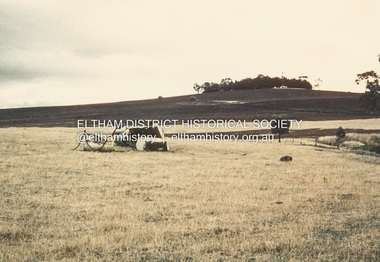
Album - Photograph, J.A. McDonald, Garden Hill, Kangaroo Ground, c. 1962
Garden Hill burnt following bush fires - most likely the 15-16 Jan 1962 fire A helicopter can be seen flying over the top of the hill Eltham Shire Council purchased this property in the early 1970s and it has now been incorpoarted within the Shire of Eltham Memorial ParkRecord of various Shire of Eltham infrastructure works undertaken during the period of 1952-1962 involving bridge and road reconstruction projects, sometimes with Eltham Shire Council Project Reference numbers quoted. It was during this period that a number of significant improvements were made to roads and new bridges constructed within the shire that remain in place as of present day (2022). In many situations, the photos provide a tangible visible record of infrastructure that existed throughout the early days of the Shire. The album was put together by or under the direction of the Shire Engineer, J.A. McDonald.1962, garden hill, kangaroo ground, shire of eltham memorial park, victorian bushfires - 1962 -
 Eltham District Historical Society Inc
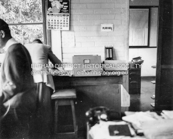
Album - Photograph, J.A. McDonald, Garden Hill, Kangaroo Ground, Feb. 1963
Most likley the interior of the Eltham Shire Offices at the corner of Artur Street and Main Road. The calendar is set on February 1963. ERngineering and Planning were also loacted in the shop fronts located next door on Main Road.Record of various Shire of Eltham infrastructure works undertaken during the period of 1952-1962 involving bridge and road reconstruction projects, sometimes with Eltham Shire Council Project Reference numbers quoted. It was during this period that a number of significant improvements were made to roads and new bridges constructed within the shire that remain in place as of present day (2022). In many situations, the photos provide a tangible visible record of infrastructure that existed throughout the early days of the Shire. The album was put together by or under the direction of the Shire Engineer, J.A. McDonald.arthur street, eltham, eltham shire office, main road, 1963-02 -
 Eltham District Historical Society Inc
Negative - Photograph, J.A. McDonald, Kangaroo Ground-Queenstown Road, Aug. 1960
Beginning of roll of film Most likely at (Kangaroo Ground-St Andrews Road) “Rymers” Corner – shifting Hawthorn hedges on Tompkins property August 1960Record of various Shire of Eltham infrastructure works undertaken during the period of 1952-1962 involving bridge and road reconstruction projects, sometimes with Eltham Shire Council Project Reference numbers quoted. It was during this period that a number of significant improvements were made to roads and new bridges constructed within the shire that remain in place as of present day (2022). In many situations, the photos provide a tangible visible record of infrastructure that existed throughout the early days of the Shire. The album was put together by or under the direction of the Shire Engineer, J.A. McDonald.infrastructure, shire of eltham, 1960-08, garden hill, kangaroo ground, kangaroo ground-queenstown road, kangaroo ground-st andrews road, rymers corner -
 Eltham District Historical Society Inc
Negative - Photograph, J.A. McDonald, Clintons Road, Christmas Hills, 2 July 1962
Looking southwards Temporary bridge on RHS 2 July 1962 The bridge was destroyed by bushfires 15-16 January 1962Record of various Shire of Eltham infrastructure works undertaken during the period of 1952-1962 involving bridge and road reconstruction projects, sometimes with Eltham Shire Council Project Reference numbers quoted. It was during this period that a number of significant improvements were made to roads and new bridges constructed within the shire that remain in place as of present day (2022). In many situations, the photos provide a tangible visible record of infrastructure that existed throughout the early days of the Shire. The album was put together by or under the direction of the Shire Engineer, J.A. McDonald.1962-07-02, bridge construction, christmas hills, clintons road, infrastructure, shire of eltham, victorian bushfires - 1962, bush fires -
 Eltham District Historical Society Inc
Negative - Photograph, J.A. McDonald, Clintons Road, Christmas Hills, 2 July 1962
Burned bridge Temporary bridge on RHS 2 July 1962 The bridge was destroyed by bushfires 15-16 January 1962Record of various Shire of Eltham infrastructure works undertaken during the period of 1952-1962 involving bridge and road reconstruction projects, sometimes with Eltham Shire Council Project Reference numbers quoted. It was during this period that a number of significant improvements were made to roads and new bridges constructed within the shire that remain in place as of present day (2022). In many situations, the photos provide a tangible visible record of infrastructure that existed throughout the early days of the Shire. The album was put together by or under the direction of the Shire Engineer, J.A. McDonald.1962-07-02, bridge construction, christmas hills, clintons road, infrastructure, shire of eltham, victorian bushfires - 1962, bush fires -
 Eltham District Historical Society Inc
Negative - Photograph, J.A. McDonald, One Tree Hill Road Bridge, Christmas Hills, 2 July 1962
One Tree Hill Road Looking south 2/7/62 The bridge was destroyed by bushfires 15-16 January 1962. A temporary bridge was set up to the east sideRecord of various Shire of Eltham infrastructure works undertaken during the period of 1952-1962 involving bridge and road reconstruction projects, sometimes with Eltham Shire Council Project Reference numbers quoted. It was during this period that a number of significant improvements were made to roads and new bridges constructed within the shire that remain in place as of present day (2022). In many situations, the photos provide a tangible visible record of infrastructure that existed throughout the early days of the Shire. The album was put together by or under the direction of the Shire Engineer, J.A. McDonald.1962-07-02, bridge construction, christmas hills, infrastructure, shire of eltham, victorian bushfires - 1962, bush fires, one tree hill road, property damage -
 Eltham District Historical Society Inc
Photograph - Black and White Print, Moor-rul Viewing Platform, March 2007
Early stages - no display panels installed. OPENING OF THE VIEWING PLATFORM AT KANGAROO GROUND Nillumbik Council has advised that the viewing platform at Kangaroo Ground 27km NE of Melbourne is to be opened to the public on Wednesday, March 26th 2008 (Melway 271 , G10). The function of the platform is to provide shelter adjacent to the War Memorial Tower whilst allowing all people to enjoy the stunning panoramic views. From the platform you. can see the Dandenongs, the city of Melbourne, the You Yangs, Mount Macedon, the Kinglake Ranges and the Mt Baw-Baw Ranges where the Yarra River starts. This landscape covers all the ancestral lands of the Wurundjeri and some of the wider Kulin nation land. The platform has been given the name Moor-rut, a name which described the fertile soils of the Kangaroo Ground area in contrast to the poorer (Silurian) country of its surrounds, which the Wurundjeri knew as 'Nillumbik' or less rich country. The full 360 degree view can be seen from the adjacent Tower of Remembrance which has 53 stairs. The viewing platform however can be accessed by wheelchair. Inside the viewing platform there are eight double sided interpretive panels giving the history and information regarding this special area. The viewing platform's interpretive panels set out the Aboriginal and European history of the area and also the geology and the local flora and fauna, so that the casual visitor comes away understanding more about this significant part of Victoria. The concept of the viewing platform is part of the refurbishment project for the Kangaroo Ground War Memorial Park which has taken place since 1997 with the active approval and financial assistance of the Nillumbik Shire Council. This project has been guided by an Advisory Committee with volunteer community representatives from the local Historical Societies, the Country Fire Authority, the Returned Services League and the Wurundjeri people. Other allied groups such as the Nillumbik Reconciliation Group have been called upon for their expertise. The initial idea for the viewing platform came from Dean Stewart when he was the caretaker while living at the park. He discussed this idea with local author Mick Woiwod and Harry Gilham of Eltham District Historical Society when they were planning the refurbishment of the War Memorial Park in 1996. When the committee was formalised by the Nillumbik Council in 1997, Nicholas Pelling, representing the CFA and RSL, joined the group. Dennis Ward, local architect, then volunteered to develop the concept plan for the refurbishment of the park and later drew up the plans for the viewing platform. The Kangaroo Ground War Memorial Park and its Tower of Remembrance is located on one of the highest locations in the Yarra Valley. The Tower of Remembrance is a unique war memorial constructed from local stone standing 14 metres high. It was built in the style of a Scottish watchtower reflecting the strong Scottish influence of the first European settlers of the district from the 1840s onward. The park was opened in 1921 and the Tower of Remembrance was dedicated in 1926 recognising the local people who served in the First World War. Those who served in the Second World War were recognised by plaques dedicated in 1951 and more recently those who served in Korea, Borneo, Malaya and Vietnam by plaques unveiled in 2001. Harry Gilham, Advisory Committee Convenor - Eltham District Historical Society Newsletter N0 179 March 2008 Black and white inkjet print on paper 14 x 21 cmmoor-rul viewing platform, garden hill, kangaroo ground, memorial park -
 Eltham District Historical Society Inc
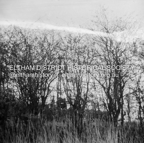
Photograph - Black and White Print, Unidentified view, possibly Eltham, c.1985
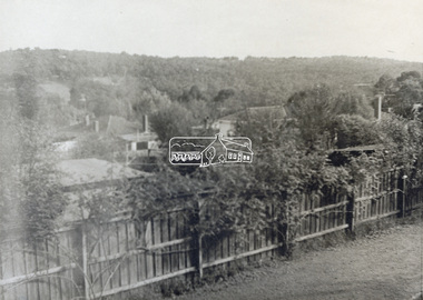
View looking over residential housing towards hills covered in trees - possibly Eltham areaBlack & White print on textured photographic paperunidentified, residential -
 Eltham District Historical Society Inc
Photograph - Black and White Print, Unidentified view, possibly Eltham, c.1985
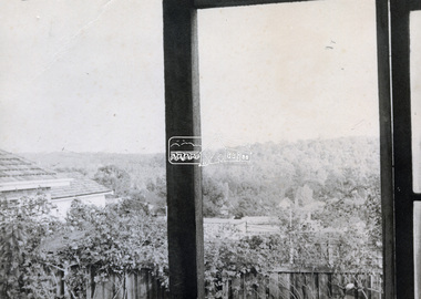
View looking over residential housing towards hills covered in trees - possibly Eltham areaBlack & White print on textured photographic paperunidentified, residential -
 Eltham District Historical Society Inc
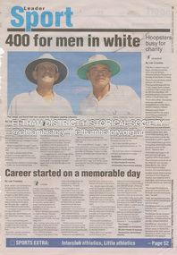
Document - Folder, Cricket, Diamond Valley News, 400 for men in white, 2 February 2005
Two local men, Paul Jenson of Briar Hill and Darrell Holt of Bundoora have brought up their 400th match as Cricket Victoria umpires.Newspaper articleTwo local men, Paul Jenson of Briar Hill and Darrell Holt of Bundoora have brought up their 400th match as Cricket Victoria umpires.cricket, umpires, paul jenson, darrell holt -
 Eltham District Historical Society Inc
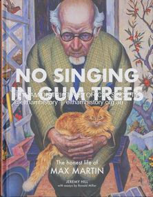
Book, Jeremy Hill et al, No singing in gum trees : the honest life of Max Martin / Jeremy Hill ; with essays by Ronald Miller, 2023
Summary "A young man from the working-class suburb of Fitzroy was on the cusp of a brilliant career and was the talk of the Academy's salons. Far from his humble origins, he now stood shoulder to shoulder with the leading figures of London's art world. Max Martin was an enigmatic achiever who stood briefly on the mountaintop but died in obscurity. It was over thirty years after his death before a painting of his was acquired by a public collection. The National Gallery of Victoria, Newcastle City Gallery in New South Wales and the art collection of the State Library of Victoria now all hold his work. What made him turn his back on painting at the height of critical acclaim? How close was he to a career in mainstream ballet and what drove him to march for disarmament in his later years?"--Booktopia.artists, eltham, max martin, biography -
 Eltham District Historical Society Inc
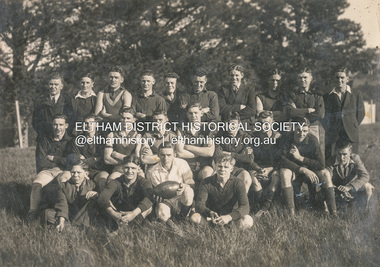
Photograph, Diamond Creek Football Club, c.1906
Thomas Edmund Fielding (1874-1957) was a significant member of the Diamond Creek Footbal Club during the early 1900s. Son of Robert Fielding (1820-1891) and Jemima Whatmough (1840-1926) and grandson of Plenty River pioneers Robert Whatmough (1815-1887) and Mary Hill (1813-1881)diamond creek football club, thomas edmund fielding, tom fielding collection, sports -
 Eltham District Historical Society Inc
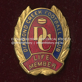
Medal - Badge, Diamond Creek Football Club Life Member, c.1906
Thomas Edmund Fielding (1874-1957) was a significant member of the Diamond Creek Footbal Club during the early 1900s. Son of Robert Fielding (1820-1891) and Jemima Whatmough (1840-1926) and grandson of Plenty River pioneers Robert Whatmough (1815-1887) and Mary Hill (1813-1881)diamond creek football club, thomas edmund fielding, tom fielding collection, sports -
 Eltham District Historical Society Inc
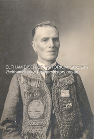
Photograph, The Allan Studio, Thomas Edmund Fielding in his IOOF uniform, c.1901
Independent Order of Odd Fellows (IOOF) https://en.wikipedia.org/wiki/Independent_Order_of_Odd_Fellows Thomas Edmund Fielding (1874-1957) was a significant member of the Diamond Creek Footbal Club during the early 1900s. Son of Robert Fielding (1820-1891) and Jemima Whatmough (1840-1926) and grandson of Plenty River pioneers Robert Whatmough (1815-1887) and Mary Hill (1813-1881) Photo: The Allan Studio, 318 Smith Street, Collingwood Mark Joshua Allan, Photographer operated fropm 318 Smith Street Collingwood from 1887 to 1901thomas edmund fielding, tom fielding collection, independent order of odd fellows (ioof), m.j. allan photographers 318 smith st collingwood -
 Glen Eira Historical Society
Photograph - Nithsdale
This file contains 2 items (4 images) of this property: One reproduction of photograph of Nithsdale, date unknown in black and white. Two photographs of tower (different angles of front) at Nithsdale, date unknown in black and white plus one photocopied photo of tower. All three are copies of photographs in 'Historical Caulfield to 1972' compiled by Mrs Jenny O'Donnell, taken between 1966-1972 and held by the Glen Eira Historical Society (p102).nithsdale', architectural features, towers, caulfield north, kambrook road, glen eira road, 'five way hill' -
Glen Eira Historical Society
Document - Elizabeth Street, 44, Elsternwick
A two page copy of a Caulfield Conservation Study by Andrew Ward, dated 09/1994, on Clifton at 44 Elizabeth Street, Elsternwick. The study includes a brief history of house occupancy, an architectural description, a statement of significance and a black and white photograph (100mm x 154mm) of the exterior of the house. The file also includes an undated and unattributed black and white photograph (90mm x 89mm) of the exterior of Clifton at 44 Elizabeth Street, Elsternwick.elizabeth street, elsternwick, clifton, clifton hill, bent street, davis street, federation style, architectural styles, architectural features, ring charles, bent thomas sir, rippon lea estate, house names, jones percy john, builders, belle vue, edwardian style, ward andrew, st georges road, english domestic revival, elsternwick urban conservation area -
Glen Eira Historical Society
Document - Glen Huntly Fire Station
This folder contains 3 copies of photographs plus notes about the Glen Huntly Fire Station: 1/A print of a small black and white photograph (95mm x 127mm) of the exterior of Glen Huntly Fire Station accompanied by typed notes sourced 13/03/2007 from the Melbourne Fire Brigade Museum. The notes indicate that the fire engine shown parked out the front was in service 1919 to circa 1924: Car 55 Rego 8499 Hose Carriage Engine No. 3178 Napier. 2/An A4 sepia copy of the same photograph (210mm x 291mm) with street advertising of one of the shops clearly visible: 'DRAPERY EMPORIUM. UNDERCLOTHING BABY LINEN; HOSIERY HABERDASHERY MILLINERY'. The electric tram at the terminus on Grange Road is also seen in the photograph. Noted on the reverse of the photo: 'Glen Huntly Road and Grange Road' in pencil. 3/A photocopy of a black and white photograph (154mm x 200mm) of Fire Engine with No. 13197 outside the Glen Huntly Fire Station. Two firefighters are seated in the carriage and three others stand on the running board. It is noted 'D DISTRICT' at the top and 'No. 29 STATION GLENHUNTLY' on the bottom.glenhuntly, glen huntly fire station, glen huntly road, glenhuntly road, grange road, eastern hill fire station, electric trams, metropolitan fire brigade board, fire stations, fire brigades, fire engines, firefighters, firefighting equipment, hose carriage engine no 3178 napier, glen huntly, melbourne fire brigade museum, russell david