Showing 5098 items
matching 1980
-
 Ringwood and District Historical Society
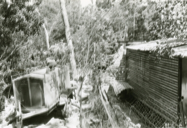
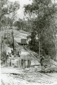
Photographs, 1979-80 MMBW pipe line project at Hubbard Reserve, North Ringwood � Line of sewer work with mole power pack near Hibberd's shed
Part of a 43-photo record of the MMBW�s engineering feat in drilling a 12 inch pipe line up to 40 feet deep through rock hardened by volcanic action associated with geological fault that occurs along the line. The work took place from October 1979 to May 1980 on the southern boundary of Hubbard Reserve, North Ringwood. The collection was presented to the Ringwood Historical Research Group by J Clarke on 9th June 1980.E560 N28 Jan 1980 A43 Line of sewer work with mole power pack near Hibberd's shed -
 Ringwood and District Historical Society
Photographs, 1979-80 MMBW pipe line project at Hubbard Reserve, North Ringwood � View east, sewer work line showing grate over pit
Part of a 43-photo record of the MMBW�s engineering feat in drilling a 12 inch pipe line up to 40 feet deep through rock hardened by volcanic action associated with geological fault that occurs along the line. The work took place from October 1979 to May 1980 on the southern boundary of Hubbard Reserve, North Ringwood. The collection was presented to the Ringwood Historical Research Group by J Clarke on 9th June 1980.E560 N30 Feb 1980 A43 View east, sewer work line showing grate over pit -
 Ringwood and District Historical Society
Photographs, 1979-80 MMBW pipe line project at Hubbard Reserve, North Ringwood
Part of a 43-photo record of the MMBW engineering feat in drilling a 12 inch pipe line up to 40 feet deep through rock hardened by volcanic action associated with geological fault that occurs along the line. The work took place from October 1979 to May 1980 on the southern boundary of Hubbard Reserve, North Ringwood. The collection was presented to the Ringwood Historical Research Group by J Clarke on 9th June 1980."E565 N8 16 April 1980 A43 The pipe laying has been finished, now to cover it all in." -
 Ringwood and District Historical Society
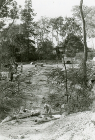
Photographs, 1979-80 MMBW pipe line project at Hubbard Reserve, North Ringwood � Line of tunnel shafts
Part of a 43-photo record of the MMBW�s engineering feat in drilling a 12 inch pipe line up to 40 feet deep through rock hardened by volcanic action associated with geological fault that occurs along the line. The work took place from October 1979 to May 1980 on the southern boundary of Hubbard Reserve, North Ringwood. The collection was presented to the Ringwood Historical Research Group by J Clarke on 9th June 1980.E561 N8 Feb 1980 A43 Line of tunnel shafts running from bottom centre to left of centre -
 Ringwood and District Historical Society
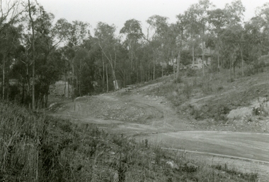
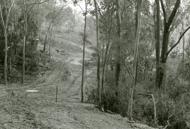
Photographs, 1979-80 MMBW pipe line project at Hubbard Reserve, North Ringwood � View east up the gully
Part of a 43-photo record of the MMBW�s engineering feat in drilling a 12 inch pipe line up to 40 feet deep through rock hardened by volcanic action associated with geological fault that occurs along the line. The work took place from October 1979 to May 1980 on the southern boundary of Hubbard Reserve, North Ringwood. The collection was presented to the Ringwood Historical Research Group by J Clarke on 9th June 1980.E568 N19 13 May 1980 A43 View east up the gully, when all the work was finished -
 Ringwood and District Historical Society
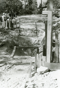
Photographs, 1979-80 MMBW pipe line project at Hubbard Reserve, North Ringwood � Tracked drill rig
Part of a 43-photo record of the MMBW�s engineering feat in drilling a 12 inch pipe line up to 40 feet deep through rock hardened by volcanic action associated with geological fault that occurs along the line. The work took place from October 1979 to May 1980 on the southern boundary of Hubbard Reserve, North Ringwood. The collection was presented to the Ringwood Historical Research Group by J Clarke on 9th June 1980.E561 N16 3 March 1980 A43 Tracked drill rig on the line of trench for sewer to Debbie Place -
 Ringwood and District Historical Society
Photographs, 1979-80 MMBW pipe line project at Hubbard Reserve, North Ringwood � Finished manhole
Part of a 43-photo record of the MMBW�s engineering feat in drilling a 12 inch pipe line up to 40 feet deep through rock hardened by volcanic action associated with geological fault that occurs along the line. The work took place from October 1979 to May 1980 on the southern boundary of Hubbard Reserve, North Ringwood. The collection was presented to the Ringwood Historical Research Group by J Clarke on 9th June 1980.E566 N15 13 May 1980 A43 The finished manhole in the gully. The tall stake is the line of the boundary of Hubbard Park. -
 Kew Historical Society Inc
Photograph, Horse Tram, Boroondara General (Kew) Cemetery, 1910
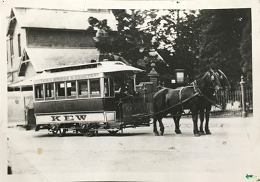
The Kew Historical Society's postcard collection includes views of Kew, Melbourne and Greater Melbourne as well as those including overseas scenes sent or received from Europe or the Middle East. They date from the 1890s to the 2000s. These postcards may or may not include the name of the publisher or printer. A number of the cards were published as parts of popular series. A way of dating early postcards is to identify whether the reverse was divided by a central line which became the norm after 1902 in the United Kingdom. However, other postcards produced after this date do not always conform to this print layout.The item forms part of the Laurie Bennett collection of thirty-six postcards and photographs of Kew and early Melbourne, donated to the Kew Historical Society in 1980. The postcards in the Bennett collection, like other images in the Society's holdings date from the 1890s to the present and comprehensively indicate points-of-view or scenes considered historically, aesthetically or socially significant in the period in which they were produced.Black and white photograph of the horse tram in High Street, Kew, outside the Boroondara (Kew) General Cemetery. The horse tram was a form of public transport linking the Cemetery with Victoria Bridge.The reverse of the photo identifies the year as 1910. The photo is one of a series of postcards / photographs donated to the Kew Historical Society by L. Bennett in 1980.Reverse: "1910. Donated by L. Bennett 1980. Reg No. KH-402"horse tram -- kew (vic.), boroondara general (kew) cemetery, public transport -- kew (vic.) -
 Port Melbourne Historical & Preservation Society
Newspaper, Emerald Hill and Sandridge Times, 1980
Emerald Hill & Sandridge Times. Five copies from 1980 (.01) - Vol 3 No 26, July 24 1980 (.02) Vol 3 No 29, August 14 1980 (.03) Vol 3 No 35, September 25 1980 (half of back page is missing) (.04) Vol 3 No 35, October 2, 1980 (.05) Vol 3 No 45, December 11 1980newspapers, publishing, advertising, emerald hill & sandridge times, port melbourne football club, pmfc, bay street -
 Ringwood and District Historical Society
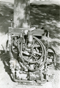
Photographs, 1979-80 MMBW pipe line project at Hubbard Reserve, North Ringwood � hydraulic mole
Part of a 43-photo record of the MMBW�s engineering feat in drilling a 12 inch pipe line up to 40 feet deep through rock hardened by volcanic action associated with geological fault that occurs along the line. The work took place from October 1979 to May 1980 on the southern boundary of Hubbard Reserve, North Ringwood. The collection was presented to the Ringwood Historical Research Group by J Clarke on 9th June 1980.E565 N10 28 April 1980 A43 The "muscles" of the mechanical mole, driven by a hydraulic line from a powerful "power pack". -
 Ringwood and District Historical Society
Photographs, 1979-80 MMBW pipe line project at Hubbard Reserve, North Ringwood � Looking east near Debbie Place
Part of a 43-photo record of the MMBW�s engineering feat in drilling a 12 inch pipe line up to 40 feet deep through rock hardened by volcanic action associated with geological fault that occurs along the line. The work took place from October 1979 to May 1980 on the southern boundary of Hubbard Reserve, North Ringwood. The collection was presented to the Ringwood Historical Research Group by J Clarke on 9th June 1980.E567 N16 13 May 1980 A43 Looking east from the ridge above Debbie Place. The finished manhole is in the gully. -
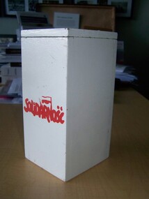 Polish Museum & Archives in Australia
Help Poland Live collection box
during 1980 when when military government was impose on Poland and the free solidarity you trade union was banned. The Australian Polish community established that help Poland live campaign where it gathered funds for humanitarian purposes. Such boxes were widespread during the collection process.one of the very few remaining help Poland live collection boxeswhite painted wooden collection box from 1980 with the solidarity symbol on the side'read solidarity logo on the front of the box coin slipped on top. Metal handle on the backhelp poland live, collection box, solidarity -
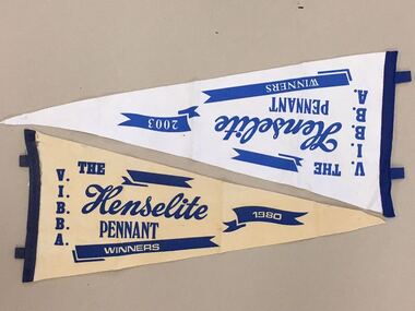 Warrnambool and District Historical Society Inc.
Pennant, Bowles Club St John's, 1980 and 2003
These are two pennants awarded to the winners of the Victorian Indoor Bias Bowls Association (perhaps the Warrnambool division) in 1980 and 2003. The winners were presumably the members of the St. John’s Bowls Club (associated with the Presbyterian Church, Warrnambool) as these pennants come from their collection. St. John’s Bowls Club was prominent in Warrnambool in the 20th century but was disbanded in the second decade of the 21st century. The Henselite company that sponsored these trophies is an Australian company that is the biggest manufacturer of lawn bowls world-wide. R.W.Hensell was the first to produce the plastic bowl in 1930 when the company was formed. These two pennants are of interest because they came from the St. John’s Bowls Cub in Warrnambool, a club no longer existing. Bowls is a very popular sport in Australia. These are two pennants from the Victorian Indoor Bias Bowls Association. Both are triangular in shape and made of felt cloth. One is white with a dark blue edging stitched on and dark blue lettering stamped on. The other is a cream colour with dark blue edging stitched on and dark blue lettering stamped on. .1 – ‘V.I.B.B.A. The Henselite Pennant, Winners 2003’ .2 – ‘V.I.B.B.A. The Henselite Pennant Winners 1980’ victorian indoor bias bowls association, henselite australia pty ltd, st. john’s bowls club, warrnambool., warrnambool -
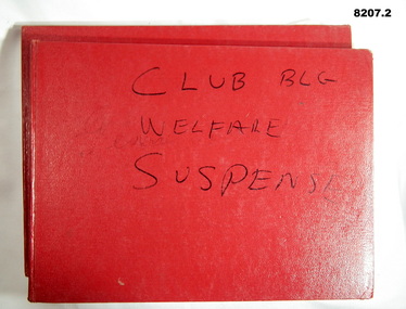 Bendigo Military Museum
Administrative record - ACCOUNT BOOKS BRSL, Bendigo RSL Sub Branch, 1975 - 1982
Income and Expenditure Account books for the Bendigo RSL Sub Branch. .1) Three Acc's are listed, General Acc 1975 - 1979, Club Building 1980 - 1982, Relief Patriotic 1980 - 1982. .2) Three Acc's are listed, Relief Acc 1975 - 1979, Club Building 1977 - 1979, General Acc 1980 - 1982..1) Book, Red cover, blue ruled lines with red and blue vertical lines, entries in blue pen, a small amount in red. Inside the front cover pasted in a large yellow envelope with two copies of different cheques to a local Football Club 1980, one letter from ANZ bank re a new term investment 1980. .2) Book, red cover same as .1) and same lines and entries. .1) On front cover in black texta, "Club Bldg, Welfare, General, suspense" .2) On front cover in black texta faded, "Relief, Club, Suspense"brsl, smirsl, account -
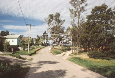
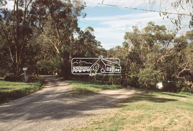
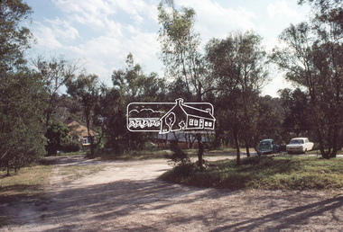
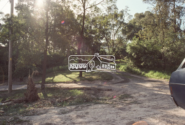
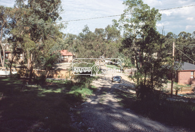
 Eltham District Historical Society Inc
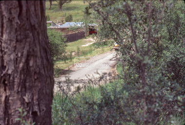
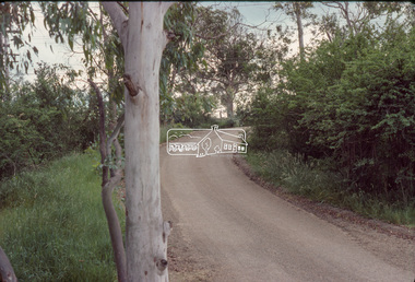
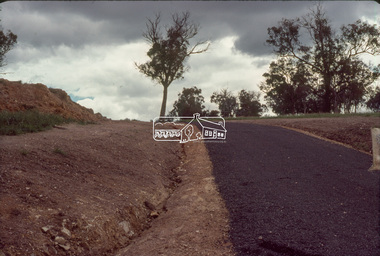
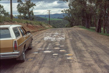
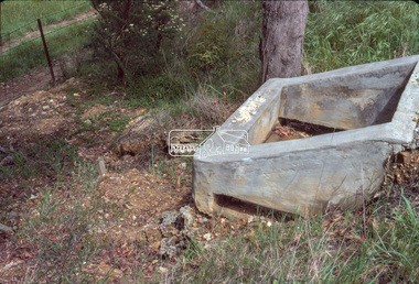
Slide - Photograph, Eltham Shire Council, Unidentified rural road within the Shire of Eltham, c.Nov. 1980
35mm colour positive transparency Kodak Kodachrome cardboard mountProcessed Nov 1980infrastructure, rural areas, rural road, unidentified -
 Eltham District Historical Society Inc
Slide - Photograph, Eltham Shire Council, Unidentified rural road within the Shire of Eltham, c.Nov. 1980
35mm colour positive transparency Kodak Kodachrome cardboard mountProcessed Nov 1980infrastructure, rural areas, rural road, unidentified -
 Eltham District Historical Society Inc
Slide - Photograph, Eltham Shire Council, Unidentified rural road within the Shire of Eltham, c.Nov. 1980
35mm colour positive transparency Kodak Kodachrome cardboard mountProcessed Nov 1980infrastructure, rural areas, rural road, unidentified -
 Eltham District Historical Society Inc
Slide - Photograph, Eltham Shire Council, Unidentified rural road within the Shire of Eltham, c.Nov. 1980
35mm colour positive transparency Kodak Kodachrome cardboard mountProcessed Nov 1980infrastructure, rural areas, rural road, unidentified -
 Eltham District Historical Society Inc
Slide - Photograph, Eltham Shire Council, Unidentified rural road within the Shire of Eltham, c.Nov. 1980
35mm colour positive transparency Kodak Kodachrome cardboard mountProcessed Nov 1980infrastructure, rural areas, rural road, unidentified -
 Eltham District Historical Society Inc
Slide - Photograph, Eltham Shire Council, Unidentified rural road within the Shire of Eltham, c.Nov. 1980
35mm colour positive transparency Kodak Kodachrome cardboard mountProcessed Nov 1980infrastructure, rural areas, rural road, unidentified -
 Eltham District Historical Society Inc
Slide - Photograph, Eltham Shire Council, Unidentified rural road within the Shire of Eltham, c.Nov. 1980
35mm colour positive transparency Kodak Kodachrome cardboard mountProcessed Nov 1980infrastructure, rural areas, rural road, unidentified -
 Eltham District Historical Society Inc
Slide - Photograph, Eltham Shire Council, Unidentified rural road within the Shire of Eltham, c.Nov. 1980
35mm colour positive transparency Kodak Kodachrome cardboard mountProcessed Nov 1980infrastructure, rural areas, rural road, unidentified -
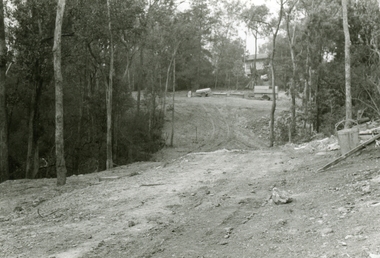
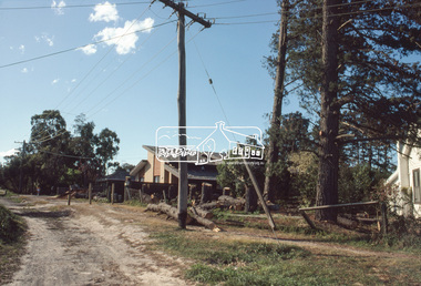
 Eltham District Historical Society Inc
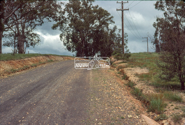
Slide, View looking northeast to turnabout near 10 McCarthy Grove, Montmorency, c.Oct. 1980
One of a series of images of roads and infrastructure taken by Eltham Shire Council Planning and Engineering officers. They provide perspective of the changes in housing styles and road development that began sweeping in from the mid 1970s with increasing urbanisation of what was once more outlying suburbs and regions.35 mm colour positive transparency Mount - Kodak Kodachrome CardProcessed Oct 1980houses, infrastructure, mccarthy grove, montmorency, roads -
 Eltham District Historical Society Inc
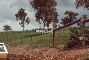
Slide, McCarthy Grove, Montmorency, extended driveway from Main Road, c.Oct. 1980
One of a series of images of roads and infrastructure taken by Eltham Shire Council Planning and Engineering officers. They provide perspective of the changes in housing styles and road development that began sweeping in from the mid 1970s with increasing urbanisation of what was once more outlying suburbs and regions.35 mm colour positive transparency Mount - Kodak Kodachrome CardProcessed Oct 1980houses, infrastructure, mccarthy grove, montmorency, roads -
 Eltham District Historical Society Inc
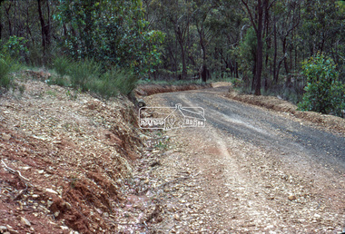
Slide, View looking southwest to turnabout near 9 McCarthy Grove, Montmorency, c.Oct. 1980
One of a series of images of roads and infrastructure taken by Eltham Shire Council Planning and Engineering officers. They provide perspective of the changes in housing styles and road development that began sweeping in from the mid 1970s with increasing urbanisation of what was once more outlying suburbs and regions.35 mm colour positive transparency Mount - Kodak Kodachrome CardProcessed Oct 1980houses, infrastructure, mccarthy grove, montmorency, roads -
 Eltham District Historical Society Inc
Slide, McCarthy Grove, Montmorency looking west near No. 27, c.Oct. 1980
One of a series of images of roads and infrastructure taken by Eltham Shire Council Planning and Engineering officers. They provide perspective of the changes in housing styles and road development that began sweeping in from the mid 1970s with increasing urbanisation of what was once more outlying suburbs and regions.35 mm colour positive transparency Mount - Kodak Kodachrome CardProcessed Oct 1980houses, infrastructure, mccarthy grove, montmorency, roads -
 Eltham District Historical Society Inc
Slide, McCarthy Grove, Montmorency looking east towards Reichelt Avenue, near no. 27, c.Oct. 1980
One of a series of images of roads and infrastructure taken by Eltham Shire Council Planning and Engineering officers. They provide perspective of the changes in housing styles and road development that began sweeping in from the mid 1970s with increasing urbanisation of what was once more outlying suburbs and regions.35 mm colour positive transparency Mount - Kodak Kodachrome CardProcessed Oct 1980houses, infrastructure, mccarthy grove, montmorency, roads -
 Eltham District Historical Society Inc
Slide, Quinn Estate, McCarthy Grove ext. driveway, Montmorency, near no. 31, c.Oct. 1980
One of a series of images of roads and infrastructure taken by Eltham Shire Council Planning and Engineering officers. They provide perspective of the changes in housing styles and road development that began sweeping in from the mid 1970s with increasing urbanisation of what was once more outlying suburbs and regions.35 mm colour positive transparency Mount - Kodak Kodachrome CardProcessed Oct 1980houses, infrastructure, mccarthy grove, montmorency, roads -
 Eltham District Historical Society Inc
Slide, Looking towards 99 Buena Vista Drive, Montmorency, c.Oct. 1980
One of a series of images of roads and infrastructure taken by Eltham Shire Council Planning and Engineering officers. They provide perspective of the changes in housing styles and road development that began sweeping in from the mid 1970s with increasing urbanisation of what was once more outlying suburbs and regions.35 mm colour positive transparency Mount - Kodak Kodachrome CardProcessed Oct 1980houses, infrastructure, mccarthy grove, montmorency, roads -
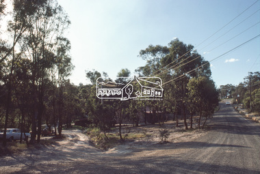 Eltham District Historical Society Inc
Slide, Roundabout at Reichelt Avenue and McCarthy Grove, Montmorency, c.Oct. 1980
One of a series of images of roads and infrastructure focussed on the Quinn Estate in Montmorency taken by Eltham Shire Council Planning and Engineering officers. They provide perspective of the changes in housing styles and road development that began sweeping in from the mid 1970s with increasing urbanisation of what was once more outlying suburbs and regions.35 mm colour positive transparency Mount - Kodak Kodachrome CardProcessed Oct 1980infrastructure, mccarthy grove, montmorency, reichelt avenue, roads, roundabout