Showing 1808 items
matching subdivision
-
 Ringwood and District Historical Society
Newspaper, Scrapbook Clipping, Library Collection, Ringwood, Victoria, `
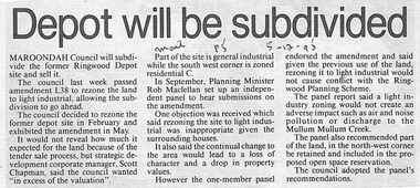
``Newspaper clipping from "The Mail"5-12-95", P 5. Depopt will be subdivided. Maroondah Council will subdivide the former Ringwood Depot site and sell it. The council last week passed amendment 1.38 to rezone the land to light industrial, allowing the subdivision to go ahead. It would not reveal how much it expected for the land because of the tender sale process.` -
 Ringwood and District Historical Society
Newspaper, Scrapbook Clipping, Library Collection, Ringwood, Victoria
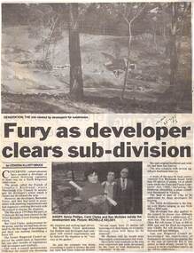
Newspaper Clipping from "The Mail", 25-7-95. P3. Fury as developer clears sub-division. By Leonora Elliot-BruceConcerned conservationists have accused a developer of almost destroying vegetation to make way for a North Ringwood subdivision. The group, Friends of Loughie's Bushland, wants Maroondah City Council to investigate the developer's action which it claims has devastated the area. The developers are Barnsdale Forest -
 Greensborough Historical Society
Certificate of Title, Certificate of Title Vol. 3182 Fol. 302, 15/02/1907
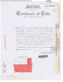
Title in the name of Joseph Laidlay of Greensborough, fruitgrower, 14 acres being Lots 7, 8 and 22 on Plan of subdivision 4759, part of Crown portion 17, Parish of Keelbundora County of Bourke, dated 15th February 1907. Northern boundary Greensborough (now Grimshaw) Road, Eastern boundary Henry Street.1 p. colour copy of Titlegreensborough, grimshaw street greensborough, henry street greensborough, joseph laidlay -
 Hymettus Cottage & Garden Ballarat
Photograph, Archie Burke's Ploughing Team Dooboobetic
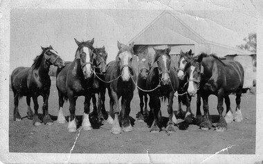
Mr William Burke settled at Dooboobetic near Donald in the 1860s his sons eventually working their own farms on subdivisions of the original property. Archibald (Archie) whose team is pictured had a portion named "Inverleigh". His daughter married Mr Michael Taffe of "Hymettus" Ballarat where the photographic archive survives. small snapshot image badly creased of team with inscription and print on reverse.Written on reverse "G'pa Burke's team. with printed words KODAK PRINT and ink stamp 431 -
 Eltham District Historical Society Inc
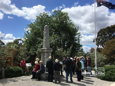
Photograph, Peter Pidgeon, Eltham War Memorial, 903-907 Main Road, Eltham, 4 November 2017, 4 Nov 2017
Eltham District Historical Society heritage walk to follow the boundaries of the original Shillinglaw Farm in central Eltham, held Saturday, 4th November, 2017. The Shillinglaw Farm comprised Lot 90 of Holloway’s 1851 Little Eltham subdivision. It was originally 30 acres in area and situated east of the Diamond Creek and north of Henry Street.Born digital imageeltham war memorial, obelisk, war memorial buidings, war memorial hall -
 Eltham District Historical Society Inc
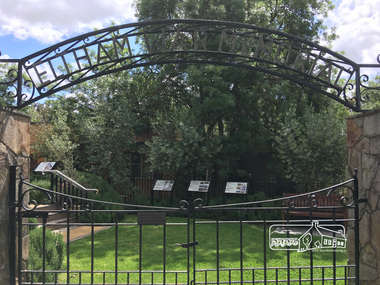
Photograph, Peter Pidgeon, Eltham War Memorial, 903-907 Main Road, Eltham, 4 November 2017, 4 Nov 2017
Eltham District Historical Society heritage walk to follow the boundaries of the original Shillinglaw Farm in central Eltham, held Saturday, 4th November, 2017. The Shillinglaw Farm comprised Lot 90 of Holloway’s 1851 Little Eltham subdivision. It was originally 30 acres in area and situated east of the Diamond Creek and north of Henry Street.Born digital imagecr. e.j. andrew, eltham war memorial, ernie andrew, war memorial buidings, war memorial garden, war memorial gates -
 Eltham District Historical Society Inc
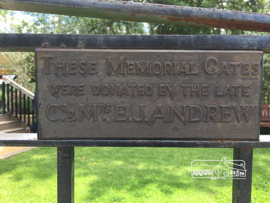
Photograph, Peter Pidgeon, Eltham War Memorial, 903-907 Main Road, Eltham, 4 November 2017, 4 Nov 2017
Eltham District Historical Society heritage walk to follow the boundaries of the original Shillinglaw Farm in central Eltham, held Saturday, 4th November, 2017. The Shillinglaw Farm comprised Lot 90 of Holloway’s 1851 Little Eltham subdivision. It was originally 30 acres in area and situated east of the Diamond Creek and north of Henry Street.Born digital imagecr. e.j. andrew, eltham war memorial, ernie andrew, war memorial buidings, war memorial garden, war memorial gates -
 Greensborough Historical Society
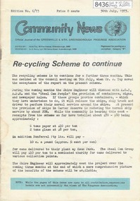
Newsletter, Greenhills and North Greensborough Progress Association, Community News: official journal of the Greenhills and Nth. Greensborough Progress Association. 30 July, 1973. Edition No. 6/73, 30/07/1973
This edition includes a report on the Progress Association's July 1973 meeting, Councillor's report, Re-cycling Scheme to continue, In the public interest, The subdivision of our district, Open forum, School and Kinder news, Letter to the Editor, Eltham Film Society, Churinga news. A digital copy of this Newsletter is available from Greensborough Historical Society.Newsletter, 24 p., illus.greenhills and north greensborough progress association, greenhills -
 Ringwood and District Historical Society
Newspaper, Scrapbook Clipping, Library Collection, Ringwood, Victoria
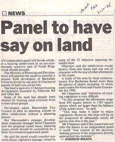
Newspaper Clipping from "The Mail", 3-10-95. P23. By Andrew Meath. Panel to have Say on LandAn independent panel will decide whether a housing subdivision in an environmentally sensitive part of North Ringwood should proceed. The Ministry of Planning and Development will appoint the panel to consider a request from developers of Barnsdale Forest to divide one acre (0.4 hectares) parcels of land into 7 lots -
 City of Moorabbin Historical Society (Operating the Box Cottage Museum)
Book, E-Gee Printers Pty.Ltd, Local History : Carrum to Cheltenham, 1999
A small softcover book dark green in colour at the top of the front cover is the authors name written in purple and the book's title written in large red letters there is also a charcoal drawing of a person driving a horse and dray with what looks like sacks of produce in the back on the back cover is text by the author and three reviews by different people.The book also contains a lot of old black and white photos of the family and places of note in the area.cheltenham, kingston, pioneers, moorabbin, carrum, mordialloc, picnic, asylum, hobsons bay, brighton, beach boxes, bridge hotel. -
 Warrnambool and District Historical Society Inc.
Map - Maps, Soldiers Settlement WW2, Circa 1950
The soldiers' settlement scheme operated after the first and second world wars in an effort to more closely settle the land and also give opportunities to returned soldiers. Crown land and other larger estates were acquired for the purpose. Most of these maps relate to the area north of Warrnambool where many of the subdivisions were parts of larger estates.These maps pertaining to the Soldiers' Settlement program, relate to an interesting part of Australian and local history. As such they have historic and social interest and significance.A collection of 25 paper maps which relate to to the soldiers settlement post World War 2. Some have details of the people allocated the land and some smaller maps have the printed details of the applicants requirements.Text is black on white paper which in some cases is quite aged. The maps are as follows: .1 Narrapumelap Estate ( Ripon & Hampden) .2 Narrapumelap Estate Part 2 (Villers & Ripon) .3 Narrapumelap Estate Part 3 ( Villiers & Ripon) .4 Burrumbeet Estate ( Ripon) .5 ' Berrambool' Estate 9 Hampden & Villiers) .6 ' Hopkins Hill' Estate Villiers 4011 acres .7 Caramut North No 2 Estate ( Villiers ) .8 ' Morpor' Estate ( Villiers) 4172 acres .9 ' Morgiana' Estate ( Normandy) 3453 acres .10 ' Chatsworth House' ( Villiers) 9341 Acres .11 ' East Elwood' Estate Villiers 2407 acres .12 Grey's Estate ( Mornington) 1151acres .13 ' Rowes Estate' ( Buln Buln Gippsland 733 acres .14 'Tarrone' Estate No 2 Part map .15 'Chaldon Meade' Estate (Bourke) Bulla 517 acres .16 ' Terranallum South' Estate Hampden 3757 acres .17 ' Brung Brungle' Estate Dundas 695 .18 ' Armidale ' Estate ( Dundas)2108 acres .19 ' Moyne Falls' Estate ( Villiers) 627 acres .20' Yulong' Estate 9 Lowan 6321 acres .21 Murray Valley Irrigation District 9 Moira)113 acres .22 Murray Valley Irrigation District 103 acres .23 ' Mount Fyans' Estate ( Hampden) .24 ' Barwidgee ' Estate ( Villiers) 4277 acres .25 'Pine Hills' Estate 2nd portion ( Lowan) 6190 acres narrapumelap, berrambool, hopkins hill, caramut north, morpor, chatsworth house, east elwood, terrinallum, moyne falls, tarrone, caramut soldiers settlers, burrumbeet, morgiana, grey's estate mornington, chaldon meade, brung brungle -
 Lake Bolac & District Historical Society
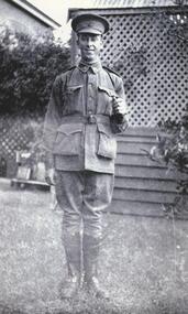
Black and white photograph, Gunner Stanley Herbert Moreton, Field Artillery Brigade, WW1
Gunner Stanley Herbert Moreton, enlisted 04/12/1916 in a Field Artillery Unit. He embarked for France on 11/05/1917. Upon his return from the war, he purchased 'Parupa Park'. After WW2 Stanley was involved in helping with the subdivision of land for soldier settlement. He died in 1978 at the age of 85.moreton, field artillery unit, 'parupa park', soldier settlement, -
 Surrey Hills Historical Society Collection
Photograph, 101 Guildford Road, Surrey Hills
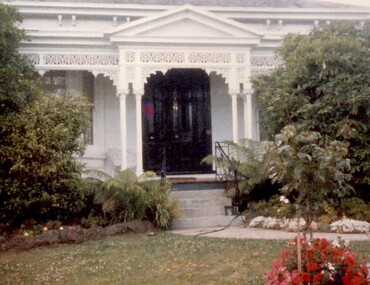
The house was built in 1883, possibly to encourage development of housing on the first urban land subdivision in Surrey Hills, the Windsor Park Estate (in the Windsor Crescent area). This coincided with the opening of the Surrey Hills Railway station. The first occupant was John Brown Nicholson, police magistrate. In 1884 the foundation meeting of the Wyclif Congregational Church was held in the house.Colour photo of the front door and verandah of 101 Guildford Road taken from the street. The house is Victorian in style with ornate lacework along the verandah. It is painted white and has a slate roof. There is a well-maintained garden with flower beds and shrubs, which partially obscure the house.victorian style, wyclif church, houses, guildford road, john brown nicholson -
 Bendigo Historical Society Inc.
Document - H.A. & S.R. WILKINSON COLLECTION: CONTRACT OF SALE
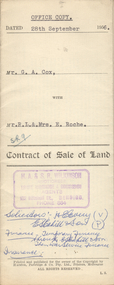
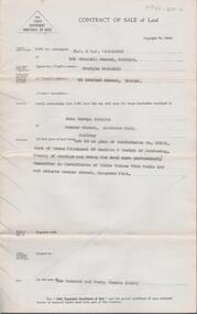
Contract of sale of land dated 28th September, 1956 between G.A. Cox (seller) and Mr. R.L. & Mrs. E. Roche (buyer) for land being lot 1 on plan of subdivision No. 18242 part of Crown allotment 337 section E described in certificate of title volume 7132 folio 389 and situate no. 150 White Hills Road, Bendigo, together with 5-roomed brick dwelling and all sundry. Price 4,750 pounds.organization, business, h.a. & s.r wilkinson real estate -
 Bendigo Historical Society Inc.
Document - H. A. & S. R. WILKINSON COLLECTION: CONTRACT OF SALE
Contract of sale of land dated 12th July 1955 between Mr. C. Naismith (vendor) and Mr. J. M. Parsons (purchaser). Property: land being lot 20 on plan of subdivision No. 22101 part of Crown allotment 60 section D Parish of Mandurang, County of Bendigo and being land described in certificate of title volume 7925 folio 69 and situate Archer Street, Kangaroo Flat. Price: 140 pounds.organization, business, h.a. & s.r wilkinson real estate -
 Ringwood and District Historical Society
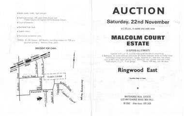
Flyer, Land Auction Brochure, Malcolm Court Estate, Ringwood East, Vic. - 1969
Bi-folded single sheet with black print both sides advertising Auction on Saturday, 22nd November, 1969. Details include location map, vendor terms, subdivision features and local facilities. Centre page shows allotment numbers and property dimensions. Agent - Whitehorse Real Estate, 1123 Whitehorse Road, Box Hill, (Phone) 890502, After hours 8781429. Separate copy of map with handwritten sale notations for some allotments.LP 859686 -
 Ringwood and District Historical Society
Flyer, Subdivisional Land Auction Sale Brochure, Grand Central Estate, Ringwood, Vic. - 1925
Douglas Street shown in the estate plan did not eventuate, but was developed as a public reserve. Refer also to Reg. No. 5149 for 1924 auction sale of land also titled Grand View Estate situated further north in Ringwood.Double sided multi-folded page advertising public auction sale on Saturday, 31st October, 1925, of residential allotments highlighting local facilities, services and layout of the estate. Includes panoramic view of Ringwood and other local photographic images.Subdivision includes Great Ryrie Street, Heathmont Road, Douglas Street, Garden Street, and Bellevue Avenue. Agents - Knight & Harwood, 315 Collins Street, Melbourne, Phone 10615, 10616 Central, in conjunction with J.B. McAlpin, Opposite Railway Station, Ringwood. Phone Ringwood 7. -
 Glen Eira Historical Society
Ephemera - Riddell Family
2 photocopied maps, one dated 1884 of the Gardenvale Estate and then named Riddell Estate, taken from the State Library of Victoria website. Research note by Claire Barton dated 16/04/2013 concerning Carre Street subdivision. Article from ‘Glen Eira Leader’ dated 13/11/2002 with advertisement for sale of an apartment in Renown Apartments.gardenvale estate, glen huntly road, elsternwick, \fraser and co., mcmillan street, brighton road, orrong road, rowan street, archibald street, hamilton street, downshire road, shoobra road, riddell mrs, elsternwick railway station, stanley street, gisborne street, carre street, muntz and muntz, ‘cave carre’, brighton railway, subdivisions, housenames -
 Melbourne Tram Museum
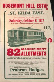
Ephemera - Real estate sale, Prahran Hodges, "Rosemont Hill Estate", Oct. 1917
Pamphlet advertising the sale of land at the "Rosemont Hill Estate", Balaclava Road, St Kilda East, 6-10-1917. On the front cover has a photo of PMTT tram No. 27. Gives terms of sale, the plan of the subdivision, and a general locality plan showing tram and rail lines. Land prices have been written in for some blocks on the pamphlet. Demonstrates the style of land sale pamphlet including the availability of tram services to prospective purchasers.Pamphlet - folded - printed in two colours of cream coloured paper with photographs and plans.has pencil notes re sale price and notes for some blocks.sale of land, trams, real estate, balaclava road, st kilda east, pmtt, tram 27, rosemont hill estate -
 Kiewa Valley Historical Society
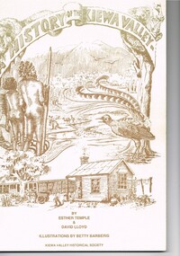
Book - A History of the Kiewa Valley, Kiewa Valley Historical Society, A History of the Kiewa Valley by Esther Temple and David Lloyd, Circa 1991
This book was compiled by Esther Temple and David Lloyd with illustrations by Betty Barberis and additional material provided by Clare Roper, Joan Macdonald, Wilma Davies and Nell Bateman. The book was first penned in 1971. It briefly covers the period from the indigenous tribes(broken down into family groupings) known as the "first Australians" who lived in the valley well before English settlers arrived. first white settlement (graziers, miners, stockmen) to smaller settlements.The development or transformation from a pristine(hunter/gatherer) valley environment to one that has been gradually changing to a more commercial rural/industrial landscaped valley. This transformation was made within a time span of two hundred years. The book details the first pioneers and their descendants, along with the changes to their environments both domestic and commercial. The book highlights dates and events that shaped the "feel" of the valley. The extreme hardships faced by pioneer families during the extremely isolated times away from "civilisation".This publication provides an insight to the struggles and victories against the harsh Australian bushland by people who had not been raised in such a sometimes inhospitable environment. It was this transformation which instilled into the Australian psyche of self sufficiency and the ability to grasp onto ideas or "bush" remedies to overcome enormous difficulties. It is is ability that has produced the many inventions useful in the 20th and 21st centuries.This book has a 250 g/m cream coloured cover with print and drawings of rural aspects of historical significance ( Aboriginal and early white settlers). The book contains 124 pages of black and white photographs(139), black and white sketches(75), two pages of sketches and freehand drawings, two freehand maps one county lease /subdivision plan and black and white printing. See KVHS 0237 (B) for the official invitation to the launch of the book.The front top cover heading(in shaded print and enclosed in a banner form) "A HISTORY OF THE KIEWA VALLEY" The bottom printing "BY ESTHER TEMPLE & DAVID LLOYD ILLUSTRATIONS BY BETTY BARBERIS" and at the very bottom "KIEWA VALLEY HISTORICAL SOCIETY" oN THE BOOK SPINE "A HISTORY OF THE KIEWA VALLEY.....BY ESTHER TEMPLE & DAVID LLOYD"early settlers, dederang, tawonga, mount beauty, sec vic hydro electricity, falls creek early settlers, bonegilla -
 Ringwood and District Historical Society
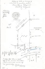
Document - Copy of Lands Department Field Notes - Survey of Extension to Recreation Reserve, Township of Ringwood, Victoria, Field Notes 1907/436 - Part of O.P. R72D Surveyed 6.8.1907
Foolscap size photocopy of survey map with handwritten notations. References include New Lilydale Road 3 chains wide (Mount Dandenong Road), Silurian, undulating, poor grass, Corner cut off to allow for road in future subdivision, Old recreation reserve, (circled area) oval now in use, A. Gisler, I certify that this is a correct copy of the recorded observations & measurements made by me personally (signed) R.J. Gray 6/8/07. -
 Bendigo Historical Society Inc.
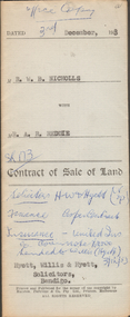
Document - H.A. & S.R. WILKINSON COLLECTION: CONTRACT OF SALE
Contract of sale of land dated 3rd December, 1953 between Mr. W.B. Nicholls (seller) and Mr. A.R. Reddie (buyer) for that piece of land that lies above the depth of 50 feet below the surface of lot 12 on plan of subdivision lodged at the office of titles in red ink No. 5394259 dated 19/1/1953 and being part of allotment 12 section 10 township Kangaroo Flat, together with all improvements thereon. Price 2,850 pounds.organization, business, h.a. & s.r wilkinson real estate -
 Bendigo Historical Society Inc.
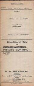
Document - H.A. & S.R. WILKINSON COLLECTION: CONTRACT OF SALE
Conditions of sale by private contract dated 19th October, 1933 between Mrs. P.I. Clark (seller) and Miss M. Thompson (buyer) for land situate McIvor Road, Bendigo being lots 2,5 and 6 on plan of subdivision No. 13539 and being Crown allotment 196 and parts of Crown allotments 151,195 and 270A section H described in certificate of title volume 5756 folio 1151098, together with all fences and erections thereon. Price 150 pounds.organization, business, h.a. & s.r wilkinson real estate -
 Bendigo Historical Society Inc.
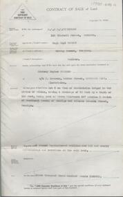
Document - H. A. & S. R. WILKINSON COLLECTION: CONTRACT OF SALE
Contract of sale of land dated 17th August, 1955 between Mr. H. B. Morgan (vendor) and Mr. L. H. Parsons (purchaser). Property: land being lot 3 on plan of subdivision lodged in the office of titles, having a frontage of 50 feet by a depth of 150 feet, being part of Crown allotment 547section H and situate in Osborne Street, Bendigo, together with 5 roomed weatherboard dwelling and all sundry. Price: 3,300 pounds.organization, business, h.a. & s.r wilkinson real estate -
 Bendigo Historical Society Inc.
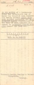
Document - JOHANSON COLLECTION: MORTGAGE MRS CATHERINE STUART RICHARDS
In the matter of a Conveyance dated the Seventeenth day of March one Thousand Nine Hundred and Twenty between Annjie Westland Hardman Patterson, Mary Margaret McNair, executrices of the Will of Annie Penistan deceased) to Catherine Stuart Richards Number 523 Book 488. Declaration of mrs. M. M. McNair. Tatchell, Dunlop, Smalley & Balmer Solicitors Bendigo. Subdivision Plan Of Allotment No. 10, Sec: 80,C. City of Bendigo, parish of Sandhurst, County of Bendigo.bendigo, house, patterson, mcnair, richards, annie westland hardman patterson, may margaret mcnair, catherine stuart richards. tatchell, dunlop, smalley & balmer solicitors bendigo. -
 Bendigo Historical Society Inc.
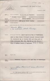
Document - H. A. & S. R. WILKINSON COLLECTION: CONTRACT OF SALE
BHS CollectionContract of sale of land dated 29th November, 1950 between Miss H. Barrass (vendor) and Mrs. M. Speer (purchaser). Property: lots 3 and 4 on plan of subdivision made by Alwyn Ernest Pritchard Licensed Surveyor dated the 19th of October, 1950 and being part of Crown allotment 230, 231, 232, 233 and 125 section H, Parish of Sandhurst City of Bendigo. Price: 3,700 pounds. Attached 8 hand written notes.organization, business, h.a. & s.r wilkinson real estate -
 Greensborough Historical Society
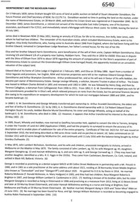
Folder, Montmorency and the Nicholson family, 2019_
This folder contains a brief history of the Nicholson family and material about Dr. George Cornwall Nicholson, purchaser of land in Montmorency formerly owned by the Donnithorne Family. Includes 9 Certificates of Title relating to the subject land and other certificates and listings relating to their residency of "Glengarriff" and activities. It records an active professional Montmorency resident and community member, and the later subdivisions of the Glengarriff EstateLoose-leaf folder containing a brief history of the Nicholson family and Dr. George Cornwall Nicholson, purchaser of land in Montmorency. Includes 9 Certificates of Title relating to the subject land and other certificates and listings relating to their residency of "Glengarriff" and activities.glengarriff estate montmorency, nicholson family, donnithorne family -
 Melbourne Tram Museum
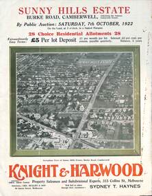
Ephemera - Real estate sale, Knight Harwood, "Sunny Hills Estate" - Burke Road Camberwell, Oct. 1922
Pamphlet advertising the sale of land at the "Sunny Hills Estate" Burke Road Camberwell 7-10-1922. Gives terms of sale, photos showing a nearby shopping centre, recently constructed houses, and plan of the subdivision. Land prices have been written in for each block on the pamphlet. Has a photo featuring Camberwell Junction with a tram, and Burke Road view with trams. Demonstrates the style of land sale pamphlet including the availability of tram services to prospective purchasers.Pamphlet - folded - printed in three colours of cream coloured paper with photographs and plans.has ink notes re sale price and notes.sale of land, trams, real estate, burke road, camberwell, sunny hills estate -
 Ringwood and District Historical Society
Map - State Aerial Survey, Dandenong Ranges Area Sheet 7, Parishes of Warrandyte, Scoresby, Ringwood and Nunawading - 1956
Map of central and southern areas of Ringwood and part of Ringwood East and Heathmont compiled by Dept of Lands and Survey, July 1956, from aerial photographs and Cadastral Survey information. Subsequent coloured hand-drawn additions showing layout of a number of post-NSW Separation era proposed subdivisions that did not eventuate, including Village of Studley Estate, Township of East Kew Estate, Township of Ballyduffy Estate, Township of New Flemington Estate, Township of East Hawthorne Estate. Ringwood A4B2, 849 A4B Zone 7. Scale: 10 chains to 1 inch. Contour interval 20 feet. -
 Bendigo Historical Society Inc.
Document - H.A & S.R. WILKINSON COLLECTION: CONTRACT OF SALE
Contract of sale dated 29th January, 1958 between Mr. M. Williamson (seller) and Mr. E.J. Spence (buyer). Solicitor for vendor: Mr. E.C. Cohen, Victoria Lane, Bendigo. Solicitor for purchaser: Messrs. Watson, James & Rogers, Bull Street, Bendigo. For property at corner White Hills Road & Grace Street, Bendigo, being lot 1 on plan of subdivision No. lodged in the office of titles being part of allotments 433 and 433A section E. Price 3,775 pounds.organization, business, h.a. & s.r wilkinson real estate