Showing 15005 items
matching the white house
-
 Bendigo Military Museum
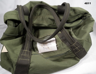
Equipment - KIT BAG, Wormald Canvas, 1989
Part of the Reverend Chaplain Major T. B. Williams, No 556101, CollectionGreen coloured canvas bag closed with a heavy duty plastic zipper. Handles are made from thick dark green canvas. Each is attached and reinforced with khaki coloured stitching. A clear plastic pocket is sewn onto one side to house a name card. Below this is a side pocket closed via a plastic zipper. On the inside of the bag are two large canvas pockets, one of which has a white manufacturer's label attached.On white manufacturer's label: 'WORMALD CANVAS, 8465-66-024-5926, (upwards arrow), 1989'.personal equipment, major thomas b. williams, army chaplain, kit bag -
 Bendigo Military Museum
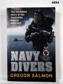
Book - BOOK, AUSTRALIAN NAVY DIVERS, Ebury Press/ Random House Australia Pty Ltd, "Navy Divers", 2011
"NAVY DIVERS - The incredible/ story of the/ Australia/ Navy's/ elite unit." Soft cover book. Soft cover cardboard - silver, gold and white print on front, spine and back. Cover, colour illustrations - front - photograph of Matthew Johnson, Clearance Diving 4 - back photograph Navy divers. 292 pages, cut, plain, off white paper. Illustrated black and white and colour photographs.books, australian navy, biography -
 Bendigo Military Museum
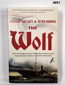
Book - BOOK, WW1 NAVAL HISTORY, GUILLIATT Richard & HOHNEN Peter, " THE WOLF', 2009
"THE WOLF' How one German raider terrorised Australia and the Southern Oceans in the First World War.Soft cover book. Soft cover - cardboard, red and black print on front, spine and back. Cover - colour illustrated - front - top German symbol, bottom, ship at sea. Back - sepia photograph - sailor and girl. 366 pages - cut, plain, off white paper. Illustrated black and white photographs and maps.Nilbook, ww1, naval operations -
 Bendigo Military Museum
Book - BOOK, AUSTRALIAN ARMED FORCES, FISHER VICTORIA for Random House Australia, Australian War Diary, 2010
"Australian War Diary" Australian Armed Force4s in a Changing World: 1870 - 2010.Hard cover book Hardcover cardboard with Glossy paper finish. White print on front, spine and back. Cover black and white and colour illustrations - montage of photographs in strips top and bottom, front to back of various Armed Forces scene. 303 pages, cut, plain white paper. Illustrated black and white and colour photographs, posters and paintings.books, military history, australia -
 Bendigo Military Museum
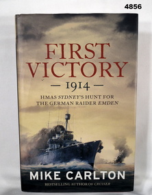
Book - BOOK, Naval Operations Australia & Germany WW1, CARLTON Mike, "First Victory 1914", 2013
"FIRST VICTORY 1914 - HMAS SYDNEY'S HUNT FOR THE GERMAN RAIDER EMDEN."Hardcover Book with Dust cover. Hardcover - cardboard, red buckram, silver print on spine. Dust cover - paper: Red gold and white print on front, spine and back. Dust cover, colour illustrations - front copy of painting of HMAS Sydney in battle with SMS Emden by the late Phil BELBIN. 467 pages, cut, plain, off white paper, illustrated - black and white, sepia and colour photographs, paintings, diagrams and maps. End papers and flyleaf - front and back - coloured green.books, naval operations, ww1, australia, germany -
 Bendigo Military Museum
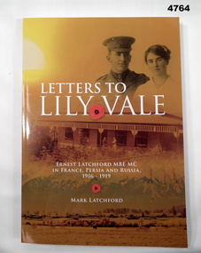
Book - PERSONAL CORRESPONDENCE, LATCHFORD Mark, "LETTERS TO LILY VALE, ERNEST LATCHFORD MBE MC, in France, Persia, and Russia, 1916-1919", 2020
Collection of transcribed correspondence written by Ern Latchford from 1916-1919, nearly all addressed to his fiancee and later wife, Linda Dehnert of 'Lily Vale' Ballan.Correspondence written to fiancee and later wife. Soft cover book. Soft cover - cardboard, black and white print on front, spine and book cover illustrated with montage of photographs in yellow sepia colours. Portrait, House, landscape with buildings in background. 328 pages, semi gloss white, illustrated black and white photographs and colour maps.book, letters, ww1, biography -
 Bendigo Military Museum
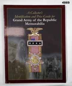
Book - MEMORABILIA CATALOGUE, USA, GREGG Dennis M, "A Collector's Identification and price guide for/Grand Army of the Republic/, 2005
Grand Army of the Republic (GAR) was in existence for 83 years.Soft cover book Soft cover - cardboard with glossy cover, white and yellow print on front, spine and back. Illustrations,. Front - in colour medal and ribbons superimposed over black and white montage of portrait photographs. Book - in colour collections of army memorabilia with portrait photograph centre. 97 pages, cut, plain, glossy white paper, illustrated black and white photographs.books, memorabilia, history usa -
 Bendigo Military Museum
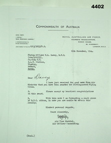
Document - LETTER of CONGRATULATIONS, Original: 16th November, 1944. Photocopy: Unknown
Congratulatory letter sent to F.G. Davey from Air Vice Marshall H.N. Wrigley on the occasion of Davey being awarded the DFC. Enclosed with the letter was a piece of DFC ribbon. Part of the F.G. Davey Collection. See catalogue no. 3536P for his service record.Black and white photocopy of an original letter to F.G. Davey on Commonwealth of Australia and Royal Australian Air Force letterhead. Wording is in black type.Photocopy of original handwritten name: 'Davey' Photocopy of sender's handwritten signature: 'H.N. Wrigley'distinguished flying cross, medals, f.g. davey, letters, raaf -
 Bendigo Military Museum
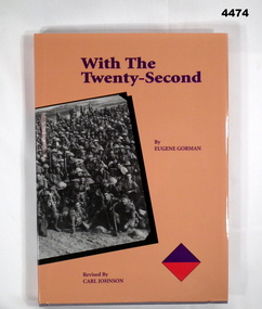
Book - BOOK WW1, Eugene GORMAN, "With the Twenty - Second", Original Edition 1919, Revised Edition 2001
"This is a revised edition of the original 1919 Regimental History" "From the beaches of Anzac Cove to the gas ridden trenches of the Western Front" "The pyramids to the rolling plains of Stone Henge" "Ground traversed by the Twenty-Second (Victorian) Infantry Battalion during World War One"Hard cover book with dust cover. Hard cover cardboard with grey coloured buckram , gold coloured print on front and spine. Illustrated with purple over red diamond colour patch. Dust cover, paper, pinkish/orange glossy coloured background, purple coloured print on front, spine and back. Illustrated with purple over red diamond colour patch (small) front and back and black and white photograph of a group of soldiers 'somewhere in France. 245 pages, cut, plain, semi gloss white. Illustrated - black and white photographs and maps.Front fly leaf - printed donation label - "Donated by 39th Australian Infantry Battalion (1941-43) Association Inc www.39battalion.com" Top right front flyleaf - printed label with handwritten in black ink "No. 120 of 500"books, military, history, wwi -
 Bendigo Military Museum
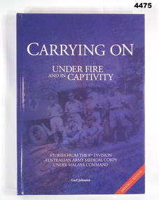
Book - BOOK, 8TH DIVISION AAMC, Carl Johnson, "CARRYING ON UNDER FIRE AND IN CAPTIVITY", 2009
Stories from the 8th Division Australian Army Medical Corps under Malaya Command, WWII. The 39th Australian Infantry Battalion (1941-1943) Association donated four books of Military History: Cat. No. 4474 With the Twenty-Second Cat. No. 4475 Carrying On Under Fire and in Captivity Cat. No. 4476 Mod Revisited Cat. No. 4477 Forward With The FifthHard cover - cardboard with dark blue glossy coloured background. White print on front, spine and back. Front illustrated black and blue toned photograph of 6 Medical Corp Soldiers in uniform. Back, photograph of trestle bridge on Thai-Burma Railway. Front and back figleaf and end papers illustrated with grey/blue and white maps. 559 pages, cut, plain, white. Illustrated black and white photographs, portraits, maps, drawings.Opposite Title Page - printed donation label - "Donated by 39th Australian Infantry Battalion (1941 - 1943) Association Inc, www.39battalion.com” Association Inc. www.39battalion.com"books, military, history, wwii -
 Bendigo Military Museum
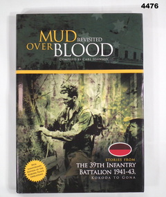
Book - BOOK, 39TH BATTALION, Carl Johnson, "Mud Revisited Over Blood"
Stories from the 39th Battalion 1941-43, Kokoda to Gona. 70th Anniversary Edition of the Kokoda Track operations, WWII.Hard cover book with dust cover (dust cover same as book). Hard cover - cardboard with dark green glossy coloured background. White and gold print on front, spine and back. Front - illustrated black and green toned photograph of 2 soldiers in uniform in jungle. Back - black and white photograph of 7 soldiers. Brown over red oval colour patch front and back. Front and back flyleaf and end papers illustrated dark green and white maps. 320 pages, cut, plain, white. Illustrated black and white photographs, portraits, documents and maps.Opposite Title Page - printed donation label - "Donated by 39th Australian Infantry Battalion (1941 - 43) Association Inc. www.39battalion.com” books, military, history, wwii -
 Bendigo Military Museum
Book - BOOK, History of the 5th Battalion AIF WWI, Albert William Keown, "Forward with the Fifth"
"Narrative of the service history of the Fifth (Victorian) Infantry Battalion 1st AIF". "A remarkable testimony of their sacrifice in the First World War".Hard cover with dust cover. Hard cover, cardboard with black coloured buckraw, red print on front and spine. Front - illustrated - silhouette drawing of soldier in uniform Back - black and white photograph of 2 soldiers on camel back. Small black over red rectangular colour patch front and back 342 pages, cut, plain, white. Illustrated black and white photographs, portraits, maps and documents.Opposite Title Page - printed donation label - "Donated by 39th Australian Infantry Battalion (1941-1943) Association Inc. www.39battalion.com"books, military, history, wwi -
 Bendigo Military Museum
Mixed media - ARCHIVE BOX - GRINTON COLLECTION, Miss Jean Grinton, Photographs and Postcards - 1916 to 1919 and Folder c.2009
Items relate to Jack Grinton No 1043, 38th Batt AIF. The photographs were taken during and after WW1. The series of postcards, some of which are labelled, were collected by Grinton. Pictures of 38th Battalion soldiers are depicted on a number of postcards. Other photographs and postcards feature scenes from France and the UK. Part of the Grinton Collection which included hundreds of negatives and developed photos taken by Jack Grinton during WW1. See also 1290.2P and 1291.2P. Refer Cat No 1280 for Jacks service recordBlack three ringed plastic folder in a black plastic box. Folder is divided into labelled sections each of which contains a number of photographs or postcards. Photographs and post cards are housed in clear plastic pockets. A handwritten white label is taped to the spine of the box..1) Each section divider is labelled in blue ink: 'ADDITIONAL PHOTOS', 'PHOTOS WITH WRITING', POSTCARDS', SCHRAPNEL POSTCARDS', HEATHER'S CARDS'. .2) On spine label handwritten in blue ink: ' ADDITIONAL PHOTOS', PHOTOS WITH WRITING', POSTCARDS', SCHRAPNEL POSTCARDS', HEATHER'S CARDS', JEAN GRINTON'.38th battalion, postcards, photography - photographs, books - albums, grinton collection, western front -
 Bendigo Military Museum
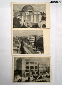
Postcard - POSTCARDS SET OF THREE OF TEL AVIV, PALESTINE, TMLINA JERUSALEM
See Cat 4575P.Set of 3 Black and white postcards printed in Palestine, WW2. 1. A scene of the Shephardic Synagogue, Tel Aviv. 2. A street scene of Allenby Street, Tel Aviv. 3. A scene of Moepabi Opera House, Tel Aviv. In the foreground can be seen horse drawn taxis.Nilww2, tel aviv, palestine -
 Bendigo Military Museum
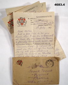
Letter - LETTER AND ENVELOPE, 1) 3.7.1919, .3).4) 14.7.1919
Letters from Alfred Ferris to his family in Terrick Terrick Victoria. Ferris collection refer Cat No 4183.3P.1) letter “YMCA” logo rectangular shape off white colour, all print in red & Black, ruled lines hand written in black pencil & dated. .2) Envelope “YMCA” Logo rectangular shape fawn colour, print in red & black, hand written in black pencil & dated, P.O stamp in black dated. .3).4) Letter “YMCA” logo rectangular shape off white colour, print in red & black, ruled lines hand written in black pencil and dated..1) Letter, “Park House Salisbury England, 3rd July 1919” .2) Envelope P.O stamp, “AIF Camp P.O JY 19, 19” (July 19th 1919) .3).4) Letter dated, “14.7.1919”envelopes, letters ymca, -
 Federation University Historical Collection
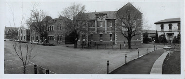
Photograph - Photograph - Black and White, Ballarat School of Mines, c1980s, c1910
... - Black and White Harris House of Photography ...The Ballarat School of Mines was estabished in 1870, making it the first site of technical education in Australia. Ballarat School of Mines from Lydiard Street South. From left to right - the Ballarat Uniting Church, School of Mines Museum (Former Wesleyan Church), New Classrooms and Administration Building, Ballarat Technical Art School, Gaol Governor's residence.ballarat school of mines, ballarat school of mines museum, former wesleyan church, lydiard street south, ballarat technical art school, governor's residence -
 Ballarat Clarendon College
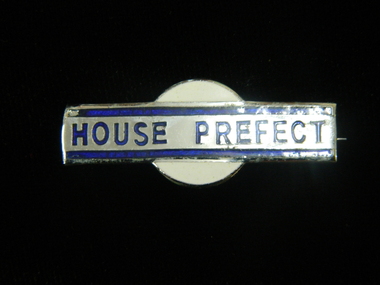
Badge, House Prefect badge
... bands and blue lettering on white round enamle mount House ...Badge awarded to Clarendon Presbyterian Ladies College House PrefectsSilver plated rectangular plate with blue border bands and blue lettering on white round enamle mountbadge, house-prefects, clarendon-presbyterian-ladies-college -
 Shepparton RSL Sub Branch
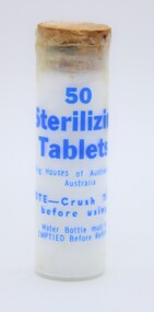
Bottle-Tablet. 50 Thio. Tablets, Bottle, Period. WW2
Normal WW2 and Korian War period, normal for this period bottle contains Sterilization Tablets.The Diggers Water Bottle had to be completly emptied then refilled with the water available, then the tablets added after crushing according to the instructions inside the lid. This enabled the Digger to drink his water in the surity that he would not pick up a problem from the contaminated water that may have been his only liquid available. These tablets have been produced by science to keep the diggers in top fighting condition. Not rare but everybody both male and female (Nurses etc.) would be issued with this tin of tablets.60 X 18 mm glass bottle with cork 11 X 17 mm and cotton wool, contains 50 White Sterilization tabletsMarked on bottle in blue paint, 50. Sterilization. Tablets. Drug Houses of Australia Ltd. Australia. ww2, new guinea, korian war, borneo, boganville etc., etc, bottle contains 50 white sterilization tablets -
 Lara RSL Sub Branch
Wallet, Y.M.C.A. Wallet Mr Sid Ellis carried by hm during WW1
WW1. Y.M.C.A. London, French scenesWW1 Wallet . YMCA LondonYMCA Wallet containing personal papers and letters - Sid Ellis- -472.01 Black leather Wallet - Y.M.C.A. Australian Logo on front. On the rear of the wallet is a Motto "Talk Clean, Live Clean, Fight Clean. Play the Game." .02 Paper slip containing details of acquaintances service numbers name and regiment details. .03 Paper Sovenior of France - written in French. .04 Paper folded to contain 10 photographic shots of French scenes countryside, sailing cutters. .05 Receipt from Returned Sailors & Soldiers Imperial League of Australia(Victoria). Issued to S. W. Ellis Brunswick Sub-branch dated 31/12/1936 Badge Number 48697. .06 Envelope Service of Campaign - printed on the front the envelope is written in Portuguese. "Servicio De Campanha" .07 Small brown paper representation of a boomerang with Cooee in gold lettering embossed on the front. .08 Small white business card for "Cafe - Debit" written in French "Albert Succr" Le Havre. .09 Cut-out from a magazine "View of the Seven Bridges" .10 Cut-out From a magazine "The New Louvre. .11 Cut-out from a magazine "Vendome Place" .12 Cut-out from a magazine "The Madeleine" .13 Cut-out from a magazine "The Arch De Triomphe - it is 150 feet high and cost 362,000 Pounds" .14 Cut-out from a magazine "The Grand Opera House - its cost was about 1,190,500 pounds and it seats over 2,000 people" .15 Cut-out from a magazine "The Cathedral of Notre Dame - A splendid example of the gothic architecture of the 13th century. .16 Cut-out from a magazine "The Trocadero Place erected from the Universal Exhibition of 1878 . with a Hall Capable of holding 5,000 people. .17 Envelope sent to Private S.W. Ellis from Lara took a well-traveled route to reach him. .18 Postcard of Park & Bandstand, Melton, Mowbray to Pte S.W Ellis. .19 Y.M.C.A. Newspaper "The Rising Sun" Vol 1, No. 14 Dated 28/1/1919 London, England. .20 Small note from Y.M.C.A. with pencil note on the rear "423 Pte. Schofield E.J." .21 Small Calander for 1918 from Y.M.C.A. London. .22 Cut out from a newspaper of a Funeral notice of Mrs. Thompson. .23 Paper note a pencil written recipe for an ointment measured amounts of the ingredients. .24 Two copies of Australian Imperial Force, Message to the "Officers, Non-Commissioned Officers, and Men of the Australian Imperial Force." From Commander in the field. .25 Memo "the Diggers" by Capt. William Denny - an order form for copies of the book.472.01 Black leather with Y.M.C.A. Australian Armed Forces Logo embossed on the front and on the Back a motto "Talk Clean, Live Clean, Fight Clean, Play The Game." .02 White pocket notebook paper. .03 Small thin cardboard white with Blue and Red chevrons on each corner. On the reverse side is a word "Souscrivez!" .04 Thin paper folder in a cascade that contains 10 small photos of French scenery. .05 Tissue paper receipt No. 31996 dated 15/01/1916 from Returned Sailors & Soldiers Imperial League of Australia (Victoria). .06 Brown Envelope with Green printing of the front. Army Form Number W 3078 (P) .07 Small Brown paper, shaped as a boomerang with a saying printed on the front "Cooee" .08 Cardboard white Business card for Cafe-Debit, Le Havre, .09 Paper cut out from a magazine with a view of the Seven Bridges. The reverse is printed with magazine writings. .10 Paper cut out from a magazine with a view of the New Louvre. The reverse is printed with magazine writings. .11 Paper cut out from a magazine with a view of Vendome Place. The reverse is printed with magazine writings. .12 Paper cut out from a magazine with a view of The Madeleine. The reverse is printed with magazine writings. .13 Paper cut out from a magazine with a view of The Arc De Triomphe. The reverse is printed with magazine writings. .14 Paper cut out from a magazine with a view of The Grand Opera House. The reverse is printed with magazine writings. .15 Paper cut out from a magazine with a view of The Cathedral Of Notre Dame. The reverse is printed with magazine writings. .16 Paper cut out from a magazine with a view of The Trocadero Palace. The reverse is printed with magazine writings. .17 Paper envelope Addressed to Pte. S. W. Ellis No. 640 sent from Lara and redirected to the recipient by Army Base Post Office. .18 Cardboard Postcard with a photographic picture of The Park & Bandstand, Melton Mowbray. Addressed to Pte. S. W. Ellis No. 640. .19 Y.M.C.A. Newspaper "The Rising Sun" Vol. 1 No. 14. .20 Thin paper from Y.M.C.A. addressed to 423 Pte. Schofield E.J. .21 Cardboard folded in two, a calendar for 1918, and small Map of Aldwych, reverse side is Y.M.C.A. in London details. Printed in red and black. .22 Cut out from a newspaper of a Funeral notice of Mrs. Thompson. .23 Thin Brown Paper with a note in pencil containing a written recipe for an ointment measured amounts of the ingredients. .24 Two copies of paper pamphlets. To the Officers & men of Australian Imperial Force dated 14th November 1918, .25 A paper pamphlet "The Diggers" by Capt. William Denny -
 Ballarat Clarendon College
Book, Untitled
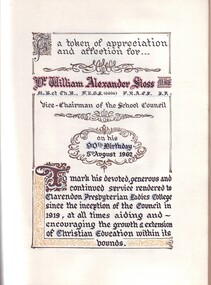
This unique document was produced in honour of Dr William (Bill) Alexander Sloss, Patron of Sloss House, Clarendon Presbyterian Ladies' College, on his birthday 5 August 1962. It features a handwritten dedication in coloured ink, black and white photograph of Dr Sloss, Dr Sloss' own 10 page history of the school and 3 pages of signatures from the 1962 members of council, members of staff and school prefects. The book has been bound by local printing company Waller & Chester but all pages have been produced by hand. It is a significant record of the esteem and appreciation in which Dr Sloss was held by the school community. Dr Sloss served on the school council 1919-1966. His daughter-in-law, wife of Bill Sloss (Old Collegian 1921-1934) Janie also served 1956-1964 and again 1969-1973 and on the Ballarat Clarendon College council in 1974. Dr Sloss was instrumental in the purchase of Clarendon Ladies College by the local Presbyterian community in 1919 and the opening, by Governor General Stonehaven, and ongoing establishment of the Mair Street site in 1925. He was instrumental in the appointment of seven Principals - Carson, Short, Shaw, McDonald, Mathieson, Kerr and McPherson. His contribution to education in Ballarat for nearly 50 years is inestimable. The book is accompanied by a black and white photograph labelled 'Clarendon College Sports', undated. This unique book is a significant record of social significance.Black leather bound book of 18 pages, including 2 illustrations pasted in place, 10 typewritten pages and 3 pages of signatures. The book is accompanied by a 4x6 landscape black and white photograph. Front cover: embossed crest / Clarendon / Presbyterian / Ladies' College / 1962 Handwritten on flyleaf: $95 / very scarce / unique copysloss, william alexander, clarendon-presbyterian-ladies-college, 1962, prefects, council-member, staff -
 Ballarat Clarendon College
Book, The heart of Mid-Lothian
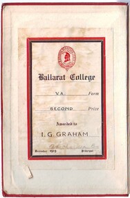
Ian Graham attended Ballarat College 1924 - 1930; member of Garbutt House; he married old collegian Gwen Griffiths (1935) Dark red leather bound book with gold lettering and ornamentation on spine; gold crest on front cover; bookplate in inside front cover; black and white illustrations;Book plate; Crest / Ballarat College / V A Form / SECOND Prize / Awarded to / I G GRAHAM / A Richardson BA / December 1929 Principalian graham, ballarat college -
 Ballarat Clarendon College
Correspondence, 1956
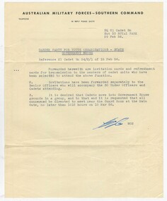
Roger Herbert Mitchell attended Ballarat College 1951-1956. Recipient of a Council Scholarship, HV McKay Scholarship for 6 years and Boarding Scholarship. Sport and co-curricular activities included: 2nd Crew 1956, Minervan & Library Committee 1955, House Prefect, and school drama productions. Roger was a Cadet Cpl 1954, Sgt 1955 and Under Officer 1956. Provides significant detail regarding the size and role of Cadet program within the school. Typewritten letter on buff-coloured, fine paper; light brown DL envelope; printed invitation on white heavy card; small refreshment card, printed on mid-yellow light card; small dress card printed on stone-coloured light card. All paper slightly aged. handwritten on invitation: Cadet Under Officer Mitchell. R. H. cadets, ballarat college, roger mitchell, 1950s, sir dallas brooks, government house -
 Bendigo Military Museum
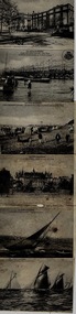
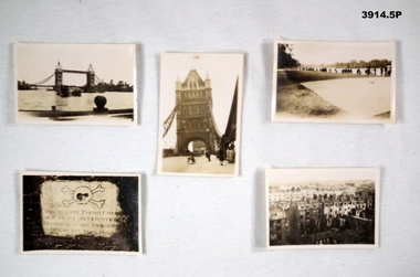
Memorabilia - PHOTOGRAPHS, 5) 1942
Photos taken by Frederick Gardner DAVEY whilst in UK, c.1942 Item re Frederick Gardner DAVEY DFC No 410533 RAAF. Refer Reg No 3536P for his service details.Series of 5 black / white photos depicting scenes of London & Brighton. .1) Tower Bridge with River Thames in foreground. .2) One of the Tower Bridge towers. People & vehicles crossing the bridge. .3) People sitting on the edge of the Serpentine River, Hyde Park. .4) Plaque. .5) View of a row of terrace houses in Brighton.Handwritten in black ink of back of each: .1) London Bridge .2) Tower Bridge, London .3) Serpentine, Hyde Park, London .4) Plaque in Tower of London .5) Roof top view of Brighton. End. 1942photography, london, wartime -
 Bendigo Military Museum
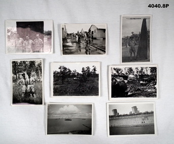
Photograph - PHOTOGRAPHS WW2, 1939 - 1940
Photos are in a collection relating to James Lyle TRUSCOTT No.1842. Enlisted in the RAAF 13.5.1935, aged 19. Discharged 7.2.1942 with the rank of LAC. .1) Photo, black & white, three men standing in front of a large tree. .2) Photo, black & white, group of men stretched out in a barracks area. .3) Photo, black & white, man in uniform, pith helment beside ant hill. .4) Photo, black & white, two men, in uniform, hats, ties in gardens. .5) Photo, black & white, Bush setting with crashed plane in distance. .6) Photo, black & white, crashed aeroplane. .7) Photo, black & white, harbour scene with two ships in distance. .8) Photo, black & white, close up of section of large ship..1) On rear in pen: ARCH LOXTON, JIM TRUSCOTT, BOB THOMPSON. .2) On rear in pen: RAAF DARWIN, ACCOMMODATION CIVIL DROME 1940, note lack of rainwater tanks. .3) On rear in pen: ARCH. A. LOXTON (S.A. ATHLETE) near Darwin 1940 - 1983 lives at Tocumwal NSW. .4) On rear in pen: Jim Truscott, Ben Kennedy, Darwin Botanic Gardens 1940. .5) On rear in pen: 6AM 11.12.39 Thursday, END OF DARWIN CIVIL DROME - No Deaths - Troops Returning south to join AIF. .6) On rear in pen: 6am 11.12.39 DARWIN CIVIL DROME, No Deaths - Lookheed Electra, DMF troops going south. .7) On rear in pen: 1939 - from ABBOTTS House DARWIN HARBOUR - foreign ships detained. (why?) .8) On rear in pen: This is part of the Queen Mary close up - will enclose this next letter - Lyle.photographs, raaf -
 Bendigo Military Museum
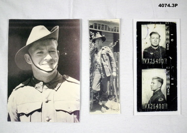
Photograph - PHOTOGRAPHS WW2, 1940 - 42
... a house. .3) Photo, black & white, portrait & side profile, both... & white, soldier on crutches outside a house. .3) Photo, black ...Joseph Earnest WHITFORD VX25490, enlisted in the 2nd AIF on 12.6.40 in Caulfield, aged 21. Embarked 8.4.41 for the Middle East. WIA 17.7.42, discharged 4.9.43 in 2/32 Bn with the rank of Pte. Refer to Cat. No. 4075.8.1) Photo, black & white, portrait of a soldier in a slouch hat. .2) Photo, black & white, soldier on crutches outside a house. .3) Photo, black & white, portrait & side profile, both with army No underneath.On rear in pen: "Pte J.E.D WHITFORD VX25490 18-19 yrs."photographs, 2/32nd, wia -
 Bendigo Military Museum
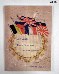
Book - POETRY BOOK, Tales from the Tree House, We Walk in Their Shadow, 2018
“We Walk in their Shadow” - An Allied Armistice book of poetry.Book, soft cover cardboard, blue print on front and back over beige background, cover has illustrated colour collection of flags above a ribbon in scroll shape of country names, 49 pages plain white, illustrated B & W sketches with poetry.books, poetry, armistice -
 Bendigo Military Museum
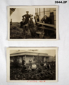
Photograph - PHOTOGRAPHS WW1, 1916
Photos relate to James Worland MILLS No 3441 59th Battalion. James is the soldier in both photos. Refer Cat No 169P for his service details. .1) Photo post card, sepia, showing a group pf men & 1 soldier at a farm around a drive belt. .2) Photo, post card, black / white, showing a group of men, women, a child & a soldier in a vegetable garden with a house in the background. ..1) On rear in ink: “L B Mills Mincha” .2) On the front in red ink: “Findlay 1916”photographs, 59th -
 Bendigo Military Museum
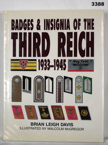
Book - BOOK, German WW2, Brian Leigh Davis et al, Badges & Insignia of the Third Reich 1933-1945, 1997
From back cover: German badges and insignia used during the period of the Third Reich 1933-45 were both numerous and multifarious. This book is about the cloth badges and insignia used by these German uniformed formations. Peter Ball collection, refer Cat No 4704.Hard cardboard cover, glossy coated finish. Dark brown & black print on front, spine & back. White colour background with coloured badges & insignia displayed on front & back. Paper dust cover covered with plastic, print & colours as above. 208 pages, cut, plain, white. Illustrated in black / white & colour photos, badges & insignia. Handwritten in blue ink front fly leaf: “Peter C Ball” In pencil top R corner: “$27, 118.549 Kew 4 10” Top L: “1507” book, insignia, german 1939 - 45 -
 Bendigo Military Museum
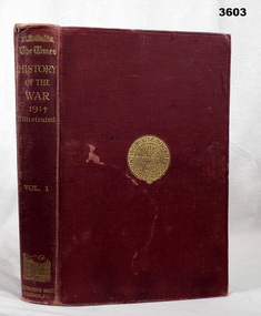
Book - BOOK, WW1, The Times - History of the War 1914, 1914
Vol I . Hard cardboard cover, red buckram, gold print on front & spine. Gold print round seal on front. 516 cut, plain, white, slightly glossy pages. Black / white photos & maps. Bookshop sticker on front end paper, title page: “D Hope, Bookseller, Devonport, Tas” Handwritten in black ink on front end paper: “Henry J Curwen Devonport Feb 27 1915” Handwritten in blue ink on title page: “Mary P Clancy”book, the times, 1914 -
 Bendigo Military Museum
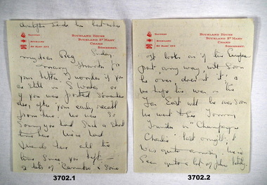
Work on paper - LETTER & ENVELOPE, 1945
.1) & .2) Addressed to R C ALLARDICE who spent leave time with the people in Somerset. The letter is signed off: Lillian & George. .3) Addressed to R C ALLARDICE 418577 RAAF. Refer Reg No 3627.5 for his service records & collection..1) & .2) 2 page letter, off white, red letterhead, handwritten in blue ink, written on both sides. .3) Envelope, off white, blue postage stamp, stamped Somerset..1) Printed in red top L: Train symbol, Taunton: ELECTRICITY Electricity symbol: BUCKLAND Phone symbol: ST MARY 223 Printed in red top R: BUCKLAND HOUSE BUCKLAND ST MARY CHARD SOMERSET .3) Handwritten in blue ink: R Allardicefriends visiting, war over soon