Showing 981 items
matching fortuna ?
-
 Bendigo Military Museum
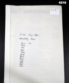
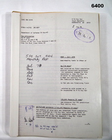
Administrative record - 5 Fd Svy Sqn Monthly Report: Jan 1979 - Dec 1979, 5 Fd Svy Sqn, 30 Dec 1979
Monthly reports were mandatory for all RASvy UnitsA plastic bound, A4 carboard covered report that includes text and diagramsroyal australian survey corps, rasvy, fortuna, army survey regiment, army svy regt, asr -
 Bendigo Military Museum
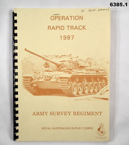
Administrative record - Army Survey Regiment - Operation Rapid Track 1987 Operation Report, Army Survey Regiment, Bendigo, 27 May 1987
The Survey Operation Report deals with the cartographic completion of four 1:50,000 topographical line maps and one Special 1:50,000 map covering the Puckapunyal Military Training Area. The report covers in detail the digital stereo plotting, field completion (checking) and the cartographic completion including printing. The four 1:50.000 maps are 7823-1 PYALONG, 7824-2 COSTERFIELD, 7923-4 TALLAROOK and 7924-3 NAGAMBIE. Annex A lists personnel and dates involved and is attached as 6385.2. Annex B lists the members of the field completion parties.A4 sized buff coloured light cardboard covered report, plastic spiral binding. Front cover includes text, Survey Corps badge and light brown image of a Centurian tank. "To Tech Library", Page 2 has two small handwritten notes indicating that Phase 2 was the Field Completion Phaseroyal australian survey corps, rasvy, fortuna, army survey regiment, army svy regt, asr -
 Bendigo Military Museum
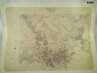
Map - Australian Topographical Survey SYDNEY / 56III Southern Half, NE Plane Table Field sheet 1915, Australian Survey Corps, 6 Dec 1915
This is a unique example of a hand drawn plane table sheet produced in the first year of the Australian Survey Corps by original members of the Corps. Of interest is the documented times that it took to create the original field sheet. Also of interest is the fact that this field sheet that was used to create the actual SYDNEY map sheet was contoured, many map sheets produced up until now were purely planimetric and lacked contouring that was needed for military use. This is a reproduction print of a photograph of the original field sheet and was printed at the Army Survey Regiment, Bendigo.Reprinted coloured Image of Australian Topographical Survey SYDNEY /56 III Southern Half, hand drawn NE Plane Table field sheet. Includes an itemized summary of work performed by HA Roseblade CSM Australian Survey Corps 1915, Signed by J Lynch Lieutenant.royal australian survey corps, rasvy, fortuna, army survey regiment, army svy regt, asr -
 Bendigo Military Museum
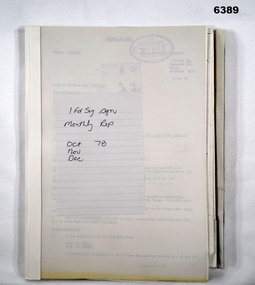
Administrative record - I Fd Svy Sqn Monthly Report: Oct - Dec 1978, 1 Fd Svy Sqn, 1978
Report covering the activities of 1 Fd Svy Sqn between Oct 78 to Dec 78. Monthly Reports were mandatory for Royal Australian Survey Corps unitsPlastic, Cardboard covered, A4 Paper reports, diagrams. Pictorial Index at rear.royal australian survey corps, rasvy, fortuna, army survey regiment, army svy regt, asr -
 Bendigo Military Museum
Administrative record - 5 Fd Svy Sqn Monthly Report: Jul - Dec 1978, 5 Fd Svy Sqn, 1978
A report covering activities of 5 Fd Svy Sqn during Period Jul - Dec 1978. Monthly reports were mandatory for all RASvy UnitsA plastic bound, A4 cardboard covered report that includes text and diagramsroyal australian survey corps, rasvy, fortuna, army survey regiment, army svy regt, asr -
 Bendigo Military Museum
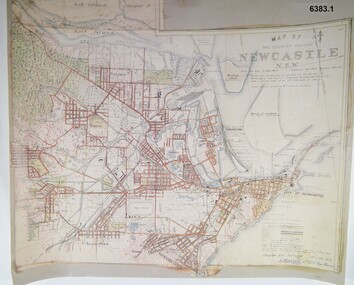
Map - Map of Newcastle NSW 4 Inch - 1 Mile 1910, Australian Intelligence Corps, Nov 1910
In 1909 the Australian Army Headquarters realized that mapping in Australia was either non existent or inadequate for Military use. It was requested that Australia borrow Survey personnel from the UK Royal Engineers (RE) for a two-year detachment. On 11 April 1910 four RE NCOs arrived in Melbourne comprising CPL J Lynch, and LCPLs AH Barrett, EF Davies and R Wilcox. LCPL Barrett had 12yrs experience with RE. They were aiming at producing eight map sheets per year covering about 7,000 square miles (18,000 square Km) This map sheet of the Newcastle area was produced using plane table methods and was surveyed and hand drawn by LCPL A Barrett Oct - Nov 2010. It was unique because it was now produced on an accurate gridded base and included contouring. Lynch and Davies transferred to the Royal Australian Engineers (RAE) whilst Barrett and Wilcox returned to the UK in June 1913. Barrett returned to Australia in 1915 and also enlisted in the RAE and served until 1919.A gridded Map of Newcastle NSW area scale four inches to one mile with 25 feet interval contouring. Coloured hand drawn map produced in 1910. Signed by " A Barrett LCPL Royal Engineers"royal australian survey corps, rasvy, fortuna, army svy regt, army survey regiment -
 Bendigo Military Museum
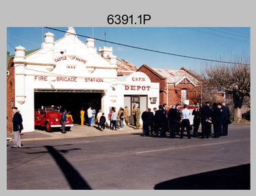
Photograph - Army Survey Regiment Contingent - Victory in the Pacific Parade, Castlemaine, 1995
This set of 13 colour photographs of a contingent of 38 personnel from the Army Survey Regiment, Bendigo sent to Castlemaine on the 13th of August 1995 to support a parade held commemorating the 50th anniversary of the Allied Victory in the Pacific. Army Survey Regiment Administrative Instruction 33/95 is stored with the photos, providing a nominal roll of the contingent involved in the parade. Refer to item 6299.11P for information and photos of an Army Survey Regiment Guard of Honour contingent sent to Canberra that year to support the Australia Remembers 1945-1995 event, one of many activities designed to commemorate and celebrate the 50th anniversary of the end of the Second World War on 15 August 1945.This set of 13 colour photographs of a contingent of 38 personnel from the Army Survey Regiment, Bendigo sent to Castlemaine on the 13th of August 1995 to support a parade commemorating the 50th anniversary of the Allied Victory in the Pacific. The photographs were printed on photographic paper and are part of the Army Survey Regiment’s Collection. The photographs were scanned at 300 dpi. .1) - Photo, colour, 1995. No personnel identified. .2) - Photo, colour, 1995. Rear row L to R: SGT Ian Read, SPR Andrew Arman, unidentified (x2), LCPL Mark Fedden, SPR Glen Norrell, unidentified (x2), LCPL Grant Lloyd, SGT Stuart Ridge, SGT Dale Hudson. Centre row L to R: SSGT Peter Coles, SPR Derek Percival, SPR Mick Muzeen, unidentified, SGT Steve Gloster, CPL Darren Maher, SPR Katie Butterworth, unidentified (x2), CPL Trevor King, SGT Brian Paul, Parade Commander LT David Sapparth. Front row L to R: SPR Allison Ottaway, unidentified, SPR Spencer Rigby, unidentified (x2), CPL Dave Scott, unidentified (x2), CPL John ‘Doc’ Commons, unidentified, SGT Jim Ash. .3) - Photo, colour, 1995. Background L to R: unidentified (x2), SPR Allison Ottaway, unidentified. Foreground L to R: unidentified (x2), CPL Paul Einam, CPL John ‘Doc’ Commons, SGT Jim Ash, unidentified, Parade Commander LT David Sapparth (facing away), unidentified (x2), SGT Stuart Ridge, unidentified, SSGT Peter Coles. .4) - Photo, colour, 1995. Unidentified parade participants. .5) - Photo, colour, 1995. Right file L to R: SGT Jim Ash (partially obscured), remainder unidentified. Centre file L to R: LT David Sapparth, unidentified, SGT Brian Paul, remainder unidentified. Left file L to R: SGT Dale Hudson, SGT Stuart Ridge, LCPL Grant Lloyd, SPR Glen Norrell, LCPL Mark Fedden, CPL Geoff Webb, unidentified, SPR Andrew Arman. At rear L to R: SPR Derek Percival, SPR Mick Muzeen. .6) - Photo, colour, 1995. Background: SPR Allison Ottaway, Right file L to R: SGT Brian Johnson, SPR Spencer Rigby, unidentified (x2), CPL Dave Scott, unidentified, CPL Paul Einam, CPL John ‘Doc’ Commons, SGT Jim Ash. Centre file L to R: SGT Brian Paul, unidentified, Parade Commander LT David Sapparth. Left file L to R: SGT Stuart Ridge, SGT Dale Hudson (partially obscured). .7) - Photo, colour, 1995. L to R: SGT Ian Read, CPL Terry Purdey, SPR Derek Percival, SPR Andrew Arman, unidentified (x2), SSGT Peter Coles, SPR Allison Ottaway, SGT Brian Johnson, remainder unidentified. Parade Commander LT David Sapparth at front. 8.) - Photo, colour, 1995. Unidentified Corporal at Flag mast. 9.) - Photo, colour, 1995. Cenotaph ceremony L to R: SPR Allison Ottaway, SPR Andrew Arman, unidentified, SGT Ian Read. 10.) - Photo, colour, 1995. Cenotaph ceremony L to R: SPR Derek Percival, COL COMDT COL Don Swiney MBE, SGT Ian Read, SPR Andrew Arman (facing away), SPR Allison Ottaway. .11) - Photo, colour, 1995. Unidentified parade participants. .12) - Photo, colour, 1995. Unveiling commemorative plaque. L to R: COL COMDT COL Don Swiney MBE, Mr Bruce Reid MHR Bendigo. .13) - Photo, colour, 1995. Army Svy Regt personnel enjoying the BBQ lunch. L to R: SPR Dave Rossiter, SPR Allison Ottaway, SPR Dik Brierley, unidentified, SPR Katie Butterworth, CPL Trevor King, SGT Stuart Ridge, LCPL Grant Lloyd, CPL John ‘Doc’ Commons, CPL Darren ‘Barney’ Maher, CPL Paul Einam, unidentified, CPL Nick Vanderzwan.Identification label ‘VP Day Castlemaine (no negs)’. No personnel are identified; however they are named in the Administrative Instruction stored with the photos.royal australian survey corps, rasvy, army survey regiment, army svy regt, fortuna, asr -
 Bendigo Military Museum
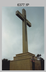
Photograph - Army Survey Regiment Mount Macedon Memorial Cross Ceremony, 1995
This set of six colour photographs of a Catafalque Party from the Army Survey Regiment was taken at the Mount Macedon Memorial Cross on the 19th of November 1995. The ceremony was held to commemorate the 60th anniversary and the refurbishment of the site. The refurbishment entailed the complete replacement of the cross and its surrounds. The cross is also known as the Cameron Memorial Cross and was built in 1935 as a memorial for those who lost their lives in the First World War. The Guest Speaker was Mr Bruce Ruxton AM MBE OBE, who at the time was the president of the Victorian RSL. He served in the 2/1st Australian Topographical Survey Company in WW2 before reallocation to the 2/25th Australian Infantry Battalion. He was the president of the Victorian RSL from 1979 to 2002 and was a staunch vocal advocate for the health and welfare of war veterans and their families. Refer to the Wikepedia web site for more detail on the history of the Mount Macedon Memorial Cross and Mr Bruce Ruxton AM MBE OBE.This set of six colour photographs of a Catafalque Party from the Army Survey Regiment was taken at the Mount Macedon Memorial Cross on the 19th of November 1995. The photographs were printed on photographic paper and are part of the Army Survey Regiment’s Collection. The photographs were scanned at 300 dpi. .1) - Photo, colour, 1995. Mount Macedon Memorial Cross Ceremony, SPR James Commons in foreground. .2) - Photo, colour, 1995. Mount Macedon Memorial Cross Ceremony, Guest Speaker - Mr Bruce Ruxton AM MBE OBE. .3) - Photo, colour, 1995. Mount Macedon Memorial Cross Ceremony, SPR Katie Royce, unidentified soldier in background. .4) - Photo, colour, 1995. Mount Macedon Memorial Cross Ceremony, James Commons. .5) - Photo, colour, 1995. Mount Macedon Memorial Cross Ceremony, L to R: SSGT Peter Coles, SPR James Commons. .6) - Photo, colour, 1995. Mount Macedon Memorial Cross Ceremony, SPR James Commons. Each photo is annotated ‘Mt Macedon Memorial Cross Ceremony 19 Nov 95. Mr Bruce Ruxton AM MBE, OBE, SSGT Peter Coles, SPR Katie Royce and SPR James Commons are identified on the photos. royal australian survey corps, rasvy, army survey regiment, army svy regt, fortuna, asr -
 Bendigo Military Museum
Administrative record - I Fd Svy Sqn Monthly Report: Jul - Nov 1979, 1 Fd Svy Sqn, 1979
A Report on activities of 1 Fd Svy Sqn during the period Jul-Nov 1979. Monthly Reports were mandatory for all RASvy units.Plastic, Cardboard covered, A4 Paper reports, diagrams.royal australian survey corps, rasvy, fortuna, army survey regiment, army svy regt, asr -
 Bendigo Military Museum
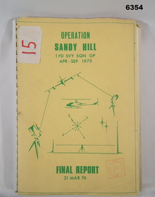
Administrative record - Operation Report - Operation Sandy Hill 1Fd Svy Sqn Apr - Sep 1975, 1 Fd Svy Sqn, 1976
Comprehensive Operation Report on Operation Sandy Hill conducted by 1Fd Svy Sqn Apr-Sep 1975 Part 1 Forward, Part 2 Planning and Mounting, Part 3 Final Report OC 1 Fd Svy Sqn, Part 4 Report Abn/EDM Gp, Part 5 Report Recon, Stn Marking and Traversing Gp, Part 6 Admin Report, Part 7 Report OC 171 Op Spt Sqn, Part 8 Computations and Results, Part 9 Observations and Recommendations.A4 size report held together with a plastic spiral binding, Light Cardboard cover includes many foldout Annexes"15" on front cover. Rubber stamp "Army Survey Regiment Map Library"royal australian survey corps, rasvy, fortuna, army survey regiment, army svy regt, asr -
 Bendigo Military Museum
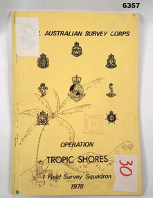
Administrative record - Royal Australian Survey Corps - Operation Tropic Shores, 1 Field Survey Squadron 1978, 31 Aug 1978
Operation Tropic Shores was conducted in 2 phases, Sep 1977 and May / Jun 78. The Operation was the field completion of Cape York 1;50,000 Mapping North of latitude 15 degrees S. Plotting was undertaken by 2, 4 and 5 Fd Svy Sqns with 1Fd Svy Sqn undertaking the mounting and Management of the field completion phase. Re-visiting and targeting of existing trig stations was also carried out as an opportunity task.Booklet, A4 cream cardboard cover, stapled Left Hand side, containing a report and plotted maps. Cover has Title and the Badges of the Australian Army Corps who participated in the Operation. 2 fd svy sqn, 4 fd svy sqn, 5 fd svy sqn, royal australian survey corps, 1 field survey squadron, 1fd svy sqn, rasvy, fortuna, army survey regiment, army svy regt, asr -
 Bendigo Military Museum
Book - Sun Observations for Azimuth - Astronomical Fixations Woomera 1951, 28.05.1951 to 02.08.1952
Field Survey control position fixing observations for the Woomera Rocket Range, South Australia. Sun Astronomical observations by Sergeant NRJ Hillier later Colonel and Director of Military Survey-Army, and Sergeant DR Ridge later Lieutenant Colonel and Commanding Officer of the Army Survey Regiment.Hard covered book, handwritten pages, map sketches, extra laminated table of figuresHandwritten observation tables and notes. Handwritten notes on front and back coversroyal australian survey corps, rasvy, fortuna, army survey regiment, army svy regt, asr -
 Bendigo Military Museum
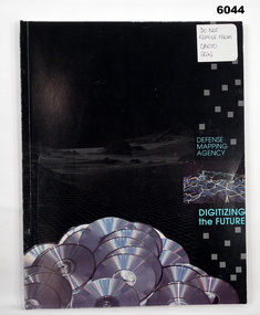
Manual - Defense Mapping Agency (US) - Digitizing the Future Third Edition, c1990
Digitizing the Future Third Edition, An information booklet describing the types of new digital geographic products produced by the US Defense Mapping Agency. The Australian Army Survey Regiment went on to also produce many of these digital productsSoft Cover Book, Paper Pages, 3 parts with Numerous Sections in each Part, Text, Diagrams and Photographs, Data Information Sheets, DMA Stock No: DDIPDIGITALPACFront Cover, "DO NOT REMOVE FROM CARTO SQN"royal australian survey corps, rasvy, fortuna, army survey regiment, army svy regt, asr -
 Bendigo Military Museum
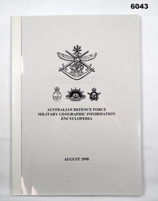
Manual - Australian Defence Force - Military Geographic Information Encyclopedia, Information Strategic Concepts Branch of the Australian Defence Force Strategic Command Division, Directorate of Strategic Military Geographic Information, 27 Aug 1998
Military Geographic Information Encyclopedia in 3 Parts- Acronyms, Definitions, Web sitesSoft Film Cover, 3 Parts (Chapters), 77 Pagesroyal australian survey corps, rasvy, fortuna, army survey regiment, army svy regt, asr -
 Bendigo Military Museum
Book - Army Survey Regiment , Visitors Book, Jan 1975 - Februrary 1996, Jan 1975
A record of visitors to the Army Survey Regiment 13 Jan 75 - 6 Feb 96Visitors Signature Book, 13 Jan 75 - 6 Feb 96. Hard covered, Leather bound, greenroyal australian survey corps, rasvy, fortuna, army survey regiment, army svy regt, asr -
 Bendigo Military Museum
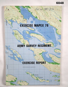
Administrative record - Army Survey Regiment - Exercise Mapex 78, Mar 1979
Exercise Report on exercise Mapex 78. The exercise was designed to test the Army Survey Regiment in an intensive production phase of 30 days duration.A4 soft covered booklet, printed map of part of the Kimberley region of Western Australia on front and back covers, staple boundTop right hand corner of front cover "File on 788-2-14"royal australian survey corps, rasvy, fortuna, army survey regiment, army svy regt, asr -
 Bendigo Military Museum
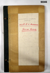
Journal - Cartographic Mapping Precis - WO2 R C Andrews Mapping Precis Folder, Circa 1960
This is a compilation of Precis about cartographic mapping procedures to produce a map, compiled by WOII RC Andrews, Technical Warrant Officer Cartographic Squadron, retired 1975.Book with 2 x "chicago" screws, cardboard cover- brown, green cloth tape along binding edge"WO II R. C. ANDREWS PRECIS FOLDER"royal australian survey corps, rasvy, fortuna, army survey regiment, army svy regt, asr -
 Bendigo Military Museum
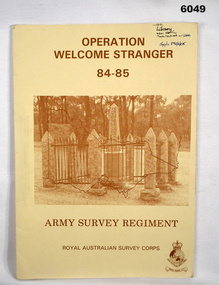
Administrative record - Army Survey Regiment - Operation Welcome Stranger - Operation Report
Operation Report of Mapping areas in central Victoria in 29 Mar 84 - 6 Mar 85. Covering 1:250,000 map areas SJ54-4 St Arnaud, SJ 55-1 Bendigo, SJ54-8 Ballarat, SJ %%-2 WangarattaAn A4 booklet sepia cardboard cover, brown text Survey Corps Badge, Photo of " Welcome Stranger Monument", outline shape of Victoria, glide on Arnos fastener binder.royal australian survey corps, rasvy, fortuna, army survey regiment, army svy regt, asr -
 Bendigo Military Museum
Photograph - RA Svy Project C4 Aerodist Operation, Eastern Arnhem Land, NT, 1967
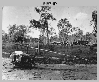
This is a set of 30 photographs of Royal Australian Survey Corps (RA Svy) personnel from Central Comd Fd Svy Unit (Adelaide) on Aerodist survey operation - Project C4 in Eastern Arnhem Land, Northern Territory in 1967. Photos of personnel were taken either at the operations base at Numbulwar or the main base at Gove (Nhulunbuy). RA Svy conducted nineteen Aerodist operations for 12 years from 1964 to 1975. Aerodist MRC2 was a tellurometer-based system adapted for aircraft to accurately measure distances between non-intervisible ground survey stations, using the aircraft as an intermediate station. Lower order geodetic results could be achieved by survey network trilateration. The measured distances between stations formed survey networks from which each station’s latitude and longitude was computed. Aerodist MRC2 was RA Svy’s major horizontal control survey tool for mainly medium scale topographic mapping (scale 1:100,000 Class A being spatially accurate to within 50 metres) in PNG, northern NT, north-west WA, Kalimantan Barat (West) Indonesia, Sumatra Indonesia, Gulf of Carpentaria and Cape York, QLD. In 1967, the Aerodist MRC2 Master equipment was installed in the aircraft featured in this set of photos, Executive Air Services’ (Essendon VIC) Grand Aero Commander VH-EXX. It was the same aircraft type and company contracted to Division of National Mapping for Aerodist MRC2 surveys. From July to October 1967 the aircraft was attached to Central Comd Fd Svy Unit (Adelaide - Major Don Ridge) on Project C4 eastern-Arnhem Land NT, where 317 Aerodist lines measuring 17,300 line miles were successfully completed. This was the most productive Aerodist project thus far. The most common helicopter used by RA Svy up to 1972 was the civilian Bell 47G-2 and the Sioux Light Observation Helicopters (LOH), the Australian Army’s equivalent featured in this photo set. These light observation helicopters had a limiting load carrying capacity of up to about 500 pounds. By comparison, one Aerodist team including two people weighed up to 1,500 pounds. Source: Royal Australian Survey Corps – Aerodist Years 1964-1975 by Peter Jensen. This is a set of 30 photographs of Royal Australian Survey Corps (RA Svy) personnel on Aerodist survey operations in Eastern Arnhem Land, Northern Territory in 1967. The photographs are on 35mm negative film and scanned at 96 dpi. They are part of the Army Survey Regiment’s Collection. .1) to .4) - black & white, 20th August 1967, Project C4 Aerodist Operations Base - Numbulwar, NT. .5) - Photo, black & white, 1967. Probable wrecked Indonesian fishing vessel. .6) to .8) - Photo, black & white, 1967. Unidentified survey operations base, L to R: unidentified personnel. .9) - Photo, black & white, 1967. Unidentified survey operations base, unidentified soldier driving a Haflinger 4x4 Light utility vehicle. .10) - Photo, black & white, 1967. Unidentified survey operations base, L to R: unidentified technician. .11) - Unidentified technician reading two survey altimeters to compute corrections to the measured distances for atmospheric refraction and to compute the sea level distances from the slope distances aircraft to the ground stations. .12) - Photo, black & white, 1967. Unidentified survey operations base, L to R: unidentified personnel. .13) to .16) - Photo, black & white, 1967. Unidentified personnel operating remote Aerodist MRC2 ground instruments. .17) to .18) - Photo, black & white, 1967. Unknown RA Svy office location. .19) to .20) - Photo, black & white, 1967. Aerodist MRC2 Master equipment. .21) to .22) - Photo, black & white, 1967. Aero Commander VH-EXX probably at Gove, NT, Central Comd Fd Svy Unit (Adelaide) – OC Major Don Ridge. .23) to .25) - Photo, black & white, 1967. Aero Commander VH-EXX probably at Gove, NT. Unidentified personnel. .26) - Photo, black & white, 1967. Aero Commander VH-EXX probably at Gove, NT. Aerodist antenna pods are visible on the aircraft. .27) to .29) - Photo, black & white, 1967. Australian Army Sioux Light Observation Helicopter (LOH) probably at Gove, NT. .30) - Photo, black & white, 1967. Panelled U337 survey station, visible as a white cross on aerial identification photo..1P to .2P – date and location on edge of film negative. .5P to .28P – no annotations .29P - annotated in white ‘RW-JEP Gove NT’ .30P - annotated in white ‘U337 Spool No1 Jun67’royal australian survey corps, rasvy, army survey regiment, army svy regt, fortuna, asr, aerodist, surveying, central comd fd svy unit -
 Bendigo Military Museum
Photograph - Bell 47G-2 helicopter used in Royal Australian Survey Corps Field Operations, c1965
This is a set of four photographs of Bell 47G-2 helicopters used in Royal Australian Survey Corps Field Operations. c1965. From 1957, helicopter transport of survey parties revolutionised transport in remote areas. The most common helicopter used by the Royal Australian Survey Corps at this time was the civilian Bell 47G-2 and the Sioux, the Australian Army’s’s equivalent. equivalent. From 1964 an Aerodist MRC2 airborne Electronic Distance Measuring (EDM) system was extensively used for topographic surveys over long distances by trilateration to replace traverse requiring survey station intervisibility. In 1965 the command field survey unit personnel attached to the Army Survey Regiment’s Topographic Squadron were used mainly in support roles such as station clearing, tower operations, station monumenting, Aerodist computations, forward base operations, geodetic observations on the north-south traverse and logistic support for Remote teams. .1P is a photo of a civilian Bell 47G-2 helicopter Registration / Serial VH-UTB owned by Helicopter Utilities from Mascot, NSW c1965. In the background of this photograph is three personnel and vehicles at a field survey camp. The left-hand vehicle is a Willys Jeep with trailer and on the right is probably a Truck, 2 1/2 ton, 6x6, General Service GMC. The Bell 47G-2: VH-UTB was destroyed, and its pilot killed in tragic circumstances during a civilian survey operation on Cape York Peninsula in June 1966. .2P is a photo of a a civilian Bell 47G-2 helicopter Registration / Serial VH-IHB taken in Wyndham, WA. As the letters ‘TAA’ appear on the fuselage, the helicopter was charted from Trans Australian Airways. .3P is a photo of a Bell 47G-2: VH-UTC with survey camp in background. .4P is a photo of a Bell 47G-2 equipped with floats and unidentified personnel loading stores, possibly in Darwin. Acknowledgement: Royal Australian Survey Corps – Aerodist Years 1964-1975 Version 2021.0 Authored by Peter Jensen.This is a set of four photographs of civilian Bell 47G-2 helicopters used in Royal Australian Survey Corps Field Operations. c1965. The photographs were printed on photographic paper and are part of the Army Survey Regiment’s Collection. The photographs were scanned at 300 dpi. .1) - Photo, black & white, c1965, Bell 47G-2 helicopter: VH-UTB with survey camp in background. .2) - Photo, black & white, c1965, Bell 47G-2 helicopter: VH-IHB with survey station in foreground. .3) - Photo, black & white, c1965, Bell 47G-2 helicopter: VH-UTC with survey camp in background. .4) - Photo, black & white, c1965, Bell 47G-2 helicopter: Unidentified personnel loading stores possibly in Darwin..2P – annotated on bottom of photo ‘Wyndham Area – Helicopter drops observing party’ The other photographs are not annotated.royal australian survey corps, rasvy, army survey regiment, army svy regt, fortuna, asr, surveying -
 Bendigo Military Museum
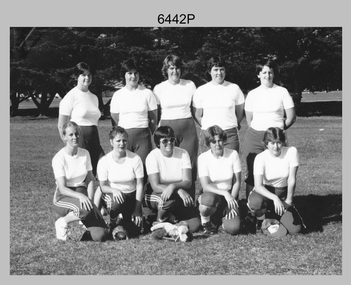
Photograph - Army’s 3rd Military District Inter-Service Softball Team, Victoria, 1981
This is a photograph of Army’s Inter-Service Softball Team that competed in the 3rd Military District, Victoria against Navy and Air Force taken on the 26th of February 1981. The competition was held from the 23rd to the 27th of February 1981. A note on the back of the photo indicated Army’s team came second. It is not known who the winning team was and where the competition was held.This is a photograph of Army’s Team that competed in the 3rd Military District Inter-Service Softball competition against Navy and Air Force, taken in an unknown location in Victoria on the 26th of February 1981. The black and white photo is on photographic paper and was scanned at 300 dpi. It is part of the Army Survey Regiment’s Collection. .1) - Photo, black and white, 1981. Back row L to R: PTE Karen Ball – DSU Broadmeadows, CPL Kay Melton – DSU Puckapunyal, SPR Scheryl Delforce – Army Survey Regiment Bendigo, WO2 Dizzy Dowsett – CARO, LT Jan McFarlane. Front row L to R: SPR Sharon Jones – Army Survey Regiment Bendigo, CPL Donna Sheldrick, CPL Di Chalmers – Army Survey Regiment Bendigo, PTE Karen ???, PTE Jackie Hubbard.Personnel and dates are identified on the back of the photo as well as on paper. royal australian survey corps, rasvy, army survey regiment, army svy regt, fortuna, asr -
 Bendigo Military Museum
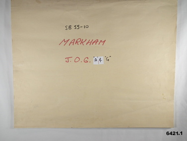
Map - SB55-10 Markham Joint Operations Graphics Air and Ground print separations, Royal Australian Survey Corps, Bendigo, Dec 1981
This set of map prints was assembled as a training aid. The collection is a complete set of individual color prints of each colour used on the final printed maps for each map Joint Operations Graphic (JOG) JOG Ground and JOG Air versions. This map series was produced in two versions to help coordinate military Ground Operations and Air Operations. The ground users required that heights and measurements were in Metres, whilst air users required height information in Feet for altimeters. The Air Version also contained more Aeronautical information including safe flying height information called Maximum Elevation Figures (MEF). Later printing of JOG incorporated printing in just four colours Cyan, Magenta, Yellow and Black (CMYK). Item 6421.1 is an example of a JOG Ground and item 6421.2 is an example of its matching JOG Air version.1:250,000 SB55-10 Markham JOG A and G colour separations bound together in a manilla card covered folder bound with a timber edge. royal australian survey corps, rasvy, fortuna, army survey regiment, army svy regt, asr -
 Bendigo Military Museum
Photograph - Defence Co-operation Project Students, School of Military Survey, Bonegilla, VIC, 1990
This is a photograph of Defence Co-operation Project (DCP) students from the Pacific region who attended the 1/90 Specialist Carto course held at the School of Military Survey, Bonegilla, Victoria from the 9th of May to the 5th of June 1990.This is a photograph of Defence Co-operation Project (DCP) students attending the 1/90 Specialist Carto course held at the School of Military Survey, Bonegilla, Victoria in 1990. The photograph was printed on photographic paper and is part of the Army Survey Regiment’s Collection. The photograph was scanned at 300 dpi. .1) - Photo, black & white, 1990, DCP Students L to R: SGT Ramos – Philippines, Miss Chukeni – Solomon Islands, SGT Laguador – Philippines, CPL Jais – Malaysia. .1P – Students, course title and date annotated on back of photo.royal australian survey corps, rasvy, army survey regiment, army svy regt, school of military survey, fortuna, asr -
 Bendigo Historical Society Inc.
Document - MARKS COLLECTION: SPECIFICATION AND GENERAL CONDITIONS OF CONTRACT HERCULES AND ENERGETIC MINE, 2nd March, 1870
Handwritten document, outlining 'specifications to bricklayers and stonemasons work required for the erection of Steam Engine, Boiler & Winding Gear for the Hercules and Energetic Goldmining Company, Sandhurst' Sections consist of details for excavation for engine and foundations, masonry, brickwork chimney, excavations for boiler seating, firing floor, firing boiler brickwork engine bed, winding gear, mortar and cement, seating of boiler. Document is dated Mar 12, 1870.Attached to the document is a blue printed 'General Conditions of Contract' document, handwritten on top 'Bricklayers' Drawings by Wm. Middleton, engineer, Sandhurst NOT ATTACHED ( as stated in document )Drawings by, Wm Middleton, Engineer Sandhursts.bendigo, buildings, fortuna villa -
 Bendigo Historical Society Inc.
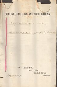
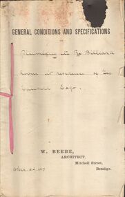
Document - MARKS COLLECTION: SPECIFICATIONS FOR CARPENTERS WORK IN ERECTING NEW BILLIARD ROOM FOR GEO LANSELL, 1st February, 1893
Contract document, held by pink secured with pink tape. On top of front page printed 'General conditions and specifications' handwritten, for Carpenters work in erecting a new billiard room for Mr. G. Lansell. On bottom of page printed : W. Beebe, Architect, Mitchell Street, Bendigo. Dated February 1, 1893.W. Beebe, Architect, Mitchel Street, Bendigobendigo, buildings, fortuna villa -
 Bendigo Historical Society Inc.
Document - MARKS COLLECTION: PLUMBING RE BILLIARD ROOM AT RESIDENCE OF GEO LANSELL ESQ, 22nd March, 1893
A3 document, secured with pink tape 'General Conditions and Specifications' printed on top. Below handwritten Plumbing etc re Billiard Room at residence of Geo Lansell Esq. On bottom of document printed W. Beebe, Architect, Mitchell Street, Bendigo. Dated Mar 22 1893.W. Beebe, Architect, Mitchel Street, Bendigo.bendigo, buildings, fortuna villa -
 Bendigo Historical Society Inc.
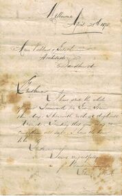
Document - MARKS COLLECTION: LETTER TO MESSRS VAHLAND & GETSCHMAN, ARCHITECTS, SANDHURST, 25th April, 1875
Parchment coloured A4 bifold letter, addressed in black ink to Messrs Vahland & Getschmann, Architects, Sandhurst. Dated Melbourne, April 25th 1875. Gentlemen, I have sent the whole of your ironwork per Goods Train this day. I herewith enclose duplicate receipts. Trusting that you may receive them all safe. I have the honour to be, Gentlemen, Yours respectfully, P. Alexander ….. (unclear ) for Geo E. Scott' On reverse of document are instructions related to the content of the ironwork sent. E.g. 'the columns are numbers from left to right as per plan. The brackets are numbered to correspond with columns'.bendigo, buildings, fortuna villa -
 Bendigo Historical Society Inc.
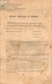
Document - MARKS COLLECTION: EMIL MAUERMANN, GEO LANSELL DOCUMENT
Buff coloured contract, black typed print. 10 page document. On top of first page letterhead of Emil Mauermann, Architect, Sandhurst General Conditions of Contract for (handwritten) alteration and addition of a 'Mansard story' (sic) to the private residence of Geo. Lansell Esq, Sandhurst. First four pages are generic typed contract document, appended are pages of handwritten details as to the construction of all aspects of the extension.Emil Mauermann Architect , Sandhurst.bendigo, buildings, fortuna villa -
 Bendigo Historical Society Inc.
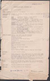
Document - R.S.L. BENDIGO COLLECTION: TIME TABLE FOR MARCH
Typed time table for march. Detailed is the Assembly, Order of March, Spacings, Route, Bands, Last Post, Reveille, Traffic arrangements, and Timings. Written at the end of the first page is:'Dawn Service 6.30 ? ?.event, official, anzac day, r.s.l. bendigo collection - time table for march, mr a v palmer, mr w e p carruthers, f jackson, w fern, w green, j murdoch, f schilling, boer war statue, 38 bn band, cenotaph, national bank, bendigo pipe band, ahq carto fortuna, lansell statue, hopetoun and municipal bands, marist brothers bands, bendigo pipe band, memorial hall -
 Bendigo Historical Society Inc.
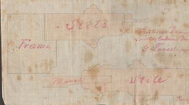
Document - MARKS COLLECTION: DRAWING ENTRANCE DOOR FOR G. LANSELL
Plan drawn on waxed paper. Written on plan 'Full size Drawing of part of entrance door for G. Lansell, Esq' Plan shows line drawings of side elevations of Frame, Stile, Pelmet, Stile, Frame. On bottom of plan purple ink stamp 'Vahland & Getzschmann, Architects, Sandhurst'.Vahland & Getzschmann, Architects, Sandhurst.bendigo, house, fortuna villa