Showing 4627 items
matching melbourne - maps
-
 Glenelg Shire Council Cultural Collection
Souvenir - Souvenir - Map and Sticker, South West Victoria, n.d
a. Tourist Guide to the S.W. region - fold out map, with tourist destinations marked; description on reverse. b. Bumper sticker, round, red, with white print ' 'Victoria, all it needs is you' - Victorian Ministry of Tourism logo. -
Glenelg Shire Council Cultural Collection
Souvenir - Postcard, c. 2000
... map of Australia. Melbourne indicated, plus rectangular area... logo on right. Reverse has line map of Australia. Melbourne ...Contemporary postcard of Portland. 4 full colour views of Portland. 'Portland Victoria, Australia' in white on blue bottle margin, left. Traveller's Notes logo on right. Reverse has line map of Australia. Melbourne indicated, plus rectangular area Portland district. Valued $ 30.15 for 9 items -
Glenelg Shire Council Cultural Collection
Souvenir - Commemorative Sandwich Plate - The MacRobertson Trophy Air Race, c. 1934
From Wikipedia: The MacRobertson Trophy Air Race (also known as the London to Melbourne Air Race) took place in October 1934 as part of the Melbourne Centenary celebrations. The race was devised by the Lord Mayor of Melbourne, Sir Harold Gengoult Smith,[1] and the prize money of £15,000 was provided by Sir Macpherson Robertson, a wealthy Australian confectionery manufacturer, on the conditions that the race be named after his MacRobertson confectionery company, and that it was organised to be as safe as possible.[2] A further condition was that a gold medal be awarded to each pilot who completed the course within 16 daysClear glass sandwich plate, commemorating the Air Race from UK to Australia. Map of UK and Australia, aeroplanes, etched into glass.Front: VICTORIAN AND MELBOURNE CENTENARY 1934-1935 - etched from beneathuk australia air race, macrobertson air race, 1934, melbourne centenary -
 Greensborough Historical Society
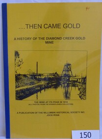
Book, Then came gold: a history of the Diamond Creek Gold Mine: by Jock Ryan, 2001_
The Diamond Creek Gold Mine was active from the 1860s and by 1912 had 12 known shafts. This book outlines ownership and contains anecdotes about the mine.A short history of the Diamond Creek Gold MineBook, 9 pages. Black and white illustrations and maps. Yellow front page with clear plastic cover.John Mackey in pencil inside front cover.diamond creek, john l ryan, jock ryan, diamond creek gold mine, gold discoveries victoria -
 Greensborough Historical Society
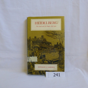
Book, Melbourne University Press, Heidelberg: the land and its people 1838-1900; by Donald P. Garden, 1838-1900
This book covers the early history of Heidelberg, Victoria from its beginnings in 1838 to 1900.There is some reference to the 'annexation' of Greensborough in 1875 and the route of the Heidelberg-Eltham railway line, 1893.Hard cover book. 218 p., ill., maps. Slip cover has a drawing based on an early photograph of the Old England Hotel.Property stamps from Nunawading Public Library (cancelled from their collection)heidelberg, greensborough, donald garden -
 Greensborough Historical Society
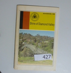
Book, Shire of Diamond Valley, Shire of Diamond Valley Handbook 1980, 1980_
Guide to services provided by Shire of Diamond Valley. The Shire of Diamond Valley was a Local Government Area located about 20 kilometres northeast of Melbourne. The shire covered an area of 74.38 square kilometres and existed from 1964 until 1994Annual guide to services in Shire of Diamond Valley32 pages, col illus., maps. Cover illustration of footbridge over the Plenty River at Flintoff Street. The span is 50 metres and cost $56,100 to build in 1978.shire of diamond valley, greensborough, handbooks -
Greensborough Historical Society
Report, Melbourne Parks and Waterways, Happy Hollow Farm Complex : Conservation Strategy [excerpts], 1996_07
This report was commissioned by the Melbourne Parks and Waterways in 1996. It contains a history of the place and building, and garden and landscape features. There is a Statement of Cultural Heritage Significance. Happy Hollow was occupied (and probably built) by Emmett Whatmough in 1893, and owned by John Cully McLaughlin. There are other family connections among the Greensborough district pioneers.Copy of document, 16 pages plus maps.happy hollow, whatmough, bell, mclaughlin, melbourne parks and waterways. cultural heritage significance -
 Greensborough Historical Society
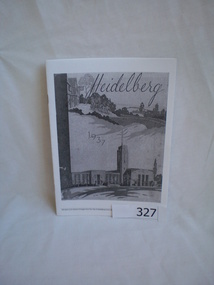
Booklet, Heidelberg 1937 - excerpts, 1937_04
Copy of parts of 1937 booklet to commemorate the official opening of the City of Heidelberg Civic Centre - Town Hall and Municipal Offices.A snapshot of the Heidelberg area in 1937, includes photos of local homes and civic amenities12 pages, photocopied and folded to A5 size. Black and white photos, maps.This flyer is an extract of images from the City of Heidelberg Civic Centre Official Opening Booklet "Heidelberg 1937" [footnote on each page]heidelberg municipal offices, heidelberg town hall, the centre ivanhoe -
 Greensborough Historical Society
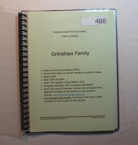
Folder, Grimshaw Family, 1849o
... Plenty Lower Plenty melbourne Passenger indexes; maps; mortgage ...Passenger indexes; maps; mortgage document 1873 Grimshaw and Britnell; history of Aaron and Joshua Grimshaw; Greensborough murder: transcript of the trial of Josiah Grimshaw for the murder of John Mitchell.History of the origins of this Greensborough family.20-page plastic binder, spiral bound, clear cover. Contains documents relating to the Grimshaw family.Collected by Greensborough Historical Society. Folder commenced 2012.grimshaw family -
 Greensborough Historical Society
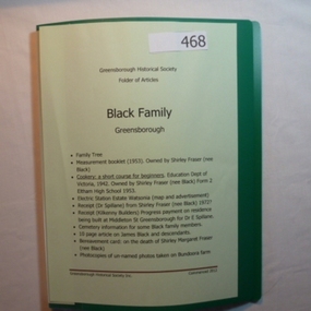
Folder, Black Family - Greensborough, 1900o
Contents: Family tree; small school books from family member; copy of map and advertisement for Watsonia Electric Station Estate; receipts; cemetery information; article on James Black and descendants; copies of un-named photos taken on Bundoora farm.The Black family owned a large portion of land from Greensborough to Watsonia. This collection is partly from family members.20-page plastic binder, green cover. Contains documents relating to the Black family of Greensborough and Watsonia.Collected by Greensborough Historical Society. Folder commenced 2012black family, shirley fraser, james black, watsonia electric station estate -
 Greensborough Historical Society
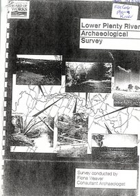
Report, Lower Plenty River Archaeological Survey; Fiona Weaver, 1989_
Archaeological survey of the Lower Plenty River undertaken in 1989-1990 by Fiona Weaver for the Board of Works. Indigenous heritage sites along the Plenty River are examined and recommendations made for the preservation and to lessen the impact of development on these sites.Printed on white A4 paper. Approx 92 pages (not numbered). Illus., maps. 2 copies.plenty river, board of works, aboriginal heritage sites -
 Greensborough Historical Society
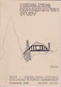
Book, Heidelberg Conservation Study: Part 1 Historic Buildings and Areas Assessment, 1985_
Report prepared by Graeme Butler on behalf of City of Heidelberg and Heidelberg Heritage Advisory Committee. Area covered is from Eaglemont in the south to Macleod in the north.This study identifies neighbourhood character, documents past development and the capacity of the environment for future development.Part one of set of three books. Paperback, 189 pages, Illus., maps. 2 copies.Stamps: Yarra Plenty Regional Library Service, and, Withdrawnheidelberg, macleod, heidelberg heritage advisory committee, graeme butler, plenty river, eaglemont -
 Greensborough Historical Society
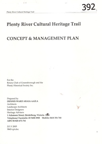
Report, Plenty River Cultural Heritage Trail : Concept & management plan, 2005_07
Prepared for the Rotary Club of Greensborough and Plenty Historical Society by Dennis Ward, this report outlines the heritage importance of the Plenty River Trail around Greensborough.This is an ongoing project by Dennis Ward. This report is an early version of the 2011 Squatters, speculators and settlers: Plenty River Cultural heritage trail. (Item 258) 66 page report, Illus, (some col.) , maps. In red 2-ring binder.Some handwritten notes in last pages.plenty river cultural heritage trail, dennis ward, rotary club of greensborough, plenty historical society, plenty river -
 Greensborough Historical Society
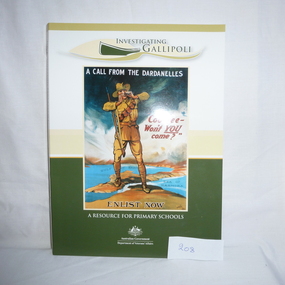
Book and CD, Australia. Department of Veterans Affairs, Investigating Gallipoli : a resource for secondary schools, 2010
Educational worksheets and activities used to teach children about Australia's role in the Gallipoli Campaign.Book: 80 p., illus. (some col.), maps, worksheets. Includes 2 discs: Disc 1 (video) Australians at War Episode 2; Disc 2 (DVD-ROM) Interactive activities and ABCs Gallipoli: the First Day website.australia department of veterans affairs, gallipoli, world war i, educational aids -
 Greensborough Historical Society
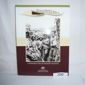
Book - Book and CD, Australia. Department of Veterans Affairs, Gallipoli and the ANZACS : a resource for secondary schools, 2010_
Educational worksheets and activities used to teach children about Australia's role in the Gallipoli Campaign.Book: 120 p., illus. (some col.), maps, worksheets. Includes 2 discs: Disc 1 (video) Australians at War Episode 2 and, Revealing Gallipoli; Disc 2 (DVD-ROM) Interactive activities and ABCs Gallipoli: the First Day website.australia department of veterans affairs, gallipoli, world war i, educational aids -
 Greensborough Historical Society
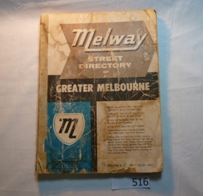
Book, Melway Street Directory of Greater Melbourne. Edition 1, 1966_
The first edition of this iconic Melbourne street directory published in 1966. The directory is accompanied by an outline of the history of the concept and publication of Melway.A surviving first edition of the Melway is rare as these directories are designed to be updated each year. Of interest in this edition is maps of the Greensborough area before large scale subdivision of the land in the late 1960s and 1970s.Soft cover street directory. Coloured maps.189 pages.melway, street directories, melbourne. -
 Greensborough Historical Society
Report, Examining Draughtsman's Report - Watts River Aqueduct, 20/07/1897
This Field Survey was commissioned by the Melbourne Board of Works and was used to position the Maroondah Aqueduct bridge north of Greensborough at its crossing point on the Plenty River. It incorporated the use of wrought iron water pipes and therefore is of lighter construction than other similar bridges in the district. It features a traverse of the Plenty RiverThe Maroondah Aqueduct bridge is a significant example of late 19th century engineering. A 4 page reproduction of an Office of Titles document. Copy of handwritten report includes maps.maroondah aqueduct, watts river aqueduct, bridge, greensborough, office of titles, 1897, wrought iron water pipes, plenty river, melbourne board of works -
 Greensborough Historical Society
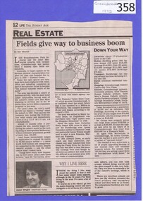
Newspaper clipping, Fields give way to business boom, 1993_
Tells some of the story of the settlement of Greensborough and Lend Leases' gradual take over of Greensborough shopping area. In Canberra Times Wednesday 17 November 1993, page 27: Melbourne: Lend Lease Corp Ltd is to undertake a $600 million redevelopment of two suburban Melbourne shopping centres, at Dandenong and Greensborough; to be built in conjunction with Australia's largest retailer; Coles Myer Ltd. The project will create about 2000 jobs; 1000 during construction and 1000 in long-term retail.Has some history of Greensborough and records the average land prices in 1993. A black and white Sunday Age newspaper story. Includes map and photograph of resident.greensborough, lend lease, 1993, land prices -
 Greensborough Historical Society
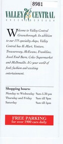
Pamphlet - Advertising pamphlet, Valley Central Greensborough, 1980s
Early advertising and list of tenants for Valley Central, now known as Greensborough Plaza. Gloss colour pamphlet and black and white mapgreensborough shopping centre, greensborough plaza, valley central -
 Greensborough Historical Society
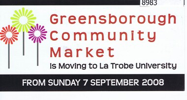
Card - Advertising Card, Diamond Valley Community, Greensborough Community Market 2008, 2008
Advertising Card about the Greensborough Community Market moving to La Trobe University in 2008. This market is managed by Diamond Valley Community Support.Coloured Advertising Card - 2 sided with mapmarkets, greensborough community market, diamond valley community support -
 Greensborough Historical Society
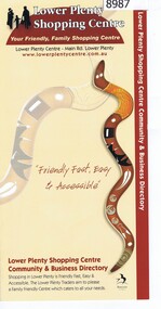
Pamphlet, Lower Plenty Shopping Centre, 2007
Coloured pamphlet from Lower Plenty Shopping Centre with list of shops, map and 2008 CalendarColour pamphlet with calendar and maplower plenty shopping centre, calendars, lower plenty -
4th/19th Prince of Wales's Light Horse Regiment Unit History Room
Booklet, Radio Printing Press Pty Ltd, Map Reading and Field Sketching 1940, 1940
... Macleod melbourne Manual map reading field sketching Soft covered ...Soft covered booklet compiled and written by Capt A S Keighley MC showing the use of the protractor and field compass and reconnaissance for Battalion Intelligencemanual, map reading, field sketching -
4th/19th Prince of Wales's Light Horse Regiment Unit History Room
Booklet, Capt W Stanley Lewis MSc, FRGS, Military Map Reading for the New Army, Feb 1941
... Macleod melbourne Manual map reading Price Two shillings and six ...Soft covered booklet covering various details of military maps and how to read them. Price Two shillings and six pencemanual, map reading -
4th/19th Prince of Wales's Light Horse Regiment Unit History Room
Booklet, George Allen & Unwin, The Observers Handbook on Maps Charts and Projections, Sep 1941
Not significant to collection. Available for transfer to more appropriate collection.Booklet written for observers and pilots of the RAF and RAFVR to help them in preparing for their examinations.maps, charts, raf, observers -
4th/19th Prince of Wales's Light Horse Regiment Unit History Room
Brass tankard
Trench art, brass tankard, brass bottom, Handle attached with solder Faintly engraved map of Middle East on one side and mosque on othertankard, mess property -
4th/19th Prince of Wales's Light Horse Regiment Unit History Room
Documents, AFV School, Army Tank Wing, Army Tank Precis, Nov 1942
A soft covered, stapled, collection of précis issued in 1942 by Army Tank Wing of the AFV School, covering AFV characteristics, orders, map marking, crew training RT Procedure, flag & semaphore signals, battle procedures, working with other arms etc.afv training, world war 2 -
4th/19th Prince of Wales's Light Horse Regiment Unit History Room
Booklet, Manual of Map Reading, Air Photo Reading & Field Sketching Part 1 Map Reading 1955, 1955
... Macleod melbourne map reading WO Code No 8868 Hard covered booklet ...Hard covered booklet for use of officer, NCOs and candidates for commission in the British Army and RAF explaining how to use a map and how to extract information from it. 4 copiesWO Code No 8868map reading -
4th/19th Prince of Wales's Light Horse Regiment Unit History Room
Booklet, Manual of Map Reading, Air Photo Reading and Field Sketching Part 3 Field Sketching 1957, 1957
Hard covered booklet. 3 copiesWO Code No 9085field sketching -
4th/19th Prince of Wales's Light Horse Regiment Unit History Room
Booklet, Map Reading Aide-Memoire 1973, 1973
... Macleod melbourne map reading DSN 7610-66-058-5570 Soft covered ...Soft covered booklet aimed at assisting with most map reading and navigation problems. 2 copiesDSN 7610-66-058-5570map reading -
4th/19th Prince of Wales's Light Horse Regiment Unit History Room
Booklet, Manual of Map Reading, Air Photo Reading & Field Sketching Part 2 Air Photo Reading
A yellow dust jacketed hard covered booklet enabling officers and NCO to make use of air photographs to support the map, and support ground recon and to use when ground recon is not possibleWO Code No 9484air photo reading