Showing 11864 items matching "on the map"
-
 Victorian Aboriginal Corporation for Languages
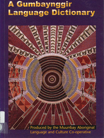
Book, Muurrbay Aboriginal Language and Culture Cooperative, A Gumbaynggir language dictionary =? Gumbayngirr bijaarr jandaygam, 2001
Maps, b&w illustrationsgumbaynggir, janggadi, birrbay, yugumbal, anaiwan, burrgadi -
 Victorian Aboriginal Corporation for Languages
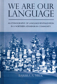
Book, Barbra Meek, We are our language an ethnography of language revitalization in a Northern Athabaskan community, 2010
maps, b&w photographskaska, language revitalisation, language revival -
 Victorian Aboriginal Corporation for Languages
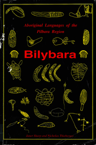
Book, Janet Sharp et al, Bilybara : the Aboriginal languages of the Pilbara region of Western Australia, 1992
Details on various Western Australian Pilbara languages, Banyjima, Manyjilyarra, Martuthunira, Ngarla, Ngarluma, Nyangumarta, Warnman, Yindijibarndi. Includes language programs, working with languages, linguistic work, some definitions, places in the Pilbara, language exercises.Maps, word lists, tablespama nyungan, kanyara, mantharta, ngayarda, marrngu, ngumpin, wati, palyku, nyiyaparli, pilbara languages -
 Victorian Aboriginal Corporation for Languages
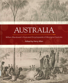
Book, Harry Allen, Australia : William Blandowski's illustrated encyclopaedia of Aboriginal Australia, 2010
William Blandowski was an explorer, natural scientist and artist who led a Victorian government expedition to the junction of the Murray and Darling Rivers from 1856 to 1857. This is the first publication in English of his nineteenth century illustrated encyclopaedia of Aboriginal life.Maps, b&w illustrationsaboriginal australian history, pictorial histories, william blandowski -
 Victorian Aboriginal Corporation for Languages
Book, Harry Allen, Australia : William Blandowski's illustrated encyclopaedia of Aboriginal Australia, 2010
William Blandowski was an explorer, natural scientist and artist who led a Victorian government expedition to the junction of the Murray and Darling Rivers from 1856 to 1857. This is the first publication in English of his nineteenth century illustrated encyclopaedia of Aboriginal life.b&w illustrations, mapswilliam blandowski, pictorial works -
 Victorian Aboriginal Corporation for Languages
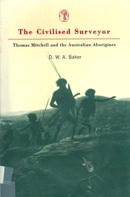
Book, D W A Baker, The civilised surveyor : Thomas Mitchell and the Australian Aborigines, 1997
Thomas Mitchell, surveyor in Sydney from 1827 at the time when Squatters were extending their runs with huge detriment to the Aboriginal population. Mitchell and his men were ambiguous in their treatment of the people. His conviction was in the superiority of the British civilisation.Maps, b&w illustrationsthomas mitchell, new south wales history, race relations, racism, colonisation -
 Victorian Aboriginal Corporation for Languages
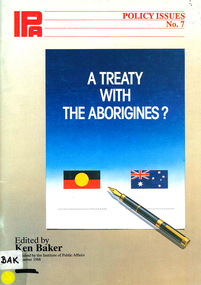
Book, Ken Baker, A treaty with the Aborigines?, 1988
A time for reconciliation / Bob Hawke -- Treaty is a recipe for separatism / John Howard -- A treaty for land justice and self-determination / Janine Haines -- Why a treaty? / Galarrwuy Yunupingu -- Aborigines are Australian, too / Bob Liddle -- Fallacies weaken the case for a treaty / Geoffrey Blainey -- Why whites also need an Aboriginal treaty / Roberta Sykes -- The quest for Aboriginal sovereignty / Hugh Morgan -- Legal and constitutional considerations / Mark Cooray -- Australia as terra nullius / Peter van Hattem -- Canada: towards Aboriginal self-government? / Jean Chretien -- American Indian treaties: historic relics / Peter Samuel -- The long aftermath of Waitangi / Antomy C. Turner -- Appendix 1: The Barunga statement -- Appendix 2: Preamble to the ATSIC Bill -- Appendix 3: Press attitudes to a treaty -- Appendix 4: Aboriginal population and landmaps, b&w photographsrace relations, racism, government relations, treaties -
 Victorian Aboriginal Corporation for Languages
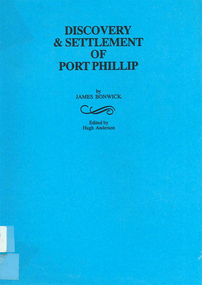
Book, James Bonwick, Discovery and settlement of Port Phillip : being a history of the country now called Victoria, up to the arrival of Mr. Superintendent Latrobe, in October, 1839, 1999
Contains a general history of the early Port Phillip district, including many references to Aboriginal peoples. Edited version of original 19th century notes by James Bonwick.Maps, b&w illustrationswilliam buckley, john batman, joseph gellibrand, john pascoe fawkner, victorian history, melbourne history, port phillip, religion, merri creek, james bonwick -
Victorian Aboriginal Corporation for Languages
Book, Thomas Francis Bride, Letters from Victorian pioneers : being a series of papers on the early occupation of the colony, the Aborigines, etc. : addressed by Victorian pioneers to His Excellency Charles Joseph La Trobe Esq., Lieutenant-Governor of the Colony of Victoria, 1898
Original edition of the letters from pioneering families in the Colony iof Port Phillip. It looks at their daily lives and hardships. It includes first hand reports of William Buckley?s role with the Aboriginal people after he returned to White society.maps, b&w illustrations -
 Victorian Aboriginal Corporation for Languages
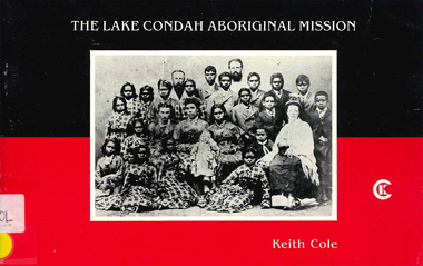
Book, Keith Cole, The Lake Condah Aboriginal Mission, 1984
Explores the history of the unusual site and the lifestyle of the people. then and now.maps, b&w photographsgunditjmara, gournditch-jmara, manmeet, lake condah, portland, heywood, hamilton -
Victorian Aboriginal Corporation for Languages
Book, Edward M Curr, Recollections of squatting in Victoria : then called the Port Phillip district, from 1841 to 1851, 1965
E. M. Curr?s recollections of early life in country Victoria, with much reference to relations with Aboriginal people and their reactions to the white settlement. Abridged edition with notes by Henry Forster.maps, b&w illustrationsbangerang, edward m curr -
 Victorian Aboriginal Corporation for Languages
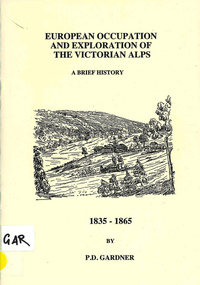
Book, P D Gardner, European occupation and exploration of the Victorian Alps : a brief history, 1835-1865, 1996
Maps, b&w illustrationsngarigo, jaitmathang, ngunawal, kosciusko, djilamatang, charlie tarra, strzelecki, gibbo range, omeo, jemmy gibber, e w bayliss, matooka, matoka, monaro -
 Victorian Aboriginal Corporation for Languages
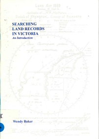
Book, Wendy Baker, Searching land records in Victoria : an introduction, 1996
maps, charts, photocopies of recordsgenealogy, victorian history, land tenure, land grants -
 Victorian Aboriginal Corporation for Languages
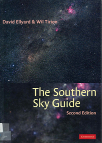
Book, David Ellyard et al, The southern sky guide, 2001
Gives detailed charts of the sky in two weekly segments.maps, charts, colour illustrationsastronomy, constellations, stars -
 Victorian Aboriginal Corporation for Languages
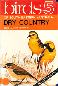
Book, AJ Reid, Birds 5 : of South-eastern Australia : dry country, 1986
Colour photographs, illustrations, mapsbirds, south eastern australia, mallee -
Victorian Aboriginal Corporation for Languages
Book, Margaret G. Corrick et al, Wildflowers of Victoria and adjoining areas, 2000
Alphabetically listed, with detailed entries.Maps, colour photographs, glossarywildflowers, plants, victoria, mallee, grampians -
Victorian Aboriginal Corporation for Languages
Book, Leon Costermans, Native trees and shrubs of South-eastern Australia, 1998
Coloured photos and detailed line drawings are used to give a very clear description of the specific plants and details of their locations and environments.Colour photographs, illustrations, mapsplants, botany, nsw, victoria, south australia -
 Victorian Aboriginal Corporation for Languages
Book, Marilyn Gray, Flora of Melbourne : a guide to the indigenous plants of the greater Melbourne area, 2001
Comprehensive book giving illustration of plants and very specific, detailed descriptions.Colour photographs, illustrations, mapsindigenous plants, werribee river, mount evelyn, sunbury, mount eliza, botany, plant associations, park regeneration, propagation, weeds -
 Victorian Aboriginal Corporation for Languages
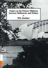
Book, P D Gardner, Names on the Princes Highway between Melbourne and Sydney : their origins, meanings and history, 2000
Place name list in a specific area. Giving descriptions and meanings.Maps, b&w illustrationsdandenong, genoa, south coast nsw, yarra river, moruya, kiama, captain cook, east gippsland, rosedale -
 Victorian Aboriginal Corporation for Languages
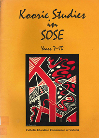
Book, Catholic Education Commission of Victoria, Koorie studies in SOSE : years 7-10, 2001
Section 1. Notes on the use of this resource Section 2. Policy support statements. Aboriginal Studies Policy Statement of Victorian Aboriginal Education Association Incorporated (VAEAI) National Principles and Guidelines for Aboriginal Studies and Torres Strait Islander Studies, K-12 Principles for the Introduction of Aboriginal Perspectives in the Curriculum of the Catholic School (Catholic Education Commission of Victoria Policy 1.3, 1987) Section 3. Language, culture and viewpoint: issues of terminology Section 4. Units of work Unit 1. Koorie people of south-east Australia: a contemporary view Unit 2. On sacred ground Unit 3. Koorie life in the pre-contact era Unit 4. Mulla Meea-Baa Gnuenjall: a long time ago, and today Unit 5. The land we share: human stories in the environment Unit 6. Frontier wars Unit 7. Aboriginal mission stations and reserves in Victoria Unit 8. Land, law and indigenous Australians Section 5. Directory of indigenous organisations and affiliated groups/?agencies. National organisations Victorian organisations Catholic Education Commission of Victoria Indigenous Education personnel Organisations within regions of the Archdiocese of Melbourne Organisations within regions of the Ballarat Diocese Organisations within regions of the Sale Diocese Organisations within regions of the Sandhurst Diocese Cultural centres/?camps across Victoria.maps, b&w photographsvaeai, history, curriculum development, koorie studies, catholic education commission of victoria, secondary school education, -
Victorian Aboriginal Corporation for Languages
Book, Aboriginal Resource and Development Services, Cross cultural awareness education for Aboriginal people : a consultancy for the Office of Aboriginal Development, 1994
Includes - Section A: Legal & Economic Research Section B: Comments on the current siruation in the two selected communities Section C: Outline of the Education Model Section D: New Understanding - The Process Section E. Indicators for Assessment - Short and Long Section F: Recommendations for the program and its expansion.Maps, b&w illustrationsnorthern territory, arnhem land, multicultural education -
 Rutherglen Historical Society
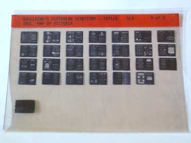
Microfiche, Bailliere's Victorian Directory 1871/2, 1871/72
A directory in Victoriasmall sheet of film SLV Incl. Map Of Victoriatown, names, victoria, map -
 Old School House Museum
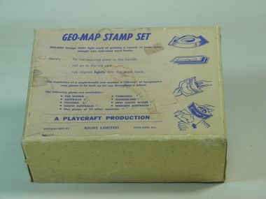
Rubber Stamp Set
Used by teachers for teaching geography, they would take the plate and attach to the handle, stamp it into ink and would make multiple copies for the students to either identify capital and countries or to learn the shape and localities of each locationIt was an early way of making multiple copies for teaching students.Geography stamp set in box which include 4 plates and handle. Plates include, Asia,Africa,Victoria,The world Geo-Map Stamp Setfrankston primary school, rubber stamps, education, geo-map, victoria, asia, the world, africa, playcraft production -
 Bendigo Historical Society Inc.
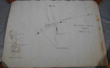
Administrative record - South Frederick The Great Mine, Sebastian, Mine map
Draftsman's drawing of South Frederick The Great Mine, Sebastian. Forms part of the Margaret Roberts Collection of mining records.Pencil markings additions to mapbendigo, margaret roberts, gold, map, south frederick the great mine -
 Greensborough Historical Society
Map, Melbourne and Metropolitan Board of Works. Survey Division, MMBW, Yarra 2500 / 13.23. Plenty, Happy Hollow, 1979_03
Melbourne and Metropolitan Board of Works. Yarra 2500 [base map] 13-23. Plenty / Happy Hollow. Parishes of Morang 3183, Nillumbik 3310 and Keelbundora 2856. Municipalities of Diamond Valley 257 and Whittlesea 239. Prominent streets include: McLaughlans Lane and Happy Hollow Drive. Includes Janefield Colony Reserve.MMBW Map in 1:2500 [scale] series. Cream parchment with green tape reinforcing on edges and punched holes on left edge.mmbw, melbourne and metropolitan board of works, shire of diamond valley, plenty - maps, happy hollow -
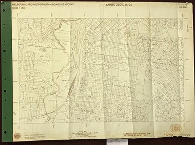 Greensborough Historical Society
Map, Melbourne and Metropolitan Board of Works. Survey Division, MMBW, Yarra 2500 / 15.20. Eltham, 1977_08
Melbourne and Metropolitan Board of Works. Yarra 2500 [base map] 15.20. Eltham. Municipalities of Diamond Valley 257 and Eltham 238. Prominent streets include: Main Road, Henry Street and Livingstone. Features include the Eltham Station, Catholic Ladies' College, Judge Book Memorial Village and Eltham Central Park.MMBW Map in 1:2500 [scale] series. Cream parchment with green tape reinforcing on edges and punched holes on left edge.mmbw, melbourne and metropolitan board of works, shire of diamond valley, nillumbik, eltham - maps -
 Greensborough Historical Society
Map, Melbourne and Metropolitan Board of Works. Survey Division, MMBW, Yarra 2500 / 13.23. Plenty, Middle Gorge, 1978_04
Melbourne and Metropolitan Board of Works. Yarra 2500 [base map] 13-23. Plenty / Middle Gorge. Parish of Morang 3183. Municipalities of Diamond Valley 257 and Whittlesea 239. Prominent streets include: Gorge Road, Kurrak Road and Browns Lane. Features include the Plenty River and Plenty Gorge Park.MMBW Map in 1:2500 [scale] series. Cream parchment with green tape reinforcing on edges and punched holes on left edge.mmbw, melbourne and metropolitan board of works, shire of diamond valley, plenty - maps, plenty gorge park -
 Bacchus Marsh & District Historical Society
Map, Lerderderg District Proposed Irrigation and Water Supply Trust (A). Plan showing boundaries of Trust District
The 1886 Irrigation Act in Victoria introduced the first legislation in Australia designed to enable the creation of a detailed scheme for agricultural irrigation. Part of the legislation saw the use of government funds for local irrigation projects. These local projects were managed by local irrigation trusts. The Lerderderg Irrigation and Water Supply Trust] was formed in 1890. This map depicts the proposed area of the Trust.Printed paper map of the proposed Lerderderg District Irrigation and Water Supply. Plan showing boundaries of Trust District. The Lerderderg District lies within the Parishes of Korkuperrumul and Merrimu in the County of Bourke. At the top of the map above its title is the letter 'A; in capital lettering. Scale: 40 Chains = 1 inch.irrigation, water supply, lerderderg irrigation and water supply trust -
 Bendigo Military Museum
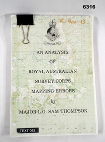
Administrative record - An analysis of Royal Australian Survey Corps mapping errors by Major LG Sam Thompson, Major LG Sam Thompson US Army Corps of Engineers at Army Survey Regiment, circa 1978
The purpose of the report is to analyze and study the map making procedures at the Army Survey Regiment to quantify the accuracy of the mapping to see if they meet acceptable accuracy standards. This was achieved through the study of possible errors.A4 loose leaf booklet held together with a "bulldog" paper clip. Cover part of an a RASvy 1:50,000 map. 1x Cover, 7x Introductory pages, 103x report pages.Marked on front cover "X - Box - 13", "TEXT 063"royal australian survey corps, rasvy, fortuna, army survey regiment, army svy regt, asr -
 Greensborough Historical Society
Map, Melbourne and Metropolitan Board of Works. Survey Division, MMBW, Yarra 2500 / 14.27. Yarrambat, Yan Yean Road, 1978_04
Melbourne and Metropolitan Board of Works. Yarra 2500 [base map] 14.26. Yarrambat, Yan Yean Road. Parishes of Morang 3183 and Greensborough 2724. Municipality of Diamond Valley 257. Prominent streets include: Yan Yean Road, North Oatlands Road and Pioneer Road. Features include Yarrambat War Memorial Reserve.MMBW Map in 1:2500 [scale] series. Cream parchment with green tape reinforcing on edges and punched holes on left edge.mmbw, melbourne and metropolitan board of works, shire of diamond valley, whttlesea, yarrambat - maps