Showing 1627 items matching "yarra river"
-
 Kew Historical Society Inc
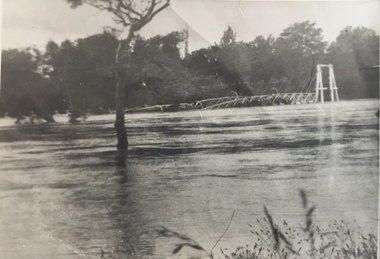
Photograph - Kane's Bridge destroyed by the 1934 Flood, 1934
... River Yarra..., further upstream. (VHD) kane's bridge River Yarra Yarra valley ...In 1928 a footbridge was erected to link Kew with the public golf course across the Yarra. The total cost of construction came to 250 pounds and the bridge became known as Kane's Bridge. During the 1934 floods the bridge was washed downstream, and was subsequently rebuilt. The present form of the bridge resembles the earlier bridge which crossed from the Yarra Bend Asylum to Kew, further upstream. (VHD)Black and white positive print (identical to 2021.70 but with a different annotation) showing the destruction of Kane's Bridge in the floods of 1934. The Kodak paper would indicate a 1950s reprinting.Annotation verso: "Kane's Bridge in 1934 flood / Dec. 1934.kane's bridge, river yarra, yarra valley, 1934 floods -
 University of Melbourne, Burnley Campus Archives
Plan, Plan showing proposed adjustment of boundaries of the Horticultural Society's Gardens in Richmond Park, c.1880-1884
... River Yarra...gardens richmond hoticultural society of victoria River ...Copy of B92.0535 framed and glazed.gardens, richmond, hoticultural society of victoria, river yarra -
 Melbourne Tram Museum
Pamphlet, Yarra Trams, "Essendon Depot Centenary", 2006
... Trams tramways Essendon Depot Centenary Yarra Trams Saltwater ...Double sided A4 sheet, on plain paper, printed in colour, titled "Essendon Depot Centenary", looking at the history of the Essendon tram depot, its opening, depot staff and wages, routes and the depot today - 2004. Has the Yarra Trams logotrams, tramways, essendon depot, centenary, yarra trams, saltwater river, 100 years of electric trams -
 Greensborough Historical Society
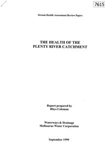
Document - Report, Rhys Coleman, The Health of the Plenty River Catchment 1999, 1999_09
... and confluence with the Yarra River.... to Greensborough and confluence with the Yarra River. plenty river ...Report prepared by Rhys Coleman for Waterways and Drainage, Melbourne Water Corporation, discusses the health of the Plenty River catchment from upstream of Toorourrong Reservoir, through Whittlesea and Mernda, South Morang and Plenty to Greensborough and confluence with the Yarra River.31 p., tables.plenty river, melbourne water corporation -
 Greensborough Historical Society
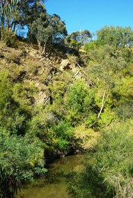
Photograph - Digital Image, Plenty River Greensborough, May 2014 -10, 21/05/2014
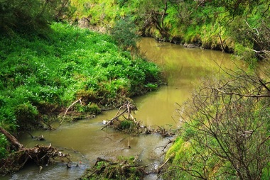
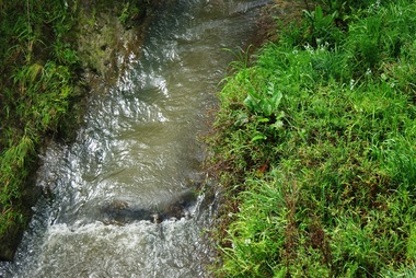
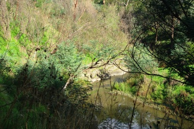
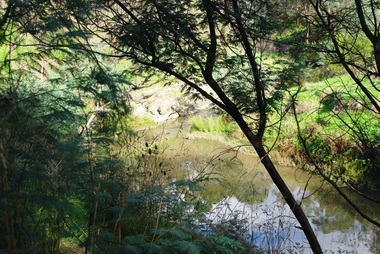
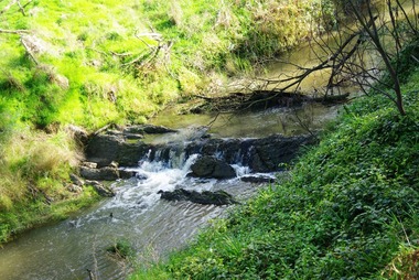
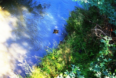
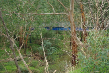
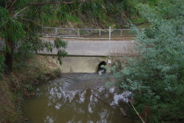
... meeting with the Yarra River at Rosanna. Early settlement... Mt Disappointment before meeting with the Yarra River ...The Plenty River flows south from Mt Disappointment before meeting with the Yarra River at Rosanna. Early settlement in Greensborough was based around the Plenty River. These images were taken in the Greensborough area by Marilyn Smith May 2014.Digital copy of colour photograph.plenty river -
 Greensborough Historical Society
Photograph - Digital Image, Plenty River Greensborough, May 2014 -9, 21/05/2014
... meeting with the Yarra River at Rosanna. Early settlement... Mt Disappointment before meeting with the Yarra River ...The Plenty River flows south from Mt Disappointment before meeting with the Yarra River at Rosanna. Early settlement in Greensborough was based around the Plenty River. These images were taken in the Greensborough area by Marilyn Smith May 2014.Digital copy of colour photograph.plenty river -
 Greensborough Historical Society
Photograph - Digital Image, Plenty River Greensborough, May 2014 -8, 18/09/2014
... meeting with the Yarra River at Rosanna. Early settlement... Mt Disappointment before meeting with the Yarra River ...The Plenty River flows south from Mt Disappointment before meeting with the Yarra River at Rosanna. Early settlement in Greensborough was based around the Plenty River. These images were taken in the Greensborough area by Marilyn Smith Sept 2014.Digital copy of colour photograph.plenty river -
 Greensborough Historical Society
Photograph - Digital Image, Plenty River Greensborough, May 2014 -7, 21/05/2014
... meeting with the Yarra River at Rosanna. Early settlement... Mt Disappointment before meeting with the Yarra River ...The Plenty River flows south from Mt Disappointment before meeting with the Yarra River at Rosanna. Early settlement in Greensborough was based around the Plenty River. These images were taken in the Greensborough area by Marilyn Smith May 2014.Digital copy of colour photograph.plenty river -
 Greensborough Historical Society
Photograph - Digital Image, Plenty River Greensborough, May 2014 -6, 21/05/2014
... meeting with the Yarra River at Rosanna. Early settlement... Mt Disappointment before meeting with the Yarra River ...The Plenty River flows south from Mt Disappointment before meeting with the Yarra River at Rosanna. Early settlement in Greensborough was based around the Plenty River. These images were taken in the Greensborough area by Marilyn Smith May 2014.Digital copy of colour photograph.plenty river -
 Greensborough Historical Society
Photograph - Digital Image, Plenty River Greensborough, May 2014 -5, 21/05/2014
... meeting with the Yarra River at Rosanna. Early settlement... Mt Disappointment before meeting with the Yarra River ...The Plenty River flows south from Mt Disappointment before meeting with the Yarra River at Rosanna. Early settlement in Greensborough was based around the Plenty River. These images were taken in the Greensborough area by Marilyn Smith May 2014.Digital copy of colour photograph.plenty river -
 Greensborough Historical Society
Photograph - Digital Image, Plenty River Greensborough, May 2014 -4, 21/05/2014
... meeting with the Yarra River at Rosanna. Early settlement... Mt Disappointment before meeting with the Yarra River ...The Plenty River flows south from Mt Disappointment before meeting with the Yarra River at Rosanna. Early settlement in Greensborough was based around the Plenty River. These images were taken in the Greensborough area by Marilyn Smith May 2014.Digital copy of colour photograph.plenty river -
 Greensborough Historical Society
Photograph - Digital Image, Plenty River Greensborough, May 2014 -3, 21/05/2014
... meeting with the Yarra River at Rosanna. Early settlement... Mt Disappointment before meeting with the Yarra River ...The Plenty River flows south from Mt Disappointment before meeting with the Yarra River at Rosanna. Early settlement in Greensborough was based around the Plenty River. These images were taken in the Greensborough area by Marilyn Smith May 2014.Digital copy of colour photograph.plenty river -
 Greensborough Historical Society
Photograph - Digital Image, Plenty River Greensborough, May 2014 -2, 21/05/2014
... meeting with the Yarra River at Rosanna. Early settlement... Mt Disappointment before meeting with the Yarra River ...The Plenty River flows south from Mt Disappointment before meeting with the Yarra River at Rosanna. Early settlement in Greensborough was based around the Plenty River. These images were taken in the Greensborough area by Marilyn Smith May 2014.Digital copy of colour photograph.plenty river -
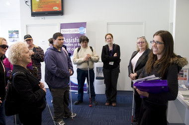 Vision Australia
Photograph - Image, Thomas Kane, 2008 International White Cane Day at Flinders St Station and Southbank, 15/10/2008
... the Yarra River and St Kilda Road at Southbank.... the escalators, along the platform and along the Yarra River and St Kilda ...To celebrate White Cane Day in 2008, a group of cane users met at the Travellers Aid office at Flinders Street station, before walking down the escalators, along the platform and along the Yarra River and St Kilda Road at Southbank.98 digital images of people participating in the 2008 White Cane Day eventvision australia, white cane day, cath caddis, tracy wright, kylie gerson, nicola misso, di seybold, flinders street station -
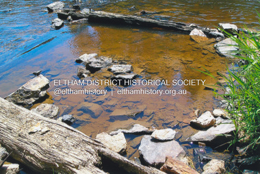 Eltham District Historical Society Inc
Photograph, Fay Bridge, Ruins of the old Warrandyte Battery, 7 November 2016
... , built here in 1897 can be seen on the banks of the Yarra River..., built here in 1897 can be seen on the banks of the Yarra River ...Remains of the timber foundation of the State Battery, built here in 1897 can be seen on the banks of the Yarra River just east of the Warrandyte Bridge on the Warrandyte side of the river. The Battery was driven by waterwheel and was used to crush ore from the Warrandyte Goldfields.fay bridge collection, 2016-11-07, warrandyte battery, ruins -
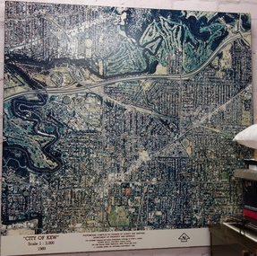 Kew Historical Society Inc
Photograph - Aerial Photograph, Division of Survey and Mapping, Department of Property and Services, City of Kew, Scale 1 : 3,000, 1989, 1989
... , Australia, on the southeast bank of the Yarra River. The city..., on the southeast bank of the Yarra River. The city covered an area of 14.56 ...The City of Kew was a local government area about 4 kilometres east of Melbourne, the state capital of Victoria, Australia, on the southeast bank of the Yarra River. The city covered an area of 14.56 square kilometres, and existed from 1860 until 1994.Very large aerial photograph of “City of Kew” Scale 1 : 3,000. 1989. “City of Kew” Scale 1 : 3,000. 1989. Photomosaic compiled by Division of Survey and Mapping, Department of Property and Services. © Crown (State of Victoria) Copyright 1990.city of kew, kew (vic.), aerial photography -
Port Melbourne Historical & Preservation Society
Photograph - Aerial view of J Kitchen and Sons site, Ingles Street, Port Melbourne, early 1930s, 1930s
... Melbourne Football ground in foreground; Yarra River in top left... Melbourne Football ground in foreground; Yarra River in top left ...Large Black and White aerial photograph on brown cardboard showing Kitchen and Sons buildings including the 1925 Administrative Building No 34 on Ingles st.Photograph taken looking North Easterly with Swanston and Barret Pty concrete works; Port Melbourne Football ground in foreground; Yarra River in top left hand corner; showing South Melbourne and Royal Botanic Gardens in the distance. Taken in the early 1930sindustry - manufacturing, built environment - industrial, j kitchen & sons pty ltd -
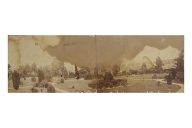 Kew Historical Society Inc
Photograph, Garden of 'Rockingham', Kew, c.1870
... down to the Yarra River. At the time the photograph was taken... down to the Yarra River. At the time the photograph was taken ...Built by John Bournane, Rockingham had a number of occupants before the newspaper magnate David Syme purchased it in 1902. The house in the 1860s and ‘70s was comprised of nine rooms, and was surrounded by a veranda on the front and sides. It was approached from the Kew road by the curve in front of the Hon. S.G. Henty’s mansion of ‘Findon’.In 1955, the Syme family sold Rockingham to the Red Cross Society to be used as a convalescent home for returned servicemen. The house was sold, demolished, and the land subdivided in 1966.An early panoramic photograph of an early Kew mansion (now demolished), dating from the 1870s.A rare, panoramic photograph (c.1870) of the garden of ‘Rockingham’, during the occupation of the house by W. Gardiner Esq. Rockingham was located beside and above the Barkers Road cutting. The view of the garden in the photograph is of the terraces leading down to the Yarra River. At the time the photograph was taken, the property covered an area of “…nine acres of beautifully laid-out grounds, interspersed with numerous terraces leading down the sloping bank of the river”.rockingham, david syme, kew -
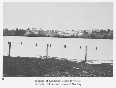 Eltham District Historical Society Inc
Work on paper (Sub-Item) - Photograph, Flooding at Diamond Creek Township
... of the Yarra River and Diamond Creek set new records for flood plain... of the Yarra River and Diamond Creek set new records for flood plain ...Black and white photograph of the Diamond Creek in flood at Diamond Creek township in 1934. In 1934 extensive flooding of the Yarra River and Diamond Creek set new records for flood plain level (Eltham Chronology EDHS) Nillumbik Historical Society collectionflood, diamond creek, flooding, nillumbik historical society -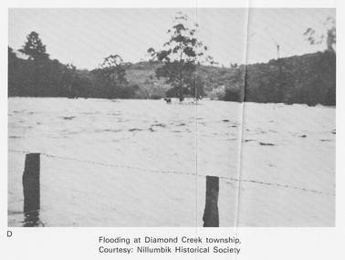
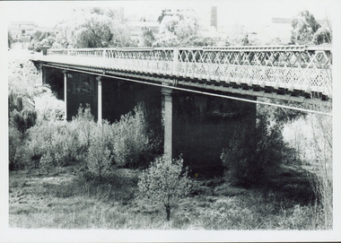 Kew Historical Society Inc
Photograph - Outer Circle Railway Viaduct
... constructed for the Outer Circle Railway to bridge the Yarra River... for the Outer Circle Railway to bridge the Yarra River between East Kew ...The heritage listed Fairfield Bridge was originally constructed for the Outer Circle Railway to bridge the Yarra River between East Kew and Fairfield stations. In the 1930s it was converted for vehicular traffic. In the 2010s a new concrete bridge was erected beside it to increase vehicular capacity.Print copy, enlarged from original snapshot, of the former railway viaduct crossing the Yarra and linking Kew and Fairfield. The original photo predates the conversion of the viaduct into the Chandler Highway Bridge in the 1930s, when the Bridge was adapted to carry vehicular traffic. The date on the reverse indicates the date of donation rather than the date on which the photograph was taken. CHANDLER HIGHWAY BRIDGE OVER RIVER / (ORIGINALLY PART OF OUTER CURCLE RAILWAY) / OCTOBER 1977railway viaduct -- kew (vic.), fairfield bridge, fairfield railway viaduct, outer circle railway, sir john monash -
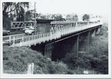 Kew Historical Society Inc
Photograph - Chandler Highway Bridge, 1977
... constructed for the Outer Circle Railway to bridge the Yarra River... for the Outer Circle Railway to bridge the Yarra River between East Kew ...The heritage listed Fairfield Bridge was originally constructed for the Outer Circle Railway to bridge the Yarra River between East Kew and Fairfield stations. In the 1930s it was converted for vehicular traffic. In the 2010s a new concrete bridge was erected beside it to increase vehicular capacity.Print copy of the Chandler Highway Bridge, [formerly the Fairfield Viaduct of the Outer Circle Railway] showing the original position of the walkway beside the bridge. The POV is from the Fairfield side looking towards Kew. CHANDLER HWY BRIDGE OVER YARRA / OCTOBER 1977 / ORIGINALLY BUILT FOR OUTER CIRCLE RWYchandler highway bridge, outer circle railway viaduct, bridges -- kew (vic.) -
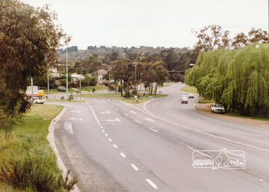 Eltham District Historical Society Inc
Photograph, Main Road-Fitzsimons Lane Roundabout, c. Oct 1987, 1987
... of the Yarra River. Date based on other similar display panels visible... of the Yarra River. Date based on other similar display panels visible ...Fitzsimons Lane was originally known as the Eltham-Templestowe Road north of the Yarra and Fitzsimons Lane south of the Yarra River. Date based on other similar display panels visible in images of the Shire of Eltham display at the Eltham Community Festival, 7 November 1987Colour photographdisplay panel, eltham festival, infrastructure, shire of eltham, main road, roundabouts, fitzsimons lane -
University of Melbourne, Burnley Campus Archives
Plan - Coloured plan, Plan of Burnley Gardens, 1929?
... hand-drawn. Area bounded by Yarra River, Swan St, Glen Iris.... Area bounded by Yarra River, Swan St, Glen Iris railway line ...Layout of gardens, farm buildings, orchard, etc. overlaid on part of Lands Department map. See paper catalogue for full descriptionPart of larger plan (Lands Department Parish Plan). Partly hand-drawn. Area bounded by Yarra River, Swan St, Glen Iris railway line. Shows Burnley Gardens layout, handwritten amendments and explanation of existing and proposed structures including: Pavilion, sketch of unbuilt Administrative Building, poultry yard, contours of old orchard, sketch for Plant Research Institute, ditch, silo, milking shed, laying pens. See aboveburnley gardens, pavilion, burnley school of horticulture, farm buildings, poultry -
 Eltham District Historical Society Inc
Negative - Photograph, Old Lower Plenty Bridge, 18 April 1998
... as a footway/bike path section joining the Yarra River path.... as a footway/bike path section joining the Yarra River path. activities ...Plenty River reflections through the old iron Lower Plenty Bridge; Autumn Excursion to Lower Plenty area. The blocked-off iron bridge at Lower Plenty - now re-opened and used as a footway/bike path section joining the Yarra River path.Roll of 35mm colour negative film, 2 strips and associated colour printKodak Gold 200-6activities, lower plenty bridge, autumn excursion, eltham district historical society, lower plenty -
 Eltham District Historical Society Inc
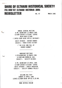
Newsletter, Newsletter, No. 47 March 1986
... : Yarra River history – “The rise and fall of Rudder Grange...: Yarra River history – “The rise and fall of Rudder Grange ...Contents: • Next meeting, guest speaker, Arthur Howard: Yarra River history – “The rise and fall of Rudder Grange” • Annual General Meeting • Arthur Howard • Records/Research workshops • Society Banner project • Geelong bus trip • Heritage Week • Society Calendar The Shire of Eltham Historical Society was formed in October 1967. The first newsletter of the Society was issued May 1978 and has been published continuously ever since on a bi-monthly basis. With the cessation of the Shire of Eltham in late 1994, the Society's name was revised to Eltham District Historical Society and this name first appeared with issue No. 103, July 1995. The collection of the Society's newsletters provides a valuable resource on the history of the Society's activities, office bearers and committee members, guest speakers and subjects of historical interest pertinent to the former Shire of Eltham and the Eltham District.A4 photocopied newsletter distributed to membersnewsletter, eltham district historical society, shire of eltham historical society -
Greensborough Historical Society
Book, Melbourne Water, Plenty River Waterway Management Activity Plan 2000, 2000_
... to the confluence with the Yarra River at Viewbank. It discusses ecological... to the confluence with the Yarra River at Viewbank. It discusses ecological ...This report covers the catchment of the Plenty River from its upper reaches in the Great Dividing Range to the confluence with the Yarra River at Viewbank. It discusses ecological diversity and methods of improving water quality and significant areas of the catchment. Includes a brief history of settlement along the Plenty River.This is a significant plan for the improvement of the Plenty River.207 p., maps, folding maps. Printed on white paper with black spiral binding and clear plastic front cover.plenty river, melbourne water -
 Ithacan Historical Society
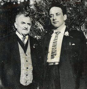
Photograph, The poets, 20 October 1957
... by the Yarra River in Kew. Both men were much loved poets... photographed by the Yarra River in Kew. Both men were much loved poets ...Nikolaos Paizis and Stathi Raftopoulos photographed by the Yarra River in Kew. Both men were much loved poets in Melbourne's Ithacan community and would be called upon to recite at various social functions. Nikolaos was known as 'the Poet' (Ο Ποιητής) amongst Melbourne's Ithacan community.A scanned black and white photograph of two men standing in a garden. -
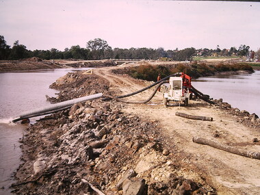 Kew Historical Society Inc
Photograph - Construction of the Eastern Freeway (F19), Ron Setford, March 1972
... (now Eastern) Freeway involving rerouting the River Yarra... the River Yarra in Kew. Photograph Construction of the Eastern ...Ron Setford and his wife Grace Setford lived in Tanner Avenue, East Kew, from c.1946 to c.1995. A keen photographer, he recorded the changing face of Kew over a 20 year period. Apart from 30 photographs of built structures and places in Kew dating from 1960 and 1961, 145 of his 35mm colour slides chronicle the development of the F19 (later renamed Eastern) Freeway through the Yarra Valley in Kew over a five year period from c.1972 to c.1977. This important collection was donated to the Society by his granddaughter in 2025.This collection of 175 35mm slides is of local and statewide significance, owing to its subject matter, particularly the major development of road transport infrastructure during the 1970s with the construction of the Eastern Freeway. The photographer also took care to annotate and date most of his slides which enable the researcher to pinpoint temporal and spatial locations.Photograph of works involved in construction of the F19 (now Eastern) Freeway involving rerouting the River Yarra in Kew."Eastern Freeway / pumping out old river bed"ron setford, eastern freeway, f19 freeway -
 Ringwood and District Historical Society
Map, Plan of the Parish of Warrandyte County of Evelyn - 1841
... Selectors' names and property locations between Yarra Yarra River... and property locations between Yarra Yarra River (Warrandyte ...Blueprint copy of Survey Map W27 detailing original Selectors' names and property locations between Yarra Yarra River (Warrandyte) and Mullum Mullum Creek (Ringwood). List of Parish map references including property bearings, distances in Links, and markings on trees. Pound Bend area of Warrandyte marked as Reserve For Aborigines. Descriptive remarks include areas marked "scrubby, flat, sandy soil". Several other references faded and illegible.(Map) by T.H. Nutt Feb 3 1841.