Showing 123690 items matching "main-road"
-
 Eltham District Historical Society Inc
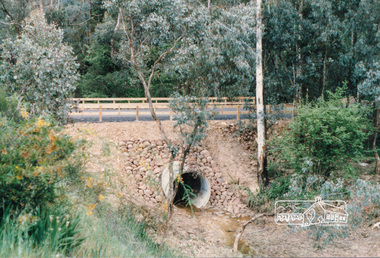
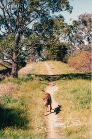
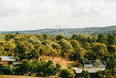
Photograph, Road and drainage works
Colour photographdrainage works, road construction, bridge construction -
 Eltham District Historical Society Inc
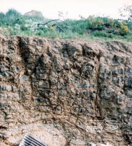
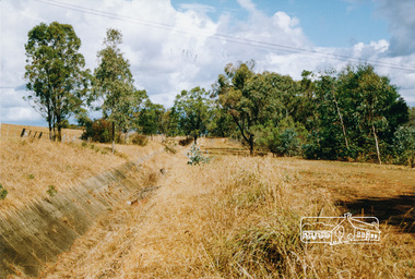
Photograph, Peter Bassett-Smith, Road making
Colour photograph -
 Eltham District Historical Society Inc
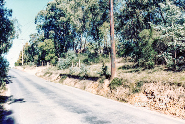
Photograph, Possibly Ryans Road
Colour photograph -
 Eltham District Historical Society Inc
Photograph, Para Road, Montmorency, industrial area looking south from Plenty River Bridge on boundary of Shire of Eltham
Colour photograph02076, montmorency (france) photo album, montmorency, para road, plenty river, industry -
 Eltham District Historical Society Inc
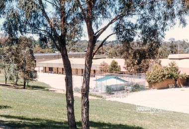
Photograph, Montmorency High School, Para Road, located north of tennis courts, 1985, 1985
Colour photograph02076, montmorency (france) photo album -
 Eltham District Historical Society Inc
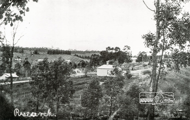
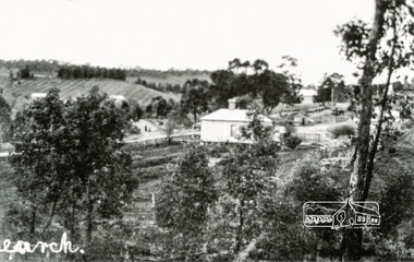
Photograph, Tom Prior, View looking down Ingrams Road, Research towards the rear of Doney's store
The small building at left of photo housed the school for a short period of time but it was too hot in summer and the community lobbied for a more substantial school.The Reynolds family were early settlers in Research. The Reynolds/ Prior collection of photographs were taken by Tom Prior, the maternal uncle of Ivy Reynolds, around 1900 and the 60 photos in the album give a fine overview of many of the landmarks of Research and Eltham over 100 years ago. lvy lived in the family home for many years at 106 Thompson Cres Research. Ivy's father, Ernst Richard Reynolds and grandfather, Richard Reynolds, lived at the same address. Ivy's father Richard worked for Mr. Trail on his property in Research. Reynolds Road is named after the family. Mr Tom Prior (wife Eva) worked at the Melbourne zoo. He was very innovative and made his own camera, using the black cloth hood to exclude the light. The photographs are a reminder of the rural nature of Research and Eltham and its rich heritage. Black and white photograph mounted in an album, the Reynolds/Prior Photograph Collection, this being one of 53 reproduced black and white images of early Eltham.The Reynolds/Prior Photograph Collection, Presented to the Eltham District Historical Society, 14 June 2006 by Ross McDonald. A second copy was also presented to the Andrew Ross Museum, Kangaroo Grounddoney property, general store, ingrams road, main road, research (vic.), research hotel, research primary school, reynolds prior collection, sepp, shire of eltham pioneers photograph collection -
 Eltham District Historical Society Inc
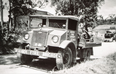
Photograph, Neil Ploog, Ford Blitz water tanker, Research Fire Brigade, Ingrams Road, Research, 1954, 1954
Early 1954 near present day site of Eltham Little TheatreThe Reynolds family were early settlers in Research.Black and white photograph mounted in an album, the Reynolds/Prior Photograph Collection, this being one of 53 reproduced black and white images of early Eltham. Also available digital colour variantThe Reynolds/Prior Photograph Collection, Presented to the Eltham District Historical Society, 14 June 2006 by Ross McDonald. A second copy was also presented to the Andrew Ross Museum, Kangaroo Groundreynolds prior collection, research (vic.), research fire brigade, fire brigades -
 Eltham District Historical Society Inc
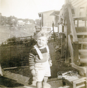
Photograph, Graeme Landy (approx. 3); looking south from the backyard of 38 Beattie Street, Montmorency, towards Rattray Road, c.1952, 1952c
Digital copy of black and white photograph38 beattie street, graeme landy, montmorency -
 Eltham District Historical Society Inc
Photograph, Richard Pinn, Jah on Maroondah Aqueduct trail south of Allendale Road, c.1991, 1991c
Colour photographmaroondah aqueduct -
 Eltham District Historical Society Inc
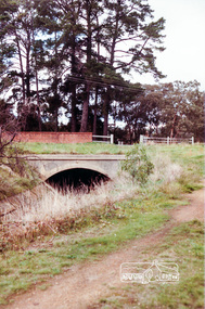
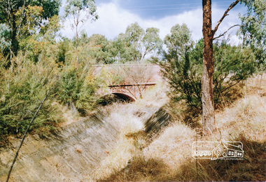
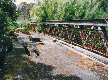
Photograph, Ingrams Road Bridge over Aqueduct, Research
Colour photographmaroondah aqueduct, aqueduct, bridge, ingrams road, research (vic.), scan - 35mm negative -
 Eltham District Historical Society Inc
Photograph, Parsons Road Bridge over Maroondah Aqueduct near Margaret Street, Eltham, c.Jun 1981, 1981
Colour photographmaroondah aqueduct, bridge, eltham, margaret street, parsons road -
 Eltham District Historical Society Inc
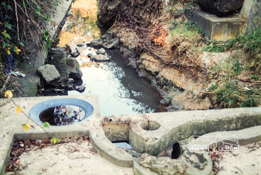
Photograph, Pipes used for original aqueduct crossing of Diamond Creek, Allendale Road, Eltham, 22 March 1991, 22/03/1991
Colour photographmaroondah aqueduct, allendale road -
 Eltham District Historical Society Inc
Photograph, View from Aqueduct Path near Parsons Road, Eltham, 1991, 1991
Colour photographmaroondah aqueduct, parsons road -
 Eltham District Historical Society Inc
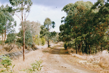
Photograph, Aqueduct path near Allendale Road, Eltham, 1991, 1991
Colour photographmaroondah aqueduct -
 Eltham District Historical Society Inc
Photograph, Parsons Road Bridge over the Aqueduct, Eltham, 1991, 1991
Colour photographmaroondah aqueduct, aqueduct, bridge, eltham, parsons road -
 Eltham District Historical Society Inc
Photograph, Maroondah Aqueduct trail west of Parsons Road, Eltham, 1991, 1991
Colour photographmaroondah aqueduct, parsons road -
 Eltham District Historical Society Inc
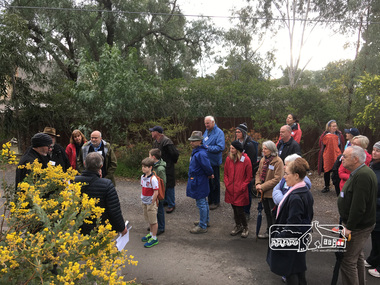
Photograph, Peter Pidgeon, Great turnout for our heritage excursion; outside Shoestring in Metery Road, Eltham, 2 Sep 2017
Heritage Excursion - An Eltham South Ramble, 2 Sep 2017Born Digitalactivities, eltham district historical society, eltham south, heritage excursion, local history centre -
 Eltham District Historical Society Inc
Photograph, Fayrefield Hat Factory, Sherbourne Road, Eltham, 1987, 1987
See also Fayrefield Hat Factory, blog post, 3 March 2015Colour photographeltham, fayrefield hat factory, sherbourne road -
 Eltham District Historical Society Inc
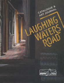
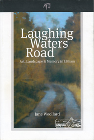
Book, Shire of Nillumbik, Laughing Waters Road - Catalogue & Art Journal, 2016
An exhibition of works created by artists who have taken part in the Laughing Waters Artist Residency Program over the past 15 years. The exhibition took place at Montsalvat, Eltham 30 January - 14 March 2016. Curators Jane Woolard and Grace Longato. Spiral bound. 1 volume (unpaged) : illustrations (chiefly colour), 1 portrait ;australian art, laughing waters artist residency program -
 Eltham District Historical Society Inc
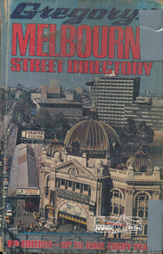
Book, Gregory's Melbourne Street Directory of Melbourne and suburbs and metropolitan road guide (8th edition) extends to Laverton, Deer Park, Epping, Diamond Creek, Lilydale, Olinda, Belgrave, Doveton and Mornington, 1973
This is the 8th edition of Gregory's Melbourne Street Directory, fully revised and up-to-date for this edition published December 1973. It is a comprehensive guide to the streets and localities of Melbourne and suburbs at that time. The colour maps are arranged in double-page spreads. Names of streets and suburbs are arranged alphabetically in the index to streets.Hard copy with plastic cover. 382 p. streets, melbourne - maps, roads -
 Eltham District Historical Society Inc
Book, Shire of Nillumbik, Laughing Waters Road: art, landscape & memory by Jane Woollard, 2016
"Laughing Waters has been a source of inspiration for many artists and designers, and was a natural extension of the dynamic art and lifestyle movement that began in the 1930s at Montsalvat. It was also an important site in the development of the Melbourne art scene in the 1960s and '70s, especially the earth building movement known as the Eltham Style. Since 2001 more than eighty artists have been in residence at Laughing Waters in Birrarung House and Riverbend. Their experiences and art making are woven together with Wurundjeri, European and family histories to create an evocative account of a special place in a bushy outer suburb of Melbourne." -- back cover. Eltham District Historical Society is acknowledged in the Acknowledgments section of this book.264 pages : illustrations, maps, portraits ISBN 9780994486707laughing waters, eltham, yarra river, artists, killeavey, mud bricks -
 Eltham District Historical Society Inc
Photograph, Doug Orford, Lower Plenty Bridge, Old Eltham Road, Lower Plenty, 1998
Originally the boundary between the former Shire of Eltham and the City of Heidelberg, a toll gate existed on the Eltham side. The bridge has since been restored and is now part of the Plenty River Trail.Two colour photograph prints 10 x 15 cm (2 copies)bridges, lower plenty, main road, plenty river, old eltham road -
 Eltham District Historical Society Inc
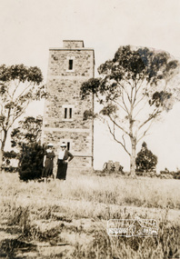
Photograph, Shire of Eltham War Memorial, Memorial Park, Garden Hill, Eltham-Yarra Glen Road, Kangaroo Ground, c.1936, 1936c
On November 11th 1926 the Shire of Eltham War Memorial Tower at Kangaroo Ground was opened. It is regarded as one of Melbourne’s most outstanding lookout towers. It commands a magnificent 360 degree panorama from Kinglake across the Diamond Valley to Macedon and the You Yangs. It is built on a peak which was once a volcano, 237 metres above sea level. After World War one a memorial cairn was erected on the site, and in 1925 a committee of public-minded citizens began to plan for a tower. Many generous donations of material and money were forthcoming so that in 1926 the Governor General Lord Stonehaven was able to unveil the plaque before a crowd of 500 people There was some concern in the 1960s when the Forests Commission wanted to build a firespotters cabin on the top. At first R.S.L. branches opposed the idea, but it was realised that this use could combine with its use as a tourist attraction, and would ensure its maintenance for the future. Today the Kangaroo Ground tower provides one of the best views around Melbourne and is a fitting memorial to those who died in two world wars. From: Historic items for Diamond Valley Community Radio September 1990 (EDHS collection) On November 8th, 1951, the memorial was re-dedicated by the Governor of Victoria, Sir Dallas Brooks with the addition of the names of men from the Shire of Eltham who fell in the Second World War. Further wreaths were added subsequent to this image in time for the 2001 Reembrance Day service to commemorate the men from th shire who had fallen in the Malayan, Korean, Borneo and Vietnam campaigns. Sepia photograph showing two ladies standing in front of the towergarden hill, kangaroo ground, kangaroo ground memorial, memorial park, shire of eltham war memorial tower, war memorial -
 Eltham District Historical Society Inc
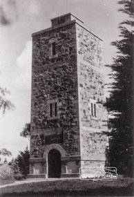
Photograph, Shire of Eltham War Memorial, Memorial Park, Garden Hill, Eltham-Yarra Glen Road, Kangaroo Ground, c.1936
Showing front angle view of tower and old fire watchbox on top On November 11th 1926 the Shire of Eltham War Memorial Tower at Kangaroo Ground was opened. It is regarded as one of Melbourne’s most outstanding lookout towers. It commands a magnificent 360 degree panorama from Kinglake across the Diamond Valley to Macedon and the You Yangs. It is built on a peak which was once a volcano, 237 metres above sea level. After World War one a memorial cairn was erected on the site, and in 1925 a committee of public-minded citizens began to plan for a tower. Many generous donations of material and money were forthcoming so that in 1926 the Governor General Lord Stonehaven was able to unveil the plaque before a crowd of 500 people There was some concern in the 1960s when the Forests Commission wanted to build a firespotters cabin on the top. At first R.S.L. branches opposed the idea, but it was realised that this use could combine with its use as a tourist attraction, and would ensure its maintenance for the future. Today the Kangaroo Ground tower provides one of the best views around Melbourne and is a fitting memorial to those who died in two world wars. From: Historic items for Diamond Valley Community Radio September 1990 (EDHS collection) On November 8th, 1951, the memorial was re-dedicated by the Governor of Victoria, Sir Dallas Brooks with the addition of the names of men from the Shire of Eltham who fell in the Second World War. Further wreaths were added subsequent to this image in time for the 2001 Reembrance Day service to commemorate the men from th shire who had fallen in the Malayan, Korean, Borneo and Vietnam campaigns.Black and white photograph showing front angle view of tower and old watchbox on topgarden hill, kangaroo ground, kangaroo ground memorial, memorial park, shire of eltham war memorial tower, war memorial -
 Eltham District Historical Society Inc
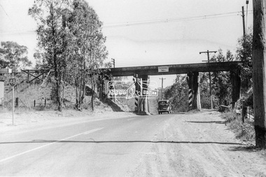
Photograph, Old railway bridge, Sherbourne Road, Montmorency, c.1955
Looking northwest in the direction of Eltham to Greensborough. The car is a Ford Prefect A493A which was manufactured in Australia between 1949-1953. The vehicle is fitted with Victorian registration plates which appear to be PG-216. AA-NNN style registration plates were replaced in 1953 with AAA-NNN plates. Registration PG would be about 1952.Printbridges, railways, sherbourne road, montmorency, eltham -
 Eltham District Historical Society Inc
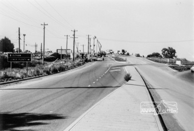
Photograph, Sherbourne Road bridge construction works over railway line, Montmorency, c.1971, 1971c
Black and white photograph printeltham, sherbourne road, railway bridge, construction, montmorency -
 Eltham District Historical Society Inc
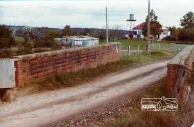
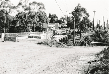
Photograph, Para Road Bridge construction, Briar Hill, near Greensborough, c.1971, 1971c
Three black and white photographs; two showing construction works of the bridge over the Plenty River at Briar Hill and one of Greensborough Park, Grimshaw Street, summer 1971-1972greensborough, briar hill, para road, bridges, construction, plenty river -
 Eltham District Historical Society Inc
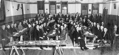
Photograph, Anglers Hall opening Night, Para Road, Briar Hill, 1937, 1937
Black and white photograph of the opening of Anglers Hall showing the table settings and 87 men seated and standing around posing for the shotanglers hall, para road, briar hill, ceremonies -
 Eltham District Historical Society Inc
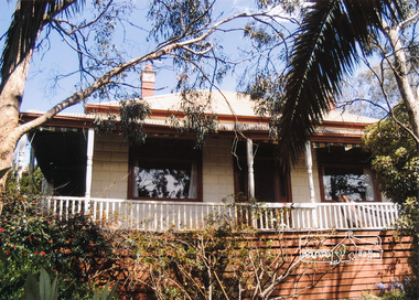
Photograph, House originally owned by the Shallard (seniors) family then F. Squire situated off Lilicur Road, Montmorency
Two colour photographs showing views from different sides of the housemontmorency, houses, lilicur road, shallard, fred squire