Showing 1532 items
matching aerial photographs
-
 Ringwood and District Historical Society
Photograph, Aerial photograph of Ringwood - 1962
... Aerial photograph of Ringwood - 1962...Aerial photograph..., 'Ringwood 1962'. Aerial photograph Aerial photograph of Ringwood ...Aerial photographWritten on backing sheet, 'Ringwood 1962'. -
 Creswick Campus Historical Collection - University of Melbourne
Still Image, 1964
... Aerial Photographs... Commission Victoria 1964. Aerial Photographs Still Image ...Subject: Lower Glenelg Plantation . 7 brown envelopes marked Run 1. No. 12 - 17of 9 prints each. Stored in a brown cardboard file box marked Lower Glenelg Plantation Run No.1. 11 - 17(x9). Photos commissioned by Forests Commission Victoria 1964.Aerial Photographs -
Creswick Campus Historical Collection - University of Melbourne
Still Image, 1962
... Aerial Photographs... Victoria 1962. Aerial Photographs Still Image ...Subject: Kuark- McKenzie Crk Project . 5 brown envelopes marked Run 1A - Run 5 of 10 prints each. Stored in a brown cardboard file box marked Kuark- McKenzie Crk Project. Photos commissioned by Forests Commission Victoria 1962.Aerial Photographs -
Creswick Campus Historical Collection - University of Melbourne
Still Image, 1966
... Aerial Photographs... envelope. Aerial Photographs Still Image ...Subject: Creswick . 9 brown envelopes marked Run 6. containing c 80 marked up photos. Numbers 30 to 50, 88 - 91 in sequence. Stored in a brown cardboard file box . Photos marked on rear as on loan from the Photographic Library of theForests Commission Victoria . pencilled in date "1946?" on one envelope.Aerial Photographs -
Creswick Campus Historical Collection - University of Melbourne
Still Image, 1952
... Aerial Photographs... section of a topographical map marked State Aerial Survey. Stored ...Subject: King Lake . 6 brown envelopes marked Run 3, 4, 7, 7a, 8, 9 containing c. 80 prints. 1 section of a topographical map marked State Aerial Survey. Stored in a brown cardboard file box marked King Lake Run No.3 - 9. (x9). Photos commissioned by Forests Commission Victoria.Aerial Photographs -
Creswick Campus Historical Collection - University of Melbourne
Still Image, 1962
... Aerial Photographs... 1962. Aerial Photographs Still Image ...Subject: Ballarat-Creswick Plantations Block A . 4 brown envelopes marked Run 4 No. 135 - 138 of c.30 prints total. Marked up with red pen. Stored in a brown cardboard file box marked Errinundra Project..Combien Project...Ballarat Plantation. commissioned by Forests Commission Victoria 1962.Aerial Photographs -
Creswick Campus Historical Collection - University of Melbourne
Still Image, 1958 -1967
... Aerial Photographs... file box marked as per contents. Aerial Photographs Still Image ...Subject: Calder Ridge Project . 3 brown envelopes marked Run 2 c.26 prints total. 1967. Subject: Mt Cole Mt Lonach 1958. 1 brown envelopes marked Run 4. c.15 prints total. Subject: Colac 1966 . 1 brown envelopes marked Run 6 c.8 prints total. Subject: Mt Tamoritha, Mt Arbuckle. 1966. 1 brown envelopes marked Civil AS-FRI-FCV-APMF CO-OP project no. 13.23 - 13.38 c.18 prints total. Stored in a brown cardboard file box marked as per contents.Aerial Photographs -
Creswick Campus Historical Collection - University of Melbourne
Still Image, 1956
... Aerial Photographs... A. Run 3. Aerial Photographs Still Image ...Subject: Ballarat-Creswick Plantations Block A . 9 brown envelopes marked Run 3 No. 84 - 92 of c.76 prints total. 1 brown envelopes marked Run 4 No. 127-136 of 9 prints total. 1956. Marked up with red pen. Stored in a brown cardboard file box marked Ballarat-Cres.Plantation Block A. Run 3.Aerial Photographs -
Creswick Campus Historical Collection - University of Melbourne
Still Image, 1964 - 1966
... Aerial Photographs.....Combien Project...Ballarat Plantation. Aerial Photographs Still ...Subject: Combienbar River Project. 1964. 2 brown envelopes marked Run 16, 17 of c.18 prints total. Subject: Errinundra Project. 1966. 2 brown envelopes marked Run 12, 13 of c.14 prints total. Stored in an unmarked brown cardboard file box . Related to item 1507. Marked Errinundra Project..Combien Project...Ballarat Plantation.Aerial Photographs -
Creswick Campus Historical Collection - University of Melbourne
Still Image, 1956
... Aerial Photographs... marked Creswick Run.6. Aerial Photographs Still Image ...Subject: Ballarat-Creswick Plantations Block A . 1956. 9 brown envelopes marked Run 4 No. 127 - 139 of c.75 prints total. Stored in a brown cardboard file box marked Creswick Run.6.Aerial Photographs -
Creswick Campus Historical Collection - University of Melbourne
Still Image, 1968
... Aerial Photographs.... Aerial Photographs Still Image ...Subject: Creswick 1968 Project . 1 x annotated map in envelope marked Run 3 No's 30 - 38 with runs marked up from aerial phtographs flown 1956 - 1968 on drafted plan of Creswick Plantations. 1 x topographical map marked Creswick with annotation "Mapsheet key diagram". 1 x topographical map marked Ballarat annotated with a grid of numbers. 13 brown envelopes marked Run 1 -3 No. 21 - 38 (missing sequences) of c.44 prints total. Mix of black and white and colour. Range of dates. Stored in a brown cardboard file box marked Creswick 1968 Project.Aerial Photographs -
Creswick Campus Historical Collection - University of Melbourne
Still Image, 1956 -1968
... Aerial Photographs... cardboard file box marked Creswick 1968 Project. Aerial Photographs ...Subject: Creswick 1956 . 8 brown envelopes marked Run 4 -3 No. 31 - 42 of c.45 prints total. 2 empty brown envelopes marked run 4 no.38 -39, and run 6 no. 85-87. 5 loose black and white prints. Subject: Lower Glenelg Plantation . 2 brown envelopes marked Run 1. No. 26-27. Stored in a brown cardboard file box marked Creswick 1968 Project.Aerial Photographs -
Creswick Campus Historical Collection - University of Melbourne
Still Image, 1948 - 1956
... Aerial Photographs... "INTERPRETATIONS. South Gippsland .......Otway area prints" Aerial ...Subject: Coffs Harbour 1956 . Subject: Grampians no. 11-15. Subject: Kinglake area 1948 -1950 Run 7 no.14 - 16, Run 8 no.69 -70 . Subject: Princetown Run 7 . Subject: South Gippsland Run 7 no.102 - 105. Subject: Otway area. Stored in 5 brown envelopes in a brown cardboard file box marked "INTERPRETATIONS. South Gippsland .......Otway area prints"Aerial Photographs -
Creswick Campus Historical Collection - University of Melbourne
Still Image, 1956 -1968
... Aerial Photographs... Creswick 1968 Project Run 1 24 - 27. 2. 42 - 47. 3. 32-33 Aerial ...Subject: Creswick 1968 Project . 10 brown envelopes marked Run 1 -3. Run 6. No.s missing sequences. c.50? prints total. Mix of black and white and colour. Range of dates. Stored in a brown cardboard file box marked Creswick 1968 Project Run 1 24 - 27. 2. 42 - 47. 3. 32-33Aerial Photographs -
Creswick Campus Historical Collection - University of Melbourne
Still Image, 1990
... Aerial Photographs... Building 719 Creswick goldfields Subject Creswick. Colour. Aerial ...Subject Creswick. Colour.Aerial Photographs -
 Tatura Irrigation & Wartime Camps Museum
Photograph, Aerial Photograph Dhurringile Mansion, 1940
... Aerial Photograph Dhurringile Mansion... Dhurringile POW camp aerial photograph. Obtain May 1989...Black and white photograph. Aerial photo of Dhurringile... Tatura the-murray Dhurringile POW camp aerial photograph. Obtain ...Dhurringile POW camp aerial photograph. Obtain May 1989 from the Historic Photographs Department, Treasury Place, Melbourne (Central Planning Office). Black and white photograph. Aerial photo of Dhurringile Camp and surrounding area. North is at top of picture.dhurringile pow camp, dhurringile aerial photo -
 Bendigo Military Museum
Booklet - RAEME BOOKLET, Ian Beaton, 4th Base Workshop Battalion
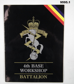
... . Aerial photograph of Bandiana workshops.... a black background. 2. Colour aerial photograph of a group.... Aerial photograph of Bandiana workshops. Cooper Collection ...1. Booklet outlines the work carried out by 4th Workshop Battalion, Bandiana, Victoria. Part of the Cooper Collection. 2. Aerial photograph of Bandiana workshops.1. A4 sized booklet with twelve pages secured to cover with two staples. Front cover has RAEME insignia in gold and silver on a black background. Title in gold and silver lettering. Pages contain colour photographs and text in white. Pages have a black background. 2. Colour aerial photograph of a group of buildings at Bandiana. 3. Business card featuring RAEME insignia and text in blue print.cooper collection, bandiana, 4th workshop battalion, raeme -
 Bayside Gallery - Bayside City Council Art & Heritage Collection
Photograph, Department of Crown Lands and Survey, Victoria, Brighton, Brighton East and Bentleigh, c. 1965-71
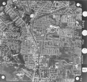
... Aerial photograph.... This aerial photograph shows parts of Brighton, Brighton East...Black and white photograph. An aerial photograph showing... and Survey Aerial photograph Bayside Port Phillip Bay Map ...The Department of Crown Lands and Survey (1857-1983) was responsible for the administration of survey and mapping and the sale, occupation and management of crown land throughout its existence. This aerial photograph shows parts of Brighton, Brighton East and Bentleigh and was taken circa 1965-71.brighton, department of crown lands and survey, aerial photograph, bayside, port phillip bay, map, cartographic material, bentleigh, brighton east, dendy park, dendy street, centre road, nepean highway, south road, football -
 Bayside Gallery - Bayside City Council Art & Heritage Collection
Photograph, Department of Crown Lands and Survey, Victoria, Brighton, Brighton East and Bentleigh, c. 1965-71
... Aerial photograph.... This aerial photograph shows parts of Brighton and Brighton East...Black and white photograph. An aerial photograph showing... Aerial photograph Bayside Port Phillip Bay Map cartographic ...The Department of Crown Lands and Survey (1857-1983) was responsible for the administration of survey and mapping and the sale, occupation and management of crown land throughout its existence. This aerial photograph shows parts of Brighton and Brighton East and was taken circa 1965-71.brighton, department of crown lands and survey, aerial photograph, bayside, port phillip bay, map, cartographic material, brighton east, dendy park, dendy street, centre road, nepean highway, south road, brighton golf course, golf -
Glen Eira Historical Society
Letter - Gardenvale Road, 78, Gardenvale
... Aerial Photographs... Caulfield Siedle Paul Townhouses Town Planning Plans Aerial ...This file contains six items. Five items of typed correspondence concerning application to build four double-storey dwellings at 78 Gardenvale Road. Correspondence between City of Glen Eira and residents R.A. and P. Darke from 08/12/2008 to 20/03/2009, and Paul Siedle. Typed copy of resident Jonathon Breedon’s objections to the proposed plan. Copy of original plans for the dwellings dated 12/09/2008. Copy of amended plans for the four dwellings dated November 2008. Typed letter dated 20/03/2009 from Glen Eira Senior Town Planner to Richard and Peta Darke notifying of council’s decision of intention to grant a planning permit for the dwellings. Typed five page notice of decision to grant a planning permit for the four dwellings dated 20/03/09. Included is a one page description of the appeal process.gardenvale road, magnolia road, gardenvale, city of glen eira, city hall, glen eira road, hawthorn road, lloloma receptions, caulfield south, darke peta, darke richard, elster avenue, elsternwick, torres ron, kokkinos stella, glen eira city council, statutory planning department, breedon jonathon, lantana road, peter l. brown architects pty ltd., glen eira planning scheme, elsternwick library, bentleigh library, carnegie library, caulfield library, staniland grove, jasper road, shepparson avenue, bentleigh, carnegie, caulfield, siedle paul, townhouses, town planning, plans, aerial photographs, architectural drawings, architects, brick houses -
Glen Eira Historical Society
Map - a'Beckett Street, 11, East St Kilda
... Aerial Photographs... Aerial Photographs Map a'Beckett Street, 11, East St Kilda ...Print of a Google map of 11 a’Becket Street, East St Kilda downloaded & printed on November 26, 2010 by Sud Abbas (role unknown). Detail shows that the address is now a car parka’beckett street, east st kilda, car parks, streetscapes, aerial photographs -
 Eltham District Historical Society Inc
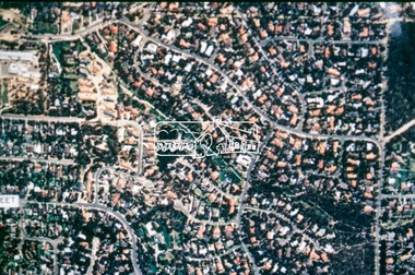
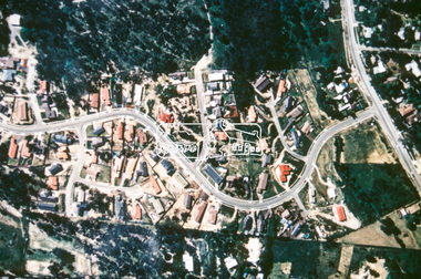
Photograph (item) - Aerial Photograph, Aerial Photo: Shire of Eltham War Memorial, Kangaroo Ground, Jan 1951
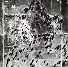
... Aerial Photograph...Aerial photographs... Caretaker's cottage. Aerial photographs Garden Hill Farm Kangaroo ...1951 Aerial photo 1423-110 Run 10 showing the Shire of Eltham War Memorial at centre of image with the newly constructed Caretaker's cottage.aerial photographs, garden hill farm, kangaroo ground, memorial park, shire of eltham war memorial -
 Eltham District Historical Society Inc
Negative - Photograph, Eltham Shire Council display, 1987 Eltham Community Festival, Alistair Knox Park, 7 Nov. 1987
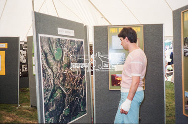
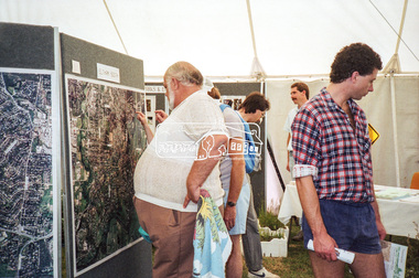
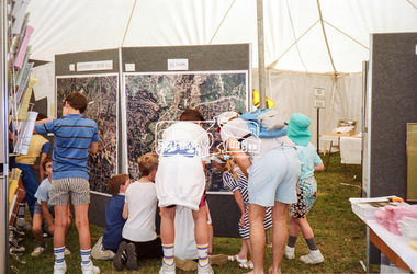
... Aerial photographs... and machinery used. Aerial photographs Alistair Knox Park Displays ...Regular display by Council at the Eltham Festival providing ratepayers and visitors some insight into the daily operations of and services provided by Council and various equipment and machinery used.Roll of 35mm colour negative film, 4 stripsKodak GB 200 5096aerial photographs, alistair knox park, displays, eltham festival, eltham shire council, infrastructure, north warrandyte, shire of eltham -
 Eltham District Historical Society Inc
Negative - Photograph, Eltham Shire Council display, 1987 Eltham Community Festival, Alistair Knox Park, 7 Nov. 1987
... aerial photographs... and machinery used. aerial photographs alistair knox park displays ...Regular display by Council at the Eltham Festival providing ratepayers and visitors some insight into the daily operations of and services provided by Council and various equipment and machinery used.Roll of 35mm colour negative film, 4 stripsKodak GB 200 5096aerial photographs, alistair knox park, displays, eltham festival, eltham shire council, infrastructure, shire of eltham, eltham south -
 Eltham District Historical Society Inc
Negative - Photograph, Eltham Shire Council display, 1987 Eltham Community Festival, Alistair Knox Park, 7 Nov. 1987
... aerial photographs... and machinery used. aerial photographs alistair knox park displays ...Regular display by Council at the Eltham Festival providing ratepayers and visitors some insight into the daily operations of and services provided by Council and various equipment and machinery used.Roll of 35mm colour negative film, 4 stripsKodak GB 200 5096aerial photographs, alistair knox park, displays, eltham festival, eltham shire council, infrastructure, shire of eltham, briar hill, eltham, montmorency -
 Eltham District Historical Society Inc
Negative - Photograph, Eltham Shire Council display, 1987 Eltham Community Festival, Alistair Knox Park, 7 Nov. 1987
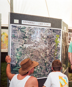
... aerial photographs... and machinery used. aerial photographs alistair knox park displays ...Regular display by Council at the Eltham Festival providing ratepayers and visitors some insight into the daily operations of and services provided by Council and various equipment and machinery used.Roll of 35mm colour negative film, 4 stripsKodak GB 200 5096aerial photographs, alistair knox park, displays, eltham festival, eltham shire council, infrastructure, shire of eltham, montmorency, lower plenty -
 Eltham District Historical Society Inc
Slide - Photograph, Aerial Photo (c.1987): Main Road, Eltham from Pitt Street to Elsa Court, c.Aug. 1990
... Aerial photographs.... infrastructure roads Aerial photographs Alistair Knox Park Bridge Street ...Part of a presentation, "Roads and Byways of the Shire of Eltham", by Russell Yeoman to the 12 September 1990 Society meeting. Slides shown included copies of old photos and recent images ranging from the suburban streets of Eltham and Montmorency to the mountain roads of Kinglake. In the byways category are views of some iof the Shire's bicycle paths including then recently completed sections of the Main Yarra Trail at Lower Plenty.35mm colour positive transparency (1 of 37) Mount - Agfachrome Agfa CS System black 8 dotsinfrastructure, roads, aerial photographs, alistair knox park, bridge street, central park, diamond street, elsa court, eltham, eltham common, eltham railway station, eltham town park, main road, pitt street -
 Eltham District Historical Society Inc
Slide - Photograph, Aerial Photo (c.1987): Woodridge Estate, Eltham, c.Aug. 1990
... aerial photographs.... infrastructure roads aerial photographs eltham Housing estate Woodridge ...Part of a presentation, "Roads and Byways of the Shire of Eltham", by Russell Yeoman to the 12 September 1990 Society meeting. Slides shown included copies of old photos and recent images ranging from the suburban streets of Eltham and Montmorency to the mountain roads of Kinglake. In the byways category are views of some iof the Shire's bicycle paths including then recently completed sections of the Main Yarra Trail at Lower Plenty.35mm colour positive transparency (1 of 37) Mount - Agfachrome Agfa CS System black 8 dotsinfrastructure, roads, aerial photographs, eltham, housing estate, woodridge estate -
 Eltham District Historical Society Inc
Slide - Photograph, Aerial Photo (c.1987): Main Road and Leanne Drive, Eltham, c.Aug. 1990
... aerial photographs.... infrastructure roads aerial photographs eltham Leanne Drive Main Road ...Part of a presentation, "Roads and Byways of the Shire of Eltham", by Russell Yeoman to the 12 September 1990 Society meeting. Slides shown included copies of old photos and recent images ranging from the suburban streets of Eltham and Montmorency to the mountain roads of Kinglake. In the byways category are views of some iof the Shire's bicycle paths including then recently completed sections of the Main Yarra Trail at Lower Plenty.35mm colour positive transparency (1 of 37) Mount - Agfachrome Agfa CS System black 8 dotsinfrastructure, roads, aerial photographs, eltham, leanne drive, main road -
 Eltham District Historical Society Inc
Slide - Photograph, Aerial Photo (c.1987): Main Road, Fitzsimons Lane, Lower Plenty, c.Aug. 1990
... aerial photographs.... infrastructure roads aerial photographs Roundabout Bolton Steet Bolton ...Part of a presentation, "Roads and Byways of the Shire of Eltham", by Russell Yeoman to the 12 September 1990 Society meeting. Slides shown included copies of old photos and recent images ranging from the suburban streets of Eltham and Montmorency to the mountain roads of Kinglake. In the byways category are views of some iof the Shire's bicycle paths including then recently completed sections of the Main Yarra Trail at Lower Plenty.35mm colour positive transparency (1 of 37) Mount - Agfachrome Agfa CS System black 8 dotsinfrastructure, roads, aerial photographs, roundabout, bolton steet, bolton steet shops, eltham, fitzsimons lane, lower plenty, main road