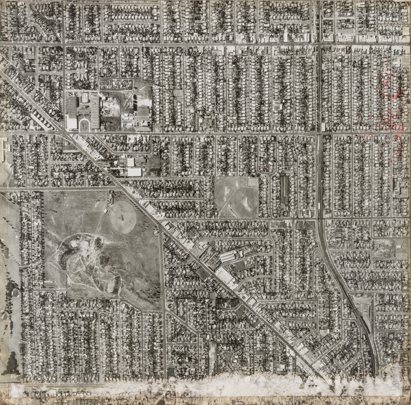
Photograph, Department of Crown Lands and Survey, Victoria, Brighton, Brighton East and Bentleigh, c. 1965-71
Brighton, Brighton East and Bentleigh
Reuse this media
Can you reuse this media without permission?No (with exceptions, see below)
Conditions of use
All rights reserved
This media item is licensed under "All rights reserved". You cannot share (i.e. copy, distribute, transmit) or rework (i.e. alter, transform, build upon) this item, or use it for commercial purposes without the permission of the copyright owner. However, an exception can be made if your intended use meets the "fair dealing" criteria. Uses that meet this criteria include research or study; criticism or review; parody or satire; reporting news; enabling a person with a disability to access material; or professional advice by a lawyer, patent attorney, or trademark attorney.
Attribution
Please acknowledge the item’s source, creator and title (where known)
Department of Crown Lands and Survey, Victoria, Brighton, Brighton East and Bentleigh c. 1965-71, photograph, 102.5 x 101 cm. Bayside City Council Art and Heritage Collection
The Department of Crown Lands and Survey (1857-1983) was responsible for the administration of survey and mapping and the sale, occupation and management of crown land throughout its existence. This aerial photograph shows parts of Brighton, Brighton East and Bentleigh and was taken circa 1965-71.
Physical description
Black and white photograph. An aerial photograph showing parts of the suburbs of Brighton, Brighton East and Bentleigh. The significant landmark featured is Dendy Park, on the corner of Dendy Street and Nepean Highway. The main roads shown include Centre Road at the top, Nepean Highway diagonally across the photograph and South Road at the bottom.