Showing 231 items
matching land register
-
 Eltham District Historical Society Inc
Document, Russell Yeoman, Tour of Historic Buildings and Locations, 1978
Self guided heritage tour information produced by the Shire of Eltham Historical Society for 1978 Eltham Community Festival of 36 locations each numbered on accompanying map. Locations and detail provided current to 1978: 1. ELTHAM SHOPPING CENTRE Whilst very little remains in the centre of historical importance, this area has interest as the "village" which developed over many years following the opening of the railway from Melbourne in 1902. Previously the shopping centre had been spread out over a long length of Main Road to the south. Shops have been continuously demolished or remodelled and the majority of buildings date from the 1950's or later. The recently erected Post Office replaced the "old" Post Office opened on the same site only in 1958. 2. WOOLWORTHS ELTHAM VILLAGE Part of the site of this modern shopping development was occupied by the former Eltham Shire Offices and Hall. The hall was paid for by public subscription whilst the Council raised a loan for the offices. The combined building was opened in 1941. It served as office and Council meeting place until 1965 and as the hall until its demolition in 1970. 3. ELTHAM WAR MEMORIAL The complex of buildings adjoining the present Shire Offices were financed by public subscription as a Memorial following World War II. Their construction and for many years their operation was organised by the now disbanded Eltham War Memorial Committee. The original buildings were the; Infant Welfare Centre, Children’s Library (now War Memorial Hall and Dental Clinic) and Kindergarten. In later years the Elderly Citizens Club was built at the rear. 4. ELTHAM SHIRE OFFICES These offices were opened in 1965 and extended in 1971 to provide additional office accommodation and the Eltham Library. They represent the last of a long line of offices and meeting places of the Eltham Shire Council and its predecessor the Eltham District Road Board. The building occupies the former site of Shillinglaw Cottage. The three tall cypress trees which stood in front of the Cottage have been retained as a feature of the office surrounds. 5. OUR LADY'S CHURCH AND SCHOOL The Catholic Church and School complex opposite the Shires Offices shows a number of stages in the development of Eltham township. The recently constructed church adjoins its predecessor (now the parish centre). Many years ago the Catholic Church was located opposite Wingrove Park and the present central site follows the northerly drift of the township. 6. SHILLINGLAW COTTAGE The Cottage was built in 1859 by George Stebbing, a local builder who was responsible for a number of other prominent buildings in the area. Its removal from the site of the Shire Offices and re-erection on the present site was financed by public subscription. It is built of handmade bricks laid in Flemish Bond with an unusual design featuring burnt "leader" bricks over the whole facade. The Cottage is occupied by Eltham Fleececrafts and will be open during the Festival and at other times during weekends. It is classified by the National Trust. 7. RAILWAY BRIDGE The timber trestle bridge over the Diamond Creek was built in 1901. Whilst all of its timbers have been replaced at various times over the years the only change to its character has been the addition of pylons and wiring for electric trains in 1923. It is one of very few similar bridges remaining in the metropolitan area. In 1976 a proposal to replace the bridge with an earth embankment and large culvert pipes was abandoned following community protests. The bridge, however, remains under threat because of the necessity for future deuplication of the railway line. 8. ELTHAM CENTPAL PARK The area between the railway and the creek has for many years been used as a park which included Eltham' s main football oval. The access road, Panther Place is named after Eltham's team playing in the Diamond Valley League. In recent years a large area extending to Bridge Street and locally known as the Town Park has been landscaped and added to the area. The excellent blending of the park with the natural landscape of the creek valley has earned a National Trust Landscape Classification. 9. OLD BAKERY On the southern corner of York Street and Main Road is an old house with a shop front which was for many years the local baker's shop. The brick bakery at the rear is of somewhat later vintage than the house. 10. BRIDGE STREET CUTTING Before reconstruction of Main Road this intersection had deep cutting embankments on all four corners, forming a distinctive feature of the entrance to Eltham. Roadworks and private development have levelled the land on the low side of the road. A memorial to the Eltham soldiers of World War I which was located at the north-western corner is now situated at the Eltham R.S.L. 11. HILLTOP MILK BAR For many years this was the site of the Eltham Post Office under the control of the Hunniford family and later their descendants the Burgoynes. It was transferred to this site in 1855, although at that time the building apparently fronted Bridge Str e et. The site contained Eltham's first telephone exchange. The post office was relocated in 1954 but the shop was operated until recently by the Burgoyne family who still own the surrounding land. 12. UNITING CHURCH and former C.B.A. BANK The former Methodist Church was built in 1880 by George Stebbing. The Sunday School extension was built in 1929 and there have been more recent extensions. The adjoining opportunity shop was built as a bank in 1874 and purchased by the Methodist Church in 1954. 13. R.S.L. HALL, TELEPHONE EXCHANGE These relatively recent buildings occupy the site of a row of shops forming part of the early ribbon of business development along Main Road. In front of the R.S.L. building is the World War I Memorial relocated from the corner of Bridge Street and Main Road. 14. ELTHAM COMMUNITY CENTRE Australia's first mudbrick "community building" was opened in April this year. Part of the site of the building was purchased in 1856 by Henry Dendy (of Brighton fame). At the rear of the land near the creek was a steam flour mill whilst Dendy's house was at the Main Road frontage of the land. His purchase totalled about 2 Ha (5 acres) and included land on the opposite side of Maria Street (Main Road). Dendy became a prominent member of the Eltham community and served one term as President of the Eltham District Road Board. In 1867 Dendy sold his land and business to William Ford of Malmsbury and shifted to Walhalla. The avenue of trees leading past the Community Centre to the creek may well have bordered the track to the mill. 15. ELTHAM HOTEL The original part of this hotel was built in 1927 following the burning of the former Watson's Eltham Hotel on the same site. The car park on the opposite side of Main Road was also the site of a hotel variously known over the years as; the Fountain of Friendship, the Fountain and the Evelyn Arms. As the Fountain of Friendship it was the first meeting place of the Eltham District Road Board in 1856. 16. ST. MARGARET'S CHURCH, PITT STREET In 1860 Henry Dendy was appointed Chairman of a committee to establish a church of England in Eltham. He donated part of his land in Pitt Street and in 1861 the church was opened. It was built by George Stebbing and remains in a well preserved state today. Th adjoining old vicarage is now named Dendy Hou se. A new mudbrick church hall is under construction on the site. The church and Dendy House are now listed on the Register of Historic Buildings. 17. NO. 86 PITT STREET Cottage built by George Stebbing and believed to be his home for some years in the 1850s. 18. LIVING AND LEARNING CENTRE The house was built in the 1850s with the kitchen at the front being added about 40 years later. By the creek below the house a number of early Eltham industries were located. These included a tannery and a brewery. 19. ELTHAM COURT HOUSE A Court of Petty Sessions was established in Eltham in 1858 and the present building dates from 1860. It is the oldest public building remaining in Eltham. In its early days the building was used as the meeting place and office of the Eltham District Road Board and as an overflow classroom for the local school. The Court House has been classified by the National Trust. The citation states that it is an example of the simple form of early brick Court House with gabled roof and porch. 20. LANDS DEPARTMENT OFFICE This building is the former police station and is probably of about the same age as the Court House. The lockup at the rear has been demolished but the old stables remain as garages. A licence was first granted for a police station at Eltham in 1856. 21. JARROLD COTTAGE The old Cottage opposite Dalton Street was formerly owned by the Jarrold family. Early records indicate that this was the building leased from the Jarrolds as a temporary police station prior to construction of the building on the corner of Brougham Street. The small building on the corner of the property was used as a boot repairer's shop. The elevated studio at the rear is a more recent construction by the present owners. 22. STATE SCHOOL RESIDENCE Erected in 1891 23. WINGROVE COTTAGE This building fills an important place in the history of Eltham and is now used as a medical clinic. It was built in 1858 for Charles S. Wingrove who was Secretary to the Eltham District Road Board and Shire Council from 1858 to 1904. During part of this period he was also Shire Engineer and was Secretary to the Heidelberg Road Board. The house was used as the office of the Board and Council for many years. Wingrove is buried in the cemetery at St. Helena. 24. WINGROVE PARK The parkland opposite Wingrove Cottage has been named after Charles Wingrove. The old Manna Gums are an outstanding feature of the park. 25. ELTHAM FRI.MARY SCHOOL NO. 209 The school first opened in the slab building in 1855 and operated from the present site since 1857. The oldest part of the present school is the stone building erected in 1876. The first school teacher, David Clark remained at the school until 1888. This school is the government township and has always been known as the Eltham School. An earlier school (no.371) known as Little Eltham School operated in Swan Street from 1853 to 1872. 26. "SHOESTRING" This house was built for school teacher David Clark. It has been extensively extended in recent years but the extensions do not detract from the character of the older part of the building. 27. ELTHAM CEMETERY The cemetery contains the graves of many of the district's pioneers . 28. MONTSALVAT This unique complex of buildings was commenced in 1935 by the late Justus Jorgensen and its development has extended over many years. Montsalvat has exerted a significant impact on Eltham The earth and stone construction of many of the buildings has influenced local architecture to a great extent and it has served as a "nerve centre" of the local artistic community. Montsalvat is open to the public for a small charge. 29. MAIN ROAD BRIDGE This location has been the main crossing of Diamond Creek since the earliest days of settlement. The present concrete bridge was erected in 1925 .and was preceded by a number of timber bridges. 30. ELTHAM LOWER PARK This park, being an unusually large flat area for Eltham, was originally the local racecourse. Horse races were held here from 1855 and the area was gazetted as a reserve for a racecourse and recreation reserve in 1857. The park is well known as a venue for school "bird days" and more recently as the site of the Diamond Valley Railway. This miniature railway features scale models of modern and old locomotives and rolling stock and has operated on this site since 1961 . Before that the railway operated at Chelsworth Park, Ivanhoe. 31. FALKINER HOUSE Frederick Falkiner was one of the earliest settlers in the Eltham township area and occupied a substantial leasehold prior to the first land sales. Early records show that Falkiner was the subject of a number of complaints from his neighbours but he has nevertheless been considered a prominent enough citizen to have a street named for him. This house was the home of Evelyn (Ely) Falkiner a member of Frederick's family. 32. WEST HOUSE Behind the large house on the hill is an early house built by the West family. This was relocated from a site near the front of the land by the present owner Mr. Fabbro. 33. FALKINER HOUSE This very old house is believed to have been the home of Frederick and may have been Eltham's first post office. Falkiner was the first post master for a short period. in 1854/55. 34. WITHERS HOUSE This house was the home of famous artist Walter Withers who shifted here from Heidelberg in 1903. 35. ELTHAM HIGH SCHOOL This school celebrated its jubilee this year, having commenced as the Eltham Higher Elementary School 50 years ago. 36. DIAMOND CREEK FOOTWAY If returning from the High School to the town centre the footpath by the bank of the Diamond Creek provides a pleasant route to finish your walk. The creek is a major tributary of the Yarra River. Together with its own major tributaries Arthurs Creek and Running Creek it commences on the southern slopes of the Dividing Range at Kinglake. It gives the name Diamond Valley to an area extending well beyond its actual drainage catchment.Recognition of the significance of various landmarks to the history of the Eltham community as of 1978‘shoestring’, 1978, bridge street cutting, burgoyne store, c.b.a. bank, diamond creek trail, eltham cemetery, eltham central park, eltham community centre, eltham community festival, eltham court house, eltham festival, eltham high school, eltham hotel, eltham lower park, eltham primary school, eltham railway trestle bridge, eltham shire offices, eltham shopping centre, eltham state school no. 209, eltham village, eltham war memorial, falkiner house, heritage trail, hilltop milk bar, jarrold cottage, lands department office, living, living and learning centre, main road bridge, montsalvat, old bakery, our eltham artistic recollections, our lady help of christian’s church, our lady help of christian’s primary school, pitt street, post office, r.s.l. hall, shillinglaw cottage, st margaret’s church, state school residence, stebbing cottage, telephone exchange, uniting church, west house, wingrove cottage, wingrove park, withers house, woolworths -
 Port Melbourne Historical & Preservation Society
Certificate - Title, Crown allotment 2, section 29, Town of Port Melbourne, Office of Titles, Victoria, Jul 1891
Certificate of title relating to Crown allotment 2, Section 29, Town of Port Melbourne, Heath Street. Title in name of Melbourne Permanent Building Society. registered 29th July 1891. title UDL 957, Folio 191304local government - town of port melbourne, town planning, land sales -
 Women's Art Register
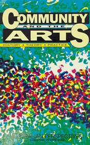
Book, Vivienne Binns, Community and the Arts. History. Theory. Practice.Australian Perspectives, 1991
Anthology of articles on the history and theory of community arts in Australia written by artists and artsworkers involved.Booknon-fictionAnthology of articles on the history and theory of community arts in Australia written by artists and artsworkers involved. community arts, collaborative practice, art history, political art, community arts network, aboriginal land rights -
 Women's Art Register
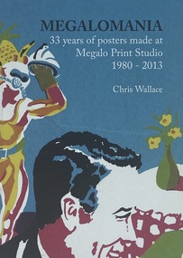
Book, Chris Wallace et al, Megalomania 35 years of posters made at Megan Print Studio 1980 - 2013, 2013
A visual record of posters made at Megalomania Print Studio, a print collective in Canberra 1980-2013Booknon-fictionA visual record of posters made at Megalomania Print Studio, a print collective in Canberra 1980-2013community, political art, artist unknown, gender, health, environment -
 Women's Art Register
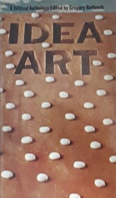
Book - Anthology, Gregory Battcock, Idea Art, 1973
... other material held in The Women's Art Register Idea Art Land ...A survey of theories, practices and documents that outlines the origins of US and European Idea Art of the 1960s and 1970s.non-fictionA survey of theories, practices and documents that outlines the origins of US and European Idea Art of the 1960s and 1970s.idea art, land art, conceptual art, lucy lippard, dore ashton, jonathan benthall, cheryl bernstein, jack burnhan, joseph kosuth, ursula meyer, john perreault, arthur rose, harold rosenberg, seth siegelaub, sol le witt, lawrence weiner, daniel buren, mel bochner, robert hughes -
 Eltham District Historical Society Inc
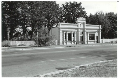
Document, Declaration of Trustees, Eltham Public Hall, Lot 20 Henry Street, Eltham, 18 Mar 1927
Robert David Taylor of Eltham declared he was the Secretary of a certain Friendly Society known as the Hope of Eltham Tent No. 195 Victoria District of the Independent Order of Rechabites; that William John Taylor the Younger, George Knapman and Isaac Hill junior the Purchasers mentioned and described in a certain Indenture of Conveyance from Barnabas Shaw Walker and others also therein described registered in the office of the Registrar General were at the time of the registration of the said Conveyance the trustees of the said Friendly Society and purchased the land and hereditaments described in the Conveyance as such Trustees; and that Edward Samuel McColl, Jack Alfred Harrison and William Wilson were on 31 December 1926 the trustees of the said Friendly Society and as such were entitled to grant and convey the land and hereditaments described in the said Indenture of Conveyance. Originally purchased in 1856 from Thomas Roberts, Yeoman of Little Eltham, for £10 for use by the Wesleyan Chapel, represented by indentured Trustees, Rev. Barnabas Shaw Walker, Minister of the Pentridge Circuit, Francis Thomas, Farmer of Keelbundora, William Harriman, Blacksmith of Nillumbik, Nicholas Rodda, Farmer of Nillumbik, Aaron Grimshaw, Farmer of Greensborough, Joseph Cooper, Gardener of Keelbundora, Peter Dredge, Scholmaster of Jika Jika and Samuel Jeffrey, Farmer of Jika Jika. Lot 20 of Subdivision of Portion 13, Section 4 of the Parish of Nillumbik in the County of Evelyn was located on the southern side of Henry street in Little Eltham North, where the current Our Lady Help of Christians Catholic Church is situated. It became the location of the Eltham Rechabite Hall. In 1893 a new hall was built and further enlarged in 1919. At the commencement of 1922, the property was purchased from the Independent Order of Rechabites with publicly subscribed funds and a new hall built at a cost of £750 and improved road access constructed to reduce the grade, running from Dudley Street to Henry Street. This hall was eventually replaced with the new Shire Offices and Hall built on the corner of Arthur Street and Main Road, which was opened in 1941. Traces the earliest history of the Eltham Public Hall in Henry Street and the various names, occupations and abodes of the Trustees associated with the propertyedward samuel mccoll, eltham public hall, eltham rechabite hall, eltham wesleyan chapel, george knapman, henry street, hope of eltham tent no. 195, isaac hill junior, jack alfred harrison, trustee, victoria district independent order of rechabites, william john taylor the younger, william wilson -
 Eltham District Historical Society Inc
Document - Folder, Eltham Town Focus Group, 1996-1997
Documents relating to a focus group brought together by the Shire of Nillumbik Chairman of Commissioners in 1996 to provide advise on the best long term use for the buildings and land situated between the former Eltham Shire Offices and Country Fire Authority buildings. These buildings are known as the Eltham War Memorial buildings located at 903-907 Main Road, Eltham. In May 2020, the Heritage Council Victoria did not recommend the site for inclusion in the Victorian Heritage Register. 11 pagesharry gilham collection, consultation, planning, eltham, eltham war memorial, eltham war memorial buildings, commissioners -
Clunes Museum
Document - LAND PURCHASE, 1862
... , IN REGISTER NO. 13 SPECIAL LAND PURCHASES, FOLIO 2483 THIS THIRTEENTH... COURT OF THE COLONY OF VICTORIA, IN REGISTER NO. 13 SPECIAL LAND ...SPECIAL LAND PURCHASE CERTIFICATE FOR LAND PURCHASED BY JAMES GRIFFIS OF CLUNES, DATED 4TH APRIL 1862.CERTIFICATE OF SPECIAL LAND PURCHASE.ENTERED ON RECORD AND ENROLLED IN THE OFFICE OF THE REGISTRAR OF THE SUPREME COURT OF THE COLONY OF VICTORIA, IN REGISTER NO. 13 SPECIAL LAND PURCHASES, FOLIO 2483 THIS THIRTEENTH DAY OF MAY 1862. SIGNED BY ACTING REGISTRARlocal history, document, certificates, griffis james -
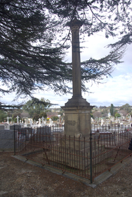
 Linton and District Historical Society Inc
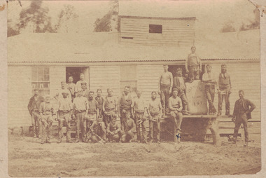
Photograph, 'Glenfine' Shearing Shed, 1890
In July 1840, Glenfine, consisting of 31,440 acres, was acquired by Thomas Downie. In March 1842 the 'Right of Run' was taken up by Thomas Chirnside who with an imported stallion 'Delapre' ran a horse stud. He apparently lived here for ten years and employed a gardener with a wife and five children from Hobart, Tasmania. Only some blocks of stone and a few trees remain of their homestead. In 1853 the property was transferred to Dr. John Chirnside, an elder brother of Thomas. I, 1857, William Rose of Naringal purchased Glenfiine where he and his family lived until 1904 when it was bought by Richard Howell's estate. It was then 39,000 acres. The present house was built by the Rowes in 1872 of bluestone quarried on the property with a cement render overall. The architect was H.R. Casselli. In 1911 R.C. Howell, son of Richard, became the owner, followed by his son in 1960. Gold was found on the property and by 1898 the township of Hollybush was first reported, situated at either side of the front entrance, on the Cressy Road. The land for the township was given by William Rowe. By 1990 Hollybush had a population of 426 persons. All of the early history of Glenfine, documents etc., were destroyed when Naringal homestead was burnt down in 1944. Glenfine was classified by the National Trust in 1974 and is on the Heritage Commission Register. Mounted black and white image of a large group of men and boys in front of a weatherboard shearing shed. The men are each holding a pair of hand shears. One young man is kneeling on top of a wool bale. A small blue biro 'x' identifies W. Todd. Glenfine was a pastoral station. The original homestead still stands.shearing sheds, shearers, rural activity, william todd, glenfine pastoral station, thomas chirnside, thomas downie, richard howell -
 Wooragee Landcare Group
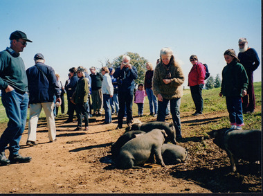
Photograph, 5 September 2004
This photograph was taken at Samaria Farm on Sunday the 5th of September when Wooragee Landcare Group took a bus trip to the Tatong area (near Benalla) to look at land use on small farms. The day trip was organised to observe land use on small farms as well as a social event for the Group. Samaria Farm at the time was a nine-hectare property located in northeast Victoria, near Mount Samaria, 130 km Northeast of Melbourne. The photograph features several pigs believed to be the breed called Large Black. The Large Black Pig breed is a traditional, heritage breed that was first imported to Australia from the UK in the early 1900's. It is believed to have originated from the Old English Hog of the 16th and 17th Centuries. The first reference to them in the Australian Pure Bred Pig Herd Book was in 1912. They are a black pig with lop ears and were prized for their superior milking and mothering abilities and soon became popular with early Dairy Farmers who fed them whey from separated milk as part of their butter making process. They proved economical to keep and, being excellent grazing pigs, were also used to pick up windfall fruit in orchards. Their black colouring also enabled them to withstand the hot Australian summers and avoid sunburn which combined with their hardiness and docile temperament made them highly suitable for free-range pork production, however Large Black pigs tend to get very fat and were not suitable for intensive farming so were often crossed with other breeds for pork production. They are now quite rare as a pure breed having been on the edge of extinction for some time. They were rescued in the early 1990s by a rare breeds farmer in the Yarra Ranges. These days they are also the focus of a small conversation effort with six registered breeders currently in Australia. For biosecurity reasons there are no imports of live pigs or pig semen permitted into Australia. This photograph shows a group of people attending one of the events that Wooragee Landcare Group has organized within the educational framework of promoting best land management practices for all types of land uses and ensuring sustainability, in addition to encouraging community interaction via social events. The Large Black pig breed is significant because of their role in early Victorian farming. They are now quite rare as a pure breed having been on the edge of extinction for some time. These days they are the focus of a small conversation effort with six registered breeders currently in Australia. For biosecurity reasons there are no imports of live pigs or pig semen permitted into Australia. Wooragee Landcare Group is important to local community landcare and environmental management practices.Colour rectangular photograph printed on paperObverse: WAN NA EONA2N2. ANN+ 3 4240/ (No. 17) 370samaria farm, wooragee landcare, wooragee landcare group, tatong, benalla, black pigs, large black, traditional breed, heritage breed, pigs, lop ears, free range pork production, early victorian farming -
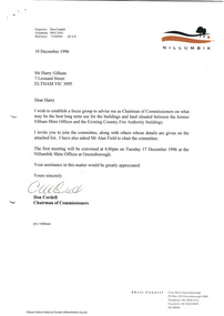
 Whittlesea Historical Society Inc.
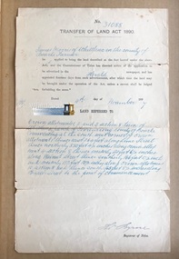
Document - Register of Titles, Transfer of Land Act 1890, 1897
Transfer of Land, James Morris of Whittlesea in the County of Bourke, Farmer, for land along Lime Street and Walnut Street, Whittlesea, Victoria. Dated 4th November 1897.1 original certificate, A4, paper, the document has been folded and has torn along the fold lines.No. 31088. Transfer of Land Act 1890.whittlesea, james morris, walnut street whittlesea, lime street whittlesea, transfer of land, 1897 -
 Ballarat Heritage Services
Photograph - Photograph - Colour, Burke and Wills Memorial at Bendigo Cemetery, 2018, 02/09/2018
Robert O'Hara Burke and Thomas Pope Besnard were childhood friends. As sexton of the local Back Creek Cemetery Thomas Besnard organised a subscription to raise the money for a monument to Burke, Wills and Gray. A subscription of one shilling, no more and not less, was asked so all subscribers were equal. The Bendigo monument was designed by Adam Duncan and features a Corinthian column mounted on a foundation stone, topped with a Grecian urn draped with the Union Jack. The stone for the monument was quarried from New Chum Mine. The site in the Bendigo Cemetery was selected by Besnard so the monument was on a grass knoll well clear of any other graves. The design included landscaping with a path and garden beds that provided dignified access. The Burke and Wills Monument in Bendigo has been entered on the Register of the National Estate as being important for its association with historical events and developments associated with exploration in the early days of Colony of Victoria. Two conifers remain from the original group sent by Mueller of the Melbourne Botanical Gardens to develop the garden layout on the knoll. These two trees are listed as Significant Trees by City of Greater Bendigo. The foundation block was laid on 20 August 1862 by Chairman of the Bendigo Municipality, Charles Burrows – exactly two years after the Expedition left Melbourne. A half day holiday was declared by Bendigo Council, and a procession left the Bendigo Town Hall and marched to the cemetery where 8000 people were gathered and another 4000 lined the route. John King was unable to attend due to ill health. Chairman of the Municipality of Bendigo, Charles Burrows, gave a long address, and diaries of members of the expedition, the Sandhurst Almanac, the Bendigo Advertiser, the Bendigo Independent Evening News, photographs of the deceased, photographs of Public Buildings in Bendigo, a Sydney half sovereign and all the silver coins of the Realm were wrapped in a Union Jack and placed in a niche in the foundation stone. Fifteen months later a column was erected on the foundation stone after Besnard openly criticised the Memorial Committee for their lack of action. The Bendigo Advertiser was disappointed at the location of the monument preferring a more central location and in 1893 an attempt was made to move the monument to Rosalind Park. On 19 May 1893, Mr Minto, the City Surveyor of the Bendigo MunicIpality reported it would cost £25, and no other action occurred. In 1940 the land around the memorial was sold off as grave sites and the paths and garden beds disappeared with graves now surrounding the base of the monument. The Burke and Wills Monument in Bendigo Cemetery was entered on the Register of the National Estate for its association with historical events and developments associated with exploration in the early days of Colony of Victoria. Two conifers remain from the original group sent by Mueller of the Melbourne Botanical Gardens to develop the garden layout on the knoll. These two trees are listed as Significant Trees by City of Greater Bendigo.Burke and Wills Memorial at Bendigo Cemetery, 2018Erected by the people of Bendigo in honor of the Victorian Explorers, Burke, Wills, Gray and King who first crossed the continent of Australia. King alone surviving the privation and suffering under which his three brave ill-fated companions sank. A.D. 1862. Robert O'Hara Burke, leader of the Victorian Expedition, left Melbounre 24th August 1860. Reached Carpentaria 12th Feby 1861. Died on his return at Coopers Creek, 30th June 1861. Charles Gray, died also on his return at Polygorum Swamp. 17th April 1861. William John Wills, second in command, died also near Coopers Creek, 29th June 1861. bendigo cemetery, burke and wills, burke and wills memorial, william john wills, john o'hara burke, charles gray, polygonum swamp, coopers creek, victorian expedition, carpentaria, bendigo public cemetery, bendigo remembrance park, thomas pope besnard -
 Wodonga & District Historical Society Inc
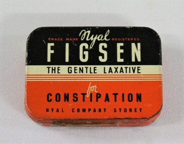
Functional object - Haeusler Collection Figsen Laxative Tin, Nyal Company
The Wodonga Historical Society Haeusler Collection provides invaluable insight into life in late nineteenth and early twentieth century north east Victoria. The collection comprises manuscripts, personal artefacts used by the Haeusler family on their farm in Wodonga, and a set of glass negatives which offer a unique visual snapshot of the domestic and social lives of the Haeusler family and local Wodonga community. The Haeusler family migrated from Prussia (Germany) to South Australia in the 1840s and 1850s, before purchasing 100 acres of Crown Land made available under the Victorian Lands Act 1862 (also known as ‘Duffy’s Land Act’) in 1866 in what is now Wodonga West. The Haeusler family were one of several German families to migrate from South Australia to Wodonga in the 1860s.This item has well documented provenance and a known owner. It forms part of a significant and representative historical collection which reflects the local history of Wodonga. It contributes to our understanding of domestic and family life in early twentieth century Wodonga, as well as providing interpretative capacity for themes including social history and medical history. A Figsen brand laxative tin manufactured by Sydney company Nyal. The tin is white, orange and black with type face on lid. Text on face of tin reading: "TRADE MARK NYAL REGISTERED/FIGSEN/THE GENTLE LAXATIVE/for/CONSTIPATION/NYAL COMPANY SYDNEY"medicine, medication, medical history, wodonga, haeusler collection, haeusler -
 Melton City Libraries
Document, Minns Family Reunion, 2004
"A perpetual spring in the adjacent creek provided a steady supply of fresh water to the site on which the homestead is built. Although we can not be certain of the identity of the builder, the first stage of ‘The Willows’ homestead appears to have been constructed in the mid 1850s. The house is situated on Crown Allotment No.1 (No Section), Parish of Kororoit, an allotment of 5 acres 3 roods 4 perches. Although it had surveyed the land, the Crown did not offer it for sale until 22nd November 1861, at which time it was purchased by Charles March Williams. (Although the property is directly opposite and immediately adjacent to the Township of Melton, and was sold as ‘Suburban Allotment 33’, it was situated within the Shire of Braybrook rather than the Shire of Melton until 1917.) Considerable improvements had taken place on the land prior to the Crown sale. When CM Williams purchased the allotment in November 1861 he paid £23.5.0 for the land itself, and valued the improvements at £400. Even allowing for some exaggeration by Williams, this is an extremely high valuation for improvements, and must have included a house. Some local research has claimed that in 1858 Williams had taken over the interest of a Mr Parkinson in the property, and that Parkinson built the house upon taking possession of the land c.1855. It was definitely built by 1861, when a map shows a square building on the site marked as ‘House’. The property is important in the district for its association with the establishment of the pound. The district pound had been established in 1854, when George Scarborough of Mount Cottrell (Mt Cottrell Road, south of Greigs Road) was appointed pound-keeper. Scarborough resigned in 1857. The pound was moved to Melton following agitation from local farmers and Charles March Williams appointed pound-keeper on 26th April 1858. Williams, the son of a doctor, had been born in London. Reminiscences of local residents of the time, as recorded in the Express newspaper, note Williams’ success in breeding horses on the property. Sales of up to 60 guineas were noted. Whether this was from Williams’s own stock or from unclaimed pound stock is not made clear. Williams appeared before a government inquiry in 1860 and advocated registration of all stock brands in the State. Williams died in 1862 leaving a widow, Catherine, and five living children aged 15 years to five months. At the time of his death Williams had entered negotiations with one Matthew Devenish and had a mortgage of £100 on allotments 1 and 2, Parish of Kororoit. Catherine Williams was appointed pound-keeper on 2 September 1863, with her eldest son Charles as her assistant. Her tenure was short for on 22nd March 1864 George Minns senior paid Matthew Devenish £135 for allotments 1 and 2 Parish of Kororoit (considerably less than Williams had claimed the property was worth in 1861) and on the same day paid William Tullidge £45 for the adjoining allotments 3 and 4. In April 1867, James Ebden Minns, the newly married son of George senior became the owner of The Willows property having entered into a mortgage arrangement with his father to the extent of £200. At the time George Minns was residing in Kaarimba having left Melton in 1867 for a short trip to England and upon his return having taken up a selection in the Kaarimba district with his son Frederick who had a hotel licence there. James paid out the mortgage on 2-1-1873. James Minns was appointed pound-keeper in 1872; in 1885 the pound was moved elsewhere and Minns purchased the old pound site and added it to his farm. The Willows residence underwent a major change about this time. A two room extension, similar in style but with a lower elevation was added to the original rear of the house with a chimney matching the distinctive originals. Window arrangements did not match the original but became a feature of the façade when the new addition became the front of the building. Six buttresses were attached to the east and west walls of the old building, two to the south wall and the whole rendered with mortar to give the appearance of dressed stonework around the windows. Galvanized iron was placed over the shingles and a verandah added on three sides. By 1876 The Willows was the homestead for a thriving mixed farm of 340 acres of which 156 was rented from a H. Ruck. In October of that year the Australasian travelling reporter visited and reported on the property. In common with the nearly every other property in the district the farm had ‘recently’ (generally within the last two years) abandoned cultivation of crops, and turned over completely to cattle pasture. Butter making was the principal occupation of the farm, which had about 50 head of cattle, a large proportion of which were milking cows. The reporter also noted that a ‘large number of pigs are kept upon this farm and are found to be very profitable stock’. Their manure was used in an orchard and garden in which ‘large quantities of lucerne and prairie grass are grown for the use of stock when ordinary feed is scarce’. Two bores attached to deep brick lined wells supplied water for the house in addition to the farm. A commodious timber barn and necessary sheds had also been constructed. Access to the property was improved following the construction of the bluestone ford across the creek c.1887, when the recreation ground came into use. Prior to this date it may have been that the crossing referred to as ‘Mr Minns bridge’ was used. This appears to have been a flimsy structure and has but two references in Council reports in the Melton Express in the 1880’s. It is believed that in the late 1890’s a timber building was added near the rear of the building to house a kitchen, ablutions and laundry rooms and rooms for seasonal workers. This was attached to the house by means of a trellised walkway using the original front entry to the house (long since the back door). A photograph of this building appears in a local history of Melton. This was demolished in recent decades during the period when the house was tenanted (after the Minns family had left). James Minns son, George, took over the property following his marriage to Alice Walsh in 1903. James and Caroline moved into a house on the former JH Games property at the eastern end of Henry Street. George held the position of Shire Secretary for Melton for 40 years. He was a most prominent member of the community being Secretary to, among others, the Melton Coursing Club, the Shooting Club and the Cemetery Trust. He also rode with the hunting parties who sported across the Plains and were entertained at Mount Kororoit. George and Alice had one son, Norman who followed his father into local government and became Secretary of the Shire of Werribee completing a record term in this position. George retired to Werribee in 1951, where he died in 1965. The National Trust records note that James Ebden Minns and his sons were ‘leading men of the district, Justices of the Peace, and Shire Councillors’. It claims that Sir Thomas Bent was a frequent visitor. The Willows passed into the hands of George’s grandson, Bruce Minns and the property was let for a number of years. In the 1960s it became vacant and was subject to vandalism. Major structural problems arose with the part demolition of the roof, the loss of windows and doors and holes dug into and under the floorboards. The outbuildings were particularly targeted. Following widespread public support, the Shire of Melton purchased the house, with 3.75 acres of land, in 1972. In 1975 the Shire of Melton and the Melton and District Historical Society were successful in nominating the building for National Trust classification, and then the Australian Heritage Commission’s Register of the National Estate. The AHC particularly noted its ‘townscape importance’. It was envisaged that the farmhouse would form ‘a picturesque centrepiece to Melton’s planned … historical park, along with Dunvegan bluestone cottage … and similar structures as they become available.’ In a time of great Melton’s ‘satellite city’ development the Council spelt out its broader vision in its submission to the AHC: ‘Melton is destined to become, by the end of the present century, a city of between 75,000 and 100,000 people. Significant relics of the past, such as ‘The Willows’, regrettably will be rare in that situation. It is essential that sufficient tangible links with Melton’s pioneering days remain to promote in the new community a sense of history and continuity’. Under the direction of ‘The Willows’ Restoration Committee and consultant architect John Hitch, all outbuildings, with the exception of the garage and toilet, were demolished and the dwelling house restored. Finances were provided by the Shire of Melton and the National Estate Grants Program, and considerable amount of voluntary labour was provided by the local community. The orchard was removed, and remaining wooden buildings were relocated to provide an open vista for visitors to the Park. The property was furnished with donations from district families keen to preserve this example of pioneer life in the area. The Willows became the headquarters of the Melton and District Historical Society". Invitation to the family reunion at the Willowslocal identities, pioneer families -
 Wodonga & District Historical Society Inc
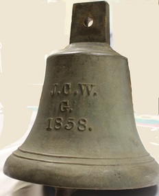
Functional object - Gordon Family Orchard Bell
The Gordons were architects and were associated with many buildings still standing in Albury and Wodonga, St Patrick's Church and the de Kerilleau Homestead among them. They established Vermont Orchard on 74 acres to the south of the Wodonga settlement. Here they grew fruit and nuts for the domestic and export market. The enterprising family also set about transforming some of the land by clearing it, creating streets and making general improvements. It was the biggest subdivision in Wodonga at the time. The 234 allotments in the Wodonga Estate were put up for sale by auction in May 1890. A total of 200 people were said to have attended. Gordon, William, Charles and Vermont streets in Wodonga are named after the family. This bell was used at the Vermont orchard to signal the beginning and end of the working day, as well as lunch breaks.The Gordon Family orchard bell is made of cast iron. It includes the inscription "J. C. W../G./1858." This is thought to represent the initials of John Gordon and sons Walter Joseph and Charles Goodwin Sylvester Gordon. There is some conjecture about this due to the date "1858". John was born in London, England in 1823 and died in 1880. Walter is generally accepted to have been born in 1857 and died 1903. In one family tree Charles is recorded as being born on 28 January 1858 but his birth was registered in 1860. The mystery of the date is therefore not fully resolved.On one side of the bell "J. C. W../G./1858."gordon family wodonga, gordon and gordon architects, vermont wodonga -
Whitehorse Historical Society Inc.
Document, Property Sales Register, 1932 - 1950
Property Sales Register for the Shire of Blackburn and Mitcham, arranged chronologically within Ridings, 1932 - 1950.Property Sales Register for the Shire of Blackburn and Mitcham, arranged chronologically within Ridings, 1932 - 1950.Property Sales Register for the Shire of Blackburn and Mitcham, arranged chronologically within Ridings, 1932 - 1950.shire of blackburn and mitcham, land sales, land subdivision, city of nunawading -
Whitehorse Historical Society Inc.
Document, Certificate of Title - William McConville, 1903, 1929
Certificate of Title in the name of William McConvilleCertificate of Title in the name of William McConville re Lots 44 and 45 on the corner of Victoria Avenue and Albert Streets, Mitcham. Includes details of mortgage registered 16 Jul 1929.Certificate of Title in the name of William McConvillemcconville, william, land titles, shire of blackburn and mitcham, victoria avenue, mitcham, albert street, mitcham -
Whitehorse Historical Society Inc.
Legal record - Land Title, Creation of easement, 1929
Ethel Mary Halley of Wellington Road Marylands S.A., registered proprietor of Lot 4 on Plan of Subdivision 4104 [Tyrrell Avenue Blackburn] to use for the purpose of drainage. Title Vol. 4824 Fol. 964713Ethel Mary Halley of Wellington Road Marylands S.A., registered proprietor of Lot 4 on Plan of Subdivision 4104 [Tyrrell Avenue Blackburn] to use for the purpose of drainage. Title Vol. 4824 Fol. 964713Ethel Mary Halley of Wellington Road Marylands S.A., registered proprietor of Lot 4 on Plan of Subdivision 4104 [Tyrrell Avenue Blackburn] to use for the purpose of drainage. Title Vol. 4824 Fol. 964713tyrrell avenue, blackburn -
 Whitehorse Historical Society Inc.
Legal record - photocopy, Titles Office Register of Easements, 1919 - 1920
Photocopy of Easement Register from the Titles Office.Vertical FilePhotocopy of Easement Register from the Titles Office.land titles, walker, e. e., small, grace newsham, langford, william allan, caplin. ethel grace, bloom, f. a. -
 Whitehorse Historical Society Inc.
Article, New indigenous plants recorded, 23/09/1992 12:00:00 AM
An article discussing the outcome of a project to list, photograph and identify indigenous plants growing on public land in the City of Nunawading. The project has discovered 28 new species. Council staff have collected seed and propagated more than 7000 plants helping to reinstate a number of endangered species. The project has extended to include non-indigenous and exotic plants. Plaques are being created identifying trees.native plants, trees, prestegar, geoff, tree register project, city of nunawading -
Whitehorse Historical Society Inc.
Document, Register of Sales, 1897 - 1906
Minute book containing Register (and alphabetical index) of land sales in and around Melbourne, 1897 - 1906Minute book containing Register (and alphabetical index) of land sales in and around Melbourne, 1897 - 1906 by T.R.B. Morton & Coghll, Auctioneers.Minute book containing Register (and alphabetical index) of land sales in and around Melbourne, 1897 - 1906 land sales, t.r.b. morton & coghill -
Whitehorse Historical Society Inc.
Document, Register of Sales, 1910 - 1911
Pages 1 - 73 of Register of Sales in and around Melbourne, 1910 - 1911Pages 1 - 73 of Register of Sales in and around Melbourne, 1910 - 1911 of T.R.B. Morton & Coghill, Auctioneers, p. 13 - 22 record Blackburn sales.Pages 1 - 73 of Register of Sales in and around Melbourne, 1910 - 1911 t.r.b. morton & coghill, land sales, blackburn -
Clunes Museum
Document - SHIRE DOCUMENT
COLLECTION MINUTES, ADVISE, RE CONSERVATION FOR TOWNSHIP OF CLUNES AND TALBOT RE LOCATION OR UNDER GROUNDING OF POWER AND REGISTER AND ATLAS OF LOCAL GOVERNMENT LAND USE ISSUESlocal history, document, conservation, talbot & clunes shire, heritage project -
 Dandenong/Cranbourne RSL Sub Branch
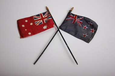
Flag - The Australian Red Ensign Flag and New Zealand Flag, unknown
Likely from WWIPair of miniature flags on small black flag poles with wooden caps. The Australian Red Ensign, or the Australian Civil Ensign, is simply a red version of the Australian National flag. It is for use only at sea and officially never on land, but can be used by private citizens. At sea, it is the only flag allowable for merchant ships registered in Australia under the Navigation and Shipping Act 1912 and The Shipping Registration Act 1981. Pleasure craft, however, may fly either the Red Ensign or the National Flag. The history of the Red Ensign is intertwined with the history of the Australian National flag. From 1901 to 1954 the Red Ensign was used as the National Flag by State and Local Governments, private organisations and individuals. The Blue Ensign was for Government use only, reflecting British practice with its ensigns. The design of the Australian Red Ensign was always kept in step with the Blue Ensign (i.e. with respect to the number of points on the stars, etc.) but there was often public confusion about which was the `correct′ flag to fly. Many thought the choice was merely one of fashion or preference. In 1941, Australia′s Prime Minister Robert Menzies stated that there should be no restrictions on private citizens using the Blue Ensign on land and, in 1947, Prime Minister Ben Chifley reaffirmed this position but it wasn’t until the passage of the Flags Act 1953 that the restriction on civilians flying the Blue Ensign was lifted after which, use of the Red Ensign on land became a rarity. Since 2008, 3 September has been officially commemorated as both Australian National Flag/Merchant Navy Day which allows the Australian Red Ensign to be flown on land for the occasion as a matter of protocol. The blue flag is the New Zealand National Flag.flag, ensign, anzac, new zealand, navy, naval -
 Eltham District Historical Society Inc
Newspaper clipping, Eltham War Memorial Trust: "Garden of Remembrance"; Baby Health Centre First Building, The News: The Newspaper of the City of Heidelberg and of the Shire of Eltham, 11 April 1947, 1947
Report on the second annual meeting of the Eltham War Memorial Trust History of the War Memorial Following the end of the First World War, communities across Victoria and Australia typically erected memorials which were predominantly statues, cenotaphs, avenues of honour and plaques. The Shire of Eltham established the Avenue of Honour at the gateway to the shire as well as an obelisk at the corner of Main Road and Bridge street and the Shire of Eltham War Memorial Tower at Kangaroo Ground. After the Second World War communities once again desired to preserve the memories of those who served and paid the ultimate sacrifice. Resources were scarce so there was a transition away from the traditional style memorials that sprang up post 1918 to one of building facilities that would provide ongoing benefit to the community. Even before the end of the Second World War, the citizens of Eltham began to consider an appropriate form of memorial for those from the area who fought and died in the First and Second World Wars. In 1943 the Eltham Women’s Auxiliary raised funds for the construction of buildings to be established on land to be purchased for the proposed War Memorial. On March 27th, 1945, the Eltham District Progress Association called a meeting of local people who in turn set up and registered the Eltham War Memorial Trust Inc. As a focus for the purpose of the memorial, the newspaper notice read:- ‘Those who have had a member of their family in the fighting services will want to see that the form of a memorial we are concerned with is the one which will be a constant reminder to us of those who fought for us and the little ones for whom they fought and died.’ At that meeting it was decided the Memorial should take the form of a baby health centre along with a creche and children’s library. In late 1945, the newly formed Eltham War Memorial Trust purchased the land at 903-907 Main Road Eltham from Miss Shillinglaw, which once formed part of the Shillinglaw farm on Lot 90 of Holloway’s 1851 “Little Eltham” subdivision. The Governor of Victoria, General Sir Dallas Brooks, laid the foundation stone on November 24th, 1950, in memory of those who fell in the Second World War. The Eltham Infant Welfare Centre was opened November 15th, 1952, the Pre-school on December 1st, 1956, and the Children’s Library in 1961. In late 1966 the children’s library service was integrated into the Heideberg Regional Library Service and the building was officially renamed the Eltham War Memorial Hall. Following the opening of the Eltham Infant Welfare Centre, work began in 1953 planning for the entrance to the grounds, which is signaled by a wrought iron arch entitled “Eltham War Memorial” . In 1954 the Eltham War Memorial Trust decided that a legacy provided by the late Councillor Ernest James Andrew (d. 29 March 1950) in memory of his wife, Mrs. Ellen Andrew (d. 13 July 1946) and who are both buried at Eltham Cemetery, should be used to fund the construction of the entrance. A metal plate inscribed to this effect was attached to the gates. Work on the Memorial Gardens was undertaken throughout the following decade, with a Memorial Forecourt included in the final 1956 plans for the Pre-School Centre. A quote was accepted by the Trust in 1963 for the implementation of a memorial garden, which included grading of a sixty-five foot strip at the rear of the Trust buildings and construction of concrete paths. The stone retaining walls at the front of the site were installed in 1968 when Main Road was widened and it is believed that the Memorial Gates were relocated at that time also. Eltham Senior Citizens Centre In 1964, Eltham Shire Council purchased a section of land from the Trust at the northern end of the site, as a provision for Country Fire Authority buildings. At the same time the Elderly Citizens Club proposed a Senior Citizens Centre on the south western section of the Trust’s property. This was approved by the Trust with the provision that the building was constructed in ‘accord’ with those already existing. In 1965 Council took on board the plans for the Senior Citizens Centre and applied for a government grant. These could only be awarded if Council owned the site. In 1962 the Trust had resolved to hand over the assets to Council once the Memorial Gardens were completed. This was in line with Health Department requirements that grants for the ongoing operation and maintenance of the three facilities would only be made once the the facilities were completed and handed over to Council. In 1965 the Department of Health further demanded substantial alterations to the Pre-School playground as a result of the pending impact of the planned Senior Citizens Centre and Main Road duplication. As a consequence, handover of the Trust’s assets to Council was initiated with a formal ceremony held in the Children’s Library on August 28th, 1965. The Trust continued on as a committee of management for another twelve months. Plans and specifications for the Senior Citizens Centre were prepared by March 1966. Council obtained a grant from the Government which covered one third of the cost and the building was completed by April 1967. Whilst the Senior Citizens Centre is contained within the original Eltham War Memorial building precinct, it was not part of the original Memorial and was not funded by the Eltham War Memorial Trust.Newsprint clippingeltham children's library, eltham infant welfare centre, eltham pre-school, eltham war memorial hall, eltham war memorial trust, women's auxiliary -
Bialik College
Mixed media (series) - Sites & Premises: fundraising appeals and plans for development
1990s, 2000s, 1980s, buildings, development, planning, shakespeare grove, elc, 1970s1990s, 2000s, 1980s, buildings, development, planning, shakespeare grove, elc, 1970s -
 City of Moorabbin Historical Society (Operating the Box Cottage Museum)
Document - Copy of Death Certificate Elizabeth Box 1914, 1914
Elizabeth Avis- Box 1835-1914 was born in Sussex, married William Box in 1854 and arrived in Melbourne in 1855. William’s parents George and Mary Box and his siblings sailed with them. William & Elizabeth at first leased land in the area of the ‘Dendy Special Survey Brighton 1841’ and then purchased the property with the pioneer cottage 1868 & 1869. William & Elizabeth established a market garden and raised 13 children. 1888 they built a larger 2nd house in front of the original cottage. William died in 1902 and Mary sold 9acres in 1908 to W. .Snowden Anderson – it later became Joyce Park where the reconstructed Box Cottage Museum now stands. After Elizabeth died her daughters Ada and Violet lived on the 1acre property until 1917 when August Reitman, a potter and monumental mason, leased the house and land. He established his pottery business and purchased the property in 1935. The business moved in 1953 but continued to use the cottage as a workshop/ storeroom until it was sold to Lewis Timber P/L in 1970 Elizabeth & William Box settled in the pioneer Cottage in Jasper Road East Brighton 1868 and established a market garden whilst raising their 13 children. This Cottage was reconstructed in Joyce Park, Ormond 1984 and is the home of City of Moorabbin Historical Society. In 1960 many local residents responded to a call for the donation of historical artefacts and the Box Cottage Museum now preserves this eclectic collection for the community. A certified true copy of the Death Certificate of Elizabeth Avis- Box 1835 -1914 in a wooden picture frame, obtained from The Births, Deaths and Marriages Office Melbourne Victoria 18/6/1985 THIRD SCHEDULE / DEATHS in the District of East Brighton in the State of Victoria Registered by George William Ward / Dated 1914 / 1st July 1914 Jasper Rd Bentleigh Shire of Moorabbin County of Bourke / Elizabeth Box / Home duties/ …… Dr A T Joyce Certified ‘true copy of an entry in a register’……… Signed by Paul Kenny Registration Officer 18 June 1985 box elizabeth avis, box william, moorabbin, bentleigh, brighton, ormond, pioneers, market gardeners, brighton cemetery, box george, box mary cripps, reitman august, anderson w. snowden, joyce park ormond, box cottage museum dendy’s special survey brighton 1841, -
 City of Moorabbin Historical Society (Operating the Box Cottage Museum)
Document - Photocopy of Land Title 1881, c1881
This is a Certificate of Title for an acre of land in 'Tucker's Road' purchased by Jabez Gurr in 1881, in the area that was part of the Crown Block known as Henry Dendy's Special Survey 1841, in the Parish of Moorabbin, County of Bourke, Victoria. Following the 'Transfer of Land Statute' allotments in the area of Henry Dendy's Special Survey of 1841 were sold to early settlers. This Certificate of Title shows the passage of history in Moorabbin Shire . Jabez Gurr, a wheelwright, of East Brighton, now Bentleigh East, purchased an acre of land in 'Tucker's Road' , near Centre Road, in 1881. In 1889 he sold to a produce merchant, Robert Smith, and in April 1916 this block was purchased by William Henry George Box, a market gardener and relative of William and Elizabeth Box, who owned the land until 1926. The land was then purchased by Charles John Greenlaw Coates and remained with this family until 1971. All these Family names appear on Councils and Community Boards during the foundation and development of City of Moorabbin3 photocopied pages of the Certificate of Title for approximately 1 acre of land near the corner of Centre Road and Tucker Road, Parish of Moorabbin, County of Bourke, Victoria that was part of the 5,120 acre Henry Dendy Special Survey in Brighton in 1841 and purchased in 1881 by Jabez Gurr. It records subsequent proprietors up to 1971Stamped CANCELLED 12 OCT 1994 (top Right) / Entered in the Register Book / Vol.1245 Fol. 248877/ signed Henry Crowe / Assistant Registrar of Titles / Coat of Arms / VICTORIA / Certificate of Title / UNDER THE ' TRANSFER OF AND STATUTE' /dated ' eleventh day of April one thousand eight / hundred and eighty one' / signed 'Henry Crowe' / Assistant Registrar of Titles/ ENCUMBRANCES REFERRED TO / circular Stamp 'OFFICE OF TITLES VICTORIA' / Drawn and shaded on the left side is the area of land in "Tucker's" Road 3331/3 links fro Centre Road, 150 links x 6662/3 links / The measurements are in linksdendy henry, dendy's special survey 1841, brighton, moorabbin, bentleigh, market gardeners, early settlers, pioneers, wheelwrights, merchants, fruit gardens, markets, smith robert, box william henry george, gurr jabez, county of bourke, victoria, melbourne, land statutes, tucker road, centre road, box william, box elizabeth, box cottage museum -
 Buninyong & District Historical Society
Photograph - Black and white photograph, Former Free Library Warrenheip Street Buninyong, 9 April 1994
Built in 1861 on land made available by Mr. Robert Allen. Grant received through municipal council and State Government. Building functioned as a library until 1926. Taken over by Buninyong Cemetery Trust and eventually fell into serious disrepair. Restored in the 1980s after great community effort, dedication and financial contributions.An important early building in the township noted for its unusual and individual classical facade of Oregon pine. Placed on Historical Buildings Register.Black and white photograph of Former Free Library built in1861. Warrenheip streetscape of former free library, currently Buninyong Information Centre, Eastern facade fully visible and Southern weatherboard side. Mature pine trees visible to the side and rear of building. Reading room on left of entrance door and former shop and residence on right.free library, information centre, mr. robert allen, buninyong cemetery trust, mechanics institutes -
Glenelg Shire Council Cultural Collection
Certificate - Certificate of Baptism - James Ward and Thomas Ward, 1854
Displayed in History House.Certified Extract of the Baptism Certificates of James Ward, 12th May 1838 and Thomas James Ward, 4th May 1836 Framed certificate. Page 21 of baptism register for Parish of Launceston in the County of Cornwall, Van Diemen's Land, 1838. Framed with 933.2, Baptism certificate of Thomas James Ward, 4th May 1836. Certified extracts from the Baptismal Registry, 28th June 1854. Carved acorns in frame.Back: Henry Ward Goldsmith/Late of Portland (black pencil, centre)baptism, family record, ward family