Showing 649 items matching "footpath"
-
 Flagstaff Hill Maritime Museum and Village
Photograph - Ship's crew, HMAS Warrnambool J202, 1941
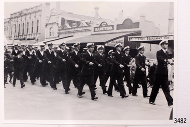
This photograph shows the crew of the first HMAS Warrnambool (J202) marching east along Timor Street in Warrnambool, just opposite the Post Office on the corner of Gillies Street. People are watching the parade from the footpath and two boys, dressed in their ‘best’ clothes, are marching alongside the crew. The HMAS Warrnambool was one of 60 Bathurst class corvette vessels built during World War II for the Royal Australian Navy (RAN) as armed minesweepers. The namesake of the City of Warrnambool, Victoria, was launched in Sydney in 1941. The HMAS Warrnambool began service with patrols off Bass Strait in 1941. In December the ship docked in the Warrnambool harbour at Lady Bay. The crew came ashore and performed a march for the city. The Mayor, Cr. John R Astbury presented them with a plaque of the City of Warrnambool’s Coat of Arms and the Warrnambool Patriotic Fund gave them a gift of 110 books for the crew’s library. The Warrnambool served in Darwin during the time it was bombed, it was involved in several rescues and carried troops to New Guinea, it carried out escort and patrol duties on Australia's east coast, then at Fremantle and back to Darwin. The ship was at Timor when the Japanese surrendered in 1945. It performed mine clearance work around the Solomon Islands and New Guinea after the war. In 1947 the HMAS Warrnambool was at the Great Barrier Reef, off the Queensland coast, to clear the defensive British mines previously laid to protect Australia’s boarders. The ship hit a mine near Cockburn Reef, exploded and sank shortly afterwards. One of the 70 or so men on board was killed and three died later. The rescued men were transferred by boats to the nearby HMAS Swan II, which took the survivors to Cairns. The four deceased were Victorian seamen. In May 1948 the Royal Australian Navy divers recovered a number of items from the wreck, including the ship’s bell and the City of Warrnambool plaque. In 1949 the RAN returned the plaque to the Warrnambool City Council, and donated the ship’s bell to the Australian War Memorial. Further objects were recovered in 1972-75 by Southern Cross Diving and Salvage. A memorial plaque was erected in Warrnambool on September 13, 1995 in honour of all who served on HMAS Warrnambool. NOTE: (1)- HMAS Warrnambool II (FCPB204 was built in 1980 in Cairns, with a compliment of 22 personnel. It was decommissioned in 2005. (2)- SS Warrnambool, a steam and sail ship, was built in 1892 in London and broken up in 1926. [A more detailed history can be found in our Collection Record 3477.]This photograph is significant for its association with the lifesaving rescue of the crew and the sinking Royal Australian Navy vessel, HMAS Warrnambool (J202). The HMAS Warrnambool played a nationally significant role in overturning Australia’s Immigration Restriction Act 1901 (colloquially known as the White Australia policy). The ship rescued, and brought to Australia, Samuel and Annie Jacob and their family after they evacuated Dutch East India. The family was threatened with deportation and made the first successful appeal to High Court regarding that Act. The HMAS Warrnambool has - Local significance for being the namesake of the City of Warrnambool - Local significance, having docked in Warrnambool Harbour - Local significance, the crew having paraded in Timor Street, Warrnambool - State significance for its first patrol being in Bass Strait. - National significance, being present in Timor at the Japanese surrender - National significance, shown by the significance of the ship’s bell being curated as Military Heritage and Technology at the Australian War Memorial. - National significance as part of Australia’s defence force history, being one of only four Bathurst class corvettes lost while in Australian service, the only Bathurst class corvette lost after World War II, the only RAN vessel to be sunk by a mine, and associated with the last four Navy deaths of WWIIPhotograph of the crew of HMAS Warrnambool J202. This black and white image shows the crew marching east along Timor Street in Warrnambool. People are watching from the footpath and two formally dressed boys are marching alongside the sailors. Inscription on the reverse.(PRIVATE details - See Notes)flagstaff hill, maritime village, maritime museum, warrnambool, shipwreck coast, mort's dock & engineering co ltd, h.m.a.s. warrnambool, hmas warrnambool, hmas warrnambool i, hmas warrnambool j202, hmas swan ii, j202, world war ii, bathurst class corvette, royal australian navy, ran, sydney built ship, bass strait patrol, sea mine patrol, mine sweeper, mine clearance, navy divers, great barrier reef, cockburn reef, southern cross diving and salvage, warrnambool city council, cr j r astbury, mayor j r astbury, warrnambool patriotic fund, seal, coat of arms, dedicatory plaque, hmas warrnambool 1941, shipwreck by sea mine 1947, sinking ship, sunk ship, marching, parade, timor street warrnambool, minesweeper -
 Phillip Island and District Historical Society Inc.
Photograph - Post Card, 1900's
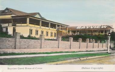
One of two photographs donated by Jean ArchibaldColoured Postcard of Bayview Guest House, showing long brick fence with strip of grass, footpath and nature strip with one street lamp."Bayview Guest House at Cowes" "(Bulmer Copyright)"cowes guest houses, bayview guest house cowes, phillip island, jean archibald -
 Stawell Historical Society Inc
Photograph, Literary Institute at Pleasant Creek
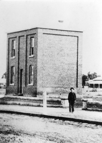
Literary Institute at Pleasant Creek, Stawell West. Built in 1868 and classified as part of a group by National Trust buildings. Worksheet notes state the building is one of the earliest known cavity wall buildings.Early black & white photograph of the two story Literary Institute built in 1868. Man, or boy standing on footpath near stone fence.stawell -
 Stawell Historical Society Inc
Photograph, Harris Home Great Western c1900's
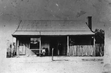
Great WesternBlack & White photograph of Harris Family home, Weatherboard cottage at Great Western next to Great Western Hall. Note Tap on Footpath. -
 Canterbury History Group
Photograph - M. White, Estate Agent, c1920
Matthew White on the footpath outside the shop he shared with Miss Duggan's confectionary at 209 Canterbury Road. c1910. Black & White photograph.canterbury, canterbury road, white> matthew, duggan> miss -
 Stawell Historical Society Inc
Photograph, Town Hall Hotel c1910-1920 with Car & People at the front, c 1910 - 1920
After hotel has been extended and Veranda has been expanded from 5 Bays to 8 B/W Photo of Town Hall Hotel c1910 -1920. Tourer Car Parked at front of Hotel and People Standing on footpath and on Balcony. -
 Sunbury Family History and Heritage Society Inc.
Photograph, Rosa McCall, 2000
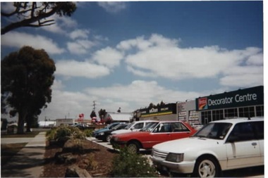
The commercial development was built along Horne Street between Mitchells Lane and Neill Street in 2000 on land that had been open space. This development was one of many that reflected the growth of Sunbury from an country town to an outer suburb of Melbourne.A coloured photograph of a commercial centre with cars parked in the designated area in front of the businesses. Along the roadside and bordering the footpath are large gum trees. horne street, neill street, mitchells lane, pasley street, sunbury, commercial development -
 Vision Australia
Photograph - Image, Mrs Walker and Mrs Mealing, May 1968
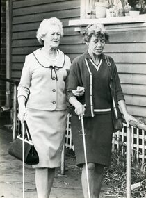
Mrs Walker and Mrs Mealing using their white canes as they walk along a sloping footpath.B/W photograph of two women with white canesMobility - historicalroyal blind society of nsw, white cane day, mrs mealing, mrs walker -
 Glen Eira Historical Society
Photograph, Murrumbeena Road, 229A, Murrumbeena, 2001
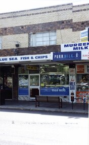
Originally labelled "Beauville Estate, Established 1936, Still Thriving 65 years on, 10th March 2001", the Beauville Estate Album contains colour photographs of houses in the Estate. They were taken around the time of the Beauville Estate’s 65th Heritage Celebration held on 10/03/2001 and donated to the Caulfield Historical Society shortly afterwards. Photographer unknown. From Glen Eira’s Heritage Management Plan by Andrew Ward (1996) Vol 2 p78: In Murrumbeena Road, the shops which form part of the estate are a simple cream brick row relieved by manganese bricks in bands across the upper storeys.City of Glen Eira’s Heritage Management Plan Vol 2 p79 (this is p84 of the pdf version) – HO12 Beauville Estate and environs, Murrumbeena: The Beauville Historic Area is important at the State level as the first large housing estate undertaken by the AV Jennings Construction Co, later Jennings Group Limited, Victoria’s largest home builder. It is important also as a very early estate development incorporating a range of features other than houses and including made roads, shops and recreation facilities. In this respect it was the forerunner of the comprehensively planned housing estate of the post war era. The estate is distinguished by its aesthetic values, as is the earlier and comparable Hillcrest Estate, which are formed by a combination of restrained diversity in house styles, with the exception of no. 30 in the emerging International style, and by a landscaped garden environment. Colour photograph of a section of a double storey, unpainted brick, commercial property containing shops at ground level all with awnings over the footpath. This specific property is a fish and chip shop. The upper storey brick residence features a curtained window, a flat roof and decorative two tone bands of brickwork. It has a large street seat on the footpath out front.BLUE SEA FISH & CHIPS / TAKE AWAY FOODmurrumbeena, architectural styles, 1930's, inter war style, a.v. jennings, av jennings, jennings, beauville estate, murrumbeena road, milk bars, commercial establishments, flats, fish & chip shops, sir albert victor jennings, a v jennings construction co, beauville estate heritage area, glen eira city council, architectural features, jennings group limited, land subdivision, beauville historic area, brick features, restaurants -
 Marysville & District Historical Society
Photograph (Item) - Black and white photograph, Unknown
A black and white photograph of Barton Bros Store in Marysville in Victoria.A black and white photograph of Barton Bros Store in Marysville in Victoria. Thomas John Barton was born in 1836 in Gloucestershire and after his father died in 1850 arrived in Melbourne in 1852 along with his mother, adult sisters, younger brothers, his uncle, his uncle's wife Suzanna and their family. Thomas tried gold mining at Woods Point but found it too difficult. He then partnered with Ewen Hugh Cameron to provide the miners with meat. In 1864 they purchased a plot of land in Marysville and set up a butchers/abattoirs and from there began their business of taking supplies to the miners at the nearby Woods Point and Jamieson goldfields. In 1865 the business was firmly established and Thomas married Selina Croker at Heidelberg and brought her back to Marysville. Their first home was 'The Chestnuts', which included the store, and was situated on the town side next to the Steavenson River. Sadly, in 1876 Selina died of complications after giving birth to their sixth child. Thomas was in need of a nanny to care for his six children, including the newborn baby, and so he employed Emily Ada Sparke, who is the eldest daughter of the local school teacher. Thomas and Emily subsequently marry in 1878 and they go on to have a further 10 children over the next several years. Thomas assisted in the establishment of the first school in Marysville in 1870 and remained a very active member of the community including as a Councillor for the Shire of Healesville, Shire President and he was also appointed as a Justice of the Peace. Thomas died in Carlton in 1911. After their father's death, his sons Fred and Frank took over the family business, which was then known as Barton Bros Store which continued to operate until sometime in the 1970's.marysville, victoria, barton's store, thomas john barton, ewen hugh cameron, woods point, jamieson, gold mining, goldfields, selina croker, the chestnuts, emily ada sparke, shire of healesville, fred barton, frank barton, barton bros store, francis adam barton, frederick john barton, photograph, barton's garage, barton bros stables -
Port Melbourne Historical & Preservation Society
Photograph - Footpath widening Bay Street between Liardet and Pool Streets, Port Melbourne, Ron Laing, 2000
Part of Ron Laing's collection of photographs recording Port Melbourne over a thirteen year period. Donated to the PMH&PS by the photographer.A set of six colour photographs showing the reconstruction work under way on the extra width footpaths in Bay Street between Liardet and Pool Streetsengineering - roads streets lanes and footpaths, built environment, ron laing -
Whitehorse Historical Society Inc.
Article, Seniors plea for safe path, 1991
Senior citizens living beside the Burwood Highway at Vermont South believe a fatal or serious injury is inevitable unless money is provided urgently for a footpath.Senior citizens living beside the Burwood Highway at Vermont South believe a fatal or serious injury is inevitable unless money is provided urgently for a footpath.Senior citizens living beside the Burwood Highway at Vermont South believe a fatal or serious injury is inevitable unless money is provided urgently for a footpath.aged people, retirement homes and villages, vermont retirement village. -
 Whitehorse Historical Society Inc.
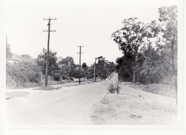
Photograph, Blackburn Road Looking South, 1960
Black and white photograph of Blackburn Road looking south from Canterbury Road in January 1960. Note lampposts and made footpath on the left side.blackburn road, canterbury road -
 Ballarat Heritage Services
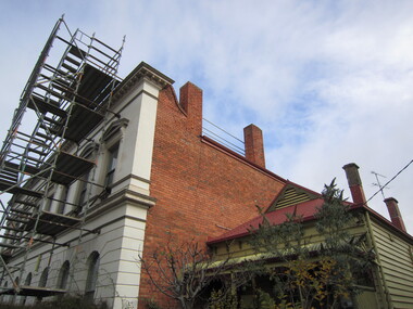
Photograph - Cottage, 18 Lyons Street South, Ballarat Central, 2023, 2023
Colour photographs of a large development being built at the back of 18 Lyons Street South, Ballarat Central. Photographs were taken from the footpath.lyons street south, ballarat -
 Lakes Entrance Historical Society
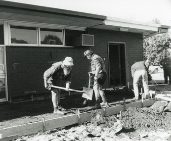
Photograph - Health Facility, Lakes Post Newspaper, 1994
Black and white photograph three workmen with shovels preparing ground for footpath during renovation works at the Community Health Centre. Lakes Entrance Victoriahealth services, maintenance -
 Ithacan Historical Society
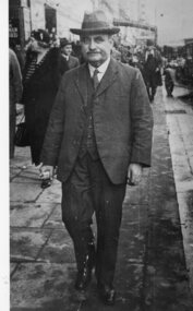
Photograph, Dionisis (Dennis) Lekatsas, c 1962
The man in the photograph is Dionisis (Dennis) Lekatsas (Matios).A black and white photograph of a full length view of a well-dressed man walking along a footpath in a city street. The photograph has a white border. dionysios, denis -
 Eltham District Historical Society Inc
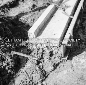
Negative - Photograph, J.A. McDonald, Eltham, Pryor Street, Sep. 1955
Construction of new concrete kerbing and footpath in Pryor Street, Eltham 18” tray and AG backing(?)Record of various Shire of Eltham infrastructure works undertaken during the period of 1952-1962 involving bridge and road reconstruction projects, sometimes with Eltham Shire Council Project Reference numbers quoted. It was during this period that a number of significant improvements were made to roads and new bridges constructed within the shire that remain in place as of present day (2022). In many situations, the photos provide a tangible visible record of infrastructure that existed throughout the early days of the Shire. The album was put together by or under the direction of the Shire Engineer, J.A. McDonald.1955-09, footpaths and gutters, pryor street, infrastructure, shire of eltham -
 Greensborough Historical Society
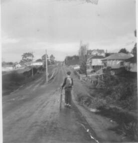
Photograph - Digital image, Nance Reardon, Grimshaw Street looking towards Cordner's 1950s, 1950s
Photograph of Grimshaw Street looking towards Cordner's house. Note the two-level road and no footpath.Digital copy of black and white photograph.simons family, grimshaw street greensborough, cordner family -
 City of Ballarat Libraries
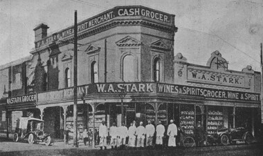
Photograph - Card Box Photographs, W.A. Stark's Grocer, Wine & Spirits Merchant Store 1916. From Citizens & Sport publication
Located on the corner of Bridge and Peel Streets. 8 staff stand on the footpath. Large display windows. w.a. stark, commericial, building, bridge street, peel street, people, vehicle -
Rutherglen Historical Society
Fire hose tap cover, T Yates, 1870-1910 (Approximate)
Rutherglen Borough Council and Fire Brigade hose taps in footpaths were covered by these small iron boxesSquare iron box with hinged lid. Foundry cast ironOn lid: "T Yates Rutherglen"fire brigade, fire hose taps, rutherglen borough -
 Phillip Island and District Historical Society Inc.
Photograph, Early 20th Century
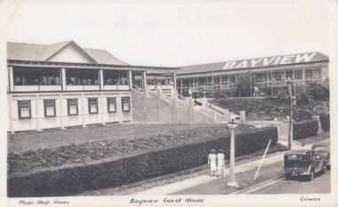
One of a collection of 7 photographs donated by Steve Stefan, Archivist, St Frances Church, MelbourneBlack & White copy of a postcard showing Bayview Guest House, Cowes. People on the Verandah and man in the garden. Two women walking along the footpath in front."Photo Shop Series" "Bayview Guest House" "Cowes"bayview guesthouse cowes, guesthouses cowes phillip island, steve stefan -
 Federation University Historical Collection
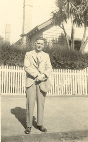
Photograph - Black and White, Arthur Stevens, Frank Wright in Pleasant Street, Ballarat, 1928, 02/1928
Frank Wright was a renown resident of Smeaton, where he was born. He lived at Laura Villa, and attended Smeaton State School. His father William was a gold miner and his mother's name was Sarah. Their family won many singing and instrumental awards. Frank was tutored by Percy Code and was awarded a gold medal for the highest marks in the ALCM examinations in the British Colonies at the age of seventeen years. He became the Australian Open Cornet Champion by the age of eighteen. A year later, Frank conducted the City of Ballarat Band, and later the Ballarat Soldiers’ Memorial Band. He formed the Frank Wright Frisco Band and Frank Wright and his Coliseum Orchestra. These bands won many South Street awards, and Frank as conductor won many awards in the Australian Band Championship contest. In 1933 Frank Wright sailed to England to conduct the famous St Hilda’s Band and was later appointed Musical Director of the London County Council, where he organized many amazing concerts in parks, in and around the London district. He was made Professor of Brass and Military Band Scoring and conducted at the Guildhall of Music and Drama. Frank was often invited to adjudicate Brass Band Championships around Europe, in Australia, including South Street and in New Zealand. The Frank Wright Medal at the Royal South Street competition is awarded to an individual recognized as making an outstanding contribution to brass music in Australia.Black and white photograph of a man dressed in a suit standing on the footpath in front of a picket fence behind which is a hedge and a timber house. The man is Frank Wright.Written in pen on back - Taken by Arthur Stevens in Pleasant St Ballarat., Feb.1928frank wright, cornet, conductor, ballarat, picket fence -
Port Melbourne Historical & Preservation Society
Photograph - North Sandridge, 1870s
One of a set of prints given by Syd Anderson (Town Clerk 1920-59) to his daughter-in-law Phyllis (donor). Photos in the set were exhibited in 1873 at the Melbourne Exhibition.North Sandridge/North Port station in the 1870s with footpath across railway reserve, Station Place in background. Hotel appears to be Lord Raglan Family Hotel"P. Anderson" ink, on back.transport - railways, built environment, sydney sims anderson, town clerks, station street, station place -
 Buninyong & District Historical Society
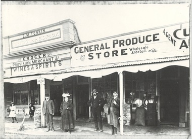
Photograph - Photograph of Original Photograph, Derek Leather, Tonkin's Grocer and Produce Store, Learmonth St. c 1910, Copy of original photograph made 1970-80
Historic BuildingsB/W Photo of original photograph, Tonkin's Grocer and Produce Store, Learmonth St. c 1910, people in front, produce visible on footpath and in windows.buninyong, learmonth st., tonkin's grocer, brydon & hedrick building, bluestone cafe -
 Clunes Museum
Photograph, PADDYMELON IMAGES, CLUB HOTEL, 2001
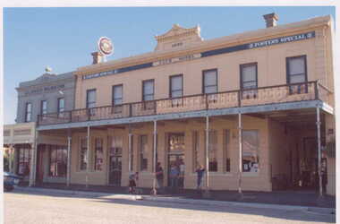
PHOTOGRAPH COPY OF CLUB HOTEL BUILT 1870 AND CLUNES MUSEUM BUILDING 1860. THIS PHOTOGRAPH WAS ON DISPLAY AT SMEATON MILL OPEN DAY 2001. CLUNES HOTELS - NOW AND THEN..1 COLOURED PHOTOGRAPH CLUB HOTEL, CLUNES AND CLUNES MUSEUM WITH FOUR MALE PATRONS AND DOG STANDING ON FOOTPATH. .2 LAMINATED COPY OF THE ABOVE PHOTOGRAPHREVERSE SIDE - ENTERPRISE VISION PTY. LTD. ABN. 95 005 604 544. COPYRIGHT CLUNES, VICTORIA.club hotel, clunes museum -
 Peterborough History Group
Photograph - James Irvine Memorial
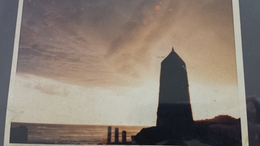
Photograph of the Memorial to James Irvine, Hotel Proprietor, who drowned whilst crossing the Curdies River. The Memorial was erected by the towns people.Significant because it is a memorial to a respected notable resident of the town who tragically drowned crossing the Curdies River 4 x 6 inch sepia photograph of the sunset with James Irvine Memorial in the foreground. Date unknown but appears to be taken prior to footpath and fencing renovations.curdies river, james irvine, peterborough, james irvine memorial -
 Whitehorse Historical Society Inc.
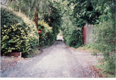
Photograph, Hill Street, Blackburn, 1/06/2003 12:00:00 AM
Coloured photograph of Hill Street, Blackburn showing tree lined narrow street with no footpaths. - Private street classified by National Trust as part of the Bellbird area.bellbird area, hill street, blackburn, national trust of australia (victoria) -
 Clunes Museum
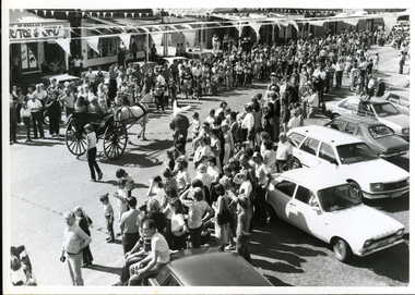
Photograph, BACK TO CLUNES 1982, 1982
BLACK AND WHITE PHOTOGRAPH 0F BACK TO CLUNES 1982 STREET PARADE HORSE DRAWN GIG, CROWDS LINING STREET, CARS PARKED AT EDGE OF FOOTPATH.photography, events and celebrations, back to clunes, street parade 1982 -
 Linton and District Historical Society Inc
Photograph, Traquair House, Sussex Street, Linton, 1988
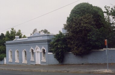
Built 1860 as Bank of New South Wales - banking chambers and residence. Sold 1903 to Mr Lewers (son of Samuel Lewers, first manager of the bank in Linton). Lived in by members of the Lewers family until the 1950s. Stella Surman nee Todd bought the building when she returned to live in Linton c.1962. Jim and Cynthia Mason ran an antique and Devonshire tea restaurant 1981-84. Photograph taken in 1988.Colour photograph showing long brick building with chimney, painted blue with white trim, fronting footpath at corner of two streets with shrubbery beside and behind.traquair house, bank of new south wales linton -
 Lakes Entrance Historical Society
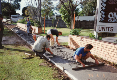
Photograph - Public Works Lakes Entrance, Lakes Post Newspaper, 1994
This photo appeared in the Lakes Post 16 June 1994, p 22Colour photograph of Steve Brazzale and work crew concreting the footpath on the south side of Roadknight Street, when the municipality was the Tambo Shire. Lakes Entrance Victoriaconstruction, public works