Showing 381 items matching "route 10"
-
 Kiewa Valley Historical Society
Black and White photograph of Road Making Machinery, Kiewa Road Making 25/8/1938(No. 3 in a series of 8), 25/08/1938
Construction of the main road from South Tawonga to the Bogong High Plains, to provide access to the construction sites for the new Kiewa Hydro Electric Scheme, was commenced early in 1938, the work being undertaken on behalf of the Commission by the Country Roads Board. For the construction work, the Commission purchased three Caterpillar - model R07 - diesel crawler tractors equipped with Kay Brunerei (Brunner) hydraulically operated trail builders (angle dozers)). This acquisition resulted from a visit to the United States of America in May, 1937 by the Construction Engineer ( Mr. C.H. Kernot) and Assistant Civil Engineer (Mr. J.F. Douglas) where they saw this relatively new type of equipment in use. With the co-operation of the CRB, the Commission demonstrated the operation of these machines at Fishermen's Bend on 6th April, 1938. They were then sent to Kiewa where they commenced operation towards the end of the month. From South Tawonga, the route led immediately across the Western Branch of the Kiewa River necessitating the construction of a bridge 100 feet long. By the end of 1939,the excavation had been 'opened up' for a distance of 19 1/2 miles (approx. 31 km.) and of this length, 10 miles (approx. 16 km) had been surfaced.The purchase and use of this type of mechanical equipment in road making was a huge investment, as prior to this most of the work would have been done manually with the use of picks and shovels. Not only were many months of hard manual labour saved, but a very significant amount of time in providing access to the proposed work sites for the new Kiewa Hydro Scheme. This photo is an excellent reminder of how primitive the early machinery was compared to the present but also represents the forward thinking of the State Electricity Commission's Engineers in purchasing such new and innovative equipment.A black and white photograph of a Caterpillar diesel crawler tractor and a hydraulically operated trailbuilder (angle dozer) making a road in the Mt. Beauty area.Hand written in black ink in the top left hand corner are the words "Kiewa Road Making 25/8/1938". On the upper right hand of the photograph has been stamped the number 3. On the back is stamped the word 'Velox' severaly times, which is the make of the photograhic paper. roadmaking, caterpillar tractor, kiewa, state electricity commission -
 Kiewa Valley Historical Society
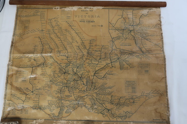
Map - Railway Map of Victoria, Amended to 1/11/1945
Railways began in the 1850s and were privately owned and operated. Later they were taken over by the Victorian Government reaching a peak in the early 1940s.Steam trains were followed by electric trains with both running after the war in 1945.Bright was the closest station to the Kiewa Valley but road transport was used more often as the Kiewa Valley Highway was improved with the construction of the Kiewa Hydro Electric Scheme. To travel to Melbourne or Sydney by train residents went via Wodonga/Albury where they also did their shopping.Plastic on parchment with detailed railway routes (in green) across Victoria including each district's 'Road Foremen' and 'Depots'. There is a length of flat wood attached by 10 tacks across the top of the mapvictorian railways 1945, trains, transport -
 RSL Victoria - Anzac House Reference Library and Memorabilia Collection
Diary of Herbert Newton Lowe, Herbert Newton Lowe, March 1917 to February 1918
Diary covers the period from 9 March 1917 to 10 February 1918 on the Western Front. Lowe was later (Aug 1918) to be awarded the Military Medal for his actions on the Somme. Military Medal 'On the 11th/12th August, 1918, during operations on the SOMME, near PROYART, this man, just previous to the attack showed great devotion to duty in laying and maintaining alternative routes up to the front line, and after the attack had commenced he acted as linesmen, and throughout the operation, during which the lines were cut on several occasions, he went out under heavy shell and machine gun fire and repair the lines thereby enabling communication to be maintained and valuable information reaching Headquarters without delay. His splendid example inspired his comrades to volunteer to continue this most important work should he become a casualty.' Source: 'Commonwealth Gazette' No. 61 Date: 23 May 1919Black, softcovered notebook. WW1 diary of Herbert Lowe (3rd Divisional Signal Company, Reinforcement 1 Wireless Section).ww1, western front, diaries, herbert newton lowe, 3 divisional signal company -
 Eltham District Historical Society Inc
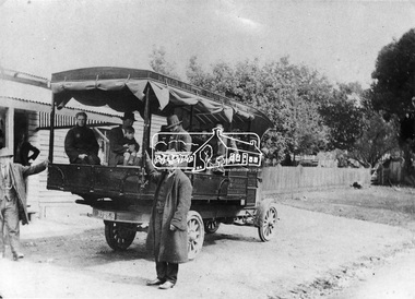
Negative - Photograph, Mail coach en route to Hurstbridge, c.1922
Coach with flaps takes aboard passengers. It travelled between Kinglake and Hurstbridge. The vehicle has advertising on the side indicating: W. BODY. HURSTBRIDGE bread and pastry. The Advertiser on 15 Sep 1922 has a display advertisement on page 2 indicating that Hurstbridge bakery 'W. Body wishes to notify the Public of Hurstbridge and surrounding district that he has purchased Mr Oliver's business'. The Advertiser, Friday 10 November 1922, page 2: Mr J. D. Chalmers, who runs the motor service from Hurstbridge to Kinglake, has just had a large, body built on a two-ton motor, which will be serviceable for either 25 passengers or general goods. The work was entrusted to Mr. D.G. Graham, motor and coach builder, Hurstbridge, who completed it within a month, the finish, painting, etc.. being quite up to the standard of a city shop. The mail coach operated the route between Kinglake and Hurstbridge motor route, on which Mr. Sharpe had pioneered and run a motor mail route with a bus which carried 20 passengers, for many years but Sharpe's license for his motor bus was refused by the Country Roads Board mid 1930 as his bus was considered too large . In February 1935, Mr Sharpe was granted a license to carry passengers between Hurstbridge and Kinglake and Mr Kell between Kinglake and Hurstbridge. In 1936 the mail contract from Heidelberg to Knglake was via car and members of the community were concerned that there was no further any conveyance of passengers from Hurstbridge to Kinglake.This photo forms part of a collection of photographs gathered by the Shire of Eltham for their centenary project book,"Pioneers and Painters: 100 years of the Shire of Eltham" by Alan Marshall (1971). The collection of over 500 images is held in partnership between Eltham District Historical Society and Yarra Plenty Regional Library (Eltham Library) and is now formally known as 'The Shire of Eltham Pioneers Photograph Collection.' It is significant in being the first community sourced collection representing the places and people of the Shire's first one hundred years.Digital image 4 x 5 inch B&W Neg 9 x 12.5 cm B&W printsepp, shire of eltham pioneers photograph collection, kinglake, mail coach, w. body, public transport, bus, bus travel, hurstbridge, pioneers and painters -
 Marysville & District Historical Society
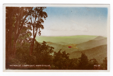
Photograph (item) - Colour tinted photograph, Valentine Publishing Co. Pty. Ltd, Nicoll's Lookout, Marysville No.10, 1923-1963
An early colour tinted photograph of Nicholl's Look-out near Marysville in Victoria. This photograph was published by the Valentine Publishing Co Pty. Ltd. as a souvenir of Marysville.An early colour tinted photograph of Nicholl's Look-out near Marysville in Victoria. This lookout is situated on the Marysville-Wood's Point Road. The Marysville-Woods Point Road was originally part of the Yarra Track, constructed in the early 1860s to provide access between Healesville and the Woods Point Goldfields. Despite the steep terrain and engineering difficulties, the Yarra Track soon became a busy route used by pack horses, horse-drawn drays, and wagons. Today this sealed mountain road is a popular scenic drive between Marysville and Warburton. This photograph was published by the Valentine Publishing Co Pty. Ltd. as a souvenir of Marysville.marysville, victoria, valentine publishing co, souvenir, nicholl's look-out, mining, yarra track -
 Marysville & District Historical Society
Photograph (item) - Black and white photograph, Valentine Publishing Co. Pty. Ltd, Nicoll's Lookout, Marysville No.10, 1923-1963
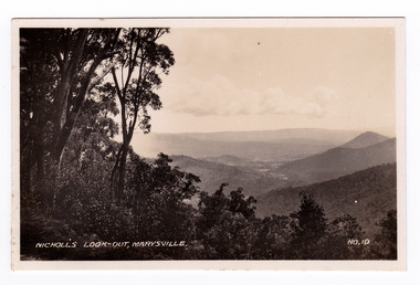
An early black and white photograph of Nicholl's Look-out near Marysville in Victoria.An early black and white photograph of Nicholl's Look-out near Marysville in Victoria. This lookout is situated on the Marysville-Wood's Point Road. The Marysville-Woods Point Road was originally part of the Yarra Track, constructed in the early 1860s to provide access between Healesville and the Woods Point Goldfields. Despite the steep terrain and engineering difficulties, the Yarra Track soon became a busy route used by pack horses, horse-drawn drays, and wagons. Today this sealed mountain road is a popular scenic drive between Marysville and Warburton. This photograph was published by the Valentine Publishing Co Pty. Ltd. as a souvenir of Marysville.marysville, victoria, valentine publishing co, souvenir, nicholl's look-out, mining, yarra track -
 Glen Eira Historical Society
Article - Rosstown Railway
This file contains three items: 1/A review of the ROSSTOWN RAIL TRAIL from LIVING IN GLEN EIRA, vol. 11, 2004, Issue 4, no. 25, date and author unknown. The review explains the purpose of the Rail Trail with a brief narrative of the history behind Rosstown Sugar Mill Railway line. Concluding with information on the location of the Trail and the expected time required to walk the entire track included in the review is a map of the Rail Trail, which marks significant sites along the trail with historic pictures. 2/A newspaper article from THE AGE, dated Tuesday 21/10/1980 and written by Iola Matthews, reporting on the circumstances that led to the publication of the book RETURN TO ROSSTOWN written by Des Jowett and Ian Weickhardt. The article begins with a brief biography of the authors before moving into details of the book’s content, providing a further biography of W. Murray Ross which includes information on his financial ventures – particularly the Rosstown Rail – his marriage and children. The article includes a black and white photograph of Weickhardt and Jowett walking along the route of the railway line, an illustration of the Rosstown sugar works and a map of the area surrounding the site of the mill. 3/Three photocopies of a black and white illustration of the Rosstown sugar works from the east, undated and artist unknown.rosstown rail trail, rosstown, ross william, ross w. murray, ross murray, sugar beet mills, mills, elsternwick, land transport, railways, railway lines, railway routes, carnegie neville street, carnegie miller street, factories, market gardens, horticulture, peat, soils, land forms, topography, geology, civic issues, cone sugar industry, elsternwick plaza, elsternwick, glenhuntly road, parks and reserves, ee gunn reserve, caulfield racecourse, sportsgrounds, caulfield, carnegie, riddell parade, clarence street, aileen avenue, princes park, dover street, marara road, oakleigh road, rosanna street, murrumbeena crescent, north road, kooyong road, hawthorn road, booran road, koornang road, poath road, warragul road, railway platforms, railway buildings, bambra road, swamps, landforms, landfill, council landfill, railway bridges, bridges, railway underpasses, sporting clubs, tennis clubs, bowls clubs, rosstown railway, rosanna street reserve, maps, railway maps, living in glen eira, weickhardt ian, jowett des, caulfield south, curraweena road, oakleigh, caulfield technical school, return to rosstown, beet sugar industry, crops, land booms, land development and subdivisions, bent thomas, fink benjamin, sugar works, rosstown hotel, oamdenong road, rosstown dry cleaners, shops, rosstown road, rosstown plate, people by circumstance, migrants, accountants, occupations, professionals, the grange, real estate, grange road, financial agents, judges, rosstown estate, financial trouble, rabbit preserving, breweries, political debates, political issues, political electorates, politics, political science, debt, financial loans, court procedures, court cases, legal events and activities, malleson and riggall, widowers, seabeach railway, economics, economic deadline, depression 1890s, economic crash, mortgages, divorce, social problems, poverty, ross claude, ross roderick, world war 1914-1918, wars, military history, servicemen, australian flying corps, engineers, caulfield council, swagmen, homelessness, glenhuntly road, glenhuntly road tram, woornack road, leila road, wild cherry road, melten avenue, illustrations, steam trains, trains, horse and cart, horse-drawn transport, railway stations -
 Federation University Historical Collection
Photograph - Photograph - Sepia, Ballarat School of Mines Cadets, 1916, c1916
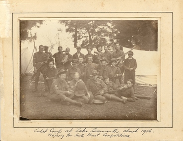
Field Marshal Viscount Kitchener of Great Britain was invited by Prime Minister Deakin in 1909 to visit Australia and advise on the best way to provide Australia with a land defence. Kitchener’s report echoed the bill, introduced to Parliament in 1909 and supported by the Opposition Labor Party at its 1908 conference, to introduce compulsory military training in peace time (referred to as universal training). On 1 January 1911, the Commonwealth Defence Act 1911 (Cth) was passed as law and all males aged 12 to 26 were required to receive military training. Men were divided according to age, with junior cadets comprising boys 12-14 years of age, senior cadets comprising boys 14-18, and young men aged 18-26 assigned to the home militia defence. The support of schools was vital to the success of the scheme, since the system of cadet training began in the primary schools, with physical training prescribed by military authorities. Junior cadet training was entirely in the hands of school teachers, who had first been trained by military officers. This early training was less military in nature than focused on physical drill and sport. It also acted to inculcate boys with the notions of loyalty to country and empire. At this age, uniforms were not worn, although there were schools with pre-existing uniformed cadet units, who continued to do so. Senior Cadets were organised by Training Areas, administered by Area Officers. If a school had at least 60 senior cadets, they could form their own units. Unlike their junior counterparts, Senior Cadets were issued uniforms, a rifle, and learned the foundations necessary for service in any arm of the defence forces. Boys and men could be exempted from compulsory training if they lived more than five miles from the nearest training site, or were passed medically unfit. Those who failed to register for training were punished with fines or jail sentences, and the severity of this punishment generated some of the strongest opposition to the scheme. While institutions such as the political parties and most churches generally supported universal training, some in the broader labour movement were less enthusiastic, as evidenced in the Daily Herald newspaper’s editorials and letters. Universal military training persisted after the conclusion of World War 1, with the Junior Cadet scheme the first to go, in 1922. Senior cadets and service with the militia was suspended in November 1929. (http://guides.slsa.sa.gov.au/content.php?pid=575383&sid=4788359, accessed 29/10/2015) According to Neil Leckie, Manager of the Ballarat Ranger Military Museum: * Originally 12 – 14 year olds went to Junior Cadets attached to their school. * From age 14 – 17 they were Senior Cadets attached to the local militia unit. * After 1 July of the year a Cadet turned 18, the Cadet left the Senior Cadets and became a member of the Citizen Military Force. * In October 1918 the AIF, Militia and Cadets were renamed to give some connection to the AIF battalion raised in the area. Ballarat saw: 8th Australian Infantry Regiment comprising: * 8th Battalion AIF renamed 1st Battalion 8th Australian Infantry Regiment * 70th Infantry Militia renamed 2nd Battalion 8th Australian Infantry Regiment * 70th Infantry Cadets renamed 3rd B, 8th Australian Infantry. 39th Australian Infantry Regiment comprising: * 39th Battalion AIF renamed 1st Battalion 39th Australian Regiment * 71st Infantry Militia renamed 2nd Bn, 39th Australian Infantry Regiment * 71st Infantry Cadets renamed 3rd Bn, 39th Australian Infantry Regiment Prior to the reorganisation in 1918 the 18th Brigade was the 70th, 71st and 73rd Infantry. It is thought that the 18th Brigade Cadet units in 1920 were those that came from the old: * 69th Infantry (Geelong/Queenscliff) * 70th Infantry (Ballarat/Colac) * 71st Infantry (Ballarat West) * 72nd Infantry Warrnambool) * 73rd Infantry (NW Vic) The next name change came in 1921!Mounted sepia photograph of 21 young males. They are the Ballarat School of Mines Cadets on a training camp at Lake Learmonth. Back row left to right: Harold Wakeling; ? ; T. Wasley; H. Witter; H.V. Maddison (staff); Lieutenant S.J. Proctor, Joe ? ; ? ; B.C. Burrows. Centre left to right: Howard Beanland; ? ; F.N. Gibbs; H. Siemering; P. Riley; ? : E. Adamthwaite. Front row left to right: Albert E. Williams; Francis Davis (RAAF Dec.); A. Miller; W. Shattock; T. Rees From the Ballarat School of Mines Magazine, 1916 "Our Competition Team, 1916 At a parade, held on the 25th August competition teams were called from from the three colleges - Ballarat College, St Patrick's College, and the School of Mines. In each case, a large muster was obtained, twenty-nine volunteering fro the School of Mines. On account of the number in a team being limited to 21, some had to be weeded out. The team decided to have a camp at Learmonth in the vacation for the benefit of training for the coming competitions. The tents, within our baggage, were brought to the Junior Technical School at 10 a.m. on Monday, 11 September. Everything was carted to the station on a lorry, which was very kindly lent by Mr C. Burrow. ... Arriving at our camp, which was in the Park, we first raised the tents. This was done in record time. Three large tents, A.B.C., were pitched one behind the other. We also pitched a smaller one to act as a provisions tent. The provisions supplied by each cadet were placed in this tent. Dinner was ready by 3.30, and was prepared by the three senior non-coms., who also acted as orderlies. Things went alright Monday night, the two senior non-coms. acting as sentries for the first two hours. On Tuesday morning Reville sounded at 7. There was no need for it, however, as nearly all the cadets were up before daylight, owing to their beds being too hard. After physical exercises were gone through we had breakfast. We then had rifle exercises until Messrs A.W. Steane and F.N. King arrived. The former put the team through the table of physical exercises set down for competition work, many valuable points being obtained. The visitors remained for dinner, afterwards returning to Ballarat. Wednesday was uneventful, until the soldiers arrived at about 11 a.m., stopping at the park for lunch. As we handed over the coppers, etc., to them, our lunch was delayed. Two more visitors arrived after lunch, and after taking a few photos returned home. That night we had a "Sing-a-long" in C Tent until "Lights out" sounded at 9.30. After physical exercises ad breakfast on Thursday, we went for a six mile route march round the lake, doing skirmishing on the way. In the afternoon we practised rifle exercises and the march past. A concert was arranged for that night, the chief singers being cadets H. Siemering and W. Shattock. Supper was served at the end of the entertainment. On Friday, Reveille sounded at 6.30 instead of 7, and, as usual, we had physical exercises before breakfast, after which the team went through skirmishing at the reserve. In the afternoon, section drill and the march past were practised. Friday night, being our last night in camp, leave was granted until 10 p.m., "lights out" sounding at 11. Reveille sounded on Saturday at 4.30, the reason being that all kits, tents, etc., had to be packed away ready to catch the 8.15 train to Balalrat. At 7.30 we were all ready to leave for the station. We had a very enjoyable time in the train, each cadet having a chip in at the patriotic songs. On arriving at Ballarat, we found the lorry awaiting us. The luggage was carted to the Junior Technical School, the team following. The team were here dismissed, everyone feeling that he had had a very good time. F.G. Davis"Written in ink on front 'cadet camp at Lake Learmonth about 1916. Training for South Street Competitions. ballarat school of mines, cadets, ballarat school of mines cadets, lake learmonth, world war one, boomerang, camp, cadet camp, h.g. wakeling, harold wakeling, f.g. davis, albert w. steane, f.n. king, h. siermering, w. shattock, francis davis, harold wakeling, t. wasley, h. witter, h.v. maddison, s.j. proctor, b.c. burrows, howard beanland, f.n. gibbs, h. siemering, p. riley, e. adamthwaite, albert e. williams; francis davis, a. miller, w. shattock, t. rees, photography, foto, boxing gloves -
 Flagstaff Hill Maritime Museum and Village
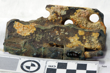
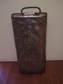
Hinge
The iron-hulled, four-masted barque, the Falls of Halladale, was a bulk carrier of general cargo. She left New York in August 1908 on her way to Melbourne and Sydney. In her hold, along with 56,763 tiles of unusual beautiful green American slates (roofing tiles), 5,673 coils of barbed wire, 600 stoves, 500 sewing machines, 6500 gallons of oil, 14400 gallons of benzene, and many other manufactured items, were 117 cases of crockery and glassware. Three months later and close to her destination, a navigational error caused the Falls of Halladale to be wrecked on a reef off the Peterborough headland at 3 am on the morning of the 15th of November, 1908. The captain and 29 crew members all survived, but her valuable cargo was largely lost, despite two salvage attempts in 1908-09 and 1910. ABOUT THE ‘FALLS OF HALLADALE’ (1886 - 1908) Built: in1886 by Russell & Co., Greenock shipyards, River Clyde, Scotland, UK. The company was founded in 1870 (or 1873) as a partnership between Joseph Russell (1834-1917), Anderson Rodger and William Todd Lithgow. During the period 1882-92 Russell & Co., standardised designs, which sped up their building process so much that they were able to build 271 ships over that time. In 1886 they introduced a 3000 ton class of sailing vessel with auxiliary engines and brace halyard winches. In 1890 they broke the world output record. Owner: Falls Line, Wright, Breakenridge & Co, 111 Union Street, Glasgow, Scotland. Configuration: Four masted sailing ship; iron-hulled barque; iron masts, wire rigging, fore & aft lifting bridges. Size: Length 83.87m x Breadth 12.6m x Depth 7.23m, Gross tonnage 2085 ton Wrecked: the night of 14th November 1908, Curdies Inlet, Peterborough south west Victoria Crew: 29 The Falls of Halladale was a four-masted sailing ship built-in 1886 in Glasgow, Scotland, for the long-distance cargo trade and was mostly used for Pacific grain trade. She was owned by Wright, Breakenridge & Co of Glasgow and was one of several Falls Line ships, all of which were named after waterfalls in Scotland. The lines flag was of red, blue and white vertical stripes. The Falls of Halladale had a sturdy construction built to carry maximum cargo and able to maintain full sail in heavy gales, one of the last of the ‘windjammers’ that sailed the Trade Route. She and her sister ship, the Falls of Garry, were the first ships in the world to include fore and aft lifting bridges. Previous to this, heavily loaded vessels could have heavy seas break along the full length of the deck, causing serious injury or even death to those on deck. The new, raised catwalk-type decking allowed the crew to move above the deck stormy conditions. This idea is still used today on the most modern tankers and cargo vessels and has proved to be an important step forward in the safety of men at sea. On 4th August 1908, with new sails, 29 crew, and 2800 tons of cargo, the Falls of Halladale left New York, bound for Melbourne and Sydney via the Cape of Good Hope. The cargo on board was valued at £35,000 and included 56,763 tiles of American slate roofing tiles (roof slates), 5,673 coils of barbed wire, 600 stoves, 500 sewing machines, 6,500 gallons of oil, 14,400 gallons of benzene, plumbing iron, 117 cases of crockery and glassware and many other manufactured items. The Falls of Halladale had been at sail for 102 days when, at 3 am on the night of 14th November 1908, under full sail in calm seas with a six knots breeze behind and misleading fog along the coast, the great vessel rose upon an ocean swell and settled on top of a submerged reef near Peterborough on the south-west Victoria’s coast. The ship was jammed on the rocks and began filling with water. The crew launched the two lifeboats and all 29 crew landed safely on the beach over 4 miles away at the Bay of Islands. The postmistress at Peterborough, who kept a watch for vessels in distress, saw the stranding and sent out an alert to the local people. A rescue party went to the aid of the sailors and the Port Campbell rocket crew was dispatched, but the crew had all managed to reach shore safely by the time help arrived. The ship stayed in full sail on the rocky shelf for nearly two months, attracting hundreds of sightseers who watched her slowly disintegrate until the pounding seas and dynamiting by salvagers finally broke her back, and her remains disappeared back into deeper water. The valuable cargo was largely lost, despite two salvage attempts in 1908-09 and 1910. Further salvage operations were made from 1974-1986, during which time 22,000 slate tiles were recovered with the help of 14 oil drums to float them, plus personal artefacts, ship fittings, reams of paper and other items. The Court of Marine Inquiry in Melbourne ruled that the foundering of the ship was entirely due to Captain David Wood Thomson’s navigational error, not too technical failure of the Clyde-built ship. The shipwreck is a popular site for divers, about 300m offshore and in 3 – 15m of water. Some of the original cargo can be seen at the site, including pieces of roof slate and coils of barbed wire. The Falls of Halladale shipwreck is listed on the Victorian Heritage Register (No. S255). She was one of the last ships to sail the Trade Routes. She is one of the first vessels to have fore and aft lifting bridges. She is an example of the remains of an International Cargo Ship and also represents aspects of Victoria’s shipping industry. The wreck is protected as a Historic Shipwreck under the Commonwealth Historic Shipwrecks Act (1976).Hinge, brass. Artefact Reg No FoH/10, recovered from the wreck of the Falls of Halladale.flagstaff hill, warrnambool, shipwrecked coast, flagstaff hill maritime museum, maritime museum, shipwreck coast, flagstaff hill maritime village, great ocean road, falls of halladale, shipwreck peterborough, 1908 shipwreck, great clipper ships, russell & co., hinge -
Bendigo Historical Society Inc.
Document - BASIL MILLER COLLECTION: TRAMS, TIME TABLE
Transparent blueprint paper. Time Table - Eaglehawk Route - Saturdays. 15 mins service till 10 am, 10 mins service till 1.30 pm, 15 mins service till 6.30 pm, then 10 mins service.organization, business, bendigo trams -
Bendigo Historical Society Inc.
Document - BASIL MILLER COLLECTION: TRAMS, TIMETABLE
Transparent blueprint paper. Electricity Supply Department, Bendigo Branch. Time table - Eaglehawk route Friday 20 minutes until 11.50 am, then 10 mins. Service. Run No.1 to No.7.organization, business, bendigo trams -
Bendigo Historical Society Inc.
Document - BASIL MILLER COLLECTION: TRAMS, TIME TABLE
Transparent blueprint paper. State Electricity Commission of Victoria, Bendigo Electricity Supply and Tramways, time table, 10 minutes service, from 7 am. Eaglehawk Route.organization, business, bendigo trams -
 Bendigo Historical Society Inc.
Document - COPIES OF LETTER FROM JOHN GRIMSON (1856), 1856
Copies of handwritten letter from John Grimson (1856) to 'My Dear Maria'. Page is copied in four (overlapping) sections. First section is notable for using as an illustration an S T Gill etching by James Blundell entitled 'Deep Creek - Mail Passengers en route to Melbourne' (approx size 10 x 20 cm). Letter describes journey to Bendigo and crossing of Deep Creek. Refer to 2007.1 for information about the letter in question.person, individual, john grimson, john grimson (1856) s t gill, james blundell, deep creek. -
 Coal Creek Community Park & Museum
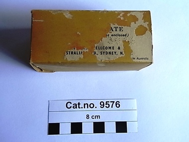
Box, cardboard, c.1937-1960
Trove : Advertised from 1937-1949 in various publications search under "Wellcome"' Calcium Borogluconate (yes with 2 'l's) . Victorian Government Gazette , no.2 Jan 5, 1960, page 16. List of Registered Stock Medicine. Registered Wholesale Dealer : Burroughs Wellcome and Co. (Aust) Ltd. Cressy Street, Rosebery New South Wales. Manufacturer, if other than the Wholesale Dealer - , Distinguishing Name of Stock Medicine : "Wellcome" Calcium Borogluconate, Approved Use or for the Treatment of : Milk Fever, hypocalcaemia. Rectangular faded pink cardboard box opening at both ends with the remnants of a paper label on one side, containing a folded paper leaflet and a cellophane bag containing white granules.Outer label '.....ATE .s enclosed)..........ELLCOME & .............STRALIA..D., SYDNEY, N....in Australia'. Impressed on one flap of box '132'. Printed leaflet (side one) Illustration of a unicorn, a thick black line under which text 'WELLCOME' brand CALCIUM BOROGLUCONATE (Vetinary)' followed by another thick black line. 'Calcium Borogluconate ia a stable , non-irritant calcium preparation for subcutaneous or intravenous injection in the treatment of milk fever and other forms of acute hypocalcaemia. It is available in the dry state as 'Wellcome' Calcium Borogluconate, a granular product in single dose containers of 2 1/2 oz. Milk Fever In the treatment of milk fever in cows, 21/2 oz. to 31/2 oz. of the granules should be injected subcutaneously at two or three points in the neck, with the usual aseptic precautions. The granules should be dissolved in 10 fl. oz. of boiling water, the solution allowed to boil for five minutes, then cooled to body temperature before administration. Repetition of the dose is very rarely necessary. Should a more rapid response be desired, the whole of the solution hay be given by slow intravenous injection; alternatively , the greater part of the solution may be injected by this route and the remainder given subcutaneously in the manner described above. A convenient apparatus for the controlled administration of large volumes of fluid (leaflet side two) is the 'Wellcome' Flutter Valve Injection Apparatus. Prophylaxis Recurrent attacks at successive parturitions may be prevented by giving calcium borogluconate immediately after calving and again about 20 hours later. Each dose should be from one or two ounces of 'Wellcome' Calcium Borogluconate, dissolved as directed above. Other Indications Certain other conditions have been found to respond readily to calcium borogluconate therapy. These include parturient hypocalcaemia or milk fever in ewes, parturient eclampsia in sows and bitches, so-called "staggers" in lactating dairy cattle suspected to be due to hypocalcaemia, and transit tetany in horses. The dosage for various species is generally within the ranges indicated below : horses and cattle 11/2 to 31/2 oz. Sheep, goats and pigs 1/2 oz. to 1 oz. Dogs 11/2 dr. to 3 dr. 'WELLCOME' brand CALCIUM BOROGLUCONATE A readily-soluble granular product issued in cartons of 21/2 oz.' Illustration of a unicorn, 'BURROUGHS WELLCOME & CO. (AUSTRALIA) LTD. (Incorporated in England) SYDNEY, N.S.W.' A black line 'ref.A5007g 54.1. 25' milk fever, hypocalcaemia, subcutaneous -
 Bendigo Historical Society Inc.
Map - GUIDE MAP OF BENDIGO & EAGLEHAWK, Late 1920's
Map. Guide Map of Bendigo & Eaglehawk. Light brown coloured booklet containing folded map of Bendigo and Eaglehawk. Outer cover is printed in blue and red ink and states - With compliments of J H Curnow & Son, Auctioneers, Real Estate Agents, Farm & Dairy Produce Merchants, Bendigo. Printed by J B Young, Lithographer. Map shows tramways & bus routes. Map shows Agricultural Showgrounds located between Park Street, Water Street, Barnard Street and Bridge Lane. Also shows Acclimitization Reserve located behind The Botanical Gardens at White Hills. Shows the location of Sailors Gully, Peg-Leg Gully, Jobs Gully, California Gully, Long Gully, Ironbark Gully, Golden Gully, Poverty Gully, Sheepshead Gully, Charcoal Gully, Eaglehawk Creek, Bendigo Creek and Back Creek. Contains interesting facts about Bendigo - Area 7,900 acres. Population - 26,000. First Council elected - 1855. Proclaimed a Borough - 1863. Proclaimed a City - 1871. Gold Rush broke out - 1851. For first 10 years gold yield averaged 8,600 ozs. per week . Total gold yield to 1923 - 572 tons valued at 82,000,000 pounds. Deepest mines - Victoria Quartz 4,614 ft., New Chum Railway 4,318 ft. 13 mines over 3.000 ft. deep. 53 mines over 2,000 ft. deep. Sewering of City commenced 1922, all principal buildings now sewered. Map printed by Arnall & Jackson, General Printers, Stationers & Engravers, 476 Collins Street. Map displays advertisement for J H Curnow & Son, Bendigo's leading Auctioneer and Estate Agents, Mitchell & Queen Sts. Bendigo. Map Scale 20 chs. = 1 in.cottage, miners, guide map of bendigo and eaglehawk -
 Bendigo Historical Society Inc.
Map - GUIDE MAP OF BENDIGO & EAGLEHAWK, Late 1920's
Map. Guide map of Bendigo & Eaglehawk. Folded map of Bendigo & Eaglehawk with blue outer cover booklet. Map is compiled by E E Parker, Eaglehawk. Map shows tramways, bus routes and cost one shilling. Map shows Agricultural Showgrounds located between Park Street, Water Street, Barnard Street and Bridge Lane. Also shows Acclimitization Reserve located behind the Botanical Gardens at White Hills. Shows the location of Sailors Gully, Peg-Leg Gully, Jobs Gully, California Gully, Long Gully, Ironbark Gully, Golden Gully, Poverty Gully, Sheepshead Gully, Charcoal Gully, Eaglehawk Creek, Bendigo Creek and Back Creek.Contains interesting facts about Bendigo:- Area - 7,900 acres, Population - 26,000, First Council elected - 1855, Proclaimed a City - 1871. Gold Rush broke out - 1851. For first 10 years gold yield averaged 8,600 ozs. Per week. Total gold yield to 1923 - 572 tons valued at 82,000,000 pounds. Deepest mines - Victoria Quartz 4,614 ft., New Chum Railway 4,318 ft., 13 mines over 3,000ft. deep, 53 mines over 2,000 ft. deep. Sewering of City commenced 1922. All principal buildings now sewered. Map printed by Arnall & Jackson, General Printers, Stationers & Engravers, 476 Collins Street. Outer map blue cover printed in red and blue ink by J B Young, Lithographer. Map displays advertisement for Bendigo Timber Co. Outer blue cover displays advertisement for Campbell Connelly & Co. Pty. Ltd, Ironmongers, Timware Manufacturers, Plumbers, Sewerage Contractors, High and Forest Sts, Bendigo 9outside back cover) and for Hartleys ( J L Shoosmith) Bendigo, displaying Indian Motor Cycles (inside back cover).map, bendigo, township, guide map of bendigo & eaglehawk -
 Puffing Billy Railway
Equipment - Victorian Railways Carriage Foot Warmer
During prestige, long distance train journeys some carriages had air-conditioning, and the majority of passengers had to brave unheated carriages. To offer some comfort during the winter months, the non-air-conditioned carriages were provided with footwarmers. These were metal containers roughly 100 mm thick and 300 mm wide, and about 750 mm long, which were filled with salt crystals (concentrated crystalline hydrated sodium acetate). The footwarmers were covered by sleeves of thick canvas, and two footwarmers were usually placed in each compartment of non-air-conditioned carriages. To activate the chemicals, the footwarmers were heated almost to boiling point. This was done by removing the canvas sleeves and placing the footwarmers in a large bath of very hot water. After they had been heated, they were removed from the bath and the sleeves refitted. They were then ready to be placed in the carriages. The McLaren patent foot warmer was used on railways in New South Wales, Queensland, Victoria and South Australia as well as South Africa and New Zealand. It was during the 1901 royal visit by the Duke and Duchess of Cornwall that these foot warmers were first used in New Zealand in the royal carriage. Before railway carriage heating was introduced, McLaren patent foot warmers were placed on the floor of New South Wales government railway carriages from 1891 to provide a little passenger comfort. The rectangular steel container worked a bit like a hot water bottle but instead of water contained six and a half kilograms of loosely-packed salt crystals, (concentrated crystalline hydrated sodium acetate). This was permanently sealed inside the container with a soldered cap. After the foot warmer was heated in vat of boiling water for about one and a quarter hours the crystals became a hot liquid. (The melting point for sodium acetate is 58 degrees). There was a whole infrastructure of special furnaces set up at stations for the daily heating of foot warmers. By 1914 the Victorian railways had 4,000 foot warmers in service and by 1935 there were 33 furnaces at principal stations to heat them. After about 10 hours the container was picked up by the handle and given a good vertical shake which helped the cooled liquid reform into a solid mass of hot crystals. Staff or sometimes passengers shook them en route when the foot warmers began to get cold. However, as they were heavy this was only possible by fit and agile passengers. At the end of the journey the containers were boiled again for reuse on the next trip. Sodium acetate railway foot warmers were introduced in Victoria in 1889, Adelaide to Melbourne express in 1899. "Shaking up" on this service took place at Murray Bridge and Stawell on the tip to Melbourne and at Ballarat and Serviceton on the trip to Adelaide. The use of foot warmers began to decline in New South Wales from the 1930s with the first trial of carriage air-conditioning in 1936, steam heating from 1948 ad LP gas heating from 1961. By the early 1960s the main services using foot warmers were the overnight mail trains. info from : http://www.powerhousemuseum.com/collection/database/?irn=67564#ixzz4UBNzVf6t Under Creative Commons License: Attribution Non-Commercial There was a whole infrastructure set up at stations for the daily heating of foot warmers in special furnaces. In Victoria alone in 1935 there were 33 heating works.Historic - Victorian Railways - Carriage Heater - Foot warmerA rectangular-shaped stainless steel casing with a welded seam down the back and welded ends. There is a handle at one end for carrying and shaking. Inside the foot warmer are two baffle plates and three trays to contain the sodium acetate. There was a cast-iron ball in each internal compartment. puffing billy, victorian railways, carriage haeter, foot warmer, passenger comfort, station furnace, railway ephemera, early heating methods -
 Victorian Aboriginal Corporation for Languages
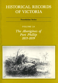
Book, Ian Macfarlane, Historical records of Victoria : foundation series : volume 2A : the Aborigines of Port Phillip 1835-1839, 1982
Reproductions of various transactions and reports dealing with Aboriginal people in Port Phillip in the period 1835-39, beginning with some of the earliest reports and tracing the evolution of government interaction and policy towards Aborigines in the 19th century. Covers mission work, government reports, the native police, conflicts with squatters, with numerous illustrations and original reports. Contents: Part I, Evolution of British policy Ch. 1. Proposals to appoint protectors of aborigines Ch. 2. Racial conflict in the year of official settlement at Port Phillip Ch. 3. House of Commons Select Committee on Aborigines Part II, The Wesleyan Mission at Buntingdale Ch. 4. Establishment and early operations of the Wesleyan mission Part III, The Government acts Ch. 5. Establishing the first government mission 1835-7 Ch. 6. Food and clothing for the Aborigines Ch. 7. Punishment of Aborigines found drunk, 1836-8 Ch. 8. Operations of the government mission, November 1837 to March 1839 Ch. 9. First attempt to form a native police corps Part IV, Growing conflict with squatters, 1837-8 Ch. 10. The disappearance of Gellibrand and Hesse Ch. 11. Attacks in the Western District Ch. 12. Attacks on the overland routes to Port Phillip Ch. 13. Evolution of policy in Sydney, 1838.b&w illustrations, b&w photographs, tables, document reproductionsvictorian history, colonisation, justice system -
Whitehorse Historical Society Inc.
Article, Torch Brightens City, 21/06/2000 12:00:00 AM
Article in Whitehorse Gazette about the route of the Olympic Torch.Article in Whitehorse Gazette about the route of the Olympic Torch. Also an article about Bob Gardiner, past Olympian, who will carry the Torch through Whitehorse.Article in Whitehorse Gazette about the route of the Olympic Torch. olympic games, gardiner, bob -
Whitehorse Historical Society Inc.
Article, Trams rumble into Vermont South for first time, 2005
Trams rumble into Vermont South for first time.Launch of Burwood Highway tram route extended to Vermont SouthTrams rumble into Vermont South for first time.tram services, burwood highway, vermont south, vermont south -
Whitehorse Historical Society Inc.
Article, Route opens, 1993
Article on the opening of the East Burwood tram route extension, July 1993Article on the opening of the East Burwood tram route extension, July 1993Article on the opening of the East Burwood tram route extension, July 1993tram services, burwood highway, burwood east -
Whitehorse Historical Society Inc.
Document - Report, Frank Isaac White, 01/06/1997
Photocopy of a Luther Collage assignment on visits to war memorials and an investigation of Frank Isaac White, a name on the Mitcham War Memorial. White served in Egypt and France,. Maps show the route of his journeys including a period in hospital in England. Information is given about soldiers living conditions and his role as a artillery man. He was killed in Belgium on 20th September 1917 and buried in the Menin Road South Cematery at Ypres. Photographs of the cemetary are included and of his grave.white, frank isaac, menin road south military cemetry, ww1, war memorials -
Whitehorse Historical Society Inc.
Map, Railway map of Victoria, 1912
Detailed map of railways in Victoria including adjacent areas of New South Wales.Detailed map of railways in Victoria including adjacent areas of New South Wales. Also shows 'principal coach routes'. On verso map of suburban lines with eastern line as far as Croydon and Bayswater. key numbers on map linked to pages of a timetable.Detailed map of railways in Victoria including adjacent areas of New South Wales.maps, railways -
Whitehorse Historical Society Inc.
Map, Facilities provided for you, 1970
Map of the City of Nunawading showing main roads and reserves with numbers indicating location of Halls, Infant Welfare Centres, Elderly Citizens Clubrooms and other major Council facilities. Route of proposes Healesville Freeway marked.Map of the City of Nunawading showing main roads and reserves with numbers indicating location of Halls, Infant Welfare Centres, Elderly Citizens Clubrooms and other major Council facilities. Route of proposes Healesville Freeway marked.Map of the City of Nunawading showing main roads and reserves with numbers indicating location of Halls, Infant Welfare Centres, Elderly Citizens Clubrooms and other major Council facilities. Route of proposes Healesville Freeway marked.city of nunawading, maps, maternal and child health centres, senior citizens centres, healesville freeway, parks and reserves -
Whitehorse Historical Society Inc.
Document, Official time table, 1978
Official time table issued by Willis Bus Service. Route No 765: Mitcham, Vermont, Forest Hill, Nunawading. Effective from 22 May 1978.Official time table issued by Willis Bus Service. Route No 765: Mitcham, Vermont, Forest Hill, Nunawading. Effective from 22 May 1978.Official time table issued by Willis Bus Service. Route No 765: Mitcham, Vermont, Forest Hill, Nunawading. Effective from 22 May 1978.bus services, time tables, willis bus company -
 Whitehorse Historical Society Inc.
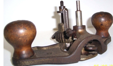
Tool - Router, c1907
From the estate of Werner Weiss of 13 Lionel Street East DoncasterSteel Stanley brand two handed wooden steel router - Stanley 71 - grooving bit fitted is 1.2cm wide. Different size bits can be installed. Height of bit can be adjusted as can the depth to which groove can be used.Stanley No.71. Patent 10-29-01 Pat 9-10-07trades, carpentry -
 Whitehorse Historical Society Inc.
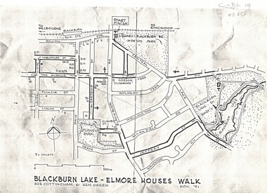
Map, Blackburn Lake - Elmore houses walk, 1/11/1991
Map of Blackburn outlining a walk through the lake.Map of Blackburn outlining a walk through the lake. The route includes four Elmore houses.Map of Blackburn outlining a walk through the lake.maps, blackburn lake sanctuary, the avenue, blackburn, laburnum street, main street, gardenia street, blackburn road, gordon crescent -
Whitehorse Historical Society Inc.
Article, Buses are too full to stop, 4/08/2014 12:00:00 AM
Transdev scrapped 5 bus services in July and 2 routes were shortened and had frequencies changed.Transdev scrapped 5 bus services in July and 2 routes were shortened and had frequencies changed.Transdev scrapped 5 bus services in July and 2 routes were shortened and had frequencies changed.bus services, public transport -
Whitehorse Historical Society Inc.
Article, Bus routes reach the end of the line, 1/07/2014 12:00:00 AM
Commuter calls for Transdev to reconsider changes to scrapped Routes 201, 286 and 303 have been ignored.Commuter calls for Transdev to reconsider changes to scrapped Routes 201, 286 and 303 have been ignored.Commuter calls for Transdev to reconsider changes to scrapped Routes 201, 286 and 303 have been ignored.bus services, public transport users association of victoria, public transport -
Whitehorse Historical Society Inc.
Article, Rage Over Bus Cuts, 2014
Commuters are angry over cancelled and altered bus routes particularly Route 286.Commuters are angry over cancelled and altered bus routes particularly Route 286.Commuters are angry over cancelled and altered bus routes particularly Route 286.transport, bus services