Showing 1134 items
matching survey map
-
 St Kilda Historical Society
Photograph - Photo map, 11/01/1968
One of a series of photo-maps produced for the Department of Crown Lands and Survey (1857-1983). For correlation with a current map, and access to other historical photo maps of Victoria, see the Historic Photo-Maps Index published by the Department of Environment, Land, Water and Planning at https://services.land.vic.gov.au/DELWPmaps/historical-photomaps/Black and white aerial photographVic 2132 State Aerial Survey Melbourne 1968 Proj. Run 29E 11.1.68 5100 ASL 196elwood, elwood park, elwood canal, elwood beach, st kilda marina, mc moran reserve, point ormond, 1968 -
 St Kilda Historical Society
Photograph - Photo map, Department of Crown Lands and Survey (1857-1983), 22/01/1970
One of a series of photo-maps produced for the Department of Crown Lands and Survey (1857-1983). For correlation with a current map, and access to other historical photo maps of Victoria, see the Historic Photo-Maps Index published by the Department of Environment, Land, Water and Planning at https://services.land.vic.gov.au/DELWPmaps/historical-photomaps/Black and white aerial photographVic 2358 Department of Crown Lands and Survey Victoria,.© Melbourne 1970 Project Run 41E 22.1.70 5,100 ASL 62caulfield, caulfield north, st kilda east, armadale, 1970 -
 St Kilda Historical Society
Photograph - Photo map, 14/12/1963
One of a series of photo-maps produced for the Department of Crown Lands and Survey (1857-1983). For correlation with a current map, and access to other historical photo maps of Victoria, see the Historic Photo-Maps Index published by the Department of Environment, Land, Water and Planning at https://services.land.vic.gov.au/DELWPmaps/historical-photomaps/Black and white aerial photographVic 1807 Melbourne 1963 Project Run 17 14.12.63 Lens 205 152.70 M/M 5.150 36st kilda, st kilda botanical gardens, balaclava, st kilda east, elwood canal, ripponlea, caulfield north, elwood, caulfield, 1963 -
 St Kilda Historical Society
Photograph - Photo map, Department of Crown Lands and Survey (1857-1983), 22/01/1970
One of a series of photo-maps produced for the Department of Crown Lands and Survey (1857-1983). For correlation with a current map, and access to other historical photo maps of Victoria, see the Historic Photo-Maps Index published by the Department of Environment, Land, Water and Planning at https://services.land.vic.gov.au/DELWPmaps/historical-photomaps/Black and white aerial photographVic 2358 Department of Crown Lands and Survey Victoria,.© Melbourne 1970 Project Run 42E 22.1.70 5,100 ASL 77st kilda, st kilda east, st kilda marina, elwood, elwood canal, elsternwick park, point ormond, balaclava, mc moran reserve, ripponlea, st kilda botanical gardens, peanut farm, 1970 -
 St Kilda Historical Society
Photograph - Photo map, Department of Crown Lands and Survey, 22/01/1970
One of a series of photo-maps produced for the Department of Crown Lands and Survey (1857-1983). For correlation with a current map, and access to other historical photo maps of Victoria, see the Historic Photo-Maps Index published by the Department of Environment, Land, Water and Planning at https://services.land.vic.gov.au/DELWPmaps/historical-photomaps/Black and white aerial photographVic 2358 Department of Crown Lands and Survey Victoria,.© Melbourne 1970 Project Run 43E 22.1.70 5,100 ASL 208elwood, elwood beach, point ormond, elwood park, elwood canal, mc moran reserve, 1970 -
 St Kilda Historical Society
Photograph - Photo map, Department of Crown Lands and Survey, 22/01/1970
One of a series of photo-maps produced for the Department of Crown Lands and Survey (1857-1983). For correlation with a current map, and access to other historical photo maps of Victoria, see the Historic Photo-Maps Index published by the Department of Environment, Land, Water and Planning at https://services.land.vic.gov.au/DELWPmaps/historical-photomaps/Black and white aerial photographCONTROLLED Vic 2358 Department of Crown Lands and Survey Victoria,.© Melbourne 1970 Project Run 41E 22.1.70 5,100 ASL 66st kilda, albert park, st kilda west, catani gardens, st kilda botanical gardens, st kilda pier, st kilda beach, 1970 -
 St Kilda Historical Society
Photograph - Photo map, Department of Crown Lands and Survey, 22/01/1970
One of a series of photo-maps produced for the Department of Crown Lands and Survey (1857-1983). For correlation with a current map, and access to other historical photo maps of Victoria, see the Historic Photo-Maps Index published by the Department of Environment, Land, Water and Planning at https://services.land.vic.gov.au/DELWPmaps/historical-photomaps/Black and white aerial photographVic 2358 Department of Crown Lands and Survey Victoria,.© Melbourne 1970 Project Run 42E 22.1.70 5,100 ASL 75st kilda, st kilda beach, st kilda marina, point ormond, st kilda pier, 1970 -
 St Kilda Historical Society
Photograph - Photo map, 14/12/1963
One of a series of photo-maps produced for the Department of Crown Lands and Survey (1857-1983). For correlation with a current map, and access to other historical photo maps of Victoria, see the Historic Photo-Maps Index published by the Department of Environment, Land, Water and Planning at https://services.land.vic.gov.au/DELWPmaps/historical-photomaps/Black and white aerial photographVic 1807 Melbourne 1963 Project Run 16 14.12.1963 Lens 205 152.70 M/M 5.150 177st kilda, st kilda pier, catani gardens, middle park, albert park, st kilda west, st kilda beach, 1963 -
 St Kilda Historical Society
Photograph - Photo map, Department of Crown Lands and Survey, 22/01/1970
One of a series of photo-maps produced for the Department of Crown Lands and Survey (1857-1983). For correlation with a current map, and access to other historical photo maps of Victoria, see the Historic Photo-Maps Index published by the Department of Environment, Land, Water and Planning at https://services.land.vic.gov.au/DELWPmaps/historical-photomaps/Black and white aerial photographVic 2358 Department of Crown Lands and Survey Victoria,.© Melbourne 1970 Project Run 41E 22.1.70 5,100 ASL 64st kilda, st kilda cemetery, balaclava, st kilda east, windsor, caulfield north, alma park, 1970 -
 St Kilda Historical Society
Photograph - Photo map, Department of Crown Lands and Survey, 08/01/1970
One of a series of photo-maps produced for the Department of Crown Lands and Survey (1857-1983). For correlation with a current map, and access to other historical photo maps of Victoria, see the Historic Photo-Maps Index published by the Department of Environment, Land, Water and Planning at https://services.land.vic.gov.au/DELWPmaps/historical-photomaps/Black and white arial photographVic 2345 Department of Crown Lands and Survey Victoria,.© Melbourne 1970 Project Run 40 8.1.70 5,100 ASL 77albert park, fawkner park, south yarra, middle park, prahran, windsor, st kilda, st kilda west, 1970 -
 St Kilda Historical Society
Photograph - Photo map, 22/01/1970
One of a series of photo-maps produced for the Department of Crown Lands and Survey (1857-1983). For correlation with a current map, and access to other historical photo maps of Victoria, see the Historic Photo-Maps Index published by the Department of Environment, Land, Water and Planning at https://services.land.vic.gov.au/DELWPmaps/historical-photomaps/Black and white aerial photographVic 2358 Department of Crown Lands and Survey Victoria,.© Melbourne 1970 Project Run 43E 22.1.70 5,100 ASL 206elwood, elsternwick, elsternwick park, 1970 -
 Clunes Museum
Map - PLAN / MAP
.1 MAP, TOWN OF CLUNES, PARISH OF CLUNES, COUNTY OF TALBOT, STAMPED BOROUGH OF CLUNES .2 PLAN OF SUBDIVISION OF PART OF CLUNES COMMON, BOROUGH OF CLUNES, PARISH OF CLUNES,COUNTY OF TALBOT. P. CAMPBELL. ASSISTANT SURVEYOR, MARCH 1904 ON RIGHT HAND BOTTOM CORNER C71/1 CLUNES COMMON. MARKED: CHARTED R.L.A.7/2/57.1 PHOTO LITHOGRAPHED. DEPARTMENT OF LANDS AND SURVEY, MELBOURNE .2 PHOTO LITHOGRAPHED AT THE DEP. OF LANDS AND SURVEY, MELBOURNE PRICE 1/- 10.11.08map town of clunes, borough of clunes, parish of clunes, county of talbot -
Clunes Museum
Map - MAPS, AC BROOKS GOVERMENT PRINTER
.1 PARISH OF CLUNES, COUNTY OF TALBOT. STAMP: DRAWING OFFICE RECORDS COPY, STATE ELECTRICITY COMMISSION OF VICTORIA. ELECTRICITY DEPARTMENT (THIS PLAN MUST NOT BE TAKEN FOR FIELD USE. PLEASE DO NOT DEFACE) C71 ON LEFT BOTTOM CORNER, CLUNES SHEET 1 .2 MAP BECKWORTH COUNTY OF TALBOT. IN RED: B-61. L.4855. THE ALLOTMENTS COLOURED BROWN ARE FREEHOLD.1.2 DRAWN AND REPRODUCED AT THE DEPARTMENT OF LANDS & SURVEY MELBOURNE. PRICE 2/- .1 IN PENCIL ON BOTTOM ' 211 ' 20%parish of clunes, electricity supply department, beckworth -
Clunes Museum
Map, DEPT. OF LANDS AND SURVEY, TOWNSHIP OF CLUNES, PARISH OF CLUNES, COUNTY OF TALBOT, 1950
MAP OF CLUNES ON PAPER SHOWING HOTELS AND TOWNSHIP HIGHLIGHTS COMPLETE WITH LEGEND. OVERWRITTEN NOTATIONS IN RED AND BLUE INKPRICE 2stownship of clunes 1950, hotels of clunes -
 Tatura Irrigation & Wartime Camps Museum
Map - Map - Photocopy, New Guinea Escape Route
At the end of January 1942 there was only about 250 men left in Wau, as the women and children had been evacuated by air a little earlier. With no planes to take the men they had to make their own way to Port Moresby and then travel by ship to Australia. Some men went down to Salamaua and made their way along the north coast, but small groups also made their way over the Owen Stanley Ranges; rafting down the Lakekamu RIver to Yule Island and by boat to Port Moresby. Donor Vanessa Kiessling's Father was part of the second group, and had drawn a detailed map of their route. This might be the same route taken by Rev. Willi Hertle (Ref C0750)Photocopy of New Guinea map showing escape routePlan of surveyed route from Edie Creek to Bulldog Dromepapua new guinea, escape, map, wau, willi hertle, kiessling -
Tatura Irrigation & Wartime Camps Museum
Folder - survey maps
... - survey maps ...Maps of no 14 A, B, C and D internment camps and documents on Loveday Camp, South Australia. Donated by Gerhard Meinke concerning Loveday Camp. Brief outline of camps life, release and repatriation, list of deaths, of POW's and internees.Blue back clear plastic folder containing maps of No 14 camp and documents on Loveday Camp.gerhard meinke, loveday camp, camp 14, south australian internment camps, japanese internees -
Tatura Irrigation & Wartime Camps Museum
Map, Department of Land and Survey, County of Rodney
Early county maps.One original map of County of Rodney and 3 photo copies. Original and one copy in colour. 2 copies in black and white. county of rodney -
Tatura Irrigation & Wartime Camps Museum
Book, Soils and Land Use, 1963
Advice to land holders on how to use the Soil Survey Report. Soils and land use in the deakin Irrigation area, Vict, Technical Bulletin No. 16, Melb. Includes maps for Deakin Irrigation AreaCream cover, black writing, Techical Bulletin No. 16soils and land use, tatura, irrigation, books, technical, rural, industry -
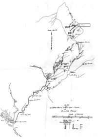
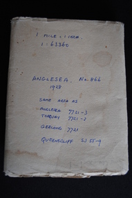 Anglesea and District Historical Society
Map, Royal Australian Survey Corps, Anglesea, Victoria, 1954
... , Victoria Map Royal Australian Survey Corps ...Anglesea, Victoria [cartographic material] produced by Royal Australian Survey Corps. Colour; Scale [1:63,360] 1 mile to 1 inch; transverse Mercator projection; Sheet No. 866, Zone 7. Two stamps: 1. Rankine and Dobbie Pty Ltd. 2. Authorised for sale / Price 2/- / By Department of the Army Original date: November 1928.(See above)anglesea map, topographic map -
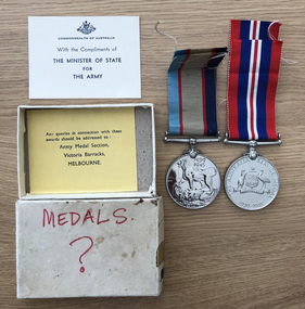 Robin Boyd Foundation
Medal - WWII medals
These are Robin Boyd's World War II medals. Robin Boyd commenced full-time war service on 19 November 1941 and was discharged in September 1945. He spent much of his war service preparing maps in the 3rd Field Survey Company in New Guinea and late in the war near Mareeba, Queensland. The Walsh Street Archive also holds the Demobilization Procedure Book (item D457).awards, honours, robin boyd, walsh st -
Victorian Aboriginal Corporation for Languages
Map, Geographic Data Victoria, Vicmap topographic map index as at June 2000, 2000
Index to Vicmap topographic mapping, including 1:25 000 and 1:50 000 topographic maps, and Outdoor leisure series, compiled by the earlier bodies, Survey &? Mapping Victoria, etc. Also indexes Royal Australian Survey Corps' 1:50 000 topographic mapping.mapsvictorian maps, topographic maps -
Victorian Aboriginal Corporation for Languages
Book, Edgar Morrison, The Loddon Aborigines : tales of old Jim Crow, 1971
This regional survey is the last of a trilogy, each of which deals with a particular aspect of living conditions and racial relationships in the Loddon watershed in the early Colonial days.maps, b&w photographsloddon -
 Victorian Aboriginal Corporation for Languages
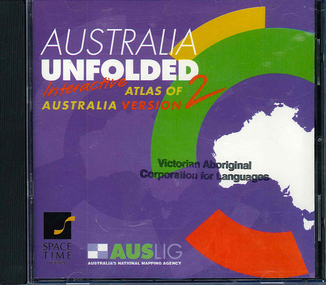
CD-ROM, Australian Surveying and Land Information Group, Australia unfolded : interactive atlas of Australia, 1996
... Street Brunswick melbourne topographic maps Australian maps ...Systems requirements: Macintosh version: Mac Plus (68030 or higher recommended), 5 MB hard disk space, 2 MB RAM (4 MB RAM recommended), CD-ROM drive, mouse, System 7 or above. "9314231106006"--CD-ROM. System requirements: Windows version: IBM compatible 386 or higher, 5MB hard disk space, 4MB RAM (8MB RAM recommended), VGA monitor, CD-ROM drive, mouse, Windows 3.1 or above. In box (19 x 27 x 5 cm.).CD-ROMtopographic maps, australian maps, surveying -
Victorian Aboriginal Corporation for Languages
Book, RMW Dixon, Australian languages: their nature and development, 2002
... Street Brunswick melbourne linguistics language surveys Maps Very ...Very comprehensive technical linguistic introduction to the Australian language family, a follow-up to Dixon?s ?The Languages of Australia? (1980). Numerous maps, isoglosses, tables, comparative grammar, phonology, semantics, etc. 1. The language situation in Australia 2. Modelling the language situation 3. Overview 4. Vocabulary 5. Case and other nominal suffixes 6. Verbs 7. Pronouns 8. Bound pronouns 9. Prefixing and fusion 10. Generic nouns, classifiers, genders and noun classes 11. Ergative/?accusative morphological and syntactic profiles 12. Phonology 13. Genetic subgroups and small linguistic areas 14. Summary and conclusion.Mapslinguistics, language surveys -
 Victorian Aboriginal Corporation for Languages
Book, John Mathew, Eaglehawk and crow : a study of the Australian Aborigines, including an inquiry into their origin and a survey of Australian languages, 2005
Original text of comprehensive detail of Mathew?s observations and theories on Origin of Species of Aboriginal People, Traditional Lifestyles, Art and Social Customs. Includes maps and word lists and meanings. -
Victorian Aboriginal Corporation for Languages
Book, John Mathew, Eaglehawk and crow : a study of the Australian Aborigines, including an inquiry into their origin and a survey of Australian languages, 1899
Original text featuring Mathew's comprehensively detailed observations and theories on the origin of species of Aboriginal people, traditional lifestyles, art and social customs.maps, b&w illustrations, word lists, tablesjohn mathew, eaglehawk and crow, stories -
 Victorian Aboriginal Corporation for Languages
Book, W J Oates, A revised linguistic survey of Australia, 1970
Lists languages under areas and language classification; records location, previous research, degree of urgency of research and assessment of total linguistic knowledge; index of variant language names.Mapslinguistics -
 Victorian Aboriginal Corporation for Languages
Book, Nick Thieberger, Macquarie Aboriginal words, 2007
A non-technical introduction and survey of seventeen Australian languages from across the continent; various authors. Simple grammatical information and wordlists organised by meaning. Introduction describing characteristics of Australian languages and relationship to kinship systems, address list of language centres, each language chapter has introduction, notes on wordlist, spelling and pronunciation, grammar and extensive wordlist in 26 or more categories; language index and English index; chapters annotated separately.Word lists, mapslinguistics, glossaries, vocabularies -
 Victorian Aboriginal Corporation for Languages
Book, Robert M Dixon, Handbook of Australian Languages. Vol.2, Wargamay, the Mpakwithi dialect of Anguthimri, Watjarri, Margany and Gunya Tasmanian, 1981
Various authors, includes technical linguistic sketch grammars of Wargamay, Mpakwithi (Anguthimri), Watjarri, Margany, Gunya and a survey of extant Tasmanian materials.Maps, word listswargamay, mpakwithi dialect of anguthimri, watjarri, margany, gunya tasmanian -
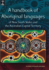 Victorian Aboriginal Corporation for Languages
Book, Jim Wafer et al, A handbook of Aboriginal languages of New South Wales and the Australian Capital Territory, 2008
Provides a survey of the Indigenous languages of NSW and the ACT and word-lists for 42 distinct language varieties. With a chapter on contact languages by Jean HarkinsMaps, word listsmadhi madhi, wemba wemba, yorta yorta, dhudhuroa, bidawal