Showing 2113 items matching " map of bendigo."
-
 Bendigo Historical Society Inc.
Book - 7 ROUTES SIGHTSEEING IN AND AROUND BENDIGO
7 Routes Sightseeing In And Around Bendigo, 32 pages with black and white maps and photographs. With IndexBendigo Chamber of Commerce & Industriesbendigo, tourism, guide -
 Bendigo Historical Society Inc.
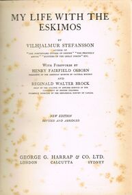
Book - ALEC H CHISHOLM COLLECTION: BOOK ''MY LIFE WITH THE ESKIMOS'' BY VILHJALMUR STEFANSSON
Book. ALEC H CHISHOLM COLLECTION. 308 page hardcover book of the journeys by the arctic explorer Vilhjalmur Stefansson. Illustrated with B & W photos and maps. Forewords by H.F. Osborn and R. W. Brock. Published in 1924 by George G. Harrap & Co, London. Printed in Great Britain by Unwin Bros. Ltd. Catalogue sticker '2142 STE' on spine. Handwritten in ink on flyleaf ''To Alec H Chisholm with pleasant remembrances of an afternoon at the Burrellls with the platypus from Vilhjalmur Stefansson Sydney August 8 1924''. Pasted inside front cover is a newspaper obituary to V. Stefansson from the Sydney Morning Herald 28-8-1962.Vilhjalmur Stefanssonbooks, collections, ethnology, alec h chisholm collection, vilhjalmur stefansson, arctic explorer, eskimos, ethnology -
 Bendigo Historical Society Inc.
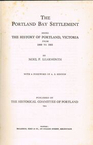
Book - ALEC H CHISHOLM COLLECTION: BOOK ''THE PORTLAND BAY SETTLEMENT'' BY NOEL F LEARMONTH
Book. ALEC H CHISHOLM COLLECTION. 285 page hardback book on the history of Portland, Victoria from 1800 to 1851 by Noel Learmonth with a forward by A. S. Kenyon. Contains maps and B & W photos of the Hentys and other people. Published in 1934 by The Historical Committee of Portland. Printed by McCarron, Bird & Co. Melbourne. Catalogue sticker '2164 LEA' on spine. Handwritten in ink inside front cover ''A. H. Chisholm in gratitude for a few bird days. Noel F Learmonth Oct 25th 1944''Noel F. Learmonthbooks, collections, history, alec h chisholm collection, noel f. learmonth, portland, henty, history -
 Bendigo Historical Society Inc.
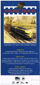
Document - BADHAM COLLECTION: VICTORIAN RAILWAYS- MAKING TRACKS BOOKLETS X 12
Victorian Railways advertising brochures x 12. Glossy fold-out map and collage of old railway photos (without notations). Articles include 'growing Victoria and various aspects of Railway life, celebrating 150 years of the Victorian Railways C 2004.books, magazines, v/r advertising -
 Bendigo Historical Society Inc.
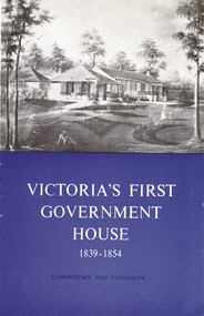
Book - VICTORIAS FIRST GOVERNMENT HOUSE
La Trobe cottage, Victoria's First Government House 1839 - 1854, commentary and catalogue, produced by the National Trust Of Australia (Victoria) with a map and black and white photographs.National Trust of Australiaaustralia, history, heritage places -
 Bendigo Historical Society Inc.
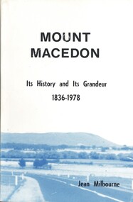
Book - MOUNT MACEDON, 1979
Mount Macedon, its history and its grandeur 1836 - 1978, 185 pages with maps and black and white photographs.Jean Milbournehistory, australian, mtmacedon, mtmacedon-history-properties -
 Bendigo Historical Society Inc.
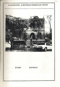
Book - EAGLEHAWK & BENDIGO HERITAGE - STUDY EXTRACT, 1993
... Eaglehawk & Bendigo Heritage Study extract, with maps...Bendigo Historical Society Inc. Bendigo Historical Society ...Eaglehawk & Bendigo Heritage Study extract, with maps and black and white photographs.bendigo, buildings, heritage buildings -
 Bendigo Historical Society Inc.
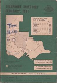
Book - TELEPHONE DIRECTORY FEBRUARY 1961, February 1961
Soft covered Telephone Directory February 1961. Districts covered are Bendigo, Castlemaine, Charlton, Deniliquin, Echuca, Kerang, Kyneton, Maryborough, Swan Hill. Cover has a green background with an outline of the map of Victoria in white. The Victorian Telephone directory boundaries are indicated and the district covered is shaded with black dots. Some handwritten jottings are written in ink on the cover. The directory contains both white and pink pages.book, bendigo, bendigo history & its people -
 Bendigo Historical Society Inc.
Map - STATE RIVERS AND WATER COMMISSION : COLIBAN DISTRICT IRRIGATION AND TOWN SUPPLY CHANNELS, 30/11/1956
State Rivers and Water Supply Commission. Foolscap-size map. Title : Coliban district Plan showing Irrigation and Town Supply Channels. The map covers the area from Raywood to Guildford. Scale : 1 inch to 4 miles. Dated 30/11/56, number 5,491 in bottom right corner.state infrastructure, water supply, coliban system, state rivers and water supply commission. coliban system. -
 Bendigo Historical Society Inc.
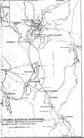
Map - STATE RIVERS AND WATER SUPPLY COMMISSION : COLIBAN SYSTEM OF WATERWORKS MAP
State Rivers and Water Supply Commission. Photocopied foolscap-size map. Title: Coliban System of Waterworks. Channels, reservoirs, reticulation systems. Maldon - S.R. & W.S.C. reticulated towns. The map includes the areas from Goornong to south of Kyneton and across to Maldon: Goornong, Marong, Bendigo, Strathfieldsaye, Lockwood, Maldon, Harcourt, Castlemaine, Newstead, Elphinstone, Taradale, Malmsbury, Kyneton.state infrastructure, water supply, coliban system, state rivers and water supply commission. coliban system. -
 Bendigo Historical Society Inc.
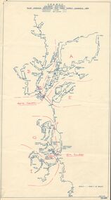
Map - STATE RIVERS AND WATER SUPPLY COMMISSION : COLIBAN DISTRICT MAP 1956, 30/11/1956
State Rivers and Water Supply Commission Coliban District map. Titled: S.R. & W.S.C. Coliban District Plan showing Irrigation and Town Supply Channels 1956. Scale: 1 inch = 4 miles. Indicates concrete lining and concrete re-lining channels. Printed in blue ink and information added in red. The map is dated at the bottom - 30/11/'56. There is a number, 25,491, in the bottom right corner.state infrastructure, water supply, coliban system, state rivers and water supply commission. coliban system. -
 Bendigo Historical Society Inc.
Book - JOAN O'SHEA COLLECTION: CENTRAL DEBORAH UNDERGOUND PROJECT, 20th June, 1986
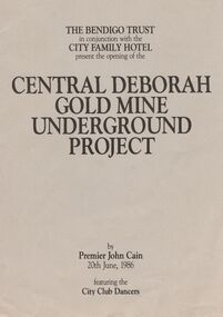
Joan O'Shea Collection. Central Deborah Gold Mine Bendigo Violet Street (off High Street) Bendigo Pamphlet. Buff and Sepia double-sided A4. The Bendigo Trust in conjunction with the City Family Hotel present the opening of the Central Deborah Gold Mine Underground Project, by Premier John Cain, 20th June, 1986 featuring the City Club Dancers. Includes a brief chronological history of the mine and photographs courtesy of Phillip Beer on recto side. The verso side contains a map of the site of the Central Deborah Gold Mine and also various photographs with further detail of areas of interest including: poppet legs and shaft, the change rooms, caretakers or rag pickers room where clothing was searched, the drying room, the first aid room, carbide light room, underground tours, carpenters shed, ore bins and loading bays, stamper battery, wilfley table, berdan plans, laboratory, display room, boiler, stoke hold, winding engine, boiler feed pump, electric driven compressor, steam driven compressor and the blacksmith's shop.Central Deborah Gold Mine Bendigobendigo, gold mining, central deborah gold mine -
 Bendigo Historical Society Inc.
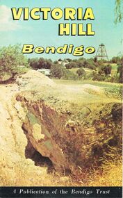
Document - JOAN O'SHEA COLLECTION: VICTORIA HILL GOLDMINING AREA BOOKLET, March 1972
Joan O'Shea Collection. Victoria Hill Bendigo Gold Mining on the Richest Quartz Reef in Bendigo, from 1854 to 1916. Colour and Black and White Booklet 16 Pages. Includes Maps of the Victoria Hill Area, photographs of the remains of a twenty head crushing battery, burnt ground from quartz roasting, The Victoria Quartz Mine Photograph from Australian Mining Standard June 1899, The compressor beds and concrete foundations for the poppet legs all that remain today of the Victoria Quartz Mine deepest mine on Bendigo Goldfield 4613 feet or 1406.04 metres. Also included photograph of the view of Victoria Hill from The New Chum Hill in the 1870s. The Location of the 3 mines Ballerstedt's open cut, North Old Chum and Lansell's 180 are marked. A depiction of Rae's Open Cut gives an understanding of the primitive nature of early workings on the Goldfields. The Booklet also provides a brief history of Victoria Hill itself.Bendigo Trust Publication March 1972. Printed in Bendigo Cambridge Press.bendigo, mining, victoria hill -
 Bendigo Historical Society Inc.
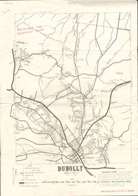
Document - JOAN O'SHEA COLLECTION: DUNNOLLY MAPS, 1980
... Bendigo Historical Society Inc. Bendigo Historical Society ...Joan O'Shea Collection. Goldfield Maps Dunolly 3 Sheets 1980. Page 1: Mines in Dunolly, Whistling Flat, Painswick and Surrounds. Page 2: Mines in Goldsborough, McKinnons Gap, Bealiba Range, Stewarts Flat and Surrounds. Page 3: Mines in Dunolly, Emu Creek, Bet Bet, Bromley & Surrounds. Scale in Chains and Kilometres.GoldField Maps 1980 based on Dunolly 7624 by Division of National Mappinggold, goldfields, goldfield maps dunolly & surrounds -
 Bendigo Historical Society Inc.
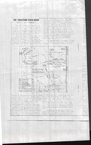
Document - PHOTOCOPIED ARTICLE OF 'THE SEBASTIAN GOLD-RUSH PART 1 & 2 . BY F. ROBBINS'
Photocopied articles of 'The Sebastian Gold-Rush parts 1 & 2 . By F. Robbins' .First page shows a map of the goldfield.F. Robbins'document, gold, the sebastian gold-rush -
 Bendigo Historical Society Inc.
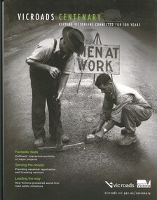
Book - VICROADS CENTENARY
Vicroads Centenary, keeping Victorians connected for 100 years, 141 pages with a loose poster, photographs and maps.victoria, history, transport -
 Bendigo Historical Society Inc.
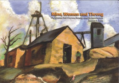
Book - MINE, WOMEN AND THRONG
Mine, Women and Throng, The Central Nell Gwynne Bendigo and its Associations, soft cover 116 pages with colour & black and white photographs, maps & graphs. Signed inside cover by author, printed by BartnPrint.James Lerkbendigo, gold mining, central nell gwynne, gold mines-gold mining victoria-bendigo-history -
 Bendigo Historical Society Inc.
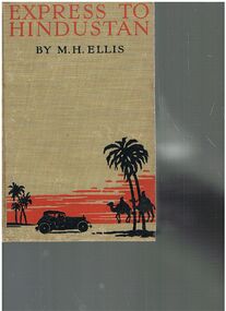
Book - ALEC H CHISHOLM COLLECTION: BOOK ''EXPRESS TO HINDUSTAN'' BY M.H.ELLIS
Book. ALEC H CHISHOLM COLLECTION. 308 page hardcover book giving an account of a motor-car journey from London to Delhi by H. M. Ellis in 1926. Illustrated with 32 B&W photographs and a sketch map of the route. Published in 1929 by the Bodley Head Ltd and printed by Butler and Tanner, London. Catalogue sticker ''2177 ELL'' on spine. Handwritten in ink inside front cover ''To A. H. Chisholm from the Perpetrator. M. H. Ellis 25/7/29''M. H. Ellisbooks, collections, travel, alec h chisholm collection, m.h.ellis, travel, motoring -
 Bendigo Historical Society Inc.
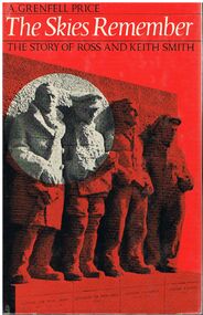
Book - ALEC H CHISHOLM COLLECTION: BOOK ''THE SKIES REMEMBER'' BY A.GRENFELL PRICE
Book. ALEC H CHISHOLM COLLECTION. 155 page hardcover book by A. Grenfell Price telling the story of Ross and Keith Smith's flight from Cairo to Calcutta and then England to Australia, 1918 - 1919. Based on the original and unpublished papers of Ross and Keith Smith. Illustrated with 39 B& W photos and 4 maps. Published in 1969 by Angus & Robertson, and printed in Great Britain by Morrison and Gibb Ltd. Catalogue sticker ''2194 PRI'' on spine. Handwritten in biro on flyleaf ''To my good friend Alec Chisholm Tom Lewis Dec '71''. SBN 207 95167 5. Copyright (c) A. Grenfell Price, 1969.A. Grenfell Pricebooks, collections, aviation, alec h chisholm collection, keith smith, ross smith, a.grenfell price, travel, aviation -
 Bendigo Historical Society Inc.
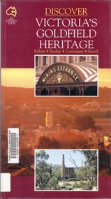
Book - VICTORIA GOLDFIELD HERITAGE
Discover Victoria's Goldfield Heritage, 128 pages in a soft cover with maps and photographs. Published by See Australia Guides.Douglas Stone & Greg Dunnettbook, rural, goldfield -
 Bendigo Historical Society Inc.
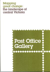
Book - POST OFFICE GALLERY MAPPING GREAT CHANGE, 2013
Post Office Gallery exhibition catalogue, Mapping great change the landscape of central Victoria, 27 pages with maps and illustrations.books, catalogues, post office gallery -
 Bendigo Historical Society Inc.
Document - AUSTRALIANS IN ACTION: ANZAC BISCUIT STORY
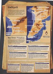
Information sheet from Australian War Memorial detailing brief stories of Australians in Action, the Anzac Biscuit Story, about the RSL and a timeline of Gallipoli key events with map. A3 size, buff background, sepia pictures.event, war, world war 1 - gallipoli key events, gallipoli, anzac -
Bendigo Historical Society Inc.
Map - CAMPBELL COLLECTION: BENDIGO AND DISTRICT MAPS, 11-4-29
... Inc. History House 11 Mackenzie Street Bendigo goldfields MAP ...Map. Huntly, Parishes of Huntly Nerring and Neilborough. Scale 20 chains to 1 inch. Total area 4738 acres. Eaglehawk. Prepared in W.J.B. from A. and C.L. Plans by W.J.Galbraith 11-4-29. (number 396 in map cupboard 1)W.J.Galbraithmap, bendigo, agricultural lands -
Bendigo Historical Society Inc.
Map - CAMPBELL COLLECTION: BENDIGO AND DISTRICT MAPS
... Inc. History House 11 Mackenzie Street Bendigo goldfields MAP ...Map. Mandurang, Parish of Mandurang. Scale 20 chains to 1 inch. Total area 5993 acres. Northern Railway. (number 395 in map cupboard 1)map, bendigo, allotments -
Bendigo Historical Society Inc.
Map - CAMPBELL COLLECTION: BENDIGO AND DISTRICT MAPS, 16-4-29
... Inc. History House 11 Mackenzie Street Bendigo goldfields MAP ...Map. Kennington, Parishes of Sandhurst, Mandurang and Strathfieldsaye. Scale 20 chains to 1 inch. Total area 2918 acres. Prepared in W.P.B. from A. and C.L. Plans by W.J.Galbraith, 16-4-29. (number 394 in map cupboard 1)W.J.Galbraithmap, bendigo, allotments -
Bendigo Historical Society Inc.
Map - CAMPBELL COLLECTION: BENDIGO AND DISTRICT MAPS, 8-6 29
... Inc. History House 11 Mackenzie Street Bendigo goldfields MAP ...Map. Kimbolton, Parishes of Kimbolton and Lyell, scale 20 chains to 1 inch. Area by Plamimeter 6258 acres. Coliban River, Knowsley, Strathfieldsaye 10 1/2 miles. Prepared in W.P.B. from Parish and Assessor's Plans. G.W.Latimer 8-6-29. (number 393 in map cupboard 1)G.W.Latimermap, bendigo, allotments -
Bendigo Historical Society Inc.
Map - CAMPBELL COLLECTION: BENDIGO AND DISTRICT MAPS
... Inc. History House 11 Mackenzie Street Bendigo goldfields MAP ...Map. Eaglehawk, Parishes of Huntly and Nerring. Scale 20 chains to 1 inch. Total area 6211 acres. Eaglehawk Kerang Railway, to Epsom 2 miles. Manure Depot. (number 390 in map cupboard 1)map, bendigo, allotments -
Bendigo Historical Society Inc.
Map - CAMPBELL COLLECTION: BENDIGO AND DISTRICT MAPS, 22-3-29
... Inc. History House 11 Mackenzie Street Bendigo goldfields MAP ...Map. Marong, Parishes of Marong, Lockwood and Mandurang, Scale 20 chains to 1 inch, Total area 5106 acres. Crusoe Reservoir & Viaduct and water race. Compiled in W.P.B. fro Field Survey and Parish Plans. B.W.L.22-3-29 (number 389 in map cupboard 1)B.W.L.map, bendigo, allotments -
Bendigo Historical Society Inc.
Map - CAMPBELL COLLECTION: BENDIGO AND DISTRICT MAPS, 14-6-29
... Inc. History House 11 Mackenzie Street Bendigo goldfields MAP ...Map. Terricks, Parish of Terrick Terrick West, scale 20 chains to 1 inch, total area 6318 acres, prepared in W.P.B. from Assessment and Parish Plans by W.J.G. 14-6-29. (number 388 in map cupboard 1)W.J.Galbraithmap, bendigo, agricultural lands -
Bendigo Historical Society Inc.
Map - CAMPBELL COLLECTION: BENDIGO AND DISTRICT MAPS
... Inc. History House 11 Mackenzie Street Bendigo goldfields MAP ...Map. Lyell, Parishes of Sedgwick, Eppalock and Lyell. Scale 20 chains to 1 inch. Total area 3307 acres. (number 387 in map cupboard 1)map, bendigo, country lands