Showing 1134 items
matching survey map
-
 Victorian Aboriginal Corporation for Languages
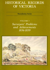
Book, Michael Cannon, Historical records of Victoria : foundation series : volume 5 : surveyors? problems and achievements 1836-1839, 1988
Reproductions of various transactions and reports dealing with the surveying history of Port Phillip, including letters, maps, illustrations, tables, and a detailed history of the surveying of Victoria.maps, b&w illustrations, b&w photographs, tablesvictorian history, port phillip, robert hoddle, monee monee creek, geelong, barwon river, werribee river -
 Victorian Aboriginal Corporation for Languages
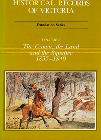
Book, Michael Cannon, Historical records of Victoria : foundation series : volume 6 : the crown, the land and the squatter 1835-1840, 1991
Reproductions of various transactions and reports dealing with squatting, land tenure and agricultural production in Port Phillip in the years 1835-1840. A history of land grants, surveying, squatters? life and land use during this period.maps, b&w illustrations, colour illustrationsvictorian history -
 Victorian Aboriginal Corporation for Languages
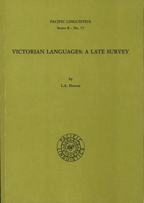
Book, L A Hercus, Victorian languages : a late survey, 1997
Outlines and notes on a variety of Victorian languages. Chapters on the Wemba Wemba language; the Wergaia Language (Djadjala dialect); the Madimadi language; and the Narinari language; phonetic notes on Gundidj, Woiwuru, Yodayoda, Ganai (Gippsland) and Southern Ngarigu; Aboriginal - English Vocabularies; and an English - Aboriginal vocabulary.maps, word lists, b&w photographswemba wemba, wembawemba, madimadi, madhi madhiu, woiwuru, woiwurrung, wergaia, djadjala, narinari, wadi wadi, gundidj, buandidj, buandig, yodayoda, yorta yorta, gippsland, southern narigu, glossaries, vocabularies, luise hercus -
 Victorian Aboriginal Corporation for Languages
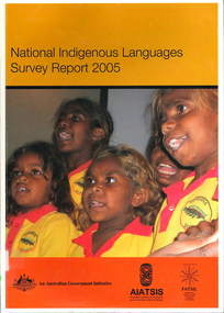
Book, Australian Institute of Aboriginal and Torres Strait Islander Studies, National Indigenous languages survey report 2005, 2005
The National Indigenous Languages Survey Report 2005 highlights that: of an original estimated 250 known Australian Indigenous languages, only 18 languages are now considered 'strong' and have speakers in all age groups; about 110 Indigenous languages are still spoken by older people but are endangered; words and phrases are still in use and there is community support in many parts of the country for reclamation and learning programs for many other languages which are no longer fully spoken; communities around Australia possess many of the elements required to keep Indigenous languages strong or to reclaim them. They have skilled and devoted language workers and teachers, excellent teaching materials, good documentation of languages and active community language centresmaps, colour photographs, tables, graphsaboriginal english, education, aiatsis, fatsil, language endangerment, language maintenance, language revival, language policy, language proficiency -
 Victorian Aboriginal Corporation for Languages
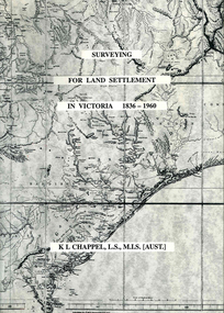
Book, K L Chappel, Surveying for land settlement in Victoria 1836-1960 : survey of the Vic-NSW boundary, survey of the Vic-SA boundary, 1996
... Street Brunswick melbourne surveying land settlement maps, b&w ...A record of the early history of surveying for land settlement. Includes appendices on the border surveys between Victoria and South Australia and between Victoria and New South Wales.maps, b&w photographs, illustrationssurveying, land settlement -
 Victorian Aboriginal Corporation for Languages
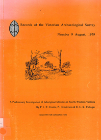
Book, PJF Coutts et al, Records of the Victorian Archaeological Survey : number 9, August 1979 : a preliminary investigation of Aboriginal mounds in North-Western Victoria, 1979
... Street Brunswick melbourne Victoria Archaeological Survey Murray ...Maps, charts, graphs, b&w photographs, diagramsvictoria archaeological survey, murray valley, grampians -
 Victorian Aboriginal Corporation for Languages
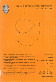
Book, Records of the Victorian Archaeological Survey : number 10, June 1980, 1980
Maps, charts, graphs, b&w photographs, diagrams -
 Creswick Campus Historical Collection - University of Melbourne
Still Image, 1952
... of a topographical map marked State Aerial Survey. Stored in a brown... section of a topographical map marked State Aerial Survey. Stored ...Subject: King Lake . 6 brown envelopes marked Run 3, 4, 7, 7a, 8, 9 containing c. 80 prints. 1 section of a topographical map marked State Aerial Survey. Stored in a brown cardboard file box marked King Lake Run No.3 - 9. (x9). Photos commissioned by Forests Commission Victoria.Aerial Photographs -
Lakes Entrance Regional Historical Society (operating as Lakes Entrance History Centre & Museum)
Book, Hawkins Richard, Geophysical survey at the New Works artificial entrance Lakes Entrance East Gippsland Victoria, 1984
Survey and comprehensive boating guide to the creeks and harbours and waterways of the Gippsland Lakes Victoria at December 1984 contains maps, charts giving depth. Brief history of the region.waterways, boats and boating -
Clunes Museum
Map - MAPS/ DOCUMENTS, CIRCA 1857
COLLECTION OF DOCUMENTS (COPIES OF10 MAPS AND DIAGRAMS OF TOURAAL PURCHASED UNDER PREEMPTIVE RIGHT BY DONALD CAMEROM 17TH FEBRUARY, 1857. COUNTY OF TALBOT - GOLDFIELD'S SURVEY PLAN NO.1 CLUNES COUNTY OF TALBOT. GLENDONALD - CRESWICK/CLUNES.local history, mining -
Clunes Museum
Map, PHOTO LITHOGRAPHED AT DEPT OF LANDS & SURVEY, MELBOURNE BY J NOONE. SURVEYED BY EDWARD C COMPTON 6TH SEPTEMBER 1872
MAP OF ALLOTMENTS IN CLUNESlocal history, documents, map, township, clunes -
Clunes Museum
Map - SURVEYERS MAP OF CLUNES, J. FINNIE, 1883
... SURVEYERS MAP OF CLUNES MAP OF CLUNES LITHOGRAPHED BY R. SHEPHERD ...A SURVEYORS MAP OF CLUNES. GEOLOGICALLY AND TOPOGRAPHICALLY SURVEYED BY R.A.F. MURRAY.LITHOGRAPHED BY R. SHEPHERD AND PRINTED BY J. FINNIE MINING DEPARTMENT, MELBOURNE,1883document, surveyers map of clunes, map of clunes -
 Peterborough History Group
Document - Survey of Town of Peterborough, 2014
... Proclamation of road district and Shires, Map of original town blocks ...Proclamation of road district and Shires, Map of original town blocks and ad for SaleDisplays original township settlement and layoutPhotocopies, copies of maps, peterborough history, peterborough 3270 -
Stawell Historical Society Inc
Map, Underground Survey of the Principal Mines of Stawell 1879, 1879
Pleasant Creek & Newington, Prince Patrick, Prince Alfred, Pioneer and Galatea, Pleasant Creek Cross Reef No. 1&2, Magdala, Old Shaft, Extended Cross Reef, Crown Cross, Great Northern, Sloanes & Scotchmans, South Cross, 10 & 11 United Scotchmans South Cross, Scotchmans Shafts, North Scothmans, West Scotchmans, Emerald Isle & Rose of Denmark, Albion, South Scotchmans, Newington & Pleasant Creek, Pleasant Creek Cross Reef, Moonlight, Extended Cross Reef, Crown cross United, Great Northern ShaftVery large Map on cloth backing, showing cross sections of mines.Surveyed by H.C. Bates. Drawn by Arthur Edwards. October 30th 1879. Scales 120 feet to an inchmining, gold -
Stawell Historical Society Inc
Archive - Maps, Victorian Government, Bailliere's Country Atlas of Victoria, 1866
Stawell is on Wimmera & Loddon MapLarge Boxed Volume of Maps in Book Burgandy Coloured BoxUnder the Supervision of the Mining and Survey Department -
Stawell Historical Society Inc
Map, R.O. Robson - Authorised Surveyor, Road from Glenorchy to near Geary's Selection Callawaddy 1880, 29.04.1880
Survey for Road CreationCloth Backed Map. Plan of Road.Parishes of Richella & Callawadda. County of Borong. Plan of Road. R.O. Robson Authorised Surveyor Stawell 29.04.80 -
Stawell Historical Society Inc
Map, Department of Lands and Survey Melbourne, Swinton Estate. Parish of Riachella. County of Borong, 3-08-1921
Shows part of Warranook TrainwayA1 Printed Map With Cloth Backing. Annotations in Red Ink W.J. Butson 3-8-21farming -
Stawell Historical Society Inc
Map - Parish Map, Barkley County of Kara Kara 1920's, 1920's ?
... grampians Johnsons Gully Lead Survey By Authority H.J. Green Govt ...Johnsons Gully LeadPaper map of Parish of BarkelyBy Authority H.J. Green Govt Printer. Photo Lithographed at the Department of Lands and Survey. Melbourne 22.11.2survey -
Stawell Historical Society Inc
Map, Easton Johnstone, Map of Stawell Surveyed by Easton Johnstone 1872, 1872
... Machines & Title Info Map of Stawell Surveyed by Easton Johnstone ...Victoria Co Crushing Machine. St Georges Co Crushing machine. Wimmera Co Crushing Machine. Government Reservoir and Drainage. Sloan Street, Skene Street Mines. old Mine WorkingsA2 map of Stawell Reefs Area. Showing Crushing Machines & Title InfoSurveyed by Easton Johnstone Contract Surveyor. Photo-Lithographed at the Department of Lands & Survey. Melbourne By J Noone 9th May 1872mining -
Stawell Historical Society Inc
Map, Lexington County of Borong 1910, 1910
Parish to the North East of MoystonA2 Parish mapPhoto Lithographed at the Department of Lands and Survey. Melbourne by T.F. McGauran 5.12.10survey -
Stawell Historical Society Inc
Map, T.F. McGauran, William Couty of Borong 1891, 1891
Stawell Water Supply Reserve. Grampians State Forest. Dairy Creek, Fyans Creek, Barney's Creek, Bovine Creek, Glasstree Creek, Stoney Creek. Stawell Water Supply Aquaduct Fkuming Tunnel.A2 Parish Map of Willam Inculdin Stawell Water Supply Reserve and Creeks. Marked in redPhoto Lithographed at the Department of Lands and Survey Melbourne. By T.F. McGauran 20.07.91 water supply survey -
Stawell Historical Society Inc
Map, T.F. McGauran, Winjallock County of Kara Kara, 1900
Noth of Navarre and BarkleyA2 Map0f Parish of Kara Kara.Photo Lithographed and the department of Lands & Survey, Melbourne by T.F. McCauran 22.10.00survey -
Stawell Historical Society Inc
Map - Parish Map, Department of Lands and Survey, Ashens County of Borung 1941, 1941
Murtoa Lake MarmaPaper Brown Coloured MapDrawn and Reproduced at the department of Lands and Survey Melbourne 1.5.1941survey -
Stawell Historical Society Inc
Map, Department of Crown Lands and Survey Victoria, Allotments in the Township of Banyana. Parish of Burrum Burrum. 1946 / 1971, 1971
... Lands and Survey Victoria 1971. Paper Map of County of Borung ...Richardson River. Avon River JunctionPaper Map of County of BorungReprint of the 1946 edition. Drawn and reproduced at the Department of Crown Lands and Survey Victoria 1971.survey -
Stawell Historical Society Inc
Map, Department of Lands & Survey J. Noone, Township of Heatherlie. Parish of Baroka. County of Borung 1888, 1888
... Lithographed at the Department of lands and Survey Melbourne By J Noone ...Stawell & Grampians Freestone Quarry Company Railway Reserve. Cross & masons Quarry Site. Mamnager'sHouse, Stead's boarding House Stawell and Grampians railwaySurveyed Township Showing Quarry and railway Reservephoto Lithographed at the Department of lands and Survey Melbourne By J Noone 15.6.88railway quarry -
Stawell Historical Society Inc
Map, Department of Lands and Survey, Borough of Stawell. Parishes of Stawell and Illawarra 1903, 1903
Victoria Co., St Georges Co., Wimerra Co., Leviathon Co. Tramway, Quarry reserve, Newington Co., Galatea Co., Moonlight Co., Federal Co., Borough reservior., A0 Map of Stawell on linen backing. Plus one Printed on PaperPhoto Lithograped at the Department of Lands and survey Melbourne by T.F. McGauran 13.6.03surevy -
Stawell Historical Society Inc
Map - Subdivision map, Subdivision of Woodlands Estate Map
Shows Homestead Cottage and Dam, Plus Shed. Malakoff NavarreA3 photocopy of MapParishes of Malakoff and Navarre. County of Kara karasurvey -
Stawell Historical Society Inc
Map, Plan of Division Line between Ararat and Stawell Shires 1877, 1877
Grampians Halls Gap Black Range Stawell Shire Ararat Shire Crowlands TownshipVery Large Map Printed on Linen with Table of bearingsExamined by H.C. Malcolm 28.12.77 Traced By D.H. Meike 28.12.77survey -
Stawell Historical Society Inc
Map, Township of Stawell
... B/W map of Stawell Surveyed by Easton Johnston Contract... grampians B/W map of Stawell Surveyed by Easton Johnston Contract ...B/W map of Stawell Surveyed by Easton Johnston Contract surveyor Scale in Chains. Showing Special Allotments Reefs, Pleasant Creek Parish of Stawell. Map No L4000 -
Stawell Historical Society Inc
Map, Charles C Reilly, Oriental & North Cross Reef Mine showing underground drives, 3/5/1900
Underground Survey of Mines Stawell c1900Charles C Reilley 3.5.00 mining, gold, map