Showing 7614 items matching " road development"
-
 Greensborough Historical Society
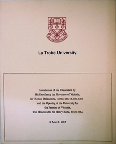
Program, La Trobe University: Installation of Chancellor and opening of the University 1967, 08/03/1967
Installation of Chancellor Sir Archibald Glenn at La Trobe University by Sir Rohan Delacombe, Governor of Victoria. Official opening of La Trobe University in Bundoora on 8th March 1967 by Premier Sir Henry Bolte. Contains background on the development of the university.Celebration of the establishment of the Third University of Victoria. Named after after Charles Joseph La Trobe, Victorias first Lieutenant Governor. It will grow to serve Victoria's North Western Community. The Setting is River Red Gums and grass lands which will be be maintained throughout.Manila coloured card folder with red coloured coat of arms of La Trobe University on cover. Development Plan of university on back cover. (3 copies)la trobe university, bundoora, archibald glenn. -
 Greensborough Historical Society
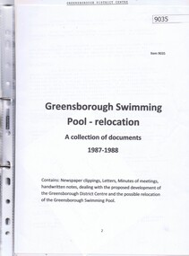
Document - Document Collection, Greensborough Swimming Pool relocation: a collection of documents 1987-1988, 1988-2000
Documents collected by Brian Smiddy from 1987-1988. Includes newspaper clippings, handwritten notes, minutes of meetings and letters dealing with the proposed development of the Greensborough District Centre and possible relocation of the Greensborough Swimming Pool. Contains objections to this development.Plastic folder with clear cover and black plastic binding containing approx 18 documents and handwritten notes.brian smiddy, greensborough district centre, greensborough swimming pool, swimming, swimming pools greensborough -
 Greensborough Historical Society
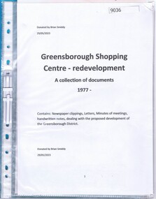
Document - Document Collection, Greensborough Shopping Centre redevelopment: a collection of documents 1977, 1977
Documents collected by Brian Smiddy from 1977. Includes newspaper clippings, handwritten notes, minutes of meetings dealing with the proposed development of the Greensborough District Centre and possible. Contains objections to this development.Plastic folder with clear cover and black plastic binding containing approx 6 documents and handwritten notes.brian smiddy, greensborough district centre, greensborough swimming pool -
 Greensborough Historical Society
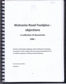
Document - Document Collection, Watsonia Road Food Plus - objections: a collection of documents 1982, 1982
Documents collected by Brian Smiddy from 1982. Includes newspaper clippings, handwritten notes, minutes of meetings and letters dealing with the proposed development of a Food plus business in Watsonia Road Watsonia. Contains objections to this development.Plastic folder with clear cover and black plastic binding containing approx 8 documents and handwritten notes.brian smiddy, watsonia food plus, watsonia s, watsonia shopping centre, watsonia road watsonia -
 Greensborough Historical Society
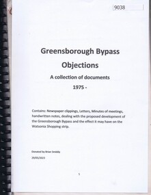
Document - Document Collection, Greensborough Bypass: objections: a collection of documents 1975, 1975
Documents collected by Brian Smiddy from 1975. Includes newspaper clippings, handwritten notes, minutes of meetings dealing with the proposed development of the Greensborough Bypass and the effect it may have on the Watsonia Shopping strip. Contains objections to this development.Black plastic folder with black plastic binding containing approx 37 documents and handwritten notes.brian smiddy, greensborough bypass, watsonia road watsonia, watsonia shopping centre -
 Ararat & District Historical Society (operating the Langi Morgala Museum)
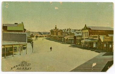
Postcard, Barkly Street Ararat
Barkly Street is the main road into the business district of Ararat and has developed significantly since this image was taken. The postcard helps define the township in its early stages of colonialisation and reflects on the style of early architecture. The image is a photographic representation of wide streets, assorted businesses and buildings with a bicyclist and horse-drawn carriage in the background. The vantage point seems to be the balcony of Leopolds hotel. This early 1900s streetscape assists in the understanding of our township's development over the decades, both socially and architecturally.Small, landscape orientation rigid postcard, colourised, featuring Barkly Street in Ararat, circa 1900s. Notable features are the Turf Hotel sign and the lettering 'Yankee Doodle' on a building wall.Front: "Barkly Street Ararat". barkly street, ararat, 1900s, buildings, streetscape, architecture, postcard, colourised, turf hotel, leopolds hotel -
 Eltham District Historical Society Inc
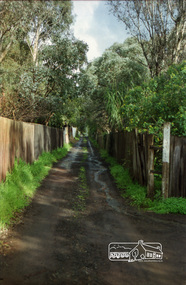
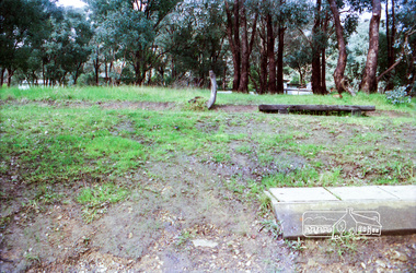
Photograph, Mountain View Road, Briar Hill, c.1976, 1976c
Taken opposite No., 140Streetscape development over timeRoll of 35mm colour negative film, 2 stripsAgfa CN S602mountain view road, briar hill -
 Eltham District Historical Society Inc
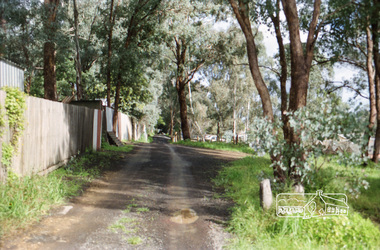
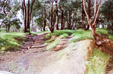
Photograph, Para Road and Main Road, Lower Plenty, c.1976, 1976c
... melbourne Streetscape development over time para road lower plenty ...Streetscape development over timeRoll of 35mm colour negative film, 2 stripsAgfa CNSpara road, lower plenty, shops, main road, shoe inn, maunder's food store -
 Eltham District Historical Society Inc
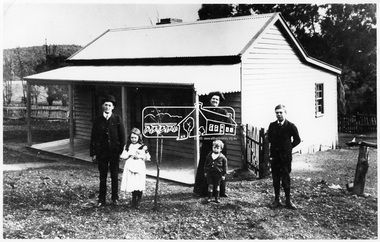
Photograph, Coleman family and home, Main Road, Eltham, c.1909
... . Demolished c.2000 for development of units. Main Road before.... Demolished c.2000 for development of units. Main Road before ...Coleman family and home, Coleman’s Corner, Eltham, c.1909 L-R: Tom Newton (school teacher and nephew of Mrs Coleman), Mary Agnes Coleman (later Mrs Dawes 1904-1957), Mrs Mary Ann Coleman nee Bourke (1877-1927); mother of Jack (John Lawrence 1895-1969), George Lawrence (1906-1953) and Mary Agnes (1904-1957). John (Jack) Coleman was father of John Jnr and father in law to Margaret (nee Dare). The cottage was located on a bend of Wattletree Rd near Main Road. Built about 1905 and later extended. Demolished c.2000 for development of units. Main Road before it was realigned used to take in the current Coleman Crescent. Same as 1678A. Not in register. Source: Mrs. M. Coleman, Coleman's Corner, Eltham This photo forms part of a collection of photographs gathered by the Shire of Eltham for their centenary project book,"Pioneers and Painters: 100 years of the Shire of Eltham" by Alan Marshall (1971). The collection of over 500 images is held in partnership between Eltham District Historical Society and Yarra Plenty Regional Library (Eltham Library) and is now formally known as the 'The Shire of Eltham Pioneers Photograph Collection.' It is significant in being the first community sourced collection representing the places and people of the Shire's first one hundred years.Digital image 4 x 5 inch B&W Neg Print 16.5 x 25 cmshire of eltham pioneers photograph collection, coleman cottage, coleman crescent, coleman family, coleman's corner, eltham, george lawrence coleman, jack coleman, john lawrence coleman, main road, mary agnes dawes (nee coleman), mary ann coleman (nee bourke), tom newton, wattletree road, 1909 -
 Eltham District Historical Society Inc
Photograph, Peter Bassett-Smith, Former Brinkkotter Poultry Farm, Main Road, Research, April 1988, 1988
Four colour photographs of the former Brinkkotter Poultry Farm, Main Road, Research depicting the 'Regency Acres' real estate development of 22 lots advertised for auction 19 April 1988. The four photographs are shot by Peter Bassett-Smith in a panoramic sweep of the estate from Eltham College to the Research Primary School.poultry farm, main road, research vic., brinkkotter -
 Eltham District Historical Society Inc
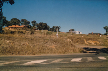
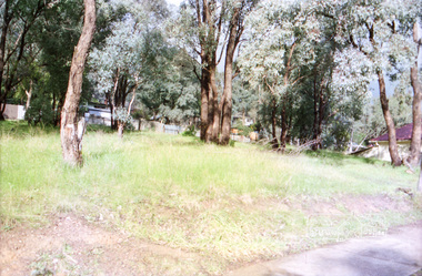
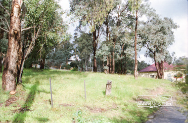
Photograph, Vacant land at 816 Heidelberg-Kinglake Road, Hurstbridge, c.1980, 1980c
Now fully developed as multiple unitsStreetscape evolution; prior to development of reserve for housing units and redevelopment of shops opposite Hurstbridge Railway StationRoll of 35mm colour negative film, 4 stripsKodak GB 200 5096streets, heidelberg-kinglake road, hurstbridge, railway station -
 Eltham District Historical Society Inc
Photograph, Vacant land at 816 Heidelberg-Kinglake Road, Hurstbridge, c.1980, 1980c
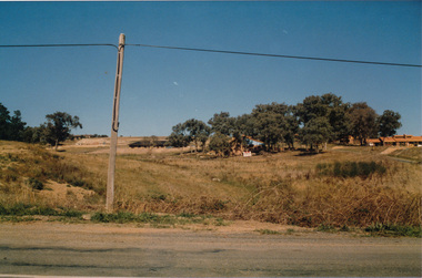
Streetscape evolution; prior to development of reserve for housing units and redevelopment of shops opposite Hurstbridge Railway StationRoll of 35mm colour negative film, 4 stripsKodak GB 200 5096streets, heidelberg-kinglake road, hurstbridge, railway station -
 Eltham District Historical Society Inc
Photograph, Vacant land at 816 Heidelberg-Kinglake Road, Hurstbridge, c.1980, 1980c
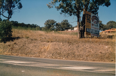
Streetscape evolution; prior to development of reserve for housing units and redevelopment of shops opposite Hurstbridge Railway StationRoll of 35mm colour negative film, 4 stripsKodak GB 200 5096streets, heidelberg-kinglake road, hurstbridge, railway station -
 Eltham District Historical Society Inc
Photograph, Vacant land at 816 Heidelberg-Kinglake Road, Hurstbridge, c.1980, 1980c
Streetscape evolution; prior to development of reserve for housing units and redevelopment of shops opposite Hurstbridge Railway StationRoll of 35mm colour negative film, 4 stripsKodak GB 200 5096streets, heidelberg-kinglake road, hurstbridge, railway station -
 Eltham District Historical Society Inc
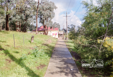
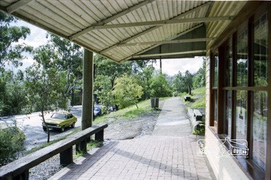
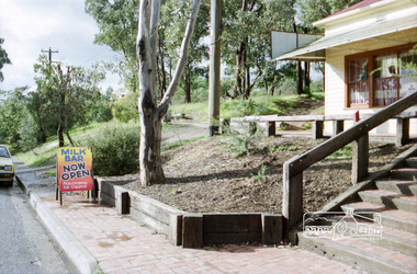
Photograph, Milk Bar at 808 and vacant land at 816 Heidelberg-Kinglake Road, Hurstbridge, c.1980, 1980c
Streetscape evolution; prior to development of reserve for housing units and redevelopment of shops opposite Hurstbridge Railway StationRoll of 35mm colour negative film, 4 stripsKodak GB 200 5096streets, heidelberg-kinglake road, hurstbridge, milk bar, bendigo bank, railway station -
 Eltham District Historical Society Inc
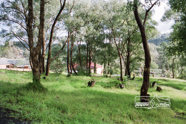
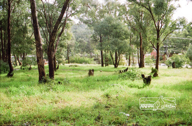
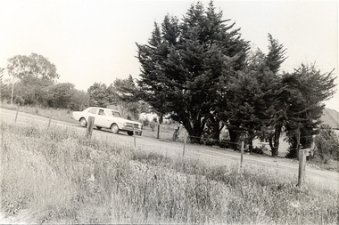
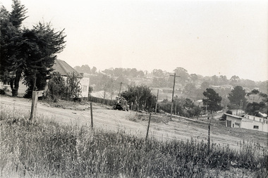
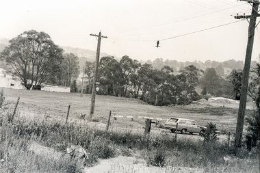
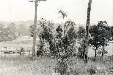
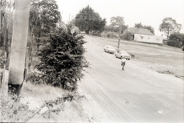
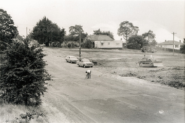
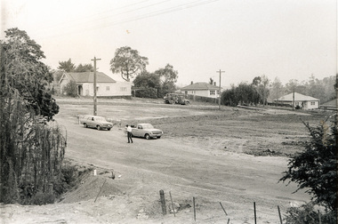
Photograph, Sherbourne Road, Para Road and Simms Road at Briar Hill/Montmorency prior to the upgrade of Sherbourne Road Railway bridge, c.1970
Collection of photographs probably taken around the same time depicting Sherbourne Road, Para Road and Simms Road at Briar Hill/Montmorency prior to the upgrade of Sherbourne Road Railway bridge, c.1970. Photo 01648_ 19 This home owned by Mrs Cameron. Her daughter married a Mr Davey, for whom Davey Road was named - email from M. Jones 20/07/2015 Photographer unknownThese photos are very significant in the documentation of the development of the Briar Hill and Montmorency areas and the changes in the physical landscape along the railway line area.20 black and white prints 9 cm x 13 cm.1970, briar hill, davey road, montmorency, para road, cameron, davey, sherbourne road, simms road, railway line, roadworks -
 Eltham District Historical Society Inc
Photograph, Sherbourne Road, Para Road and Simms Road at Briar Hill/Montmorency prior to the upgrade of Sherbourne Road Railway bridge, c.1970
Collection of photographs probably taken around the same time depicting Sherbourne Road, Para Road and Simms Road at Briar Hill/Montmorency prior to the upgrade of Sherbourne Road Railway bridge, c.1970. Photo 01648_ 19 This home owned by Mrs Cameron. Her daughter married a Mr Davey, for whom Davey Road was named - email from M. Jones 20/07/2015 Photographer unknownThese photos are very significant in the documentation of the development of the Briar Hill and Montmorency areas and the changes in the physical landscape along the railway line area.20 black and white prints 9 cm x 13 cm.1970, briar hill, davey road, montmorency, para road, cameron, davey, sherbourne road, simms road, railway line, roadworks