Showing 9293 items matching "warrandyte"
-
 Ringwood and District Historical Society
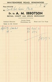
Document, 1957 Receipt to Godbehear Bros, North Ringwood Orchardists, from AM Ibbotson, Grain Merchant, Warrandyte Road, Ringwood
-
 Ringwood and District Historical Society
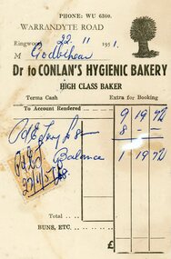
Document, 1951 Receipt to Charles & Jack Godbehear, North Ringwood Orchardists, from Conlan's Hygienic Bakery, Warrandyte Road, Ringwood
-
 Ringwood and District Historical Society
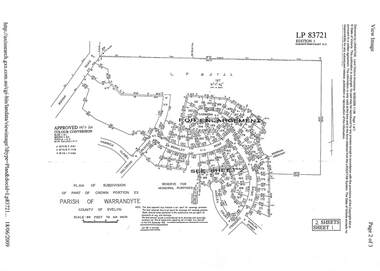
Document - Subdivision Plan, LP83721 - Part of Crown Portion 23, Parish of Warrandyte, County of Evelyn - 1969
A4 LANDATA Land Victoria plan printout dated 2009Two A4 maps of residential subdivision off Wonga Road, Ringwood. Enlargement map includes Holyrood Crescent, Berkley Road, Carmen Court, Frederic Drive, Kenwood Crescent, Marilyn Street and Adele Court. -
 Ringwood and District Historical Society
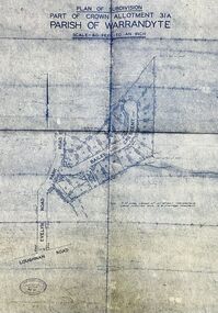
Map - Plan of Subdivision, Part of Crown Allotment 31A, Parish of Warrandyte - (Undated)
Facsimile blueprint copy of 24 residential allotments with property dimensions in Bailey Crescent (later Gabriella Court) and McEwan Street (later Suzanne Court) off Park Road and Evelyn Road, Ringwood North. Attached photocopy of undated map of allotment on south-east corner of Evelyn and Park Roads.Rubber stamp impression - J. Horne, Licensed Surveyor, 458 Nepean Highway, Frankston 31736. -
 Ringwood and District Historical Society
Document - Subdivision Map, Part of Crown Sections 18, 19, 24 & 25, Parish of Warrandyte, County of Evelyn, Vol 5228 Fol 472 - 1926. (Park Orchards, Victoria)
A3 and A4 sized photocopies showing map section of land title showing streets, easements and allotment numbers, some with handwritten names and pricing notations circa mid 1950s.Map includes Valley Road, Granard Avenue, Park Road, Arundel Avenue, Hylton Avenue, Aviemore Avenue, Bowmore Avenue, Hopetoun Road, Colin Avenue, Daintree Avenue, Brucedale Crescent, Feversham Avenue, Ennismore Crescent, Iona Grove, Elgin Crescent and Gosford Crescent, Park Orchards, Victoria. -
 Ringwood and District Historical Society
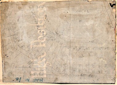
Map, Planned subdivision on White Horse Road & Warrandyte Road corner, Ringwood, Victoria - (Undated - circa 1950s)
Faded hand-drawn map on lightly transparent paper with cardboard backing. Subdivision plan for Bamford's Timber site, later varied for Safeway supermarket and subsequently part of Eastland shopping precinct by 2020s.P. Bamford -
 Ringwood and District Historical Society
Document - Map, Part of Crown Allotment 27C, Parish of Warrandyte, County of Evelyn, Ringwood, Victoria - c.1970
Photocopy of subdivision plan 75131 Vol 3439 Fol 712 showing numbered residential allotments with property dimensions.Surveyors and Consulting Engineers - O'Connor & Beveridge, Main Eltham Road, Lower Plenty, Tel. 432668. Rubber-stamped "Photocopy - Titles Office Complied 17 Feb 1970". Map includes Lockhart Road, Lansell Close, Terrara Place, Goldsmith Avenue, Park Hill Drive, Hilldale Close, and Elm Court, Ringwood, Victoria. -
 Ringwood and District Historical Society
Document - Plan of Subdivision, Part of Crown Allotment 31B, Parish of Warrandyte - 1965
Map showing residential allotments numbered 1, 2, 4 and 5, on Through Road, Ringwood, Vic., with property dimensions, including weatherboard house and galvanised iron garage on lot 2.Kirkpatrick & Webber, Licensed Surveyors, Civil Engineers & Town Planners, Maroondah Highway, Ringwood, Telephone 8700321. Ref 3438C. Date 4th December, 1964. Amended 19th July, 1965. Notation: "The land coloured blue is a drainage and sewerage easement. Levels are to Board of Works Datum. Lot number 3 has been omitted." -
 Ringwood and District Historical Society
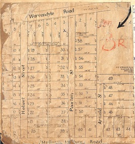
Map, Residential Subdivision Allotment Layout on Mullum Mullum Road, Hobart Street, Paxton Street, Arnold Street and Warrandyte Road, Ringwood, Vic. circa 1920
One of 3 unrelated land subdivision maps on cardboard backing.H.C. Crouch, Licensed Surveyor, 443 Lt Collins Street, Melbourne. -
 Ringwood and District Historical Society
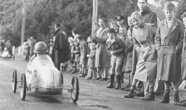
Photograph, Soap Box Derby, Warrandyte Road, Ringwood - 10/10/1953
Black and white photographTyped below photograph: "Soap Box Derby 15/10/53. Funds being raised for a new kindergarten building for Ringwood." Written on rear of backing sheet: "Mail 15/10/53. Ringwood Soap Box Derby. 'Silver Flash' from Northcote had a fairly comfortable win from Ringwood's 'Lilbom'." -
 Ringwood and District Historical Society
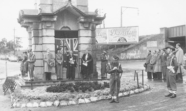
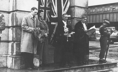
Photograph, Anzac Day Ceremony at Ringwood Clocktower in original position, cnr. Maroondah Highway and Warrandyte Road, Ringwood - circa 1952
Black and white photograph (2 copies- 1 large, 1 small)Typed below photograph: "Clock Tower in original position Anzac Day Ceremony." Ringwood Mayor, Cr.F. Corr at microphone. -
 Ringwood and District Historical Society
Photograph, Anzac Day Ceremony at Ringwood Clocktower in original position, cnr. Maroondah Highway and Warrandyte Road, Ringwood - circa 1952
Black and white photographImage shows Ringwood Mayor Cr.F. Corr speaking on the steps of the clocktower at the Anzac Day ceremony. -
 Ringwood and District Historical Society
Photograph, Anzac Day Ceremony at Ringwood Clocktower in original position, cnr. Maroondah Highway and Warrandyte Road, Ringwood - circa 1952
Black and white p[hotograph (2 copies- 1 large, 1 small)Image shows Ringwood Mayor Cr.F. Corr, and other dignitaries standing alongside the clocktower at the Anzac Day Service, 1952. -
 Ringwood and District Historical Society
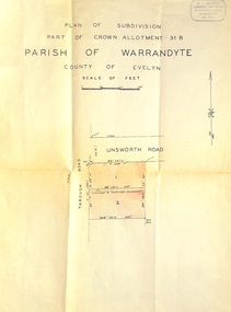
Document - Plan of Subdivision, Part of Crown Allotment 31B, Parish of Warrandyte, County of Evelyn - (undated, circa 1960s)
Map showing residential allotments numbered 1 and 2 on Through Road and Unsworth Road, Ringwood, Vic., with property dimensions and location of drainage & sewerage easement.H.J. Macey Licensed Surveyor, 36 Nerissa Street, Burwood (Telephone) BX1917. -
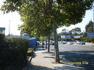
 Ringwood and District Historical Society
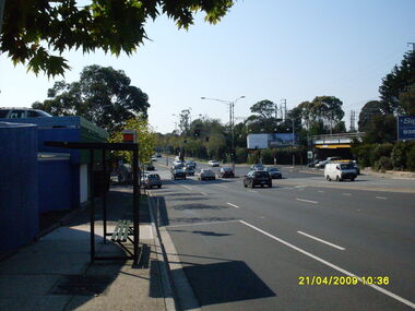
Photograph, Looking east along Maroondah Highway with bus stop on left and Warrandyte Road railway underpass on right, on 21 April 2009
Ron Brons photographic study of Ringwood. -
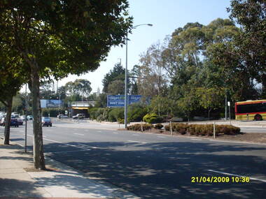
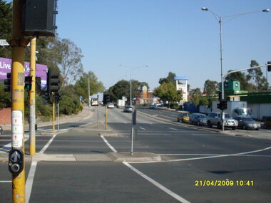
 Ringwood and District Historical Society
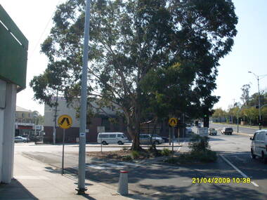
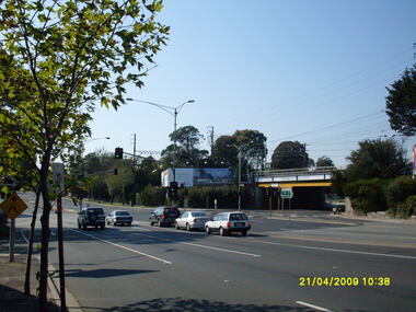
Photograph, Looking east at Maroondah Highway and Warrandyte Road intersection, on 21 April 2009
Ron Brons photographic study of Ringwood. -
 Ringwood and District Historical Society
Photograph, Looking along Maroondah Highway looking east with Harris Scarfe on left and Warrandyte Road railway underpass on right, on 21 April 2009
Ron Brons photographic study of Ringwood. -
 Ringwood and District Historical Society
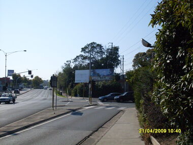
Photograph, Looking across Maroondah Highway looking south-east to the Warrandyte Road railway underpass, on 21 April 2009
Ron Brons photographic study of Ringwood. -
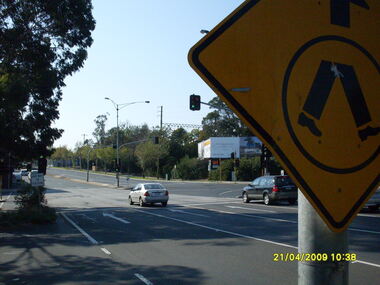
 Ringwood and District Historical Society
Photograph, Looking south-east at Maroondah Highway and Warrandyte Road intersection, on 21 April 2009
Ron Brons photographic study of Ringwood. -
 Ringwood and District Historical Society
Photograph, Looking east at Maroondah Highway and Warrandyte Road intersection, on 21 April 2009
Ron Brons photographic study of Ringwood. -
 Ringwood and District Historical Society
Photograph, Looking east along Maroondah Highway with Warrandyte Road underpass on right, on 21 April 2009
Ron Brons photographic study of Ringwood. -
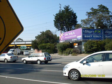
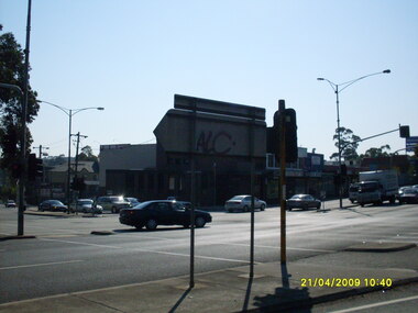
 Ringwood and District Historical Society
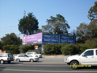
Photograph, Looking south south-east at Maroondah Highway and Warrandyte Road intersection, on 21 April 2009, showing advertising signs
Ron Brons photographic study of Ringwood. -
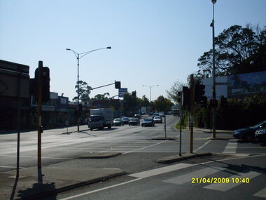
 Ringwood and District Historical Society
Photograph, Looking east along Maroondah Highway, on 21 April 2009, at the corner of Warrandyte Road
Ron Brons photographic study of Ringwood. -
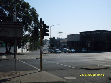
 Ringwood and District Historical Society
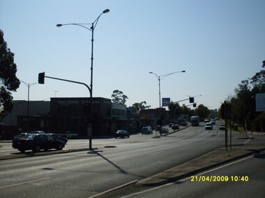
Photograph, Looking east along Maroondah Highway, on 21 April 2009, at the corner of Warrandyte Road showing Van Lierop Lawyers
Ron Brons photographic study of Ringwood. -
 Ringwood and District Historical Society
Photograph, West along Maroondah Highway, on 21 April 2009, Harris Scarfe shop at the corner of Warrandyte Road
Ron Brons photographic study of Ringwood. -
 Ringwood and District Historical Society
Photograph, Looking north-east along Maroondah Highway, on 21 April 2009, at the corner of Warrandyte Road showing Van Lierop Lawyers
Ron Brons photographic study of Ringwood. -
 Ringwood and District Historical Society
Photograph, Looking east along Maroondah Highway, on 21 April 2009, at the corner of Warrandyte Road showing Officeworks
Ron Brons photographic study of Ringwood. -
 Ringwood and District Historical Society
Photograph, Looking north-east along Maroondah Highway, on 21 April 2009, at the corner of Warrandyte Road
Ron Brons photographic study of Ringwood. -
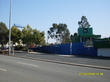
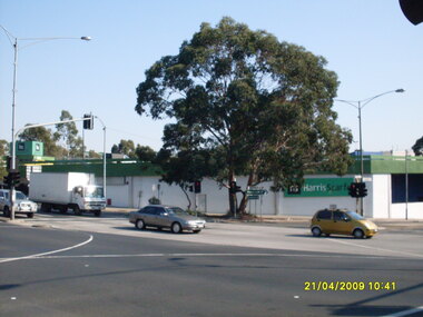 Ringwood and District Historical Society
Photograph, Corner of Maroondah Highway and Warrandyte Road showing Harris Scarfe shop, on 21 April 2009
Ron Brons photographic study of Ringwood. -
 Ringwood and District Historical Society
Photograph, Looking west along Maroondah Highway, on 21 April 2009,from east corner of Warrandyte Road
Ron Brons photographic study of Ringwood.