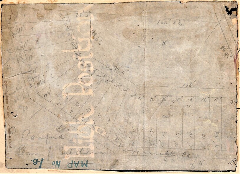
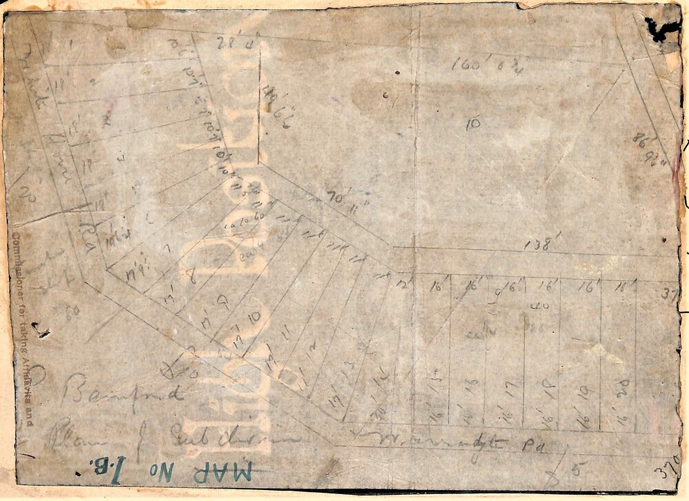
Map, Planned subdivision on White Horse Road & Warrandyte Road corner, Ringwood, Victoria - (Undated - circa 1950s)
Untitled image
Reuse this media
Can you reuse this media without permission?Yes
Conditions of use
Attribution-NonCommercial-ShareAlike 4.0 International (CC BY-NC-SA 4.0)
This media item is licensed under Attribution-NonCommercial-ShareAlike 4.0 International (CC BY-NC-SA 4.0). You may share (i.e. copy, distribute, transmit) and rework (i.e. alter, transform, build upon) this item provided that you attribute the content source and copyright holder, and identify any alterations; do not use the content for commercial purposes; and distribute the reworked content under the same or similar license.
Attribution
Please acknowledge the item’s source, creator and title (where known)
Faded hand-drawn map on lightly transparent paper with cardboard backing. Subdivision plan for Bamford's Timber site, later varied for Safeway supermarket and subsequently part of Eastland shopping precinct by 2020s.