Showing 1189 items matching " excursions"
-
 Eltham District Historical Society Inc
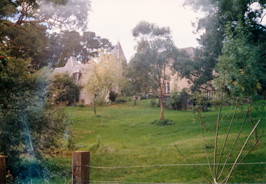
Photograph, Liz Pidgeon, Killeavey, Laughing Waters Road, Eltham 5 Nov 2016, 5 Nov 2016
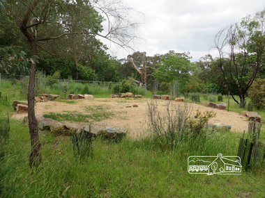
At the entrance to Killeavey; a great turnout from EDHS members and others.Born Digitalactivities, eltham district historical society, heritage excursion, kileavey, parks victoria, laughing waters road, eltham -
 Eltham District Historical Society Inc
Photograph, Liz Pidgeon, Killeavey, Laughing Waters Road, Eltham 5 Nov 2016, 5 Nov 2016
At the entrance to Killeavey; a great turnout from EDHS members and others.Born Digitalactivities, eltham district historical society, heritage excursion, kileavey, parks victoria, laughing waters road, eltham -
 Eltham District Historical Society Inc
Photograph, Peter Pidgeon, Killeavey, Laughing Waters Road, Eltham 5 Nov 2016, 5 Nov 2016
At the entrance to Killeavey; a great turnout from EDHS members and others.Born Digitalactivities, eltham district historical society, heritage excursion, kileavey, parks victoria, laughing waters road, eltham -
 Eltham District Historical Society Inc
Photograph, Holiday Program Excursion
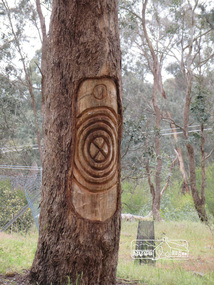
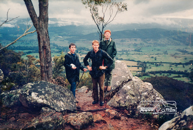
One of a set of display images thought to be produced by the Shire of Eltham c.1979-1987. Three young men stand on top of a hill, possibly Hanging Rock, Woodend. Probably members of the Eltham Youth Group Illustrative of services provided by former Shire of ElthamColour photograph 20 x 29 cm mounted on green-painted chipboard 28 x 35.5 cm (string on back for hanging)Title printed on label adhered to board below photograph (replaced June 2017)youth group -
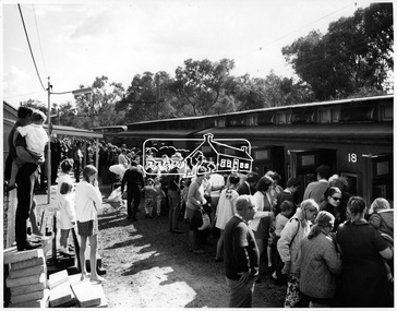 Eltham District Historical Society Inc
Photograph, Vintage Steam Train Excursion. View of train and passengers at Montmorency Station, 18 April 1971
Passengers boarding the vintage steam train at Montmorency Train Station. Regular trips travelled from Montmorency to Hurstbridge and return as part of the Shire of Eltham centenary program. The train also stopped at Eltham, Diamond Creek and Wattle Glen stations on the afternoon of Sunday 18th April 1971. This photo forms part of a collection of photographs gathered by the Shire of Eltham for their centenary project book, "Pioneers and Painters: 100 years of the Shire of Eltham" by Alan Marshall (1971). The collection of over 500 images is held in partnership between Eltham District Historical Society and Yarra Plenty Regional Library (Eltham Library) and is now formally known as 'The Shire of Eltham Pioneers Photograph Collection.' It is significant in being the first community sourced collection representing the places and people of the Shire's first one hundred years.Digital imagesepp, shire of eltham pioneers photograph collection, shire of eltham, shire of eltham centenary, centenary celebrations, montmorency railway station, steam train -
 Eltham District Historical Society Inc
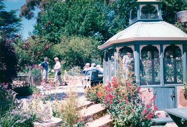
Photograph, Buda, Castlemaine, Spring Gardens Excursion, 30 October 1988, 30 Oct 1988
Pam and Marion EDHS Newsletter No. 62, September, 1988 SPRING GARDENS TRIP 30 Oct 1988 On this trip we will be visiting gardens which are of historic interest or of old world character. The date has been selected to coincide with the time when the gardens are likely to be at their best. The Central Victorian Goldfields area has been selected because it offers a wide range of gardens open to the public. From this range we have chosen three gardens which we think will be of great interest to members and their families and friends. These are the gardens: • "Buda", Castlemaine One of Victoria's most famous historic gardens. The mansion which was the home of the Leviny family for 118~ years is also open for inspection. • "Badger's Keep", Chewton This is a cottage garden (complete with 100 year old cottage) with a great diversity of plants. • "The Springs", Sedgwick A country garden also with a great array of plants The cost of the bus is $9.00 for adults and $5.00 for children. There is an additional charge for entry to the gardens, $2.00 each for "Badger's Keep" and "The Springs": for "Buda" it is $3.00, $1.50 for pensioners and $1.00 for children Each of the gardens has plants for sale. Bring your own picnic lunch. Please be at the Eltham Shire Offices by 8.15 a.m. so we can leave promptly at 8.30. To book for this trip complete the attached form and return the appropriate fare. EDHS Newsletter No. 63, November, 1988 RECENT ACTIVITIES More recently the Spring Gardens trip attracted a full bus load and a waiting list. Those who went thoroughly enjoyed the historic garden and mansion at "Buda" and two other excellent gardens at "Badger's Keep" and "The Springs". The popularity of this trip warrants a repeat performance. There are a number of other gardens of historic and general interest which are worth a visit in the future.Two colour photographic printsactivities, eltham district historical society, buda, castlemaine -
 Eltham District Historical Society Inc
Photograph, Buda, Castlemaine, Spring Gardens Excursion, 30 October 1988, 30 Oct 1988
Pam and Marion EDHS Newsletter No. 62, September, 1988 SPRING GARDENS TRIP 30 Oct 1988 On this trip we will be visiting gardens which are of historic interest or of old world character. The date has been selected to coincide with the time when the gardens are likely to be at their best. The Central Victorian Goldfields area has been selected because it offers a wide range of gardens open to the public. From this range we have chosen three gardens which we think will be of great interest to members and their families and friends. These are the gardens: • "Buda", Castlemaine One of Victoria's most famous historic gardens. The mansion which was the home of the Leviny family for 118~ years is also open for inspection. • "Badger's Keep", Chewton This is a cottage garden (complete with 100 year old cottage) with a great diversity of plants. • "The Springs", Sedgwick A country garden also with a great array of plants The cost of the bus is $9.00 for adults and $5.00 for children. There is an additional charge for entry to the gardens, $2.00 each for "Badger's Keep" and "The Springs": for "Buda" it is $3.00, $1.50 for pensioners and $1.00 for children Each of the gardens has plants for sale. Bring your own picnic lunch. Please be at the Eltham Shire Offices by 8.15 a.m. so we can leave promptly at 8.30. To book for this trip complete the attached form and return the appropriate fare. EDHS Newsletter No. 63, November, 1988 RECENT ACTIVITIES More recently the Spring Gardens trip attracted a full bus load and a waiting list. Those who went thoroughly enjoyed the historic garden and mansion at "Buda" and two other excellent gardens at "Badger's Keep" and "The Springs". The popularity of this trip warrants a repeat performance. There are a number of other gardens of historic and general interest which are worth a visit in the future.Seven colour photographic printsactivities, eltham district historical society, buda, castlemaine -
 Eltham District Historical Society Inc
Photograph, Lunch in Fitzroy Gardens, Melbourne City excursion, 12 April 1987, 12/04/1987
Two colour photographsactivities, fitzroy gardens -
 Eltham District Historical Society Inc
Photograph, Churchill Island, Spring Excursion, 22 November 1987, 22/11/1987
Churchill Island is a small island adjacent to Philip Island. It is the site where James Grant planted the first crops in Victoria in 1801. It also contains other features of historical and environmental interest.Six colour photographsactivities, churchill island -
 Eltham District Historical Society Inc
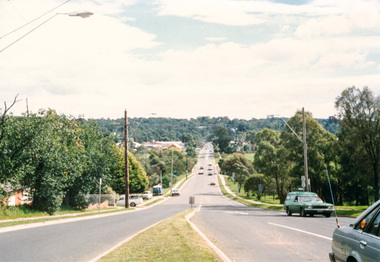
Photograph, Looking west along Bridge Street, Eltham from Main Road; 15 April 1989, 15/04/1989
[from EDHS Newsletter No. 65, March, 1989:] ELTHAM HERITAGE WALK The Society's contribution to Heritage Week this year will be a guided walk around Eltham featuring a number of buildings and locations of historical and environmental interest. Three dates are listed as official Heritage Week events, Sundays 16th and 23rd April and Saturday 22nd. In addition, there will be a walk on Saturday 15th for Society Members. All walks will start at 1:00 p.m. in Panther Place near Shillinglaw Cottage. Each will take about four hours and the distance is about 5km. Old photos of locations visited will be available for viewing.Two colour photographsactivities, bridge street, eltham, heritage excursion, main road -
 Eltham District Historical Society Inc
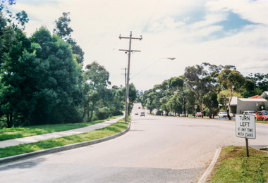
Photograph, Looking north along Bridge Street, Eltham from Main Road; 15 April 1989, 15/04/1989
[from EDHS Newsletter No. 65, March, 1989:] ELTHAM HERITAGE WALK The Society's contribution to Heritage Week this year will be a guided walk around Eltham featuring a number of buildings and locations of historical and environmental interest. Three dates are listed as official Heritage Week events, Sundays 16th and 23rd April and Saturday 22nd. In addition, there will be a walk on Saturday 15th for Society Members. All walks will start at 1:00 p.m. in Panther Place near Shillinglaw Cottage. Each will take about four hours and the distance is about 5km. Old photos of locations visited will be available for viewing.Colour photographactivities, bridge street, eltham, heritage excursion, main road -
 Eltham District Historical Society Inc
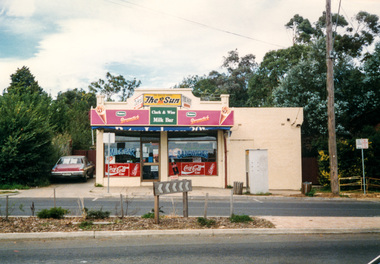
Photograph, Clark and Wise, Milk Bar, former Burgoyne shop, 820 Main Road, Eltham; 15 April 1989, 15/04/1989
[from EDHS Newsletter No. 65, March, 1989:] ELTHAM HERITAGE WALK The Society's contribution to Heritage Week this year will be a guided walk around Eltham featuring a number of buildings and locations of historical and environmental interest. Three dates are listed as official Heritage Week events, Sundays 16th and 23rd April and Saturday 22nd. In addition, there will be a walk on Saturday 15th for Society Members. All walks will start at 1:00 p.m. in Panther Place near Shillinglaw Cottage. Each will take about four hours and the distance is about 5km. Old photos of locations visited will be available for viewing.Colour photographactivities, heritage excursion, main road, burgoyne store, milk bar, shops -
 Eltham District Historical Society Inc
Photograph, Former CBA bank, 810 Main Road, Eltham near John Street; 15 April 1989, 15/04/1989
[from EDHS Newsletter No. 65, March, 1989:] ELTHAM HERITAGE WALK The Society's contribution to Heritage Week this year will be a guided walk around Eltham featuring a number of buildings and locations of historical and environmental interest. Three dates are listed as official Heritage Week events, Sundays 16th and 23rd April and Saturday 22nd. In addition, there will be a walk on Saturday 15th for Society Members. All walks will start at 1:00 p.m. in Panther Place near Shillinglaw Cottage. Each will take about four hours and the distance is about 5km. Old photos of locations visited will be available for viewing.Colour photographactivities, heritage excursion, main road, eltham, john street, cba bank -
 Eltham District Historical Society Inc
Photograph, Uniting Church, cnr Main Road and John Street, Eltham; 15 April 1989, 15/04/1989
[from EDHS Newsletter No. 65, March, 1989:] ELTHAM HERITAGE WALK The Society's contribution to Heritage Week this year will be a guided walk around Eltham featuring a number of buildings and locations of historical and environmental interest. Three dates are listed as official Heritage Week events, Sundays 16th and 23rd April and Saturday 22nd. In addition, there will be a walk on Saturday 15th for Society Members. All walks will start at 1:00 p.m. in Panther Place near Shillinglaw Cottage. Each will take about four hours and the distance is about 5km. Old photos of locations visited will be available for viewing.Colour photographactivities, heritage excursion, main road, eltham, john street, uniting church -
 Eltham District Historical Society Inc
Photograph, Monument and Time Capsule, Eltham Community Centre, cnr Main Road and Pitt Street, Eltham; 15 April 1989, 15/04/1989
L-R: Phyllis McDonald, Dolly Smith, Russell Yeoman, Joyce McMahon, Opal Smith, Brian Smith, Lu Robertson, Jack Shallard [from EDHS Newsletter No. 65, March, 1989:] ELTHAM HERITAGE WALK The Society's contribution to Heritage Week this year will be a guided walk around Eltham featuring a number of buildings and locations of historical and environmental interest. Three dates are listed as official Heritage Week events, Sundays 16th and 23rd April and Saturday 22nd. In addition, there will be a walk on Saturday 15th for Society Members. All walks will start at 1:00 p.m. in Panther Place near Shillinglaw Cottage. Each will take about four hours and the distance is about 5km. Old photos of locations visited will be available for viewing.Colour photographheritage excursion, main road, eltham, 150th anniversary monument, 20th anniversary, activities, eltham community centre, pitt street, plaques, time capsule -
 Eltham District Historical Society Inc
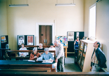
Photograph, Eltham Community Centre; 15 April 1989, 15/04/1989
[from EDHS Newsletter No. 65, March, 1989:] ELTHAM HERITAGE WALK The Society's contribution to Heritage Week this year will be a guided walk around Eltham featuring a number of buildings and locations of historical and environmental interest. Three dates are listed as official Heritage Week events, Sundays 16th and 23rd April and Saturday 22nd. In addition, there will be a walk on Saturday 15th for Society Members. All walks will start at 1:00 p.m. in Panther Place near Shillinglaw Cottage. Each will take about four hours and the distance is about 5km. Old photos of locations visited will be available for viewing.Colour photographheritage excursion, activities, eltham community centre -
 Eltham District Historical Society Inc
Photograph, Eltham Hotel, cnr Main Road and Pitt Street; 15 April 1989, 15/04/1989
[from EDHS Newsletter No. 65, March, 1989:] ELTHAM HERITAGE WALK The Society's contribution to Heritage Week this year will be a guided walk around Eltham featuring a number of buildings and locations of historical and environmental interest. Three dates are listed as official Heritage Week events, Sundays 16th and 23rd April and Saturday 22nd. In addition, there will be a walk on Saturday 15th for Society Members. All walks will start at 1:00 p.m. in Panther Place near Shillinglaw Cottage. Each will take about four hours and the distance is about 5km. Old photos of locations visited will be available for viewing.Colour photographheritage excursion, activities, main road, eltham hotel -
 Eltham District Historical Society Inc
Photograph, Former Police Residence, 728 Main Road, Eltham; 15 April 1989, 15/04/1989
[from EDHS Newsletter No. 65, March, 1989:] ELTHAM HERITAGE WALK The Society's contribution to Heritage Week this year will be a guided walk around Eltham featuring a number of buildings and locations of historical and environmental interest. Three dates are listed as official Heritage Week events, Sundays 16th and 23rd April and Saturday 22nd. In addition, there will be a walk on Saturday 15th for Society Members. All walks will start at 1:00 p.m. in Panther Place near Shillinglaw Cottage. Each will take about four hours and the distance is about 5km. Old photos of locations visited will be available for viewing.Colour photographheritage excursion, activities, main road, police residence -
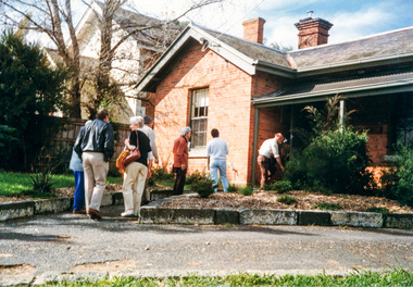
 Eltham District Historical Society Inc
Photograph, Eltham Courthouse, 730 Main Road, Eltham; 15 April 1989, 15/04/1989
L-R: Doug Orford, Russell Yeoman [from EDHS Newsletter No. 65, March, 1989:] ELTHAM HERITAGE WALK The Society's contribution to Heritage Week this year will be a guided walk around Eltham featuring a number of buildings and locations of historical and environmental interest. Three dates are listed as official Heritage Week events, Sundays 16th and 23rd April and Saturday 22nd. In addition, there will be a walk on Saturday 15th for Society Members. All walks will start at 1:00 p.m. in Panther Place near Shillinglaw Cottage. Each will take about four hours and the distance is about 5km. Old photos of locations visited will be available for viewing.Colour photographheritage excursion, activities, doug orford, russell yeoman, eltham courthouse -
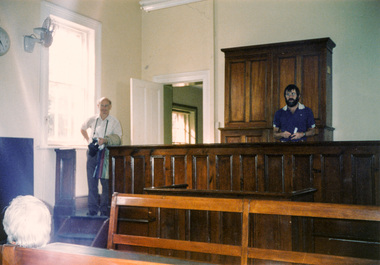
 Eltham District Historical Society Inc
Photograph, Eltham Courthouse, 730 Main Road, Eltham; 15 April 1989, 15/04/1989
[from EDHS Newsletter No. 65, March, 1989:] ELTHAM HERITAGE WALK The Society's contribution to Heritage Week this year will be a guided walk around Eltham featuring a number of buildings and locations of historical and environmental interest. Three dates are listed as official Heritage Week events, Sundays 16th and 23rd April and Saturday 22nd. In addition, there will be a walk on Saturday 15th for Society Members. All walks will start at 1:00 p.m. in Panther Place near Shillinglaw Cottage. Each will take about four hours and the distance is about 5km. Old photos of locations visited will be available for viewing.Colour photographheritage excursion, activities, eltham courthouse, opal smith, sue law -
 Eltham District Historical Society Inc
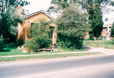
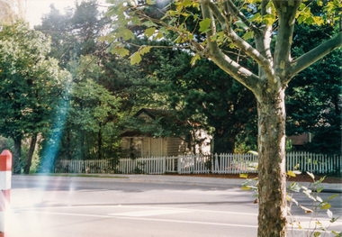
Photograph, Jarrold Cottage, Main Road, Eltham, opposite Dalton Street; 15 April 1989, 15/04/1989
[from EDHS Newsletter No. 65, March, 1989:] ELTHAM HERITAGE WALK The Society's contribution to Heritage Week this year will be a guided walk around Eltham featuring a number of buildings and locations of historical and environmental interest. Three dates are listed as official Heritage Week events, Sundays 16th and 23rd April and Saturday 22nd. In addition, there will be a walk on Saturday 15th for Society Members. All walks will start at 1:00 p.m. in Panther Place near Shillinglaw Cottage. Each will take about four hours and the distance is about 5km. Old photos of locations visited will be available for viewing.Colour photographheritage excursion, activities, eltham, jarrold cottage, main road -
 Eltham District Historical Society Inc
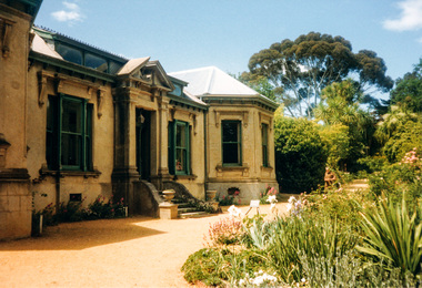
Photograph, Montsalvat; 15 April 1989, 15/04/1989
[from EDHS Newsletter No. 65, March, 1989:] ELTHAM HERITAGE WALK The Society's contribution to Heritage Week this year will be a guided walk around Eltham featuring a number of buildings and locations of historical and environmental interest. Three dates are listed as official Heritage Week events, Sundays 16th and 23rd April and Saturday 22nd. In addition, there will be a walk on Saturday 15th for Society Members. All walks will start at 1:00 p.m. in Panther Place near Shillinglaw Cottage. Each will take about four hours and the distance is about 5km. Old photos of locations visited will be available for viewing.Colour photographheritage excursion, activities, montsalvat -
 Eltham District Historical Society Inc
Photograph, Buda, Castlemaine, Spring Gardens Excursion, 30 October 1988, 30/10/1988
[from EDHS Newsletter No. 62, September 1988:] SPRING GARDENS TRIP 30 Oct 1988 On this trip we will be visiting gardens which are of historic interest or of old world character. The date has been selected to coincide with the time when the gardens are likely to be at their best. The Central Victorian Goldfields area has been selected because it offers a wide range of gardens open to the public. From this range we have chosen three gardens which we think will be of great interest to members and their families and friends. These are the gardens: • "Buda", Castlemaine: One of Victoria's most famous historic gardens. The mansion, which was the home of the Leviny family for 118~ years, is also open for inspection. • "Badger's Keep", Chewton: This is a cottage garden (complete with 100 year old cottage) with a great diversity of plants. • "The Springs", Sedgwick: A country garden also with a great array of plants. The cost of the bus is $9.00 for adults and $5.00 for children. There is an additional charge for entry to the gardens, $2.00 each for "Badger's Keep" and "The Springs"; for "Buda" it is $3.00, $1.50 for pensioners and $1.00 for children. Each of the gardens has plants for sale. Bring your own picnic lunch. Please be at the Eltham Shire Offices by 8.15 a.m. so we can leave promptly at 8.30. To book for this trip complete the attached form and return the appropriate fare. [from EDHS Newsletter No. 63, November 1988:] RECENT ACTIVITIES More recently the Spring Gardens trip attracted a full bus load and a waiting list. Those who went thoroughly enjoyed the historic garden and mansion at "Buda" and two other excellent gardens at "Badger's Keep" and "The Springs". The popularity of this trip warrants a repeat performance. There are a number of other gardens of historic and general interest which are worth a visit in the future.Two colour photographsactivities, buda, castlemaine -
 Eltham District Historical Society Inc
Photograph, Clay Nuneham Eltham Heritage Tour, 23 May 1993, 23/05/1993
Colour photographactivities, clay nuneham, heritage excursion -
 Eltham District Historical Society Inc
Photograph, At Gordon Ford's property, Eltham Heritage Tour, 23 May 1993, 23/05/1993
Colour photographactivities, heritage excursion -
 Eltham District Historical Society Inc
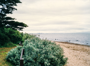
Photograph, Doug Orford, Melbourne from Point Cook, Spring Excursion to Steiglitz and Point Cook, 3 October 1993, 03/10/1993
Colour photographactivities, point cook -
 Eltham District Historical Society Inc
Photograph, Hume and Hovell passed here at Seymour 28 Oct 1824, Spring Excursion, Hume and Hovell's 1824 expedition (Part 2), 26 October 1997, 26/10/1997
[article by Diana Bassett-Smith in EDHS Newsletter No. 117, November 1997:] MONUMENT HUNTING THE HUME AND HOVELL WAY - Sunday October 26 1997 dawned bright and very warm. Some twenty-five members, complete with picnic baskets, met outside the Eltham Library awaiting the Cobb and Co. large coach which would be taking us on the second leg of our travels along the route of the early explorers Hume and Hovell. Stephen West was our very good driver for the day. He would be guided around the circuitous route by Russell Yeoman who had made a detailed study, not only of the intended route, but of the story of these two explorers. During the trip Russell regaled us with poetry, quotations from the Journals and the History of the Shire of Seymour, "The New Crossing Place" by Martindale, 1982, (now Mitchell Shire due to the recent amalgamations). We headed towards the Hume Highway via Greensborough and Cooper Street and proceeded north to our first stop, noting on the way Monument Hill in the distance which is near Kilmore and, according to Russell, well worth the effort to visit as the view across the valley is magnificent. Past Sunday Creek Valley, Mt Piper and Mt Disappointment, all traversed and noted and named by them. We passed through Tallarook, then onto Seymour where we took photos of the monument telling us that Hume and Hovell had passed through on the 28th of October 1824. We also deviated down Hume and Hovell Road viewing deer and emu farming and the Bellbourie property now a sanctuary. Leaving Seymour behind we travelled up the Avenel Road to the Avenel monument, pyramidal in design of four reducing square blocks with a sharply pointed peak, erected in 1924 in memory of the 1824 exploration. The day was warming up and the countryside showing the dryness of the current drought. A parallel note had been made in their journal too of 1824 of the drought appearance of the country they were traversing. At Seven Creeks, Euroa we stopped for some minutes to check the monument placed 20th November 1924 to commemorate their passage on the 29th December 1824. More photos. Russell had pointed out the abrupt termination of the distant ranges which is noted in their journal. The next monument is beside the road at the entrance to Honey Suckle Creek Caravan Park, Violet Town. The squarish shaped monument some eight feet high is topped with a simple steel cross, and was to mark the date of 28th December 1824 and built for the 20th November 1924. By now it was 12.20 and nearly lunchtime as we drove along the Warranbayne Road to Roach's Road, monument hunting without success. Though there is a large, what appears to be an old timber sign which was hard to read, maybe this was the lost monument. In many of the paddocks hay had been cut and baled or was being cut, what a contrast to the rugged country they had passed through which was smoky from the fires of the natives burning off. By 1.00 pm we were at Benalla and pulled up beside the park where abundant beds of roses filled the air with their scent and the smell of barbecued food twitched the nostrils whilst the cheerful sounds of other picnickers could be heard throughout the park. We left the bus and collected up our picnics, dispersed to the various tables and enjoyed the shade from the various European trees. 2.00 pm and we were on the road again driving along the Benalla, Mansfield, Yea road. The Swanpool monument states that they passed four miles south and returned three miles north. Then we stopped at the Barjarg monument which notes that they camped near this spot. It is again a pyramidal monument and this time topped with a steel arrow indicating their route of the 29th November 1824. Half an hour later we came to another monument, again with a steel arrow marker on top and the plaque dated the 2nd of 12th 1824. Erected on the 12th of 12th 1924. "They blazed the way that we might inherit the land." Another square based and needle topped monument appeared at Yarck near Yea and this plaque records the date of 3 December 1824. Near McGuigans Road Russell related that the expedition had lost a dog but it had found them next day, the dog was apparently torn by a kangaroo. A short while later Russell reminded us here of the problems they encountered in crossing the Goulburn River near Molesworth where banks were high, water deep and wide. "Good coat of grass but quite dry due to drought". At Yea we stopped for afternoon tea and raided the last of our picnics and looked at the monument to their journey of 1824, situated at a corner of the gardens near the bowling green. No photo – we were out of film. We returned home via Kinglake West and Whittlesea past the Yan Yean Reservoir, not full. 5.00 pm back at Eltham we emptied out of the bus and everyone, including Joan Cole, collected their things, Joan also had the major souvenir of the day, a large carp she had picked up from the river bank, her cat was in for a great feast. The day was made so interesting by the informed commentary which Russell provided. His background knowledge of the route and nature of the journey could only have come from many hours of reading and driving the area. Thank you to Russell and to everyone who made the day so informative and pleasurable. Colour photographactivities, hume and hovell, monument, seymour -
 Eltham District Historical Society Inc
Photograph, Gaol at Seymour, Spring Excursion, Hume and Hovell's 1824 expedition (Part 2), 26 October 1997, 26/10/1997
[article by Diana Bassett-Smith in EDHS Newsletter No. 117, November 1997:] MONUMENT HUNTING THE HUME AND HOVELL WAY - Sunday October 26 1997 dawned bright and very warm. Some twenty-five members, complete with picnic baskets, met outside the Eltham Library awaiting the Cobb and Co. large coach which would be taking us on the second leg of our travels along the route of the early explorers Hume and Hovell. Stephen West was our very good driver for the day. He would be guided around the circuitous route by Russell Yeoman who had made a detailed study, not only of the intended route, but of the story of these two explorers. During the trip Russell regaled us with poetry, quotations from the Journals and the History of the Shire of Seymour, "The New Crossing Place" by Martindale, 1982, (now Mitchell Shire due to the recent amalgamations). We headed towards the Hume Highway via Greensborough and Cooper Street and proceeded north to our first stop, noting on the way Monument Hill in the distance which is near Kilmore and, according to Russell, well worth the effort to visit as the view across the valley is magnificent. Past Sunday Creek Valley, Mt Piper and Mt Disappointment, all traversed and noted and named by them. We passed through Tallarook, then onto Seymour where we took photos of the monument telling us that Hume and Hovell had passed through on the 28th of October 1824. We also deviated down Hume and Hovell Road viewing deer and emu farming and the Bellbourie property now a sanctuary. Leaving Seymour behind we travelled up the Avenel Road to the Avenel monument, pyramidal in design of four reducing square blocks with a sharply pointed peak, erected in 1924 in memory of the 1824 exploration. The day was warming up and the countryside showing the dryness of the current drought. A parallel note had been made in their journal too of 1824 of the drought appearance of the country they were traversing. At Seven Creeks, Euroa we stopped for some minutes to check the monument placed 20th November 1924 to commemorate their passage on the 29th December 1824. More photos. Russell had pointed out the abrupt termination of the distant ranges which is noted in their journal. The next monument is beside the road at the entrance to Honey Suckle Creek Caravan Park, Violet Town. The squarish shaped monument some eight feet high is topped with a simple steel cross, and was to mark the date of 28th December 1824 and built for the 20th November 1924. By now it was 12.20 and nearly lunchtime as we drove along the Warranbayne Road to Roach's Road, monument hunting without success. Though there is a large, what appears to be an old timber sign which was hard to read, maybe this was the lost monument. In many of the paddocks hay had been cut and baled or was being cut, what a contrast to the rugged country they had passed through which was smoky from the fires of the natives burning off. By 1.00 pm we were at Benalla and pulled up beside the park where abundant beds of roses filled the air with their scent and the smell of barbecued food twitched the nostrils whilst the cheerful sounds of other picnickers could be heard throughout the park. We left the bus and collected up our picnics, dispersed to the various tables and enjoyed the shade from the various European trees. 2.00 pm and we were on the road again driving along the Benalla, Mansfield, Yea road. The Swanpool monument states that they passed four miles south and returned three miles north. Then we stopped at the Barjarg monument which notes that they camped near this spot. It is again a pyramidal monument and this time topped with a steel arrow indicating their route of the 29th November 1824. Half an hour later we came to another monument, again with a steel arrow marker on top and the plaque dated the 2nd of 12th 1824. Erected on the 12th of 12th 1924. "They blazed the way that we might inherit the land." Another square based and needle topped monument appeared at Yarck near Yea and this plaque records the date of 3 December 1824. Near McGuigans Road Russell related that the expedition had lost a dog but it had found them next day, the dog was apparently torn by a kangaroo. A short while later Russell reminded us here of the problems they encountered in crossing the Goulburn River near Molesworth where banks were high, water deep and wide. "Good coat of grass but quite dry due to drought". At Yea we stopped for afternoon tea and raided the last of our picnics and looked at the monument to their journey of 1824, situated at a corner of the gardens near the bowling green. No photo – we were out of film. We returned home via Kinglake West and Whittlesea past the Yan Yean Reservoir, not full. 5.00 pm back at Eltham we emptied out of the bus and everyone, including Joan Cole, collected their things, Joan also had the major souvenir of the day, a large carp she had picked up from the river bank, her cat was in for a great feast. The day was made so interesting by the informed commentary which Russell provided. His background knowledge of the route and nature of the journey could only have come from many hours of reading and driving the area. Thank you to Russell and to everyone who made the day so informative and pleasurable. Colour photographactivities, hume and hovell, seymour, gaol -
 Eltham District Historical Society Inc
Photograph, Hume and Hovell Monument, Avenel, Spring Excursion, Hume and Hovell's 1824 expedition (Part 2), 26 October 1997, 26/10/1997
[article by Diana Bassett-Smith in EDHS Newsletter No. 117, November 1997:] MONUMENT HUNTING THE HUME AND HOVELL WAY - Sunday October 26 1997 dawned bright and very warm. Some twenty-five members, complete with picnic baskets, met outside the Eltham Library awaiting the Cobb and Co. large coach which would be taking us on the second leg of our travels along the route of the early explorers Hume and Hovell. Stephen West was our very good driver for the day. He would be guided around the circuitous route by Russell Yeoman who had made a detailed study, not only of the intended route, but of the story of these two explorers. During the trip Russell regaled us with poetry, quotations from the Journals and the History of the Shire of Seymour, "The New Crossing Place" by Martindale, 1982, (now Mitchell Shire due to the recent amalgamations). We headed towards the Hume Highway via Greensborough and Cooper Street and proceeded north to our first stop, noting on the way Monument Hill in the distance which is near Kilmore and, according to Russell, well worth the effort to visit as the view across the valley is magnificent. Past Sunday Creek Valley, Mt Piper and Mt Disappointment, all traversed and noted and named by them. We passed through Tallarook, then onto Seymour where we took photos of the monument telling us that Hume and Hovell had passed through on the 28th of October 1824. We also deviated down Hume and Hovell Road viewing deer and emu farming and the Bellbourie property now a sanctuary. Leaving Seymour behind we travelled up the Avenel Road to the Avenel monument, pyramidal in design of four reducing square blocks with a sharply pointed peak, erected in 1924 in memory of the 1824 exploration. The day was warming up and the countryside showing the dryness of the current drought. A parallel note had been made in their journal too of 1824 of the drought appearance of the country they were traversing. At Seven Creeks, Euroa we stopped for some minutes to check the monument placed 20th November 1924 to commemorate their passage on the 29th December 1824. More photos. Russell had pointed out the abrupt termination of the distant ranges which is noted in their journal. The next monument is beside the road at the entrance to Honey Suckle Creek Caravan Park, Violet Town. The squarish shaped monument some eight feet high is topped with a simple steel cross, and was to mark the date of 28th December 1824 and built for the 20th November 1924. By now it was 12.20 and nearly lunchtime as we drove along the Warranbayne Road to Roach's Road, monument hunting without success. Though there is a large, what appears to be an old timber sign which was hard to read, maybe this was the lost monument. In many of the paddocks hay had been cut and baled or was being cut, what a contrast to the rugged country they had passed through which was smoky from the fires of the natives burning off. By 1.00 pm we were at Benalla and pulled up beside the park where abundant beds of roses filled the air with their scent and the smell of barbecued food twitched the nostrils whilst the cheerful sounds of other picnickers could be heard throughout the park. We left the bus and collected up our picnics, dispersed to the various tables and enjoyed the shade from the various European trees. 2.00 pm and we were on the road again driving along the Benalla, Mansfield, Yea road. The Swanpool monument states that they passed four miles south and returned three miles north. Then we stopped at the Barjarg monument which notes that they camped near this spot. It is again a pyramidal monument and this time topped with a steel arrow indicating their route of the 29th November 1824. Half an hour later we came to another monument, again with a steel arrow marker on top and the plaque dated the 2nd of 12th 1824. Erected on the 12th of 12th 1924. "They blazed the way that we might inherit the land." Another square based and needle topped monument appeared at Yarck near Yea and this plaque records the date of 3 December 1824. Near McGuigans Road Russell related that the expedition had lost a dog but it had found them next day, the dog was apparently torn by a kangaroo. A short while later Russell reminded us here of the problems they encountered in crossing the Goulburn River near Molesworth where banks were high, water deep and wide. "Good coat of grass but quite dry due to drought". At Yea we stopped for afternoon tea and raided the last of our picnics and looked at the monument to their journey of 1824, situated at a corner of the gardens near the bowling green. No photo – we were out of film. We returned home via Kinglake West and Whittlesea past the Yan Yean Reservoir, not full. 5.00 pm back at Eltham we emptied out of the bus and everyone, including Joan Cole, collected their things, Joan also had the major souvenir of the day, a large carp she had picked up from the river bank, her cat was in for a great feast. The day was made so interesting by the informed commentary which Russell provided. His background knowledge of the route and nature of the journey could only have come from many hours of reading and driving the area. Thank you to Russell and to everyone who made the day so informative and pleasurable. Colour photographactivities, hume and hovell, avenel, monument -
 Eltham District Historical Society Inc
Photograph, Hume and Hovell Monument, Seven Creeks, Euroa (29.12.1824), Spring Excursion, Hume and Hovell's 1824 expedition (Part 2), 26 October 1997, 26/10/1997
[article by Diana Bassett-Smith in EDHS Newsletter No. 117, November 1997:] MONUMENT HUNTING THE HUME AND HOVELL WAY - Sunday October 26 1997 dawned bright and very warm. Some twenty-five members, complete with picnic baskets, met outside the Eltham Library awaiting the Cobb and Co. large coach which would be taking us on the second leg of our travels along the route of the early explorers Hume and Hovell. Stephen West was our very good driver for the day. He would be guided around the circuitous route by Russell Yeoman who had made a detailed study, not only of the intended route, but of the story of these two explorers. During the trip Russell regaled us with poetry, quotations from the Journals and the History of the Shire of Seymour, "The New Crossing Place" by Martindale, 1982, (now Mitchell Shire due to the recent amalgamations). We headed towards the Hume Highway via Greensborough and Cooper Street and proceeded north to our first stop, noting on the way Monument Hill in the distance which is near Kilmore and, according to Russell, well worth the effort to visit as the view across the valley is magnificent. Past Sunday Creek Valley, Mt Piper and Mt Disappointment, all traversed and noted and named by them. We passed through Tallarook, then onto Seymour where we took photos of the monument telling us that Hume and Hovell had passed through on the 28th of October 1824. We also deviated down Hume and Hovell Road viewing deer and emu farming and the Bellbourie property now a sanctuary. Leaving Seymour behind we travelled up the Avenel Road to the Avenel monument, pyramidal in design of four reducing square blocks with a sharply pointed peak, erected in 1924 in memory of the 1824 exploration. The day was warming up and the countryside showing the dryness of the current drought. A parallel note had been made in their journal too of 1824 of the drought appearance of the country they were traversing. At Seven Creeks, Euroa we stopped for some minutes to check the monument placed 20th November 1924 to commemorate their passage on the 29th December 1824. More photos. Russell had pointed out the abrupt termination of the distant ranges which is noted in their journal. The next monument is beside the road at the entrance to Honey Suckle Creek Caravan Park, Violet Town. The squarish shaped monument some eight feet high is topped with a simple steel cross, and was to mark the date of 28th December 1824 and built for the 20th November 1924. By now it was 12.20 and nearly lunchtime as we drove along the Warranbayne Road to Roach's Road, monument hunting without success. Though there is a large, what appears to be an old timber sign which was hard to read, maybe this was the lost monument. In many of the paddocks hay had been cut and baled or was being cut, what a contrast to the rugged country they had passed through which was smoky from the fires of the natives burning off. By 1.00 pm we were at Benalla and pulled up beside the park where abundant beds of roses filled the air with their scent and the smell of barbecued food twitched the nostrils whilst the cheerful sounds of other picnickers could be heard throughout the park. We left the bus and collected up our picnics, dispersed to the various tables and enjoyed the shade from the various European trees. 2.00 pm and we were on the road again driving along the Benalla, Mansfield, Yea road. The Swanpool monument states that they passed four miles south and returned three miles north. Then we stopped at the Barjarg monument which notes that they camped near this spot. It is again a pyramidal monument and this time topped with a steel arrow indicating their route of the 29th November 1824. Half an hour later we came to another monument, again with a steel arrow marker on top and the plaque dated the 2nd of 12th 1824. Erected on the 12th of 12th 1924. "They blazed the way that we might inherit the land." Another square based and needle topped monument appeared at Yarck near Yea and this plaque records the date of 3 December 1824. Near McGuigans Road Russell related that the expedition had lost a dog but it had found them next day, the dog was apparently torn by a kangaroo. A short while later Russell reminded us here of the problems they encountered in crossing the Goulburn River near Molesworth where banks were high, water deep and wide. "Good coat of grass but quite dry due to drought". At Yea we stopped for afternoon tea and raided the last of our picnics and looked at the monument to their journey of 1824, situated at a corner of the gardens near the bowling green. No photo – we were out of film. We returned home via Kinglake West and Whittlesea past the Yan Yean Reservoir, not full. 5.00 pm back at Eltham we emptied out of the bus and everyone, including Joan Cole, collected their things, Joan also had the major souvenir of the day, a large carp she had picked up from the river bank, her cat was in for a great feast. The day was made so interesting by the informed commentary which Russell provided. His background knowledge of the route and nature of the journey could only have come from many hours of reading and driving the area. Thank you to Russell and to everyone who made the day so informative and pleasurable. Colour photographactivities, hume and hovell, monument, euroa, seven creeks