Showing 11982 items
matching ringwood
-
 Ringwood and District Historical Society
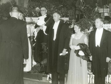
Photograph, Ringwood Proclamation Ball, March 1960 with Mayor Cr. AG Lavis
Proclamation Ball, March, 1960 – Mayor Cr. AG Lavis (4rd from right), Bob and Gwen Horman (far right). In Ringwood Town Hall. On the occasion of the Proclamation of Ringwood as a City. All material is from Gwen Horman’s three albums that she owned. Some photos have been taken by Peter Payens of Ringwood Studios, 36 Whitehorse Road, Ringwood, WU-7609, probably for the Ringwood mail newspaper. -
 Ringwood and District Historical Society
Biographies, War histories of two brothers: Leonard Grant Collett and Keith Charles Collett c1950, c. 1950
War histories of two brothers: Leonard Grant Callett and Keith Charles Collett who joined the VX41760 2/23 Battalion. Both were killed within a week of each other. Their mother Cecilia Evelyn Collett lived in Greenwood Avenue, Ringwood.War histories of two brothers: Leonard Grant Collett and Keith Charles Collett who joined the VX41760 2/23 Battalion. Both were killed within a week of each other. Their mother Cecilia Evelyn Collett lived in Greenwood Avenue, Ringwood. +Additional Keywords: Collett, Leonard Grant / Collett, Keith Charles / Collett, Cecilia Evelyn -
 Ringwood and District Historical Society
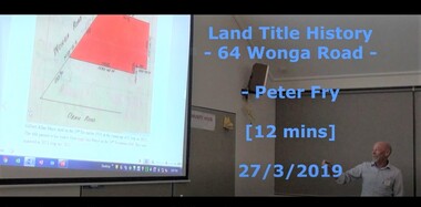
Mixed media - Video, RDHS Guest Speaker Presentation - "Land Title History, 64 Wonga Road, Ringwood" - Peter Fry
Digitised video (662MB). Duration: 12 minutes. Recorded March, 2019. (Video is available for viewing at Ringwood & District Historical Society Archives by appointment)Presentation: Peter Fry has done quite a bit of tracing of properties in the Ringwood area where he grew up. In this talk, Peter presents an example of his research, covering the house and property now known as 64 Wonga Road, which has a long and interesting history dating back to the early days of orcharding in the district. -
 Ringwood and District Historical Society
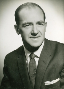
Photograph, Official photo of Cr Bob Horman at Ringwood Proclamation, March 1960
Official photo of Cr Robert "Bob" C Horman at Ringwood Proclamation, March 1960. All material is from Gwen Horman’s three albums that she owned. Some photos have been taken by Peter Payens of Ringwood Studios, 36 Whitehorse Road, Ringwood, WU-7609, probably for the Ringwood mail newspaper. -
 Ringwood and District Historical Society
Map - State Aerial Survey, Dandenong Ranges Area, Parishes of Warrandyte and Ringwood - 1956
Map of central and southern areas of Ringwood and part of Ringwood East and Heathmont compiled by Dept of Lands and Survey, July 1956, from aerial photographs and Cadastral Survey information. Subsequent hand-drawn addition of streets showing layout of "Township of Ballyduffy Estate 1858-60", an earlier proposed subdivision that did not eventuate. (See attached 5009b Ballyshanassy_ Melbourne’s lost suburb.pdf for Ballyduffy historical naming relevance). Ballyduffy Estate streets include City Road, West Prussia Road, Duffy Street, Ireland Street, Evans Street, Victoria Street, Regina Street, Short Road, Prussia Road, Duffy Street East, Ireland Street East, Evans Street East, Chapman Street. Misc Topo 93 Sheet 22, Ringwood A4B2. Scale: 4 chains to 1 inch. Contour interval 20 feet. -
 Ringwood and District Historical Society
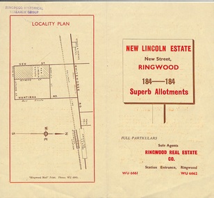
Document - Folder, Land Sale Brochure, New Lincoln Estate, Ringwood, Vic. - circa 1960. Also 1951 newspaper advertisement
Bi-fold advertisement for sale of residential allotments - New Lincoln Estate, New Street, Ringwood, with summary of local facilities and services, locality plan, layout of sub-division, and price list. Also an advertisement from Ringwood Mail dated 12 July 1951. Subdivision includes New Street, Heywood Street, Barkly Street, Keith Grove, Maurice Avenue, Inez Avenue, Catherine Street, Neville Street, Neale Grove (later Heather Grove), and Sylvia Grove. Agent - Ringwood Real Estate Co., Station Entrance, Ringwood. (Phone) WU 6661, WU 6662.Accompanying handwritten sales notes researched in 2024 by Richard Carter - Carter Real Estate ... "Maurice Ashkanasy KC CMG owned the rectangular estate located between New, Barkly, Heywood Streets and Sylvia Grove in South-West Ringwood. It was given the name "The New Lincoln Estate". It was first advertised around July 1951 as "48 superb allotments", through Ringwood Real Estate (Station Entrance). A sub-divisional plan from CE Carter showed 152 blocks with 60-foot frontages and varying between 110 and 150 feet in length. Later, in 1954 house and land packages were offered through William White in Elsternwick - "Three modern bedrooms, large lounge-dining-room, kitchen with dinette, nicely equipped bathroom - £2,685 to £2,762, deposit £300". The roads were created and named after family members - Neale (later Heather) Grove - after Maurice's son Neal Mark Ashkanasy. The street was later re-named Heather Grove after Maurice's wife, Heather Helen Ashkanasy (Epstein), who passed away in 1999, aged 95. Neville Street - after Marice's other son, Aaron Solomon Neville Ashkanasy known as Neville. Catherine Street and Inez Street - after Heather's mother Catherine Inez Epstein. Maurice Avenue - after Maurice Ashkanasy, vendor. Keith Grove - after Keith Epstein. ..." -
 Ringwood and District Historical Society
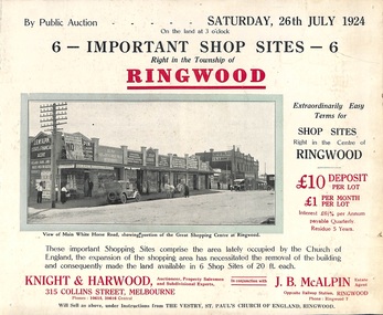
Flyer, Shop Sites Sale By Public Auction, Ringwood, Victoria - 1924
Folded double-sided brochure advertising six Ringwood shop sites for sale by Public Auction at 3pm, Saturday, July, 1924, with town photographs, location map, and summary of local features and services. Includes newspaper extract from the Real Estate and Property section from "Evening Sun", 6th June, 1924.Locality plan highlights shop sites for auction east of Pratt Street along Whitehorse Road. (Agents) Knight & Harwood, 315 Collins Street, Melbourne, Phones 10615, 10616 Central, in conjunction with J.B. McAlpin, Estate Agent, Opposite Railway Station, Ringwood, Phone Ringwood 7. -
 Ringwood and District Historical Society
Photograph, No.1 Bond Street, Ringwood - 1981
No.1 Bond Street, Ringwood - 1981.Written on back of photograph, "1981, View of 1 Bond Street (Dr. Matthews?). Where Dalty's are soon to build". -
 Ringwood and District Historical Society
Document, Packet: Ringwood City Council Clippings, News and Booklets 1990s
Ringwood News and booklets c.1990 -
Ringwood and District Historical Society
Envelope, First land sales in Ringwood 1858
First land sales in Ringwood 1858 -
 Ringwood and District Historical Society
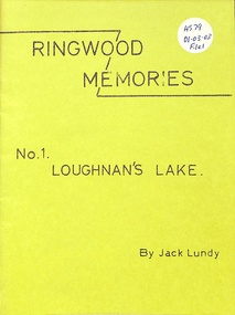
Booklet, Ringwood Memories
Ringwood Memories No 1 Loughnan's Lake -
 Ringwood and District Historical Society
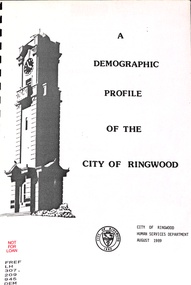
Book, Demographic Profile of the City of Ringwood, 1989
Demographic Profile of the City of Ringwood 1989 -
 Ringwood and District Historical Society
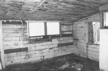
Photograph, Dismantling Ringwood miners cottage in 1975
Dismantling Ringwood miners cottage in 1975 -
 Ringwood and District Historical Society
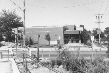
Photograph, Church of Christian Science, Station Street, Ringwood - 1973, 1973
Church of Christian Science, Ringwood in 19734-3-73 Station St. -
 Ringwood and District Historical Society
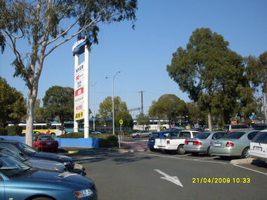
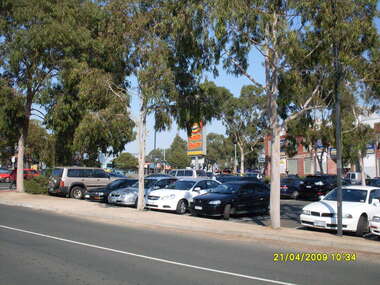
Photograph, Eastland car park looking south, Ringwood on 21 April 2009. Showing former entrance to Adelaide Street from Maroondah Highway, overlooking bus terminus
Ron Brons photographic study of Ringwood -
 Ringwood and District Historical Society
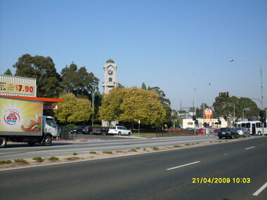
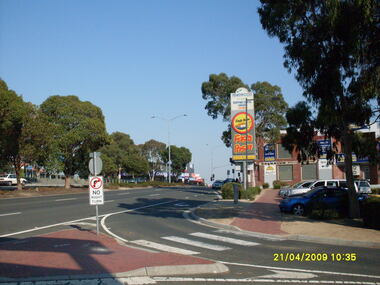
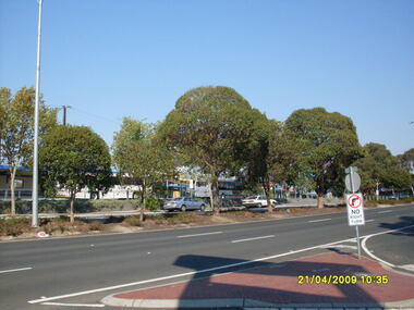
Photograph, Corner of Maroondah Highway and Wantirna Road looking south-west, Ringwood on 21 April 2009. Memorial Clocktower, Haymes Paint and Johnny Boys Pizza
Ron Brons photographic study of Ringwood -
 Ringwood and District Historical Society
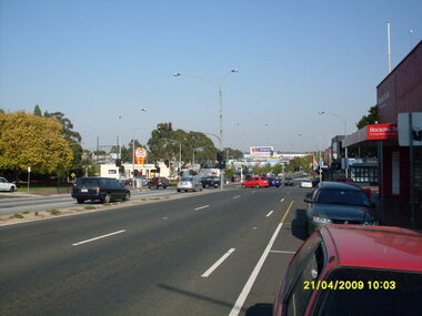
Photograph, Corner of Maroondah Highway and Wantirna Road looking west, Ringwood on 21 April 2009
Ron Brons photographic study of Ringwood -
 Ringwood and District Historical Society
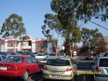
Photograph, Looking across stage 4 Eastland carpark, towards the south-west, on 21 April 2009. Showing strip of shops opposite the Ringwood Station
Ron Brons photographic study of Ringwood. -
 Ringwood and District Historical Society
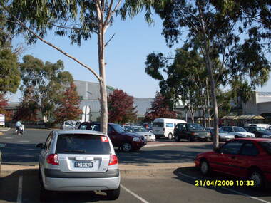
Photograph, Looking across stage 4 Eastland carpark, towards the west, on 21 April 2009. Showing the former Ringwood Library
Ron Brons photographic study of Ringwood. -
 Ringwood and District Historical Society
Photograph, Looking across stage 4 Eastland carpark, towards the south-west, on 21 April 2009. Showing Ringwood Railway Station across Maroondah Highway
Ron Brons photographic study of Ringwood. -
 Ringwood and District Historical Society
Photograph, Looking along Maroondah Highway towards the south-east, on 21 April 2009. Showing entrance to Ringwood Railway Station, Carter Real Estate and Fasta Pasta sign
Ron Brons photographic study of Ringwood. -
 Ringwood and District Historical Society
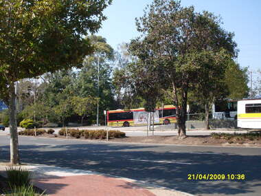
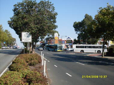
Photograph, Looking across Maroondah Highway towards the entrance to the Ringwood bus terminus, on 21 April 2009
Ron Brons photographic study of Ringwood. -
 Ringwood and District Historical Society
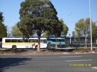
Photograph, Looking across Maroondah Highway towards the Ringwood bus terminus, on 21 April 2009
Ron Brons photographic study of Ringwood. -
 Ringwood and District Historical Society
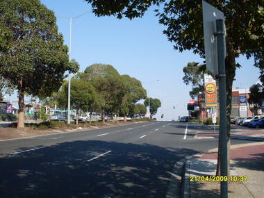
Photograph, Looking west along Maroondah Highway with Ringwood Railway Station on left and shops on right, on 21 April 2009
Ron Brons photographic study of Ringwood. -
 Ringwood and District Historical Society
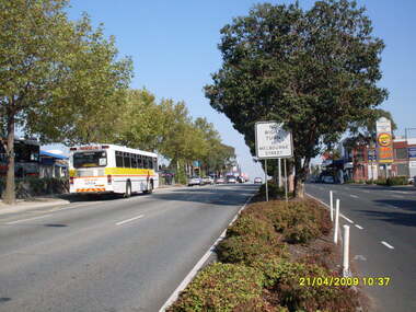
Photograph, Looking west along Maroondah Highway with Ringwood Railway Station and bus terminus on left and entrance to Eastland car park and shops on right, on 21 April 2009
Ron Brons photographic study of Ringwood. -
 Ringwood and District Historical Society
Photograph, Looking west along Maroondah Highway with Ringwood Railway Station on left and entrance to Eastland car park and shops on right, on 21 April 2009
Ron Brons photographic study of Ringwood. -
 Ringwood and District Historical Society
Photograph, Looking across Maroondah Highway towards the south-west, on 21 April 2009. Showing entrance to Ringwood bus terminus
Ron Brons photographic study of Ringwood. -
 Ringwood and District Historical Society
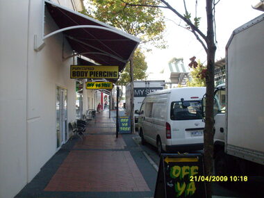
Photograph, Access road in front of Eastland looking east. Showing "Off Ya Tree" and "Punctured Body Piercing" shops. Ringwood on 21 April 2009
Ron Brons photographic study of Ringwood. -
 Ringwood and District Historical Society
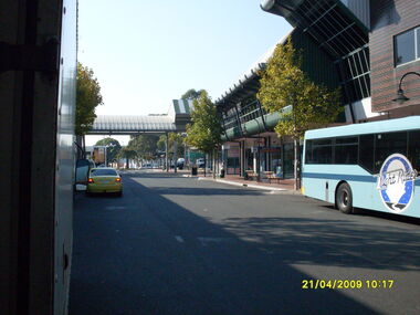
Photograph, Access road in front of Eastland looking east. Showing "Easy Rider" bus. Ringwood on 21 April 2009
Ron Brons photographic study of Ringwood. -
 Ringwood and District Historical Society
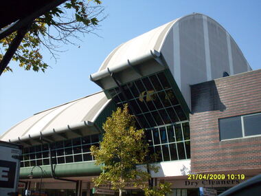
Photograph, Rear view of former Ringwood Library, from Eastland access road, on 21 April 2009
Ron Brons photographic study of Ringwood.