Showing 3604 items
matching background history
-
 Eltham District Historical Society Inc
Photograph, Spring Excursion, Hume and Hovell bus tour Stage 2, Seymour, Benalla; 26 Oct 1997, 26/10/1997
MONUMENT HUNTING THE HUME AND HOVELL WAY (Newsletter No. 117, November 1997, by Diana Bassett-Smith) Sunday October 26 1997 dawned bright and very warm. Some twenty-five members, complete with picnic baskets, met outside the Eltham Library awaiting the Cobb and Co. large coach which would be taking us on the second leg of our travels along the route of the early explorers Hume and Hovell. Stephen West was our very good driver for the day. He would be guided around the circuitous route by Russell Yeoman wh9 had made a detailed study, not only of the intended route, but of the story of these two explorers. During the trip Russell regaled us with poetry, quotations from the Journals and the History of the Shire of Seymour, "The New Crossing Place: by Martindale, 1982, (now Mitchell Shire due to the recent amalgamations). We headed towards the Hume Highway via Greensborough and Cooper Street and proceeded north to our first stop, noting on the way Monument Hill in the distance which is near Kilmore and, according to Russell, well worth the effort to visit as the view across the valley is magnificent. Past Sunday Creek Valley, Mt Piper and Mt Disappointment, all traversed and noted and named by them. We passed through Tallarook, then onto Seymour where we took photos of the monument telling us that Hume and Hovell had passed through on the 28th of October 1824. We also deviated down Hume and Hovell Road viewing deer and emu farming and the Bellbourie property now a sanctuary. Leaving Seymour behind we travelled up the Avenel Road to the Avenel monument, pyramidal in design of four reducing square blocks with a sharply pointed peak, erected in 1924 in memory of the 1824 exploration. The day was warming up and the countryside showing the dryness of the current drought. A parallel note had been made in their journal too of 1824 of the drought appearance of the country they were traversing. At Seven Creeks, Euroa we stopped for some minutes to check the monument placed 20th November 1924 to commemorate their passage on the 29th December 1824. More photos. Russell had pointed out the abrupt termination of the distant ranges which is noted in their journal. The next monument is beside the road at the entrance to Honey Suckle Creek Caravan Park, Violet Town. The squarish shaped monument some eight feet high is topped with a simple steel cross, and was to mark the date of 28th December 1824 and built for the 20th November 1924. By now it was 12.20 and nearly lunchtime as we drove along the Warranbayne Road to Roach's Road, monument hunting without success. Though there is a large, what appears to be an old timber sign which was hard to read, maybe this was the lost monument. In many of the paddocks hay had been cut and baled or was being cut, what a contrast to the rugged country they had passed through which was smoky from the fires of the natives burning off By 1.00 pm we were at Benalla and pulled up beside the park where abundant beds of roses filled the air with their scent and the smell of barbecued food twitched the nostrils whilst the cheerful sounds of other picnickers could be heard throughout the park. We left the bus and collected up our picnics, dispersed to the various tables and enjoyed the shade from the various European trees. 2.00 pm and we were on the road again driving along the Benalla, Mansfield, Yea road. The Swanpool monument states that they passed four miles south and returned three miles north. Then we stopped at the Barjarg monument which notes that they camped near this spot. It is again a pyramidal monument and this time topped with a steel arrow indicating their route of the 29th November 1824. Half an hour later we came to another monument, again with a steel arrow marker on top and the plaque dated the 2nd of 12th 1824. Erected on the 12th of 12th 1924. "They blazed the way that we might inherit the land." Another square based and needle topped monument appeared at Yarck near Yea and this plaque records the date of 3 December 1824. Near McGuigans Road Russell related that the expedition had lost a dog but it had found them next day, the dog was apparently torn by a kangaroo. A short while later Russell reminded us here of the problems they encountered in crossing the Goulburn River near Molesworth where banks were high, water deep and wide. "Good coat of grass but quite dry due to drought". At Yea we stopped for afternoon tea and raided the last of our picnics and looked at the monument to their journey of 1824, situated at a corner of the gardens near the bowling green. No photo – we were out of film. We returned home via Kinglake West and Whittlesea past the Yan Yean Reservoir, not full. 5.00 pm back at Eltham we emptied out of the bus and everyone, including Joan Cole, collected their things, Joan also had the major souvenir of the day, a large carp she had picked up from the river bank, her cat was in for a great feast. The day was made so interesting by the informed commentary which Russell provided. His background knowledge of the route and nature of the journey could only have come from many hours of reading and driving the area. Thank you to Russell and to everyone who made the day so informative and pleasurable. Diana Bassett-Smith. Record of the Society's history of activities - Spring 1997 excursionRoll of 35mm colour negative film, 6 stripsFuji 200shire of eltham historical society, activities, pretty hill, seymour, benalla, hume and hovell, monuments -
 Eltham District Historical Society Inc
Photograph, Spring Excursion, Hume and Hovell bus tour Stage 2, Seymour, Benalla; 26 Oct 1997, 26/10/1997
MONUMENT HUNTING THE HUME AND HOVELL WAY (Newsletter No. 117, November 1997, by Diana Bassett-Smith) Sunday October 26 1997 dawned bright and very warm. Some twenty-five members, complete with picnic baskets, met outside the Eltham Library awaiting the Cobb and Co. large coach which would be taking us on the second leg of our travels along the route of the early explorers Hume and Hovell. Stephen West was our very good driver for the day. He would be guided around the circuitous route by Russell Yeoman wh9 had made a detailed study, not only of the intended route, but of the story of these two explorers. During the trip Russell regaled us with poetry, quotations from the Journals and the History of the Shire of Seymour, "The New Crossing Place: by Martindale, 1982, (now Mitchell Shire due to the recent amalgamations). We headed towards the Hume Highway via Greensborough and Cooper Street and proceeded north to our first stop, noting on the way Monument Hill in the distance which is near Kilmore and, according to Russell, well worth the effort to visit as the view across the valley is magnificent. Past Sunday Creek Valley, Mt Piper and Mt Disappointment, all traversed and noted and named by them. We passed through Tallarook, then onto Seymour where we took photos of the monument telling us that Hume and Hovell had passed through on the 28th of October 1824. We also deviated down Hume and Hovell Road viewing deer and emu farming and the Bellbourie property now a sanctuary. Leaving Seymour behind we travelled up the Avenel Road to the Avenel monument, pyramidal in design of four reducing square blocks with a sharply pointed peak, erected in 1924 in memory of the 1824 exploration. The day was warming up and the countryside showing the dryness of the current drought. A parallel note had been made in their journal too of 1824 of the drought appearance of the country they were traversing. At Seven Creeks, Euroa we stopped for some minutes to check the monument placed 20th November 1924 to commemorate their passage on the 29th December 1824. More photos. Russell had pointed out the abrupt termination of the distant ranges which is noted in their journal. The next monument is beside the road at the entrance to Honey Suckle Creek Caravan Park, Violet Town. The squarish shaped monument some eight feet high is topped with a simple steel cross, and was to mark the date of 28th December 1824 and built for the 20th November 1924. By now it was 12.20 and nearly lunchtime as we drove along the Warranbayne Road to Roach's Road, monument hunting without success. Though there is a large, what appears to be an old timber sign which was hard to read, maybe this was the lost monument. In many of the paddocks hay had been cut and baled or was being cut, what a contrast to the rugged country they had passed through which was smoky from the fires of the natives burning off By 1.00 pm we were at Benalla and pulled up beside the park where abundant beds of roses filled the air with their scent and the smell of barbecued food twitched the nostrils whilst the cheerful sounds of other picnickers could be heard throughout the park. We left the bus and collected up our picnics, dispersed to the various tables and enjoyed the shade from the various European trees. 2.00 pm and we were on the road again driving along the Benalla, Mansfield, Yea road. The Swanpool monument states that they passed four miles south and returned three miles north. Then we stopped at the Barjarg monument which notes that they camped near this spot. It is again a pyramidal monument and this time topped with a steel arrow indicating their route of the 29th November 1824. Half an hour later we came to another monument, again with a steel arrow marker on top and the plaque dated the 2nd of 12th 1824. Erected on the 12th of 12th 1924. "They blazed the way that we might inherit the land." Another square based and needle topped monument appeared at Yarck near Yea and this plaque records the date of 3 December 1824. Near McGuigans Road Russell related that the expedition had lost a dog but it had found them next day, the dog was apparently torn by a kangaroo. A short while later Russell reminded us here of the problems they encountered in crossing the Goulburn River near Molesworth where banks were high, water deep and wide. "Good coat of grass but quite dry due to drought". At Yea we stopped for afternoon tea and raided the last of our picnics and looked at the monument to their journey of 1824, situated at a corner of the gardens near the bowling green. No photo – we were out of film. We returned home via Kinglake West and Whittlesea past the Yan Yean Reservoir, not full. 5.00 pm back at Eltham we emptied out of the bus and everyone, including Joan Cole, collected their things, Joan also had the major souvenir of the day, a large carp she had picked up from the river bank, her cat was in for a great feast. The day was made so interesting by the informed commentary which Russell provided. His background knowledge of the route and nature of the journey could only have come from many hours of reading and driving the area. Thank you to Russell and to everyone who made the day so informative and pleasurable. Diana Bassett-Smith. Record of the Society's history of activities - Spring 1997 excursionRoll of 35mm colour negative film, 2 stripsKodak Gold 400-5shire of eltham historical society, activities, pretty hill, seymour, benalla, hume and hovell, monuments -
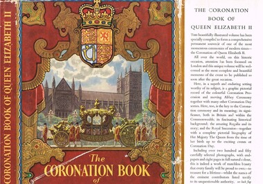 Kiewa Valley Historical Society
Book - History, The Coronation Book of Queen Elizabeth II, Circa 1952
This book was produced in a period of time when Australians, especially those in rural areas referred to Britain as "the mother" country. It was a time when the transition from a colonial dominion of Britain to the status of an individual State through the Australian Constitution was quite apparent, except for the affection and respect of the majority of the population towards "their" Queen. It was a time when the Governor General (Queen's representative) were British born and picked. Australia had grown from a colonial status to an individual state. The feeling towards the monarchy is aptly demonstrated by the words from the High Commissioner for Australia, Sir Thomas White K.B.E., proposal for Australia to adopt the royal title "Elizabeth the Second by the grace of God of the United Kingdom, Australia and her realms and territories Queen, Head of the Commonwealth, defender of the Faith" Here faith implies the christian (Church of England) religion. In rural Australia the respect and admiration for the Queen was very high and all public offices, clubs and halls displayed a well positioned, large photograph of the Queen. The respect for British royalty was quite pronounced by the royal toast, offered before "official" proceedings commenced, and in the military flying the royal "blessed" colours.This book was donated by one of the founding families residing in the Kiewa Valley and is typical of the general feeling of respect and admiration felt by the rural communities towards the British Royal Family, especially towards Queen Elizabeth II. The rural slant towards any form of patriotism was along the lines of "Queen and Country", in that order. After World War II the social texture through multi-culturalism (especially in the Cities)moved away from this "motherland" bondage but it had taken a longer period to penetrate those rural sectors within the Kiewa valley and high plains areas. The great post World War II immigration of European refugees started a shift of numbers of Australian families whose parents were not born in Australia or had British family ties. The book represents a period in time where ties to Britain where a lot strong and entrenched in the social fabric of the Australian rural sector. The growing push for a republic is becoming stronger and stronger as the level of rural royalists deminishes.This item is a hard covered book of 200 pages including 8 pages in full colour and over 250 photographs covering the British royal family and in particular Queen Elizabeth II and her coronation. The external protective paper dust-jacket is in colour. Specific references to Australia appear on pages 9,36 to 41 and 97. The hard cover has a "off" white cloth textured (glued reinforced) cover over thick cardboard . The front and back pages depict the Royal investiture carriage with guards and footmen. Little cherubs are portrayed around the sheath holding the Royal Crown. Crowned lion and stallion sit at attention on either side of the carriage, with the Royal shield supporting their front legs.,The dust jacket is in full colour with the wording "The CORONATION BOOK of QUEEN ELIZABETH II" With a Pictorial Record of the Ceremony" The spin of the jacket (in gold print on a regal red background) "THE CORONATION BOOK OF QUEEN ELIZABETH II" on the bottom "ODHAMS" The cover has a pressed oval shaped double lined border enclosing a crown and the words Elizabeth R, below which is pressed 1953. The spine has the following words in gold coloured print "THE CORONATION BOOK OF QUEEN ELIZABETH II. The front, inside flap, of the dust jacket details the significance of what is contained within the book and the back inside flap has the contents and those personages who contributed. The back of the dust jacket has a brief review of three other books covering other aspects of British royalty and they are titled "THE DUKE OF EDINBURGH" ( a pictorial biography), "QUEEN MARY" (her life and times) and "ROYAL HOMES ILLUSTRATED" (with an essay on the royal palaces by A.L. Rowse.modern australian history, british royalty, queen elizabeth ii, coronation of queen elizabeth ii, australia's "mother country" -
 Kiewa Valley Historical Society
Book - Ledger Commercial, unknown, Circa 1920
Historically(1920 to 1927), this ledger not only details the legible hand writing of this era but also the day to day commercial activity in the Kiewa Valley region. The neatness and the diligence of those who were required to pen the information into this ledger was a requirement by all who were involved in commercial trade be it in the city or in the rural area. Emphasis on neatness was ingrained in students at a young age. This era was well before general commercial stock computer based inventories. Generally all students of commerce required an accuracy in writing and arithmetic. Neatness and order were a "selection criteria" requirementThis item clearly identifies the Kiewa Valley as having a substantial financial hub to accommodate the various commercial enterprises within a rural environment Circa 1880's. Although Kiewa Valley had mining, agriculture, cattle and sheep it was also composed of a mixed society, encompassing all levels of society at that period. It identifies some the commercial activities(newsagency) undertaken by specific families farming in the Kiewa Valley and relates their history in the period of 1920 to 1927This ledger has a very thick cover of strong compressed cardboard. It has a cloth covering (Glued on) and is a faded blue colour. The corners of the opening side of the cover are reinforced by suede cloth,in a triangular shape, and enclose both the front and inside portions of the the ledger. The spin is reinforced by a suede section to provide increased strength and protection. The inside cover (both front and back) has an orange and brown bubbles and specks pattern. The grammage of the lined sheets (blue) is approximately 120g/m. The first twelve pages are indented and alphabetically marked with alternating red and black letters (two letters per page except for the last page which has three letters). The remaining pages are numbered in black print at the top outside edge of each page. There are 742 page numbers. Each page has thirty two blue horizontal lines and one double red line (second from top) Each page has thirteen vertical lines starting from the top horizontal double red lines and ending at the bottom of the page. These lines segregate the page into blocks for the date, the transaction and financial input. There are three double vertical red lines which designate the amount of money of each transaction (in pounds shillings,and pence).Located on the top section of the spin (in gold print on red background) "LEDGER" This is framed within a golden printed pattern of straight and squiggly lines.ledger, book keeping, 1920s commercial transactions, local kiewa valley commercial history -
 Kiewa Valley Historical Society
Book - Ledger Commercial, "Ledger No. 4", Circa 1895
Historically this ledger not only details the legible hand writing of this era but also the day to day commercial activity in this region(first entry in 1895).The neatness and the diligence of those who were required to pen the information was a requirement by all who were in commercial trade. Emphasis on neatness was ingrained in students at a young age. This era was well before general typewriters and computers. Generally all students of commerce required an accuracy in writing and arithmetic. Neatness and order were a selection requirement. This ledger belonged to a general store, which was a forerunner to supermarkets and specialty stores. The shop provided everything from food, postage stamps, nails, tobacco, boots and Epsom salts. The general store provided nearly every product required to exist in a remote rural area of Australia in the 1800's.This item clearly identifies the Kiewa Valley as having a substantial financial hub to accommodate the various commercial enterprises within a rural environment Circa 1880's. Although Kiewa Valley had mining, agriculture, cattle and sheep it was also composed of a mixed society, encompassing all levels of society at that period. It identifies some the commercial activities(newsagency/general store) undertaken by specific families farming in the Kiewa Valley and relates their history in the pioneer period of the late 1800's. Some of those pioneers still have descendants living on the same home sites provided by the 1847 Land Act.This ledger has a very thick cover of strong compressed cardboard. Originally it had a cloth covering both front and back(Glued on) but due to wear and tear it is only attached to the back cover) and is a faded blue colour. The corners of the opening side of the cover are reinforced by suede cloth,in a triangular shape, and enclose both the front and inside portions of the the ledger. The spine is reinforced by a suede section to provide increased strength and protection. The inside cover (both front and back) has an orange bubbles with red and blue sinuous lines forming shapes in a haphazardous pattern. The grammage of the lined sheets (blue) is approximately 120g/m. Originally the first seven of twelve pages were indented and alphabetically marked with black letters (one letter per page) however this ledger had been modified to cover only the initials of customers and the pages of unused letters were glued to the previous page. The remaining pages are numbered in black print at the top outside edge of each page. There are 890 page numbers. Each page has thirty seven blue horizontal lines and one double red line ( top). Each page has thirteen vertical lines starting from the top horizontal double red lines and ending at the bottom of the page. These lines segregate the page into blocks for the date, the transaction and financial input. There are three double vertical red lines which designate the amount of money of each transaction (in pounds, shillings,and pence).On the suede spine in gold lettering and on a red (port coloured) background "LEDGER"grocery shop, haberdashery, general store -
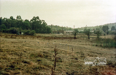 Eltham District Historical Society Inc
Photograph, Looking northwest to corner of Susan and Brougham Streets, Eltham, c.1980, 1980c
In the foreground is the site of the current Leisure Centre built 1981 and in the background the current site of Eltham Crash RepairRecord of the Society's history of activities - The Society members would have picnics on the Bassett-Smith propertyRoll of 35mm colour negative film, 4 stripsKodacolor IIsusan street, fabbro's farm, eltham leisure centre, brougham street, bell street -
 Eltham District Historical Society Inc
Photograph, Spring Excursion, Hume and Hovell bus tour Stage 2, Seymour, Benalla; 26 Oct 1997, 26/10/1997
MONUMENT HUNTING THE HUME AND HOVELL WAY (Newsletter No. 117, November 1997, by Diana Bassett-Smith) Sunday October 26 1997 dawned bright and very warm. Some twenty-five members, complete with picnic baskets, met outside the Eltham Library awaiting the Cobb and Co. large coach which would be taking us on the second leg of our travels along the route of the early explorers Hume and Hovell. Stephen West was our very good driver for the day. He would be guided around the circuitous route by Russell Yeoman wh9 had made a detailed study, not only of the intended route, but of the story of these two explorers. During the trip Russell regaled us with poetry, quotations from the Journals and the History of the Shire of Seymour, "The New Crossing Place: by Martindale, 1982, (now Mitchell Shire due to the recent amalgamations). We headed towards the Hume Highway via Greensborough and Cooper Street and proceeded north to our first stop, noting on the way Monument Hill in the distance which is near Kilmore and, according to Russell, well worth the effort to visit as the view across the valley is magnificent. Past Sunday Creek Valley, Mt Piper and Mt Disappointment, all traversed and noted and named by them. We passed through Tallarook, then onto Seymour where we took photos of the monument telling us that Hume and Hovell had passed through on the 28th of October 1824. We also deviated down Hume and Hovell Road viewing deer and emu farming and the Bellbourie property now a sanctuary. Leaving Seymour behind we travelled up the Avenel Road to the Avenel monument, pyramidal in design of four reducing square blocks with a sharply pointed peak, erected in 1924 in memory of the 1824 exploration. The day was warming up and the countryside showing the dryness of the current drought. A parallel note had been made in their journal too of 1824 of the drought appearance of the country they were traversing. At Seven Creeks, Euroa we stopped for some minutes to check the monument placed 20th November 1924 to commemorate their passage on the 29th December 1824. More photos. Russell had pointed out the abrupt termination of the distant ranges which is noted in their journal. The next monument is beside the road at the entrance to Honey Suckle Creek Caravan Park, Violet Town. The squarish shaped monument some eight feet high is topped with a simple steel cross, and was to mark the date of 28th December 1824 and built for the 20th November 1924. By now it was 12.20 and nearly lunchtime as we drove along the Warranbayne Road to Roach's Road, monument hunting without success. Though there is a large, what appears to be an old timber sign which was hard to read, maybe this was the lost monument. In many of the paddocks hay had been cut and baled or was being cut, what a contrast to the rugged country they had passed through which was smoky from the fires of the natives burning off By 1.00 pm we were at Benalla and pulled up beside the park where abundant beds of roses filled the air with their scent and the smell of barbecued food twitched the nostrils whilst the cheerful sounds of other picnickers could be heard throughout the park. We left the bus and collected up our picnics, dispersed to the various tables and enjoyed the shade from the various European trees. 2.00 pm and we were on the road again driving along the Benalla, Mansfield, Yea road. The Swanpool monument states that they passed four miles south and returned three miles north. Then we stopped at the Barjarg monument which notes that they camped near this spot. It is again a pyramidal monument and this time topped with a steel arrow indicating their route of the 29th November 1824. Half an hour later we came to another monument, again with a steel arrow marker on top and the plaque dated the 2nd of 12th 1824. Erected on the 12th of 12th 1924. "They blazed the way that we might inherit the land." Another square based and needle topped monument appeared at Yarck near Yea and this plaque records the date of 3 December 1824. Near McGuigans Road Russell related that the expedition had lost a dog but it had found them next day, the dog was apparently torn by a kangaroo. A short while later Russell reminded us here of the problems they encountered in crossing the Goulburn River near Molesworth where banks were high, water deep and wide. "Good coat of grass but quite dry due to drought". At Yea we stopped for afternoon tea and raided the last of our picnics and looked at the monument to their journey of 1824, situated at a corner of the gardens near the bowling green. No photo – we were out of film. We returned home via Kinglake West and Whittlesea past the Yan Yean Reservoir, not full. 5.00 pm back at Eltham we emptied out of the bus and everyone, including Joan Cole, collected their things, Joan also had the major souvenir of the day, a large carp she had picked up from the river bank, her cat was in for a great feast. The day was made so interesting by the informed commentary which Russell provided. His background knowledge of the route and nature of the journey could only have come from many hours of reading and driving the area. Thank you to Russell and to everyone who made the day so informative and pleasurable. Diana Bassett-Smith. Record of the Society's history of activities - Spring 1997 excursionRoll of 35mm colour negative film, 6 stripsFuji 200shire of eltham historical society, activities, pretty hill, seymour, benalla, hume and hovell, monuments -
 Eltham District Historical Society Inc
Photograph, Spring Excursion, Hume and Hovell bus tour Stage 2, Seymour, Benalla; 26 Oct 1997, 26/10/1997
MONUMENT HUNTING THE HUME AND HOVELL WAY (Newsletter No. 117, November 1997, by Diana Bassett-Smith) Sunday October 26 1997 dawned bright and very warm. Some twenty-five members, complete with picnic baskets, met outside the Eltham Library awaiting the Cobb and Co. large coach which would be taking us on the second leg of our travels along the route of the early explorers Hume and Hovell. Stephen West was our very good driver for the day. He would be guided around the circuitous route by Russell Yeoman wh9 had made a detailed study, not only of the intended route, but of the story of these two explorers. During the trip Russell regaled us with poetry, quotations from the Journals and the History of the Shire of Seymour, "The New Crossing Place: by Martindale, 1982, (now Mitchell Shire due to the recent amalgamations). We headed towards the Hume Highway via Greensborough and Cooper Street and proceeded north to our first stop, noting on the way Monument Hill in the distance which is near Kilmore and, according to Russell, well worth the effort to visit as the view across the valley is magnificent. Past Sunday Creek Valley, Mt Piper and Mt Disappointment, all traversed and noted and named by them. We passed through Tallarook, then onto Seymour where we took photos of the monument telling us that Hume and Hovell had passed through on the 28th of October 1824. We also deviated down Hume and Hovell Road viewing deer and emu farming and the Bellbourie property now a sanctuary. Leaving Seymour behind we travelled up the Avenel Road to the Avenel monument, pyramidal in design of four reducing square blocks with a sharply pointed peak, erected in 1924 in memory of the 1824 exploration. The day was warming up and the countryside showing the dryness of the current drought. A parallel note had been made in their journal too of 1824 of the drought appearance of the country they were traversing. At Seven Creeks, Euroa we stopped for some minutes to check the monument placed 20th November 1924 to commemorate their passage on the 29th December 1824. More photos. Russell had pointed out the abrupt termination of the distant ranges which is noted in their journal. The next monument is beside the road at the entrance to Honey Suckle Creek Caravan Park, Violet Town. The squarish shaped monument some eight feet high is topped with a simple steel cross, and was to mark the date of 28th December 1824 and built for the 20th November 1924. By now it was 12.20 and nearly lunchtime as we drove along the Warranbayne Road to Roach's Road, monument hunting without success. Though there is a large, what appears to be an old timber sign which was hard to read, maybe this was the lost monument. In many of the paddocks hay had been cut and baled or was being cut, what a contrast to the rugged country they had passed through which was smoky from the fires of the natives burning off By 1.00 pm we were at Benalla and pulled up beside the park where abundant beds of roses filled the air with their scent and the smell of barbecued food twitched the nostrils whilst the cheerful sounds of other picnickers could be heard throughout the park. We left the bus and collected up our picnics, dispersed to the various tables and enjoyed the shade from the various European trees. 2.00 pm and we were on the road again driving along the Benalla, Mansfield, Yea road. The Swanpool monument states that they passed four miles south and returned three miles north. Then we stopped at the Barjarg monument which notes that they camped near this spot. It is again a pyramidal monument and this time topped with a steel arrow indicating their route of the 29th November 1824. Half an hour later we came to another monument, again with a steel arrow marker on top and the plaque dated the 2nd of 12th 1824. Erected on the 12th of 12th 1924. "They blazed the way that we might inherit the land." Another square based and needle topped monument appeared at Yarck near Yea and this plaque records the date of 3 December 1824. Near McGuigans Road Russell related that the expedition had lost a dog but it had found them next day, the dog was apparently torn by a kangaroo. A short while later Russell reminded us here of the problems they encountered in crossing the Goulburn River near Molesworth where banks were high, water deep and wide. "Good coat of grass but quite dry due to drought". At Yea we stopped for afternoon tea and raided the last of our picnics and looked at the monument to their journey of 1824, situated at a corner of the gardens near the bowling green. No photo – we were out of film. We returned home via Kinglake West and Whittlesea past the Yan Yean Reservoir, not full. 5.00 pm back at Eltham we emptied out of the bus and everyone, including Joan Cole, collected their things, Joan also had the major souvenir of the day, a large carp she had picked up from the river bank, her cat was in for a great feast. The day was made so interesting by the informed commentary which Russell provided. His background knowledge of the route and nature of the journey could only have come from many hours of reading and driving the area. Thank you to Russell and to everyone who made the day so informative and pleasurable. Diana Bassett-Smith. Record of the Society's history of activities - Spring 1997 excursionRoll of 35mm colour negative film, 2 stripsKodak Gold 400-5shire of eltham historical society, activities, pretty hill, seymour, benalla, hume and hovell, monuments -
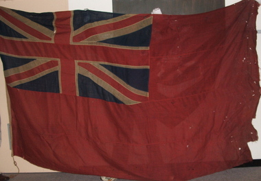 4th/19th Prince of Wales's Light Horse Regiment Unit History Room
Red Ensign, Surgeons' Banner, 1850 (estimated)
Red Ensign 1801 design. - The British red ensign was altered in 1801 to include the change to the design of the Union Jack. British legislation required, with a few exceptions, that all merchant shipping throughout the British Empire fly the British Red Ensign, without any defacement or modification. The ensign is sometimes referred to as the red duster. The Royal Navy stopped using the Red Ensign in 1864. This red ensign was used by the Surgeons of the Kyneton District Mounted Rifles to indicate their location. The Banner is a large red ensign mounted on a 10 foot long polished wooden pike. The Banner was used by the Kyneton District Mounted Rifles, later The Royal Volunteer Cavalry Regiment (Prince of Wales Hussars), then Prince of Wales Victorian Light Horse, ancestor units of the modern day 4th /19th Prince of Wales’s Light Horse Regiment. In the binding is the inscription ‘Kyneton Prince of Wales Light Horse’ and three names: Surg-Major S Smith MRSLE, Dr McMillan, and Maj Thirkettle. These surgeons played a significant role in the military and civil affairs of Kyneton. Dr McMillan Dr McMillan was the first surgeon but left KPWLH 2-3 months after its formation and little else is known of him. Surgeon-Major Samuel Smith 1836 Born, Scotland 1857 Surgeon to the Hon. Hudson Bay Company. Ship “Prince Arthur” from London to Moose Fort, Hudson Bay. June 13 – Aug. 24 1857. 1858 Appointed Medical Officer of large immigrant ship to Port Phillip 1859 Appointed Assistant District Coroner, Castlemaine 1859 Appointed to Castlemaine Hospital 1862 Appointed first resident surgeon and manager of Kyneton Hospital Foundation member of Kyneton District Mounted Rifles 1874 Appointed Surgeon-Major Kyneton Volunteer Prince of Wales Light Horse Conducted a private practice in Kyneton. 1909 Died 8 November 1909, aged 73 years Samuel Smith was a Life Governor of Castlemaine Benevolent Asylum, a member of St Andrews Presbyterian Church, a Mark Master Mason of the Edward Coulson Lodge No 17, Kyneton. He also had a notable collection of stuffed native birds and animals of which he had great knowledge. Major Thirkettle 1855 Major Thirkettle arrived in Kyneton Established a timber merchant and ironmongery business in Kyneton with Robert Burton. 1857 By 1857 he was practising as an architect. His house is still standing in Yaldwin St, West Kyneton. 1860 Joined the Prince of Wales Light Horse 1863 Joined Rifle Volunteers and appointed Captain. On their disbandment he was made Honorary Major. 1864 Won Queen’s prize for rifle shooting. Major Thirkettle was noted for his skill with woodwork. He won many prizes and orders of merit for his models of yachts It is believed likely that he made the wooden pike with its metal head (now missing). He was Tyler of the Zetland Lodge, also Secretary of the MUIOOF and Bowling Club. 1904 Died in Kyneton, aged 75 years Protection for medical services The Surgeons’ Banner indicated the location of the Regimental Aid Post. The use of this device in the 1860’s overlapped the adoption of the Red Cross which became the symbol for the protection of sick and wounded soldiers. In 1864 twelve European nations signed a treaty stating that in future wars they would care for all sick and wounded military personnel, regardless of nationality. They would also recognise the neutrality of medical personnel, hospitals and ambulances identified by the emblem of a red cross on a white background. The treaty was called the Geneva Convention. This Convention was concerned only with soldiers wounded on the battlefield. Over the years, however, it has been expanded to cover everyone caught up in conflicts but not actually taking an active part in the fighting. The Surgeons’ Banner complements the Colours of the Kyneton District Mounted Rifles, also held by the Unit History Room, in presenting the colonial period of the Regiment’s history. Provenance It is believed that the Banner was manufactured in Britain and brought to Australia by Samuel Smith. After the disbanding of Colonial units, the Banner was in the care of the Shire of Kyneton until presented to the 4/19 Prince of Wales’s Light Horse Regiment on 14 September 1986 on the occasion of the Regiment exercising its right of freedom of entry to the city. There are many examples of Regimental and King’s/Queen’s Colours held by various organisations. However A Surgeons’ Banner such as this is rare, if not unique, in Australia. A large red ensign, post 1801 design. - The British red ensign was altered in 1801 to include the change to the design of the Union Jack. British legislation required, with a few exceptions, that all merchant shipping throughout the British Empire fly the British Red Ensign, without any defacement or modification. The ensign is sometimes referred to as the red duster. The Royal Navy stopped using the Red Ensign in 1864. On the binding is the inscription: "Kyneton Prince of Wales Light Horse", and three names - Surgeon Major S Smith MRSLE Dr McMillan Major Thirkettlekyneton district mounted rifles, heraldry, red ensign, surgeons banner -
 4th/19th Prince of Wales's Light Horse Regiment Unit History Room
Slide Plate, Cinema Advertising, 1980 (estimated)
Glass Plate, 80 x 80 mm, cinema advertising. Orange background. In black borderded 40 x 25 mm rectangle - black print on yellow fill - "Join up 4/19 Prince of Wales Light Horse George Street FITZROY". Next to this message is a picture of M113A1 Armoured Personnel Carrier, under which is "Army Reserve The Ready Men" Note incorrect spelling of unit title: "Wales" instead of "Wales's"advertising, army recruiting, cinema, glass slide, advertising, army recruiting, cinema, glass slide -
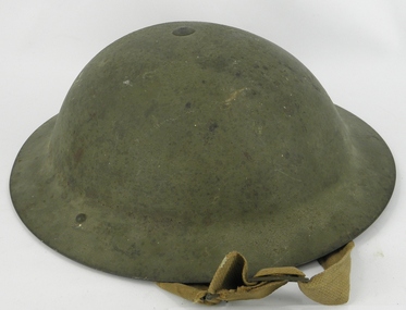 4th/19th Prince of Wales's Light Horse Regiment Unit History Room
Helmet, Steel British, Circa 1939-1945
Background unknownThis helmet although manufactured in WW2, is an almost identical style to the WW1 helmet worn by soldiers of the 4th Light Horse in France and Belgium.helmet steel british, helmet steel british -
4th/19th Prince of Wales's Light Horse Regiment Unit History Room
Flag, 4th Light Horse Association, 1920 (estimated)
Flag of the 4th Australian Light Horse Regiment Association. Previously held at the Shrine of Remembrance and flown on commemorative occasions. Flag has deteriorated over the years and has been replaced with a new flagFlag depicting the two colour patches (1740 x 1130 mm) of the 4th Light Horse Regiment ( 2 blues and, red & white) on light grey background. On hoist "4th L Horse"heraldry, flags, 4th light horse regiment -
4th/19th Prince of Wales's Light Horse Regiment Unit History Room
Badge, cloth, 2 BRAAC
Worn on battle dress uniform. Design also displayed on army vehicles as formation sign. 2nd Armoured Brigade no longer exists. The Australian Army no longer has any armoured brigadesCloth badge of 2nd Armoured Brigade, Royal Australian Armoured Corps. Featuring, in black, an armoured right arm holding a battle axe on yellow background. For right sleeveheraldry, army, badges, armour -
4th/19th Prince of Wales's Light Horse Regiment Unit History Room
Training Set, Universal, Wireless, No 1, about 1948
The kit is packed in 2 wooden transit boxes. The Training Set is a semi-portable instrument for training operators in morse reading and sending and R.T. communication. The set comprises audio oscillators for morse reading, morse interference and background noise interference, power supply for microphones, an audio amplifier, and a switch board for group working with up to six independent, contained in the instructor's set. The instructor and each operator under training has a receiver-head gear, a hand microphone and a morse key. The instructor has an additional morse key used for providing morse interference. In the case of each operator, the microphones and headphones plug into an "operator's control unit" fitted to the table in front of each operator. The units also house a morse key, and are connected to the instructor's set by four-core cable. Plug and socket connections are used. The apparatus may be used for a class of up to 36 operators. Working Instructions - filed on Object Data Record radio, wireless, training set -
 Kiewa Valley Historical Society
Photo - Mount Beauty Houses circa 1947
A photo of Beauty Avenue houses looking south. A good example of the garden's created very early in Mount Beauty's history. Photo circa 1947These houses were built for the workers and their families during the construction phase of the Kiewa Hydro Electric Scheme by the State Electricity Commission of Victoria.Large coloured photograph with mountains in the background, houses,and SEC poles in the centre, and gardens in the foregroundOn the back in pencil 13411mount beauty housing, kiewa hydro electric scheme, mount beauty gardens, mount beauty township -
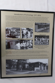 Kiewa Valley Historical Society
Posters - "Tawonga Remembers" x 5
The town of Tawonga is in the Kiewa Valley surrounded by farmland. It is adjacent to Mt Beauty (built from 1946), an SECV town built for the workers on the Kiewa Hydro Electric Scheme which was being constructed from 1911-to 1961. Tawonga consisted of essential amenities including a store, school, butter factory, sporting facilities, post office, hall and hotel. Activities involved sport, social get togethers eg. dances, fundraising, CWA etc.The posters are a collection of historical photos, documentation and information regarding the history of the town of Tawonga, which is the centre of a farming community in the Kiewa Valley.Posters framed with thin black plastic strip, covered by glass. Each one has a title re "Tawonga Remembers" and includes print and photos in black and white. Beige background. 1.Butcher Shop and Slaughter Yard; 2. Tawonga Saw Mill; 3. Post Office; 4. Tawonga District Hospital (2 pages); 5. Introduction of Technology: 1971-2016tawonga, photos of early tawonga, kiewa valley, tawonga remembers, businesses