Showing 16996 items
matching plenty-river
-
 Eltham District Historical Society Inc
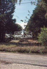
Slide, Bonds Road, Lower Plenty, Mar. 1981
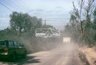
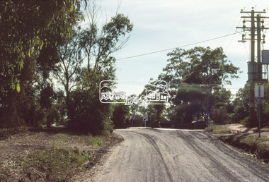
One of a series of images of road infrastructure focussed on Bonds Road, Lower Plenty, the section connecting Old Eltham Road with Rosehill Road, taken by Eltham Shire Council Planning and Engineering officers. They provide perspective of the changes in housing styles and road development that began sweeping in from the mid 1970s with increasing urbanisation of what was once more outlying suburbs and regions. All images have been identified with GPS35 mm colour positive transparency (1 of 13) Mount - Kodak Kodachrome CardProcessed Mar 1981infrastructure, roads, bonds road, lower plenty -
 Eltham District Historical Society Inc
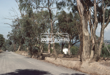
Slide, Bonds Road, Lower Plenty, Mar. 1981
One of a series of images of road infrastructure focussed on Bonds Road, Lower Plenty, the section connecting Old Eltham Road with Rosehill Road, taken by Eltham Shire Council Planning and Engineering officers. They provide perspective of the changes in housing styles and road development that began sweeping in from the mid 1970s with increasing urbanisation of what was once more outlying suburbs and regions. All images have been identified with GPS35 mm colour positive transparency (1 of 13) Mount - Kodak Kodachrome CardProcessed Mar 1981infrastructure, roads, bonds road, lower plenty -
 Eltham District Historical Society Inc
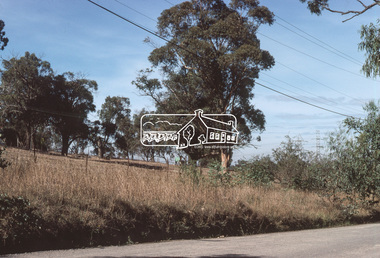
Slide, Bonds Road, Lower Plenty, Mar. 1981
One of a series of images of road infrastructure focussed on Bonds Road, Lower Plenty, the section connecting Old Eltham Road with Rosehill Road, taken by Eltham Shire Council Planning and Engineering officers. They provide perspective of the changes in housing styles and road development that began sweeping in from the mid 1970s with increasing urbanisation of what was once more outlying suburbs and regions. All images have been identified with GPS35 mm colour positive transparency (1 of 13) Mount - Kodak Kodachrome CardProcessed Mar 1981infrastructure, roads, bonds road, lower plenty -
 Eltham District Historical Society Inc
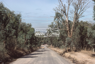
Slide, Bonds Road, Lower Plenty, Mar. 1981
One of a series of images of road infrastructure focussed on Bonds Road, Lower Plenty, the section connecting Old Eltham Road with Rosehill Road, taken by Eltham Shire Council Planning and Engineering officers. They provide perspective of the changes in housing styles and road development that began sweeping in from the mid 1970s with increasing urbanisation of what was once more outlying suburbs and regions. All images have been identified with GPS35 mm colour positive transparency (1 of 13) Mount - Kodak Kodachrome CardProcessed Mar 1981infrastructure, roads, bonds road, lower plenty -
 Eltham District Historical Society Inc
Slide, Bonds Road, Lower Plenty, Mar. 1981
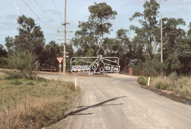
One of a series of images of road infrastructure focussed on Bonds Road, Lower Plenty, the section connecting Old Eltham Road with Rosehill Road, taken by Eltham Shire Council Planning and Engineering officers. They provide perspective of the changes in housing styles and road development that began sweeping in from the mid 1970s with increasing urbanisation of what was once more outlying suburbs and regions. All images have been identified with GPS35 mm colour positive transparency (1 of 13) Mount - Kodak Kodachrome CardProcessed Mar 1981infrastructure, roads, bonds road, lower plenty, rosehill road -
 Eltham District Historical Society Inc
Slide, Bonds Road, Lower Plenty, Mar. 1981
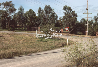
One of a series of images of road infrastructure focussed on Bonds Road, Lower Plenty, the section connecting Old Eltham Road with Rosehill Road, taken by Eltham Shire Council Planning and Engineering officers. They provide perspective of the changes in housing styles and road development that began sweeping in from the mid 1970s with increasing urbanisation of what was once more outlying suburbs and regions. All images have been identified with GPS35 mm colour positive transparency (1 of 13) Mount - Kodak Kodachrome CardProcessed Mar 1981infrastructure, roads, bonds road, lower plenty, rosehill road -
 Eltham District Historical Society Inc
Slide, Bonds Road, Lower Plenty, Mar. 1981
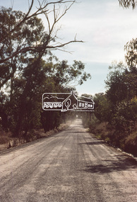
One of a series of images of road infrastructure focussed on Bonds Road, Lower Plenty, the section connecting Old Eltham Road with Rosehill Road, taken by Eltham Shire Council Planning and Engineering officers. They provide perspective of the changes in housing styles and road development that began sweeping in from the mid 1970s with increasing urbanisation of what was once more outlying suburbs and regions. All images have been identified with GPS35 mm colour positive transparency (1 of 13) Mount - Kodak Kodachrome CardProcessed Mar 1981infrastructure, roads, bonds road, lower plenty, rosehill road -
 Eltham District Historical Society Inc
Slide, Bonds Road, Lower Plenty, Mar. 1981
One of a series of images of road infrastructure focussed on Bonds Road, Lower Plenty, the section connecting Old Eltham Road with Rosehill Road, taken by Eltham Shire Council Planning and Engineering officers. They provide perspective of the changes in housing styles and road development that began sweeping in from the mid 1970s with increasing urbanisation of what was once more outlying suburbs and regions. All images have been identified with GPS35 mm colour positive transparency (1 of 13) Mount - Kodak Kodachrome CardProcessed Mar 1981infrastructure, roads, bonds road, lower plenty -
 Eltham District Historical Society Inc
Slide, Bonds Road, Lower Plenty, Mar. 1981
One of a series of images of road infrastructure focussed on Bonds Road, Lower Plenty, the section connecting Old Eltham Road with Rosehill Road, taken by Eltham Shire Council Planning and Engineering officers. They provide perspective of the changes in housing styles and road development that began sweeping in from the mid 1970s with increasing urbanisation of what was once more outlying suburbs and regions. All images have been identified with GPS35 mm colour positive transparency (1 of 13) Mount - Kodak Kodachrome CardProcessed Mar 1981infrastructure, roads, bonds road, lower plenty, old eltham road -
 Stawell Historical Society Inc
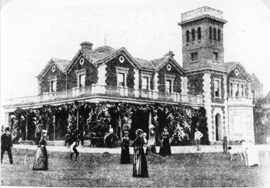
Photograph, "Woodlands" Homestead on Wimmera River near Crowlands owned by William McCulloch 1894
Photograph of Woodlands Homestead on Wimmera River near Crowlands 1894 owned by William McCulloch when photo taken in 1894stawell -
 Kiewa Valley Historical Society
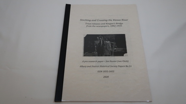
Book - Kiewa River, Stocking and Crossing the Kiewa River by Jan Hunter (nee Chick), 2020
The Chick brothers, Alf, Les and Allan, plus friends, began trout fishing and camping in the Kiewa Valley before the early 1930s. Les continued his connection with the Kiewa River until his death in 1972. Fingerlings were placed in the Kiewa River from the early 1880s. Keegan's Bridge is a crossing near Upper Gundowring and about 4 km south east of Dederang. References to the crossing were made in the early 1900s and a petition presented to Council in 1904 calling for a bridge.The bridge was built and opened in 1907. The photos are of the release of fingerling trout in the Kiewa River, thought to be at Keegan's Bridge. The fingerlings were transported in drums on the back of trucks. The photos are c1940s.The Kiewa Valley has been a popular spot for fishermen, tourists and campers from the 1880s. One of the many attractions has been the excellent fishing along the Kiewa River due to the regular release of fish especially brown trout. This continues to the present day (2020) when a few fish were marked with $$ signs for the lucky fisherman who caught them. This attracts visitors, their families and boosts the economy and dates back to visits at the Tawonga Pub prior to the Kiewa Hydro Electric Scheme.19 page book with black plastic spine and clear plastic cover over the beige paper cover with title , author and black & white photo. Note: In KVHS photo collection there are 4 good quality reproduction photos on photographic paper. These have been produced professionally. These photos of Jan Hunter's are featured on the second page of her book. These also have a letter attached. The book is a pre-research paper & is No 33 of the Albury and District Historical Society Papers. The sub-title is "Trout releases and Keegan's Bridge / from the newpapers, 1882-1935"None on the book but a letter is attached from Jan Hunter, the author as a follow up to the photos she donated. On the photos - On the back: Fujifilm / Fujicolor Crystal Archive / Paper / Production - run codekiewa river; trout; fish; keegan's crossing; keegan's bridge; fingerlings; chick family; camping; tourism -
 Orbost & District Historical Society
map/brochure, Discovering Marlo & The Snowy River Estuary, December 1988
In 1983 the Department of Conservation, Forests and Lands replaced the Department of Crown Lands and Survey, the Department of State Forests and the Ministry for Conservation. This brochure/map was used as tourist information in Orbost.This item is a useful research tool.A folded map/brochure titled "DISCOVERING MARLO & THE SNOWY RIVER ESTUARY". On the front is a photograph of Marlo and the title in yellow print. There is a locality map for access to Corringle beach and the brochure Includes a key to fishing sites and various tourist locations. On the back of the brochure are notes on fishing, wildlife and a boating guide, map brochure snowy-river marlo -
 Glenelg Shire Council Cultural Collection
Book, Peter Leake Dust Jacket Design - Michael Payne, 'Big River Glenelg' - First Edition, 1978
Hardcover book, black with dust jacket, lime, black and white, lime print 'BIG RIVER GLENELG' Peter Leake. First edition 1978. Dust cover front shows Glenelg - Wannon Junction near Sandford, Vic. back above Donovan's Landing. Lower Glenelg, S.A. -
 National Vietnam Veterans Museum (NVVM)
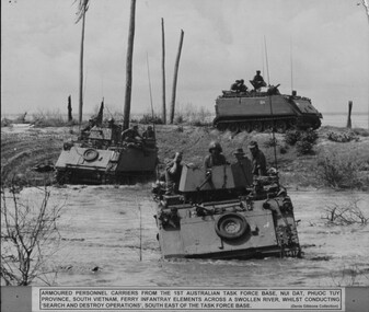
Photograph, Swollen River Crossing
A black and whitie photograph of Armoured Personnel Carriers from the 1st Australian Task Force Base at Nui Dat, Phuoc Tuy Province, South Vietnam ferry infantry elements across a swollen river whilst conducting search and destroy operations South East of the Task Force Base.photograph, apc, 1st australian task force, nui dat, phuoc tuy province, gibbons collection catalogue, infantry -
 Greensborough Historical Society
Advertising Leaflet, 3/19 River Street Briar Hill, 23/11/2012
3/19 River Street Briar Hill. 3 bedroom home, private sale, sold 23 November 2012 for $445,000Real estate advertising leaflet, 1 sheet, printed in colour both sidesriver street briar hill -
Tatura Irrigation & Wartime Camps Museum
Booklet, River Improvement & Land Drainage, 1952
River improvement and land drainage and flood protection with spectial reference to the nature and operation of land drainage legislation in Great Britain 1952Grey cover, black writing. Includes fold out mapsirrigation, books, history, local -
Lakes Entrance Regional Historical Society (operating as Lakes Entrance History Centre & Museum)
Photograph, Phillip Hancock, January 1915 c
Black and white photograph showing small launch beside river and large Aboriginal canoe tree in background and eighteen adults and two children, James, Maud, Eva, May, Mabel Howlett, Fred, Marion, Alf, Gladys Legg, Carrie Froud, Jessie Bly, Lena Brideson, George Bull, Will Bell, Jim Thompson, Mr Wilson on the bank of the Tambo River Gippsland Victoriagenealogy -
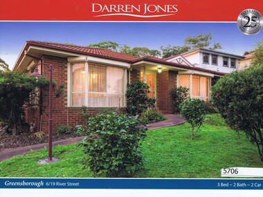 Greensborough Historical Society
Advertising Leaflet, Darren Jones, 6/19 River Street Greensborough, 28/07/2018
6/19 River Street Greensborough. Three bedroom unit, sold for $830,000 in July 2018. Previous sales: November 1998, $35,000.Real estate advertising leaflet, 1 sheet, printed in colour both sides. river street greensborough -
Lakes Entrance Regional Historical Society (operating as Lakes Entrance History Centre & Museum)
Postcard, Sherwood, 1907 c
Black and white postcard of the bridge over the Brodribb River near Orbost VictoriaBrodribb River 6.4.07waterways, bridges -
Lakes Entrance Regional Historical Society (operating as Lakes Entrance History Centre & Museum)
Postcard, 1920 c
One of the series of postcards used in the tourist industryPostcard of scene of Mitchell River with fences in the foreground and in the background bridge and Bairnsdale VictoriaThe Mitchell River Bairnsdalehouses, waterways -
 Federation University Historical Collection
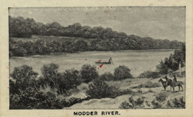
Photograph (black & White), Modder River - South Africa
When war broke out in 1899, and early target for the Boers was the diamond-mining centre of Kimberley. This was located near the point where the Transvaal, Orange Free State and Cape Colony met. General Sir Redvers Buller detached the 1st Division under Lieutenant General Lord Methuen to relieve the Siege of Kimberley. This decision was made partly for reasons of prestige. To capture Kimberley (which contained the famous imperialist and former Prime Minister of Cape Colony, Cecil Rhodes) would be a major propaganda victory for the British. Methuen's force advanced north and won two engagements against the Boers of the Orange Free State. Reinforcements from Transvaal under General Koos de la Rey arrived and he convinced the Boers to follow his plans for attacking the British. Instead of relying on the hills for protection and missing their targets, de la Rey proposed they make use of the flat veld and introduced them to the Mauser rifle with its flat trajectory. Trenches were built in the banks of the Modder River from which they could sweep the veld for a great distance. The trenches were built on the south side of the river and on the smaller Riet River where they meet at Modder River Station. Methuen's force began advancing towards the Modder planning to cross the river. The Boers opened fire and the British troops were unable to find cover on the veld. They had to lay flat so as not to be seen or hit. The British guns pounded the buildings near Modder River Station and the north bank of the river, missing the trenches on the south bank. The battle became a stalemate. The British found an opening on the Boer's right flank at Rosmead ford downstream and drove the Boers out of Rosmead. De la Rey drove them back into a small insecure bridgehead. The Boers feared they were vulnerable and withdrew during the night. Methuen reported that the battle had been "one of the hardest and most trying fights in the annals of the British army". Individual image from photographed poster of tobacco and cigarette cards.boers, diamind-mining, kimberley, transvaal, orange free state, cape colony, sir rdvers buller, lieutenant general lord methuen, siege of kimberley, cecil rhodes, general koos dde la rey, mauser rifle, veld, modder river, modder river station, trenches, riet river, rosmead -
 Malmsbury Historical Society
Photograph (Item), Two Men Fishing In A River (Coliban?), Malmsbury c1900
People - "Townsend, E; Hall, Percy; Smith, W. H. (Photographer)" Buildings - River (Coliban?) Associated with - "Smith, W.H. (Photographer); Bank Of Victoria" -
 St Patrick's Old Collegians Association (SPOCA)
Photograph - Students, 1920s
-
![View of the River Murray, near Echuca, showing the Railway Wharf with steamers unloading / [by] Nicholas Caire, circa 1876](/media/collectors/550653872162f11fb04854aa/items/57774776d0cdd10a5c111b2d/item-media/57774888d0cdd10a5c11c099/item-fit-380x285.jpg) Kew Historical Society Inc
Kew Historical Society IncPhotograph, Anglo-Australasian Photographic Company, View of the River Murray, near Echuca, showing the Railway Wharf with steamers unloading, c. 1876
Nicholas Caire was born on Guernsey in the Channel Islands in 1837. He arrived in Adelaide with his parents in about 1860. In 1867, following photographic journeys in Gippsland, he opened a studio in Adelaide. From 1870 to 1876 he lived and worked in Talbot in Central Victoria. In 1876 he purchased T. F. Chuck's studios in the Royal Arcade Melbourne. In 1885, following the introduction of dry plate photography, he began a series of landscape series, which were commercially successful. As a photographer, he travelled extensively through Victoria, photographing places few of his contemporaries had previously seen. He died in 1918. Reference: Jack Cato, 'Caire, Nicholas John (1837–1918)', Australian Dictionary of Biography.An original, rare photograph from the series 'Views of Victoria: General Series' by the photographer, Nicholas Caire (1837-1918). The series of 60 photographs that comprise the series was issued c. 1876 and reinforced a neo-Romantic view of the Australian landscape to which a growing nationalist movement would respond. Nicholas Caire was active as a photographer in Australia from 1858 until his death in 1918. His vision of the Australian bush and pioneer life had a counterpart in the works of Henry Lawson and other nationalist poets, authors and painters.albumen silver photograph on boardprinted in ink on support l.c.: VIEW ON THE RIVER MURRAY, NEAR ECHUCA, SHOWING THE RAILWAY WHARF WITH STEAMERS UNLOADING. / COPYRIGHT REGISTERED. printed in ink on support reverse c.: VIEWS OF VICTORIA. / (GENERAL SERIES.) / No. 7. / VIEW ON THE RIVER MURRAY, NEAR ECHUCA, SHOWING THE RAILWAY WHARF WITH STEAMERS UNLOADING. / The rapidly increasing traffic on the River Murray, with wool, timber, and other colonial produce, has called / into requisition no less than 400 steamers and over 1000 barges. To meet this growing emergency the Victorian / Government has expended several thousand pounds in the erection of a Railway Wharf which during the wool- / season presents a very busy scene, the crowded steamers laden with precious clip taxing to the utmost the / powers of the Railway Department in the process of unloading. The River here is about a quarter of a mile wide, / and is from 60 to 70 feet deep. printed in ink on support reverse l.c.l.: J.W. FORBES, Agent, printed in ink on support reverse l.c.: ANGLO-AUSTRALASIAN PHOTOGRAPHIC COMPANY, MELBOURNE. printed in ink on support reverse l.c.r.: 10 Temple Court, Collins Street West.nicholas caire (1837-1918), landscape photography, river murray, echuca -
 Stawell Historical Society Inc
Photograph, Glenorchy Bridge on the Wimmera River 1866
Glenorchy Bridge Wimmera River. Part of a collection of Photographs by Mr. O.G. Armstrong as commissioned by the Shire of Stawell for the Inter-colonial and Paris Exhibition in Melbourne in 1866.stawell -
Malmsbury Historical Society
Photograph (Item), B/W Photo Children Swimming In Coliban River 1958, Malmsbury 1958
People - Stirling; Holliday; Barker; Andrews; Pittaway; Mccracken Etc Buildings - Coliban River Associated with - Herald & Weekly Times (Also 6/1/1960) -
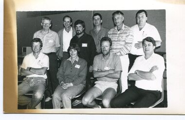 Orbost & District Historical Society
black and white photograph, Snowy River Mail, October 1987
This a photograph of the Gippsland representatives at the C.A.T.S. conference. This photograph was taken at the Curriculum and Technology in Schools workshop held in Bendigo, Victoria in October 1987. Eighty rural primary schools were involved including many from East Gippsland. From the Snowy River Mail; " A large number of technologies was......demonstrated at the conference. Participants were given hands on experience with audio and computer conferencing, CD Rom. an Invicon booth ( individual video console (INVICON) enables any teacher to produce short, relevant teaching videos for individual pupils without assistance), packet radio, videodisk, robotics and many more...." In the back row are: Al Balfour (Bairnsdale Min of E); Graeme Rodier (OHS); Roger Nink (Swifts Creek); John Hillier (Mallacoota); Barry Lay ( Bairnsdale HS); Ross Burn ( Bairnsdale HS), In the front row are: Jeff Wilson (Mallacoota); Bea Lay (Bairnsdale HS); Rick Box ( Swifts Creek) and Brian Pomeroy (AVRB Bairnsdalel). Al Balfour was a noted educator, local identity and one of country Victoria's strongest advocates.This is a pictorial record associated with education in East Gippsland.A black / white photograph of a group of people. The back row is standing and the front is sitting on chairs.education-east-gippsland technology -
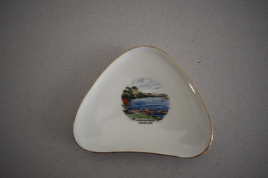 Warrnambool and District Historical Society Inc.
Artefact, Alka, Dish, Mid 20th century
This souvenir dish has been made by the German firm of Alka. The name comes from the surnames of the two proprietors, Alboth and Kaiser. This type of dish was made between 1938 and 1958. Tourism has been an important industry in the Warrnambool area for over 100 years and souvenir dishes of this kind were a popular buy by the visiting tourists. The dish features a scene from the Hopkins River, a fishing and recreational area in Warrnambool since the early days of European settlement. Souvenir dishes such as this one can be sometimes found in local second hand and opportunity shops. This dish is of interest as an example of the high-quality souvenirs bought by local tourists in the Warrnambool area in the mid 20th century.This is a china dish made in a rounded-edged triangular shape. The rim is gilt-edged. In the centre of the dish is a coloured sketch/photograph of the Hopkins River in Warrnambool (Clifton Banks region). ‘Warrnambool Hopkins River’ ‘Alka Bavaria Germany’ tourism in warrnambool, hopkins river, warrnambool, history of warrnambool -
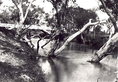
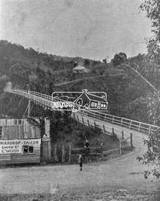 Eltham District Historical Society Inc
Photograph, Warrandyte Bridge on River Yarra
Bridge across the Yarra River which links North Warrandyte and Warrandyte. A house sits prominantly on a hill in the distance. A wooden building on the side of the road before the bridge has advertising for Wardrop Tailor, Smith Street, Collingwood. It is suggested that the photo has had this fake information added at a later date. Wardrop Tailor did operate from about 1915 to 1921. Alternataive title: Warrandyte Bridge - River Yarra. "Wardrop-Tailor, Smith St. C'wood" sign - faked?This photo forms part of a collection of photographs gathered by the Shire of Eltham for their centenary project book,"Pioneers and Painters: 100 years of the Shire of Eltham" by Alan Marshall (1971). The collection of over 500 images is held in partnership between Eltham District Historical Society and Yarra Plenty Regional Library (Eltham Library) and is now formally known as 'The Shire of Eltham Pioneers Photograph Collection.' It is significant in being the first community sourced collection representing the places and people of the Shire's first one hundred years.Digital imagesepp, shire of eltham pioneers photograph collection, warrandyte, bridge, north warrandyte, yarra river, wardrop tailor, collingwood