Showing 2559 items
matching aerial
-
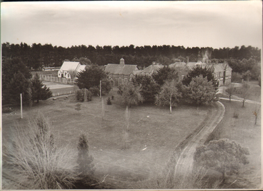 Ballarat and Queen's Anglican Grammar School
b&w Photograph, Aerial photograph of School Buildings
Aerial view of School buildings showing chapel LHS and foreground on south east corner of Ballarat Grammar propertyVerso - N. L. HARVEY (Press Photo Service) A.M.P. Chambers Lydiard St. N. 2993 pencilled in on versoballarat-grammar, buildings, school, education, wendouree, ballarat, chapel -
 Port Melbourne Historical & Preservation Society
Photograph, Aerial Survey of Port Melbourne; December 1945, 2105
Seventeen (17) individual photos were joined together by John KIRBY to make a compsite image.Aerial Survey of Port Melbourne; December 1945 Large photograph mounted on foam board. Shows aerial view of Port Melbourne showing its extent from the Bay. Panel on right hand side has key to numbered areas on map . PMHPS logo on top left cornereclipse picture theatre, brookes lemos ltd, built environment, local government, natural environment, built environment - industrial, religion - roman catholic church (st josephs), gmh, general motors-holden, rotten row, sport - trotting, j kitchen & sons pty ltd, australian wool board, government aircraft factory, gaf, commonwealth aircraft corporation, cac, north port oval, fire and fire services, market reserve, religion - presbyterian church, leading lights, foresters arms hotel, commonwealth government engine works, st josephs catholic primary school, mission to seamen, centenary bridge, naval drill hall, mail exchange, gasworks, piers and wharves - town pier, robert harper & co ltd, ran - royal australian navy, hmas lonsdale, port melbourne yacht club, pmyc -
Moorabbin Air Museum
Book (Item) - Aerial agriculture, Handbook on Aerial Application in Agriculture December 1956
Aerial Agriculture -
 Federation University Historical Collection
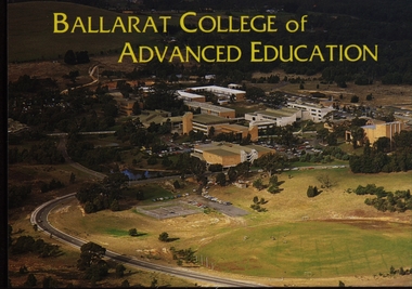
Postcard - Colour, Ballarat College of Advanced Education Aerial View, c1980, c1980
Colour photographic postcard of an aerial view of the Ballarat College of Advanced Education (now Federation University) campus at Mount Helen. ballarat college of advanced education, mt helen campus, aerial photograph -
 NMIT (Northern Melbourne Institute of TAFE)
Photographs: PTS Admin Building c1940s aerial view, Photographs: Preston Technical School Administration Building c1940s aerial view
Two black and white photographs of aerial view of Building A (Administration Building) Preston campus of Preston Technical School c1940s. preston technical school, buildings, nmit -
Whitehorse Historical Society Inc.
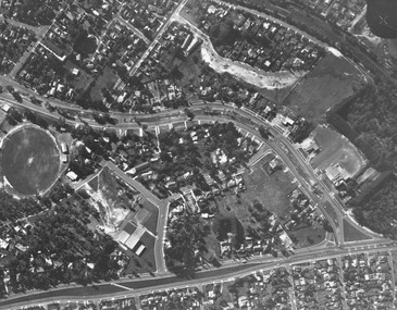
Map, Aerial photograph, c1950
Arial photo of Vermont South and Burwood East, Middleborough Road, Burwood Highway, Springvale Road, Highbury Road and environs.Aerial photo of Vermont South and Burwood East, Middleborough Road, Burwood Highway, Springvale Road, Highbury Road and environs.Arial photo of Vermont South and Burwood East, Middleborough Road, Burwood Highway, Springvale Road, Highbury Road and environs.vermont south, burwood east, aerial photographs -
 Whitehorse Historical Society Inc.
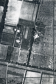
Photograph, Aerial View of Matheson Orchard, 1944
Poor photo copy of black and white photo of Aerial View of Matheson Orchard 'Strathdon', Springvale Road , Forest Hill.matheson, strathdon orchard, orchards -
 International House, The University of Melbourne
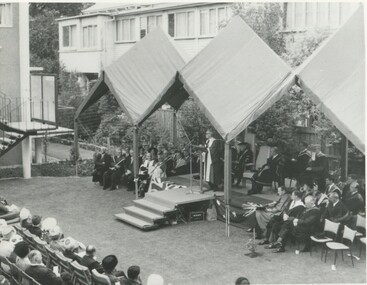
Photograph (Item), Aerial view of speakers and some audience members at the opening of the Samuel Wadham Wing at International House
ceremony -
 University of Melbourne, Burnley Campus Archives
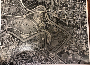
Photograph - Black and white print, Aerial View of Burnley Campus c. 1960, c. 1960
Colour photograph of black and white photograph. Aerial View of Burnley Campus.Enlargement, showing layout of Burnley Campus. Same as B91.296burnley campus, aerial view, yarra river, freeway -
 City of Kingston
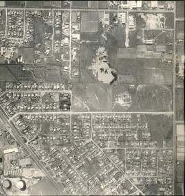
Photograph - Black and white, Aerial photograph Highett, 26 March 1956
Part of broad aerial photographic survey of the area. Aerial photograph Highett - Highett Reserve, Sandpits, Gasworks, Nepean Highway, Chesterville Road, Wickham Road.The photograph shows the development of the city of Highett, suburban expansion and industrialisationsquare black and white photographic print on paper, with thick black border; printed text on bottom indicating date and other reference codeshighett, city of moorabbin, aerial photograph, suburbs, highett gas works, recreation, infrastructure -
 Stawell Historical Society Inc
Photograph, Aerial Photos of Stawell
Aerial Photos of Stawellstawell -
Moorabbin Air Museum
Newsletter (Item) - Man and Aerial Machines magazine, Man and Aerial Machines Basil Watson and his Aircraft
Man and Aerial Machines -
 Stawell Historical Society Inc
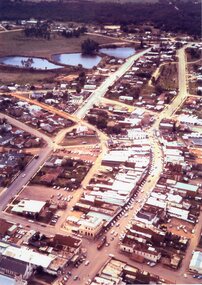
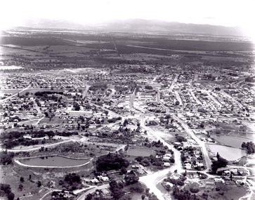
Photograph, Stawell Aerial View 1969
Aerial View of Stawell 1969stawell -
 Stawell Historical Society Inc
Photograph, Stawell Hospital -- Aerial view
Aerial view of Stawell Hospitalstawell hospital -
Stawell Historical Society Inc
Photograph, Stawell Aerial View 1933
Aerial Photo of Stawell 1933stawell -
 Stawell Historical Society Inc
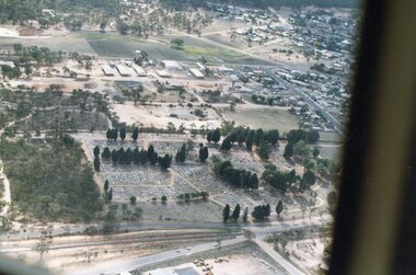
Photograph, Stawell Cemetery, Aerial View -- 2 Photos -- Coloured
Stawell Cemetery (Aerial Photos)stawell -
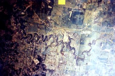
Tatura Irrigation & Wartime Camps Museum
Photographs, aerial photos of Tatura 1959
Two aerial photos of Tatura 19592 photos -
 Stawell Historical Society Inc
Photograph, Stawell Water Supply -- Aerial View -- Coloured
Aerial view of Stawell Water Supplystawell -
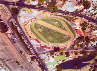 Stawell Historical Society Inc
Photograph, Central Park -- Aerial Photo 2007 -- Coloured
Central Park (Aerial Photo) 2007stawell sport -
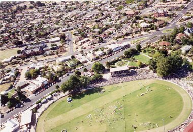
Stawell Historical Society Inc
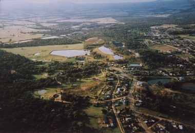
Photograph, Stawell Aerial View 1992 -- Colour
Colour Aerial View of Stawell 1992stawell -
 Stawell Historical Society Inc
Photograph, Central Park -- Aerial Photo 1995
Central Park (Aerial Photo) 1995stawell sport -
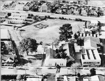 Stawell Historical Society Inc
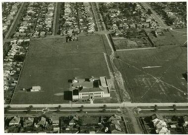
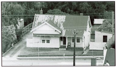
Photograph, Stawell Technical School Aerial Photograph
Stawell Technical School Aerial Photographstawell education -
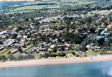 Phillip Island and District Historical Society Inc.
Photograph, Aerial photographs of Phillip Island and letter from Joshua Gliddon to June Gould
Joshua Gliddon wrote Phillip Island in Picture and Story which is referred to in the letter. The McHaffie family were original settlers on the Island. Historical3 large coloured aerial photos of Cowes and San Remo and a letter from Joshua Gliddon to June Gould re the McHaffie propertycoloured photograph, aerial photograph, joshua gliddon, mchaffie family, sambell family, cowes, san remo, cowes yacht club, phillip island in picture and story, june gould -
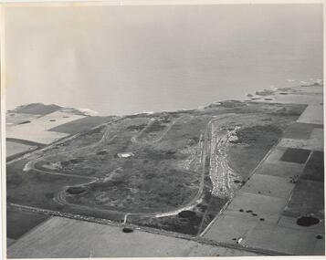 Phillip Island and District Historical Society Inc.
Photograph, J D Payens, Aerial photo of Grand prix track and painting of 1932 Grand Prix
The Circuit was built in the 1950's and opened in 1956. The circuit was closed in 1962 due to lack of finance for repair work to the track. In 1964 Len Lukey purchased the cirtuit and reopened in 1967, but once again was closed in 1978 as not suitable for modern racing. It was used only for Historic Rallies and the like until 1982. In 1985 The Circuit was purchsed by Placetac Pty Ltd. The Circuit was refurbished in 1988. In 1989 The Australian Motorcycle Grand Prix - 1st World Championship Round - was held at the Circuit on 9th April. 2004 the Circuit and surrounding land was purchased by The Linfox Group who still own it to this day (8/10/2016).Black & White aerial view of the Phillip Island Grand Prix Race Track with Bass Strait in the background and painting of 1932 Grand PrixJ. D. Payne - Commercial Photographer, Rice Street, Moorabbin. Phone: XL 3144phillip island g p circuit, grand prix circuit phillip island, len lukey, linfox group, jean parle, bill thompson, keith riordan, bugatti, 1932 grand prix -
Glenelg Shire Council Cultural Collection
Photograph, Aerial view of North West Portland, 1968
Port of Portland Authority archives.Front: (no inscriptions) Back: WOOL STORES & T.B + S AT NORTH PORTLAND/ PORTLAND HARBOUR TRUST COMMISSIONERS/ JAN 1968port of portland, wool stores, thomas borthwick -
 Ringwood and District Historical Society
Photograph, Aerial view showing East Ringwood oval, Mount Dandenong Road, and Civic Centre, Braeside Avenue/Maroondah Hwy, c.1970
Aerial view showing East Ringwood oval, Mount Dandenong Road, and Civic Centre, Braeside Avenue/Maroondah Hwy, c.1970. -
 Greensborough Historical Society
Slide - Photograph, John Ramsdale, Aerial view of Plenty River: Slide 16, 1990s
Photograph shows aerial view of the Plenty River.Part of the John Ramsdale collection of slides and audio visual material.Colour photograph scanned from slide.No maker's marks. No caption on slide.plenty river, aerial photograph -
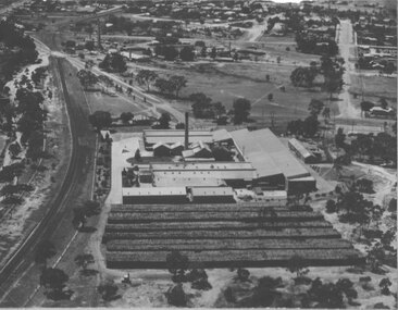
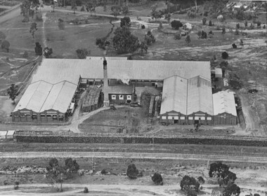 Stawell Historical Society Inc
Photograph, North Western Woollen Mills -- Aerial View, Duplicate of Framed Image
North Western Woollen Mills Aerial Viewstawell industry -
 Stawell Historical Society Inc
Photograph, North Western Woollen Mills -- Aerial View, Duplicate of Framed Image
North Western Woollen Mills Aerial ViewUnframed Copystawell industry -
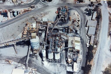 Stawell Historical Society Inc
Photograph, Stawell Gold Mine -- Aerial photo 1998
Stawell Gold Mine 1998 - Aerial photostawell