Showing 862 items
matching australian landscape
-
 City of Greater Bendigo - Civic Collection
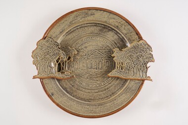
Decorative object - Ceramic platter, Bendigo Pottery, Strathfieldsaye Shire 1866 - 1991, 1991
... of low relief stoneware depicting Australian animals... of low relief stoneware depicting Australian animals ...Graham Masters is a potter based at Sweenies Creek, just outside Bendigo, Victoria who specialises in a patented technique of low relief stoneware depicting Australian animals and landscapes. He obtained a Diploma of Art and Design in Ceramics from the Bendigo Institute of Technology in 1973, then operated a pottery for a year in Bendigo, before becoming an employee, then a partner at Maldon Pottery, Victoria with Neville Wilson and Thomas Metcalf. He left Maldon to set up his own pottery at Sweenies Creek in 1984. (1.) (Judith Pearce). Built in 1869, the (former) Strathfieldsaye Shire Hall is one of The City of Bendigo's earliest surviving public buildings. Designed by George Steane and built by George Pallett in 1869 the Strathfieldsaye Shire Hall has aesthetic significance as a purpose built Shire Hall designed in the Free Classical manner. It is also of importance as an early example of the novel system of cavity wall construction. The building is largely intact and unaltered. Other important elements include the arched portico of the main entrance with brick arched features on either side; the brick quoining and dressings to the round arch windows; the three gabled roof; and the matching chimneys that reinforce the symmetrical design. The Hall has social significance as a temporary schooling facility in the 1870s and as a flood refuge in 1889. The Strathfieldsaye Shire Hall is a brick building designed in the Free Classical manner. This style was favoured by the Public Works Department for a number of public buildings including Shire Halls and courthouses. The form includes a central taller volume flanked by matching smaller gables. In the case of the Shire Hall these would be occupied by the Shire Secretary and Shire Engineer whilst the larger volume was the council chamber. The portico at the front is designed with a flat arch in the centre and matching smaller arches each side. The face red brick is unadorned apart from a plain string course at the roof springing point, brick quoining and dressings to the round arch windows. There are matching chimneys that are located to reinforce the symmetrical design and the original roof is believed to have been slate but is now corrugated iron. Large wheel thrown ceramic platter with a shallow well, broad flaring ledge and raised on a high foot rim. Rim decorated with slab rolled gum trees protruding on centre left and right sides of plater. which reflect the low relief image of trees and the Strathfieldsaye Shire Hall on the surface of the plate. Glazed with golden brown and cream. Front centre top; 'Shire of Strathfieldsaye'. Front lower centre '1866 - 1991 - 125 Years'. Signed 'G Master / 1991' on rim centre right. Reverse; signed 'G Master' / 1991. Bendigo Pottery stamp.shire of strathfieldsaye, bendigo pottery -
 Eltham District Historical Society Inc
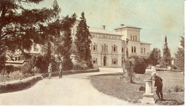
Photograph - Digital Photograph, Alan King, Alistair Knox Park, Eltham, 2008
... under National Trust of Australia (Victoria) Landscape... under National Trust of Australia (Victoria) Landscape ...Alistair Knox Park, an oasis of peace and beauty. Covered under National Trust of Australia (Victoria) Landscape Significance and Heritage Overlay, Nillumbik Planning Scheme. Published: Nillumbik Now and Then / Marguerite Marshall 2008; photographs Alan King with Marguerite Marshall.; p173 It is hard to imagine that the Alistair Knox Park, an oasis of peace and beauty beside busy Main Road, Eltham, was once the township’s rubbish dump. It was only in the 1970s that the tip was transformed into this beautiful six hectare space, which later earned it a National Trust Landscape classification. Before its life as a dump, the area was used for small farms. Thanks largely to the foresight and efforts of local environmental builder Alistair Knox, the park was designed sympathetically with the character of the wider Eltham landscape. Then, appropriately, the park was named after Knox, who was an Eltham Shire Councillor from 1971 to 1975 and Shire President in 1975. The park designers were four major forces in the urban bush landscape garden –Knox, landscape designer Gordon Ford, artist Peter Glass and landscaper Ivan Stranger.1 The National Trust citation for the park, originally called Eltham Town Park, includes the Eltham railway trestle bridge and the Shillinglaw Cottage. The citation states ‘the semi-natural setting of the parkland provides a landscape which is evocative of the history of the area’. Manna Gums (Eucalyptus viminalis) and Candlebarks (Eucalyptus rubida) are significant features. Most of the park’s construction was directed by Bob Grant, Superintendent of the Parks and Gardens Department for the Eltham Shire Council. First plantings occurred in Arbour Week in 1973, then the lake and botanic area were completed in 1975, with Federal Government funding, and the toilet block in 1978. Bounded by the Eltham railway line, Panther Place, Main Road, Bridge and Susan Streets, the park is in a valley about a kilometre wide overlooked by steep hills at the east and west. The Diamond Creek flows through it and the picturesque historic timber trestle railway bridge edges the north. Informal plantings of Australian indigenous and native species in open and undulating grassed settings blend with the natural landscape of the Diamond Creek to the west. The bush-style plants, particularly around the creek, balance with open lawns, paths and a cascade flowing from a small lake to another below. A footbridge over the creek leads to the park’s west. The park includes an adventure playground and barbecue areas. The park stands on part of the land bought from the Crown in 1851 by Josiah Holloway, who subdivided it into allotments and which he called Little Eltham. Most of the land was subdivided into residential lots, but the creek valley, on which the park stands, was subdivided into farm-size lots, used mainly for orchards and grazing. One of the earliest owners was John Hicks Petty, who in 1874 bought a plot from Holloway. Other families who owned properties in that area, included Rees, Clark, Waterfall, Graham, Hill and Morant.2 In 1901 the railway was built through the area. Jock Read, an Eltham resident since around 1920, remembers several farms in the 1920s and ’30s that occupied the site of today’s park. A poultry farm, which extended from present day Panther Place, was owned by the Gahan family. Next to that farm was another for grazing cattle owned by Jack Carrucan. Beside this was land owned by John Lyon. A doctor lived beside this, and at the north-west corner of Bridge Street and Main Road stood a memorial to the soldiers who died in World War One, which was later moved to the RSL site. Mr Read also remembers other farms and orchards west of the creek In the early 1960s the Eltham Council began buying these farms and in the late 1960s turned the areas east of the Diamond Creek into a garbage tip. When this was filled above the creek’s flood plain, the tip was moved to the west of the creek.This collection of almost 130 photos about places and people within the Shire of Nillumbik, an urban and rural municipality in Melbourne's north, contributes to an understanding of the history of the Shire. Published in 2008 immediately prior to the Black Saturday bushfires of February 7, 2009, it documents sites that were impacted, and in some cases destroyed by the fires. It includes photographs taken especially for the publication, creating a unique time capsule representing the Shire in the early 21st century. It remains the most recent comprehenesive publication devoted to the Shire's history connecting local residents to the past. nillumbik now and then (marshall-king) collection, alistair knox park, eltham -
 Eltham District Historical Society Inc
Photograph - Digital Photograph, Alan King, The Robins, 13 Kangaroo Ground-Warrandyte Road, North Warrandyte, 2 March 2008
... of Australia’s finest landscape painters. He loved colour, having been... of Australia’s finest landscape painters. He loved colour, having been ...Built by noted artist Theodore Penleigh Boyd, father of architect Robin Boyd. Covered under National Estate, National Trust of Australia (Victoria) Local Significance and Heritage Overlay, Nillumbik Planning Scheme. Published: Nillumbik Now and Then / Marguerite Marshall 2008; photographs Alan King with Marguerite Marshall.; p111 The Robins at Warrandyte,* was once home to a member of a famous family and is also one of the first reinforced concrete houses in Victoria. The builder, Theodore Penleigh Boyd, born in 1890, was a talented painter1 noted for his works of the Warrandyte bush. He was the father of architect Robin Boyd, author of the Australian Ugliness and the uncle of painter, Arthur Boyd. Penleigh Boyd’s great grandfather was Sir William A’Beckett, Victoria’s first Chief Justice. Penleigh Boyd is considered by some to be an ‘unsung hero’ overshadowed by more famous members of his family. Mornington Gallery Director Andrea May said many believed Boyd ‘had never received the national acclaim that he deserved’.2 Classified by the National Trust3 and part of the Australian National Heritage,4 The Robins is set well back near the end of Kangaroo Ground – Warrandyte Road, unobserved by passers-by. Built in 1913, The Robins has some Art Nouveau influences and is a descendant of the Queen Anne style. It is covered in stucco and has a prominent attic, which Boyd used as a studio. Some parts of the house are up to 33 centimetres thick and built in part with pisé (rammed earth) and in part with reinforced concrete. Amazingly, Boyd built The Robins without an accessible driveway, and only a narrow track along which he had to cart building materials. The journey was uphill and Boyd terraced the land with Warrandyte rock5 without the aid of machinery. At only 33 years, Boyd was killed in a car accident in 1923. He was buried in Brighton near the home of his parents. Several people have since owned the house, including political journalist, Owen Webster. Boyd was born at Penleigh House, Wiltshire, and studied at Haileybury College, Melbourne and The Hutchins School, Hobart. He attended the Melbourne National Gallery School and in his final year exhibited at the Victorian Artists’ Society. He arrived in London in 1911 and his painting Springtime was hung at the Royal Academy. He painted in several studios in England and then worked in Paris.6 There he met painter Phillips Fox through whom he met artists of the French modern school and also his wife-to-be, Edith Anderson, whom he married in Paris in 1912. After touring France and Italy, the couple returned to Melbourne. In 1913 Boyd held an exhibition and won second prize in the Federal Capital site competition, then the Wynne Prize for landscape in 1914. In 1915 Boyd joined the Australian Imperial Force, and became a sergeant in the Electrical and Mechanical Mining Company. However he was severely gassed at Ypres and invalided to England. In 1918 in London Boyd published Salvage, writing the text and illustrating it with 20 black-and-white ink-sketches of army scenes. Later that year he returned to Melbourne, and, despite suffering from the effects of gas, he held several successful one-man shows, quickly selling his water-colour and oil paintings. In his short career Penleigh Boyd was recognized as one of Australia’s finest landscape painters. He loved colour, having been influenced early by Turner and McCubbin. His works are in all Australian state galleries, the National Collection in Canberra as well as in regional galleries.7 His wife Edith was also an artist having studied at the Slade School, London, and in Paris with Phillips Fox. After her marriage she continued to paint and excelled in drawing. In later years she wrote several dramas, staged by repertory companies, and radio plays for the Australian Broadcasting Commission, in which she took part. She was the model for the beautiful red-haired woman in several of Phillips Fox’s paintings and the family hold three of his portraits of her. *Possibly named after the Aboriginal words warran, meaning ‘object’ and dyte, meaning ‘thrown at’.This collection of almost 130 photos about places and people within the Shire of Nillumbik, an urban and rural municipality in Melbourne's north, contributes to an understanding of the history of the Shire. Published in 2008 immediately prior to the Black Saturday bushfires of February 7, 2009, it documents sites that were impacted, and in some cases destroyed by the fires. It includes photographs taken especially for the publication, creating a unique time capsule representing the Shire in the early 21st century. It remains the most recent comprehenesive publication devoted to the Shire's history connecting local residents to the past. nillumbik now and then (marshall-king) collection, kangaroo ground-warrandyte road, north warrandyte, the robins -
 Bendigo Military Museum
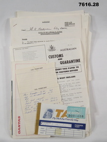
Document - VIETNAM PAPERS - HERDMAN
... FOR AUSTRALIAN ARMY FORCES IN VIETNAM." 9. Two page A4 sized document... oriented in landscape. Title: AUSTRALIAN MILITARY FORCES, VISITS ...5. Pocketbook issued to Australian Troops during the Vietnam War. Contents include: The War in South Vietnam, The People, Government Services, Armed Services, Viet Cong, Vietnamese Language, Useful information. 14. Details of Australia V US. Hill climb with program of Events, 22nd February 1970. 15. Details of dog races with fields listed on a six race program - 20th February 1970. 18. Document details departure itinerary (ex SVN) for K.J. HERDMAN. 27. Notebook contains names and addresses of US service personnel. Papers related to "Kevin John Herdman's" visit to South Vietnam from 18th February to 4th March 1970. Part of the Kevin John Herdman, No. 397661 Collection. See Cat. No. 5942P for details of his service. 27. Collection of documents related to K.J. Herdman. 1. Two page TAA flight ticket. Text in blue coloured type. Two baggage tickets stapled to front. 2. Single diary page with torn edge. Handwritten flight itinerary in section dated 16th February. 3. Two page QANTAS flight ticket. Text in red and black type. Flight details printed in purple type. 4. Printed flier outlining Australian Customs and Quarantine regulations. Recipient's name handwritten in black ink. 5. Green coloured soft cover pocketbook. 74 pages with cut edges. Black and white diagrams. Text in black type. 6. Small pamphlet with black type. Written in Vietnamese. 7. Foolscap sized 5 page document stapled on top LHC. Text in black type. Title "VISITS BY CMF OFFICERS TO VIETNAM". 8. A4 sized one page document with text in black type on one side only. Two sided pamphlet on blue paper stapled to top LHC. Black type on pamphlet. Title "NINE RULES FOR AUSTRALIAN ARMY FORCES IN VIETNAM." 9. Two page A4 sized document with text in black type. Text on one side of each page. Title "AUSTRALIAN FORCE VIETNAM, RTA BRIEFING NOTES - QANTAS CHARTER, SAIGON/SYDNEY". 10. Foolscap signed proforma oriented in landscape. Title: AUSTRALIAN MILITARY FORCES, VISITS BY CMF OFFICERS TO SYN". Details of personnel in black type. 11. Quarto sized two page document with printing on one side. Text in black type. Staple in top LHC. Title: "CMF VISITOR - LT. K.J. HERDMAN, (ITINERARY FOR LT. K.J. HERDMAN)". 12. Quarto sized two page document with printing on one side. Text in black type. Staple in top LHC. Title: " CMF VISITOR - LT K.J. HERDMAN (ITINERARY FOR LT. K.J.HERDMAN)" 13. A4 sized document with text in black type. Text on one side only. Title: CMF VISITOR - LT. K.J. HERDMAN". 14. Foolscap sized document with text in black type. Printing on one side. Title: "LONG HI HILL CLIMB". 15. Quarto sized document with text in black type. Printing on one side. Title: "DAT DO DOGS". 16. Foolscap sized 9 page document with text on one side. Printing in black type. Pages stapled together in top LHC. Title: "1 ATF G INSTRUCTIONS 14/69, SUPPLIES, POL AND AMMUNITION HOLDINGS". 17. A4 sized document with text on one side. Printing in black type. TITLE; "AMENDMENT 1 TO Q INSTRUCTION 14/69, DATED 23 OCT 69". 18. A4 SIZED DOCUMENT WITH TEXT ON BOTH SIDES. PRINTING IN BLACK TYPE. 19. Foolscap sized 3 page document with staple in top LHC. Text on page 1 in black type. Text on pages 2 & 3 in purple type. Pages are entitled "TEMA FLYING PROGRAMME - CH 47". 20. Foolscap sized 7 page document with text in black type. Printing on one side. Title: " OPERATIONS BREF - DET 52 SUP PL RAASC, REPUBLIC SOUTH VIETNAM (1967-69)", Dated 20 Sept, 69. 21. Foolscap sized 2 page document with text in black type. Printing on one side. Pages stapled on top LHC. Title: " Q INSTRUCTION 15/69, RETURN OF PRODUCE, " Dated 16 Oct 69. 22. Foolscap sized single page document with text in black type. Printing on one side. Title: " Q INSTRUCTION 19/69, RETURN AND DISPOSAL OF UNSERVICEABLE AMMUNITION" Dated 5 Nov 69. 23. Foolscap sized single page proforma with text and lines in black. No handwritten details. Title: "26 TRANSPORT COY RAASC VEHICLE SERVICEABILITY/AVAILABILITY STATE". 24. Foolscap sized single page proforma with text and lines in black. No handwritten details. Title: "DAILY EMPLOYMENT STATE, 85 TPT PL RAASC". 25. Foolscap sized single page document. Text and lines in purple. Reproduced on a spirit duplicator. Title: "INDENTING PROGRAMME FRESH". 26. Foolscap sized single sheet proforma with text and lines in black. No handwritten details. Title: DAILY MAINT MOVEMENT PLANNING TABLE". Printing on both sides. 27. Red and white covered note book. Title on front and details on back in black type. Lined pages. Handwritten information on most pages. 28. Illustrated Christmas Card. Illustration features an angel and the three Magi. Printing on inside in black. Handwritten message in black ink. 1. Passenger details handwritten in blue, carbon copy. 2. Itinerary notes handwritten in blue ink. 3. Handwritten in black ink: "CAPT K.J. HERDMAN". Flight details printed in purple coloured text. 4. Handwritten in black ink : "KEVIN JOHN HERDMAN". 7. Handwritten in black ink on page 1: LT. K. HERDMAN, 6 Coy RAASC, 17 Feb 70." Handwritten in black ink on last page: "1. Ensure teeth are all O.K., 2. Have you still got your tags Identity? (Signature). 11. Handwritten on top RHC of page 1: "CAPT A". 12. Handwritten on top RHC of page 1: "LT HERDMAN". 27. Handwritten notes in black ink on various pages. 28. Handwritten in black ink on inside of card: "Hello Kevin, Perhaps you remember the 62nd Trans. Company at Long Bing? I completely enjoyed your brief stay. If you are ever in the U.S. do stop by. Have a Merry Christmas to you and yours. Margo and Jack Olsen." vietnam war, army, training notes, kevin john herdman -
 Flagstaff Hill Maritime Museum and Village
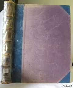
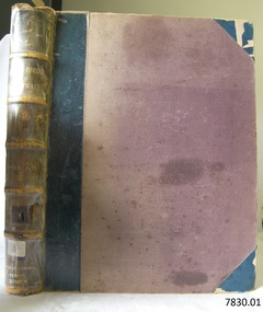
Book, The Birds of Australia Vol 3 - 4
... migrated to Portland (Victoria, Australia), working his passage... to Portland (Victoria, Australia), working his passage as part ...The Work “The Birds of Australia; containing over 300 full-page illustrations, with a descriptive account of the life and characteristic habits of over 700 species” by Gracius J. [Joseph] Broinowski – Australian author, artist and ornithologist - was created in 40 parts for subscribers and sold for 10s [shillings]., These parts were later published in six volumes, which were later published and bound in pairs to make three volumes, each of which contain two of the six original volumes, numbered volumes, “I”, “III” and “V” on their fly page, but numbered “Vols. I-II”, “Vols. III-IV” and “Vols. V-VI” on their respective spines. The volumes were all published by Charles Stuart & Co. (Melbourne, Sydney, Adelaide, Brisbane, New Zealand, and Tasmania). All of the beautifully drawn and coloured illustrations in The Birds of Australia were illustrated by Broinowski. They were printed using a new 19th century method called chromolithography. This is the art of making multi-coloured prints. The skilled lithographer would work from an original coloured painting and create a copy for every one of the many layers of colour used to build the painting. These layers were then printed carefully over each other to re-build the picture. Gracius J. Broinowski’s Work “The Birds of Australia” was described by Jean.Anker as “a semi-popular but comprehensive treatment of the subject” in the book “Bird Books and Bird Art: an outline of the Literary History and Iconology of Descriptive Ornithology” 1979. It may be that these books were donated to, or ordered specifically for, the Warrnambool Public Museum, due to the embossing on the spine “WARRNAMBOOL PUBLIC LIBRARY”. The acquisition of these books would most likely to have made 1891-1910, between the date the books were published and the date that the Museum amalgamated with the Mechanics Institute, which then became part of The Museum and Art Gallery. These three books were part of the collection of books belonging to the Warrnambool Public Museum, established 1873 by Joseph Archibald. The Museum moved into the back of the Mechanics’ Institute in 1885, along with the Art Gallery and School of Dancing. In 1886 it was officially opened as The Warrnambool Museum and Art Gallery, with Joseph Archibald as its curator. In 1887 the Museum section was moved to the former court house in Timor Street, with Joseph Archibald as Curator until 1897. In 1910 the Museum was transferred back to the original building and the management of the Mechanics' Institute was handed over to the Warrnambool City Council. In 1935 Ralph Pattison was appointed as City Librarian. He developed his own sorting and cataloguing system and organised the collection of books accordingly. In the 1960’s the Warrnambool City Council closed down the Museum and Art Gallery and the books and artefacts were redistributed to other organisations in Warrnambool. Each spine of this book set, The Birds of Australia by Gracius Broinowski, shows a space on which a previous cataloguing label may have been affixed. The volumes are amongst the many books at Flagstaff Hill Maritime Village that display stamps and markings from Pattison as well as a variety of other institutions including the Mechanics’ Institute itself. Some other Australian Libraries also include these books in their collections; Australian National University, University of NSW, University of Western Australia, State Library of Western Australia, Deakin University, Queen Victoria Museum and Art Gallery, University of Adelaide, University of Queensland, University of Tasmania. The Library of Congress and the University of British Columbia also have sets of these volumes. These books are considered as Rare Book; a set of Broinowski’s 3 volumes was advertised in Melbourne’s Rare Book Fair 2012, “for ornithological collectors”. (See the more detailed information below in “Warrnambool Public Museum and Mechanics Institute” and the “Pattison Collection”.) GRACIUS JOSEP BROINOWSKI Gracius Joseph Broinowski (7/3/1837 – 11/4/1913), artist and ornithologist, was born in Walichnowy, Poland, son of a landowner and military officer of the same name. He was educated privately then later, at the Munich University, he was a student of languages, classics and art. To avoid conscription into the Russian army, he migrated to Germany. At the age of about 20 years he migrated to Portland (Victoria, Australia), working his passage as part of the crew of a windjammer. Broinowski worked in the country for a few years then found employment working for a Melbourne publisher and later sold his own paintings. In about 1863, while on one of his many travels in eastern Australia painting landscapes and scenes, he married Jane Smith in Richmond, Victoria (her father was captain of a whaler). In 1880 he settled in Sydney where his work involved teaching painting, lecturing on art and exhibiting his own work at showings of the Royal Art Society. Also in the 1880s he began to publish illustrated works on Australian natural history, including; - illustrations of the birds and mammals of Australia, commissioned by the Department of Public Instruction, New South Wales, and mounted, varnished and hung on walls in many classrooms - "The Birds and Mammals of Australia"; a bound collection of illustrations with appropriated text - 1888 "The Cockatoos and Nestors of Australia and New Zealand" - 1890-1891, "The Birds of Australia" Broinowski died in 1913 at Mosman, Sydney, survived by his wife, six sons and a daughter. His son, Leopold, became a significant political journalist in Tasmania. WARRNAMBOOL PUBLIC MUSEUM & MECHANICS INSTITUTE Warrnambool's Mechanics' Institute (or Institution as it was sometimes called) was one of the earliest in Victoria. On 17th October 1853 a meeting was held where it was resolved to request the Lieutenant Governor of the Colony to grant land for the erection of a Mechanics' Institutes building. A committee was formed at the meeting and Richard Osburne chaired the first meeting of this committee. The land on the North West corner of Banyan and Merri Streets was granted but there were no funds to erect the building. The Formal Rights of the Warrnambool Mechanics' Institute's encompassed its aims and these were officially adopted in1859; "This Institution has for its object the diffusion of literary, scientific, and other useful knowledge amongst its members, excluding all controversial subjects, religious or political. These objects are sought to be obtained by means of a circulating library, a reading room, the establishment of classes, debates, and the occasional delivery of lectures on natural and experimental philosophy, mechanics, astronomy, chemistry, natural history, literature, and the useful and ornamental arts, particularly those which have a more immediate reference to the colony." The Warrnambool Mechanics' Institute opened its first reading room in December 1854 in the National School building at the corner of Banyan and Timor Streets. The Institute was funded by member subscription, payable on a quarterly, half yearly or yearly basis. Samuel Hannaford, the Manager of the Warrnambool Bank of Australasia, was the first Honorary Secretary of the Mechanics' Institutes, and an early President and Vice-President. He also gave several of the early lectures in the Reading Room. Another early Secretary, Librarian and lecturer was Marmaduke Fisher, the teacher at the National School. Lecture topics included The Poets and Poetry of Ireland', 'The Birth and Development of the Earth', 'The Vertebrae - with Remarks on the pleasures resulting from the study of Natural History' and 'Architecture'. In 1856 the Reading Room was moved to James Hider's shop in Timor Street, and by 1864 it was located in the bookshop of Davies and Read. In the 1860's the Mechanics' Institute struggled as membership waned but in 1866, after a series of fund raising efforts, the committee was able to purchase land in Liebig Street, on a site then called Market Square, between the weighbridge and the fire station. A Mechanics' Institute building was opened at this site in August 1871. The following year four more rooms were added to the main Reading Room and in 1873 the Artisan School of Design was incorporated into the Institute. The same year, 1873, Joseph Archibald established the Warrnambool Public Museum [Warrnambool Museum], however it deteriorated when he was transferred to Bendigo in 1877. In 1880, with Archibald's return to Warrnambool, the Museum was re-established and he served as Curator 1882-1897. In 1885 a new building was added to the back of the Mechanics’ Institute to accommodate the re-created School of Design, the Art Gallery and the Museum. It was officially opened as the Warrnambool Museum and Art Gallery on 26th July 1886 with Mr Joseph Archibald as Curator. In 1887 the Museum section was moved to the former court house in Timor Street (for some time the walls of the building formed part of the TAFE cafeteria but all is now demolished). In 1910 the Museum was transferred back to the original building and the management of the Mechanics' Institute was handed over to the Warrnambool City Council. The Museum and Art Gallery became one and housed many fine works of art, and the Library continued to grow. The building was well patronised, with records showing that at the beginning of the 20th century there were between 500 and 800 visitors. During World War One the monthly figures were in the thousands, with 3,400 people visiting in January 1915. The Museum was a much loved Institution in Warrnambool until 1963 when the Museum and Art Gallery was closed and the contents removed to make room for the Warrnambool City Council Engineers' Department. The contents were stored but many of the items were scattered or lost. The Museum has never been re-opened. When the original building was demolished the site became occupied by the Civic Centre, which included the new City Library. (The library was temporarily located in the old Palais building in Koroit Street.) In the process of reorganisation the Collection was distributed amongst the community groups: -The new City Library took some of the historic books and some important documents, historic photographs and newspapers. -The Art Gallery kept the 19th Century art collection and some of the artefacts from the museum. -The Historic Society has some items -The State Museum has some items -Some items were destroyed -Flagstaff Hill Maritime Village has old newspapers, Government Gazettes, most of the Mechanics' Institute Library (which included books from the Warrnambool Public Museum), ledgers and documents connected to the Mechanics' Institute Library, some framed and unframed art works and some photographs. THE PATTISON COLLECTION These books “The Birds of Australia” by Broinowsky, are also listed as part of the ‘Pattison Collection’, a collection of books and records that was originally owned by the Warrnambool Mechanics’ Institute, which was founded in Warrnambool in 1853. In 1935 Ralph Pattison was appointed as City Librarian to establish and organise the Warrnambool Library, as the Warrnambool Mechanics’ Institute was then called. When the Warrnambool Mechanics’ Institute building was pulled down in 1963 a new civic building was erected on the site and the new Warrnambool Library, on behalf of the City Council, took over all the holdings of the Warrnambool Mechanics’ Institute. At this time some of the items were separated and identified as the ‘Pattison Collection’, named after Ralph Pattison. Eventually the components of the Warrnambool Mechanics’ Institute were distributed from the Warrnambool Library to various places, including the Art Gallery, Historical Society and Flagstaff Hill. Later some were even distributed to other regional branches of Corangamite Regional Library and passed to and fro. It is difficult now to trace just where all of the items have ended up. The books at Flagstaff Hill Maritime Village generally display stamps and markings from Pattison as well as a variety of other institutions including the Mechanics’ Institute itself. RALPH ERIC PATTISON Ralph Eric Pattison was born in Rockhampton, Queensland, in 1891. He married Maude Swan from Warrnambool in 1920 and they set up home in Warrnambool. In 1935 Pattison accepted a position as City Librarian for the Warrnambool City Council. His huge challenge was to make a functional library within two rooms of the Mechanics’ Institute. He tirelessly cleaned, cleared and sorted a disarrayed collection of old books, jars of preserved specimens and other items reserved for exhibition in the city’s museum. He developed and updated the library with a wide variety of books for all tastes, including reference books for students; a difficult task to fulfil during the years following the Depression. He converted all of the lower area of the building into a library, reference room and reading room for members and the public. The books were sorted and stored using a cataloguing and card index system that he had developed himself. He also prepared the upper floor of the building and established the Art Gallery and later the Museum, a place to exhibit the many old relics that had been stored for years for this purpose. One of the treasures he found was a beautiful ancient clock, which he repaired, restored and enjoyed using in his office during the years of his service there. Ralph Pattison was described as “a meticulous gentleman whose punctuality, floorless courtesy and distinctive neat dress were hallmarks of his character, and ‘his’ clock controlled his daily routine, and his opening and closing of the library’s large heavy doors to the minute.” Pattison took leave during 1942 to 1945 to serve in the Royal Australian Navy, Volunteer Reserve as Lieutenant. A few years later he converted one of the Museum’s rooms into a Children’s Library, stocking it with suitable books for the younger generation. This was an instant success. In the 1950’s he had the honour of being appointed to the Victorian Library Board and received more inspiration from the monthly conferences in Melbourne. He was sadly retired in 1959 after over 23 years of service, due to the fact that he had gone over the working age of council officers. However he continued to take a very keen interest in the continual development of the Library until his death in 1969. References: Archibald Street, Discover the History of Warrnambool Streets, https://www.warrnambool.vic.gov.au/sites/warrnambool.vic.gov.au/files/images/Property/roads/The%20story%20of%20Warrnambool's%20streets.pdf Broinowski, Bird Books and Bird Art etc, Jean Anker 1979, https://books.google.com.au/books?id=B5TpCAAAQBAJ&pg=PA66&lpg=PA66&dq=the+birds+of+australia,+broinowski,+bird+books+and+bird+art&source=bl&ots=nQroxqePdY&sig=a3lnn-_FqB-ZcFAwqRYVK6Y7ZeM&hl=en&sa=X&ved=0ahUKEwj5sL7-2JTSAhWIyLwKHaCHAJcQ6AEIUTAN#v=onepage&q=the%20birds%20of%20australia%2C%20broinowski%2C%20bird%20books%20and%20bird%20art&f=false Broinowski, Gracius Joseph, by A.H. Chisholm, Australian Dictionary of Biography http://adb.anu.edu.au/biography/broinowski-gracius-joseph-3061 Chromolithography, Wikipedia https://en.wikipedia.org/wiki/Chromolithography Document, Flagstaff Hill, ‘Mechanics’ Institute Collection’: Books on Dean, Melbourne Rare Book Fare 2015, BookFare Newsletter #5, www.anzaab.com/newsletters/BookFare_1207.pdf Flagstaff Hill archives; document “Re: Ralph Eric Pattison”] Gracius Broinowski, Wikipedia https://en.wikipedia.org/wiki/Gracius_Broinowski Gracius Joseph Broinowski, Design & Art Australia online, https://www.daao.org.au/bio/gracius-joseph-broinowski/biography/ Mechanics' Institutes of Victoria Pg ix, 283; Significance Assessment, Warrnambool Mechanics’ Institute Books, FHMV, 2010 The Birds of Australia by Gracius J. Broinowski, Libraries of Australia, Trove http://trove.nla.gov.au/work/12425131?q&sort=holdings+desc&_=1487246530281&versionId=210683608 The Birds of Australia, Broinowski; www.Librarything.com The History of Warrnambool, R. Osburne, 1887, p.72, p. 283 The Warrnambool Mechanics’ Institute – FHMV datasheet Warrnambool Art Gallery History, Warrnambool Art Gallery Foundation Information Booklet, http://www.wagf.com.au/cms/downloads/WAGF-Information-Booklet.pdf Warrnambool Museum and Art Gallery, The Argus, 29th July 1886 Web; The Birds of Australia (Broinowski), Wikipedia The Birds of Australia by Gracius J. Broinowski is a respected source of scientific information. It is also significant for its rarity and as an early Australian Work. The book is significant for its association with the Warrnambool Public Museum, which played an important educational and social role in the early settlement of Warrnambool and District. The book is also significant for its association with the Warrnambool Mechanics' Institute Library book collection, which is deemed to be of great importance because it is one of the few collections in an almost intact state, and many of the books are now very rare and of great value. The Warrnambool Mechanics’ Institute Collection is primarily significant in its totality, rather than for the individual objects it contains. Its contents are highly representative of the development of Mechanics' Institute libraries across Australia, particularly Victoria. A diversity of publications and themes has been amassed, and these provide clues to our understanding of the nature of and changes in the reading habits of Victorians from the 1850s to the middle of the 20th century. The Warrnambool Mechanics Institute book collection has historical and social significance for its strong association with the Mechanics Institute movement and the important role it played in the intellectual, cultural and social development of people throughout the latter part of the nineteenth century and the early twentieth century. The collection of books is a rare example of an early lending library and its significance is enhanced by the survival of an original collection of many volumes. The collection also highlights the Warrnambool community’s commitment to the Mechanics’ Institute, reading, literacy and learning in the regions, and proves that access to knowledge was not impeded by distance. These items help to provide a more complete picture of our community’s ideals and aspirations. The book is also significant for its inclusion in the Pattison Collection, a collection that as a whole shows a snapshot of the types of reading material offered to the local public at that point in time. The Birds of Australia Vol 3 - 4 Author and Illustrator: Gracius J Broinowski Publisher: Charles Stuart & Co Date: 1890Label on spine cover with typed text RA 598.2 BRO Pastedown front endpaper has sticker from Warrnambool Mechanics Institute and Free Library Embossing added to spine “WARRNAMBOOL PUBLIC MUSEUM” flagstaff hill, warrnambool, shipwrecked coast, flagstaff hill maritime museum, maritime museum, shipwreck coast, flagstaff hill maritime village, great ocean road, the birds of australia, gracius joseph broinowski, charles stuart & co, joseph archibald, warrnambool public museum, warrnambool museum, warrnambool library, warrnambool art gallery, warrnambool city librarian, pattison collection, ralph eric pattison, samuel hannaford, warrnambool mechanics’ institute and free library, mechanics’ institute library, victorian library board, warrnambool books and records, rare books, australian bird illustrations, australian bird text, australian natural history, the birds of australia vol 3 - 4 -
 Flagstaff Hill Maritime Museum and Village
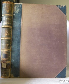
Book, The Birds of Australia Vol 5 - 6
... migrated to Portland (Victoria, Australia), working his passage... to Portland (Victoria, Australia), working his passage as part ...The Work “The Birds of Australia; containing over 300 full-page illustrations, with a descriptive account of the life and characteristic habits of over 700 species” by Gracius J. [Joseph] Broinowski – Australian author, artist and ornithologist - was created in 40 parts for subscribers and sold for 10s [shillings]., These parts were later published in six volumes, which were later published and bound in pairs to make three volumes, each of which contain two of the six original volumes, numbered volumes, “I”, “III” and “V” on their fly page, but numbered “Vols. I-II”, “Vols. III-IV” and “Vols. V-VI” on their respective spines. The volumes were all published by Charles Stuart & Co. (Melbourne, Sydney, Adelaide, Brisbane, New Zealand, and Tasmania). All of the beautifully drawn and coloured illustrations in The Birds of Australia were illustrated by Broinowski. They were printed using a new 19th century method called chromolithography. This is the art of making multi-coloured prints. The skilled lithographer would work from an original coloured painting and create a copy for every one of the many layers of colour used to build the painting. These layers were then printed carefully over each other to re-build the picture. Gracius J. Broinowski’s Work “The Birds of Australia” was described by Jean.Anker as “a semi-popular but comprehensive treatment of the subject” in the book “Bird Books and Bird Art: an outline of the Literary History and Iconology of Descriptive Ornithology” 1979. It may be that these books were donated to, or ordered specifically for, the Warrnambool Public Museum, due to the embossing on the spine “WARRNAMBOOL PUBLIC LIBRARY”. The acquisition of these books would most likely to have made 1891-1910, between the date the books were published and the date that the Museum amalgamated with the Mechanics Institute, which then became part of The Museum and Art Gallery. These three books were part of the collection of books belonging to the Warrnambool Public Museum, established 1873 by Joseph Archibald. The Museum moved into the back of the Mechanics’ Institute in 1885, along with the Art Gallery and School of Dancing. In 1886 it was officially opened as The Warrnambool Museum and Art Gallery, with Joseph Archibald as its curator. In 1887 the Museum section was moved to the former court house in Timor Street, with Joseph Archibald as Curator until 1897. In 1910 the Museum was transferred back to the original building and the management of the Mechanics' Institute was handed over to the Warrnambool City Council. In 1935 Ralph Pattison was appointed as City Librarian. He developed his own sorting and cataloguing system and organised the collection of books accordingly. In the 1960’s the Warrnambool City Council closed down the Museum and Art Gallery and the books and artefacts were redistributed to other organisations in Warrnambool. Each spine of this book set, The Birds of Australia by Gracius Broinowski, shows a space on which a previous cataloguing label may have been affixed. The volumes are amongst the many books at Flagstaff Hill Maritime Village that display stamps and markings from Pattison as well as a variety of other institutions including the Mechanics’ Institute itself. Some other Australian Libraries also include these books in their collections; Australian National University, University of NSW, University of Western Australia, State Library of Western Australia, Deakin University, Queen Victoria Museum and Art Gallery, University of Adelaide, University of Queensland, University of Tasmania. The Library of Congress and the University of British Columbia also have sets of these volumes. These books are considered as Rare Book; a set of Broinowski’s 3 volumes was advertised in Melbourne’s Rare Book Fair 2012, “for ornithological collectors”. (See the more detailed information below in “Warrnambool Public Museum and Mechanics Institute” and the “Pattison Collection”.) GRACIUS JOSEP BROINOWSKI Gracius Joseph Broinowski (7/3/1837 – 11/4/1913), artist and ornithologist, was born in Walichnowy, Poland, son of a landowner and military officer of the same name. He was educated privately then later, at the Munich University, he was a student of languages, classics and art. To avoid conscription into the Russian army, he migrated to Germany. At the age of about 20 years he migrated to Portland (Victoria, Australia), working his passage as part of the crew of a windjammer. Broinowski worked in the country for a few years then found employment working for a Melbourne publisher and later sold his own paintings. In about 1863, while on one of his many travels in eastern Australia painting landscapes and scenes, he married Jane Smith in Richmond, Victoria (her father was captain of a whaler). In 1880 he settled in Sydney where his work involved teaching painting, lecturing on art and exhibiting his own work at showings of the Royal Art Society. Also in the 1880s he began to publish illustrated works on Australian natural history, including; - illustrations of the birds and mammals of Australia, commissioned by the Department of Public Instruction, New South Wales, and mounted, varnished and hung on walls in many classrooms - "The Birds and Mammals of Australia"; a bound collection of illustrations with appropriated text - 1888 "The Cockatoos and Nestors of Australia and New Zealand" - 1890-1891, "The Birds of Australia" Broinowski died in 1913 at Mosman, Sydney, survived by his wife, six sons and a daughter. His son, Leopold, became a significant political journalist in Tasmania. WARRNAMBOOL PUBLIC MUSEUM & MECHANICS INSTITUTE Warrnambool's Mechanics' Institute (or Institution as it was sometimes called) was one of the earliest in Victoria. On 17th October 1853 a meeting was held where it was resolved to request the Lieutenant Governor of the Colony to grant land for the erection of a Mechanics' Institutes building. A committee was formed at the meeting and Richard Osburne chaired the first meeting of this committee. The land on the North West corner of Banyan and Merri Streets was granted but there were no funds to erect the building. The Formal Rights of the Warrnambool Mechanics' Institute's encompassed its aims and these were officially adopted in1859; "This Institution has for its object the diffusion of literary, scientific, and other useful knowledge amongst its members, excluding all controversial subjects, religious or political. These objects are sought to be obtained by means of a circulating library, a reading room, the establishment of classes, debates, and the occasional delivery of lectures on natural and experimental philosophy, mechanics, astronomy, chemistry, natural history, literature, and the useful and ornamental arts, particularly those which have a more immediate reference to the colony." The Warrnambool Mechanics' Institute opened its first reading room in December 1854 in the National School building at the corner of Banyan and Timor Streets. The Institute was funded by member subscription, payable on a quarterly, half yearly or yearly basis. Samuel Hannaford, the Manager of the Warrnambool Bank of Australasia, was the first Honorary Secretary of the Mechanics' Institutes, and an early President and Vice-President. He also gave several of the early lectures in the Reading Room. Another early Secretary, Librarian and lecturer was Marmaduke Fisher, the teacher at the National School. Lecture topics included The Poets and Poetry of Ireland', 'The Birth and Development of the Earth', 'The Vertebrae - with Remarks on the pleasures resulting from the study of Natural History' and 'Architecture'. In 1856 the Reading Room was moved to James Hider's shop in Timor Street, and by 1864 it was located in the bookshop of Davies and Read. In the 1860's the Mechanics' Institute struggled as membership waned but in 1866, after a series of fund raising efforts, the committee was able to purchase land in Liebig Street, on a site then called Market Square, between the weighbridge and the fire station. A Mechanics' Institute building was opened at this site in August 1871. The following year four more rooms were added to the main Reading Room and in 1873 the Artisan School of Design was incorporated into the Institute. The same year, 1873, Joseph Archibald established the Warrnambool Public Museum [Warrnambool Museum], however it deteriorated when he was transferred to Bendigo in 1877. In 1880, with Archibald's return to Warrnambool, the Museum was re-established and he served as Curator 1882-1897. In 1885 a new building was added to the back of the Mechanics’ Institute to accommodate the re-created School of Design, the Art Gallery and the Museum. It was officially opened as the Warrnambool Museum and Art Gallery on 26th July 1886 with Mr Joseph Archibald as Curator. In 1887 the Museum section was moved to the former court house in Timor Street (for some time the walls of the building formed part of the TAFE cafeteria but all is now demolished). In 1910 the Museum was transferred back to the original building and the management of the Mechanics' Institute was handed over to the Warrnambool City Council. The Museum and Art Gallery became one and housed many fine works of art, and the Library continued to grow. The building was well patronised, with records showing that at the beginning of the 20th century there were between 500 and 800 visitors. During World War One the monthly figures were in the thousands, with 3,400 people visiting in January 1915. The Museum was a much loved Institution in Warrnambool until 1963 when the Museum and Art Gallery was closed and the contents removed to make room for the Warrnambool City Council Engineers' Department. The contents were stored but many of the items were scattered or lost. The Museum has never been re-opened. When the original building was demolished the site became occupied by the Civic Centre, which included the new City Library. (The library was temporarily located in the old Palais building in Koroit Street.) In the process of reorganisation the Collection was distributed amongst the community groups: -The new City Library took some of the historic books and some important documents, historic photographs and newspapers. -The Art Gallery kept the 19th Century art collection and some of the artefacts from the museum. -The Historic Society has some items -The State Museum has some items -Some items were destroyed -Flagstaff Hill Maritime Village has old newspapers, Government Gazettes, most of the Mechanics' Institute Library (which included books from the Warrnambool Public Museum), ledgers and documents connected to the Mechanics' Institute Library, some framed and unframed art works and some photographs. THE PATTISON COLLECTION These books “The Birds of Australia” by Broinowsky, are also listed as part of the ‘Pattison Collection’, a collection of books and records that was originally owned by the Warrnambool Mechanics’ Institute, which was founded in Warrnambool in 1853. In 1935 Ralph Pattison was appointed as City Librarian to establish and organise the Warrnambool Library, as the Warrnambool Mechanics’ Institute was then called. When the Warrnambool Mechanics’ Institute building was pulled down in 1963 a new civic building was erected on the site and the new Warrnambool Library, on behalf of the City Council, took over all the holdings of the Warrnambool Mechanics’ Institute. At this time some of the items were separated and identified as the ‘Pattison Collection’, named after Ralph Pattison. Eventually the components of the Warrnambool Mechanics’ Institute were distributed from the Warrnambool Library to various places, including the Art Gallery, Historical Society and Flagstaff Hill. Later some were even distributed to other regional branches of Corangamite Regional Library and passed to and fro. It is difficult now to trace just where all of the items have ended up. The books at Flagstaff Hill Maritime Village generally display stamps and markings from Pattison as well as a variety of other institutions including the Mechanics’ Institute itself. RALPH ERIC PATTISON Ralph Eric Pattison was born in Rockhampton, Queensland, in 1891. He married Maude Swan from Warrnambool in 1920 and they set up home in Warrnambool. In 1935 Pattison accepted a position as City Librarian for the Warrnambool City Council. His huge challenge was to make a functional library within two rooms of the Mechanics’ Institute. He tirelessly cleaned, cleared and sorted a disarrayed collection of old books, jars of preserved specimens and other items reserved for exhibition in the city’s museum. He developed and updated the library with a wide variety of books for all tastes, including reference books for students; a difficult task to fulfil during the years following the Depression. He converted all of the lower area of the building into a library, reference room and reading room for members and the public. The books were sorted and stored using a cataloguing and card index system that he had developed himself. He also prepared the upper floor of the building and established the Art Gallery and later the Museum, a place to exhibit the many old relics that had been stored for years for this purpose. One of the treasures he found was a beautiful ancient clock, which he repaired, restored and enjoyed using in his office during the years of his service there. Ralph Pattison was described as “a meticulous gentleman whose punctuality, floorless courtesy and distinctive neat dress were hallmarks of his character, and ‘his’ clock controlled his daily routine, and his opening and closing of the library’s large heavy doors to the minute.” Pattison took leave during 1942 to 1945 to serve in the Royal Australian Navy, Volunteer Reserve as Lieutenant. A few years later he converted one of the Museum’s rooms into a Children’s Library, stocking it with suitable books for the younger generation. This was an instant success. In the 1950’s he had the honour of being appointed to the Victorian Library Board and received more inspiration from the monthly conferences in Melbourne. He was sadly retired in 1959 after over 23 years of service, due to the fact that he had gone over the working age of council officers. However he continued to take a very keen interest in the continual development of the Library until his death in 1969. References: Archibald Street, Discover the History of Warrnambool Streets, https://www.warrnambool.vic.gov.au/sites/warrnambool.vic.gov.au/files/images/Property/roads/The%20story%20of%20Warrnambool's%20streets.pdf Broinowski, Bird Books and Bird Art etc, Jean Anker 1979, https://books.google.com.au/books?id=B5TpCAAAQBAJ&pg=PA66&lpg=PA66&dq=the+birds+of+australia,+broinowski,+bird+books+and+bird+art&source=bl&ots=nQroxqePdY&sig=a3lnn-_FqB-ZcFAwqRYVK6Y7ZeM&hl=en&sa=X&ved=0ahUKEwj5sL7-2JTSAhWIyLwKHaCHAJcQ6AEIUTAN#v=onepage&q=the%20birds%20of%20australia%2C%20broinowski%2C%20bird%20books%20and%20bird%20art&f=false Broinowski, Gracius Joseph, by A.H. Chisholm, Australian Dictionary of Biography http://adb.anu.edu.au/biography/broinowski-gracius-joseph-3061 Chromolithography, Wikipedia https://en.wikipedia.org/wiki/Chromolithography Document, Flagstaff Hill, ‘Mechanics’ Institute Collection’: Books on Dean, Melbourne Rare Book Fare 2015, BookFare Newsletter #5, www.anzaab.com/newsletters/BookFare_1207.pdf Flagstaff Hill archives; document “Re: Ralph Eric Pattison”] Gracius Broinowski, Wikipedia https://en.wikipedia.org/wiki/Gracius_Broinowski Gracius Joseph Broinowski, Design & Art Australia online, https://www.daao.org.au/bio/gracius-joseph-broinowski/biography/ Mechanics' Institutes of Victoria Pg ix, 283; Significance Assessment, Warrnambool Mechanics’ Institute Books, FHMV, 2010 The Birds of Australia by Gracius J. Broinowski, Libraries of Australia, Trove http://trove.nla.gov.au/work/12425131?q&sort=holdings+desc&_=1487246530281&versionId=210683608 The Birds of Australia, Broinowski; www.Librarything.com The History of Warrnambool, R. Osburne, 1887, p.72, p. 283 The Warrnambool Mechanics’ Institute – FHMV datasheet Warrnambool Art Gallery History, Warrnambool Art Gallery Foundation Information Booklet, http://www.wagf.com.au/cms/downloads/WAGF-Information-Booklet.pdf Warrnambool Museum and Art Gallery, The Argus, 29th July 1886 Web; The Birds of Australia (Broinowski), Wikipedia The Birds of Australia by Gracius J. Broinowski is a respected source of scientific information. It is also significant for its rarity and as an early Australian Work. The book is significant for its association with the Warrnambool Public Museum, which played an important educational and social role in the early settlement of Warrnambool and District. The book is also significant for its association with the Warrnambool Mechanics' Institute Library book collection, which is deemed to be of great importance because it is one of the few collections in an almost intact state, and many of the books are now very rare and of great value. The Warrnambool Mechanics’ Institute Collection is primarily significant in its totality, rather than for the individual objects it contains. Its contents are highly representative of the development of Mechanics' Institute libraries across Australia, particularly Victoria. A diversity of publications and themes has been amassed, and these provide clues to our understanding of the nature of and changes in the reading habits of Victorians from the 1850s to the middle of the 20th century. The Warrnambool Mechanics Institute book collection has historical and social significance for its strong association with the Mechanics Institute movement and the important role it played in the intellectual, cultural and social development of people throughout the latter part of the nineteenth century and the early twentieth century. The collection of books is a rare example of an early lending library and its significance is enhanced by the survival of an original collection of many volumes. The collection also highlights the Warrnambool community’s commitment to the Mechanics’ Institute, reading, literacy and learning in the regions, and proves that access to knowledge was not impeded by distance. These items help to provide a more complete picture of our community’s ideals and aspirations. The book is also significant for its inclusion in the Pattison Collection, a collection that as a whole shows a snapshot of the types of reading material offered to the local public at that point in time. The Birds of Australia Vol 5 - 6 Author and Illustrator: Gracius J Broinowski Publisher: Charles Stuart & Co Date: 1891 Label on spine cover with typed text RA 598.2 BRO Pastedown front endpaper has sticker from Warrnambool Mechanics Institute and Free Library Embossing added to spine “WARRNAMBOOL PUBLIC MUSEUM” flagstaff hill, warrnambool, shipwrecked coast, flagstaff hill maritime museum, maritime museum, shipwreck coast, flagstaff hill maritime village, great ocean road, the birds of australia, gracius joseph broinowski, charles stuart & co, joseph archibald, warrnambool public museum, warrnambool museum, warrnambool library, warrnambool art gallery, warrnambool city librarian, pattison collection, ralph eric pattison, samuel hannaford, warrnambool mechanics’ institute and free library, mechanics’ institute library, victorian library board, warrnambool books and records, rare books, australian bird illustrations, australian bird text, australian natural history, the birds of australia vol 5 - 6 -
 Flagstaff Hill Maritime Museum and Village
Book - Reference Book, The Birds of Australia Vol 1-2, 1890-1891
... migrated to Portland (Victoria, Australia), working his passage... to Portland (Victoria, Australia), working his passage as part ...The Work “The Birds of Australia; containing over 300 full-page illustrations, with a descriptive account of the life and characteristic habits of over 700 species” by Gracius J. [Joseph] Broinowski – Australian author, artist and ornithologist - was created in 40 parts for subscribers and sold for 10s [shillings]., These parts were later published in six volumes, which were later published and bound in pairs to make three volumes, each of which contain two of the six original volumes, numbered volumes, “I”, “III” and “V” on their fly page, but numbered “Vols. I-II”, “Vols. III-IV” and “Vols. V-VI” on their respective spines. The volumes were all published by Charles Stuart & Co. (Melbourne, Sydney, Adelaide, Brisbane, New Zealand, and Tasmania). All of the beautifully drawn and coloured illustrations in The Birds of Australia were illustrated by Broinowski. They were printed using a new 19th century method called chromolithography. This is the art of making multi-coloured prints. The skilled lithographer would work from an original coloured painting and create a copy for every one of the many layers of colour used to build the painting. These layers were then printed carefully over each other to re-build the picture. Gracius J. Broinowski’s Work “The Birds of Australia” was described by Jean.Anker as “a semi-popular but comprehensive treatment of the subject” in the book “Bird Books and Bird Art: an outline of the Literary History and Iconology of Descriptive Ornithology” 1979. It may be that these books were donated to, or ordered specifically for, the Warrnambool Public Museum, due to the embossing on the spine “WARRNAMBOOL PUBLIC LIBRARY”. The acquisition of these books would most likely to have made 1891-1910, between the date the books were published and the date that the Museum amalgamated with the Mechanics Institute, which then became part of The Museum and Art Gallery. These three books were part of the collection of books belonging to the Warrnambool Public Museum, established 1873 by Joseph Archibald. The Museum moved into the back of the Mechanics’ Institute in 1885, along with the Art Gallery and School of Dancing. In 1886 it was officially opened as The Warrnambool Museum and Art Gallery, with Joseph Archibald as its curator. In 1887 the Museum section was moved to the former court house in Timor Street, with Joseph Archibald as Curator until 1897. In 1910 the Museum was transferred back to the original building and the management of the Mechanics' Institute was handed over to the Warrnambool City Council. In 1935 Ralph Pattison was appointed as City Librarian. He developed his own sorting and cataloguing system and organised the collection of books accordingly. In the 1960’s the Warrnambool City Council closed down the Museum and Art Gallery and the books and artefacts were redistributed to other organisations in Warrnambool. Each spine of this book set, The Birds of Australia by Gracius Broinowski, shows a space on which a previous cataloguing label may have been affixed. The volumes are amongst the many books at Flagstaff Hill Maritime Village that display stamps and markings from Pattison as well as a variety of other institutions including the Mechanics’ Institute itself. Some other Australian Libraries also include these books in their collections; Australian National University, University of NSW, University of Western Australia, State Library of Western Australia, Deakin University, Queen Victoria Museum and Art Gallery, University of Adelaide, University of Queensland, University of Tasmania. The Library of Congress and the University of British Columbia also have sets of these volumes. These books are considered as Rare Book; a set of Broinowski’s 3 volumes was advertised in Melbourne’s Rare Book Fair 2012, “for ornithological collectors”. (See the more detailed information below in “Warrnambool Public Museum and Mechanics Institute” and the “Pattison Collection”.) GRACIUS JOSEP BROINOWSKI Gracius Joseph Broinowski (7/3/1837 – 11/4/1913), artist and ornithologist, was born in Walichnowy, Poland, son of a landowner and military officer of the same name. He was educated privately then later, at the Munich University, he was a student of languages, classics and art. To avoid conscription into the Russian army, he migrated to Germany. At the age of about 20 years he migrated to Portland (Victoria, Australia), working his passage as part of the crew of a windjammer. Broinowski worked in the country for a few years then found employment working for a Melbourne publisher and later sold his own paintings. In about 1863, while on one of his many travels in eastern Australia painting landscapes and scenes, he married Jane Smith in Richmond, Victoria (her father was captain of a whaler). In 1880 he settled in Sydney where his work involved teaching painting, lecturing on art and exhibiting his own work at showings of the Royal Art Society. Also in the 1880s he began to publish illustrated works on Australian natural history, including; - illustrations of the birds and mammals of Australia, commissioned by the Department of Public Instruction, New South Wales, and mounted, varnished and hung on walls in many classrooms - "The Birds and Mammals of Australia"; a bound collection of illustrations with appropriated text - 1888 "The Cockatoos and Nestors of Australia and New Zealand" - 1890-1891, "The Birds of Australia" Broinowski died in 1913 at Mosman, Sydney, survived by his wife, six sons and a daughter. His son, Leopold, became a significant political journalist in Tasmania. WARRNAMBOOL PUBLIC MUSEUM & MECHANICS INSTITUTE Warrnambool's Mechanics' Institute (or Institution as it was sometimes called) was one of the earliest in Victoria. On 17th October 1853 a meeting was held where it was resolved to request the Lieutenant Governor of the Colony to grant land for the erection of a Mechanics' Institutes building. A committee was formed at the meeting and Richard Osburne chaired the first meeting of this committee. The land on the North West corner of Banyan and Merri Streets was granted but there were no funds to erect the building. The Formal Rights of the Warrnambool Mechanics' Institute's encompassed its aims and these were officially adopted in1859; "This Institution has for its object the diffusion of literary, scientific, and other useful knowledge amongst its members, excluding all controversial subjects, religious or political. These objects are sought to be obtained by means of a circulating library, a reading room, the establishment of classes, debates, and the occasional delivery of lectures on natural and experimental philosophy, mechanics, astronomy, chemistry, natural history, literature, and the useful and ornamental arts, particularly those which have a more immediate reference to the colony." The Warrnambool Mechanics' Institute opened its first reading room in December 1854 in the National School building at the corner of Banyan and Timor Streets. The Institute was funded by member subscription, payable on a quarterly, half yearly or yearly basis. Samuel Hannaford, the Manager of the Warrnambool Bank of Australasia, was the first Honorary Secretary of the Mechanics' Institutes, and an early President and Vice-President. He also gave several of the early lectures in the Reading Room. Another early Secretary, Librarian and lecturer was Marmaduke Fisher, the teacher at the National School. Lecture topics included The Poets and Poetry of Ireland', 'The Birth and Development of the Earth', 'The Vertebrae - with Remarks on the pleasures resulting from the study of Natural History' and 'Architecture'. In 1856 the Reading Room was moved to James Hider's shop in Timor Street, and by 1864 it was located in the bookshop of Davies and Read. In the 1860's the Mechanics' Institute struggled as membership waned but in 1866, after a series of fund raising efforts, the committee was able to purchase land in Liebig Street, on a site then called Market Square, between the weighbridge and the fire station. A Mechanics' Institute building was opened at this site in August 1871. The following year four more rooms were added to the main Reading Room and in 1873 the Artisan School of Design was incorporated into the Institute. The same year, 1873, Joseph Archibald established the Warrnambool Public Museum [Warrnambool Museum], however it deteriorated when he was transferred to Bendigo in 1877. In 1880, with Archibald's return to Warrnambool, the Museum was re-established and he served as Curator 1882-1897. In 1885 a new building was added to the back of the Mechanics’ Institute to accommodate the re-created School of Design, the Art Gallery and the Museum. It was officially opened as the Warrnambool Museum and Art Gallery on 26th July 1886 with Mr Joseph Archibald as Curator. In 1887 the Museum section was moved to the former court house in Timor Street (for some time the walls of the building formed part of the TAFE cafeteria but all is now demolished). In 1910 the Museum was transferred back to the original building and the management of the Mechanics' Institute was handed over to the Warrnambool City Council. The Museum and Art Gallery became one and housed many fine works of art, and the Library continued to grow. The building was well patronised, with records showing that at the beginning of the 20th century there were between 500 and 800 visitors. During World War One the monthly figures were in the thousands, with 3,400 people visiting in January 1915. The Museum was a much loved Institution in Warrnambool until 1963 when the Museum and Art Gallery was closed and the contents removed to make room for the Warrnambool City Council Engineers' Department. The contents were stored but many of the items were scattered or lost. The Museum has never been re-opened. When the original building was demolished the site became occupied by the Civic Centre, which included the new City Library. (The library was temporarily located in the old Palais building in Koroit Street.) In the process of reorganisation the Collection was distributed amongst the community groups: -The new City Library took some of the historic books and some important documents, historic photographs and newspapers. -The Art Gallery kept the 19th Century art collection and some of the artefacts from the museum. -The Historic Society has some items -The State Museum has some items -Some items were destroyed -Flagstaff Hill Maritime Village has old newspapers, Government Gazettes, most of the Mechanics' Institute Library (which included books from the Warrnambool Public Museum), ledgers and documents connected to the Mechanics' Institute Library, some framed and unframed art works and some photographs. THE PATTISON COLLECTION These books “The Birds of Australia” by Broinowsky, are also listed as part of the ‘Pattison Collection’, a collection of books and records that was originally owned by the Warrnambool Mechanics’ Institute, which was founded in Warrnambool in 1853. In 1935 Ralph Pattison was appointed as City Librarian to establish and organise the Warrnambool Library, as the Warrnambool Mechanics’ Institute was then called. When the Warrnambool Mechanics’ Institute building was pulled down in 1963 a new civic building was erected on the site and the new Warrnambool Library, on behalf of the City Council, took over all the holdings of the Warrnambool Mechanics’ Institute. At this time some of the items were separated and identified as the ‘Pattison Collection’, named after Ralph Pattison. Eventually the components of the Warrnambool Mechanics’ Institute were distributed from the Warrnambool Library to various places, including the Art Gallery, Historical Society and Flagstaff Hill. Later some were even distributed to other regional branches of Corangamite Regional Library and passed to and fro. It is difficult now to trace just where all of the items have ended up. The books at Flagstaff Hill Maritime Village generally display stamps and markings from Pattison as well as a variety of other institutions including the Mechanics’ Institute itself. RALPH ERIC PATTISON Ralph Eric Pattison was born in Rockhampton, Queensland, in 1891. He married Maude Swan from Warrnambool in 1920 and they set up home in Warrnambool. In 1935 Pattison accepted a position as City Librarian for the Warrnambool City Council. His huge challenge was to make a functional library within two rooms of the Mechanics’ Institute. He tirelessly cleaned, cleared and sorted a disarrayed collection of old books, jars of preserved specimens and other items reserved for exhibition in the city’s museum. He developed and updated the library with a wide variety of books for all tastes, including reference books for students; a difficult task to fulfil during the years following the Depression. He converted all of the lower area of the building into a library, reference room and reading room for members and the public. The books were sorted and stored using a cataloguing and card index system that he had developed himself. He also prepared the upper floor of the building and established the Art Gallery and later the Museum, a place to exhibit the many old relics that had been stored for years for this purpose. One of the treasures he found was a beautiful ancient clock, which he repaired, restored and enjoyed using in his office during the years of his service there. Ralph Pattison was described as “a meticulous gentleman whose punctuality, floorless courtesy and distinctive neat dress were hallmarks of his character, and ‘his’ clock controlled his daily routine, and his opening and closing of the library’s large heavy doors to the minute.” Pattison took leave during 1942 to 1945 to serve in the Royal Australian Navy, Volunteer Reserve as Lieutenant. A few years later he converted one of the Museum’s rooms into a Children’s Library, stocking it with suitable books for the younger generation. This was an instant success. In the 1950’s he had the honour of being appointed to the Victorian Library Board and received more inspiration from the monthly conferences in Melbourne. He was sadly retired in 1959 after over 23 years of service, due to the fact that he had gone over the working age of council officers. However he continued to take a very keen interest in the continual development of the Library until his death in 1969. References: Archibald Street, Discover the History of Warrnambool Streets, https://www.warrnambool.vic.gov.au/sites/warrnambool.vic.gov.au/files/images/Property/roads/The%20story%20of%20Warrnambool's%20streets.pdf Broinowski, Bird Books and Bird Art etc, Jean Anker 1979, https://books.google.com.au/books?id=B5TpCAAAQBAJ&pg=PA66&lpg=PA66&dq=the+birds+of+australia,+broinowski,+bird+books+and+bird+art&source=bl&ots=nQroxqePdY&sig=a3lnn-_FqB-ZcFAwqRYVK6Y7ZeM&hl=en&sa=X&ved=0ahUKEwj5sL7-2JTSAhWIyLwKHaCHAJcQ6AEIUTAN#v=onepage&q=the%20birds%20of%20australia%2C%20broinowski%2C%20bird%20books%20and%20bird%20art&f=false Broinowski, Gracius Joseph, by A.H. Chisholm, Australian Dictionary of Biography http://adb.anu.edu.au/biography/broinowski-gracius-joseph-3061 Chromolithography, Wikipedia https://en.wikipedia.org/wiki/Chromolithography Document, Flagstaff Hill, ‘Mechanics’ Institute Collection’: Books on Dean, Melbourne Rare Book Fare 2015, BookFare Newsletter #5, www.anzaab.com/newsletters/BookFare_1207.pdf Flagstaff Hill archives; document “Re: Ralph Eric Pattison”] Gracius Broinowski, Wikipedia https://en.wikipedia.org/wiki/Gracius_Broinowski Gracius Joseph Broinowski, Design & Art Australia online, https://www.daao.org.au/bio/gracius-joseph-broinowski/biography/ Mechanics' Institutes of Victoria Pg ix, 283; Significance Assessment, Warrnambool Mechanics’ Institute Books, FHMV, 2010 The Birds of Australia by Gracius J. Broinowski, Libraries of Australia, Trove http://trove.nla.gov.au/work/12425131?q&sort=holdings+desc&_=1487246530281&versionId=210683608 The Birds of Australia, Broinowski; www.Librarything.com The History of Warrnambool, R. Osburne, 1887, p.72, p. 283 The Warrnambool Mechanics’ Institute – FHMV datasheet Warrnambool Art Gallery History, Warrnambool Art Gallery Foundation Information Booklet, http://www.wagf.com.au/cms/downloads/WAGF-Information-Booklet.pdf Warrnambool Museum and Art Gallery, The Argus, 29th July 1886 Web; The Birds of Australia (Broinowski), Wikipedia The Birds of Australia by Gracius J. Broinowski is a respected source of scientific information. It is also significant for its rarity and as an early Australian Work. The book is significant for its association with the Warrnambool Public Museum, which played an important educational and social role in the early settlement of Warrnambool and District. The book is also significant for its association with the Warrnambool Mechanics' Institute Library book collection, which is deemed to be of great importance because it is one of the few collections in an almost intact state, and many of the books are now very rare and of great value. The Warrnambool Mechanics’ Institute Collection is primarily significant in its totality, rather than for the individual objects it contains. Its contents are highly representative of the development of Mechanics' Institute libraries across Australia, particularly Victoria. A diversity of publications and themes has been amassed, and these provide clues to our understanding of the nature of and changes in the reading habits of Victorians from the 1850s to the middle of the 20th century. The Warrnambool Mechanics Institute book collection has historical and social significance for its strong association with the Mechanics Institute movement and the important role it played in the intellectual, cultural and social development of people throughout the latter part of the nineteenth century and the early twentieth century. The collection of books is a rare example of an early lending library and its significance is enhanced by the survival of an original collection of many volumes. The collection also highlights the Warrnambool community’s commitment to the Mechanics’ Institute, reading, literacy and learning in the regions, and proves that access to knowledge was not impeded by distance. These items help to provide a more complete picture of our community’s ideals and aspirations. The book is also significant for its inclusion in the Pattison Collection, a collection that as a whole shows a snapshot of the types of reading material offered to the local public at that point in time The Birds of Australia Vol 1-2 Author and Illustrator: Gracius J Broinowski Publisher: Charles Stuart & Co Date: 1890 - 1891Label on spine cover with typed text RA 598.2 BRO Embossing added to spine “WARRNAMBOOL PUBLIC MUSEUM" Pastedown front endpaper has sticker from Warrnambool Mechanics Institute and Free Librarythe birds of australia vol 1-2, flagstaff hill, warrnambool, shipwrecked coast, flagstaff hill maritime museum, maritime museum, shipwreck coast, flagstaff hill maritime village, great ocean road, the birds of australia, gracius joseph broinowski, charles stuart & co, joseph archibald, warrnambool public museum, warrnambool museum, warrnambool library, warrnambool art gallery, warrnambool city librarian, pattison collection, ralph eric pattison, samuel hannaford, warrnambool mechanics’ institute and free library, mechanics’ institute library, victorian library board, warrnambool books and records, rare books, australian bird illustrations, australian bird text, australian natural history -
 The Beechworth Burke Museum
Photograph - Postcard, George Rose, c. 1910
Produced c. 1910 by The Rose Stereograph co. This colourised photographic postcard shows the exterior of the administrative buildings at Mayday Hills mental hospital with three young boys in the foreground. This postcard forms part of the extensive Rose Series. (P. 4689) of postcards being produced by the Rose Stereograph co. which depicted landmarks from across Australia. Despite the early date attributed to this image, according to Walsh dates from this series place the postcards being produced typically between 1920-54. Mayday Hills Hospital, then known as the Beechworth Lunatic Asylum was constructed between 1864-67 designed by The Public Works Department. The hospital is made up of a number of buildings, landscaping, ha-ha, workshops, laundry, administrative facilities and farmland, it was constructed in 'Italianate' style by a team of up to two hundred and fifty workers (Woods p. 122). The asylum was established in response to the need for the regional shire to locally care for those particularly affected by their time working the Ovens goldfield during the Indigo Shire gold rush era where poor living conditions and isolation were significantly affecting the welfare of a great many people through poverty and lack of resources. The gaol and orphan labour systems were not able to effectively support to give housing, rehabilitation and ongoing care for the mentally ill, and transporting to Melbourne by waggon was a time consuming and counter-productive solution when the metro facilities were already overcrowded. According to Woods (A Titan's Field p. 122), between 1901 and 1911 a large percentage (thirty five percent in 1901 and twenty four in 1911) of the Beechworth population were either patients or inmates of Beechworth institutions, Mayday Hills accounted for some six hundred and seventy four patients in 1901, Beechworth's Mayday Hills was chosen as the site of Victoria's newest asylum, at the time, due to the landscape and altitude. The hilltop atmosphere and the native fauna, it was argued, would assist in the cure of the patients kept at the hospital (Wood 1985, 122). The positioning of the hospital had a beneficial effect on the rural town and the large volume of people living at the hospital and contributing to this population growth is counted as reason for the survival of Beechworth as a regional township. Mayday Hills continued to function as a mental hospital up until 1995 when it was sold to LaTrobe university. The building and grounds are listed on the Victorian Heritage Register under criterion A, B, D, E and F. Through the colourisation of the photograph and through the unusual choice of the subject matter being used as a postcard, we can get a good indication of aesthetic interests of the time.Rectangular coloured photograph printed as postcardObverse: Beautiful / Beechworth / (Vic.) / 1800 ft. / above / Sea / Level / - / Asylum / for / insane / (Front / View) / Copyright. / F. / Foxcroft / Photo Reverse: 1997.2454 / Postcard / THIS / SPACE / MAY / BE / USED / FOR / CORRESPONDENCE: / THIS / SPACE / FOR / NAME / AND / ADDRESS / STAMPpostcard, rose series, mayday hills hospital, mayday hills, beechworth lunatic asylum, photographic postcard, george rose, the rose stereograph co., social welfare, welfare services, ovens goldfield, lunatic asylum, the public works department, australian landmark, regional shire, indigo shire council, gold rush, beechworth institution, victorian heritage register -
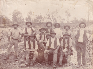 The Beechworth Burke Museum
Photograph, c. 1870
... . It can also provide information on the landscape of Australia ...This photograph was captured at an undisclosed location and at an unidentified time but likely dates to approximately 1870. The photographer's details are not recorded and the identities of the men in the image are also not known. This image depicts a group of 10 men in typical miners fashion. Four of them are sat on a large log with one holding a small dog. Six miners stand behind those sitting. All these men are wearing a white button-up shirt and tan coloured work trousers. They wear heavy boots and seven have included a dark vest over their shirt. The man holding the dog has a pipe in his mouth. Two of these men are clean shaven with the remainder sporting a moustache and two with a beard. The ages of these men vary from late 20s to middle age. This group of men are located in a mining location with what appears to be an open cut mine in the background of the image. The ground is muddy and has elements which can help identify it as a mining location based on the condition of the landscape. The bottom of the men's trousers are muddy which provides the assurance that these men were working in this location when their photograph was captured. In the background there is one structure, possibly a dwelling, and bush which identifies the location as Australia. Open cut sluicing is a method used to extract gold and other precious metals from beneath the surface of the earth. This technique involved the use of high-powered hoses which broke down the soil enabling miners to come along and search this soil for gold. After the gold rush of the early 1850s, diggers had to enlist the assistance of heavy machinery and techniques like hydraulic sluicing in order to reach gold because the surface alluvial gold had already been discovered and removed. This heavy machinery was not used until after 1853. The search for gold is ingrained into the history of Victoria and therefore, images like this one which portray an open cut sluicing site can reveal important information for society and technology for the date when the photograph was taken. This image is of important historical significance for its ability to convey information about sluicing and the methods used to find gold in the late 1800s and early 1900s. It also shows a location where sluicing was undertook which provides insight into the impact of sluicing on the environment at a time when it was done. Images, like this one, of Australian gold rush history can reveal important information about the social and environmental impact of this period. This image depicts diggers standing in a mining location and therefore, this image has the capacity to reveal or support significant information for researchers studying the fashion and social status of diggers in Australia in approximately 1870. It can also provide information on the landscape of Australia in this period and the impact of mining for gold on both society and the Australian landscape. The Burke Museum is home to a substantial collection of Australian mining photographs which can be used to gain a deeper understanding into life on the gold fields, technology used in mining, the miners themselves and the impact of the gold digging on the environment.Sepia toned rectangular photograph printed on matte photographic paper mounted on board.Reverse: 1997.2518mining, goldfields, beechworth, 1870, australia, australian goldfields, diggers, victoria, sluicing, gold mining, miners, diggers victoria -
 The Beechworth Burke Museum
Photograph - Photograph - Reproduction, W. D. Gibbon, Early 1900s
... information on the landscape of Australia in this period ...This photograph was taken in 1911 at Three Mile Creek, about five kilometers south of Beechworth town. Significant digging took place at this location from late 1855, which led to a flood of workers and stores to follow, though daily earnings were slim compared to the nearby Woolshed site. This remained the case even after workers at Three Mile Creek attempted to protest around Beechworth during an election in November 1855. Three Mile Creek was one of seven significant divisions of the Beechworth Mining District formalised by the Governor-in-Council in 1858, though by the time this photograph was taken, the boundaries of the original seven districts had shifted to create seventeen divisions. The Three Mile Goldfields was a site of rich alluvial gold deposits located about 5km south of Beechworth in Victoria. Today, the location of this gold deposit is called Baarmutha. It was a popular area for gold mining in the 1850s but became largely abandoned by the following decade. In 1865, a man named John Pund (a man second from the left in the back row of this photograph shares this surname) recognized that the area could be potentially rich if a better water supply could be obtained. He secured a 15 year license with three other miners. Within the next five years, these men had constructed 19 km of water race going from Upper Nine Mile Creek to Three Mile Creek. By 1881, these four men had delivered 950,000 gallons to the Three Mile Sluicing area which is depicted in this photograph. Pund would later go into partnership with John Alston Wallace who would become owner of the Star Hotel in Beechworth. The Three Mile sluicing location continued to be operational until 1950. The eleven miners in this photograph are: Back row: Led Guthrie, P. Pund, F. Beel, [Unknown] Miller Front row: Paddy McNamara, J. King, W. Beel, [Unknown] Garland, J. Clarke, J. Ryan, H. Bartsh In the background of the photograph is a huge dirt wall that appears to suffer damage caused by hydraulic sluicing. Hydraulic sluicing is a specialised mining technique that involves directing high pressure water flows at dirt to uncover gold. The technique played a significant role in shaping Beechworth's landscape during the gold rush to create the topography seen today.The search for gold is ingrained into the history of Victoria and therefore, images like this one which portray an open cut sluicing site can reveal important information for society and technology for the date when the photograph was taken. This image is of important historical significance for its ability to convey information about sluicing and the methods used to find gold in the late 1800s and early 1900s. It also shows a location where sluicing was undertook which provides insight into the impact of sluicing on the environment at a time when it was done. Images, like this one, of Australian gold rush history can reveal important information about the social and environmental impact of this period. This image depicts diggers standing in a mining location and therefore, this image has the capacity to reveal or support significant information for researchers studying the fashion and social status of diggers in Australia in approximately 1911. It can also provide information on the landscape of Australia in this period and the impact of mining for gold on both society and the Australian landscape. The Burke Museum is home to a substantial collection of Australian mining photographs which can be used to gain a deeper understanding into life on the gold fields, technology used in mining, the miners themselves and the impact of the gold digging on the environment.Black and white / sepia rectangular reproduced photograph printed on glossy photographic paper mounted on board.beechworth, beechworth museum, mining, mining team, three mile creek, sluicing, hydraulic sluicing, photography, gold sluicing, gold mining, pund mining -
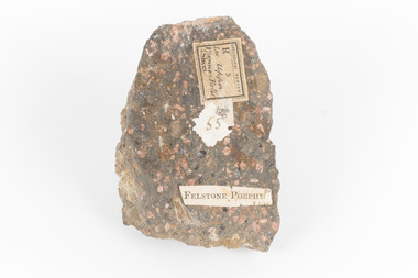 The Beechworth Burke Museum
Geological specimen - Porphyritic Rhyodacite
This specimen was recovered from the Nigretta Falls (previously named the Upper Wannon Falls), Victoria. The falls are fed by the Wannon River that has its head waters in the Grampians mountains. Approx. 10km upstream of the Wannon Falls, Nigretta is a multi-channel segmented cascade of smaller drops and bounces guided by patterns of joints in a much older (Devonian) rhyolitic volcanic rock. Both the Wannon and Nigretta Falls are iconic landscape features, entrenched in the history and identity of the region. These falls are particularly rare as they are the product of volcanic activity, which is unique in the context of the Volcanic Plain of Victoria. Waterfalls of this capacity are generally associated with the Uplands areas of Victoria, rather than the edges of the Volcanic Plain. This specimen is part of a larger collection of geological and mineral specimens collected from around Australia (and some parts of the world) and donated to the Burke Museum between 1868-1880. A large percentage of these specimens were collected in Victoria as part of the Geological Survey of Victoria that begun in 1852 (in response to the Gold Rush) to study and map the geology of Victoria. Collecting geological specimens was an important part of mapping and understanding the scientific makeup of the earth. Many of these specimens were sent to research and collecting organisations across Australia, including the Burke Museum, to educate and encourage further study. A solid, dark grey mineral specimen with pale terracotta coloured inclusions. Rhyodacite is a volcanic rock intermediate in composition between dacite and rhyolite. Rhyodacites form from rapid cooling of lava relatively rich in silica and low in alkali metal oxides.GEOLOGICAL SURVEY / R / S 55 FELSTONE PORPHYburke museum, beechworth, indigo shire, beechworth museum, geological, geological specimen, porphyritic rhyodacite, lava, nigretta falls, upper wannon falls, dacite, rhyolite, volcanic geology -
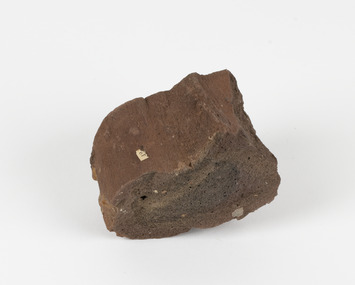 The Beechworth Burke Museum
Geological specimen - Ropy Lava
... shows the conditions in which the Australian landscape ...‘Ropy lava’ is known for its sculptural and layered qualities. It occurs in specific lava flows that are slow moving and slow cooling, allowing for unique formations to be created out of the motion. Ropy Lava is a flow that has a hardened crust with molten material underneath, the tension between these states is what creates its characteristic form. The brown/red hue of the stone is an indication of age, as it is oxidised iron deposits. This rock deposit is thought to be sourced from the area by Talbot, in western Victoria. This area has a rich mineral history and experienced the gold rush in the 1850's. The traditional owners of this area are the Dja Dja Wurrung people.This geological specimen shows the conditions in which the Australian landscape was created as well as provides an indication as to how these events occurred. It is representative of a common natural process that contextualises the formation of Australia with the formation of other landmasses. This specimen is part of a larger collection of geological and mineral specimens collected from around Australia (and some parts of the world) and donated to the Burke Museum between 1868-1880. A large percentage of these specimens were collected in Victoria as part of the Geological Survey of Victoria that begun in 1852 (in response to the Gold Rush) to study and map the geology of Victoria. Collecting geological specimens was an important part of mapping and understanding the scientific makeup of the earth. Many of these specimens were sent to research and collecting organisations across Australia, including the Burke Museum, to educate and encourage further study.Hand sized specimen in brown/red hues42 / victoria, talbot, lava, ropy, ropy lava, mineral, geological specimen, geological, geological heritage, natural stone, natural history -
 The Beechworth Burke Museum
Geological specimen - Dolomite
Dolomite is a mineral, calcium magnesium carbonate, with the chemical formula CaMg(CO3)2. It is a principle component of various rock types sometimes also referred to as dolomite, including dolostone, dolomitic marble and dolomitic limestone (according to the composition of each type). Dolomite rock is found in sedimentary basins throughout the world, comprising approximately 2% of the Earth's crust. It is formed when lime mud or limestone encounters groundwater containing magnesium. Dolomite can contain elements such as lead, zinc and copper. Dolomite and limestone are used in various construction, landscaping and agricultural processes. This specimen was donated to the Burke Museum in 1868 by Alfred Selwyn as part of the Geological Survey of Victoria. It was donated to the Museum in 1868. Victoria and other regions of Australia were surveyed for sites of potential mineral wealth throughout the 19th Century. The identification of sites containing valuable commodities such as gold, iron ore and gemstones in a locality had the potential to shape the development and history of communities and industries in the area. The discovery of gold in Victoria, for instance, had a significant influence on the development of the area now known as 'the goldfields', including Beechworth; the city of Melbourne and Victoria as a whole. Dolomite and limestone are mined at several locations in Victoria, including sites in the North-East of the state in Bindi and Limestone Creek. There are notable dolomite deposits in most Australian states. The dolomitised form of the mineral tends to come from older limestone deposits, formed during the palaeozoic era in marine settings, so this specimen may have come from a deposit located along a coastline in Victoria or another state. The specimen is significant as an example of surveying activity undertaken to assess and direct the development of the mineral resource industries in Victoria and Australia, as well as the movement to expand human knowledge of earth sciences such as mineralogy and geology in the nineteenth century. This specimen is part of a larger collection of geological and mineral specimens collected from around Australia (and some parts of the world) and donated to the Burke Museum between 1868-1880. A large percentage of these specimens were collected in Victoria as part of the Geological Survey of Victoria that begun in 1852 (in response to the Gold Rush) to study and map the geology of Victoria. Collecting geological specimens was an important part of mapping and understanding the scientific makeup of the earth. Many of these specimens were sent to research and collecting organisations across Australia, including the Burke Museum, to educate and encourage further study.Hand-sized piece of pale pink dolomite (calcium magnesium carbonate) with dark grey rim and hollowed centre. geological specimen, geology, geology collection, burke museum, beechworth, dolomite, mineralogy, geological survey, alfred selwyn, limestone, calcium magnesium carbonate -
 The Beechworth Burke Museum
Photograph - Lantern Slide, c1900
This image shows the gorge adjacent to Beechworth in approximately 1900. Although the exact location of the photograph is yet to be determined, the present-day Beechworth Gorge Walk includes views of the Cascades at the point at which Spring Creek flows into the valley on the level below. Gold-sluicing techniques in use in the town during periods of active gold extraction may have altered the landscape since the photograph was taken, however. In the 1850s a mill was built at the top of the Spring Creek falls by Russian-born Louis Chevalier, brother of artist Nicholas Chevalier. The mill supplied the town with lumber that supported the town's initial construction boom. Lantern slides, sometimes called 'magic lantern' slides, are glass plates on which an image has been secured for the purpose of projection. Glass slides were etched or hand-painted for this purpose from the Eighteenth Century but the process became more popular and accessible to the public with the development of photographic-emulsion slides used with a 'Magic Lantern' device in the mid-Nineteenth Century. Photographic lantern slides comprise a double-negative emulsion layer (forming a positive image) between thin glass plates that are bound together. A number of processes existed to form and bind the emulsion layer to the base plate, including the albumen, wet plate collodion, gelatine dry plate and woodburytype techniques. Lantern slides and magic lantern technologies are seen as foundational precursors to the development of modern photography and film-making techniques.This glass slide is significant because it provides insight into Beechworth's built environment and natural landscape in the early Twentieth Century, around the time of Australia's Federation. It is also an example of an early photographic and film-making technology in use in regional Victoria in the time period.Thin translucent sheet of glass with a square image printed on the front and framed in a black backing. It is held together by metals strips to secure the edges of the slide.burke museum, beechworth, lantern slide, slide, glass slide, plate, burke museum collection, photograph, monochrome, indigo shire, north-east victoria, spring creek falls, beechworth gorge, louis chevalier, nicholas chevalier, lumber industry, timber industry, 1850s, construction, building, mill, mills, waterfall -
 The Beechworth Burke Museum
Photograph - Lantern Slide, c1900
This image shows a semi-aerial view of a property along a river adjacent to Beechworth in approximately 1900. The photographer has capitalised words in the label, indicating that 'The Precipice' may have suggested a particular rather than a general vantage point to local people at the time. Although the exact location of the photograph is yet to be determined, Beechworth Gorge is popular today with hikers and nearby Mt Stanley is noted for its views. Lantern slides, sometimes called 'magic lantern' slides, are glass plates on which an image has been secured for the purpose of projection. Glass slides were etched or hand-painted for this purpose from the Eighteenth Century but the process became more popular and accessible to the public with the development of photographic-emulsion slides used with a 'Magic Lantern' device in the mid-Nineteenth Century. Photographic lantern slides comprise a double-negative emulsion layer (forming a positive image) between thin glass plates that are bound together. A number of processes existed to form and bind the emulsion layer to the base plate, including the albumen, wet plate collodion, gelatine dry plate and woodburytype techniques. Lantern slides and magic lantern technologies are seen as foundational precursors to the development of modern photography and film-making techniques.This glass slide is significant because it provides insight into Beechworth's built environment and natural landscape in the early Twentieth Century, around the time of Australia's Federation. It is also an example of an early photographic and film-making technology in use in regional Victoria in the time period.Thin translucent sheet of glass with a square image printed on the front and framed in a black backing. It is held together by metals strips to secure the edges of the slide.Obverse: Image from The Precipice. /burke museum, beechworth, lantern slide, slide, glass slide, plate, burke museum collection, photograph, monochrome, views, landscapes, farmsteads, rivers, beechworth gorge, mt stanley, emulsion, the precipice -
 The Beechworth Burke Museum
Photograph - Lantern Slide, c1900
This image shows a view of a properties bordering a river in the vicinity of Beechworth in approximately 1900. Although the exact location of the photograph is yet to be determined, the water source pictured may feed into the bigger system that flows through Beechworth Gorge. A man wearing a hat, possibly the photographer, is silhouetted in the foreground of the picture. Lantern slides, sometimes called 'magic lantern' slides, are glass plates on which an image has been secured for the purpose of projection. Glass slides were etched or hand-painted for this purpose from the Eighteenth Century but the process became more popular and accessible to the public with the development of photographic-emulsion slides used with a 'Magic Lantern' device in the mid-Nineteenth Century. Photographic lantern slides comprise a double-negative emulsion layer (forming a positive image) between thin glass plates that are bound together. A number of processes existed to form and bind the emulsion layer to the base plate, including the albumen, wet plate collodion, gelatine dry plate and woodburytype techniques. Lantern slides and magic lantern technologies are seen as foundational precursors to the development of modern photography and film-making techniques.This glass slide is significant because it provides insight into Beechworth's built environment and natural landscape in the early Twentieth Century, around the time of Australia's Federation. It is also an example of an early photographic and film-making technology in use in regional Victoria in the time period.Thin translucent sheet of glass with a square image printed on the front and framed in a black backing. It is held together by metals strips to secure the edges of the slide.burke museum, beechworth, lantern slide, slide, glass slide, plate, burke museum collection, photograph, monochrome, photographer, beechworth gorge, river, stream, water source, 1900s -
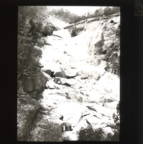 The Beechworth Burke Museum
Photograph - Lantern Slide, c1900
This image shows the gorge adjacent to Beechworth in approximately 1900. Although the exact location of the photograph is yet to be determined, the present-day Beechworth Gorge Walk includes views of the Cascades at the point at which Spring Creek flows into the valley on the level below. Gold-sluicing techniques in use in the town during periods of active gold extraction may have altered the landscape since the photograph was taken, however. In the 1850s a mill was built at the top of the Spring Creek falls by Russian-born Louis Chevalier, brother of artist Nicholas Chevalier. The mill supplied the town with lumber that supported the town's initial construction boom. Lantern slides, sometimes called 'magic lantern' slides, are glass plates on which an image has been secured for the purpose of projection. Glass slides were etched or hand-painted for this purpose from the Eighteenth Century but the process became more popular and accessible to the public with the development of photographic-emulsion slides used with a 'Magic Lantern' device in the mid-Nineteenth Century. Photographic lantern slides comprise a double-negative emulsion layer (forming a positive image) between thin glass plates that are bound together. A number of processes existed to form and bind the emulsion layer to the base plate, including the albumen, wet plate collodion, gelatine dry plate and woodburytype techniques. Lantern slides and magic lantern technologies are seen as foundational precursors to the development of modern photography and film-making techniques.This glass slide is significant because it provides insight into Beechworth's built environment and natural landscape in the early Twentieth Century, around the time of Australia's Federation. It is also an example of an early photographic and film-making technology in use in regional Victoria in the time period.Thin translucent sheet of glass with a square image printed on the front and framed in a black backing. It is held together by metals strips to secure the edges of the slide.burke museum, beechworth, lantern slide, slide, glass slide, plate, burke museum collection, photograph, monochrome, beechworth gorge, indigo shire, landscapes, mill, sluicing, gold mining, north-east victoria, spring creek, louis chevalier, cascades -
 Orbost & District Historical Society
magazines, Croajingolong 1971, 1971
This is the twenty-fourth issue of the annual magazine of Orbost High School. The name Croajingolong derives from the Australian Aboriginal Krauatungalung words galung, meaning "belonging to" and kraua, meaning "east". 2219.1 belonged to Mary Gilbert, a former teacher at the school. 2219.2 belonged to Peter Traill.This magazine is a useful reference tool.Three copies of Croajingolong 1971. The magazine is in landscape format and has a white cover with a free form shape filled with mosaic type patterns in black and white. 2219.2 has Peter Trailll written in blue pen on the front cover.croajingolong orbost-high-school -
 The Beechworth Burke Museum
Photograph, Unknown
The A1 Gold Mine is located north of Woods Point, near Jamieson, in the Upper Goulburn region of Victoria. Gold was discovered at the A1 site in 1861 and mining operations began in 1864. The A1 Mine Settlement refers to a small township known variously as Castle Reef, Castle Point, and Raspberry Creek, which developed in the 1860s around mining industry centred on a crushing machine that worked the three gold reefs in the area. Historically, the name "A1"referred to the high quality of gold found in the quartz reefs at depths of at least two thousand feet. Along with the Morning Star mine at Woods Point, the A1 gold mine produced almost sixty percent of Victoria's gold output in the 1950s to 1970s and continued operating until 1992 when it went into administration. Operations at the site were revived in 2016 and the A1 Mine is now considered one of Victoria's premier gold mines. The A1 mine is part of the extensive and prospective Lachlan Fold Belt, a north-west trending belt of tightly folded Early Devonian sedimentary rocks extending from New South Wales to Victoria. Mineralisation is hosted within or immediately adjacent to diorite dykes. Contemporary development of the 'Queens Lode' at the A1 mine signals a move from high-grade, narrow vein airleg mining into larger scale, mechanical mining designed to increase ore production volume. This original, undated photograph of the A1 Mine appears to depict an area or phase of disuse or abandonment. The aged and humble appearance of the cottage suggests association with the historical A1 Mine Settlement, therefore the image may have been taken prior to the 1950s-1970s revival period in which the A1 mine is known to have produced high gold yields. The photograph contributes to our understanding of the A1 Gold Mine's impact on the landscape and the social, environmental impacts of mining on communities and may be compared with others in the Burke Museum's extensive collection of mining photographs to deepen our understanding of mining in the Jamieson area.Black and white rectangular photograph printed on photographic paperReverse: 5577 / A1 Mine / Near Jamieson / Vic. /burke museum, beechworth museum, beechworth, gold fields, gold rush, victorian gold rush, mining tunnels, gold ming history, colonial australia, australian gold rushes, mining technology, beechworth historic district, indigo gold trail, indigo shire, upper goulburn shire, jamieson, woods point-walhalla goldfield, a1 gold mine, victorian high country, modern mining methods, orogenic gold province, gold mineralisation, devonian, dykes -
 The Beechworth Burke Museum
Photograph - Photograph - Reproduction, ca. 1900
This image shows the approach to Beechworth from the south-west via the Newtown Bridge. Numerous early buildings line the road as it bifurcates to become Ford and High Streets on the ridge above Spring Creek and Newtown Falls. The sloping, rocky terrain and water course along the gorge show evidence of the intense mining activity that occurred at the site. The Ovens Gold Rush at Beechworth started when gold was found at Spring Creek in February 1852, prompting an influx of miners from around the world. The population grew over 20,000 by 1857. While the earliest mining at Beechworth was similar to that in other Victorian goldfields like Ballarat and Bendigo, Beechworth is notable for its use of hydraulic sluicing as a major method of removing wash-dirt. Hydraulic sluicing employs high pressure jets of water to blast away large areas of earth and wash it down to be run through a sluice box. Gold gets caught in the sluice and the remaining slurry is washed away. This method of mining is extremely effective but causes significant environmental impacts and damage to waterways. Large water quantities were required for large-scale sluicing, and the long water races and deep tailraces that were constructed in the Beechworth area in the nineteenth century are nonetheless considered feats of engineering. The site in the photograph is associated with the Rocky Mountain Mining Company who constructed an eight hundred meter tunnel under the township between 1876-1880 to reduce water levels at Spring Creek, which had been subject to diversions since the earliest days of alluvial mining. Over four million ounces of gold (115 tones) were found at Beechworth between 1852 and 1868, and the wealth from the gold rushes built Beechworth and the nationally significant buildings that remain standing today.This image shows the early development of the Beechworth township above Spring Creek, where gold was discovered in 1852. Evidence of hydraulic sluicing, a uniquely predominant method at Beechworth, and water-works engineering are present in the landscape. By the 1870s, alluvial gold deposits were depleted and increasingly complex engineering was required so deeper shafts could reach bedrock. This image is significant for understanding changes to the landscape and the evolution of mining methods and engineering practices related to the extensive construction, manipulation and management of water networks. The shift from smaller scale alluvial mining to larger company dominance in the mining industry has implications for understanding wider social, economic, political and industrial changes in the region of Beechworth and within the context of the Victorian Gold Rush more broadly. A black and white rectangular reproduction photograph printed on photographic paper. burke museum, beechworth museum, beechworth, gold fields, gold rush, victorian gold rush, hydraulic sluicing, rocky mountain mining company, spring creek, netwown falls, mining tunnels, water races, tailraces, colonial australia, australian gold rushes, mining technology, beechworth historic district, indigo gold trail, migration, indigo shire, gold mining, gold mining history -
 The Beechworth Burke Museum
Photograph, 1920-1950
This image taken between 1920-1930 depicts open-cut hydraulic sluicing at the Three Mile Mine, located about five kilometres south of Beechworth. Alluvial, or surface, mining began on this site in the 1850s, but was soon replaced by hydraulic sluicing methods. By the start of 1880 it is estimated that nine hundred miles of water races had been cut though soil and rock in the Beechworth district. Hydraulic sluicing employs high pressure jets of water to blast away large areas of earth and wash it down to be run through a sluice box. Gold gets caught in the sluice and the remaining slurry is washed away. Large water quantities were required for hydraulic sluicing, and the long water races and deep tailraces that were constructed were considered great engineering feats. This method of mining is extremely effective, but causes significant environmental damage and impacts to waterways and agricultural operations. Miners at Beechworth built extensive networks of races and dams to secure reliable supplies of water on a scale far greater than elsewhere in Victoria. By the 1880s Beechworth's water barons continued to hold more than half of all the water right licences on issue and undertook sluicing operations on a massive scale. The manipulation of surface and ground water via race networks was well planned and recorded in detail by local mining surveyors. The maps that were created, combined with modern geo-spatial technologies, provide a vital key in understanding the great lengths to which miners went to capture and control critical water resources. Today, Three Mile mine is called Baarmutha. The Three Mile Mine was unproductive until 1865 when John Pund and three other miners secured a fifteen year license and constructed a water race from Upper Nine Mile Creek to Three Mile Creek. In the early twentieth century Pund & Co. averaged over one thousand ounces of gold per year from the mine. After Pund's death in 1915, GSG Amalgamated Co operated the site, continuing sluicing until 1950. This image of hydraulic sluicing methods shows the extent of water-works engineering in the landscape. This photograph has historic and research potential for understanding changes to the landscape, the evolution of mining methods, and the extensive construction, manipulation and management of water networks in the Beechworth district. Black and white rectangular photograph on matte paperReverse: 7597-1 / Sluice Mining / Copied from original on loan from Webb (Qld) / Donated Nov 2009 / Baarmutha Three Mile Mine c1920-1950 / Managed by the Plain Bros then Parkinsons / Current Location is: Beechworth Animal Shelter / used for Baarmuthaburke museum, beechworth museum, beechworth, gold fields, gold rush, victorian gold rush, hydraulic sluicing, spring creek, netwown falls, mining tunnels, water races, tailraces, gold ming history, colonial australia, australian gold rushes, mining technology, beechworth historic district, indigo gold trail, indigo shire, john pund, water manipulation, water engineering, three mile creek, three mile mine, water race, large-scale mining methods, historical mining construction, alluvial mining, mining environmental impacts, baarmutha, water barons -
 The Beechworth Burke Museum
Postcard, George Symons, c.1990
The photograph printed on this postcard comes from the collection of the Mitchell Library in Sydney. It is sepia in tone and depicts seven men standing and sitting around a mine shaft in the Beechworth region. The photograph has been dated to approximately 1872. This period in history post-dates the Victorian gold rushes which occurred 1852-1853 in Ballarat, Bendigo and Beechworth. During this period, in the 1870s, the surface alluvial gold had been discovered and removed from location. Therefore, in order to reach the deeper and less accessible alluvial gold, diggers began to dig shafts into the earth. These shafts sunk below the ground level by 20 to 30 feet and required timber structures around the entrance and winches to bring the paydirt to the top. The top of this wooden structure is visible behind the man standing in the upper right of the image. This type of mining was highly dangerous as mines often caved in which injured the minors and often resulted in death. Thus, following this period, in the early 1900s, miners opted instead for hydrolic slucing which cut away the earth without the devastating consequences of a mine cave in. This particular group of miners appear to have been unable to afford a horse (then worth around 50 pounds) which were generally used at mines like this to help pull buckets attached to ropes up and down the mine. Instead, this group brought the buckets up and down by windlass. The windlass was a wooden structure mounted over the mining shaft and fitted with a hand-cranked winch which enabled the bucket attached to the rope to be brought up and down.Gold was first discovered in Beechworth in Spring and Reid's Creek in the summer of 1852-1853. At its popularity, this region had approximately 8000 people on the gold fields searching for gold on the banks of these creeks. These periods did not require the use of heavy machinery or the digging of deep mining shafts like the one depicted in this image. Therefore, this image has important connotations for the technologies associated with mining during the approximated 1870s when gold was harder to access. This is a later period in gold history which does not fit into the "gold rush" period. Instead, it occurred after the surface gold had disappeared and therefore, is essential for researchers who are investigating the mining techniques and structures used to reach the alluvial gold which was located deeper under ground in the 1870s. This period predates the use of big heavy machinery used to mine in the 1900s which include dredges. Images such as this one can also impart essential information as to the wardrobe and fashion of men during this period. It also imparts knowledge about the landscape of Beechworth which is useful for people researching the environment and impact of gold mining in the north-east region of Victoria. In addition, since this image is a postcard reproduction of an early Australian image which may date to approximately 1990 it can impart knowledge as to the interests of people during this time period when there may have been an increase into Australian history.A sepia tone facsimile of an early Australian photograph (circa 1872) printed as a postcard.Obverse: BEECHWORTH / Victoria, Australia / Reverse: GM 2 3275 / CORRESPONDENCE / AUSTRALIAN / YESTERYEAR / CARDS / ADDRESS / Published by George Symons (057) 65 3240 / THE MINEHEAD C. 1872 / The easily gleaned gold of the early fields did / not last very long. In order to reach less / accessible alluvial gold diggers began sinking shafts as much as twenty to thirty feet down / and the mines required timbering and winches / to bring the paydirt to the top. / This syndicate has been unable to afford the / luxury of a horse (about 50 pounds) and so everything / must go up and down by windlass and rawhide / bucket. / Photo: Mitchell Library, Sydney / A sepia tone facsimile of / an early Australian photographmining album, gold mine, beechworth, burke museum, mine shaft, postcard, australian yesteryear cards, george symons, the minehead, gold fields, alluvial gold, early australia, c.1872, 1872, gold diggers, north east victoria -
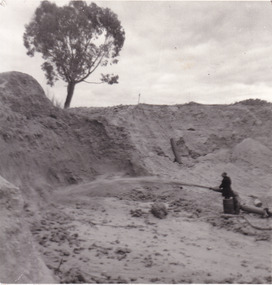 The Beechworth Burke Museum
Photograph
This photograph depicts a man in dark clothing, standing in front of a cut away section of earth. He is undertaking hydraulic sluicing, which involves the use of high powered hoses, in order to cut away the earth which can then be sifted for gold. There is a single tree in the background and the earth contains numerous signs of damage because of the mining. Beechworth become a mining settlement after the discovery of gold in 1852. Gold fever had already spread across Australia's colonies and the American states. Sluicing the landscape for gold, as shown in this photograph, was done by diverting water and washing away the lighter dirt, allowing the gold particles to sift down in to catchments for collection. In Beechworth, there was considerable discontent caused by attempts to restrict water use for sluicing to those with certain 'water rights'. The extensive use of hydraulic sluicing, and the washing away of top soils has continued to impact the surrounds of Beechworth in to the present day. Sluicing as a method for gold mining which was widespread across Victoria during the 1870s. The erosion of the top soil in search of gold has a continuing environmental impact on the landscape and this photograph depicts but one example of this occurring and can provide much information to a researcher interested in understanding the history of gold mining in Victoria. This image of the miner and hose is historically important because it demonstrates the methods of goldmining employed in the later years of the goldrush at Beechworth. It shows how much land is washed away by the use of this technology. The image has good interpretive capacity because it allows researchers to see a different mining technique to what is usually presented. Black and white square photograph on card.reverse: 84-50-3 / 1997 3141 / smdsluicing, goldmining, beechworth, burke museum, miners, gold miners, gold sluicing, environmental impact -
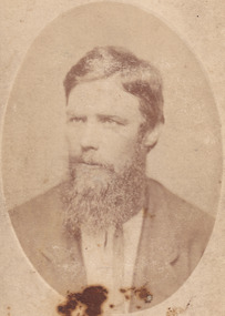 The Beechworth Burke Museum
Photograph - Carte de Visite, James Bray, 1870
A Carte de Visite (hereafter CdV) (also known as a calling card) was popular within the mid-19th Century. It is a small card with a photographic portrait mounted on it. These cards were exchanged during the Victorian era (peaking in the 1860s) between families and friends. This particular CdV was captured by James Bray in c.1870. Bray who worked as a professional photographer in Camp Street Beechworth from 1870-1891. He was one of four men who photographed the Kelly Gang after the siege in Glenrowan in 1880. He is also renowned for his previous work photographing members of the Kelly gang. Depicted in this photograph is Isaiah “Wild” Wright. Wright was born in approximately 1846 in County Monaghan, Ireland. At age 11, Wright arrived with his father John Wright, mother Margaret and younger siblings in Victoria on the 9th of July 1857. They sailed on the ship ‘Carleton’ which left from Liverpool in England. Wright was stood 5 foot 11 inches tall and had brown hair with hazel eyes. He had a scar on the inside corner of his left eyebrow, a large scar on his right cheek and a scar on the back of his head. Over the years in Australia, Wright was sentenced on numerous (particularly of horse theft) charges and spent time in Pentridge, Hulk Sacramento and Hulk Sandridge. Wright married Bridget Lloyd in 1973. Through this marriage he was connected to the Kelly family as Bridget’s mother was one of Ellen Kelly’s (Ellen was the mother of Edward “Ned” Kelly) sisters. Wright is famous for his participation in the horse stealing incident of 1871 and subsequent bare knuckle fight against Ned Kelly that occurred in 1874. In 1878, Bridget and Isaiah Wright became parents to John "Jack" Thomas Wright. Jack Wright was an Australian rules footballer who played for Geelong in the Victorian Football League 1902-1906. Wright passed away on the 29th of May 1911.This photograph is part of the Burke Museum "Kelly album" which includes a significant collection of photographs and artefacts connected to Ned Kelly and the Kelly Gang. Ned Kelly and his gang have become ingrained in Australian popular culture and thus many museums, art galleries and private collections house material connected to the Kelly story which allows the events and people to be researched and interpreted. Individuals like Isaiah “Wild” Wright played an essential part in the Kelly story which have been enlarged and adapted for popular culture. The study of these individuals thorugh their images and records can help researchers to correctly interpret their involvement with Ned Kelly and the Kelly gang. Artefacts and photographs pertaining to the Kelly gang are particularly valuable for Australian museums. This particular photograph is significant for its connection to Beechworth photographer James Bray who is responsible for many images depicting members of the Kelly Gang. Sepia oval CDV printed on Card. Obverse: J.E. Bray/ Photo Reverse: 10238 Portrait & Landscape/ Photographer J E Bray Signature Beechworth/ Victoria/ Negatives Kept. Copies 5I/. Each May/ Be Had By Forwarding Name And Address/ Accompanied With Remittance To/ The Amount Of Order/ Photographs Coloured In Watercolourskelly album, kelly gang, beechworth, wild wright, boxing, burke museum, imperial hotel, bare-knuckle boxing, isaiah wright, ned kelly, isaiah wild wright, horse theft, hulk sacramento, calling card, pentridge, james bray, cdv, carte de visite -
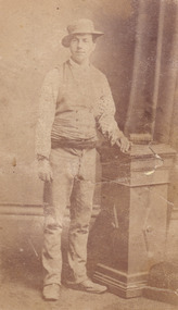 The Beechworth Burke Museum
Photograph - Carte de Visite, James Bray, 1870
This photograph was taken in c.1870 and depicts Aaron Sherrtt who is best known for his involvements with, and eventual assassination by, the Kelly gang. He stands upright in the image with his arm leaning on a podium which reaches his hip. He is wearing an outfit for which he was infamous. Richard Warren, son of the proprietor of the Ovens and Murray Advertiser once stated that “anyone seeing [Aaron] coming down Ford Street would ask, “Who the hell’s this? Some advance agent for the circus?”’. The outfit Aaron wore for this particular photoshoot is reminiscent of this quote. He wears an unusual spotted shirt with a waistcoat and a sash is tied at his waist. He wears boots which turn up slightly at the toes. The hat is a “pork pie” hat which is worn in the typical “Greta Mob” style with the chinstrap under the nose. Aaron Sherritt was born in 1854 in Prahran, Melbourne, to Irish Protestant parents John and Anne. Sherritt stood at 5 foot 10. He had hazel eyes, dark brown hair and pale olive skin. Sherritt was childhood friends with Kelly Gang member, Joe Byrne, having previously attended the same school. Both men had a reputation for stealing horses and on one occasion, after stealing and butchering a cow, Sherritt and Byrne were convicted to six months in Beechworth Gaol (1876). Sherritt, along with Byrne, were reportedly recruited by Ned Kelly in 1877 in stealing stock; however, Sherritt never became a fully-fledged member of the Kelly Gang. Nevertheless, Sherritt scouted for the Kelly Gang in 1878. He later struck a deal with the police (specifically, with Chief Commissioner Standish) to save Joe Byrne's life in exchange for leading the police to the other members of the Gang. From then on, Aaron Sherritt lived the dangerous life of a double agent, providing police with what is assumed today to have been outdated or incorrect information in return for money. On the 26th of June 1880, Aaron Sherritt was murdered in the Woolshed Valley. He was approximately 23-25 years old at death. This event marked the start of the Kelly gang’s last days. Sherritt was murdered by Byrne in front of his wife, 15 year old and heavily pregnant Ellen “Belle” Sherritt and her mother Ellen Barry. Also in the Sherritt dwelling on this particular night were four policemen. The intention behind Sherritt’s murder was for the police to send word to Melbourne that the Kelly gang had murdered Sherritt and a police train would be sent to Glenrowan where the rest of the Kelly gang were waiting. This plan did not go as predicted and ultimately the Kelly gang fell at Glenrowan in 1880. This photograph was taken by James Bray who worked as a professional photographer in Camp Street Beechworth from 1870-1891. He was one of four men who photographed the Kelly Gang after the siege in Glenrowan in 1880. He is also renowned for his previous work photographing members of the Kelly gang. This photograph is part of the Burke Museum "Kelly album" which includes a significant collection of photographs and artefacts connected to Ned Kelly and the Kelly Gang. Ned Kelly and his gang have become ingrained in Australian popular culture and thus many museums, art galleries and private collections house material connected to the Kelly story which allows the events and people to be researched and interpreted. Artefacts and photographs pertaining to the Kelly gang are particularly valuable for Australian museums. This particular photograph is significant for its connection to Beechworth photographer James Bray who is responsible for many images depicting members of the Kelly Gang. The photograph is also of artistic significance as an example of a Carte de Viste dating to 1880 and it's connection to Aaron Sherritt.Sepia rectangular photograph printed on card. Obverse: J.E.Bray./ Photo/ Beechworth Reverse: Portrait & Landscape/ Photographer 5/ Aaron Sherritt J E Bray Signature Beechworth/ Victoria Beware (almost erased out) Negatives Kept. Copies 5I/.Each May/ Be Had By Forwarding Name And Address/ Accompanied With Remittance To/ The Amount Of Order/ Photographs Coloured In Water Colours 10237. kelly album, woolshed valley, 1870s, kelly gang, joe byrne, ned kelly, aaron sherritt, james bray, beechworth, burke museum -
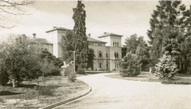 The Beechworth Burke Museum
Postcard, George Rose, c.1945
The Rose Stereograph Company first began producing postcards, identified as the 'P' series (like this particular example) in 1913 and continued in this business until 1967 after which they switched to machine manufactured colour postcards printed by an external company. These were produced by Victorian-era photographer George Rose (1861-1942) often reputed as one of the best photographers in Australia during the later 19th Century and early 20th Century. Rose was born in 1861 in Clunes and began his photography business in 1880 when he founded the Rose Stereograph Company. He later switched to producing postcards after stereographs lost popularity in the early 1920s. The Mayday Hills Hospital was one of these locations photographed by George Rose and published as a postcard. Beechworth's Mayday Hills was chosen as the site of Victoria's newest asylum, at the time, due to the landscape and altitude. The hilltop atmosphere and the native fauna, it was argued, would assist in the cure of the patients kept at the hospital (Wood 1985, 122). The positioning of the hospital had a beneficial effect on the rural town. A pamphlet published by James Ingram and Son (1849) reveal that famous landmarks in Beechworth which included the Post Office, Gaol, Courthouse and Asylum "demonstrate the appreciation of Beechworth by the Government not only as as important district center, but also as a site unrivaled as a sanitarium". There were other locations in contention at the time, but ultimately Beechworth was chosen (Craig 2000,33). Prior to the creation of the Asylum in Beechworth, those charged with having mental illnesses or, as it was termed, "insanity" were unable to be properly cared for in the Gaol (which is where they were often sent). John Buckley Castieau wrote, in 1861 for the Ovens and Murray Advertiser, that the Gaol was unable to properly care for those classified then as "insane" but that they would endeavor to treat them above the other inmates (which he notes is not always the case in other establishments). Castieau wrote this in favour of supporting the building of the Mayday Hills Hospital in Beechworth. It was stated that at the time the Mayday Hills Hospital was built, there were 83 prisoners kept in the Gaol who were to be rehoused to the Hospital on the grounds of "insanity". The classification as someone as "insane", in this period of time is a reflection on the inability to cure and understand illnesses of the mind during the mid to late 1800s. Opening on the 24th of October 1867, the Mayday Hills Hospital was originally named the "Ovens Lunatic Asylum", a title which is very much a product of its time. Whilst controversial, changes to the name is part of the history of the Hospital and can provide much insight into the understanding of mental illness throughout history and the use/disuse of this term provides information into the reception/changing opinions of mental illness in society. The Hospital would later become known as the "Mayday Hills Asylum" and/or "Mayday Hills Hospital" with the latter being the most commonly used title. An article in the Ovens and Murray Advertiser notes that on the 7th of March 1865, the foundation stone of the Hospital was laid (it would officially open in 1867) and that it was such a moment of accomplishment and joy for Beechworth that a letter to the editor even suggested that there should be a holiday dedicated to the day the foundation stone as laid. This reveals an extent to which the townspeople of early Beechworth valued the construction of the Hospital in their town. It provided the town with a sense of prestige and honour. At first glance, the remains of the Mayday Hills Hospital in Beechworth, Victoria, inspire tragedy, trauma and beauty. The buildings themselves, with their Italianate style Renaissance architecture designed by J.J. Clark (Craig 2000, 49 & Smith 2016, 203) reflect a bygone period of European and Australian history. The gardens provide a sense of tranquility and beauty. The experience of those within these walls remains a valuable area of study to provide a more complete understanding. This particular hospital is considered the fourth of its like and one of three identified as the largest of their kind. The Mayday Hills Hospital is a sister to the Kew and Ararat Asylums in Melbourne which are both located in relative proximity. Understanding the role of the Mayday Hills Hospital in Beechworth history is integral to understanding the development of the goldfields town, but also for providing important information as to the history of caring for, and the reception of, mental illnesses in Australian and wider European history. Mayday Hills provides a case study which can be researched through oral history, an analysis of the grounds/buildings and through images like this postcard which portray the structure in a highly deliberate manner. Images like this depict the strong façade of the Hospital and provide a glimpse into the tranquility of the gardens. This has been done deliberately to provide a sense of comfort and healing about the building to those looking from the outside. Further research into the importance of the Hospital in Beechworth and it's connection to the town will be supported through images like these kept in the Mayday Hills photo album in the collection of the Burke Museum.Pale sepia toned rectangular postcard printed on matte card.Obverse: THE ROSE SERIES P. 4689 / COPYRIGHT / ADMINISTRATIVE OFFICES, MENTAL HOSPITAL, BEECHWORTH, VIC / Reverse: Published by the Rose Stereograph Co. / Armadale, Victoria / POST CARD / THE "ROSE" SERIES / DE LUXE / A REAL PHOTOGRAPH / PRODUCED IN AUSTRALIA /mayday hills, asylum, mental hospital, hospital, beechworth -
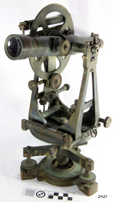 Flagstaff Hill Maritime Museum and Village
Theodolite, Troughton & Simms, Mid 19th Century
... the landscape of the Australian Colony’s interior. Theodolites ...The theodolite was sold by T. Gaunt & Co. of Melbourne, a manufacturer, importer and retailer of a wide variety of goods including jewellery, clocks and watches, navigational and measuring instruments, dinnerware, glassware and ornaments. Thomas Gaunt photograph was included in an album of security identity portraits of members of the Victorian Court, Centennial International Exhibition, Melbourne, 1888. (See further details below.) History for Troughton & Simms: Edward Troughton & William Simms established a scientific instrument making business in London in 1826. Edward Troughton (1756-1835) had previously had his own scientific instrument business, inherited from his father. His achievement's included a transit telescope for Greenwich Observatory (1816) and the precision surveying instruments for the Ordnance Survey of Britain, Ireland and India. William Simms (1793-1860) had trained as a goldsmith and began to gain work dividing circles on fine astronomical instruments. When William Simms died in 1860, the business was taken over by his son James and nephew William. Troughton & Simms shop in Fleet Street became the hub of the finest scientific instrument made in London, in a period in which there was an expanding demand for precision instruments, for astronomy, surveying and precision measurement. They made instruments for Greenwich Observatory, for imperial surveys and exploring expeditions. When fire destroyed the Houses of Parliament in 1834, the firm was commissioned to create new standard lengths, this required 10 years of testing against the remaining old measurements. Troughton and Simms made several of the main instruments for Melbourne Observatory, including an 18 inch azimuth used of the Geodetic Survey, portable transit instrument (circa 1850), zenith sector (1860), a 4.5 inch equatorial telescope (1862), an 8 inch equatorial telescope (1874) spectroscope (1877) and an 8 inch transit instrument in (1884). While the firm had an excellent reputation for quality the company exasperated many of its customers with delays of years in delivering some instruments. History for Thomas Gaunt: Thomas Ambrose Gaunt (1829 – 1890) was a jeweller, clock maker, and manufacturer of scientific instruments, whose head office and showroom were at 337–339 Bourke Street, Melbourne, Victoria, Australia. Thomas Gaunt established Melbourne's leading watchmaking, optical and jewellery business during the second half of the 19th century. Gaunt arrived in Melbourne in 1852, and by 1858 had established his own business at 14 Little Bourke Street. Around 1869 he moved to new premises in Bourke Street on the corner of Royal Arcade, Gaunt's shop quickly became a Melbourne institution. Gaunt proudly advertised that he was 'The only watch manufacturer in the Australian colonies'. While many watches and clocks may have had Gaunt's name on the dial, few would have been made locally. Gaunt did make some watches for exhibitions, and perhaps a few expensive watches for wealthy individuals. Gaunt's received a telegraph signal from Melbourne Observatory each day to correct his main clock and used this signal to rate and repair ship's chronometers and good quality watches. Thomas Gaunt also developed a department that focused on scientific instrumentation, making thermometers and barometers (from imported glass tubes), telescopes, surveying instruments and microscopes. Significance: With the rapid urban expansion, one of the most important needs of the new colony was to survey and map the landscape of the Australian Colony’s interior. Theodolites, such as this one, made by Troughton and Simms, who were significant scientific instrument makers of the 19th century were instrumental to the colony's surveyors and would have played an important part in their everyday work. This transit theodolite remains of national significance due to its pioneering role in Australian science and its association with Australia's earliest surveyors and astronomers. It is also significant for its association with nineteenth-century surveying instruments and instrument makers. Theodolite, Vernier repetition theodolite with enclosed horizontal circle (of about 130 mm diameter). Vertical circle exposed and somewhat corroded (diameter about 115 mm). Plate level 20" per division. Altitude bubble 20" per division. Horizontal and vertical circle intervals 20". Original (blue/grey) paint. Altitude bubble setting screw disabled. Tribrach allows movement of theodolite by 15 mm inside tribrach (for centering).Inscribed on the inner mounting plate,“Specially made in England for T Gaunt & Co Melbourne” and inscribed a little lower “Troughton & Simms London”flagstaff hill, warrnambool, shipwrecked-coast, flagstaff-hill, flagstaff-hill-maritime-museum, maritime-museum, shipwreck-coast, flagstaff-hill-maritime-village, theodolite, t. gaunt & co, troughton & simms, scientific instrument, measuring instrument, surveyor's instrument -
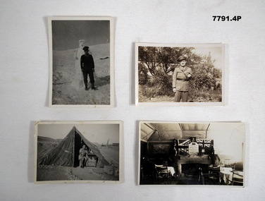 Bendigo Military Museum
Photograph - PHOTOGRAPHS
Relates to Acting Captain “John Eric Wiles” VX16067. Posted Middle East 1940. Part of his collection. Refer Cat. No. 5410P for his Service Details.Series of black and white/ sepia photos. 1. Portrait B & W photo of soldier standing in front of a snowman in Syria. 2. Landscape, sepia photo of an officer in uniform posed to camera. 3. Landscape B & W photo of Jack Wilks in a tent in an Army base in Syria. 4. Landscape B & W photo of the Officer's Mess in Australia.On back of photos; 1. "A snowman and myself. Syria - New Year 1942" 2. Stamp on back. G 17. 3. Detailed little message from Syria. 4. "Our Mess" Australia 44.postcards, captain john eric wiles -
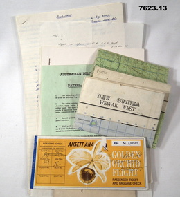 Bendigo Military Museum
Document - PNG PAPERS, HERDMAN, Ansett - ANA et al, 1964- 1969
Collection of documents related to K.J. Herdman's visit to PNG as part of CMF Officer's visit, 2nd Dec to 13th Dec 1968. Part of the "Kevin John Herdman" No. 397661 Collection. See Catalogue No. 5942P for details of his service. 2. Notes related to Herdman's visit to PNG. List of personnel on visit. 4. Patrol ration pack details. 5. PNG Training Depot Hand Book, 6. Report - CMF Officer's visit to PNG. 2-13 Dec 1968. 8. Extended report by K.J. Herdman on CMF Officer's visit to PNG Command 1968. dated 21 Feb 1969. 9. Document related to CMF Officer's visit to Lae battlefields. 10. Detailed itinerary of CMF Officer's visit to Lae Battlefields. 11. Document detailing the organisation of PNG Command. 12. Document detailing the organisation of PNG Command. 12. Document detailing the organisation of HQ PNG Command (Murray Barracks) 13. Document detailing the itinerary for CMF Officers visit to PNG Command. the groups involved. K.J. Herdman was in Group 2. 1. Two (2) Rectangular paper airline tickets. Front page is orange in colour with black and white text. Picture of a flower. handwritten passenger details, handwritten flight details inside each, tickets stapled together. 2. Small cream coloured soft cover notebook. Title and Rising Sun logo on front in black. lined pages with cut edges. Pages secured with two staples. 3. Topographical map of New Guinea - Wewak West. 4. Green coloured single page pamphlet with text in black on both sides. one side in English and the other in Pidgin English. 5. Quarto sized nine page document. Front cover has title in black and a black line illustration featuring a palm tree and crocodile. Pages stapled together along spine. 6. Handwritten foolscap sized document. Text in black ink. Writing on one side. 7. Letter handwritten in blue ink. Writing on one side. plain paper. 8. Handwritten foolscap sized document. Text in blue ink. 8 pages of writing. Pages stapled in top LHC. 9. Foolscap sized document with text in black type. Printing on one side of each page. Two sheets of plain paper stapled on to LHC. 10. Three (3) page foolscap sized document with pages stapled on top LHC. Text in black type. Printing on one side of each page. 11. Five (5) page foolscap sized document with pages stapled on top LHC in landscape format. Text in black type, 12. Single page foolscap sized document with text in black type. 13. Eight (8) page foolscap sized document with pages stapled on top LHC. Text in black type.1. Handwritten passenger details on cover and inside each ticket. 2. Handwritten notes in blue ink on first 11 pages. 12. Handwritten on back of paper in black ink: THE DOCTOR SAID "YES", Brian Best.army, training notes, kevin john herdman -
 Port of Echuca
Functional object - metal stencil ' X Bred'
Metal stencils were predominately used in the late 1800s to mark wool bales with sheep station identifiers. This stencil is a good example of the types of hand-marking that took place in the industrial landscape of Echuca, where bales were transported from nearby stations to places around Australia using the barge system that the Port has captured in its exhibition precinct to date.This item is in excellent condition and adds to the interpretative capacity of the Port Echuca collection. Small rectangular flat metal stencil with letters XBRED cut out.XBRED port of echuca, stencil