Showing 5916 items
matching east road
-
 Ringwood and District Historical Society
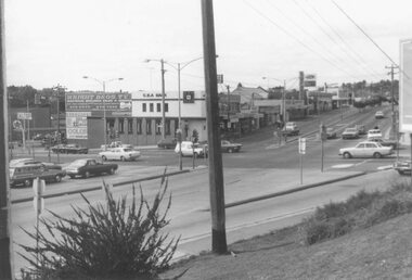
Photograph, Maroondah Highway East, Ringwood- 1976. Looking east from Warrandyte Road intersection
... Maroondah Highway East, Ringwood- 1976. Looking east from...- 1976. Looking east from Warrandyte Road intersection ...Black and white photographImage shows intersection with C.B.A. Bank on north east corner. Photograph taken mid 1976. -
 Ringwood and District Historical Society
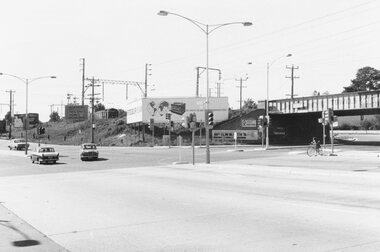
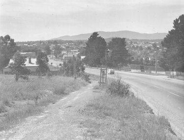
Photograph, Maroondah Highway East, Ringwood- 1969. Looking east from Warrandyte Road railway bridge
... Maroondah Highway East, Ringwood- 1969. Looking east from... Road Ringwood North melbourne Written on back of photograph ...Black and white photographWritten on back of photograph: "May 1969, Site of first clock tower." -
 Eltham District Historical Society Inc
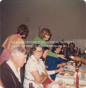
Photograph, Rose Fielding's birthday celebration at Bentleigh Public Hall, Centre Road, East Bentleigh, 1973
... Hall, Centre Road, East Bentleigh... Fielding's birthday celebration at Bentleigh Public Hall, Centre Road ...Margaret Rose Teagle was born 8 June, 1912 at Sandringham, Victoria. She married Kenneth Douglas Ingram in 1935 but the mariage ended in divorce in 1944. She subsequently married Richard Fielding in 1948. Rose was diagnosed with cancer and died 30 November 1978. It is understood that this photo was taken shortly before she became ill. L-R: Leslie John Teagle (never married), Julie Ingram (bare back, daughter of Kenneth Albert Ingram), Edwin 'Ted' Layfield (nee Teagle), ? , Vicki Weeks (standing green top), Lorraine Layfield, rest unidentified except Rose Fielding at end of table on far right. Vicki Weeks is 1st cousin one removed to Pam Thoonen.Processed Nov 1973pam thoonen (nee ingram) collection, bentleigh public hall, birthday celebration, edwina (ted) layfield (nee teagle), julie ingram, leslie john teagle, lorraine layfield, margaret rose fielding, vicki weeks, margaret rose fielding (nee teagle) -
 Eltham District Historical Society Inc
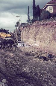
Negative - Photograph, J.A. McDonald, Rattray Road East, Montmorency, 8 May 1961
... Rattray Road East, Montmorency... Road East, Montmorency Negative Photograph J.A. McDonald ...From south boundary lot looking along proposed alignment 1 May 1961Record of various Shire of Eltham infrastructure works undertaken during the period of 1952-1962 involving bridge and road reconstruction projects, sometimes with Eltham Shire Council Project Reference numbers quoted. It was during this period that a number of significant improvements were made to roads and new bridges constructed within the shire that remain in place as of present day (2022). In many situations, the photos provide a tangible visible record of infrastructure that existed throughout the early days of the Shire. The album was put together by or under the direction of the Shire Engineer, J.A. McDonald.infrastructure, montmorency, rattray road, road construction, shire of eltham, 1961-05-08 -
 Eltham District Historical Society Inc
Negative - Photograph, J.A. McDonald, Rattray Road East, Montmorency, 1 May 1961
... Rattray Road East, Montmorency... Road East, Montmorency Negative Photograph J.A. McDonald ...From south boundary lot looking along proposed alignment 1 May 1961Record of various Shire of Eltham infrastructure works undertaken during the period of 1952-1962 involving bridge and road reconstruction projects, sometimes with Eltham Shire Council Project Reference numbers quoted. It was during this period that a number of significant improvements were made to roads and new bridges constructed within the shire that remain in place as of present day (2022). In many situations, the photos provide a tangible visible record of infrastructure that existed throughout the early days of the Shire. The album was put together by or under the direction of the Shire Engineer, J.A. McDonald.1961-05-01, infrastructure, montmorency, rattray road, road construction, shire of eltham -
 Eltham District Historical Society Inc
Negative - Photograph, J.A. McDonald, Rattray Road East, Montmorency, 1 May 1961
... Rattray Road East, Montmorency.... Rattray Road East, Montmorency Negative Photograph J.A. McDonald ...From south boundary lot looking along proposed alignment 1 May 1961Record of various Shire of Eltham infrastructure works undertaken during the period of 1952-1962 involving bridge and road reconstruction projects, sometimes with Eltham Shire Council Project Reference numbers quoted. It was during this period that a number of significant improvements were made to roads and new bridges constructed within the shire that remain in place as of present day (2022). In many situations, the photos provide a tangible visible record of infrastructure that existed throughout the early days of the Shire. The album was put together by or under the direction of the Shire Engineer, J.A. McDonald.1961-05-01, infrastructure, montmorency, rattray road, road construction, shire of eltham, reichelt avenue -
 Eltham District Historical Society Inc
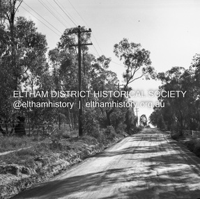
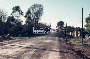
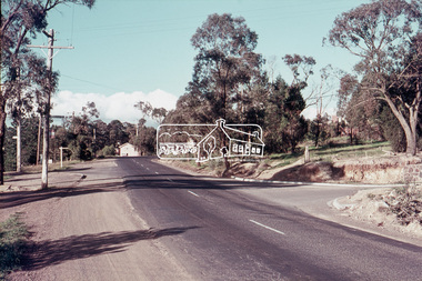
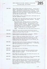
Slide, Possibly looking east along Rosehill Road, Lower Plenty towards Bolton Street intersection, 18 July 1972, 1972
... Possibly looking east along Rosehill Road, Lower Plenty... Service (Blue) Possibly looking east along Rosehill Road, Lower ...Reconstruction works by Eltham Shire Council, Bolton Street, Eltham, 18 July 197235 mm colour positive transparency Mount - Agfacolor Service (Blue)bolton steet, eltham, eltham shire council, infrastructure, lower plenty, road construction, rosehill road -
 Eltham District Historical Society Inc
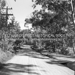
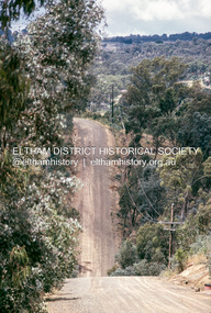
Photograph, Michael Wood, Looking east along Progress Road, Eltham North, February 1970, 1970
... Looking east along Progress Road, Eltham North, February... date FEB70M6 Looking east along Progress Road, Eltham North ...Wood family home (1969-2011) pre and post construction by Knox and HellemonsKodachrome 35mm colour transparency in cardboard mount Processing date FEB70M6Inscribed in ink "Progress Rd looking east Eltham North from 184 to Lower Rd 1970"eltham north, progress road -
 Eltham District Historical Society Inc
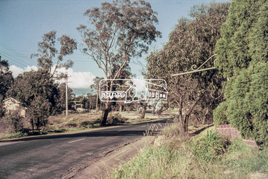
Photograph, Looking east along Main Road near intersection of Cheverton Road, Lower Plenty, July 1969, 1969
... Looking east along Main Road near intersection of Cheverton... east along Main Road near intersection of Cheverton Road, Lower ...35mm colour positive transparency blue Agfacolour Service plastic mountlower plenty, main road, cheverton road -
 Eltham District Historical Society Inc
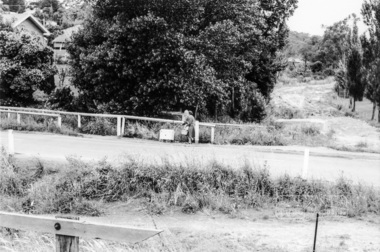
Photograph, Looking east along Main Road, Lower Plenty approaching the top of the hill and Grand Boulevard, July 1969, 1969
... Looking east along Main Road, Lower Plenty approaching the... as duplicate Main Road, Lower Plenty, east of Grand Boulevard including... as duplicate Main Road, Lower Plenty, east of Grand Boulevard including ...The Eltham Apex Club conducted a Community Service Project (1965-1968) to raise funds for a new Ambulance Station to service the community. A site bounded by the intersection of Main Road, Grand Boulevard and Looker Road at Montmorency was purchased in 1969. In 1970, Eltham Shire Council undertook roadworks to construct Apex Way in preparation for the new station as well as duplicate Main Road, Lower Plenty, east of Grand Boulevard including the new Lower Plenty Bridge, which had been opened in November 1966, bordering with the City of Heidelberg.35mm colour positive transparency blue Agfacolour Service plastic mountambulance station, apex-diamond valley ambulance station, eltham ambulance station, eltham apex club, lower plenty, main road, montmorency -
 Eltham District Historical Society Inc
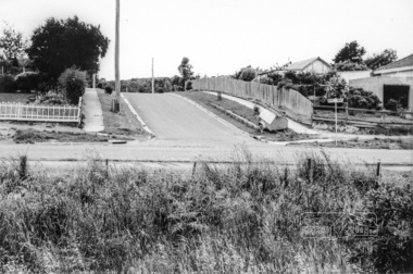
Slide, Looking east along Main Road, Lower Plenty near No. 184 during road widening works, 20 July 1970, 1970
... Looking east along Main Road, Lower Plenty near No. 184... Mount - Agfacolor Service (Blue) Looking east along Main Road ...Road works to widen and duplicate Main Road at Lower Plenty from top of hill near Grand Boulevard, Montmorency to shire border at Lower Plenty bridge35 mm colour positive transparency Mount - Agfacolor Service (Blue)duplication, lower plenty, main road, road construction -
 Greensborough Historical Society
Article, Brief history of the Rose, Shamrock and Thistle Hotel, Plenty Road East Preston, 21/06/1854o
... , Plenty Road East Preston.... and Thistle Hotel, Plenty Road East Preston. Article ...The history of the Rose Shamrock and Thistle Hotel dates from 1854.Early history taken from the local council rate books.2 foolscap pages, typed.rose shamrock and thistle hotel, hotels, preston -
 Eltham District Historical Society Inc
Photograph, Looking east across Main Road from just north of intersection with Diamond Street, Eltham, February 1968, Feb 1968
... Looking east across Main Road from just north of... the Eltham Hotel at Pitt Street heading north along Main Road through ...The watercourse passes under the road and railway at this point. Significant flash flooding occurred along this water course on Christmas Day 2011 causing significant damage to the railway line and road and flooding of Judge Book Village. In February 1968 an unknown person took a series of photos from the Eltham Hotel at Pitt Street heading north along Main Road through the shopping centre to just north of Elsa Court covering the length of the section of Main Road which was duplicated shortly thereafter. Shows the condition and environment of the streesscape of Main Road, Eltham immediately prior to the duplication between Pitt Street and Elsa Court through the shopping centre. Also shows a number of shops and businesses that operated at that time.Black and white photographduplication, eltham, main road, diamond street, bible street reserve, watercourse, drainage -
 Eltham District Historical Society Inc
Photograph, Looking east across Main Road towards Elsa Court, Eltham, February 1968, Feb 1968
... Looking east across Main Road towards Elsa Court, Eltham... photograph Looking east across Main Road towards Elsa Court, Eltham ...In February 1968 an unknown person took a series of photos from the Eltham Hotel at Pitt Street heading north along Main Road through the shopping centre to just north of Elsa Court covering the length of the section of Main Road which was duplicated shortly thereafter. Shows the condition and environment of the streesscape of Main Road, Eltham immediately prior to the duplication between Pitt Street and Elsa Court through the shopping centre. Also shows a number of shops and businesses that operated at that time.Black and white photographduplication, eltham, main road, elsa court -
 Eltham District Historical Society Inc
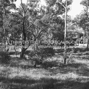
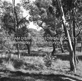
Photograph, Peter Pidgeon, View to Diamond Creek from Maroondah Aqueduct Trail just east of Godber Road, Eltham North, 3 Sept 2016, 5 Mar 2016
... east of Godber Road, Eltham North, 3 Sept 2016... diamond creek godber road eltham north Born Digital View ...Heritage Excursion - Maroondah Aqueduct Born Digitalactivities, eltham district historical society, heritage excursion, maroondah aqueduct, diamond creek, godber road, eltham north -
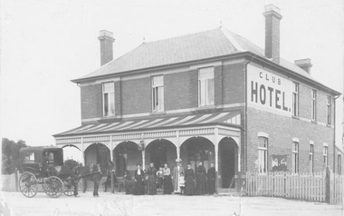 Ringwood and District Historical Society
Photograph, Club Hotel, Mount Dandenong Road, (East) Ringwood in 1897
... Club Hotel, Mount Dandenong Road, (East) Ringwood in 1897... Road, (East) Ringwood in 1897 Photograph ...Black and white photograph.(several copies) of brick hotel with veranda. Horse and card outside and group of people standing in front of veranda.Typed below one photograph, "Club Hotel Mt. Dandenong Rd. 1897". Another adds "Incorporated in present structure". A third copy is labelled "Mrs Sweeney", possible owner. -
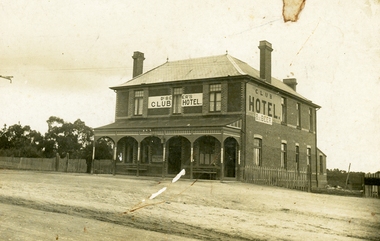 Ringwood and District Historical Society
Photograph, Club Hotel, Mount Dandenong Road, (East) Ringwood, Circa 1900
... Club Hotel, Mount Dandenong Road, (East) Ringwood, Circa... Road, (East) Ringwood, Circa 1900 Photograph ...Brick hotel with veranda. Sign above veranda reads "De Beer's Club Hotel" Sign on side of building reads, "Club Hotel - De Beer"(De Beer added to original Club Hotel sign - See item #2819 for earlier photo)Was H006. Photographed by "The Studio of Ringwood" -
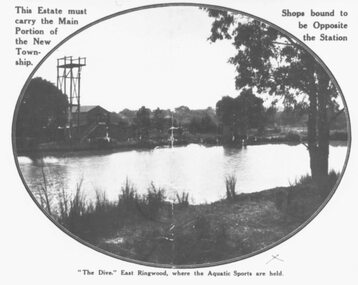 Ringwood and District Historical Society
Photograph, "The Dive" East Ringwood, Knaith Road. (1924/5)
... "The Dive" East Ringwood, Knaith Road. (1924/5)...." East Ringwood, Knaith Road. (1924/5). Photograph ...Black and white photograph. See also VC 2975 (Images RE 0026 and RE 0028) Typed directly below photograph, "'The Dive' East Ringwood, where the Aquatic Sports are held". Typed on mounting sheet below photograph, "'The Dive' East Ringwood, Knaith Rd. where the aquatic sports were held was a clayhole from a brickworks. Note diving tower. Building to left was part of the brickworks complex. Later the site of the East Ringwood Community Centre". One copy marked 1924, another "1925?" -
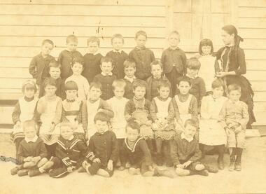 Ringwood and District Historical Society
Photograph, Miss Cass with pupils of Mr. Cass's school, corner Main Road and Everard Road East Ringwood, 1888
... Road and Everard Road East Ringwood, 1888.... school, corner Main Road and Everard Road East Ringwood, 1888 ...Typed below photograph, "Mr. Cass's school, corner Main Rd. and Everard Rd. 1888". Notes on other copies read, "Miss Cass with scholars at school opposite Mr. Molloy's, Ringwood -
 Ringwood and District Historical Society
Photograph, Maroondah Highway West, Ringwood- c1948. Looking East from Heatherdale Road
... Maroondah Highway West, Ringwood- c1948. Looking East from.... Looking East from Heatherdale Road. Photograph ...Black and white photograph (2 copies)Typed below photograph: "Maroondah Highway. Taken from near Heatherdale Road - 1948". Written on back of another copy, "Coming into Ringwood". -
 Ringwood and District Historical Society
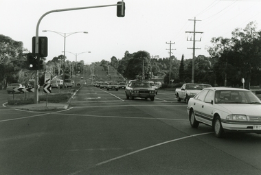
Photograph, Maroondah Highway, Ringwood, looking east from Oban Road - 1999
... Maroondah Highway, Ringwood, looking east from Oban Road... Road Ringwood North melbourne Looking East along Maroondah ...Looking East along Maroondah Highway, near the corner of Oban Road in December 1999 -
 Ringwood and District Historical Society
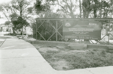
Photographs, Army Depot, Dublin Road, East Ringwood in 1999
... Army Depot, Dublin Road, East Ringwood in 1999..., Royal Australian Engineers Army Depot, Dublin Road, East ...4th Combat Engineer Regiment, Royal Australian Engineers -
 Ringwood and District Historical Society
Photographs, Old Lilydale road, East Ringwood in 1999
... Old Lilydale road, East Ringwood in 1999... Road Ringwood North melbourne Old Lilydale road, East Ringwood ... -
 Ringwood and District Historical Society
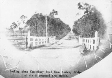
Photograph, Image used for land sale promotion of Coleman's Heathmont Estate, looking east along Canterbury Road, Heathmont, towards Bedford Road. Sale 15/12/1923 by Public Auction
... Estate, looking east along Canterbury Road, Heathmont, towards... of Coleman's Heathmont Estate, looking east along Canterbury Road ...Written on back of photograph, "Coleman's Heathmont Estate, looking towards Bedford Rd. Sale 15/12/1923 by Public Auction". -
 Ringwood and District Historical Society
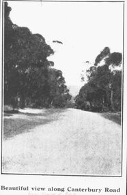
Photograph, Image used for land sale promotion of Coleman's Heathmont Estate, looking east along Canterbury Road, Heathmont. Sale 15/12/1923 by Public Auction
... Estate, looking east along Canterbury Road, Heathmont. Sale 15... Road Ringwood North melbourne Catalogue card reads, "Coleman's ...Catalogue card reads, "Coleman's Heathmont Estate - 1923. Sale 15/12/1923." -
 Ringwood and District Historical Society
Photograph, Maroondah Highway West, Ringwood- 1969. Looking east from Heatherdale Road
... Maroondah Highway West, Ringwood- 1969. Looking east from..., Ringwood- 1969. Looking east from Heatherdale Road. Photograph ...Black and white photographWritten on back of photograph: "May, 1969" -
 Ringwood and District Historical Society
Photograph, Maroondah Highway West, Ringwood- 1960. Looking east from Heatherdale Road
... Maroondah Highway West, Ringwood- 1960. Looking east from... Road Ringwood North melbourne Written on back of photograph ...Black and white photographWritten on back of photograph: "Maroondah Highway coming into Ringwood, 1960". -
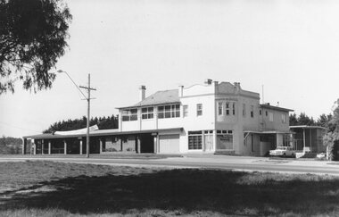 Ringwood and District Historical Society
Photograph, Club Hotel, Mount Dandenong Road, East Ringwood in November 1969
... Club Hotel, Mount Dandenong Road, East Ringwood in November..., East Ringwood in November 1969 Club Hotel, Mount Dandenong Road ...Club Hotel, East Ringwood in November 1969Written on backing sheet, "Club 1969. Site originally marked out as local cemetery 1871. Hotel built as single storey 1877" The hotel has a long association with the Reddish family, thus given the name of "Daisy's Hotel". Ryman Healthcare bought the site in 2019, including the garden supply business next door, making up a 2.2ha area. The proposal was for a $220 million retirement village to be built. The location is next to Ringwood Lake with the old hotel being knocked down in the early 2020s. Was H17 in previous numbering system.