Showing 1290 items matching "george main"
-
 Eltham District Historical Society Inc
Photograph - Aerial Photograph, Landata, Eltham; Crown Allotment 15, Section 5, Parish of Nillumbik (Stokes Orchard Estate), Apr. 1978
Centred on present day Diosma Rd, Stokes Pl, Nyora Rd and Eucalyptus Rd Historic Aerial Imagery Source: Landata.vic.gov.au Aerial Photo Details: Project No :1368 Project : DIAMOND CREEK Run : 5 Frame : 71 Date : 03/1975 Film Type : B/W Camera : RC8 Flying Height : 2200 Scale : 4000 Film Number : 3279 GDA2020 : 37°42'50"S, 145°09'36"E MGA2020 : 337821, 5824325 (55) Melways : 22 B5 (ed. 42) A History of the Development of Crown Allotment 15, Section 5, Parish of Nillumbik – Stokes Orchard Crown Allotment 15, Section 5, Parish of Nillumbik (CA15) is a square allotment of 158 acres or approximately a quarter of a square mile. It lies just beyond the eastern end of Pitt Street, south of Nyora Road to the northern end of Eucalyptus Road and extends east from Eucalyptus Road to Reynolds Road. The topography of CA15 is generally steep, sloping up to a hill near the centre of the land, the ridgeline passing through the properties along the southern side of Diosma Road. Eucalyptus Road is a straight north-south road with its northern end at the north west corner of CA15. Until the end of the 1970s this road was an un-named Government Road and was largely not open to traffic. With residential development in the 1970s the road was constructed, and the council allocated the name obviously in recognition of the predominant species of the local bushland. CA15 was purchased from the Crown by George D’Arley Boursiquot, a prominent Melbourne printer, on 28th October 1852. On November 23, 1922, former Member for Gippsland and Melbourne Real Estate Agent, Hubert Patrick Keogh purchased the allotment then sold it March 13, 1925, to local farmer, Robert David Taylor, a former Shire of Eltham Councillor (1911-1920) and Shire President (1919). Taylor had extensive land holdings stretching west towards Bible Street and Main Road. The Taylor home was situated at the top of the hill in Bible Street at present day 82 Bible Street. At the time of Taylor’s purchase in 1925, CA15 was subdivided into 48 lots that could be described as small rural properties or large residential lots. A typical lot size was one hectare or 2.5 acres. The subdivision created two roads, Nyora Road, and Diosma Road, each following an irregular alignment between Eucalyptus and Reynolds Roads. However, the lots were not sold off separately nor were the roads constructed. The land effectively remained as one parcel for many further years. Robert David Taylor died November 30, 1934, and probate was granted to his son of the same name, Robert David Taylor of Bible Street, Salesman and William McLelland Vance Taylor of 73 Emmeline Street, Northcote, Clerk, with the transfer of the land into their names on July 8, 1935. Frank Stokes worked as a qualified accountant at Kennons leather factory in Burnley, while living at 1 Thomas Street, Mitcham. He suffered from migraines and wanted to return to working the land (he had previously worked on farms and orchards since coming to Australia from England in 1926, both in WA and Vic.). He first travelled to the district by train in July 1942 to find land with the intention to establish an orchard. By chance he met Arthur Bird of Bird Orchard (bounded by Pitt Street, Eucalyptus Road, and Wattle Grove) and they got talking over their common interest. Arthur put Frank up for the night and pointed out the land, 158 acres- part of the Taylor Estate- £900, Crown Allotment 15, Section 5, Parish of Nillumbik (CA15) somewhat diagonally opposite Bird Orchard. Stokes applied through the Riverina Agency to purchase the land who in turn applied for permission from Canberra to sell as there was a new government regulation introduced during the Second World War banning land sales except for immediate production. Stokes obtained a loan on his Mitcham house of £600 @ 5% and paid £450 deposit with quarterly payments of £15 spread over 5 years. Stokes was assisted and advised by Arthur Bird who farmed the neighbouring orchard. In early 1943 Stokes took possession and would catch the train out to Eltham on Fridays after work and began building a hut on the corner of Nyora Road and the Government Road (Eucalyptus Road) for shelter and to lock up tools. He established an orchard on the central western part of the land through the centre of which ran a natural waterway (part of the present-day linear park) and was able to pay a neighbour (Hawkins) to help with clearing and fencing 25 acres, and with a horse and single furrowed plough, planted approximately 2,500 fruit trees - cherries, peaches, plums, almonds, pears, apricots and lemons as well as a few apples and oranges; a massive task. Aerial photographs from the 1940s through to the 1990s clearly show the orchard with most of the larger CA15 site remaining as natural bushland. A huge problem was hares and rabbits eating all the new buds off the tiny trees. As well as laying poison he painted the trees with a mixture of cow manure and lime, often working by moonlight. Procurement of wire and wire netting was difficult because of the war but after much effort he obtained a permit from the Agricultural Department for supplies in March 1944. In February 1945 Stokes applied for a permit to build a “packing shed” as no house building was allowed. It was to be 33 feet x 21 feet and cost £312. It was constructed mostly from second-hand materials, which were hard to obtain, especially iron for roofing. Stokes finished work at Kennons on October 31, 1945, and in March 1946 he sold the family home at Mitcham for £1,230 plus £170 for furniture. On May 15, 1946, title to the CA15 property was issued to Frank Howard Alfred Stokes, Orchardist and Gladys Ethel Stokes, Married Woman, both of Pitt Street, Eltham. The family of five then moved into the very unfinished “packing shed” at Eltham, which was a struggle to weatherproof. Eventually rooms were divided off and lined with hessian bags and whitewashed. Their income was firewood (cut and sold), selling rockery stones and cut Sweet Bursaria. (It was discovered during the 1940s that Sweet Bursaria contained the sunscreen compound Aesculin. The RAAF utilised this compound from Sweet Bursaria during WW2 for pilots and gunners.) The orchard’s first fruit sale was a half-case of Le Vanq peaches in December 1947 for the price of 8 shillings. In 1956 plans for house were drawn and Glen Iris bricks purchased (1956 Olympic Rings variant). The building of the house commenced in 1957 - 12 feet of original packing shed was removed – and was completed in 1959. Water was connected from newly built pressure storage on the property at the end of 1959 and the electricity connection for the first time at 3pm on April 29, 1960. The house remains to present day (somewhat modified) at 1 Nyora Road, home to Nyora Studio Gallery. On occasions, spare remnants of the 1956 bricks have been known to be unearthed in gardens on the estate as they were utilised by Frank Stokes to fill in rabbit holes. On May 26, 1950, a parcel of land was compulsorily acquired by the Melbourne and Metropolitan Board of Works on the hilltop to establish an easement for a high-level service reservoir to augment Eltham’s water supply. The project also included pipe tracks for the necessary water mains. The reservoir has now been superseded by higher level water tanks east of Reynolds Road and its former site is now a public reserve. On November 27, 1964, the State Electricity Commission served notice to compulsorily acquire a further parcel through the eastern part of the land for a major electricity transmission line that augmented supply from the La Trobe Valley to Melbourne. The easement was registered February 11, 1966. The easement was widened July 18, 1969 for a second transmission line to be constructed. In 1971 Melbourne Metropolitan Planning Scheme amendments adopted Nyora Road as the boundary between a residential zone to the north and a rural zone to the south. This determined the future development of the land. In the mid-1970s the Shire of Eltham divided the orchard into numerous rate-able parcel lots, the 48 lots having been established in 1925 and the subsequent rates assessment proved unsustainable for Stokes. He commenced selling lots outside the boundary of the orchard, north of Diosma and South of Nyora. However shortly later the land between Nyora and Diosma Roads and west of the electricity easement was sold and subdivided into residential lots, a housing development by Macquarie Builders and marketed as the Stokes Orchard Estate. New streets were created, and most were named after trees, although one, Stokes Place, commemorates the former owners. The development was undertaken in two stages; Stage 1 (1975) encompassing Scarlet Ash Court, Ironbark Close and Peppermint Grove bounded by Nyora and Eucalyptus roads and Stage 2 (1978) encompassing Stokes Place, Orchard Way, The Crest and The Lookout bound by Nyora and Diosma roads. The developer, Macquarie Builders went bankrupt shortly after the release of Stage 2 leaving many purchasers to fend for themselves and arrange for their own independent builders. There were also difficulties with sewerage for the land immediately south of Diosma Road and so the conventional residential lots were abandoned in favour of larger lots. The development of Orchard Way, The Crest and The Lookout did not proceed as planned and the proposed lots were incorporated into five-acre parcels instead. These included a low-density group housing development by the Graves family and the award winning Choong House (1983) with Gordon Ford developed garden immediately next door situated on the ridge of the hill nestled amongst the original bush, Eucalypt trees and Sweet Bursaria. In 1994, Nillumbik Shire Council applied Significant Environment and Significant Landscape overlays upon the properties on the south side of Diosma Road to ensure protection of this natural bush garden environment. With the arrival of the sewer along Diosma Road in the 1990s, most of these five-acre parcels have since been subdivided multiple times. The Choong house presently sits on a 2.7-acre property, which in 2022 Nillumbik Council nominated for Cultural Significance Heritage protection and is considered potentially significant at State level. The Stokes family were also associated with the Eltham Christian Church. In the 1970s this church had met in temporary premises in Eltham. Lots of the original 1925 subdivision remained south of Nyora Road and a number of these lots were utilized for the Eltham Christian School, which was established by the Eltham Christian Church in 1981. The school operated on this site until 2000. The premises are now used by The Vine Baptist Church. By the mid-1980s the whole of CA15 had been developed for residential and school purposes, except for the sections north of Diosma Road and between the transmission lines and Reynolds Road. Sewerage issues had been resolved for the section north of Diosma Road and in 1987 it was in the process of being subdivided into residential lots. The development coincided with the discovery of colonies of the rare and endangered Eltham Copper Butterfly on the site. This resulted in a community and political campaign to save the butterfly habitat. With the co-operation of the land developer the subdivision was altered to create two bushland reserves in the critical butterfly habitat areas. In the late 1980s the State Government was investigating options for establishing a metropolitan ring road link between Diamond Creek and Ringwood. The chosen route was adjacent to Reynolds Road and so this created a freeze on development of CA15 between Reynolds Road and the electricity easement. The ring road proposal was eventually abandoned, and this part of the land was subdivided into low density residential lots. Diosma Road has been discontinued at the electricity easement and the eastern part incorporated into View Mount Court with access from Reynolds Road. The whole of CA15 has now been developed for residential or associated purposes, ranging from conventional density to quite low density south of Nyora Road. Some remnants of the orchard remain, a few cherry trees on the Graves property and a lone apple tree in Stokes Place. The butterfly reserves comprise significant areas of remnant bushland. Linear reserves through the estate link with central Eltham via the Woodridge linear reserve and with Research along the electricity easement. CA15 as it exists today has a complicated history of rural use, Government acquisition, urban development, and community action. References: • “Stokes Orchard, an incomplete history”; Russell Yeoman with Doug Orford • Correspondence, Beryl Bradbury (nee Stokes) • Aerial Photographs, 1931-1991, Landata (landata.vic.gov.au) • Certificate of Title, Vol. 4930 Fol. 985900 • Plan Number LP 10859 aerial photo, diosma road, eltham copper butterfly, eucalyptus road, ironbark close, nyora road, peppermint grove, peter & elizabeth pidgeon collection, power transmission lines, reynolds road, scarlet ash court, stokes orchard estate, stokes place, woodridge estate, frank stokes -
 Eltham District Historical Society Inc
Photograph - Aerial Photograph, Landata, Eltham; Crown Allotment 15, Section 5, Parish of Nillumbik (Stokes Orchard Estate), Feb. 1979
Centred on present day Diosma Rd, Stokes Pl, Nyora Rd and Eucalyptus Rd Historic Aerial Imagery Source: Landata.vic.gov.au Aerial Photo Details: Project No :1716 Project : WESTERN PORT FORESHORES Run : 15 Frame : 91 Date : 02/1979 Film Type : B/W Camera : RC8 Flying Height : 5500 Scale : 10000 Film Number : 3286 GDA2020 : 37°42'47"S, 145°09'57"E MGA2020 : 338339, 5824447 (55) Melways : 22 C4 (ed. 42) A History of the Development of Crown Allotment 15, Section 5, Parish of Nillumbik – Stokes Orchard Crown Allotment 15, Section 5, Parish of Nillumbik (CA15) is a square allotment of 158 acres or approximately a quarter of a square mile. It lies just beyond the eastern end of Pitt Street, south of Nyora Road to the northern end of Eucalyptus Road and extends east from Eucalyptus Road to Reynolds Road. The topography of CA15 is generally steep, sloping up to a hill near the centre of the land, the ridgeline passing through the properties along the southern side of Diosma Road. Eucalyptus Road is a straight north-south road with its northern end at the north west corner of CA15. Until the end of the 1970s this road was an un-named Government Road and was largely not open to traffic. With residential development in the 1970s the road was constructed, and the council allocated the name obviously in recognition of the predominant species of the local bushland. CA15 was purchased from the Crown by George D’Arley Boursiquot, a prominent Melbourne printer, on 28th October 1852. On November 23, 1922, former Member for Gippsland and Melbourne Real Estate Agent, Hubert Patrick Keogh purchased the allotment then sold it March 13, 1925, to local farmer, Robert David Taylor, a former Shire of Eltham Councillor (1911-1920) and Shire President (1919). Taylor had extensive land holdings stretching west towards Bible Street and Main Road. The Taylor home was situated at the top of the hill in Bible Street at present day 82 Bible Street. At the time of Taylor’s purchase in 1925, CA15 was subdivided into 48 lots that could be described as small rural properties or large residential lots. A typical lot size was one hectare or 2.5 acres. The subdivision created two roads, Nyora Road, and Diosma Road, each following an irregular alignment between Eucalyptus and Reynolds Roads. However, the lots were not sold off separately nor were the roads constructed. The land effectively remained as one parcel for many further years. Robert David Taylor died November 30, 1934, and probate was granted to his son of the same name, Robert David Taylor of Bible Street, Salesman and William McLelland Vance Taylor of 73 Emmeline Street, Northcote, Clerk, with the transfer of the land into their names on July 8, 1935. Frank Stokes worked as a qualified accountant at Kennons leather factory in Burnley, while living at 1 Thomas Street, Mitcham. He suffered from migraines and wanted to return to working the land (he had previously worked on farms and orchards since coming to Australia from England in 1926, both in WA and Vic.). He first travelled to the district by train in July 1942 to find land with the intention to establish an orchard. By chance he met Arthur Bird of Bird Orchard (bounded by Pitt Street, Eucalyptus Road, and Wattle Grove) and they got talking over their common interest. Arthur put Frank up for the night and pointed out the land, 158 acres- part of the Taylor Estate- £900, Crown Allotment 15, Section 5, Parish of Nillumbik (CA15) somewhat diagonally opposite Bird Orchard. Stokes applied through the Riverina Agency to purchase the land who in turn applied for permission from Canberra to sell as there was a new government regulation introduced during the Second World War banning land sales except for immediate production. Stokes obtained a loan on his Mitcham house of £600 @ 5% and paid £450 deposit with quarterly payments of £15 spread over 5 years. Stokes was assisted and advised by Arthur Bird who farmed the neighbouring orchard. In early 1943 Stokes took possession and would catch the train out to Eltham on Fridays after work and began building a hut on the corner of Nyora Road and the Government Road (Eucalyptus Road) for shelter and to lock up tools. He established an orchard on the central western part of the land through the centre of which ran a natural waterway (part of the present-day linear park) and was able to pay a neighbour (Hawkins) to help with clearing and fencing 25 acres, and with a horse and single furrowed plough, planted approximately 2,500 fruit trees - cherries, peaches, plums, almonds, pears, apricots and lemons as well as a few apples and oranges; a massive task. Aerial photographs from the 1940s through to the 1990s clearly show the orchard with most of the larger CA15 site remaining as natural bushland. A huge problem was hares and rabbits eating all the new buds off the tiny trees. As well as laying poison he painted the trees with a mixture of cow manure and lime, often working by moonlight. Procurement of wire and wire netting was difficult because of the war but after much effort he obtained a permit from the Agricultural Department for supplies in March 1944. In February 1945 Stokes applied for a permit to build a “packing shed” as no house building was allowed. It was to be 33 feet x 21 feet and cost £312. It was constructed mostly from second-hand materials, which were hard to obtain, especially iron for roofing. Stokes finished work at Kennons on October 31, 1945, and in March 1946 he sold the family home at Mitcham for £1,230 plus £170 for furniture. On May 15, 1946, title to the CA15 property was issued to Frank Howard Alfred Stokes, Orchardist and Gladys Ethel Stokes, Married Woman, both of Pitt Street, Eltham. The family of five then moved into the very unfinished “packing shed” at Eltham, which was a struggle to weatherproof. Eventually rooms were divided off and lined with hessian bags and whitewashed. Their income was firewood (cut and sold), selling rockery stones and cut Sweet Bursaria. (It was discovered during the 1940s that Sweet Bursaria contained the sunscreen compound Aesculin. The RAAF utilised this compound from Sweet Bursaria during WW2 for pilots and gunners.) The orchard’s first fruit sale was a half-case of Le Vanq peaches in December 1947 for the price of 8 shillings. In 1956 plans for house were drawn and Glen Iris bricks purchased (1956 Olympic Rings variant). The building of the house commenced in 1957 - 12 feet of original packing shed was removed – and was completed in 1959. Water was connected from newly built pressure storage on the property at the end of 1959 and the electricity connection for the first time at 3pm on April 29, 1960. The house remains to present day (somewhat modified) at 1 Nyora Road, home to Nyora Studio Gallery. On occasions, spare remnants of the 1956 bricks have been known to be unearthed in gardens on the estate as they were utilised by Frank Stokes to fill in rabbit holes. On May 26, 1950, a parcel of land was compulsorily acquired by the Melbourne and Metropolitan Board of Works on the hilltop to establish an easement for a high-level service reservoir to augment Eltham’s water supply. The project also included pipe tracks for the necessary water mains. The reservoir has now been superseded by higher level water tanks east of Reynolds Road and its former site is now a public reserve. On November 27, 1964, the State Electricity Commission served notice to compulsorily acquire a further parcel through the eastern part of the land for a major electricity transmission line that augmented supply from the La Trobe Valley to Melbourne. The easement was registered February 11, 1966. The easement was widened July 18, 1969 for a second transmission line to be constructed. In 1971 Melbourne Metropolitan Planning Scheme amendments adopted Nyora Road as the boundary between a residential zone to the north and a rural zone to the south. This determined the future development of the land. In the mid-1970s the Shire of Eltham divided the orchard into numerous rate-able parcel lots, the 48 lots having been established in 1925 and the subsequent rates assessment proved unsustainable for Stokes. He commenced selling lots outside the boundary of the orchard, north of Diosma and South of Nyora. However shortly later the land between Nyora and Diosma Roads and west of the electricity easement was sold and subdivided into residential lots, a housing development by Macquarie Builders and marketed as the Stokes Orchard Estate. New streets were created, and most were named after trees, although one, Stokes Place, commemorates the former owners. The development was undertaken in two stages; Stage 1 (1975) encompassing Scarlet Ash Court, Ironbark Close and Peppermint Grove bounded by Nyora and Eucalyptus roads and Stage 2 (1978) encompassing Stokes Place, Orchard Way, The Crest and The Lookout bound by Nyora and Diosma roads. The developer, Macquarie Builders went bankrupt shortly after the release of Stage 2 leaving many purchasers to fend for themselves and arrange for their own independent builders. There were also difficulties with sewerage for the land immediately south of Diosma Road and so the conventional residential lots were abandoned in favour of larger lots. The development of Orchard Way, The Crest and The Lookout did not proceed as planned and the proposed lots were incorporated into five-acre parcels instead. These included a low-density group housing development by the Graves family and the award winning Choong House (1983) with Gordon Ford developed garden immediately next door situated on the ridge of the hill nestled amongst the original bush, Eucalypt trees and Sweet Bursaria. In 1994, Nillumbik Shire Council applied Significant Environment and Significant Landscape overlays upon the properties on the south side of Diosma Road to ensure protection of this natural bush garden environment. With the arrival of the sewer along Diosma Road in the 1990s, most of these five-acre parcels have since been subdivided multiple times. The Choong house presently sits on a 2.7-acre property, which in 2022 Nillumbik Council nominated for Cultural Significance Heritage protection and is considered potentially significant at State level. The Stokes family were also associated with the Eltham Christian Church. In the 1970s this church had met in temporary premises in Eltham. Lots of the original 1925 subdivision remained south of Nyora Road and a number of these lots were utilized for the Eltham Christian School, which was established by the Eltham Christian Church in 1981. The school operated on this site until 2000. The premises are now used by The Vine Baptist Church. By the mid-1980s the whole of CA15 had been developed for residential and school purposes, except for the sections north of Diosma Road and between the transmission lines and Reynolds Road. Sewerage issues had been resolved for the section north of Diosma Road and in 1987 it was in the process of being subdivided into residential lots. The development coincided with the discovery of colonies of the rare and endangered Eltham Copper Butterfly on the site. This resulted in a community and political campaign to save the butterfly habitat. With the co-operation of the land developer the subdivision was altered to create two bushland reserves in the critical butterfly habitat areas. In the late 1980s the State Government was investigating options for establishing a metropolitan ring road link between Diamond Creek and Ringwood. The chosen route was adjacent to Reynolds Road and so this created a freeze on development of CA15 between Reynolds Road and the electricity easement. The ring road proposal was eventually abandoned, and this part of the land was subdivided into low density residential lots. Diosma Road has been discontinued at the electricity easement and the eastern part incorporated into View Mount Court with access from Reynolds Road. The whole of CA15 has now been developed for residential or associated purposes, ranging from conventional density to quite low density south of Nyora Road. Some remnants of the orchard remain, a few cherry trees on the Graves property and a lone apple tree in Stokes Place. The butterfly reserves comprise significant areas of remnant bushland. Linear reserves through the estate link with central Eltham via the Woodridge linear reserve and with Research along the electricity easement. CA15 as it exists today has a complicated history of rural use, Government acquisition, urban development, and community action. References: • “Stokes Orchard, an incomplete history”; Russell Yeoman with Doug Orford • Correspondence, Beryl Bradbury (nee Stokes) • Aerial Photographs, 1931-1991, Landata (landata.vic.gov.au) • Certificate of Title, Vol. 4930 Fol. 985900 • Plan Number LP 10859 aerial photo, diosma road, eltham copper butterfly, eucalyptus road, ironbark close, nyora road, peppermint grove, peter & elizabeth pidgeon collection, power transmission lines, reynolds road, scarlet ash court, stokes orchard estate, stokes place, woodridge estate, frank stokes -
 Eltham District Historical Society Inc
Photograph - Aerial Photograph, Landata, Eltham; Crown Allotment 15, Section 5, Parish of Nillumbik (Stokes Orchard Estate), Jan. 1984
Centred on present day Diosma Rd, Stokes Pl, Nyora Rd and Eucalyptus Rd Historic Aerial Imagery Source: Landata.vic.gov.au Aerial Photo Details: Project No :1716 Project : WESTERN PORT FORESHORES Run : 15 Frame : 70 Date : 01/1984 Film Type : B/W Camera : RC8 Flying Height : 5300 Scale : 10000 Film Number : 3833 GDA2020 : 37°42'38"S, 145°10'09"E MGA2020 : 338612, 5824719 (55) Melways : 22 D4 (ed. 42) A History of the Development of Crown Allotment 15, Section 5, Parish of Nillumbik – Stokes Orchard Crown Allotment 15, Section 5, Parish of Nillumbik (CA15) is a square allotment of 158 acres or approximately a quarter of a square mile. It lies just beyond the eastern end of Pitt Street, south of Nyora Road to the northern end of Eucalyptus Road and extends east from Eucalyptus Road to Reynolds Road. The topography of CA15 is generally steep, sloping up to a hill near the centre of the land, the ridgeline passing through the properties along the southern side of Diosma Road. Eucalyptus Road is a straight north-south road with its northern end at the north west corner of CA15. Until the end of the 1970s this road was an un-named Government Road and was largely not open to traffic. With residential development in the 1970s the road was constructed, and the council allocated the name obviously in recognition of the predominant species of the local bushland. CA15 was purchased from the Crown by George D’Arley Boursiquot, a prominent Melbourne printer, on 28th October 1852. On November 23, 1922, former Member for Gippsland and Melbourne Real Estate Agent, Hubert Patrick Keogh purchased the allotment then sold it March 13, 1925, to local farmer, Robert David Taylor, a former Shire of Eltham Councillor (1911-1920) and Shire President (1919). Taylor had extensive land holdings stretching west towards Bible Street and Main Road. The Taylor home was situated at the top of the hill in Bible Street at present day 82 Bible Street. At the time of Taylor’s purchase in 1925, CA15 was subdivided into 48 lots that could be described as small rural properties or large residential lots. A typical lot size was one hectare or 2.5 acres. The subdivision created two roads, Nyora Road, and Diosma Road, each following an irregular alignment between Eucalyptus and Reynolds Roads. However, the lots were not sold off separately nor were the roads constructed. The land effectively remained as one parcel for many further years. Robert David Taylor died November 30, 1934, and probate was granted to his son of the same name, Robert David Taylor of Bible Street, Salesman and William McLelland Vance Taylor of 73 Emmeline Street, Northcote, Clerk, with the transfer of the land into their names on July 8, 1935. Frank Stokes worked as a qualified accountant at Kennons leather factory in Burnley, while living at 1 Thomas Street, Mitcham. He suffered from migraines and wanted to return to working the land (he had previously worked on farms and orchards since coming to Australia from England in 1926, both in WA and Vic.). He first travelled to the district by train in July 1942 to find land with the intention to establish an orchard. By chance he met Arthur Bird of Bird Orchard (bounded by Pitt Street, Eucalyptus Road, and Wattle Grove) and they got talking over their common interest. Arthur put Frank up for the night and pointed out the land, 158 acres- part of the Taylor Estate- £900, Crown Allotment 15, Section 5, Parish of Nillumbik (CA15) somewhat diagonally opposite Bird Orchard. Stokes applied through the Riverina Agency to purchase the land who in turn applied for permission from Canberra to sell as there was a new government regulation introduced during the Second World War banning land sales except for immediate production. Stokes obtained a loan on his Mitcham house of £600 @ 5% and paid £450 deposit with quarterly payments of £15 spread over 5 years. Stokes was assisted and advised by Arthur Bird who farmed the neighbouring orchard. In early 1943 Stokes took possession and would catch the train out to Eltham on Fridays after work and began building a hut on the corner of Nyora Road and the Government Road (Eucalyptus Road) for shelter and to lock up tools. He established an orchard on the central western part of the land through the centre of which ran a natural waterway (part of the present-day linear park) and was able to pay a neighbour (Hawkins) to help with clearing and fencing 25 acres, and with a horse and single furrowed plough, planted approximately 2,500 fruit trees - cherries, peaches, plums, almonds, pears, apricots and lemons as well as a few apples and oranges; a massive task. Aerial photographs from the 1940s through to the 1990s clearly show the orchard with most of the larger CA15 site remaining as natural bushland. A huge problem was hares and rabbits eating all the new buds off the tiny trees. As well as laying poison he painted the trees with a mixture of cow manure and lime, often working by moonlight. Procurement of wire and wire netting was difficult because of the war but after much effort he obtained a permit from the Agricultural Department for supplies in March 1944. In February 1945 Stokes applied for a permit to build a “packing shed” as no house building was allowed. It was to be 33 feet x 21 feet and cost £312. It was constructed mostly from second-hand materials, which were hard to obtain, especially iron for roofing. Stokes finished work at Kennons on October 31, 1945, and in March 1946 he sold the family home at Mitcham for £1,230 plus £170 for furniture. On May 15, 1946, title to the CA15 property was issued to Frank Howard Alfred Stokes, Orchardist and Gladys Ethel Stokes, Married Woman, both of Pitt Street, Eltham. The family of five then moved into the very unfinished “packing shed” at Eltham, which was a struggle to weatherproof. Eventually rooms were divided off and lined with hessian bags and whitewashed. Their income was firewood (cut and sold), selling rockery stones and cut Sweet Bursaria. (It was discovered during the 1940s that Sweet Bursaria contained the sunscreen compound Aesculin. The RAAF utilised this compound from Sweet Bursaria during WW2 for pilots and gunners.) The orchard’s first fruit sale was a half-case of Le Vanq peaches in December 1947 for the price of 8 shillings. In 1956 plans for house were drawn and Glen Iris bricks purchased (1956 Olympic Rings variant). The building of the house commenced in 1957 - 12 feet of original packing shed was removed – and was completed in 1959. Water was connected from newly built pressure storage on the property at the end of 1959 and the electricity connection for the first time at 3pm on April 29, 1960. The house remains to present day (somewhat modified) at 1 Nyora Road, home to Nyora Studio Gallery. On occasions, spare remnants of the 1956 bricks have been known to be unearthed in gardens on the estate as they were utilised by Frank Stokes to fill in rabbit holes. On May 26, 1950, a parcel of land was compulsorily acquired by the Melbourne and Metropolitan Board of Works on the hilltop to establish an easement for a high-level service reservoir to augment Eltham’s water supply. The project also included pipe tracks for the necessary water mains. The reservoir has now been superseded by higher level water tanks east of Reynolds Road and its former site is now a public reserve. On November 27, 1964, the State Electricity Commission served notice to compulsorily acquire a further parcel through the eastern part of the land for a major electricity transmission line that augmented supply from the La Trobe Valley to Melbourne. The easement was registered February 11, 1966. The easement was widened July 18, 1969 for a second transmission line to be constructed. In 1971 Melbourne Metropolitan Planning Scheme amendments adopted Nyora Road as the boundary between a residential zone to the north and a rural zone to the south. This determined the future development of the land. In the mid-1970s the Shire of Eltham divided the orchard into numerous rate-able parcel lots, the 48 lots having been established in 1925 and the subsequent rates assessment proved unsustainable for Stokes. He commenced selling lots outside the boundary of the orchard, north of Diosma and South of Nyora. However shortly later the land between Nyora and Diosma Roads and west of the electricity easement was sold and subdivided into residential lots, a housing development by Macquarie Builders and marketed as the Stokes Orchard Estate. New streets were created, and most were named after trees, although one, Stokes Place, commemorates the former owners. The development was undertaken in two stages; Stage 1 (1975) encompassing Scarlet Ash Court, Ironbark Close and Peppermint Grove bounded by Nyora and Eucalyptus roads and Stage 2 (1978) encompassing Stokes Place, Orchard Way, The Crest and The Lookout bound by Nyora and Diosma roads. The developer, Macquarie Builders went bankrupt shortly after the release of Stage 2 leaving many purchasers to fend for themselves and arrange for their own independent builders. There were also difficulties with sewerage for the land immediately south of Diosma Road and so the conventional residential lots were abandoned in favour of larger lots. The development of Orchard Way, The Crest and The Lookout did not proceed as planned and the proposed lots were incorporated into five-acre parcels instead. These included a low-density group housing development by the Graves family and the award winning Choong House (1983) with Gordon Ford developed garden immediately next door situated on the ridge of the hill nestled amongst the original bush, Eucalypt trees and Sweet Bursaria. In 1994, Nillumbik Shire Council applied Significant Environment and Significant Landscape overlays upon the properties on the south side of Diosma Road to ensure protection of this natural bush garden environment. With the arrival of the sewer along Diosma Road in the 1990s, most of these five-acre parcels have since been subdivided multiple times. The Choong house presently sits on a 2.7-acre property, which in 2022 Nillumbik Council nominated for Cultural Significance Heritage protection and is considered potentially significant at State level. The Stokes family were also associated with the Eltham Christian Church. In the 1970s this church had met in temporary premises in Eltham. Lots of the original 1925 subdivision remained south of Nyora Road and a number of these lots were utilized for the Eltham Christian School, which was established by the Eltham Christian Church in 1981. The school operated on this site until 2000. The premises are now used by The Vine Baptist Church. By the mid-1980s the whole of CA15 had been developed for residential and school purposes, except for the sections north of Diosma Road and between the transmission lines and Reynolds Road. Sewerage issues had been resolved for the section north of Diosma Road and in 1987 it was in the process of being subdivided into residential lots. The development coincided with the discovery of colonies of the rare and endangered Eltham Copper Butterfly on the site. This resulted in a community and political campaign to save the butterfly habitat. With the co-operation of the land developer the subdivision was altered to create two bushland reserves in the critical butterfly habitat areas. In the late 1980s the State Government was investigating options for establishing a metropolitan ring road link between Diamond Creek and Ringwood. The chosen route was adjacent to Reynolds Road and so this created a freeze on development of CA15 between Reynolds Road and the electricity easement. The ring road proposal was eventually abandoned, and this part of the land was subdivided into low density residential lots. Diosma Road has been discontinued at the electricity easement and the eastern part incorporated into View Mount Court with access from Reynolds Road. The whole of CA15 has now been developed for residential or associated purposes, ranging from conventional density to quite low density south of Nyora Road. Some remnants of the orchard remain, a few cherry trees on the Graves property and a lone apple tree in Stokes Place. The butterfly reserves comprise significant areas of remnant bushland. Linear reserves through the estate link with central Eltham via the Woodridge linear reserve and with Research along the electricity easement. CA15 as it exists today has a complicated history of rural use, Government acquisition, urban development, and community action. References: • “Stokes Orchard, an incomplete history”; Russell Yeoman with Doug Orford • Correspondence, Beryl Bradbury (nee Stokes) • Aerial Photographs, 1931-1991, Landata (landata.vic.gov.au) • Certificate of Title, Vol. 4930 Fol. 985900 • Plan Number LP 10859 aerial photo, diosma road, eltham copper butterfly, eucalyptus road, ironbark close, nyora road, peppermint grove, peter & elizabeth pidgeon collection, power transmission lines, reynolds road, scarlet ash court, stokes orchard estate, stokes place, woodridge estate, frank stokes -
 Eltham District Historical Society Inc
Photograph - Aerial Photograph, Landata, Eltham; Crown Allotment 15, Section 5, Parish of Nillumbik (Stokes Orchard Estate), Mar. 1987
Centred on present day Diosma Rd, Stokes Pl, Nyora Rd and Eucalyptus Rd Historic Aerial Imagery Source: Landata.vic.gov.au Aerial Photo Details: Project No :1716 Project : WESTERN PORT FORESHORES Run : 15 Frame : 108 Date : 03/1987 Film Type : B/W Camera : RC10 Flying Height : 5600 Scale : 10000 Film Number : 4102 GDA2020 : 37°43'00"S, 145°10'13"E MGA2020 : 338725, 5824036 (55) Melways : 22 D5 (ed. 42)719 (55) Melways : 22 D4 (ed. 42) A History of the Development of Crown Allotment 15, Section 5, Parish of Nillumbik – Stokes Orchard Crown Allotment 15, Section 5, Parish of Nillumbik (CA15) is a square allotment of 158 acres or approximately a quarter of a square mile. It lies just beyond the eastern end of Pitt Street, south of Nyora Road to the northern end of Eucalyptus Road and extends east from Eucalyptus Road to Reynolds Road. The topography of CA15 is generally steep, sloping up to a hill near the centre of the land, the ridgeline passing through the properties along the southern side of Diosma Road. Eucalyptus Road is a straight north-south road with its northern end at the north west corner of CA15. Until the end of the 1970s this road was an un-named Government Road and was largely not open to traffic. With residential development in the 1970s the road was constructed, and the council allocated the name obviously in recognition of the predominant species of the local bushland. CA15 was purchased from the Crown by George D’Arley Boursiquot, a prominent Melbourne printer, on 28th October 1852. On November 23, 1922, former Member for Gippsland and Melbourne Real Estate Agent, Hubert Patrick Keogh purchased the allotment then sold it March 13, 1925, to local farmer, Robert David Taylor, a former Shire of Eltham Councillor (1911-1920) and Shire President (1919). Taylor had extensive land holdings stretching west towards Bible Street and Main Road. The Taylor home was situated at the top of the hill in Bible Street at present day 82 Bible Street. At the time of Taylor’s purchase in 1925, CA15 was subdivided into 48 lots that could be described as small rural properties or large residential lots. A typical lot size was one hectare or 2.5 acres. The subdivision created two roads, Nyora Road, and Diosma Road, each following an irregular alignment between Eucalyptus and Reynolds Roads. However, the lots were not sold off separately nor were the roads constructed. The land effectively remained as one parcel for many further years. Robert David Taylor died November 30, 1934, and probate was granted to his son of the same name, Robert David Taylor of Bible Street, Salesman and William McLelland Vance Taylor of 73 Emmeline Street, Northcote, Clerk, with the transfer of the land into their names on July 8, 1935. Frank Stokes worked as a qualified accountant at Kennons leather factory in Burnley, while living at 1 Thomas Street, Mitcham. He suffered from migraines and wanted to return to working the land (he had previously worked on farms and orchards since coming to Australia from England in 1926, both in WA and Vic.). He first travelled to the district by train in July 1942 to find land with the intention to establish an orchard. By chance he met Arthur Bird of Bird Orchard (bounded by Pitt Street, Eucalyptus Road, and Wattle Grove) and they got talking over their common interest. Arthur put Frank up for the night and pointed out the land, 158 acres- part of the Taylor Estate- £900, Crown Allotment 15, Section 5, Parish of Nillumbik (CA15) somewhat diagonally opposite Bird Orchard. Stokes applied through the Riverina Agency to purchase the land who in turn applied for permission from Canberra to sell as there was a new government regulation introduced during the Second World War banning land sales except for immediate production. Stokes obtained a loan on his Mitcham house of £600 @ 5% and paid £450 deposit with quarterly payments of £15 spread over 5 years. Stokes was assisted and advised by Arthur Bird who farmed the neighbouring orchard. In early 1943 Stokes took possession and would catch the train out to Eltham on Fridays after work and began building a hut on the corner of Nyora Road and the Government Road (Eucalyptus Road) for shelter and to lock up tools. He established an orchard on the central western part of the land through the centre of which ran a natural waterway (part of the present-day linear park) and was able to pay a neighbour (Hawkins) to help with clearing and fencing 25 acres, and with a horse and single furrowed plough, planted approximately 2,500 fruit trees - cherries, peaches, plums, almonds, pears, apricots and lemons as well as a few apples and oranges; a massive task. Aerial photographs from the 1940s through to the 1990s clearly show the orchard with most of the larger CA15 site remaining as natural bushland. A huge problem was hares and rabbits eating all the new buds off the tiny trees. As well as laying poison he painted the trees with a mixture of cow manure and lime, often working by moonlight. Procurement of wire and wire netting was difficult because of the war but after much effort he obtained a permit from the Agricultural Department for supplies in March 1944. In February 1945 Stokes applied for a permit to build a “packing shed” as no house building was allowed. It was to be 33 feet x 21 feet and cost £312. It was constructed mostly from second-hand materials, which were hard to obtain, especially iron for roofing. Stokes finished work at Kennons on October 31, 1945, and in March 1946 he sold the family home at Mitcham for £1,230 plus £170 for furniture. On May 15, 1946, title to the CA15 property was issued to Frank Howard Alfred Stokes, Orchardist and Gladys Ethel Stokes, Married Woman, both of Pitt Street, Eltham. The family of five then moved into the very unfinished “packing shed” at Eltham, which was a struggle to weatherproof. Eventually rooms were divided off and lined with hessian bags and whitewashed. Their income was firewood (cut and sold), selling rockery stones and cut Sweet Bursaria. (It was discovered during the 1940s that Sweet Bursaria contained the sunscreen compound Aesculin. The RAAF utilised this compound from Sweet Bursaria during WW2 for pilots and gunners.) The orchard’s first fruit sale was a half-case of Le Vanq peaches in December 1947 for the price of 8 shillings. In 1956 plans for house were drawn and Glen Iris bricks purchased (1956 Olympic Rings variant). The building of the house commenced in 1957 - 12 feet of original packing shed was removed – and was completed in 1959. Water was connected from newly built pressure storage on the property at the end of 1959 and the electricity connection for the first time at 3pm on April 29, 1960. The house remains to present day (somewhat modified) at 1 Nyora Road, home to Nyora Studio Gallery. On occasions, spare remnants of the 1956 bricks have been known to be unearthed in gardens on the estate as they were utilised by Frank Stokes to fill in rabbit holes. On May 26, 1950, a parcel of land was compulsorily acquired by the Melbourne and Metropolitan Board of Works on the hilltop to establish an easement for a high-level service reservoir to augment Eltham’s water supply. The project also included pipe tracks for the necessary water mains. The reservoir has now been superseded by higher level water tanks east of Reynolds Road and its former site is now a public reserve. On November 27, 1964, the State Electricity Commission served notice to compulsorily acquire a further parcel through the eastern part of the land for a major electricity transmission line that augmented supply from the La Trobe Valley to Melbourne. The easement was registered February 11, 1966. The easement was widened July 18, 1969 for a second transmission line to be constructed. In 1971 Melbourne Metropolitan Planning Scheme amendments adopted Nyora Road as the boundary between a residential zone to the north and a rural zone to the south. This determined the future development of the land. In the mid-1970s the Shire of Eltham divided the orchard into numerous rate-able parcel lots, the 48 lots having been established in 1925 and the subsequent rates assessment proved unsustainable for Stokes. He commenced selling lots outside the boundary of the orchard, north of Diosma and South of Nyora. However shortly later the land between Nyora and Diosma Roads and west of the electricity easement was sold and subdivided into residential lots, a housing development by Macquarie Builders and marketed as the Stokes Orchard Estate. New streets were created, and most were named after trees, although one, Stokes Place, commemorates the former owners. The development was undertaken in two stages; Stage 1 (1975) encompassing Scarlet Ash Court, Ironbark Close and Peppermint Grove bounded by Nyora and Eucalyptus roads and Stage 2 (1978) encompassing Stokes Place, Orchard Way, The Crest and The Lookout bound by Nyora and Diosma roads. The developer, Macquarie Builders went bankrupt shortly after the release of Stage 2 leaving many purchasers to fend for themselves and arrange for their own independent builders. There were also difficulties with sewerage for the land immediately south of Diosma Road and so the conventional residential lots were abandoned in favour of larger lots. The development of Orchard Way, The Crest and The Lookout did not proceed as planned and the proposed lots were incorporated into five-acre parcels instead. These included a low-density group housing development by the Graves family and the award winning Choong House (1983) with Gordon Ford developed garden immediately next door situated on the ridge of the hill nestled amongst the original bush, Eucalypt trees and Sweet Bursaria. In 1994, Nillumbik Shire Council applied Significant Environment and Significant Landscape overlays upon the properties on the south side of Diosma Road to ensure protection of this natural bush garden environment. With the arrival of the sewer along Diosma Road in the 1990s, most of these five-acre parcels have since been subdivided multiple times. The Choong house presently sits on a 2.7-acre property, which in 2022 Nillumbik Council nominated for Cultural Significance Heritage protection and is considered potentially significant at State level. The Stokes family were also associated with the Eltham Christian Church. In the 1970s this church had met in temporary premises in Eltham. Lots of the original 1925 subdivision remained south of Nyora Road and a number of these lots were utilized for the Eltham Christian School, which was established by the Eltham Christian Church in 1981. The school operated on this site until 2000. The premises are now used by The Vine Baptist Church. By the mid-1980s the whole of CA15 had been developed for residential and school purposes, except for the sections north of Diosma Road and between the transmission lines and Reynolds Road. Sewerage issues had been resolved for the section north of Diosma Road and in 1987 it was in the process of being subdivided into residential lots. The development coincided with the discovery of colonies of the rare and endangered Eltham Copper Butterfly on the site. This resulted in a community and political campaign to save the butterfly habitat. With the co-operation of the land developer the subdivision was altered to create two bushland reserves in the critical butterfly habitat areas. In the late 1980s the State Government was investigating options for establishing a metropolitan ring road link between Diamond Creek and Ringwood. The chosen route was adjacent to Reynolds Road and so this created a freeze on development of CA15 between Reynolds Road and the electricity easement. The ring road proposal was eventually abandoned, and this part of the land was subdivided into low density residential lots. Diosma Road has been discontinued at the electricity easement and the eastern part incorporated into View Mount Court with access from Reynolds Road. The whole of CA15 has now been developed for residential or associated purposes, ranging from conventional density to quite low density south of Nyora Road. Some remnants of the orchard remain, a few cherry trees on the Graves property and a lone apple tree in Stokes Place. The butterfly reserves comprise significant areas of remnant bushland. Linear reserves through the estate link with central Eltham via the Woodridge linear reserve and with Research along the electricity easement. CA15 as it exists today has a complicated history of rural use, Government acquisition, urban development, and community action. References: • “Stokes Orchard, an incomplete history”; Russell Yeoman with Doug Orford • Correspondence, Beryl Bradbury (nee Stokes) • Aerial Photographs, 1931-1991, Landata (landata.vic.gov.au) • Certificate of Title, Vol. 4930 Fol. 985900 • Plan Number LP 10859 aerial photo, diosma road, eltham copper butterfly, eucalyptus road, ironbark close, nyora road, peppermint grove, peter & elizabeth pidgeon collection, power transmission lines, reynolds road, scarlet ash court, stokes orchard estate, stokes place, woodridge estate, frank stokes -
 Eltham District Historical Society Inc
Photograph - Aerial Photograph, Landata, Eltham; Crown Allotment 15, Section 5, Parish of Nillumbik (Stokes Orchard Estate), Sep. 1991
Centred on present day Diosma Rd, Stokes Pl, Nyora Rd and Eucalyptus Rd Historic Aerial Imagery Source: Landata.vic.gov.au Aerial Photo Details: Project No :2072 Project : MELBOURNE PROJECT Run : 13 Frame : 119 Date : 09/1991 Film Type : COL Camera : RC10 Flying Height : 8300 Scale : 15000 Film Number : 4419 GDA2020 : 37°43'07"S, 145°09'35"E MGA2020 : 337812, 5823811 (55) Melways : 22 B6 (ed. 42) A History of the Development of Crown Allotment 15, Section 5, Parish of Nillumbik – Stokes Orchard Crown Allotment 15, Section 5, Parish of Nillumbik (CA15) is a square allotment of 158 acres or approximately a quarter of a square mile. It lies just beyond the eastern end of Pitt Street, south of Nyora Road to the northern end of Eucalyptus Road and extends east from Eucalyptus Road to Reynolds Road. The topography of CA15 is generally steep, sloping up to a hill near the centre of the land, the ridgeline passing through the properties along the southern side of Diosma Road. Eucalyptus Road is a straight north-south road with its northern end at the north west corner of CA15. Until the end of the 1970s this road was an un-named Government Road and was largely not open to traffic. With residential development in the 1970s the road was constructed, and the council allocated the name obviously in recognition of the predominant species of the local bushland. CA15 was purchased from the Crown by George D’Arley Boursiquot, a prominent Melbourne printer, on 28th October 1852. On November 23, 1922, former Member for Gippsland and Melbourne Real Estate Agent, Hubert Patrick Keogh purchased the allotment then sold it March 13, 1925, to local farmer, Robert David Taylor, a former Shire of Eltham Councillor (1911-1920) and Shire President (1919). Taylor had extensive land holdings stretching west towards Bible Street and Main Road. The Taylor home was situated at the top of the hill in Bible Street at present day 82 Bible Street. At the time of Taylor’s purchase in 1925, CA15 was subdivided into 48 lots that could be described as small rural properties or large residential lots. A typical lot size was one hectare or 2.5 acres. The subdivision created two roads, Nyora Road, and Diosma Road, each following an irregular alignment between Eucalyptus and Reynolds Roads. However, the lots were not sold off separately nor were the roads constructed. The land effectively remained as one parcel for many further years. Robert David Taylor died November 30, 1934, and probate was granted to his son of the same name, Robert David Taylor of Bible Street, Salesman and William McLelland Vance Taylor of 73 Emmeline Street, Northcote, Clerk, with the transfer of the land into their names on July 8, 1935. Frank Stokes worked as a qualified accountant at Kennons leather factory in Burnley, while living at 1 Thomas Street, Mitcham. He suffered from migraines and wanted to return to working the land (he had previously worked on farms and orchards since coming to Australia from England in 1926, both in WA and Vic.). He first travelled to the district by train in July 1942 to find land with the intention to establish an orchard. By chance he met Arthur Bird of Bird Orchard (bounded by Pitt Street, Eucalyptus Road, and Wattle Grove) and they got talking over their common interest. Arthur put Frank up for the night and pointed out the land, 158 acres- part of the Taylor Estate- £900, Crown Allotment 15, Section 5, Parish of Nillumbik (CA15) somewhat diagonally opposite Bird Orchard. Stokes applied through the Riverina Agency to purchase the land who in turn applied for permission from Canberra to sell as there was a new government regulation introduced during the Second World War banning land sales except for immediate production. Stokes obtained a loan on his Mitcham house of £600 @ 5% and paid £450 deposit with quarterly payments of £15 spread over 5 years. Stokes was assisted and advised by Arthur Bird who farmed the neighbouring orchard. In early 1943 Stokes took possession and would catch the train out to Eltham on Fridays after work and began building a hut on the corner of Nyora Road and the Government Road (Eucalyptus Road) for shelter and to lock up tools. He established an orchard on the central western part of the land through the centre of which ran a natural waterway (part of the present-day linear park) and was able to pay a neighbour (Hawkins) to help with clearing and fencing 25 acres, and with a horse and single furrowed plough, planted approximately 2,500 fruit trees - cherries, peaches, plums, almonds, pears, apricots and lemons as well as a few apples and oranges; a massive task. Aerial photographs from the 1940s through to the 1990s clearly show the orchard with most of the larger CA15 site remaining as natural bushland. A huge problem was hares and rabbits eating all the new buds off the tiny trees. As well as laying poison he painted the trees with a mixture of cow manure and lime, often working by moonlight. Procurement of wire and wire netting was difficult because of the war but after much effort he obtained a permit from the Agricultural Department for supplies in March 1944. In February 1945 Stokes applied for a permit to build a “packing shed” as no house building was allowed. It was to be 33 feet x 21 feet and cost £312. It was constructed mostly from second-hand materials, which were hard to obtain, especially iron for roofing. Stokes finished work at Kennons on October 31, 1945, and in March 1946 he sold the family home at Mitcham for £1,230 plus £170 for furniture. On May 15, 1946, title to the CA15 property was issued to Frank Howard Alfred Stokes, Orchardist and Gladys Ethel Stokes, Married Woman, both of Pitt Street, Eltham. The family of five then moved into the very unfinished “packing shed” at Eltham, which was a struggle to weatherproof. Eventually rooms were divided off and lined with hessian bags and whitewashed. Their income was firewood (cut and sold), selling rockery stones and cut Sweet Bursaria. (It was discovered during the 1940s that Sweet Bursaria contained the sunscreen compound Aesculin. The RAAF utilised this compound from Sweet Bursaria during WW2 for pilots and gunners.) The orchard’s first fruit sale was a half-case of Le Vanq peaches in December 1947 for the price of 8 shillings. In 1956 plans for house were drawn and Glen Iris bricks purchased (1956 Olympic Rings variant). The building of the house commenced in 1957 - 12 feet of original packing shed was removed – and was completed in 1959. Water was connected from newly built pressure storage on the property at the end of 1959 and the electricity connection for the first time at 3pm on April 29, 1960. The house remains to present day (somewhat modified) at 1 Nyora Road, home to Nyora Studio Gallery. On occasions, spare remnants of the 1956 bricks have been known to be unearthed in gardens on the estate as they were utilised by Frank Stokes to fill in rabbit holes. On May 26, 1950, a parcel of land was compulsorily acquired by the Melbourne and Metropolitan Board of Works on the hilltop to establish an easement for a high-level service reservoir to augment Eltham’s water supply. The project also included pipe tracks for the necessary water mains. The reservoir has now been superseded by higher level water tanks east of Reynolds Road and its former site is now a public reserve. On November 27, 1964, the State Electricity Commission served notice to compulsorily acquire a further parcel through the eastern part of the land for a major electricity transmission line that augmented supply from the La Trobe Valley to Melbourne. The easement was registered February 11, 1966. The easement was widened July 18, 1969 for a second transmission line to be constructed. In 1971 Melbourne Metropolitan Planning Scheme amendments adopted Nyora Road as the boundary between a residential zone to the north and a rural zone to the south. This determined the future development of the land. In the mid-1970s the Shire of Eltham divided the orchard into numerous rate-able parcel lots, the 48 lots having been established in 1925 and the subsequent rates assessment proved unsustainable for Stokes. He commenced selling lots outside the boundary of the orchard, north of Diosma and South of Nyora. However shortly later the land between Nyora and Diosma Roads and west of the electricity easement was sold and subdivided into residential lots, a housing development by Macquarie Builders and marketed as the Stokes Orchard Estate. New streets were created, and most were named after trees, although one, Stokes Place, commemorates the former owners. The development was undertaken in two stages; Stage 1 (1975) encompassing Scarlet Ash Court, Ironbark Close and Peppermint Grove bounded by Nyora and Eucalyptus roads and Stage 2 (1978) encompassing Stokes Place, Orchard Way, The Crest and The Lookout bound by Nyora and Diosma roads. The developer, Macquarie Builders went bankrupt shortly after the release of Stage 2 leaving many purchasers to fend for themselves and arrange for their own independent builders. There were also difficulties with sewerage for the land immediately south of Diosma Road and so the conventional residential lots were abandoned in favour of larger lots. The development of Orchard Way, The Crest and The Lookout did not proceed as planned and the proposed lots were incorporated into five-acre parcels instead. These included a low-density group housing development by the Graves family and the award winning Choong House (1983) with Gordon Ford developed garden immediately next door situated on the ridge of the hill nestled amongst the original bush, Eucalypt trees and Sweet Bursaria. In 1994, Nillumbik Shire Council applied Significant Environment and Significant Landscape overlays upon the properties on the south side of Diosma Road to ensure protection of this natural bush garden environment. With the arrival of the sewer along Diosma Road in the 1990s, most of these five-acre parcels have since been subdivided multiple times. The Choong house presently sits on a 2.7-acre property, which in 2022 Nillumbik Council nominated for Cultural Significance Heritage protection and is considered potentially significant at State level. The Stokes family were also associated with the Eltham Christian Church. In the 1970s this church had met in temporary premises in Eltham. Lots of the original 1925 subdivision remained south of Nyora Road and a number of these lots were utilized for the Eltham Christian School, which was established by the Eltham Christian Church in 1981. The school operated on this site until 2000. The premises are now used by The Vine Baptist Church. By the mid-1980s the whole of CA15 had been developed for residential and school purposes, except for the sections north of Diosma Road and between the transmission lines and Reynolds Road. Sewerage issues had been resolved for the section north of Diosma Road and in 1987 it was in the process of being subdivided into residential lots. The development coincided with the discovery of colonies of the rare and endangered Eltham Copper Butterfly on the site. This resulted in a community and political campaign to save the butterfly habitat. With the co-operation of the land developer the subdivision was altered to create two bushland reserves in the critical butterfly habitat areas. In the late 1980s the State Government was investigating options for establishing a metropolitan ring road link between Diamond Creek and Ringwood. The chosen route was adjacent to Reynolds Road and so this created a freeze on development of CA15 between Reynolds Road and the electricity easement. The ring road proposal was eventually abandoned, and this part of the land was subdivided into low density residential lots. Diosma Road has been discontinued at the electricity easement and the eastern part incorporated into View Mount Court with access from Reynolds Road. The whole of CA15 has now been developed for residential or associated purposes, ranging from conventional density to quite low density south of Nyora Road. Some remnants of the orchard remain, a few cherry trees on the Graves property and a lone apple tree in Stokes Place. The butterfly reserves comprise significant areas of remnant bushland. Linear reserves through the estate link with central Eltham via the Woodridge linear reserve and with Research along the electricity easement. CA15 as it exists today has a complicated history of rural use, Government acquisition, urban development, and community action. References: • “Stokes Orchard, an incomplete history”; Russell Yeoman with Doug Orford • Correspondence, Beryl Bradbury (nee Stokes) • Aerial Photographs, 1931-1991, Landata (landata.vic.gov.au) • Certificate of Title, Vol. 4930 Fol. 985900 • Plan Number LP 10859 aerial photo, diosma road, eltham copper butterfly, eucalyptus road, ironbark close, nyora road, peppermint grove, peter & elizabeth pidgeon collection, power transmission lines, reynolds road, scarlet ash court, stokes orchard estate, stokes place, woodridge estate, frank stokes -
 Eltham District Historical Society Inc
Document - Certificate of Title, Landata, Vol. 4930 Fol. 985900, Crown Portion 15 Section 5, Parish of Nillumbik, County of Evelyn, 1925
(Cancelled) Certificate of Title originally issued for Crown Portion 15, Section 5 to Robert David Taylor, of Eltham, County of Evelyn, Farmer, 13 March 1925. It is with this title that the land allotment was subdivided into 48 lots. The title shows the issuance to Robert David Taylor with encumbrance placed upon it by immediate former owner, Hugh Patrick Keogh, a former member for Gippsland and Melbourne Real Estate Agent. Following Taylor's death in 1934 the title passes to his Executors, sons Robert David Taylor of Bible Street, Eltham and William McLelland Vance Taylor of Northcote. The property is then sold to Frank Stokes who develops the Stokes Orchard. Compulsory acquisitions by the Melbourne Metropolitan Board of Works and State Electricity Commission show provisions of easemenst for town water supply and high voltage power transmission lines. Subsequent lots are then sold off with the development of the Stokes Orchard Estate residential development in the mid to late 1970s. A History of the Development of Crown Allotment 15, Section 5, Parish of Nillumbik – Stokes Orchard Crown Allotment 15, Section 5, Parish of Nillumbik (CA15) is a square allotment of 158 acres or approximately a quarter of a square mile. It lies just beyond the eastern end of Pitt Street, south of Nyora Road to the northern end of Eucalyptus Road and extends east from Eucalyptus Road to Reynolds Road. The topography of CA15 is generally steep, sloping up to a hill near the centre of the land, the ridgeline passing through the properties along the southern side of Diosma Road. Eucalyptus Road is a straight north-south road with its northern end at the north west corner of CA15. Until the end of the 1970s this road was an un-named Government Road and was largely not open to traffic. With residential development in the 1970s the road was constructed, and the council allocated the name obviously in recognition of the predominant species of the local bushland. CA15 was purchased from the Crown by George D’Arley Boursiquot, a prominent Melbourne printer, on 28th October 1852. On November 23, 1922, former Member for Gippsland and Melbourne Real Estate Agent, Hubert Patrick Keogh purchased the allotment then sold it March 13, 1925, to local farmer, Robert David Taylor, a former Shire of Eltham Councillor (1911-1920) and Shire President (1919). Taylor had extensive land holdings stretching west towards Bible Street and Main Road. The Taylor home was situated at the top of the hill in Bible Street at present day 82 Bible Street. At the time of Taylor’s purchase in 1925, CA15 was subdivided into 48 lots that could be described as small rural properties or large residential lots. A typical lot size was one hectare or 2.5 acres. The subdivision created two roads, Nyora Road, and Diosma Road, each following an irregular alignment between Eucalyptus and Reynolds Roads. However, the lots were not sold off separately nor were the roads constructed. The land effectively remained as one parcel for many further years. Robert David Taylor died November 30, 1934, and probate was granted to his son of the same name, Robert David Taylor of Bible Street, Salesman and William McLelland Vance Taylor of 73 Emmeline Street, Northcote, Clerk, with the transfer of the land into their names on July 8, 1935. Frank Stokes worked as a qualified accountant at Kennons leather factory in Burnley, while living at 1 Thomas Street, Mitcham. He suffered from migraines and wanted to return to working the land (he had previously worked on farms and orchards since coming to Australia from England in 1926, both in WA and Vic.). He first travelled to the district by train in July 1942 to find land with the intention to establish an orchard. By chance he met Arthur Bird of Bird Orchard (bounded by Pitt Street, Eucalyptus Road, and Wattle Grove) and they got talking over their common interest. Arthur put Frank up for the night and pointed out the land, 158 acres- part of the Taylor Estate- £900, Crown Allotment 15, Section 5, Parish of Nillumbik (CA15) somewhat diagonally opposite Bird Orchard. Stokes applied through the Riverina Agency to purchase the land who in turn applied for permission from Canberra to sell as there was a new government regulation introduced during the Second World War banning land sales except for immediate production. Stokes obtained a loan on his Mitcham house of £600 @ 5% and paid £450 deposit with quarterly payments of £15 spread over 5 years. Stokes was assisted and advised by Arthur Bird who farmed the neighbouring orchard. In early 1943 Stokes took possession and would catch the train out to Eltham on Fridays after work and began building a hut on the corner of Nyora Road and the Government Road (Eucalyptus Road) for shelter and to lock up tools. He established an orchard on the central western part of the land through the centre of which ran a natural waterway (part of the present-day linear park) and was able to pay a neighbour (Hawkins) to help with clearing and fencing 25 acres, and with a horse and single furrowed plough, planted approximately 2,500 fruit trees - cherries, peaches, plums, almonds, pears, apricots and lemons as well as a few apples and oranges; a massive task. Aerial photographs from the 1940s through to the 1990s clearly show the orchard with most of the larger CA15 site remaining as natural bushland. A huge problem was hares and rabbits eating all the new buds off the tiny trees. As well as laying poison he painted the trees with a mixture of cow manure and lime, often working by moonlight. Procurement of wire and wire netting was difficult because of the war but after much effort he obtained a permit from the Agricultural Department for supplies in March 1944. In February 1945 Stokes applied for a permit to build a “packing shed” as no house building was allowed. It was to be 33 feet x 21 feet and cost £312. It was constructed mostly from second-hand materials, which were hard to obtain, especially iron for roofing. Stokes finished work at Kennons on October 31, 1945, and in March 1946 he sold the family home at Mitcham for £1,230 plus £170 for furniture. On May 15, 1946, title to the CA15 property was issued to Frank Howard Alfred Stokes, Orchardist and Gladys Ethel Stokes, Married Woman, both of Pitt Street, Eltham. The family of five then moved into the very unfinished “packing shed” at Eltham, which was a struggle to weatherproof. Eventually rooms were divided off and lined with hessian bags and whitewashed. Their income was firewood (cut and sold), selling rockery stones and cut Sweet Bursaria. (It was discovered during the 1940s that Sweet Bursaria contained the sunscreen compound Aesculin. The RAAF utilised this compound from Sweet Bursaria during WW2 for pilots and gunners.) The orchard’s first fruit sale was a half-case of Le Vanq peaches in December 1947 for the price of 8 shillings. In 1956 plans for house were drawn and Glen Iris bricks purchased (1956 Olympic Rings variant). The building of the house commenced in 1957 - 12 feet of original packing shed was removed – and was completed in 1959. Water was connected from newly built pressure storage on the property at the end of 1959 and the electricity connection for the first time at 3pm on April 29, 1960. The house remains to present day (somewhat modified) at 1 Nyora Road, home to Nyora Studio Gallery. On occasions, spare remnants of the 1956 bricks have been known to be unearthed in gardens on the estate as they were utilised by Frank Stokes to fill in rabbit holes. On May 26, 1950, a parcel of land was compulsorily acquired by the Melbourne and Metropolitan Board of Works on the hilltop to establish an easement for a high-level service reservoir to augment Eltham’s water supply. The project also included pipe tracks for the necessary water mains. The reservoir has now been superseded by higher level water tanks east of Reynolds Road and its former site is now a public reserve. On November 27, 1964, the State Electricity Commission served notice to compulsorily acquire a further parcel through the eastern part of the land for a major electricity transmission line that augmented supply from the La Trobe Valley to Melbourne. The easement was registered February 11, 1966. The easement was widened July 18, 1969 for a second transmission line to be constructed. In 1971 Melbourne Metropolitan Planning Scheme amendments adopted Nyora Road as the boundary between a residential zone to the north and a rural zone to the south. This determined the future development of the land. In the mid-1970s the Shire of Eltham divided the orchard into numerous rate-able parcel lots, the 48 lots having been established in 1925 and the subsequent rates assessment proved unsustainable for Stokes. He commenced selling lots outside the boundary of the orchard, north of Diosma and South of Nyora. However shortly later the land between Nyora and Diosma Roads and west of the electricity easement was sold and subdivided into residential lots, a housing development by Macquarie Builders and marketed as the Stokes Orchard Estate. New streets were created, and most were named after trees, although one, Stokes Place, commemorates the former owners. The development was undertaken in two stages; Stage 1 (1975) encompassing Scarlet Ash Court, Ironbark Close and Peppermint Grove bounded by Nyora and Eucalyptus roads and Stage 2 (1978) encompassing Stokes Place, Orchard Way, The Crest and The Lookout bound by Nyora and Diosma roads. The developer, Macquarie Builders went bankrupt shortly after the release of Stage 2 leaving many purchasers to fend for themselves and arrange for their own independent builders. There were also difficulties with sewerage for the land immediately south of Diosma Road and so the conventional residential lots were abandoned in favour of larger lots. The development of Orchard Way, The Crest and The Lookout did not proceed as planned and the proposed lots were incorporated into five-acre parcels instead. These included a low-density group housing development by the Graves family and the award winning Choong House (1983) with Gordon Ford developed garden immediately next door situated on the ridge of the hill nestled amongst the original bush, Eucalypt trees and Sweet Bursaria. In 1994, Nillumbik Shire Council applied Significant Environment and Significant Landscape overlays upon the properties on the south side of Diosma Road to ensure protection of this natural bush garden environment. With the arrival of the sewer along Diosma Road in the 1990s, most of these five-acre parcels have since been subdivided multiple times. The Choong house presently sits on a 2.7-acre property, which in 2022 Nillumbik Council nominated for Cultural Significance Heritage protection and is considered potentially significant at State level. The Stokes family were also associated with the Eltham Christian Church. In the 1970s this church had met in temporary premises in Eltham. Lots of the original 1925 subdivision remained south of Nyora Road and a number of these lots were utilized for the Eltham Christian School, which was established by the Eltham Christian Church in 1981. The school operated on this site until 2000. The premises are now used by The Vine Baptist Church. By the mid-1980s the whole of CA15 had been developed for residential and school purposes, except for the sections north of Diosma Road and between the transmission lines and Reynolds Road. Sewerage issues had been resolved for the section north of Diosma Road and in 1987 it was in the process of being subdivided into residential lots. The development coincided with the discovery of colonies of the rare and endangered Eltham Copper Butterfly on the site. This resulted in a community and political campaign to save the butterfly habitat. With the co-operation of the land developer the subdivision was altered to create two bushland reserves in the critical butterfly habitat areas. In the late 1980s the State Government was investigating options for establishing a metropolitan ring road link between Diamond Creek and Ringwood. The chosen route was adjacent to Reynolds Road and so this created a freeze on development of CA15 between Reynolds Road and the electricity easement. The ring road proposal was eventually abandoned, and this part of the land was subdivided into low density residential lots. Diosma Road has been discontinued at the electricity easement and the eastern part incorporated into View Mount Court with access from Reynolds Road. The whole of CA15 has now been developed for residential or associated purposes, ranging from conventional density to quite low density south of Nyora Road. Some remnants of the orchard remain, a few cherry trees on the Graves property and a lone apple tree in Stokes Place. The butterfly reserves comprise significant areas of remnant bushland. Linear reserves through the estate link with central Eltham via the Woodridge linear reserve and with Research along the electricity easement. CA15 as it exists today has a complicated history of rural use, Government acquisition, urban development, and community action. References: • “Stokes Orchard, an incomplete history”; Russell Yeoman with Doug Orford • Correspondence, Beryl Bradbury (nee Stokes) • Aerial Photographs, 1931-1991, Landata (landata.vic.gov.au) • Certificate of Title, Vol. 4930 Fol. 985900 • Plan Number LP 10859 neil webster collection, diosma road, eltham copper butterfly, eucalyptus road, ironbark close, nyora road, peppermint grove, power transmission lines, reynolds road, scarlet ash court, stokes orchard estate, stokes place, woodridge estate, frank stokes, certificate of title -
 Eltham District Historical Society Inc
Document - Folder, Ness family
James Johnston settled at Kangaroo Ground in 1849. His nephew James Mess joined him and a descendant Robert James Mess changed his surname to Ness. The family became active in all aspects of Kangaroo Ground life. Contents Text (handwritten and transcribed): "The Ness Family, Kangaroo Ground", Joy Ness, 1989. Newspaper article: "True pioneer stock", Diamond Valley News, 2 March 1982. History of the Mess/Ness family Newspaper article: "Ness family are keepers of 140 years of historical knowledge", Diamond Valley News, 4 February 1986. History of Joseph Stephenson and descendants. Newspaper article: "Joy Ness paints native flowers for posterity". Diamond Valley News, 21 October 1986. Life and career of Joy Ness as painter. Newspaper article: "His Cup runneth of with Joy", ?Diamond Valley Leader, 6 December 2000. Bruce and Joy Ness celebrate 60th wedding anniversary. Pencil sketch by Joh Ebeli no date but pre 2004: Portrait of Joy Ness dressed for the Historical Society Parade. Order of Service: Thanksgiving service for the life of Robert Bruce Ness 22 January 1917 / 28 June 2004. Eltham District Historical Society newsletter no date: "Robert Bruce Ness 1917-2004", obituary and extract from Joy Ness's history of the family. Copy of letter from Joh Ebeli to Gwen Orford, no date but ~2004: Describes drawings he made of Robert Bruce Ness when taking part in Diamond Valley Arts Society float and enclosed 3 drawings and a photograph of drawing of the bakers (corner Main Road and York Street Eltham). Eltham District Historical Society newsletter September 2013: "Vale Joy Ness", obituary and extract from Diamond Valley News article of 6 December 2000.Newspaper clippings, A4 photocopies, etcness family kangaroo ground, james johnston, kangaroo ground, pretty hill farm, wellers hotel, betsy sadler, ingleside kangaroo ground, james mess, jane stevenson, ness lane kangaroo ground, view hill kangaroo ground, stte savings bank agency, ruth lettice gosling nee mess, kangaroo ground state school, garden hills kangaroo ground, william mess, joseph mess, isabella mess, james johnson mess, ruth ettie mess, george mess, alexander mess, janes mess, robert david mess, heidelberg agricultural show, diamond creek agricultural show, rober james ness, pearl ness nee mills, william mills, sabina mills, robert bruce ness, beryl ness, vera ness, donald ness, kangaroo ground presbyterian church, kangaroo ground cemetery trust, kangaroo ground tennis club, professor osborne, doctor osborne, joseph stevenson, joy ness, kangaroo ground fire brigade, bruce ness, country fire authority, ship wellington 1837, diamond creek, david christmas, christmas hills, andres harkness, samuel furphy, andrew ross, caledonian gold fields, queenstown now st andrews, mother coleman of kangaroo ground, diamond valley arts society, winifred joy ness, andrew ross museum, eltham art show -
 Eltham District Historical Society Inc
Certificate - Certificate of Registry of Birth, Fanny Flinn, 1 June, 1858
Born at Soho Hill in the District of Handsworth in the County of Stafford, England True copy of Entry 473/1858 issued 17 April 1888.birth certificate, 1858, fanny flinn, fanny withers (nee flinn), george frederick flinn, mary whitehead flinn (nee mcclare), john withers collection -
 Eltham District Historical Society Inc
Certificate - Marriage Certificate, Walter Herbert Withers and Fanny Flinn, 11 October, 1887
Marriage solemnized at the Parish Church in the Parish of Handsworth, in the Couthy of Stafford Witnessed by Frederick George Flinn, Ethel Creswell, M.W. Flinn, Walter Flinn, Alice E. Flinn, Charles E. Withers1887, alice e. flinn, charles e. withers, edwin withers, ethel creswell, fanny flinn, fanny withers (nee flinn), frederick george flinn, m.w. flinn, marriage certificate, walter flinn, walter herbert withers, john withers collection -
 Eltham District Historical Society Inc
Photograph, X-ray, left arm of C.S.M. Tyrrell George Evans, Sern. 789, 31st Battalion, AIF, 1916
No. 11 AGH X-Ray Department photo of a gun shot wound to left arm suffered July 1916 in France by C.S.M. Tyrrell George Evans, Sern. 789, 31st Battalion, AIF Tyrrell George Granville Evans was born on 17th August 1892 Enlisted (No. 789) 7 July 1915 as a Private and was assigned to the 31st Battalion. Promoted to Sergeant 1 Nov 1915. Disembarked Suez 7 Feb 1916 Admitted to 32nd Stat. Hospital in France 21 July 1916 with a gunshot wound to the left arm. According to daughter-in-law, Janet Evans, on 19 July 1916, in the battle near Pozieres on the Somme, he was hit by a German high explosive shell and was unconscious and badly wounded. His left arm was shattered, and he had a bullet wound on his leg. Embarked at Boulogne on H.S. Cambria for Middlesex War Hospital, England 24 July 1916. Evans returned to Australia and was discharged medically unfit, 7 April 1917. After months in the Caulfield Hospital his arm could not be saved, and it was amputated 18 July 1917. On July 6, 1918, Tyrrell George Granville Evans married Mary Pitt Withers at Eltham, daughter of artist Walter Herbert Withers (deceased) and wife Fanny (nee Flinn). They had three children, Mary Roberta Evans born February 8, 1921, at Balwyn and twins Shirley and Joyce born June 10, 1922. Mary died 17 days later, June 27, 1922, at Balwyn. Tyrrell had to cope with three children under three years old and a missing left arm. He had been lefthanded before his war injuries. He had help from the family, especially his sister. On August 1, 1924, Tyrrell George Granville Evans married Marian Frances Wilcox and they had two children: Barbara Marian, born 27 July 1925 and Tyrrell Granville, born 3 July 1928. The children were all brought up together in Glen Iris. Tyrrell became renowned as a one-armed golfer and tennis player. He was Senior Vice-President of the Lawn Tennis Association of Victoria and was on the committee of the Metropolitan Golf Club. At the time of his retirement, he was General Manager of the Colonial Meat Company. Tyrrell died September 3, 1962 and was succeeded by sixteen grandchildren. Contributed to by Janet Evans (daughter-in-law), 27 May 2024Many items in this collection have suffered from significant water damage and black mouldjohn withers collection, eltham, 1916, gun shot wound, tyrrell george granville evans, x-ray, mary pitt withers -
 Eltham District Historical Society Inc
Photograph, Sgt Tyrrell George Evans, Sern. 789, 31st Battalion, c.1916
Tyrrell George Granville Evans was born on 17th August 1892 Enlisted (No. 789) 7 July 1915 as a Private and was assigned to the 31st Battalion. Promoted to Sergeant 1 Nov 1915. Disembarked Suez 7 Feb 1916 Admitted to 32nd Stat. Hospital in France 21 July 1916 with a gunshot wound to the left arm. According to daughter-in-law, Janet Evans, on 19 July 1916, in the battle near Pozieres on the Somme, he was hit by a German high explosive shell and was unconscious and badly wounded. His left arm was shattered, and he had a bullet wound on his leg. Embarked at Boulogne on H.S. Cambria for Middlesex War Hospital, England 24 July 1916. Evans returned to Australia and was discharged medically unfit, 7 April 1917. After months in the Caulfield Hospital his arm could not be saved, and it was amputated 18 July 1917. On July 6, 1918, Tyrrell George Granville Evans married Mary Pitt Withers at Eltham, daughter of artist Walter Herbert Withers (deceased) and wife Fanny (nee Flinn). They had three children, Mary Roberta Evans born February 8, 1921, at Balwyn and twins Shirley and Joyce born June 10, 1922. Mary died 17 days later, June 27, 1922, at Balwyn. Tyrrell had to cope with three children under three years old and a missing left arm. He had been lefthanded before his war injuries. He had help from the family, especially his sister. On August 1, 1924, Tyrrell George Granville Evans married Marian Frances Wilcox and they had two children: Barbara Marian, born 27 July 1925 and Tyrrell Granville, born 3 July 1928. The children were all brought up together in Glen Iris. Tyrrell became renowned as a one-armed golfer and tennis player. He was Senior Vice-President of the Lawn Tennis Association of Victoria and was on the committee of the Metropolitan Golf Club. At the time of his retirement, he was General Manager of the Colonial Meat Company. Tyrrell died September 3, 1962 and was succeeded by sixteen grandchildren. Contributed to by Janet Evans (daughter-in-law), 27 May 2024Many items in this collection have suffered from significant water damage and black mouldjohn withers collection, eltham, 1916, tyrrell george granville evans, x-ray, mary pitt withers -
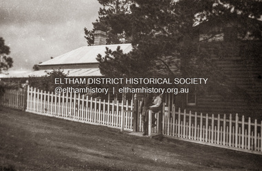 Eltham District Historical Society Inc
Photograph, Sgt Tyrrell George Evans with fiancee, Mary Pitt Withers outside the Withers family home, Southernwood, Bolton Street, Eltham, c.1917
Present day Google Street View https://goo.gl/maps/PZZMoEdJYUXbgf4a8 Tyrrell George Granville Evans was born on 17th August 1892 Enlisted (No. 789) 7 July 1915 as a Private and was assigned to the 31st Battalion. Promoted to Sergeant 1 Nov 1915. Disembarked Suez 7 Feb 1916 Admitted to 32nd Stat. Hospital in France 21 July 1916 with a gunshot wound to the left arm. According to daughter-in-law, Janet Evans, on 19 July 1916, in the battle near Pozieres on the Somme, he was hit by a German high explosive shell and was unconscious and badly wounded. His left arm was shattered, and he had a bullet wound on his leg. Embarked at Boulogne on H.S. Cambria for Middlesex War Hospital, England 24 July 1916. Evans returned to Australia and was discharged medically unfit, 7 April 1917. After months in the Caulfield Hospital his arm could not be saved, and it was amputated 18 July 1917. On July 6, 1918, Tyrrell George Granville Evans married Mary Pitt Withers at Eltham, daughter of artist Walter Herbert Withers (deceased) and wife Fanny (nee Flinn). They had three children, Mary Roberta Evans born February 8, 1921, at Balwyn and twins Shirley and Joyce born June 10, 1922. Mary died 17 days later, June 27, 1922, at Balwyn. Tyrrell had to cope with three children under three years old and a missing left arm. He had been lefthanded before his war injuries. He had help from the family, especially his sister. On August 1, 1924, Tyrrell George Granville Evans married Marian Frances Wilcox and they had two children: Barbara Marian, born 27 July 1925 and Tyrrell Granville, born 3 July 1928. The children were all brought up together in Glen Iris. Tyrrell became renowned as a one-armed golfer and tennis player. He was Senior Vice-President of the Lawn Tennis Association of Victoria and was on the committee of the Metropolitan Golf Club. At the time of his retirement, he was General Manager of the Colonial Meat Company. Tyrrell died September 3, 1962 and was succeeded by sixteen grandchildren. Contributed to by Janet Evans (daughter-in-law), 27 May 2024Many items in this collection have suffered from significant water damage and black mouldjohn withers collection, eltham, tyrrell george granville evans, mary pitt withers, 1917, bolton steet, scan - 620 format 6x9 negative, southernwood -
 Eltham District Historical Society Inc
Card - Card and Envelope, Wisteria blossoms, Kameido, Tokyo, c.1920s
The outer envelope is addressed Mr E. Fielding which is believed to be Richard Edward (Eddie) Fielding. It is understood from Tom Fielding, that this item was collected by his Uncle Bill Teagle when visiting Japan in the 1920s whilst serving in the Navy. It is further understood that Bill always made efforts to collect souvenirs from his travels to give to family members. William George Teagle, more commonly known as Bill, was born 2 August 1899 at Sandringham, Victoria. Bill, a milk carter first attempted to enslist in the AIF in October 1917 but was rejected on the grounds of being too small. On a second attempt he was successful and his application was accepted 1 June 1918. He embarked in November 1918 for overseas with the 17th Reinforcements. He was discharged a year later in December 1918. On 6 May 1919 he enlisted in the Royal Australian Navy for a period of 7 years service with the rank of Stoker however he remained with the navy throughout till the end of the Second World War, and was finally discharged 14 November 1945 with the rank of Petty Officer. This item, a souvenir from Japan from between the wars (circa 1923) was brought home to Research, Victoria by Bill Teagle who was serving in the Royal Australian Navy (1919-1945). Bill Teagle's sister Violet Amelda Teagle had married Theodore (Curly) Feldbauer in 1933. Bill's brother-in-law Curly was taken as a Prisoner of War by the Japanese and died at Sandakan in March 1945. The family did not learn of Curly’s death till months later and Bill's sister, Violet, herself could never forgive the Japanese for what happened to Curly. Curly is remembered on the Eltham Roll of Honour Board and his son, Albert Feldbauer (Bill’s nephew and youngest child of the children of the soldier fathers attending a school in the district), was given the honour of turning the first sod for the Eltham War Memorial Infant Welfare Centre Building. Despite this, the family maintained this cherished souvenir from a time of previous foreign friendship with Japan. The item was possibly given by Bill Teagle to his sister Margaret Rose (formerly Ingram) who later married Richard Edward (Eddie) Fielding in early 1948. (Eddie had been engaged to someone else before he went to war, but his fiancée broke it off before his return to Australia.) It was cared for by the Teagle/Fielding family for approximately one hundred years. It is of particular significance given the family's connection to the Eltham War Memorial and the significance of that memorial to the local community and represents that despite the horrors of war, former friends then foes can become friends again.tom fielding collection -
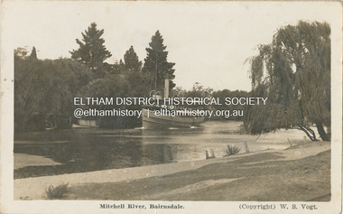 Eltham District Historical Society Inc
Photograph - Postcard, Mitchell River, Bairndale (W.S. Vogt, Photographer), c.1920s
W.S. Vogt Photographer of Main Street Bairnsdale 1920s Dear Ruby No doubt you would know this spot, & this is the boat we went for our trip on Sunday & we did enjoy it, no doubt Lakes Entrance is some place. I did enjoy it. Yesterday we went to Eagle Point for a ?? and it was good oh. & we have been out motoring all the morning some swank us. Hope bu? is good, & how are the cats & George. Regards to Bert, home ??? Jack & self, your loved sister Maud How is the euchr?s Home on Thurs on ???tom fielding collection, postcard, bairnsdale, boat, mitchell river -
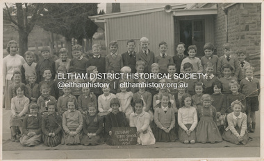 Eltham District Historical Society Inc
Photograph - Digital Copy, George Murray, Eltham State School, Grade 2, 1958
Back Row (L-R): Russell Smart, John Mead, Peter Norman, Kim Hunter, Richard Lynch, Stephen Short, Gilbert McGloughlin, Don Muir, Jeff Steele, Geoffrey Thorpe, Ian Murray, Marcus Skipper, Ray ( ? ), Robert Spencer Third Row (L-R): Bruce Martin, Neville Myers, Nelson (Smart?), George Sutherland, Robert Dowdell, David Campbell, Ken Dickerson, Kit Hill, Wayne Brodford, Martin Fowler, Michael Kilpatrick, Colin Graham, Ken Brown, David Boss, Greg Lewis Second Row (L-R): Bora Meredith, Heather Dyke, Linda Morris, Janne Miles, Biddy Quinlan, Cheryl Croft, Terry Croft, Margaret Box, Shelley Barker, Wendy Bradley, Sandra Black, Lynette Pitcher Front Row (L-R): Sally Lewis, Faye Harris, Elizabeth Jolley, Wendy Rainsbury, Helen Corrie, Bronwen Cavistock, June Skippington, Gloria Oldfield, Anna Jacka, Ruth GangellNames written on reverse and photographer's stamp1958, anna jacka, biddy quinlan, bora meredith, bronwen cavistock, bruce martin, cheryl croft, class photo, colin graham, david boss, david campbell, don muir, elizabeth jolley, eltham state school no. 209, faye harris, faye walker (nee harris) collection, geoffrey thorpe, george sutherland, gilbert mcgloughlin, gloria oldfield, grade 2, greg lewis, heather dyke, helen corrie, ian murray, janne miles, jeff steele, john mead, june skippington, ken brown, ken dickerson, kim hunter, kit hill, linda morris, lynette pitcher, marcus skipper, margaret box, martin fowler, michael kilpatrick, nelson smart, neville myers, peter norman, richard lynch, robert dowdell, robert spencer, russell smart, ruth gangell, sally lewis, sandra black, shelley barker, stephen short, terry croft, wayne brodford, wendy bradley, wendy rainsbury -
Eltham District Historical Society Inc
Document - Folder, Partington family
Charles Partington married Ellen Whatmough; they and their children, Robert and James, came to Australia in 1857 because Ellen's brother, Robert Whatmough, had come here in 1841. Whatmough was Melbourne's first lamplighter while also working in John Batman's Spencer Street orchard; he moved in 1842 to establish an orchard in Greensborough. Both Partington boys died soon after the family arrived at Greensborough but later two daughters were born, Prudina and Maria, and five sons, including William . On arrival Charles Partington began work for Mr Flintoff at Black Hills and was later toll keeper on what is now Watsonia Road. He was later a successful orchardist. William Partington married Annie-May Medhurst, daughter of David Medhurst and Martha Ruston, daughter of Peter Ruston who had settled in Greensborough in the 1850s after working for Mr Hooper in Darebin Creek, then moved to Panton Hill in 1866 working as a carrier. The Rustons had six children, including Martha and James. Martha married David Medhurst in 1882 who was the son of David Medhurst and Charity Jane Pink. After David's death, Charity Jane married George Wescott. David and Martha Medhurst had eight children, including Annie May. They bought land in Main Street, Greensborough and set up as a greengrocer. William and Annie-May Partington's family home, Willis Vale, purchased from Mr Meagher by William's father, Charles; it was built by Meagher in 1839 but destroyed by vandals in 1966 after being compulsory purchased for parkland now called Partington's Flat. Their children were Eva, Grace, Alan, Jessie, and Jack. They attended Greensborough Primary School. Alan married Wyn. Contents Newspaper article: "Link with the past", Diamond Valley News, 21 February 1984. Alan Partington's research on Robert Whatmough, early settler in Greensborough, and his brother-in-law Charles Partington. Newspaper article: "How early families linked up", Diamond Valley News, 28 February 1984. Alan Partington's research into the Ruston and Medhurst families. Newspaper article: "Old days recalled", Diamond Valley News, 13 March 1984. Alan Partington's research in the Partington family.Newspaper clippings, A4 photocopies, etcalan partington, robert whatmough, watmough park greensborough, robert partington, james partington, elen partington nee whatmough, road tolls watsonia road, prudina partington, maria partington, william partington, willis vale, partington's flat greensborugh, mr meagher of greensborough, apollo parkways estate, charles partington, annie-may partington nee medhurst, david medhurst, martha medhurst (nee ruston), jack medhurst, peter ruston, hooper of darebin creek, greensborough hotel, james ruston, charity jane medhurst (nee pink), main street greensborough, eva partington, grace partington, jessie partington, jack partington, orchards in plenty river area, greensborough primary school, wyn partington, flintoff of black hills -
Eltham District Historical Society Inc
Document - Folder, Porter, John
John Porter owned land at the junction of the Plenty and Yarra Rivers, leased to Thomas Mundy. Contents Photocopies: Victorian Parliamentary Papers, 1864-1865, Vol, 3, No. 22, "Reports of Collectors of Agricultural Statistics", pp95-96. Handwritten notes: On George Porter, John Alfrey, Newspaper clippings, A4 photocopies, etcjohn porter, plenty river, yarra river, thomas mundy'henry stooks, john brown, diamons creek, aitken's creek, evelyn county, george porter, john alfrey -
Glen Eira Historical Society
Document - Heatherbrae
A three page photocopy from a Caulfield Conservation Study by Andrew Ward, on house Heatherbrae located at 73 Neerim Road. The study gives a brief history of the property, describes the house’s architectural features and heritage significance and includes a photograph (100mm x 152mm) of the exterior of the house. The file also includes a page of undated, unattributed, handwritten notes giving a partial list of Heatherbrae’s occupants from 1885 to 1900s and some description of the house. Also included in the file is an undated, unattributed one page handwritten list of the main occupants of Heatherbrae between 1880 and 1970. The file also includes one page of research notes by Dianne Visnovsky, dated 06/11/2009, with details of a publication that describes church fairs held at Heathrbrae circa 1910. These notes are accompanied by a handwritten annotation by Claire Barton dated 05/03/2012.heatherbrae, mansions, neerim road, caulfield conservation study, architectural features, architectural styles, holland john charles, booran road, glenhuntly road, kambrook roads, griffiths george f, vail e l junior, clarke alfred e, clarke margaret h, mcgowan beatrice, mcgowan leslie, macgowan leslie, buildings, caulfield, heatherbrae avenue, clarke street, stoddart j, ross william murray, wright william t, macgowan m h, mcgowan malcom, mcgowan jean, barton claire, visnovsky dianne -
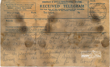 Eltham District Historical Society Inc
Telegram, Telegram, Victoria Barracks, Melbourne to Mrs Annie Castledine, Old Eltham Road, Lower Plenty, 3 May 1941, 3 May 1941
"Postal acknowledgement delivery personal" "It is with deep regret that I have to inform you that VX10044 Sapper G. E. Castledine has been killed in action April 18th & desire to convey to you the profound sympathy of the Minister for the Army and the Military Board. - Minister for the Army" Sapper George Ernest Castledine (1914-1941), son of Arthur Frederick and Annie Castledine, enlisted 23 January 1940 at Lower Plenty and was assigned to the 2/2 Field Company. He is buried in the Phaleron War Cemetery, Athens, Greece and is remembered on the Roll of Honour at Eltham.George was the first soldier from the Shire of Eltham to be killed in the Second World War. The telegram is oil stained as it was kept by George's brother Sid in his toolbox.Digital image of original held in private collection of Joan Castledine (niece of George Ernest Castledine and daughter of Sid and Polly (nee Arrowsmith) Castledine).Original bears oil stains from being stored in a tool box2/2 field company, aif, annie castledine, arthur frederick castledine, eltham war memorial, george ernest castledine, military, minister for the army, roll of honour, second word war, sid castledine, telegram -
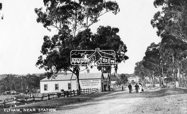 Eltham District Historical Society Inc
Photograph, Eltham, Main Road near station, c.1910
View looking north along Main Road, Eltham from near present day Dudley Street. On the immediate left is the railway station. The large weatherboard building on the bend (opposite present-day Arthur Street) with signs for General Store, Refreshments and Summer Drinks painted on the side is Luther and Ada Haley’s General Store and Bakery, built 1902. This was the first building in what is now Eltham’s present shopping town centre. Haley previously ran the General Store and Bakery on the corner of Main Road and York Street until his lease expired and the premises were bought by Mrs Sarah Burgoyne in 1902. The store later was known as Staff's Store. Followed by the saleyards, entrance to station, slaughter yard and William J Capewell’s butcher shop. Contained within the saleyards facing the street, a small shelter with the name H.H. Clark upon it. Horace Harold Clark was the son of Eltham State School’s first Head Teacher, David George Clark. As well as being a farmer, he was an Estate Agent and conducted auction sales, presumably from this shelter. On the eastern (right) side of Main Street is Haley’s Paddock, which was used on occasions for community picnics. Capable of holding 10,000 people, with ample shade and hilly surroundings it was an ideal place for any community gathering such as the State Schools’ Picnic in 1904. A worker from the bakery store is standing in the gateway at the rear of the store observing the photographer. People in the ‘Sunday Best’ are milling in front of the bakery or strolling down the centre of Main Road. The picture was most likely taken on a Sunday. With the opening of the railway to Eltham in 1902, Melbourne residents would regularly enjoy a Sunday excursion journey on the train to Eltham for a day’s outing to the countryside or beyond to Hurstbridge from 1912 when the railway was extended. Picture dated as c.1910 based on similar picture published in the Weekly Times, Feb. 1912. Cross Ref: 609 (looking south), 612, 611 (later stage), 613.This photo forms part of a collection of photographs gathered by the Shire of Eltham for their centenary project book,"Pioneers and Painters: 100 years of the Shire of Eltham" by Alan Marshall (1971). The collection of over 500 images is held in partnership between Eltham District Historical Society and Yarra Plenty Regional Library (Eltham Library) and is now formally known as the 'The Shire of Eltham Pioneers Photograph Collection.' It is significant in being the first community sourced collection representing the places and people of the Shire's first one hundred years.Digital image (4 x 5 inch negative missing - scanned from print) Printbaker, eltham, eltham railway station, general store, haley's paddock, luther haley, luther haley general store, main road, shire of eltham pioneers photograph collection, sign, summer drinks, butcher, railway station, w.j. capewell, eltham town centre, hot water, m.m. clark, eltham sale yards, eltham slaughter yard, staffs general store -
 Eltham District Historical Society Inc
Certificate, Shire of Eltham: Presented to Pte. George Melville Balfour, VX6104, 1 August 1942
Certificate of appreciation presented to Private George Melville Balfour, VX6104, for voluntary enlistment for active service overseas. Prior to the war, George Balfour lived at Wangakeirra(?), Kangaroo Ground. Post war, he lived at Lavender Park, Eltham. He served in the 2/8 Batallion, AIF, in North Africa and taken prisoner of war in Greece. In the UK post May 1945 and in Australia December 1949. Never married.Colour photocopy 33 x 24 cm of a certificate 2/8 battallion, aif, certiificate, cr. a. brinkkotter, cr. price, eltham, george melville balfour, lavender park, prisoner of war, second word war, shire of eltham, vx6104 -
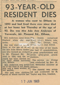 Eltham District Historical Society Inc
Newsclipping, 93 year-old resident dies, Unk. publication, 17 June 1969, 17 Jun 1969
"A woman who went to Eltham in 1893 and had lived there ever since died at her home last Thursday at the age of 93. She was Mrs Ada Ann Anderson of Yarravale, Mt. Pleasant Rd., Eltham." Digital file only - Digitised by EDHS from a scrapbook on loan from Beryl Bradbury (nee Stokes), daughter of Frank Stokes.ada anderson, ada ann anderson, alfred anderson, alice anderson, ann anderson, beryl bradbury (nee stokes) collection, edwin anderson, eltham, flo anderson, george anderson, grace anderson, henry anderson, john henry anderson, methodist church, mount pleasant road, orchards, rev. n. lee, yarravale -
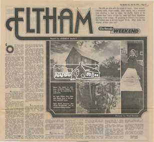 Eltham District Historical Society Inc
Newsclipping, Eltham, Report by Andrew Mckay, Pictures by Noel Butcher, The Herald, 26 July 1975, pp 21-22, 26 Jul 1975
Digital file only - Digitised by EDHS from a scrapbook on loan from Beryl Bradbury (nee Stokes), daughter of Frank Stokes.alistair knox, alma road, arthur munday, beryl bradbury (nee stokes) collection, cameron jackson, carina hack, charlie macgillicuddy, charlie stevenson, circus, clifton pugh, david stephens, dorian le gallienne, eltham, eltham college, eltham hotel, eltham living and learning centre, eltham town square, eltham village, george paul, graham bell, great hall, green wedge, harold holt, jazz, jim chinaman's road, justus jorgensen, kangaroo ground, lower plenty, marcus skipper, matcham skipper, montmorency, montsalvat, mud brick construction, mudbrick, myra skipper, professor dick downing, professor macmahon ball, professor richard downing, research (vic.), roger bell, shire of eltham, shire president, shopping centre, swiper's gully, tim burstall, white cloud cottage -
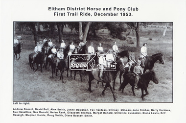 Eltham District Historical Society Inc
Photograph, Eltham District Horse and Pony Club, First Trail Ride, December 1953, Dec 1953
The Pony Club was a dream of Diana Bassett-Smith, which came true, based on the British Horse Society Pony Club formed in 1929; a worldwide organisation. A meeting was called at ‘Lavender Park’, the home of Mrs Mary Grant and her brother George ‘Mel’ Balfour. Invited to the meeting were Baye Skues, Eric Rundle, Ben Taylor, the Barringtons, Smiths, Lou Lewis and Gwen Cascaden. They all supported Diana Bassett-Smith for forming a Pony Club. The first formal meeting was held at ‘Landscape’, which was the home of the Barringtons and the former home of artist Percy Leason. Negotiations with the Lands Department resulted in the club being granted use of the grounds in Eltham Lower Park for a peppercorn rent. Eltham was the 4th Pony Club in Victoria; the other three being Frankston, Templestowe and Western District. Together they formed the Pony Club Association of Victoria at Diana Bassett-Smith’s instigation. This image shows club members attending their first rally held in the summer school holidays, December 1953 L-R: Andrew Donald, Alex Smith, Jenny McMahon, David Bell, Fay Hardess, Chrissy Mclean, Jane Kimber, Barry Hardess, Sue Heseltine, Sue Donald, Helen Rank, Elizabeth Thomas, Margot Donald, Christine Cuscaden, Diana Lewis, Erif Reseigh, Stephen Harris, Diana Bassett-Smith Black and white photographic reprint with names printed on frontalex smith, andrew donald, barry hardess, chrissy mclean, christine cuscaden, david bell, diana bassett-smith, diana lewis, elizabeth thomas, eltham district horse and pony club, erif reseigh, fay hardess, helen rank, jane kimber, jenny mcmahon, margot donald, stephen harris, sue donald, sue heseltine -
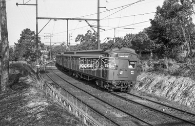 Eltham District Historical Society Inc
Photograph, George Coop, Tait Red Rattler approaching Mont Albert Railway Station from Box Hill, c.Feb. 1964
Tait Red Rattler approaching Mont Albert Railway Station from Box Hill, c. Feb. 1964 See also EDHS_05402-2 both taken from the same location. adjacent to the end of present day Trafalgar StreetDigital TIFF file Scan of 35mm Ilford FP3 black and white transparencygeorge coop collection, red rattler, tait train, mont albert railway station -
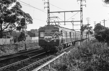 Eltham District Historical Society Inc
Photograph, George Coop, Harris (Blue) electric train approaching Mont Albert Railway Station, c.Feb. 1964
Climbing the hill from Surrey Hills having just crossed Mont Albert Road.Digital TIFF file Scan of 35mm Ilford FP3 black and white transparencygeorge coop collection, harris (blue) train, mont albert railway station -
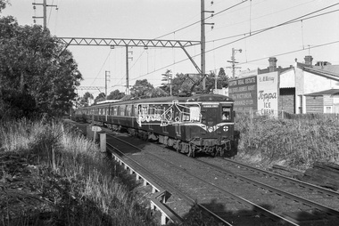 Eltham District Historical Society Inc
Photograph, George Coop, Harris (Blue) electric train leaving Mont Albert Railway Station heading for the city, c.Feb. 1964
Behind the train on the rear walls of buildings are advertising for Haydn Real Estate, Victoria Insurance Co. Ltd and K&M Murray selling Toppa Ice Cream.Digital TIFF file Scan of 35mm Ilford FP3 black and white transparencygeorge coop collection, harris (blue) train, advertising, haydn real estate, k&m murray, toppa ice cream., victoria insurance co ltd -
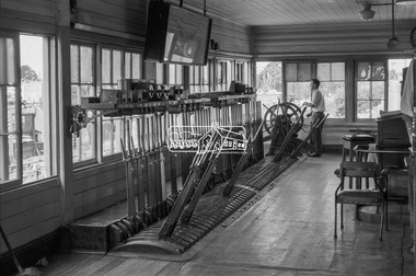 Eltham District Historical Society Inc
Photograph, George Coop, Box Hill Signal Box, c.Feb. 1964
... Eltham District Historical Society Inc 728 Main Rd Eltham ...Digital TIFF file Scan of 35mm Ilford FP3 black and white transparencygeorge coop collection, box hill railway signal box, box hill railway station, signal box -
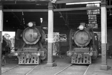 Eltham District Historical Society Inc
Photograph, Steam locomotives J-516, and N-464 in the locomotive workshop at Seymour Railway Station, c.May 1963
... Eltham District Historical Society Inc 728 Main Rd Eltham ...Digital TIFF file Scan of 35mm Ilford FP3 black and white negative transparencygeorge coop collection, j-516, j-class steam locomotive (vulcan foundry), railway turntable, railway workshop, seymour, seymour railway station, n-464, n-class steam locomotive -
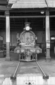 Eltham District Historical Society Inc
Photograph, Steam locomotive D3-629 in the locomotive workshop at Seymour Railway Station, c.May 1963
... Eltham District Historical Society Inc 728 Main Rd Eltham ...Digital TIFF file Scan of 35mm Ilford FP3 black and white negative transparencygeorge coop collection, railway workshop, seymour, seymour railway station, d3-629, d3-class steam locomotive, railway turntable