Showing 11648 items matching "maps "
-
 Robin Boyd Foundation
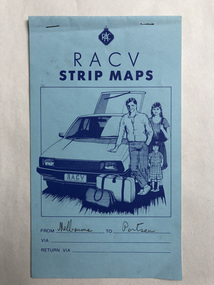
Map, RACV, Strip Maps Melbourne to Portsea
... Strip Maps Melbourne to Portsea ...walsh st library -
 Robin Boyd Foundation
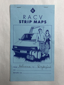
Map, RACV, Strip Maps Melbourne to Portsea
... Strip Maps Melbourne to Portsea ...walsh st library -
 Robin Boyd Foundation
Map, RACV, Strip Maps Melbourne to Benalla
... Strip Maps Melbourne to Benalla ...walsh st library -
 Robin Boyd Foundation
Map, RACV, Strip Maps Melbourne to Ballarat
... Strip Maps Melbourne to Ballarat ...walsh st library -
 Robin Boyd Foundation
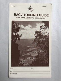
Pamphlet, RACV, Strip Maps Melbourne to Warrnambool
... Strip Maps Melbourne to Warrnambool ...walsh st library -
 Robin Boyd Foundation
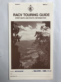
Pamphlet, RACV, Strip Maps Melbourne to Tidal River-Tarra Valley
... Strip Maps Melbourne to Tidal River-Tarra Valley ...walsh st library -
 Moorabbin Air Museum
Souvenir (Item) - Ansett - Souvenir of Ansett & TAA inflight menus and old tickets AND Qantas route maps & menus
... tickets AND Qantas route maps & menus ... -
Moorabbin Air Museum
Souvenir (Item) - Ansett - flight souvenirs, maps, company manners, staff booklets, Boeing 727 Fan Jet, Marketing Booklets
... Ansett - flight souvenirs, maps, company manners, staff ... -
Moorabbin Air Museum
Pamphlet (Item) - London to Australia Air Race 1969 - photos, results, maps
... London to Australia Air Race 1969 - photos, results, maps ... -
Moorabbin Air Museum
Photograph (Item) - Photos & Maps of First Air Board - plus early Qantas/TAA postcards & crop-duster pics
... Photos & Maps of First Air Board - plus early Qantas/TAA ... -
Moorabbin Air Museum
Map (Item) - airport maps Includes a tribunal letter about avoiding night flying test, Maps of Australian airports
... Maps of Australian airports ... -
Moorabbin Air Museum
Manual (Item) - RAAF Advanced Navigation Course - Maps And Charts.TG-53 Volume 1
... RAAF Advanced Navigation Course - Maps And Charts.TG-53 ... -
Moorabbin Air Museum
Booklet (Item) - Instructions For The Preparation Of Weather Maps, With Tables Of The Specifications And Symbols
... Instructions For The Preparation Of Weather Maps, With ...Air Ministry - Meteorological Office -
Moorabbin Air Museum
Map (Item) - Maps of Northern Australia and New Guinea, AUS RNC 5 and 6 radio navigation maps
... AUS RNC 5 and 6 radio navigation maps ... -
Kew Historical Society Inc
Archive (series) - Subject File, Maps and plans, 1838-1998
... Maps and plans ...Reference, Research, InformationSecondary Values (KHS Imposed Order)Subject file containing a range of maps from different historical periods. Some have newspaper articles with background historical information. Some are maps produced by the MMBW, Members of Parliament, Melways, and hand-drawn maps locating where buildings, people and places were formerly in evidence. -
Stawell Historical Society Inc
Archive - CD/DVD, Historical Survey Maps of Ararat & Stawell - BMP's of all Images Scan of Book, 1/12/2005 12:00:00 AM
... Historical Survey Maps of Ararat & Stawell - BMP's of all ...stawell -
Friends of St Brigids Association
Leatherwood honey for Gall : A convict marries an immigrant Girl, Reddrop, Mary. 2000. Leatherwood Honey for Gall : A Convict Marries an Immigrant Girl. Blackburn, Vic. : PenFolk Publishing, 2000 viii, 210 p. : ill. (some col.), facsim., maps, ports.; 21 cm
... , 2000 viii, 210 p. : ill. (some col.), facsim., maps, ports ... -
Friends of St Brigids Association
Book - Letters from Irish Australia 1825-1929, O’Farrell, Patrick James. 1984. Letters from Irish Australia 1825-1929. Sydney : New South Wales University Press ; Belfast : Ulster Historical Foundation, 1984 244 p. : ill., maps ; 25 cm
... ; Belfast : Ulster Historical Foundation, 1984 244 p. : ill., maps ... -
Friends of St Brigids Association
Book - Croppies, Celts, and Catholics : The Irish in Australia, McConville, Chris. 1987. Croppies, Celts, and Catholics : The Irish in Australia. Caulfield East, Vic. : Edward Arnold, 1987 167 p. : ill., maps, ports. ; 25 cm
... , 1987 167 p. : ill., maps, ports. ; 25 cm. ... -
Friends of St Brigids Association
Book - A Shamrock beneath the Southern Cross : An History of the Shire of Belfast, Marriott, Pamela M. 1988. A Shamrock beneath the Southern Cross : An History of the Shire of Belfast.[Warrnambool, Vic.] : P. Marriott, 1988 184 p. : ill., maps, ports. ; 22 cm
... .] : P. Marriott, 1988 184 p. : ill., maps, ports. ; 22 cm. ... -
Friends of St Brigids Association
Book - Saving St Brigid’s, Lane, Regina. 2014. Saving St Brigid’s. Carlton South, Victoria : Bridin Books, 2014 .242 pages, 16 unnumbered pages of plates : illustrations (some colour), maps, portraits ; 24 cm
... plates : illustrations (some colour), maps, portraits ; 24 cm ... -
Friends of St Brigids Association
Book - An Atlas of Irish History, Edwards, Ruth Dudley. 1989. An Atlas of Irish History. London ; New York : Methuen, 1981 1 atlas (286 p.) : maps ; 24 cm
... . London ; New York : Methuen, 1981 1 atlas (286 p.) : maps ; 24 ... -
 Ringwood RSL Sub-Branch
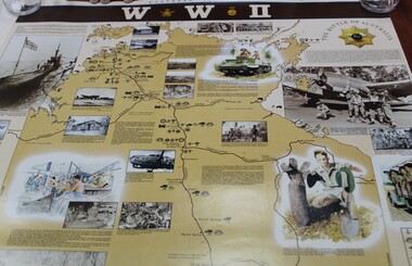
Work on paper - Commemorative WWII sites map Northern Territory, Maps
... Maps ... -
Moorabbin Air Museum
Document (item) - Cierva C30 gyrocopter 5 WW2 photos of Soldiers on parade WW1 photo of Soldiers in trench accommodation near Ypres Wackett bomber schematic Boeing Vertol helicopter Poster of Sunderland short 201 squadron listing of CAC technical publications outline of CAC aircraft over 46 year mfr poster of the sabre aircraft family Plan of CAC lorimer st plant ordinance maps of: Ringwood area Korumburra Woolamai Western port lots of acid free paper Richthofen duelling with Major Hawker Nov 1916 Jimmy Doolittle first blind flight 1929 1914 Max Immelmann flying over Paris Sept 1917 Werner Voss in battle with S.E 5's June 1915 Warneford shoots down Zeppelin 1918 Willy Coppens collides with Zeppelin Oct 1918 William barker duels with 60 German planes May 1918 Edward Mannock outwits German planes July 1915 Nungesser flying Voisin bomber ohn Robertson Duigan and his Duigan Biplane Iroquois rescue Poster CT-4A airtrainer Ansett aircraft since 1920 Poster Nomad N22B mission master Commuter Qantas aircraft story Hawker De Havilland 60 years of aircraft FA 18 schematic Poster Bushrangers Iroquois Vietnam RAAF Poster Sopwith Snipe Albert Packer Poster, Soldiers in uniform Gyrocopter Posters Aircraft history Ordinance maps
... Ordinance maps ... -
Moorabbin Air Museum
Document (item) - Wackett trainer Boomerang CA15 Mustang Spitfire Mignet H.M. 14 Pou-du- Ciel Curtiss Hawk 75A-4 CurtissP-40E Kittyhawk Cloth Map South Celebes The Griff Falcon flapping wing Repco Steering Shaft M14A2401 1140 series Tugan LJW7 Monoplane Gannet Rotol contra rotating propeller Rolls Royce BS 360 engine oil system Avro York Handley Page nosewheel Douglas DC10 Auster aircraft Autocrat 5J1 Taylor aircraft Sulu Archipelago Philippines Victoria Australia radio centres FISCOM Tasmania air navigation chart Wagga Wagga Charleville navigation map Broken Hill Bourke New Guinea Bismarck sea Coral sea Solomon islands Gulf of Carpentaria Tennant creek Mackay Palau Suain east and west Nanu east and west Hauk East Aitape East Maprik West But west Rockhampton map Australian built beaufort poster Beaufighter 30 Squadron Poster Woomera 737 overhead instrument panel Uiver London to Melbourne 1934 1984 memorial flight Poster Air India to Australia Poster, Posters of aircraft navigational maps schematics of engines instrument panel drawings
... Posters of aircraft navigational maps schematics of ... -
 Ararat Gallery TAMA
Textile, Sue Rosenthal, Egyptian Fragments; Maps and Murals or which way to the schist quarries?
... Egyptian Fragments; Maps and Murals or which way to the ... -
![Map, Late the Property of Robert Lawson Esq. [Landsberg Estate Blackwood]](/media/collectors/5e461d8021ea67224c82f2a1/items/67763722eb6d2cbd24dff14f/item-media/677637b7eb6d2cbd24dff29d/item-fit-380x285.jpg) Bacchus Marsh & District Historical Society
Bacchus Marsh & District Historical SocietyMap, Late the Property of Robert Lawson Esq. [Landsberg Estate Blackwood]
The date this map was created has not been identified. It was possibly created at the time the Landsberg Estate near Blackwood was subdivided and sold into smaller lots in December 1886. This land once belonged to Robert Lawson who died in 1869. Lawson was a well known school teacher who founded Scotch College in Melbourne before setting up a school near Blackwood. This map is similar to another map in the BMDHS collection titled 'Landsberg Estate Blackwood' Victorian Collections record 459 and was possibly produced at the same time.Single page map showing land allotments which made up the Landsberg Estate near Blackwood. Scale 20 chains to 1 inch. The map is pasted into a bound volume containing 76 maps or plans in total. High resolution digital image stored on BMDHS computer network. At the top of the map: 'Late the Property of Robert Lawson Esq.'bacchus marsh victoria maps, landsberg estate blackwood -
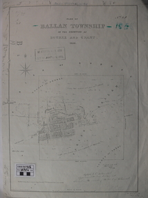 Ballan Shire Historical Society
Map - Map. Ballan Township, Plan of Ballan Township in the Counties of Bourke and Grant
The map is an early one of the township of Ballan showing street names and land owners.The map is significant in that it lists the owners of the house blocks within the township.A map showing the township and surrounding area of Ballan in 1856. Town streets are named as are the owners of the subdivided blocks of land. The map is a lithocopy and there is a scale in chains."D D Fraser" is written across the top of the map and "1856" is written in the near top right corner. There are other additions to the map but they are very difficult to decipher accurately or completely.ballan, ballan township map, ballan1856 -
Clunes Museum
Map, A.C. BROOKS GOVERNMENT PRINTER MELBOURNE, EGLINTON COUNTY OF TALBOT, 1965
MAP OF EGLINTONMAP OF EGLINTON, COUNTY OF TALBOT PRINTED ON CANVAS WITH PLASTIC TAB FOR HANGING. MAP SHOWS TOWN ALLOTMENTSADMINISTRATIVE STAMP ON BOTTOM LEFT AND ON THE BACK OF THE MAP ANOTHER STAMP - NORTHERN DIVISION (299) FORESTS COMMISSION BENDIGOeglinton, historical map -
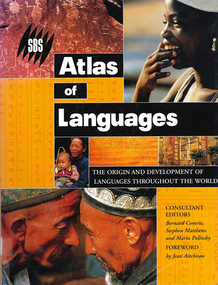 Victorian Aboriginal Corporation for Languages
Book, Bernard Comrie, SBS SBS atlas of languages : the origin and development of languages throughout the world, 2003
... maps ...Over 30 full-colour maps, over 40 of the world?s major languages, language family trees, over 100 stunning full-colour photographs. A full glossary of linguistic terms.Maps, colour illustrations, colour photographslinguistics, maps, atlases