Historical information
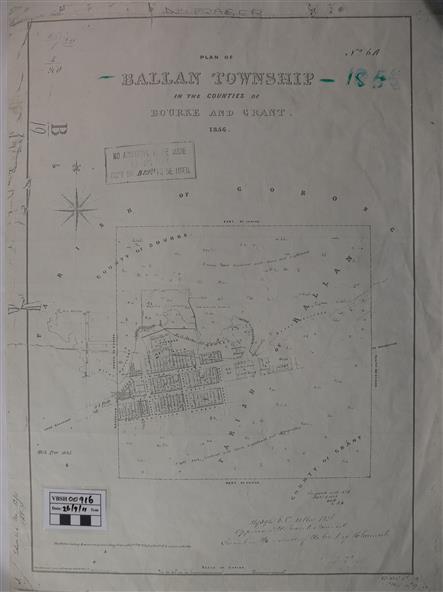
The map is an early one of the township of Ballan showing street names and land owners.
Significance
The map is significant in that it lists the owners of the house blocks within the township.
Physical description
A map showing the township and surrounding area of Ballan in 1856. Town streets are named as are the owners of the subdivided blocks of land.
The map is a lithocopy and there is a scale in chains.
Inscriptions & markings
"D D Fraser" is written across the top of the map and "1856" is written in the near top right corner.
There are other additions to the map but they are very difficult to decipher accurately or completely.