Showing 262 items
matching north-eastern historical society
-
 Ringwood and District Historical Society
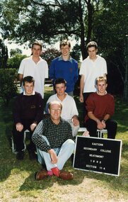
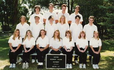
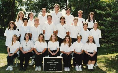
Photograph - Group, Eastern Secondary College 1992 Section 11.4, c 1992
Colour Photographrts, ringwood tech, esc -
 Ringwood and District Historical Society
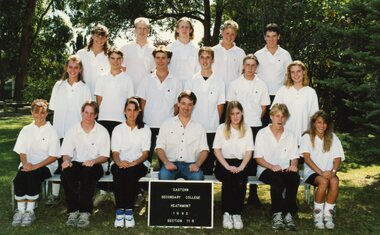
Photograph - Group, Eastern Secondary College 1992 Section 11.5, c 1992
Colour Photographrts, ringwood tech, esc -
 Ringwood and District Historical Society
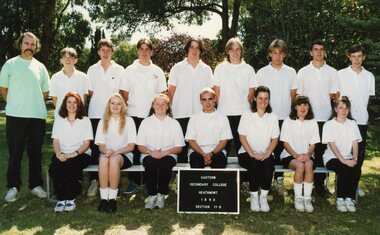
Photograph - Group, Eastern Secondary College 1992 Section 11.6, c 1992
Colour Photographrts, ringwood tech, esc -
 Ringwood and District Historical Society
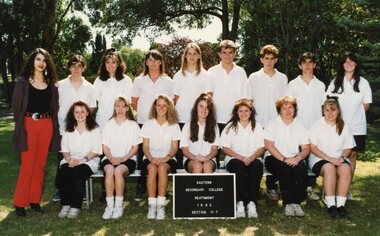
Photograph - Group, Eastern Secondary College 1992 Section 11.7, c 1992
Colour Photographrts, ringwood tech, esc -
 Ringwood and District Historical Society
Photograph - Group, Eastern Secondary College 1992 Section 12.1, c 1992
Colour Photographrts, ringwood tech, esc -
 Ringwood and District Historical Society
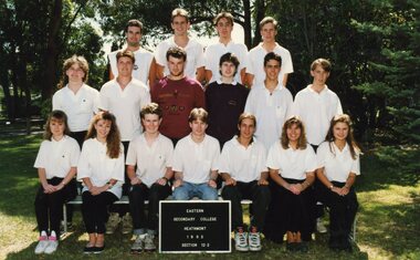
Photograph - Group, Eastern Secondary College 1992 Section 12.2, c 1992
Colour Photographrts, ringwood tech, esc -
 Ringwood and District Historical Society
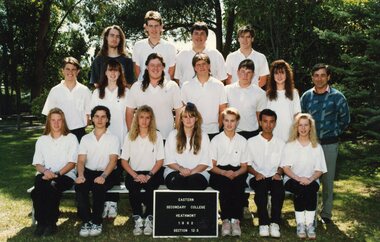
Photograph - Group, Eastern Secondary College 1992 Section 12.3, c 1992
Colour Photographrts, ringwood tech, esc -
 Ringwood and District Historical Society
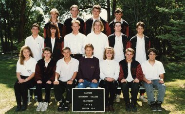
Photograph - Group, Eastern Secondary College 1992 Section 12.4, c 1992
Colour Photographrts, ringwood tech, esc -
 Ringwood and District Historical Society
Photograph - Group, Eastern Secondary College 1992 Section 12.5, c 1992
Colour Photographrts, ringwood tech, esc -
 Ringwood and District Historical Society
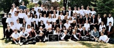
Photograph - Group, Eastern Secondary College 1992 Section 12-ALL, c 1992
Colour Photographrts, ringwood tech, esc -
 Ringwood and District Historical Society
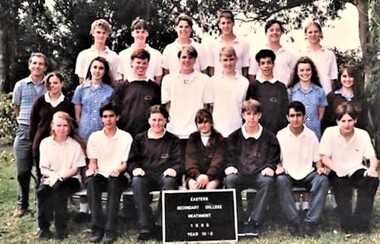
Photograph - Group, Eastern Secondary College 1993 Section 10.3, c 1993
Colour Photographrts, ringwood tech, esc -
 Ringwood and District Historical Society
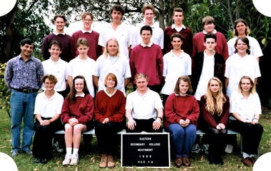
Photograph - Group, Eastern Secondary College 1993 Section VCE 1A, c 1993
Colour Photographrts, ringwood tech, esc -
 Ringwood and District Historical Society
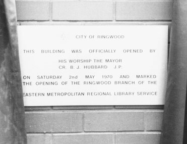
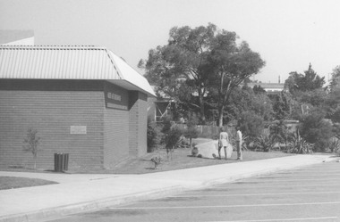
Photograph, Library plaque of official opening inscribed "City of Ringwood" 1970
This building was officially opened by His Worship The Mayor - Cr. B.J. Hubbard J.P. on Saturday 2nd May 1970 and marked the opening of the Ringwood branch of the Eastern Metropolitan Regional Library Service."Written on back of photograph, "Library plaque". -
 Ringwood and District Historical Society
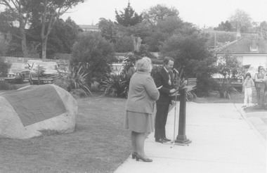
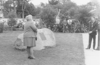
Photograph, Plaque unveiling at Ringwood Eastern Metropolitan Regional Library, Warrandyte Road, Ringwood on 26/10/1974, marking the Golden Jubilee of Ringwood's severance from Lilydale. Mrs. E Pullin, Ringwood Historical Group President (left), and Mayor, Cr. Stan Morris
Catalogue card reads, 'Library. Unveiling stone outside library to commemorate Matthew Flinders explorers and early graves of settlers, 1970'. Back of photograph reads, 'Unveiling of plaque, 1970. Cr. Stan Norris and E. Pullin'. -
 Ringwood and District Historical Society
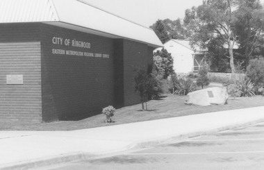
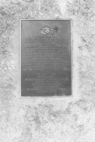
Photograph, Plaque unveiling at Ringwood Eastern Metropolitan Regional Library, Warrandyte Road, Ringwood on 26/10/1974, marking the Golden Jubilee of Ringwood's severance from Lilydale
Catalogue card reads, 'Library - unveiling stone outside library to commemorate Matthew Flinders explorers and early graves of settlers, 1970'. Written on back of photograph, '1970 - Rock and plaque, Cr. Stan Morris, Mayor'. -
 Ringwood and District Historical Society
Photograph, Plaque unveiling at Ringwood Eastern Metropolitan Regional Library, Warrandyte Road, Ringwood on 26/10/1974, marking the Golden Jubilee of Ringwood's severance from Lilydale
Catalogue card reads, 'Library unveiling stone outside library to commemorate Matthew Flinders explorers and early graves of settler, 1970'. Written on back of photograph, 'Library 1970'. -
 Ringwood and District Historical Society
Photograph, Plaque unveiling at Ringwood Eastern Metropolitan Regional Library, Warrandyte Road, Ringwood on 26/10/1974, marking the Golden Jubilee of Ringwood's severance from Lilydale
Written on back of photograph, 'Plaque and rock 1970. Ringwood Library'. Catalogue card reads, 'Library - Unveiling stone outside library to commemorate Matthew Flinders, explorers and early graves of settlers, 1970.' -
 Ringwood and District Historical Society
Photograph, Plaque unveiled at Ringwood Eastern Metropolitan Regional Library, Warrandyte Road, Ringwood on 26/10/1974, marking the Golden Jubilee of Ringwood's severance from Lilydale
Written on back of photograph, 'Plaque, 1970'. -
 Ringwood and District Historical Society
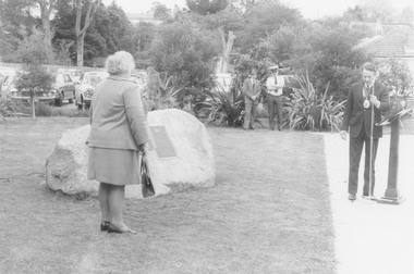
Photograph, Plaque unveiling at Ringwood Eastern Metropolitan Regional Library, Warrandyte Road, Ringwood on 26/10/1974, marking the Golden Jubilee of Ringwood's severance from Lilydale. Mrs. E Pullin, Ringwood Historical Group President (left), and Mayor, Cr. Stan Morris
Written on catalogue card, 'Library. Unveiling stone outside library to commemorate Matthew Flinders explorers and early graves of settlers, 1970.' Written on back of photograph, 'Mayor Cr. Stan Morris dedication rock plaque outside library 1970'. -
 Glen Eira Historical Society
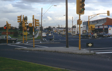
Album - Page 8 of folder D-F, Caulfield Municipality Photo Slide Collection, c.1976 - c.1994
The photographs for the slides are believed to have been taken by the inaugural Editor for the Caulfield Contact - the official newspaper of the former City of Caulfield from 1976-1994. The Editor was also Council's Community Liaison Officer and she (and her successor) took many photographs of official events and Council-related services and locations in connection with both these official roles. The City of Caulfield was the Municipal Council for an area of the South Eastern suburbs of Melbourne, including Brighton East, Carnegie, Caulfield, Elsternwick, Gardenvale, Glen Huntly, McKinnon, Murrumbeena, Ormond and St Kilda East. Credit: Glen Eira Historical Society - This item was digitised and made available through the Glen Eira Heritage Digitisation Strategy 2019-2023. Glen Eira Historical Society acknowledges the support of Glen Eira City Council. Page 8 of slide album D to F, in a polypropylene slide sleeve containing 20 x 35mm colour slides. A sample of 7 images from this page is included. glen eira city council, local government, caulfield city council, caulfield council, city of caulfield, caulfield contact, council services, brighton east, carnegie, caulfield, elsternwick, gardenvale, glen huntly, mckinnon, murrumbeena, ormond, st kilda east, caulfield municipality photo slide collection, roads and streets, north road, murrumbeena road, neerim road, queens avenue, sports and recreations, tennis, petrol stations, alma road, orrong crescent, caulfield north, east boundary road -
 Glen Eira Historical Society
Document - CUMBERNAULD
This file contains nine pages about people related to this property: 1/Copy and pasted eight pages taken from Census Records and Trove items. Articles include the death of Thomas Livingstone Cleland during WWI. Various social notes regarding his family up to 1953. There are articles on the W.J. Mathieson family, who also resided there, as well as residing in Benalla. 2/Print from Trove of an article from the 23/11/1934 edition of The North Eastern Ensign (Benalla, Vic) about the wedding anniversary of Mr and Mrs W.J. Mathieson, held at Cumbernauld on 27/10/1934.cumbernauld, thornleigh grange, house names, cleland thomas livingstone, cleland annie, gardeners market, clayton road, ‘hillside’, caulfield, anderson street, cleland sydney, cleland margaret, cleland james, cleland adelaide, cleland robert, cleland bessie adelaide, cleland agnes, cleland lily, cleland alick douglas milkman, cleland aggie, cleland tom h.s. draftsman, cleland kenneth malcolm, cleland ethel, cleland hector, cleland edna may, mathieson w.j., mathieson isabel, burrows f.a. lieut., east st. kilda, hawthorn road, ‘thornleigh grange’, south caulfield progress association, south caulfield junction, caulfield court, jenkins harry, giles alfred, grafton street, elsternwick, dawes john, chloris crescent, st. john’s presbyterian church, mathieson evelyn mary, marks theodore leslie, mathieson kitty, masonic hall, st. george’s road, haverfield frank, haverfield mrs, haverfield robert ross, rynn mary buckley, cyclists, cycling, donald alexander, martin lottie, whitelaw joan, trinity hall, brighton road, gilmore patricia phyllis, brooklyn ave., point nepean road, north road, brighton court, cleland nora, seaview drive, cleland john stuart, mathieson isabella cristina, kalymna grove, mathieson catherine m., tailor, mathieson william james, councillors, social events and activities, births deaths and marriages, anniversaries, world war 1914-18, soldiers -
 Bright & District Historical Society operating the Bright Museum
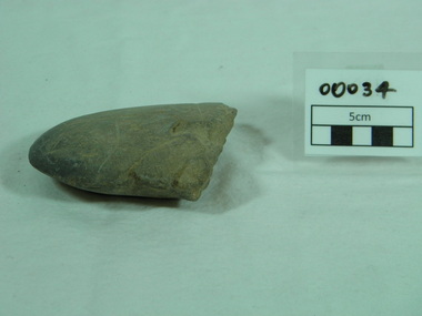
Axe, Stone, prior to 1860
Donated by Charles Willoughby who found the axe and two others on his farm on the site of the present Lake Buffalo.Aboriginal atrtefacts are relatively rare in the North Eastern Region. This is a well made axe. The location of the quartzite may be significant in showing regional affinities.Quartzite ground edge stone axe with use polish on working edge and flaking on opposite edgeaxe, aboriginal artefact, buffalo river, north east region -
 Bright & District Historical Society operating the Bright Museum
Axe Stone
Collected by Charles Willoughby on his farm on the site of the current Lake Buffaloregional significance as ground edge stone axes are relatively rare in North Eastern Regionedge ground stone axe, quartzite,flat backed and evidence of hafting axe, aboriginal artefact, buffalo river -
 Yarra Glen & District Historical Society
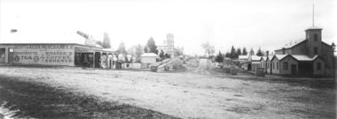
Black and white photographs, Bell Street Yarra Glen looking north c.1900
View of Bell Street Yarra Glen looking north from junction with King Street. On left hand side is Scott & Allen's General Store, next to that is a bootmaker, then the house of Charles Bath, the Grand Hotel and the Colonial Bank building. On the eastern side of Bell Street (right hand side of photograph) is the Victoria Hall. Beyond that is W.J.Dawborn's General Store, then Smith's bakery, and on top of the hill the trees surrounding 'Point Pleasant' owned by the Herbert family.yarra glen, point pleasant, grand hotel, victoria hall, bell street, charles bath, general store, colonial bank, bank building, w j dawborn, scott and allen, bootmaker, smith, bakery, baker s shop, herbert -
 Yarra Glen & District Historical Society
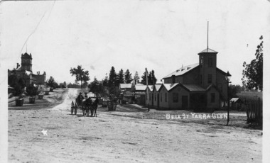
Black and white postcards, Bell St Yarra Glen c.1900
Photograph taken from the junction of Bell and King Streets looking north up Bell Street early 20th century. On the eastern side of Bell Street (left hand side of photograph) is the Victoria Hall. Behind the hall is a newsagency and behind that is the bakery. The pine trees at the top of the hill are at 'Point Pleasant', home of the Herbert family. On the western side of Bell Street can be seen the Grand Hotel and the Colonial Bank. The street trees are in wooden tree guards. In the middle foreground are two men in a buggy drawn by two horses.On back of the postcard at the top "POST CARD". Under those words are "CORRESPONDENCE" on the left and "ADDRESS ONLY" on the right.yarra glen, point pleasant, victoria hall, horse drawn vehicle, bell street, bakery, herbert, newsagency, newsagent, bakers shop, horse buggy, buggy -
 Ringwood and District Historical Society
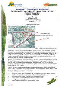
Document - Community Engagement Workshop, Eastern Gateway "Lake To Creek Link" Project - Ringwood, Victoria, 2007
2-page Maroondah City Council notice for workshop on Tuesday 3 July 2007 at Urban Life, 143 Maroondah Highway, Ringwood - light refreshments served.A key initiative of the Precinct Plan is the significant street upgrade which may include creative water features along Larissa Avenue to better connect recreational paths along Mullum Mullum Creek and Ringwood Lake. -
 Ringwood and District Historical Society
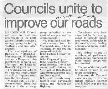
Newspaper, Scrapbook Clipping, Library Collection, Ringwood, Victoria
Newspaper Clipping from The Mail, 19-3-96, P 5. Councils unite to improve our roads.Maroondah Councilwill push for road improvements in the north eastern suburbs through a strategy group backed by Vicroads and five other councils. The municipalities of Banyule, Nillumbik, Manningham, Whitehorse and Yarra Ranges are also members of North East Metropolitan Regional Roads Strategy Group. -
 Ringwood and District Historical Society
Booklet - Geological Survey Report, Explanatory Notes on Ringwood, Victoria by A.H.M. Vandenberg, 1971
Geological description of the eastern and southeastern suburbs of Melbourne, Dandenong Ranges, Harkaway Hills and the Silvan and Macclesfield districts. -
 Ringwood and District Historical Society
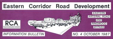
Newsletter, Eastern Arterial Road and Ringwood Bypass Information Bulletin - October 1987
Tri-fold A4 size brochure (6 pages) issued by Road Construction Authority reporting on specialist studies currently being undertaken for the Eastern Corridor Road Development investigations. Topics include Air Quality Study, Landscape and Recreation, Public Transport Study, Bypass Preferred Route, Long Term Access Strategy, Road Design. A government decision on the road development strategy proposal public exhibition commencing in November 1987 for 4 months could be made later in 1988. -
 Ringwood and District Historical Society
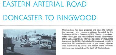
Newsletter, Eastern Arterial Road Doncaster to Ringwood Environment Effects Statement Summary Brochure - November 1987
8-page A4 size brochure issued by Road Construction Authority reporting on the proposed extension of the Eastern Freeway between Doncaster and Ringwood. Topics include Community Consultation, Initial Four Lane Development, Estimated Capital Costs, Traffic Effects, Public Transport, Landscape Creek and Visual Aspects, Pedestrian/Bicycle Access, Noise, Air Quality, Lighting, Construction Impacts.