Showing 216 items matching "wombats"
-
 Hepburn Shire Council Art and Heritage Collection
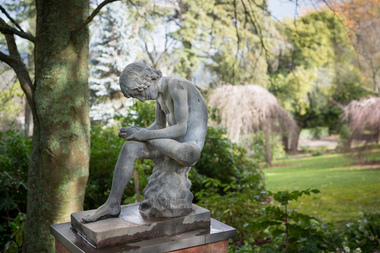
Public Art Work, Boy with a thorn - 'Lo Spinario', c. 1900
Boy with a Thorn Though the classical bronze that the figure was modeled has become known as Lo Spinario, both Stuart Rattle and Kevin O’Neill referred to it as The Boy with a Thorn. Information from the late Stuart Rattle and John Graham, the late Kevin O’Neill’s partner. The statue was bought by Kevin O’Neill from a South Yarra antique dealer in the 1980s. She had bought it in Europe. Stuart believed that it was cast in Berlin by Moritz Geiss who had pioneered the popular process of zinc casting of classical statues. Schinkel, the architect of early 19th Century Prussian public buildings used the process extensively. I assume that the decorations that can be seen in Berlin currently are copies of those copies, given the comprehensive destruction of the city in 1945. Unless there is a date stamped on the statue, and there might well be, there is no firm indication of its age, although Stuart and Kevin believed it was “turn of the century”. It was given to Stuart by John Graham after the death of Kevin O’Neill. Prior to its installation at Musk Farm, it was “by the dam” at Marnarnie, O’Neill’s property at Mt Macedon. It became a much photographed focal point in the sunken garden at Musk Farm. The statue is a gift from the Rattle family to The Friends of Wombat Hill Botanic Gardens who intend to give it, in turn, to Hepburn Shire to be placed in the Botanic Gardens. Both the family and the Friends see it as a memorial to Stuart’s tireless work to raise funds for the Gardens and to raise the profile of the Gardens so that their considerable significance could be more broadly acknowledged. The CMP notes that statuary has been a feature of most botanic gardens (and a notable feature of the Ballarat Botanical Gardens) and James Lowe, the head of Parks for the Shire has also commented that it is an area that could well be developed in the Gardens. This comes from his attendance at meetings of the BGANZ, the “peak professional body” for the development and maintenance of registered botanic gardens in Aus and NZ. Given the lack of funds that the Shire has been able to allocate to the Gardens, a donation of this calibre is a welcome addition to the cultural asset that the Gardens represent. A very large number of residents of the Shire are members of the Friends, have visited Musk Farm and are appreciative of the Gardens. There is a current feeling that the Gardens are undergoing a dynamic revival as a result of the success of the Café and also because of the extraordinary improvement and enhancement of the amenity that has been undertaken over the past two years by the Friends. The installation of the Boy with the Thorn is another move forward for the Gardens. The statue is cast zinc. It is sometimes referred to a white bronze. As can be seen in the photographs, it is in very good condition with no damage or apparent degeneration of the metal. The Smithsonian Institution has a lengthy document relating to the deterioration and repair of similar casts in the US where urban pollution has taken its toll but for the most part it deals with inappropriate repair rather than maintenance protocols. One of the properties of zinc that is appreciated in Australia is its ability to withstand the elements and given that the artwork has been either on Mt Macedon or at Musk for the last 30 years or more, its relocation to Wombat Hill seems to be an appropriate one. The Friends are prepared to organise and pay for the relocation of the statue. The issue of security from the point of view of theft, malicious damage and environmental impact will need to be addressed. The Ballarat Botanical Gardens have recently reinstalled statuary which has been damaged and which had been removed from the Gardens on account of this. They have used Rockworks Ballarat and Wilson’s Memorials to make plinths, secure artworks with steel pins and to provide especially robust fixings to ensure the safety of the various sculptures. The CMP (2007) makes a number of recommendations regarding security in the Gardens ranging from the installation of lighting to the locking of the gates overnight and the repair/reinstatement of appropriate fencing – not done as yet to my knowledge. Paul Bangay has also agreed to act as a consultant in the process of installing the Boy. John Graham estimates its value at $20,000 The preferred location for the work would be at the entrance to the Fernery from the lawn. The paths form an intersection at that point that could be modified to fit the statue. But this is currently a suggested location only. The statue is a gift from the Rattle family to The Friends of Wombat Hill Botanic Gardens who have gifted it to the Hepburn Shire to be placed in the Botanic Gardens. Both the family and the Friends of the Wombat Hill Botanical Gardens Daylesford see it as a memorial to Stuart’s tireless work to raise funds for the Gardens and to raise the profile of the Gardens so that their considerable significance could be more broadly acknowledged. Lo Spinario (Boy with a thorn) c. 1900 copy after the Greco-Roman Hellenistic antique bronze in Rome. c. 1900 copy after the Greco-Roman Hellenistic antique bronze in Rome (Palazzo dei Conservatori, Musei Capitolini, Rome) Manufacturer M. Geiss, Berlin Nonedaylesford, wombat hill botanical gardens, stuart rattle, kevin o'neill, john graham, boy with a thorn, lo spinario, classical sculpture, zinc, classical nude, hepburn shire, public art, sculpture, art -
 Melbourne Tram Museum
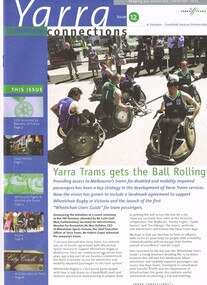
Magazine, Yarra Trams, "Yarra Connections", Dec. 2003
Demonstrates a Yarra Trams staff newsletter..1 - Magazine - 8 pages, full colour, centre stapled, printed on recycled paper, titled "Yarra Connections Issue 12, December 2003", published by Yarra Trams. Notes the launch of the "Wheelchair users guide" for tram passenger, Yarra Trams support for Wheelchair Rugby, planning for Vermont South extension, French award for CEO, Hubert Guyot, photo exhibition featuring employees by Georgia Metaxas, Boroondara residents and Travelsmart, Metlink Team Tigers Basketball, Ikea store in Richmond, pram friendly trams, feedback and return of W class trams to route 30. New track maintenance vehicle -"scrubber truck". .2 - Letter on Yarra Trams letterhead, addressed to Ron Wilson of Orange Grove Bayswater, signed by Paul Matthews Marketing Manager forwarding a copy of the magazine to Ron, noting highlights. Gives address details. .3 - Magazine - as for .1 - issue 1 dated October 1999 with a forward by the CEO Steve Macdonald , Camberwell depot, Deputy CEO Hubert Guyot, new logo designs, reduction in tram stops, tennis trams, family day, Docklands route 70 extension and competition. .4 - magazine - 3 fold A4 - issue 9, dated Nov. 2002, Notes the construction of Route 109, W class, St Vincent's Plaza, Gordon Atkins, Docklands tram services, explorer program, Feedback, Line Officers, Corporate Report and Melbourne Museum tram. .5 - magazine - issue 11 - August 2003 - 8 pages - opening of Box Hill line, Harry the Wombat, trams in the press, Welcome to Dennis Cliche, B class seating trial, Metlink, Docklands, trial information at tram stops (early TramTracker) project and route 75. .6 - magazine issue 13 - April 2004 - Australian Open tram service, Collins and Spencer Superstop, tram services, feedback, Metlink, Channel 10 - The Secret life of us, PTC Cricket Squad. .7 - issue 8 - April 2002 - Grand Prix, Box Hill update, Citadis update, Collins and Spring superstop, Australia Open, Fare Evastion and track joints. 8 - issue 10, undated - Australian Open tennis, Eurotram comes to Melbourne, Docklands joins the City Circle, route 109, Box Hill extension and what is a substation.trams, tramways, yarra trams, w class, disability services, vermont south, awards, metlink, route 30, camberwell depot, docklands, route 70, st vincent's plaza, line officers, box hill, route 109, b class, superstops, cricket, tennis, tramtracker, route 75, city circle -
 Eltham District Historical Society Inc
Photograph - Digital Photograph, Marguerite Marshall, Art Gallery at Clifton Pugh's Artists' Colony, Dunmoochin, Barreenong Road, Cottles Bridge, 5 February 2008
Art Gallery with mural painted by Clifton Pugh (1924-1990) at his Artists' Colony, Dunmoochin, Barreenong Road, Cottles Bridge. Following military service in the second world war, Clifton Pugh studied under artist Sir William Dargie at the National Gallery School in Melbourne as well as Justus Jorgensen, founder of Montsalvat. For a while he lived on the dole but also worked packing eggs for the Belot family saving sufficient to purchase six acres (2.4 ha) of land at Barreenong Road, Cottles Bridge. He accumulated more land and persuaded several other artists and friends to buy land nearby, resulting in a property of approximately 200 acres, stablishing it as one of the first artistic communes in Australia alongside Montsalvat in Eltham. It was around 1951 that Pugh felt he had '"done moochin' around" and so the name of the property evolved. He bought timber from Alistair Knox to build his house on the crest of a hill. Inspired by local goldminer's huts, it was a one room wattle-and-daub structure with dirt floor. Over the years it expanded with thick adobe walls made from local clay, high ceilings and stone floors. All materials other than the local earth were sourced from second hand materials, most found at wreckers' yards. Artists from across the nation were drawn to Dunmoochin, with several setting up houses and shacks on the property, maintaining their independence but sharing their artistic zeal. Artists who worked or resided at Dunmoochin included Mirka Mora, John Perceval, Albert Tucker, Fred Williams, Charles Blackman, Arthur Boyd and John Olsen. In 2002, Pugh's house along with its treasure trove of art and a library of some 20,000 books was destroyed by fire. Traces of Pugh's home remain with the presence of the Victorian doorframe archway with leadlight of intricate design, procured from a demolished Melbourne mansion; and two bronze life-sized female statues created by Pugh and cast by Matcham Skipper. In place of Pugh's house rose two double-storey mud-brick artists' studios topped with corrugated iron rooves curved like the wings of a bird with accommodation for seven. The original studios, gallery and other buildings survived the fire. Covered under Heritage Overlay, Nillumbik Planning Scheme. Published: Nillumbik Now and Then / Marguerite Marshall 2008; photographs Alan King with Marguerite Marshall.; p153 It’s not surprising that artist Clifton Pugh was drawn to Cottles Bridge to establish his artists’ colony Dunmoochin. Undisturbed by the clamour of modern life at Barreenong Road, Pugh was surrounded by the Australian bush he loved, and where his ashes were later scattered. The 200 acres (81ha) of bushland, broken by glimpses of rolling hills, has more than 50 species of orchids and Pugh shared his property with native animals including kangaroos, emus, phascogales, wombats, and diverse bird life. Pugh encouraged these creatures to join him in the bush by creating, with Monash University, a holding station where the animals were raised. Dunmoochin inspired Pugh for such paintings as in a book on orchids and the Death of a Wombat series.1 But his love for the bush was accompanied by the fear that Europeans were destroying it and much of his painting illustrated this fear and his plea for its conservation.2 However it was his house rather than the surrounding bush that was to be destroyed. Tragically in 2002 Pugh’s house, with its treasure of art and library of 20,000 art books, was destroyed by fire. Traces of the beauty of Pugh’s home still remain, however, in the magnificent Victorian doorframe archway with leadlight of intricate design procured from a demolished Melbourne mansion; and two bronze life-sized female statues created by Pugh and cast by Matcham Skipper. Now in place of Pugh’s house, are two double-storey mud-brick artists’ studios topped with corrugated roofs curved like birds’ wings, with accommodation for seven. The original studios, gallery and other buildings remain.3 Pugh grew up on his parents’ hobby farm at Briar Hill and attended the Briar Hill Primary School, then Eltham High School and later Ivanhoe Grammar. At 15 he became a copy boy for the Radio Times newspaper, then worked as a junior in a drafting office. Pugh was to have three wives and two sons. After serving in World War Two in New Guinea and Japan, Pugh studied under artist Sir William Dargie, at the National Gallery School in Melbourne.4 Another of his teachers was Justus Jörgensen, founder of Montsalvat the Eltham Artists’ Colony. Pugh lived on the dole for a while and paid for his first six acres (2.4ha) at Barreenong Road by working as an egg packer for the Belot family. Pugh accumulated more land and persuaded several other artists and friends to buy land nearby, resulting in the 200 acre property. They, too, purchased their land from the Belot family by working with their chickens. Around 1951 Pugh felt he had ‘Done moochin’ around’ and so the name of his property was born. Pugh bought some used timber from architect Alistair Knox to build his house on the crest of a hill. Inspired by local goldminers’ huts it was a one-room wattle-and-daub structure with a dirt floor. It was so small that the only room he could find for his telephone was on the fork of a tree nearby.5 Over the years the mud-brick house grew to 120 squares in the style now synonymous with Eltham. It had thick adobe walls (sun-dried bricks) made from local clay, high ceilings and stone floors with the entire structure made of second-hand materials – most found at wreckers’ yards. Pugh’s first major show in Melbourne in 1957, established him as a distinctive new painter, breaking away from the European tradition ‘yet not closely allied to any particular school of Australian painting’.6 Pugh became internationally known and was awarded the Order of Australia. He won the Archibald Prize for portraiture three times, although he preferred painting the bush and native animals. In 1990 not long before he died, Pugh was named the Australian War Memorial’s official artist at the 75th anniversary of the landing at Gallipoli. Today one of Pugh’s legacies is the Dunmoochin Foundation, which gives seven individual artists or couples and environmental researchers the chance to work in beautiful and peaceful surroundings, usually for a year. By November 2007, more than 80 people had taken part, and the first disabled artist had been chosen to reside in a new studio with disabled access.1 In 1989, not long before Pugh died in 1990 of a heart attack at age 65, he established the Foundation with La Trobe University and the Victorian Conservation Trust now the Trust for Nature. Pugh’s gift to the Australian people – of around 14 hectares of bushland and buildings and about 550 art works – is run by a voluntary board of directors, headed by one of his sons, Shane Pugh. La Trobe University in Victoria stores and curates the art collection and organises its exhibition around Australia.2 The Foundation aims to protect and foster the natural environment and to provide residences, studios and community art facilities at a minimal cost for artists and environmental researchers. They reside at the non-profit organisation for a year at minimal cost. The buildings, some decorated with murals painted by Pugh and including a gallery, were constructed by Pugh, family and friends, with recycled as well as new materials and mud-bricks. The Foundation is inspired by the tradition begun by the Dunmoochin Artists’ Cooperative which formed in the late 1950s as one of the first artistic communes in Australia. Members bought the land collaboratively and built the seven dwellings so that none could overlook another. But, in the late 1960s, the land was split into private land holdings, which ended the cooperative. Dunmoochin attracted visits from the famous artists of the day including guitarists John Williams and Segovia; singer and comedian Rolf Harris; comedian Barry Humphries; and artists Charles Blackman, Arthur Boyd and Mirka Mora. A potters’ community, started by Peter and Helen Laycock with Alma Shanahan, held monthly exhibitions in the 1960s, attracting local, interstate and international visitors – with up to 500 attending at a time.3 Most artists sold their properties and moved away. But two of the original artists remained into the new millennium as did relative newcomer Heja Chong who built on Pugh’s property (now owned by the Dunmoochin Foundation). In 1984 Chong brought the 1000-year-old Japanese Bizan pottery method to Dunmoochin. She helped build (with potters from all over Australia) the distinctive Bizan-style kiln, which fires pottery from eight to 14 days in pine timber, to produce the Bizan unglazed and simple subdued style. The kiln, which is rare in Australia, is very large with adjoining interconnected ovens of different sizes, providing different temperatures and firing conditions. Frank Werther, who befriended Pugh as a fellow student at the National Gallery Art School in Melbourne, built his house off Barreenong Road in 1954. Werther is a painter of the abstract and colourist style and taught art for about 30 years. Like so many in the post-war years in Eltham Shire, as it was called then, Werther built his home in stages using mud-brick and second-hand materials. The L-shaped house is single-storey but two-storey in parts with a corrugated-iron pitched roof. The waterhole used by the Werthers for their water supply is thought to be a former goldmining shaft.4 Alma Shanahan at Barreenong Road was the first to join Pugh around 1953. They also met at the National Gallery Art School and Shanahan at first visited each weekend to work, mainly making mud-bricks. She shared Pugh’s love for the bush, but when their love affair ended, she designed and built her own house a few hundred yards (metres) away. The mud-brick and timber residence, made in stages with local materials, is rectangular, single-storey with a corrugated-iron roof. As a potter, Shanahan did not originally qualify as an official Cooperative member.This collection of almost 130 photos about places and people within the Shire of Nillumbik, an urban and rural municipality in Melbourne's north, contributes to an understanding of the history of the Shire. Published in 2008 immediately prior to the Black Saturday bushfires of February 7, 2009, it documents sites that were impacted, and in some cases destroyed by the fires. It includes photographs taken especially for the publication, creating a unique time capsule representing the Shire in the early 21st century. It remains the most recent comprehenesive publication devoted to the Shire's history connecting local residents to the past. nillumbik now and then (marshall-king) collection, art gallery, clifton pugh, dunmoochin, cottlesbridge, cottles bridge, barreenong road -
 Eltham District Historical Society Inc
Photograph - Digital Photograph, Marguerite Marshall, Doorway of Clifton Pugh's former house at Dunmoochin, Barreenong Road, Cottles Bridge, 5 February 2008
Following military service in the second world war, Clifton Pugh studied under artist Sir William Dargie at the National Gallery School in Melbourne as well as Justus Jorgensen, founder of Montsalvat. For a while he lived on the dole but also worked packing eggs for the Belot family saving sufficient to purchase six acres (2.4 ha) of land at Barreenong Road, Cottles Bridge. He accumulated more land and persuaded several other artists and friends to buy land nearby, resulting in a property of approximately 200 acres, stablishing it as one of the first artistic communes in Australia alongside Montsalvat in Eltham. It was around 1951 that Pugh felt he had '"done moochin' around" and so the name of the property evolved. He bought timber from Alistair Knox to build his house on the crest of a hill. Inspired by local goldminer's huts, it was a one room wattle-and-daub structure with dirt floor. Over the years it expanded with thick adobe walls made from local clay, high ceilings and stone floors. All materials other than the local earth were sourced from second hand materials, most found at wreckers' yards. Artists from across the nation were drawn to Dunmoochin, with several setting up houses and shacks on the property, maintaining their independence but sharing their artistic zeal. Artists who worked or resided at Dunmoochin included Mirka Mora, John Perceval, Albert Tucker, Fred Williams, Charles Blackman, Arthur Boyd and John Olsen. In 2002, Pugh's house along with its treasure trove of art and a library of some 20,000 books was destroyed by fire. Traces of Pugh's home remain with the presence of the Victorian doorframe archway with leadlight of intricate design, procured from a demolished Melbourne mansion; and two bronze life-sized female statues created by Pugh and cast by Matcham Skipper. In place of Pugh's house rose two double-storey mud-brick artists' studios topped with corrugated iron rooves curved like the wings of a bird with accommodation for seven. The original studios, gallery and other buildings survived the fire. Covered under Heritage Overlay, Nillumbik Planning Scheme. Published: Nillumbik Now and Then / Marguerite Marshall 2008; photographs Alan King with Marguerite Marshall.; p155 It’s not surprising that artist Clifton Pugh was drawn to Cottles Bridge to establish his artists’ colony Dunmoochin. Undisturbed by the clamour of modern life at Barreenong Road, Pugh was surrounded by the Australian bush he loved, and where his ashes were later scattered. The 200 acres (81ha) of bushland, broken by glimpses of rolling hills, has more than 50 species of orchids and Pugh shared his property with native animals including kangaroos, emus, phascogales, wombats, and diverse bird life. Pugh encouraged these creatures to join him in the bush by creating, with Monash University, a holding station where the animals were raised. Dunmoochin inspired Pugh for such paintings as in a book on orchids and the Death of a Wombat series.1 But his love for the bush was accompanied by the fear that Europeans were destroying it and much of his painting illustrated this fear and his plea for its conservation.2 However it was his house rather than the surrounding bush that was to be destroyed. Tragically in 2002 Pugh’s house, with its treasure of art and library of 20,000 art books, was destroyed by fire. Traces of the beauty of Pugh’s home still remain, however, in the magnificent Victorian doorframe archway with leadlight of intricate design procured from a demolished Melbourne mansion; and two bronze life-sized female statues created by Pugh and cast by Matcham Skipper. Now in place of Pugh’s house, are two double-storey mud-brick artists’ studios topped with corrugated roofs curved like birds’ wings, with accommodation for seven. The original studios, gallery and other buildings remain.3 Pugh grew up on his parents’ hobby farm at Briar Hill and attended the Briar Hill Primary School, then Eltham High School and later Ivanhoe Grammar. At 15 he became a copy boy for the Radio Times newspaper, then worked as a junior in a drafting office. Pugh was to have three wives and two sons. After serving in World War Two in New Guinea and Japan, Pugh studied under artist Sir William Dargie, at the National Gallery School in Melbourne.4 Another of his teachers was Justus Jörgensen, founder of Montsalvat the Eltham Artists’ Colony. Pugh lived on the dole for a while and paid for his first six acres (2.4ha) at Barreenong Road by working as an egg packer for the Belot family. Pugh accumulated more land and persuaded several other artists and friends to buy land nearby, resulting in the 200 acre property. They, too, purchased their land from the Belot family by working with their chickens. Around 1951 Pugh felt he had ‘Done moochin’ around’ and so the name of his property was born. Pugh bought some used timber from architect Alistair Knox to build his house on the crest of a hill. Inspired by local goldminers’ huts it was a one-room wattle-and-daub structure with a dirt floor. It was so small that the only room he could find for his telephone was on the fork of a tree nearby.5 Over the years the mud-brick house grew to 120 squares in the style now synonymous with Eltham. It had thick adobe walls (sun-dried bricks) made from local clay, high ceilings and stone floors with the entire structure made of second-hand materials – most found at wreckers’ yards. Pugh’s first major show in Melbourne in 1957, established him as a distinctive new painter, breaking away from the European tradition ‘yet not closely allied to any particular school of Australian painting’.6 Pugh became internationally known and was awarded the Order of Australia. He won the Archibald Prize for portraiture three times, although he preferred painting the bush and native animals. In 1990 not long before he died, Pugh was named the Australian War Memorial’s official artist at the 75th anniversary of the landing at Gallipoli. Today one of Pugh’s legacies is the Dunmoochin Foundation, which gives seven individual artists or couples and environmental researchers the chance to work in beautiful and peaceful surroundings, usually for a year. By November 2007, more than 80 people had taken part, and the first disabled artist had been chosen to reside in a new studio with disabled access.1 In 1989, not long before Pugh died in 1990 of a heart attack at age 65, he established the Foundation with La Trobe University and the Victorian Conservation Trust now the Trust for Nature. Pugh’s gift to the Australian people – of around 14 hectares of bushland and buildings and about 550 art works – is run by a voluntary board of directors, headed by one of his sons, Shane Pugh. La Trobe University in Victoria stores and curates the art collection and organises its exhibition around Australia.2 The Foundation aims to protect and foster the natural environment and to provide residences, studios and community art facilities at a minimal cost for artists and environmental researchers. They reside at the non-profit organisation for a year at minimal cost. The buildings, some decorated with murals painted by Pugh and including a gallery, were constructed by Pugh, family and friends, with recycled as well as new materials and mud-bricks. The Foundation is inspired by the tradition begun by the Dunmoochin Artists’ Cooperative which formed in the late 1950s as one of the first artistic communes in Australia. Members bought the land collaboratively and built the seven dwellings so that none could overlook another. But, in the late 1960s, the land was split into private land holdings, which ended the cooperative. Dunmoochin attracted visits from the famous artists of the day including guitarists John Williams and Segovia; singer and comedian Rolf Harris; comedian Barry Humphries; and artists Charles Blackman, Arthur Boyd and Mirka Mora. A potters’ community, started by Peter and Helen Laycock with Alma Shanahan, held monthly exhibitions in the 1960s, attracting local, interstate and international visitors – with up to 500 attending at a time.3 Most artists sold their properties and moved away. But two of the original artists remained into the new millennium as did relative newcomer Heja Chong who built on Pugh’s property (now owned by the Dunmoochin Foundation). In 1984 Chong brought the 1000-year-old Japanese Bizan pottery method to Dunmoochin. She helped build (with potters from all over Australia) the distinctive Bizan-style kiln, which fires pottery from eight to 14 days in pine timber, to produce the Bizan unglazed and simple subdued style. The kiln, which is rare in Australia, is very large with adjoining interconnected ovens of different sizes, providing different temperatures and firing conditions. Frank Werther, who befriended Pugh as a fellow student at the National Gallery Art School in Melbourne, built his house off Barreenong Road in 1954. Werther is a painter of the abstract and colourist style and taught art for about 30 years. Like so many in the post-war years in Eltham Shire, as it was called then, Werther built his home in stages using mud-brick and second-hand materials. The L-shaped house is single-storey but two-storey in parts with a corrugated-iron pitched roof. The waterhole used by the Werthers for their water supply is thought to be a former goldmining shaft.4 Alma Shanahan at Barreenong Road was the first to join Pugh around 1953. They also met at the National Gallery Art School and Shanahan at first visited each weekend to work, mainly making mud-bricks. She shared Pugh’s love for the bush, but when their love affair ended, she designed and built her own house a few hundred yards (metres) away. The mud-brick and timber residence, made in stages with local materials, is rectangular, single-storey with a corrugated-iron roof. As a potter, Shanahan did not originally qualify as an official Cooperative member.This collection of almost 130 photos about places and people within the Shire of Nillumbik, an urban and rural municipality in Melbourne's north, contributes to an understanding of the history of the Shire. Published in 2008 immediately prior to the Black Saturday bushfires of February 7, 2009, it documents sites that were impacted, and in some cases destroyed by the fires. It includes photographs taken especially for the publication, creating a unique time capsule representing the Shire in the early 21st century. It remains the most recent comprehenesive publication devoted to the Shire's history connecting local residents to the past. nillumbik now and then (marshall-king) collection, art gallery, clifton pugh, dunmoochin, cottlesbridge, cottles bridge, barreenong road -
 Ringwood and District Historical Society
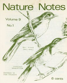
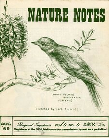
Magazine, Nature Notes magazines 1972 (Vol 9) Issues 1, 3-4, 6 to 10
Printed magazinesFrom “The History of Ringwood East Primary School 1924-1990” 'Nature Notes' was a children's nature magazine, produced at Ringwood East Primary School for approximately 10 years. It came to us from Blackburn Lake Primary School and before that Blackburn South Primary School. It was originally developed by Harry Hopkins in 1964. He was a District Inspector of schools and also President of the Gould League at the time. Fred Rodgers and Len Delacca were original contributors, Fred writing on native flora and Len writing on native flora [fauna]. It came to Ringwood East in 1975 with Keith Dyer, a teacher on the staff, as editor. The magazine had a large circulation, supplying to schools, private subscribers and societies as well as sending many complimentary copies to libraries, and museums; distribution was throughout Australia. The Magazine continued to grow under consequent editors, Anne Gibson (who also developed 'Probe' a junior version of 'Nature Notes' designed for grades 2 and 4), Barry Archibald, Colin Bull, Russell Hall, Deborah Brydon and Mandy Charmichael. The editors would research, compile, edit and print the magazine which was a monthly issue. The parents would then come in on a Monday to collate, fold and staple. This usually was a morning’s work but this depended on how many helping hands there were. The Wednesday was packing and posting day and in the early days the parents used to deliver the local orders to save costs. Subscribers were sought through advertisements in various school literature and material. The Parents Club received an annual remuneration for their hard work and in turn were able to help purchase many items needed throughout the school. These magazines were packed with really good nature information and taught children how to look after their environment using articles, puzzles, riddles, questions and quizzes. There were special characters as well like 'Wally the Wombat' and 'Ernie the Echidna' for the children to follow on various adventures every month. Children would enjoy watching them crop up in each edition. The magazine stayed with us at Ringwood East until 1986, when due to restructuring and various other things was moved to Healesville Sanctuary where it adopted a new format and name. From here it has since folded and so the end of 'Nature Notes'. 'Nature Notes' was a very successful magazine. Many people through the years devoted a lot of time and energy to its production and readers throughout Australia, as well as its many creators and producers during its 20-year existence, mourn its passing. Written from material supplied by Barry Archibald (editor 'Nature Notes' 1977-78) Margaret Preece & Lois Aders (parents in charge of collating and packaging during its last years of existence. -
 Ringwood and District Historical Society
Magazine, Nature Notes magazines 1974 (Vol 11) Issues 1-10
Printed magazinesFrom “The History of Ringwood East Primary School 1924-1990” 'Nature Notes' was a children's nature magazine, produced at Ringwood East Primary School for approximately 10 years. It came to us from Blackburn Lake Primary School and before that Blackburn South Primary School. It was originally developed by Harry Hopkins in 1964. He was a District Inspector of schools and also President of the Gould League at the time. Fred Rodgers and Len Delacca were original contributors, Fred writing on native flora and Len writing on native flora [fauna]. It came to Ringwood East in 1975 with Keith Dyer, a teacher on the staff, as editor. The magazine had a large circulation, supplying to schools, private subscribers and societies as well as sending many complimentary copies to libraries, and museums; distribution was throughout Australia. The Magazine continued to grow under consequent editors, Anne Gibson (who also developed 'Probe' a junior version of 'Nature Notes' designed for grades 2 and 4), Barry Archibald, Colin Bull, Russell Hall, Deborah Brydon and Mandy Charmichael. The editors would research, compile, edit and print the magazine which was a monthly issue. The parents would then come in on a Monday to collate, fold and staple. This usually was a morning’s work but this depended on how many helping hands there were. The Wednesday was packing and posting day and in the early days the parents used to deliver the local orders to save costs. Subscribers were sought through advertisements in various school literature and material. The Parents Club received an annual remuneration for their hard work and in turn were able to help purchase many items needed throughout the school. These magazines were packed with really good nature information and taught children how to look after their environment using articles, puzzles, riddles, questions and quizzes. There were special characters as well like 'Wally the Wombat' and 'Ernie the Echidna' for the children to follow on various adventures every month. Children would enjoy watching them crop up in each edition. The magazine stayed with us at Ringwood East until 1986, when due to restructuring and various other things was moved to Healesville Sanctuary where it adopted a new format and name. From here it has since folded and so the end of 'Nature Notes'. 'Nature Notes' was a very successful magazine. Many people through the years devoted a lot of time and energy to its production and readers throughout Australia, as well as its many creators and producers during its 20-year existence, mourn its passing. Written from material supplied by Barry Archibald (editor 'Nature Notes' 1977-78) Margaret Preece & Lois Aders (parents in charge of collating and packaging during its last years of existence. -
 Ringwood and District Historical Society
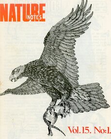
Magazine, Nature Notes magazines 1978 (Vol 15) Issues 1-9
Printed magazinesFrom “The History of Ringwood East Primary School 1924-1990” 'Nature Notes' was a children's nature magazine, produced at Ringwood East Primary School for approximately 10 years. It came to us from Blackburn Lake Primary School and before that Blackburn South Primary School. It was originally developed by Harry Hopkins in 1964. He was a District Inspector of schools and also President of the Gould League at the time. Fred Rodgers and Len Delacca were original contributors, Fred writing on native flora and Len writing on native flora [fauna]. It came to Ringwood East in 1975 with Keith Dyer, a teacher on the staff, as editor. The magazine had a large circulation, supplying to schools, private subscribers and societies as well as sending many complimentary copies to libraries, and museums; distribution was throughout Australia. The Magazine continued to grow under consequent editors, Anne Gibson (who also developed 'Probe' a junior version of 'Nature Notes' designed for grades 2 and 4), Barry Archibald, Colin Bull, Russell Hall, Deborah Brydon and Mandy Charmichael. The editors would research, compile, edit and print the magazine which was a monthly issue. The parents would then come in on a Monday to collate, fold and staple. This usually was a morning’s work but this depended on how many helping hands there were. The Wednesday was packing and posting day and in the early days the parents used to deliver the local orders to save costs. Subscribers were sought through advertisements in various school literature and material. The Parents Club received an annual remuneration for their hard work and in turn were able to help purchase many items needed throughout the school. These magazines were packed with really good nature information and taught children how to look after their environment using articles, puzzles, riddles, questions and quizzes. There were special characters as well like 'Wally the Wombat' and 'Ernie the Echidna' for the children to follow on various adventures every month. Children would enjoy watching them crop up in each edition. The magazine stayed with us at Ringwood East until 1986, when due to restructuring and various other things was moved to Healesville Sanctuary where it adopted a new format and name. From here it has since folded and so the end of 'Nature Notes'. 'Nature Notes' was a very successful magazine. Many people through the years devoted a lot of time and energy to its production and readers throughout Australia, as well as its many creators and producers during its 20-year existence, mourn its passing. Written from material supplied by Barry Archibald (editor 'Nature Notes' 1977-78) Margaret Preece & Lois Aders (parents in charge of collating and packaging during its last years of existence. -
 Ringwood and District Historical Society
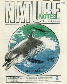
Magazine, Nature Notes magazines 1976 (Vol 13) Issues 1-10
Printed magazinesFrom “The History of Ringwood East Primary School 1924-1990” 'Nature Notes' was a children's nature magazine, produced at Ringwood East Primary School for approximately 10 years. It came to us from Blackburn Lake Primary School and before that Blackburn South Primary School. It was originally developed by Harry Hopkins in 1964. He was a District Inspector of schools and also President of the Gould League at the time. Fred Rodgers and Len Delacca were original contributors, Fred writing on native flora and Len writing on native flora [fauna]. It came to Ringwood East in 1975 with Keith Dyer, a teacher on the staff, as editor. The magazine had a large circulation, supplying to schools, private subscribers and societies as well as sending many complimentary copies to libraries, and museums; distribution was throughout Australia. The Magazine continued to grow under consequent editors, Anne Gibson (who also developed 'Probe' a junior version of 'Nature Notes' designed for grades 2 and 4), Barry Archibald, Colin Bull, Russell Hall, Deborah Brydon and Mandy Charmichael. The editors would research, compile, edit and print the magazine which was a monthly issue. The parents would then come in on a Monday to collate, fold and staple. This usually was a morning’s work but this depended on how many helping hands there were. The Wednesday was packing and posting day and in the early days the parents used to deliver the local orders to save costs. Subscribers were sought through advertisements in various school literature and material. The Parents Club received an annual remuneration for their hard work and in turn were able to help purchase many items needed throughout the school. These magazines were packed with really good nature information and taught children how to look after their environment using articles, puzzles, riddles, questions and quizzes. There were special characters as well like 'Wally the Wombat' and 'Ernie the Echidna' for the children to follow on various adventures every month. Children would enjoy watching them crop up in each edition. The magazine stayed with us at Ringwood East until 1986, when due to restructuring and various other things was moved to Healesville Sanctuary where it adopted a new format and name. From here it has since folded and so the end of 'Nature Notes'. 'Nature Notes' was a very successful magazine. Many people through the years devoted a lot of time and energy to its production and readers throughout Australia, as well as its many creators and producers during its 20-year existence, mourn its passing. Written from material supplied by Barry Archibald (editor 'Nature Notes' 1977-78) Margaret Preece & Lois Aders (parents in charge of collating and packaging during its last years of existence. -
 Ringwood and District Historical Society
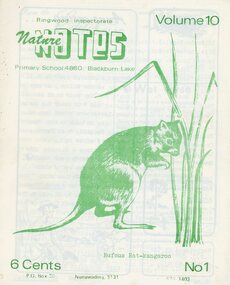
Magazine, Nature Notes magazines 1973 (Vol 10) Issues 1-4, 6-10
Printed magazinesFrom “The History of Ringwood East Primary School 1924-1990” 'Nature Notes' was a children's nature magazine, produced at Ringwood East Primary School for approximately 10 years. It came to us from Blackburn Lake Primary School and before that Blackburn South Primary School. It was originally developed by Harry Hopkins in 1964. He was a District Inspector of schools and also President of the Gould League at the time. Fred Rodgers and Len Delacca were original contributors, Fred writing on native flora and Len writing on native flora [fauna]. It came to Ringwood East in 1975 with Keith Dyer, a teacher on the staff, as editor. The magazine had a large circulation, supplying to schools, private subscribers and societies as well as sending many complimentary copies to libraries, and museums; distribution was throughout Australia. The Magazine continued to grow under consequent editors, Anne Gibson (who also developed 'Probe' a junior version of 'Nature Notes' designed for grades 2 and 4), Barry Archibald, Colin Bull, Russell Hall, Deborah Brydon and Mandy Charmichael. The editors would research, compile, edit and print the magazine which was a monthly issue. The parents would then come in on a Monday to collate, fold and staple. This usually was a morning’s work but this depended on how many helping hands there were. The Wednesday was packing and posting day and in the early days the parents used to deliver the local orders to save costs. Subscribers were sought through advertisements in various school literature and material. The Parents Club received an annual remuneration for their hard work and in turn were able to help purchase many items needed throughout the school. These magazines were packed with really good nature information and taught children how to look after their environment using articles, puzzles, riddles, questions and quizzes. There were special characters as well like 'Wally the Wombat' and 'Ernie the Echidna' for the children to follow on various adventures every month. Children would enjoy watching them crop up in each edition. The magazine stayed with us at Ringwood East until 1986, when due to restructuring and various other things was moved to Healesville Sanctuary where it adopted a new format and name. From here it has since folded and so the end of 'Nature Notes'. 'Nature Notes' was a very successful magazine. Many people through the years devoted a lot of time and energy to its production and readers throughout Australia, as well as its many creators and producers during its 20-year existence, mourn its passing. Written from material supplied by Barry Archibald (editor 'Nature Notes' 1977-78) Margaret Preece & Lois Aders (parents in charge of collating and packaging during its last years of existence. -
 Ringwood and District Historical Society
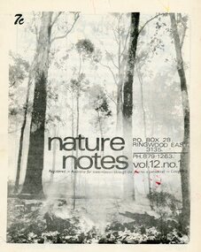
Magazine, Nature Notes magazines 1975 (Vol 12) Issues 1-10
Printed magazinesFrom “The History of Ringwood East Primary School 1924-1990” 'Nature Notes' was a children's nature magazine, produced at Ringwood East Primary School for approximately 10 years. It came to us from Blackburn Lake Primary School and before that Blackburn South Primary School. It was originally developed by Harry Hopkins in 1964. He was a District Inspector of schools and also President of the Gould League at the time. Fred Rodgers and Len Delacca were original contributors, Fred writing on native flora and Len writing on native flora [fauna]. It came to Ringwood East in 1975 with Keith Dyer, a teacher on the staff, as editor. The magazine had a large circulation, supplying to schools, private subscribers and societies as well as sending many complimentary copies to libraries, and museums; distribution was throughout Australia. The Magazine continued to grow under consequent editors, Anne Gibson (who also developed 'Probe' a junior version of 'Nature Notes' designed for grades 2 and 4), Barry Archibald, Colin Bull, Russell Hall, Deborah Brydon and Mandy Charmichael. The editors would research, compile, edit and print the magazine which was a monthly issue. The parents would then come in on a Monday to collate, fold and staple. This usually was a morning’s work but this depended on how many helping hands there were. The Wednesday was packing and posting day and in the early days the parents used to deliver the local orders to save costs. Subscribers were sought through advertisements in various school literature and material. The Parents Club received an annual remuneration for their hard work and in turn were able to help purchase many items needed throughout the school. These magazines were packed with really good nature information and taught children how to look after their environment using articles, puzzles, riddles, questions and quizzes. There were special characters as well like 'Wally the Wombat' and 'Ernie the Echidna' for the children to follow on various adventures every month. Children would enjoy watching them crop up in each edition. The magazine stayed with us at Ringwood East until 1986, when due to restructuring and various other things was moved to Healesville Sanctuary where it adopted a new format and name. From here it has since folded and so the end of 'Nature Notes'. 'Nature Notes' was a very successful magazine. Many people through the years devoted a lot of time and energy to its production and readers throughout Australia, as well as its many creators and producers during its 20-year existence, mourn its passing. Written from material supplied by Barry Archibald (editor 'Nature Notes' 1977-78) Margaret Preece & Lois Aders (parents in charge of collating and packaging during its last years of existence. -
 Ringwood and District Historical Society
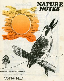
Magazine, Nature Notes magazines 1977 (Vol 14) Issues 1-10
Printed magazinesFrom “The History of Ringwood East Primary School 1924-1990” 'Nature Notes' was a children's nature magazine, produced at Ringwood East Primary School for approximately 10 years. It came to us from Blackburn Lake Primary School and before that Blackburn South Primary School. It was originally developed by Harry Hopkins in 1964. He was a District Inspector of schools and also President of the Gould League at the time. Fred Rodgers and Len Delacca were original contributors, Fred writing on native flora and Len writing on native flora [fauna]. It came to Ringwood East in 1975 with Keith Dyer, a teacher on the staff, as editor. The magazine had a large circulation, supplying to schools, private subscribers and societies as well as sending many complimentary copies to libraries, and museums; distribution was throughout Australia. The Magazine continued to grow under consequent editors, Anne Gibson (who also developed 'Probe' a junior version of 'Nature Notes' designed for grades 2 and 4), Barry Archibald, Colin Bull, Russell Hall, Deborah Brydon and Mandy Charmichael. The editors would research, compile, edit and print the magazine which was a monthly issue. The parents would then come in on a Monday to collate, fold and staple. This usually was a morning’s work but this depended on how many helping hands there were. The Wednesday was packing and posting day and in the early days the parents used to deliver the local orders to save costs. Subscribers were sought through advertisements in various school literature and material. The Parents Club received an annual remuneration for their hard work and in turn were able to help purchase many items needed throughout the school. These magazines were packed with really good nature information and taught children how to look after their environment using articles, puzzles, riddles, questions and quizzes. There were special characters as well like 'Wally the Wombat' and 'Ernie the Echidna' for the children to follow on various adventures every month. Children would enjoy watching them crop up in each edition. The magazine stayed with us at Ringwood East until 1986, when due to restructuring and various other things was moved to Healesville Sanctuary where it adopted a new format and name. From here it has since folded and so the end of 'Nature Notes'. 'Nature Notes' was a very successful magazine. Many people through the years devoted a lot of time and energy to its production and readers throughout Australia, as well as its many creators and producers during its 20-year existence, mourn its passing. Written from material supplied by Barry Archibald (editor 'Nature Notes' 1977-78) Margaret Preece & Lois Aders (parents in charge of collating and packaging during its last years of existence. -
 Ringwood and District Historical Society
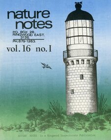
Magazine, Nature Notes magazines 1979 (Vol 16) Issues 1-5, 7-8, 10
Printed magazinesFrom “The History of Ringwood East Primary School 1924-1990” 'Nature Notes' was a children's nature magazine, produced at Ringwood East Primary School for approximately 10 years. It came to us from Blackburn Lake Primary School and before that Blackburn South Primary School. It was originally developed by Harry Hopkins in 1964. He was a District Inspector of schools and also President of the Gould League at the time. Fred Rodgers and Len Delacca were original contributors, Fred writing on native flora and Len writing on native flora [fauna]. It came to Ringwood East in 1975 with Keith Dyer, a teacher on the staff, as editor. The magazine had a large circulation, supplying to schools, private subscribers and societies as well as sending many complimentary copies to libraries, and museums; distribution was throughout Australia. The Magazine continued to grow under consequent editors, Anne Gibson (who also developed 'Probe' a junior version of 'Nature Notes' designed for grades 2 and 4), Barry Archibald, Colin Bull, Russell Hall, Deborah Brydon and Mandy Charmichael. The editors would research, compile, edit and print the magazine which was a monthly issue. The parents would then come in on a Monday to collate, fold and staple. This usually was a morning’s work but this depended on how many helping hands there were. The Wednesday was packing and posting day and in the early days the parents used to deliver the local orders to save costs. Subscribers were sought through advertisements in various school literature and material. The Parents Club received an annual remuneration for their hard work and in turn were able to help purchase many items needed throughout the school. These magazines were packed with really good nature information and taught children how to look after their environment using articles, puzzles, riddles, questions and quizzes. There were special characters as well like 'Wally the Wombat' and 'Ernie the Echidna' for the children to follow on various adventures every month. Children would enjoy watching them crop up in each edition. The magazine stayed with us at Ringwood East until 1986, when due to restructuring and various other things was moved to Healesville Sanctuary where it adopted a new format and name. From here it has since folded and so the end of 'Nature Notes'. 'Nature Notes' was a very successful magazine. Many people through the years devoted a lot of time and energy to its production and readers throughout Australia, as well as its many creators and producers during its 20-year existence, mourn its passing. Written from material supplied by Barry Archibald (editor 'Nature Notes' 1977-78) Margaret Preece & Lois Aders (parents in charge of collating and packaging during its last years of existence. -
 Ringwood and District Historical Society
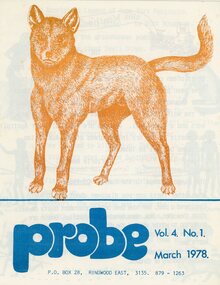
Magazine, Probe magazines 1978 (Vol 4) Issues 1-5, 7-10
Printed magazinesFrom “The History of Ringwood East Primary School 1924-1990” 'Nature Notes' was a children's nature magazine, produced at Ringwood East Primary School for approximately 10 years. It came to us from Blackburn Lake Primary School and before that Blackburn South Primary School. It was originally developed by Harry Hopkins in 1964. He was a District Inspector of schools and also President of the Gould League at the time. Fred Rodgers and Len Delacca were original contributors, Fred writing on native flora and Len writing on native flora [fauna]. It came to Ringwood East in 1975 with Keith Dyer, a teacher on the staff, as editor. The magazine had a large circulation, supplying to schools, private subscribers and societies as well as sending many complimentary copies to libraries, and museums; distribution was throughout Australia. The Magazine continued to grow under consequent editors, Anne Gibson (who also developed 'Probe' a junior version of 'Nature Notes' designed for grades 2 and 4), Barry Archibald, Colin Bull, Russell Hall, Deborah Brydon and Mandy Charmichael. The editors would research, compile, edit and print the magazine which was a monthly issue. The parents would then come in on a Monday to collate, fold and staple. This usually was a morning’s work but this depended on how many helping hands there were. The Wednesday was packing and posting day and in the early days the parents used to deliver the local orders to save costs. Subscribers were sought through advertisements in various school literature and material. The Parents Club received an annual remuneration for their hard work and in turn were able to help purchase many items needed throughout the school. These magazines were packed with really good nature information and taught children how to look after their environment using articles, puzzles, riddles, questions and quizzes. There were special characters as well like 'Wally the Wombat' and 'Ernie the Echidna' for the children to follow on various adventures every month. Children would enjoy watching them crop up in each edition. The magazine stayed with us at Ringwood East until 1986, when due to restructuring and various other things was moved to Healesville Sanctuary where it adopted a new format and name. From here it has since folded and so the end of 'Nature Notes'. 'Nature Notes' was a very successful magazine. Many people through the years devoted a lot of time and energy to its production and readers throughout Australia, as well as its many creators and producers during its 20-year existence, mourn its passing. Written from material supplied by Barry Archibald (editor 'Nature Notes' 1977-78) Margaret Preece & Lois Aders (parents in charge of collating and packaging during its last years of existence. -
 Ringwood and District Historical Society
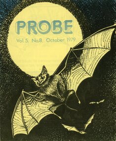
Magazine, Probe magazines 1979 (Vol 5) Issues 8-10
Printed magazinesFrom “The History of Ringwood East Primary School 1924-1990” 'Nature Notes' was a children's nature magazine, produced at Ringwood East Primary School for approximately 10 years. It came to us from Blackburn Lake Primary School and before that Blackburn South Primary School. It was originally developed by Harry Hopkins in 1964. He was a District Inspector of schools and also President of the Gould League at the time. Fred Rodgers and Len Delacca were original contributors, Fred writing on native flora and Len writing on native flora [fauna]. It came to Ringwood East in 1975 with Keith Dyer, a teacher on the staff, as editor. The magazine had a large circulation, supplying to schools, private subscribers and societies as well as sending many complimentary copies to libraries, and museums; distribution was throughout Australia. The Magazine continued to grow under consequent editors, Anne Gibson (who also developed 'Probe' a junior version of 'Nature Notes' designed for grades 2 and 4), Barry Archibald, Colin Bull, Russell Hall, Deborah Brydon and Mandy Charmichael. The editors would research, compile, edit and print the magazine which was a monthly issue. The parents would then come in on a Monday to collate, fold and staple. This usually was a morning’s work but this depended on how many helping hands there were. The Wednesday was packing and posting day and in the early days the parents used to deliver the local orders to save costs. Subscribers were sought through advertisements in various school literature and material. The Parents Club received an annual remuneration for their hard work and in turn were able to help purchase many items needed throughout the school. These magazines were packed with really good nature information and taught children how to look after their environment using articles, puzzles, riddles, questions and quizzes. There were special characters as well like 'Wally the Wombat' and 'Ernie the Echidna' for the children to follow on various adventures every month. Children would enjoy watching them crop up in each edition. The magazine stayed with us at Ringwood East until 1986, when due to restructuring and various other things was moved to Healesville Sanctuary where it adopted a new format and name. From here it has since folded and so the end of 'Nature Notes'. 'Nature Notes' was a very successful magazine. Many people through the years devoted a lot of time and energy to its production and readers throughout Australia, as well as its many creators and producers during its 20-year existence, mourn its passing. Written from material supplied by Barry Archibald (editor 'Nature Notes' 1977-78) Margaret Preece & Lois Aders (parents in charge of collating and packaging during its last years of existence. -
 Ringwood and District Historical Society
Archive, Parent Record for Nature Notes & Probe magazines Collection
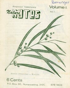
Parent Record for Archive collection of photographs, documents, minutes etc relating to the Nature Notes and Probe magazines published by the Ringwood Electorate State/Primary SchoolsFrom “The History of Ringwood East Primary School 1924-1990” 'Nature Notes' was a children's nature magazine, produced at Ringwood East Primary School for approximately 10 years. It came to us from Blackburn Lake Primary School and before that Blackburn South Primary School. It was originally developed by Harry Hopkins in 1964. He was a District Inspector of schools and also President of the Gould League at the time. Fred Rodgers and Len Delacca were original contributors, Fred writing on native flora and Len writing on native flora [fauna]. It came to Ringwood East in 1975 with Keith Dyer, a teacher on the staff, as editor. The magazine had a large circulation, supplying to schools, private subscribers and societies as well as sending many complimentary copies to libraries, and museums; distribution was throughout Australia. The Magazine continued to grow under consequent editors, Anne Gibson (who also developed 'Probe' a junior version of 'Nature Notes' designed for grades 2 and 4), Barry Archibald, Colin Bull, Russell Hall, Deborah Brydon and Mandy Charmichael. The editors would research, compile, edit and print the magazine which was a monthly issue. The parents would then come in on a Monday to collate, fold and staple. This usually was a morning’s work but this depended on how many helping hands there were. The Wednesday was packing and posting day and in the early days the parents used to deliver the local orders to save costs. Subscribers were sought through advertisements in various school literature and material. The Parents Club received an annual remuneration for their hard work and in turn were able to help purchase many items needed throughout the school. These magazines were packed with really good nature information and taught children how to look after their environment using articles, puzzles, riddles, questions and quizzes. There were special characters as well like 'Wally the Wombat' and 'Ernie the Echidna' for the children to follow on various adventures every month. Children would enjoy watching them crop up in each edition. The magazine stayed with us at Ringwood East until 1986, when due to restructuring and various other things was moved to Healesville Sanctuary where it adopted a new format and name. From here it has since folded and so the end of 'Nature Notes'. 'Nature Notes' was a very successful magazine. Many people through the years devoted a lot of time and energy to its production and readers throughout Australia, as well as its many creators and producers during its 20-year existence, mourn its passing. Written from material supplied by Barry Archibald (editor 'Nature Notes' 1977-78) Margaret Preece & Lois Aders (parents in charge of collating and packaging during its last years of existence. -
 Ringwood and District Historical Society
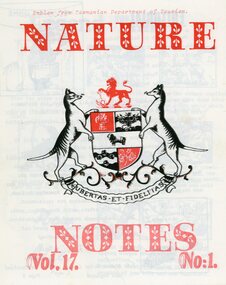
Magazine, Nature Notes magazines 1980 (Vol 17) Issues 1-10
Printed magazinesFrom “The History of Ringwood East Primary School 1924-1990” 'Nature Notes' was a children's nature magazine, produced at Ringwood East Primary School for approximately 10 years. It came to us from Blackburn Lake Primary School and before that Blackburn South Primary School. It was originally developed by Harry Hopkins in 1964. He was a District Inspector of schools and also President of the Gould League at the time. Fred Rodgers and Len Delacca were original contributors, Fred writing on native flora and Len writing on native flora [fauna]. It came to Ringwood East in 1975 with Keith Dyer, a teacher on the staff, as editor. The magazine had a large circulation, supplying to schools, private subscribers and societies as well as sending many complimentary copies to libraries, and museums; distribution was throughout Australia. The Magazine continued to grow under consequent editors, Anne Gibson (who also developed 'Probe' a junior version of 'Nature Notes' designed for grades 2 and 4), Barry Archibald, Colin Bull, Russell Hall, Deborah Brydon and Mandy Charmichael. The editors would research, compile, edit and print the magazine which was a monthly issue. The parents would then come in on a Monday to collate, fold and staple. This usually was a morning’s work but this depended on how many helping hands there were. The Wednesday was packing and posting day and in the early days the parents used to deliver the local orders to save costs. Subscribers were sought through advertisements in various school literature and material. The Parents Club received an annual remuneration for their hard work and in turn were able to help purchase many items needed throughout the school. These magazines were packed with really good nature information and taught children how to look after their environment using articles, puzzles, riddles, questions and quizzes. There were special characters as well like 'Wally the Wombat' and 'Ernie the Echidna' for the children to follow on various adventures every month. Children would enjoy watching them crop up in each edition. The magazine stayed with us at Ringwood East until 1986, when due to restructuring and various other things was moved to Healesville Sanctuary where it adopted a new format and name. From here it has since folded and so the end of 'Nature Notes'. 'Nature Notes' was a very successful magazine. Many people through the years devoted a lot of time and energy to its production and readers throughout Australia, as well as its many creators and producers during its 20-year existence, mourn its passing. Written from material supplied by Barry Archibald (editor 'Nature Notes' 1977-78) Margaret Preece & Lois Aders (parents in charge of collating and packaging during its last years of existence. -
 Ringwood and District Historical Society
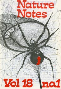
Magazine, Nature Notes magazines 1981 (Vol 18) Issues 1-10
Printed magazinesFrom “The History of Ringwood East Primary School 1924-1990” 'Nature Notes' was a children's nature magazine, produced at Ringwood East Primary School for approximately 10 years. It came to us from Blackburn Lake Primary School and before that Blackburn South Primary School. It was originally developed by Harry Hopkins in 1964. He was a District Inspector of schools and also President of the Gould League at the time. Fred Rodgers and Len Delacca were original contributors, Fred writing on native flora and Len writing on native flora [fauna]. It came to Ringwood East in 1975 with Keith Dyer, a teacher on the staff, as editor. The magazine had a large circulation, supplying to schools, private subscribers and societies as well as sending many complimentary copies to libraries, and museums; distribution was throughout Australia. The Magazine continued to grow under consequent editors, Anne Gibson (who also developed 'Probe' a junior version of 'Nature Notes' designed for grades 2 and 4), Barry Archibald, Colin Bull, Russell Hall, Deborah Brydon and Mandy Charmichael. The editors would research, compile, edit and print the magazine which was a monthly issue. The parents would then come in on a Monday to collate, fold and staple. This usually was a morning’s work but this depended on how many helping hands there were. The Wednesday was packing and posting day and in the early days the parents used to deliver the local orders to save costs. Subscribers were sought through advertisements in various school literature and material. The Parents Club received an annual remuneration for their hard work and in turn were able to help purchase many items needed throughout the school. These magazines were packed with really good nature information and taught children how to look after their environment using articles, puzzles, riddles, questions and quizzes. There were special characters as well like 'Wally the Wombat' and 'Ernie the Echidna' for the children to follow on various adventures every month. Children would enjoy watching them crop up in each edition. The magazine stayed with us at Ringwood East until 1986, when due to restructuring and various other things was moved to Healesville Sanctuary where it adopted a new format and name. From here it has since folded and so the end of 'Nature Notes'. 'Nature Notes' was a very successful magazine. Many people through the years devoted a lot of time and energy to its production and readers throughout Australia, as well as its many creators and producers during its 20-year existence, mourn its passing. Written from material supplied by Barry Archibald (editor 'Nature Notes' 1977-78) Margaret Preece & Lois Aders (parents in charge of collating and packaging during its last years of existence. -
 Ringwood and District Historical Society
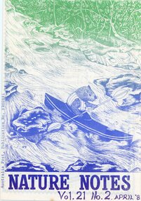
Magazine, Nature Notes magazines 1984 (Vol 21) Issues 1-5, 7-10
Printed magazinesFrom “The History of Ringwood East Primary School 1924-1990” 'Nature Notes' was a children's nature magazine, produced at Ringwood East Primary School for approximately 10 years. It came to us from Blackburn Lake Primary School and before that Blackburn South Primary School. It was originally developed by Harry Hopkins in 1964. He was a District Inspector of schools and also President of the Gould League at the time. Fred Rodgers and Len Delacca were original contributors, Fred writing on native flora and Len writing on native flora [fauna]. It came to Ringwood East in 1975 with Keith Dyer, a teacher on the staff, as editor. The magazine had a large circulation, supplying to schools, private subscribers and societies as well as sending many complimentary copies to libraries, and museums; distribution was throughout Australia. The Magazine continued to grow under consequent editors, Anne Gibson (who also developed 'Probe' a junior version of 'Nature Notes' designed for grades 2 and 4), Barry Archibald, Colin Bull, Russell Hall, Deborah Brydon and Mandy Charmichael. The editors would research, compile, edit and print the magazine which was a monthly issue. The parents would then come in on a Monday to collate, fold and staple. This usually was a morning’s work but this depended on how many helping hands there were. The Wednesday was packing and posting day and in the early days the parents used to deliver the local orders to save costs. Subscribers were sought through advertisements in various school literature and material. The Parents Club received an annual remuneration for their hard work and in turn were able to help purchase many items needed throughout the school. These magazines were packed with really good nature information and taught children how to look after their environment using articles, puzzles, riddles, questions and quizzes. There were special characters as well like 'Wally the Wombat' and 'Ernie the Echidna' for the children to follow on various adventures every month. Children would enjoy watching them crop up in each edition. The magazine stayed with us at Ringwood East until 1986, when due to restructuring and various other things was moved to Healesville Sanctuary where it adopted a new format and name. From here it has since folded and so the end of 'Nature Notes'. 'Nature Notes' was a very successful magazine. Many people through the years devoted a lot of time and energy to its production and readers throughout Australia, as well as its many creators and producers during its 20-year existence, mourn its passing. Written from material supplied by Barry Archibald (editor 'Nature Notes' 1977-78) Margaret Preece & Lois Aders (parents in charge of collating and packaging during its last years of existence. -
 Ringwood and District Historical Society
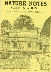
Magazine, Nature Notes magazines 1985 (Vol 22) Issues 1-9
Printed magazinesFrom “The History of Ringwood East Primary School 1924-1990” 'Nature Notes' was a children's nature magazine, produced at Ringwood East Primary School for approximately 10 years. It came to us from Blackburn Lake Primary School and before that Blackburn South Primary School. It was originally developed by Harry Hopkins in 1964. He was a District Inspector of schools and also President of the Gould League at the time. Fred Rodgers and Len Delacca were original contributors, Fred writing on native flora and Len writing on native flora [fauna]. It came to Ringwood East in 1975 with Keith Dyer, a teacher on the staff, as editor. The magazine had a large circulation, supplying to schools, private subscribers and societies as well as sending many complimentary copies to libraries, and museums; distribution was throughout Australia. The Magazine continued to grow under consequent editors, Anne Gibson (who also developed 'Probe' a junior version of 'Nature Notes' designed for grades 2 and 4), Barry Archibald, Colin Bull, Russell Hall, Deborah Brydon and Mandy Charmichael. The editors would research, compile, edit and print the magazine which was a monthly issue. The parents would then come in on a Monday to collate, fold and staple. This usually was a morning’s work but this depended on how many helping hands there were. The Wednesday was packing and posting day and in the early days the parents used to deliver the local orders to save costs. Subscribers were sought through advertisements in various school literature and material. The Parents Club received an annual remuneration for their hard work and in turn were able to help purchase many items needed throughout the school. These magazines were packed with really good nature information and taught children how to look after their environment using articles, puzzles, riddles, questions and quizzes. There were special characters as well like 'Wally the Wombat' and 'Ernie the Echidna' for the children to follow on various adventures every month. Children would enjoy watching them crop up in each edition. The magazine stayed with us at Ringwood East until 1986, when due to restructuring and various other things was moved to Healesville Sanctuary where it adopted a new format and name. From here it has since folded and so the end of 'Nature Notes'. 'Nature Notes' was a very successful magazine. Many people through the years devoted a lot of time and energy to its production and readers throughout Australia, as well as its many creators and producers during its 20-year existence, mourn its passing. Written from material supplied by Barry Archibald (editor 'Nature Notes' 1977-78) Margaret Preece & Lois Aders (parents in charge of collating and packaging during its last years of existence. -
 Ringwood and District Historical Society
Magazine, Nature Notes magazines 1983 (Vol 20) Issues 1-5, 7-10
Printed magazinesFrom “The History of Ringwood East Primary School 1924-1990” 'Nature Notes' was a children's nature magazine, produced at Ringwood East Primary School for approximately 10 years. It came to us from Blackburn Lake Primary School and before that Blackburn South Primary School. It was originally developed by Harry Hopkins in 1964. He was a District Inspector of schools and also President of the Gould League at the time. Fred Rodgers and Len Delacca were original contributors, Fred writing on native flora and Len writing on native flora [fauna]. It came to Ringwood East in 1975 with Keith Dyer, a teacher on the staff, as editor. The magazine had a large circulation, supplying to schools, private subscribers and societies as well as sending many complimentary copies to libraries, and museums; distribution was throughout Australia. The Magazine continued to grow under consequent editors, Anne Gibson (who also developed 'Probe' a junior version of 'Nature Notes' designed for grades 2 and 4), Barry Archibald, Colin Bull, Russell Hall, Deborah Brydon and Mandy Charmichael. The editors would research, compile, edit and print the magazine which was a monthly issue. The parents would then come in on a Monday to collate, fold and staple. This usually was a morning’s work but this depended on how many helping hands there were. The Wednesday was packing and posting day and in the early days the parents used to deliver the local orders to save costs. Subscribers were sought through advertisements in various school literature and material. The Parents Club received an annual remuneration for their hard work and in turn were able to help purchase many items needed throughout the school. These magazines were packed with really good nature information and taught children how to look after their environment using articles, puzzles, riddles, questions and quizzes. There were special characters as well like 'Wally the Wombat' and 'Ernie the Echidna' for the children to follow on various adventures every month. Children would enjoy watching them crop up in each edition. The magazine stayed with us at Ringwood East until 1986, when due to restructuring and various other things was moved to Healesville Sanctuary where it adopted a new format and name. From here it has since folded and so the end of 'Nature Notes'. 'Nature Notes' was a very successful magazine. Many people through the years devoted a lot of time and energy to its production and readers throughout Australia, as well as its many creators and producers during its 20-year existence, mourn its passing. Written from material supplied by Barry Archibald (editor 'Nature Notes' 1977-78) Margaret Preece & Lois Aders (parents in charge of collating and packaging during its last years of existence. -
 Ringwood and District Historical Society
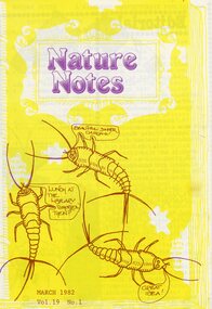
Magazine, Nature Notes magazines 1982 (Vol 19) Issues 1-10
Printed magazinesFrom “The History of Ringwood East Primary School 1924-1990” 'Nature Notes' was a children's nature magazine, produced at Ringwood East Primary School for approximately 10 years. It came to us from Blackburn Lake Primary School and before that Blackburn South Primary School. It was originally developed by Harry Hopkins in 1964. He was a District Inspector of schools and also President of the Gould League at the time. Fred Rodgers and Len Delacca were original contributors, Fred writing on native flora and Len writing on native flora [fauna]. It came to Ringwood East in 1975 with Keith Dyer, a teacher on the staff, as editor. The magazine had a large circulation, supplying to schools, private subscribers and societies as well as sending many complimentary copies to libraries, and museums; distribution was throughout Australia. The Magazine continued to grow under consequent editors, Anne Gibson (who also developed 'Probe' a junior version of 'Nature Notes' designed for grades 2 and 4), Barry Archibald, Colin Bull, Russell Hall, Deborah Brydon and Mandy Charmichael. The editors would research, compile, edit and print the magazine which was a monthly issue. The parents would then come in on a Monday to collate, fold and staple. This usually was a morning’s work but this depended on how many helping hands there were. The Wednesday was packing and posting day and in the early days the parents used to deliver the local orders to save costs. Subscribers were sought through advertisements in various school literature and material. The Parents Club received an annual remuneration for their hard work and in turn were able to help purchase many items needed throughout the school. These magazines were packed with really good nature information and taught children how to look after their environment using articles, puzzles, riddles, questions and quizzes. There were special characters as well like 'Wally the Wombat' and 'Ernie the Echidna' for the children to follow on various adventures every month. Children would enjoy watching them crop up in each edition. The magazine stayed with us at Ringwood East until 1986, when due to restructuring and various other things was moved to Healesville Sanctuary where it adopted a new format and name. From here it has since folded and so the end of 'Nature Notes'. 'Nature Notes' was a very successful magazine. Many people through the years devoted a lot of time and energy to its production and readers throughout Australia, as well as its many creators and producers during its 20-year existence, mourn its passing. Written from material supplied by Barry Archibald (editor 'Nature Notes' 1977-78) Margaret Preece & Lois Aders (parents in charge of collating and packaging during its last years of existence. -
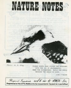 Ringwood and District Historical Society
Magazine, Nature Notes magazines 1969 (Vol 6) Issues 1 to 2, 4 to 10
Printed magazinesFrom “The History of Ringwood East Primary School 1924-1990” 'Nature Notes' was a children's nature magazine, produced at Ringwood East Primary School for approximately 10 years. It came to us from Blackburn Lake Primary School and before that Blackburn South Primary School. It was originally developed by Harry Hopkins in 1964. He was a District Inspector of schools and also President of the Gould League at the time. Fred Rodgers and Len Delacca were original contributors, Fred writing on native flora and Len writing on native flora [fauna]. It came to Ringwood East in 1975 with Keith Dyer, a teacher on the staff, as editor. The magazine had a large circulation, supplying to schools, private subscribers and societies as well as sending many complimentary copies to libraries, and museums; distribution was throughout Australia. The Magazine continued to grow under consequent editors, Anne Gibson (who also developed 'Probe' a junior version of 'Nature Notes' designed for grades 2 and 4), Barry Archibald, Colin Bull, Russell Hall, Deborah Brydon and Mandy Charmichael. The editors would research, compile, edit and print the magazine which was a monthly issue. The parents would then come in on a Monday to collate, fold and staple. This usually was a morning’s work but this depended on how many helping hands there were. The Wednesday was packing and posting day and in the early days the parents used to deliver the local orders to save costs. Subscribers were sought through advertisements in various school literature and material. The Parents Club received an annual remuneration for their hard work and in turn were able to help purchase many items needed throughout the school. These magazines were packed with really good nature information and taught children how to look after their environment using articles, puzzles, riddles, questions and quizzes. There were special characters as well like 'Wally the Wombat' and 'Ernie the Echidna' for the children to follow on various adventures every month. Children would enjoy watching them crop up in each edition. The magazine stayed with us at Ringwood East until 1986, when due to restructuring and various other things was moved to Healesville Sanctuary where it adopted a new format and name. From here it has since folded and so the end of 'Nature Notes'. 'Nature Notes' was a very successful magazine. Many people through the years devoted a lot of time and energy to its production and readers throughout Australia, as well as its many creators and producers during its 20-year existence, mourn its passing. Written from material supplied by Barry Archibald (editor 'Nature Notes' 1977-78) Margaret Preece & Lois Aders (parents in charge of collating and packaging during its last years of existence. -
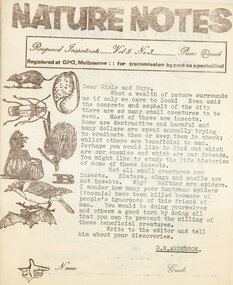 Ringwood and District Historical Society
Magazine, Nature Notes magazines 1968 (Vol 5) Issues 3 to 10
Printed magazinesFrom “The History of Ringwood East Primary School 1924-1990” 'Nature Notes' was a children's nature magazine, produced at Ringwood East Primary School for approximately 10 years. It came to us from Blackburn Lake Primary School and before that Blackburn South Primary School. It was originally developed by Harry Hopkins in 1964. He was a District Inspector of schools and also President of the Gould League at the time. Fred Rodgers and Len Delacca were original contributors, Fred writing on native flora and Len writing on native flora [fauna]. It came to Ringwood East in 1975 with Keith Dyer, a teacher on the staff, as editor. The magazine had a large circulation, supplying to schools, private subscribers and societies as well as sending many complimentary copies to libraries, and museums; distribution was throughout Australia. The Magazine continued to grow under consequent editors, Anne Gibson (who also developed 'Probe' a junior version of 'Nature Notes' designed for grades 2 and 4), Barry Archibald, Colin Bull, Russell Hall, Deborah Brydon and Mandy Charmichael. The editors would research, compile, edit and print the magazine which was a monthly issue. The parents would then come in on a Monday to collate, fold and staple. This usually was a morning’s work but this depended on how many helping hands there were. The Wednesday was packing and posting day and in the early days the parents used to deliver the local orders to save costs. Subscribers were sought through advertisements in various school literature and material. The Parents Club received an annual remuneration for their hard work and in turn were able to help purchase many items needed throughout the school. These magazines were packed with really good nature information and taught children how to look after their environment using articles, puzzles, riddles, questions and quizzes. There were special characters as well like 'Wally the Wombat' and 'Ernie the Echidna' for the children to follow on various adventures every month. Children would enjoy watching them crop up in each edition. The magazine stayed with us at Ringwood East until 1986, when due to restructuring and various other things was moved to Healesville Sanctuary where it adopted a new format and name. From here it has since folded and so the end of 'Nature Notes'. 'Nature Notes' was a very successful magazine. Many people through the years devoted a lot of time and energy to its production and readers throughout Australia, as well as its many creators and producers during its 20-year existence, mourn its passing. Written from material supplied by Barry Archibald (editor 'Nature Notes' 1977-78) Margaret Preece & Lois Aders (parents in charge of collating and packaging during its last years of existence. -
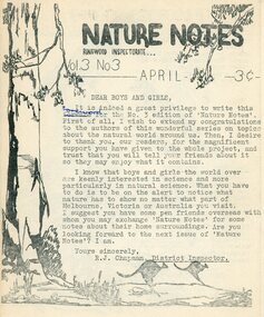 Ringwood and District Historical Society
Magazine, Nature Notes magazines 1966 (Vol 3) Issues 3 & 8 only
Printed magazinesFrom “The History of Ringwood East Primary School 1924-1990” 'Nature Notes' was a children's nature magazine, produced at Ringwood East Primary School for approximately 10 years. It came to us from Blackburn Lake Primary School and before that Blackburn South Primary School. It was originally developed by Harry Hopkins in 1964. He was a District Inspector of schools and also President of the Gould League at the time. Fred Rodgers and Len Delacca were original contributors, Fred writing on native flora and Len writing on native flora [fauna]. It came to Ringwood East in 1975 with Keith Dyer, a teacher on the staff, as editor. The magazine had a large circulation, supplying to schools, private subscribers and societies as well as sending many complimentary copies to libraries, and museums; distribution was throughout Australia. The Magazine continued to grow under consequent editors, Anne Gibson (who also developed 'Probe' a junior version of 'Nature Notes' designed for grades 2 and 4), Barry Archibald, Colin Bull, Russell Hall, Deborah Brydon and Mandy Charmichael. The editors would research, compile, edit and print the magazine which was a monthly issue. The parents would then come in on a Monday to collate, fold and staple. This usually was a morning’s work but this depended on how many helping hands there were. The Wednesday was packing and posting day and in the early days the parents used to deliver the local orders to save costs. Subscribers were sought through advertisements in various school literature and material. The Parents Club received an annual remuneration for their hard work and in turn were able to help purchase many items needed throughout the school. These magazines were packed with really good nature information and taught children how to look after their environment using articles, puzzles, riddles, questions and quizzes. There were special characters as well like 'Wally the Wombat' and 'Ernie the Echidna' for the children to follow on various adventures every month. Children would enjoy watching them crop up in each edition. The magazine stayed with us at Ringwood East until 1986, when due to restructuring and various other things was moved to Healesville Sanctuary where it adopted a new format and name. From here it has since folded and so the end of 'Nature Notes'. 'Nature Notes' was a very successful magazine. Many people through the years devoted a lot of time and energy to its production and readers throughout Australia, as well as its many creators and producers during its 20-year existence, mourn its passing. Written from material supplied by Barry Archibald (editor 'Nature Notes' 1977-78) Margaret Preece & Lois Aders (parents in charge of collating and packaging during its last years of existence. -
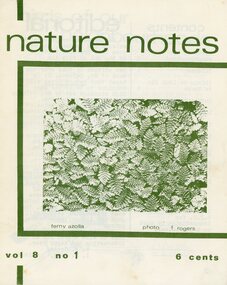 Ringwood and District Historical Society
Magazine, Nature Notes magazines 1971 (Vol 8) Issues 1 to 10
Printed magazinesFrom “The History of Ringwood East Primary School 1924-1990” 'Nature Notes' was a children's nature magazine, produced at Ringwood East Primary School for approximately 10 years. It came to us from Blackburn Lake Primary School and before that Blackburn South Primary School. It was originally developed by Harry Hopkins in 1964. He was a District Inspector of schools and also President of the Gould League at the time. Fred Rodgers and Len Delacca were original contributors, Fred writing on native flora and Len writing on native flora [fauna]. It came to Ringwood East in 1975 with Keith Dyer, a teacher on the staff, as editor. The magazine had a large circulation, supplying to schools, private subscribers and societies as well as sending many complimentary copies to libraries, and museums; distribution was throughout Australia. The Magazine continued to grow under consequent editors, Anne Gibson (who also developed 'Probe' a junior version of 'Nature Notes' designed for grades 2 and 4), Barry Archibald, Colin Bull, Russell Hall, Deborah Brydon and Mandy Charmichael. The editors would research, compile, edit and print the magazine which was a monthly issue. The parents would then come in on a Monday to collate, fold and staple. This usually was a morning’s work but this depended on how many helping hands there were. The Wednesday was packing and posting day and in the early days the parents used to deliver the local orders to save costs. Subscribers were sought through advertisements in various school literature and material. The Parents Club received an annual remuneration for their hard work and in turn were able to help purchase many items needed throughout the school. These magazines were packed with really good nature information and taught children how to look after their environment using articles, puzzles, riddles, questions and quizzes. There were special characters as well like 'Wally the Wombat' and 'Ernie the Echidna' for the children to follow on various adventures every month. Children would enjoy watching them crop up in each edition. The magazine stayed with us at Ringwood East until 1986, when due to restructuring and various other things was moved to Healesville Sanctuary where it adopted a new format and name. From here it has since folded and so the end of 'Nature Notes'. 'Nature Notes' was a very successful magazine. Many people through the years devoted a lot of time and energy to its production and readers throughout Australia, as well as its many creators and producers during its 20-year existence, mourn its passing. Written from material supplied by Barry Archibald (editor 'Nature Notes' 1977-78) Margaret Preece & Lois Aders (parents in charge of collating and packaging during its last years of existence. -
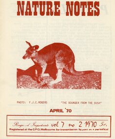 Ringwood and District Historical Society
Magazine, Nature Notes magazines 1970 (Vol 7) Issues 2 to 10
Printed magazinesFrom “The History of Ringwood East Primary School 1924-1990” 'Nature Notes' was a children's nature magazine, produced at Ringwood East Primary School for approximately 10 years. It came to us from Blackburn Lake Primary School and before that Blackburn South Primary School. It was originally developed by Harry Hopkins in 1964. He was a District Inspector of schools and also President of the Gould League at the time. Fred Rodgers and Len Delacca were original contributors, Fred writing on native flora and Len writing on native flora [fauna]. It came to Ringwood East in 1975 with Keith Dyer, a teacher on the staff, as editor. The magazine had a large circulation, supplying to schools, private subscribers and societies as well as sending many complimentary copies to libraries, and museums; distribution was throughout Australia. The Magazine continued to grow under consequent editors, Anne Gibson (who also developed 'Probe' a junior version of 'Nature Notes' designed for grades 2 and 4), Barry Archibald, Colin Bull, Russell Hall, Deborah Brydon and Mandy Charmichael. The editors would research, compile, edit and print the magazine which was a monthly issue. The parents would then come in on a Monday to collate, fold and staple. This usually was a morning’s work but this depended on how many helping hands there were. The Wednesday was packing and posting day and in the early days the parents used to deliver the local orders to save costs. Subscribers were sought through advertisements in various school literature and material. The Parents Club received an annual remuneration for their hard work and in turn were able to help purchase many items needed throughout the school. These magazines were packed with really good nature information and taught children how to look after their environment using articles, puzzles, riddles, questions and quizzes. There were special characters as well like 'Wally the Wombat' and 'Ernie the Echidna' for the children to follow on various adventures every month. Children would enjoy watching them crop up in each edition. The magazine stayed with us at Ringwood East until 1986, when due to restructuring and various other things was moved to Healesville Sanctuary where it adopted a new format and name. From here it has since folded and so the end of 'Nature Notes'. 'Nature Notes' was a very successful magazine. Many people through the years devoted a lot of time and energy to its production and readers throughout Australia, as well as its many creators and producers during its 20-year existence, mourn its passing. Written from material supplied by Barry Archibald (editor 'Nature Notes' 1977-78) Margaret Preece & Lois Aders (parents in charge of collating and packaging during its last years of existence. -
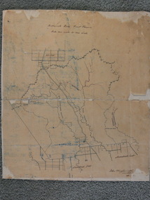 Ballan Shire Historical Society
Map - Map. Bullarook State Forest, Bullarook State Forest Reserve
A small map of the Bullarook State Forest Reserve. Drawn on a fine buff coloured paper attached to a stiff cloth backing sheet. The title is hand written and includes a "scale one mile to one inch" hand written also. The map is signed "John Wrigglesworth, assistant ? and dated 26/6/1869" although the month and year are almost illegible.moorabool west, state forest, bullarook, eastern moorabool river, werribee river, moorabool east, blakes saw mill, wombat, andersons saw mill -
 Ballan Shire Historical Society
Map - Map. Korweinguboora, Department of Lands and Survey, Korweinguboora. Counties of Talbot and Grant
A map of the Korweinguboora area showing roads, forests, railway lines and properties with the owners names.The inclusion of the names of landowners is of significance and value to historians.A map of the Korweinguboora area showing land subdivisions and names of owners and other physical features. There is a scale in chains. No date is certain but it could be 1902. The map has been repaired with sellotape.There are various pencil annotations but the are difficult to read.talbot, moorarbool west, wombat, bullarto, korweinguboora, moorarbool east, dean, wombat state forest, barkstead -
 Eltham District Historical Society Inc
Book, Land Conservation Council, Report on the Melbourne Study Area, December 1973
This report is one of a series describings the physical nature of the land and its environment, examines the likely forms of land use, and assesses the hazards associated with these uses. It is divided into four main sections: Introduction, Characteristics of environment, main forms of land use and description of 24 specific blocks in the study area which include Torquay, Brisbane Ranges, Werribee, Wombat, Loddon, Romsey, Puckapunyal, Strathbogie, Eildon, Disappointment, Break O'Day, Black Range, Cerberean, Upper Goulburn, Kinglake, Donna Buang, Upper Yarra, Thomson, Dandenongs, Bunyip-Latrobe, Shady Creek, Tyers, Westernport and Strzelecki. The Land Conservation Act 1970 established the Land Conservation Council whose functions is to "carry out investigations and make recommendations to the Minister with respect to the use of public land in order to provide for the balanced use of land in Victoria. This report sets out to describe and assess the natural resources of the public lands in the Melbourne area and provides a factual basis on which members of the community may base submissions to the [Land Conservation] Council of Victoria.444 pagesnon-fictionThis report is one of a series describings the physical nature of the land and its environment, examines the likely forms of land use, and assesses the hazards associated with these uses. It is divided into four main sections: Introduction, Characteristics of environment, main forms of land use and description of 24 specific blocks in the study area which include Torquay, Brisbane Ranges, Werribee, Wombat, Loddon, Romsey, Puckapunyal, Strathbogie, Eildon, Disappointment, Break O'Day, Black Range, Cerberean, Upper Goulburn, Kinglake, Donna Buang, Upper Yarra, Thomson, Dandenongs, Bunyip-Latrobe, Shady Creek, Tyers, Westernport and Strzelecki. The Land Conservation Act 1970 established the Land Conservation Council whose functions is to "carry out investigations and make recommendations to the Minister with respect to the use of public land in order to provide for the balanced use of land in Victoria. This report sets out to describe and assess the natural resources of the public lands in the Melbourne area and provides a factual basis on which members of the community may base submissions to the [Land Conservation] Council of Victoria.land use, kinglake, thomson valley, conservation, public lands -
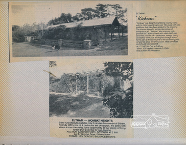 Eltham District Historical Society Inc
Newsclipping, Kinbrae and Lot 6, Wombat Drive, Eltham, 1991, 1991
Contained in Volume 2 of a set of two spiral magnetic photo albums, each containing 10 leaves, 20 pages; Vol. 1 labelled "Houses - Eltham South" and Vol. 2 labelled "Eltham Houses". Newspaper clippings advertising house auctionseltham, real estate advertisement, houses, kinbrae, wombat drive