Historical information
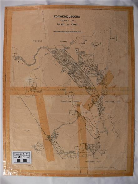
A map of the Korweinguboora area showing roads, forests, railway lines and properties with the owners names.
Significance
The inclusion of the names of landowners is of significance and value to historians.
Physical description
A map of the Korweinguboora area showing land subdivisions and names of owners and other physical features. There is a scale in chains. No date is certain but it could be 1902. The map has been repaired with sellotape.
Inscriptions & markings
There are various pencil annotations but the are difficult to read.